
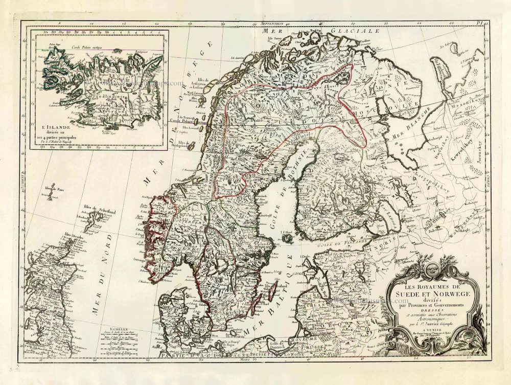
Scandinavia, by Francesco Santini. 1776-79
Francesco and Paolo Santini (c.1729-1793)
Francesco Santini, a Venetian publisher, acquired the printing plates of Vaugondy’s Atlas Universel …, a commercial and cartographic success, with widespread influence on mapmakers throughout Europe. Together with his brother Paolo, he commissioned a new set of plates and reissued the atlas in 1776. The following year, Paolo Santini assigned all his publication rights to M. Remondini, who in 1777 reissued the same atlas but with his name.
Sr. Janvier Jean Denis [Robert] (? - 1776)
A French cartographer who worked in Paris from about 1746.
He collaborated with other cartographers and publishers in producing a considerable number of maps, many of which were used in general atlases by William Fadan, P. Santini and others.
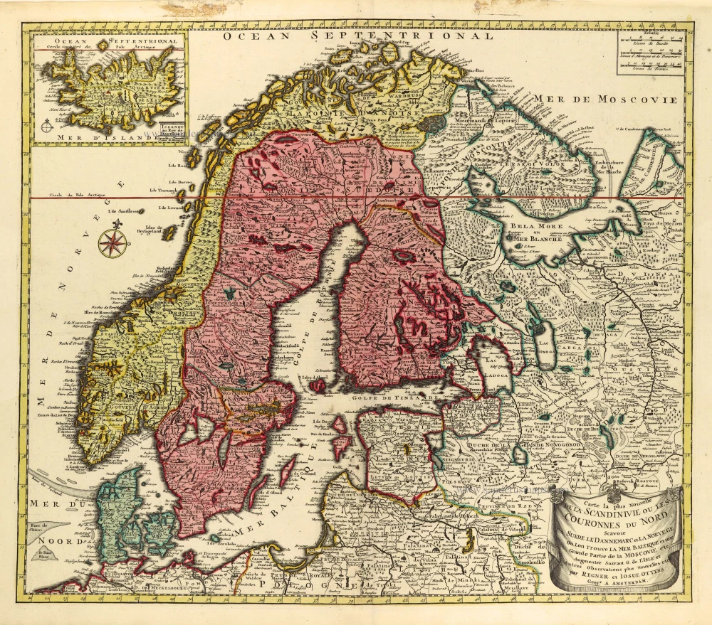
Les Royaumes de Suede et Norwege Divisés par Provinces et Gouvernements.
Item Number: 26964 Authenticity Guarantee
Category: Antique maps > Europe > Northern Europe
Old, antique map of Denmark, by Francesco Santini.
With a large inset of Iceland.
Cartographer: Jean Denis Janvier (Sieur)
First state with the imprint of Remondini: with engraved page numbers in the top right corner: "P.I.45".
Date of the first edition: 1776
Date of this map: 1776
Copper engraving, printed on paper.
Size (not including margins): 48 x 56cm (18.7 x 21.8 inches)
Verso: Blank
Condition: Original coloured in outline, excellent.
Condition Rating: A+
References: Pedley, #72.
From: Atlas Universel dressé sur les meilleures cartes modernes. Venice, Remondini, 1776.
Francesco and Paolo Santini (c.1729-1793)
Francesco Santini, a Venetian publisher, acquired the printing plates of Vaugondy’s Atlas Universel …, a commercial and cartographic success, with widespread influence on mapmakers throughout Europe. Together with his brother Paolo, he commissioned a new set of plates and reissued the atlas in 1776. The following year, Paolo Santini assigned all his publication rights to M. Remondini, who in 1777 reissued the same atlas but with his name.
Sr. Janvier Jean Denis [Robert] (? - 1776)
A French cartographer who worked in Paris from about 1746.
He collaborated with other cartographers and publishers in producing a considerable number of maps, many of which were used in general atlases by William Fadan, P. Santini and others.
Related items
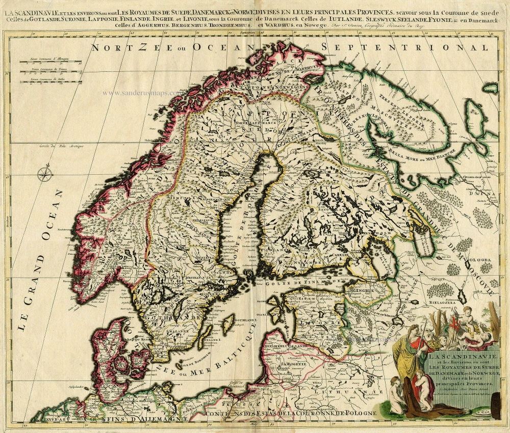
La Scandinavie, et les Environs, ou sont les Royaumes de Suede, de Danemark et de Norwege, divises en leurs principales Provinces. c. 1700
SCANDINAVIA by Schenk P.
[Item number: 19145]
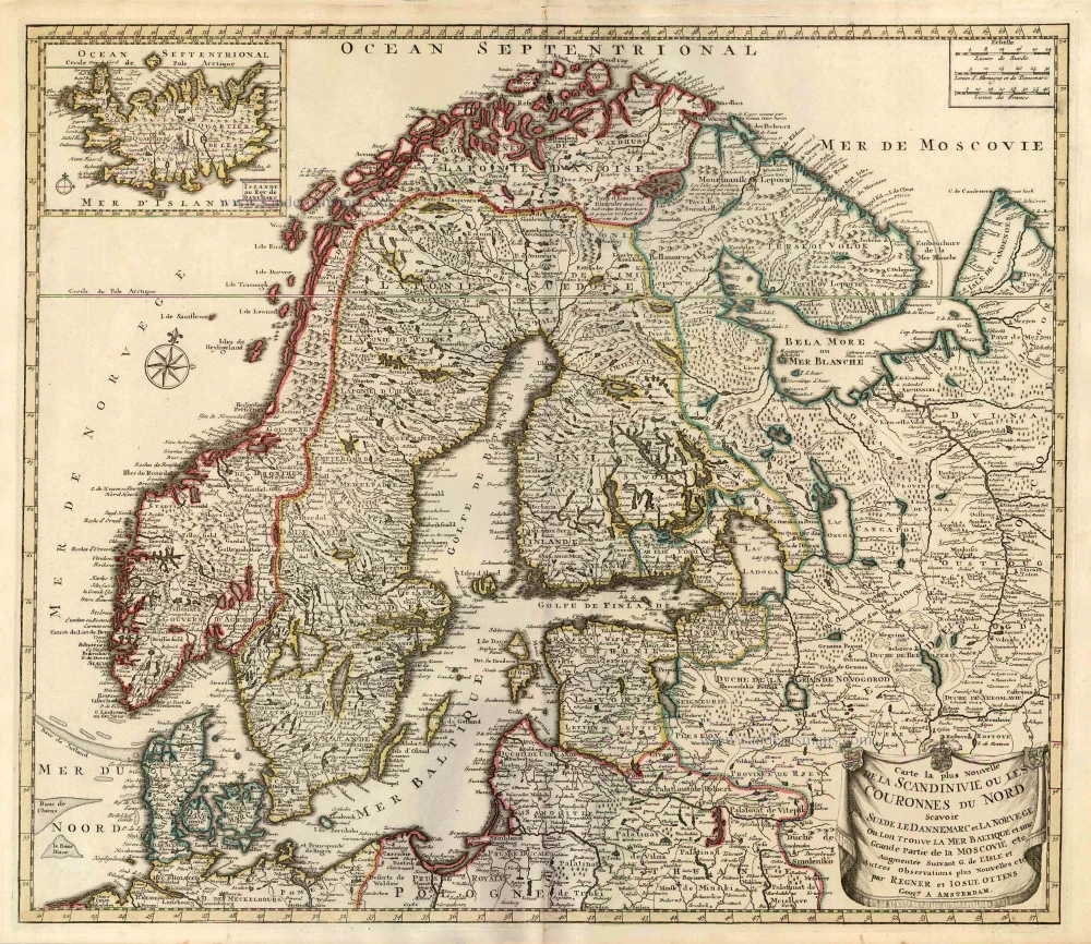
Carte la Plus Nouvelle de la Scandinivie ou les Couronnes du Nord Scavoir La Suede le Dannemarc et La Norvege Ou Lon Trouve La Mer Baltique et une Grande Partie de la Moscovie etc. 1730-45
Scandinavia par R. & I. Ottens.
[Item number: 25858]
Les Royaumes de Suede et Norwege Divisés par Provinces et Gouvernements. 1776-79
Scandinavia, by Francesco Santini.
[Item number: 26964]
Rare and important map.
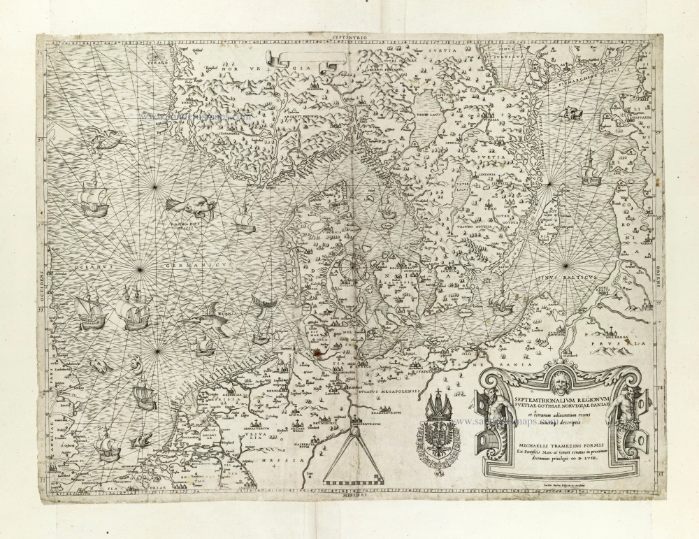
Septemtrionalium Regionum Svetiae Gothiae Norvegiae Daniae et terrarum adiacentium recens exactaq[ue] descriptio. 1558
Scandinavia, by Michele Tramezini.
[Item number: 27045]
Carte la Plus Nouvelle de la Scandinivie ou les Couronnes du Nord Scavoir La Suede le Dannemarc et La Norvege Ou Lon Trouve La Mer Baltique et une Grande Partie de la Moscovie etc. 1730-45
Scandinavia par R. & I. Ottens.
[Item number: 28269]
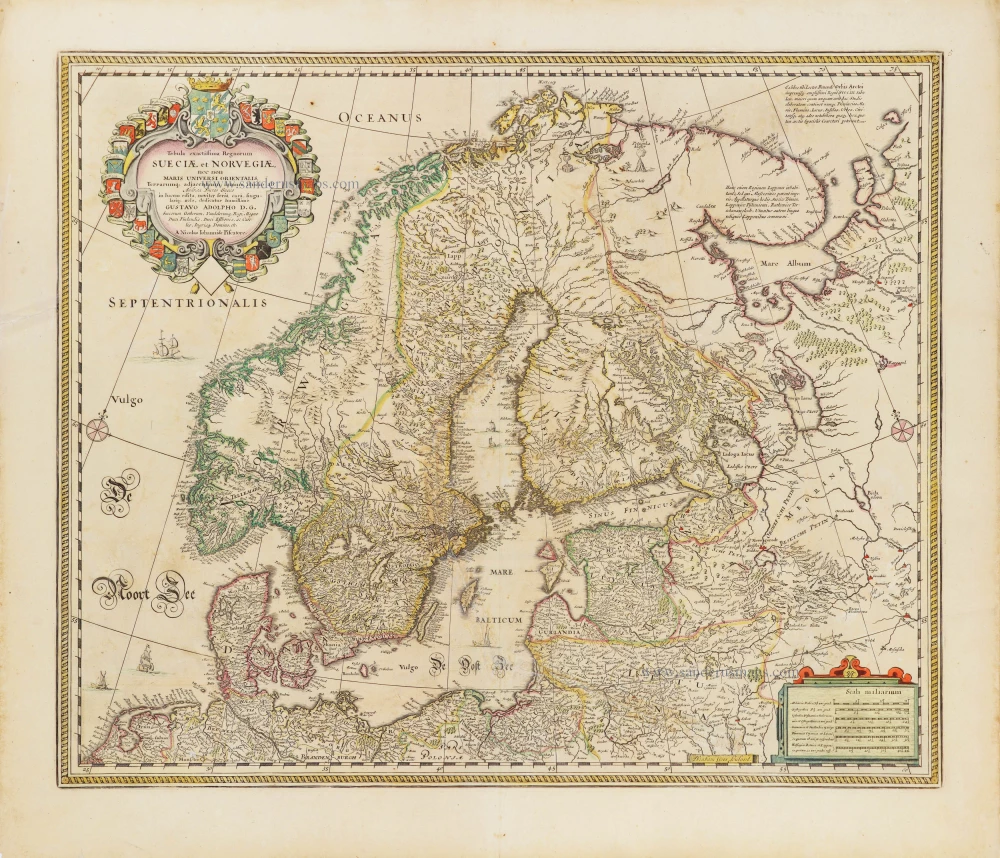
Tabula exactissima Regnorum Sueciae et Norvegiae, nec non Maris Universi Orientalis, 1656-80
Scandinavia by Nicolaas Visscher.
[Item number: 28742]
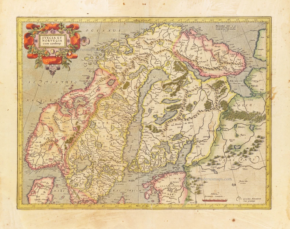
Svecia et Norvegia cum confinijs. 1628
Scandinavia, by Gerard Mercator.
[Item number: 28815]
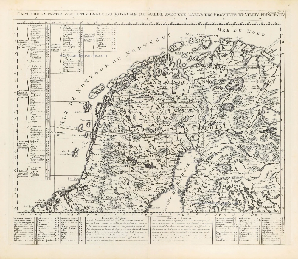
Carte de la Partie Septentrionale du Royaume de Suède avec une Table des Provinces et Villes Principales. 1714
Northern Scandinavia by Zacharias Châtelain.
[Item number: 29412]
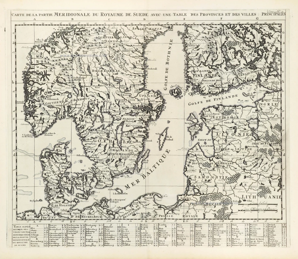
Carte de la Partie Meridionale du Royaume de Suède avec une Table des Provinces et Villes Principales. 1714
Southern Scandinavia by Zacharias Châtelain.
[Item number: 29413]
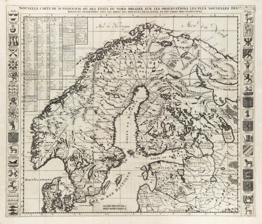
Nouvelle Carte de Scandinavie ou des Etats du Nord Dressée sur les observations les plus nouvelles des meilleurs Géographes avec les Armes des Provinces de la Suède et des Tables tres instructives. 1714
Scandinavia, by Zacharias Châtelain.
[Item number: 29499]

La Scandinavie et les environs ou sont les Estats et Royaumes de Danemarck Norwegue et Suede. 1652
Scandinavia by Nicolas Sanson.
[Item number: 29607]
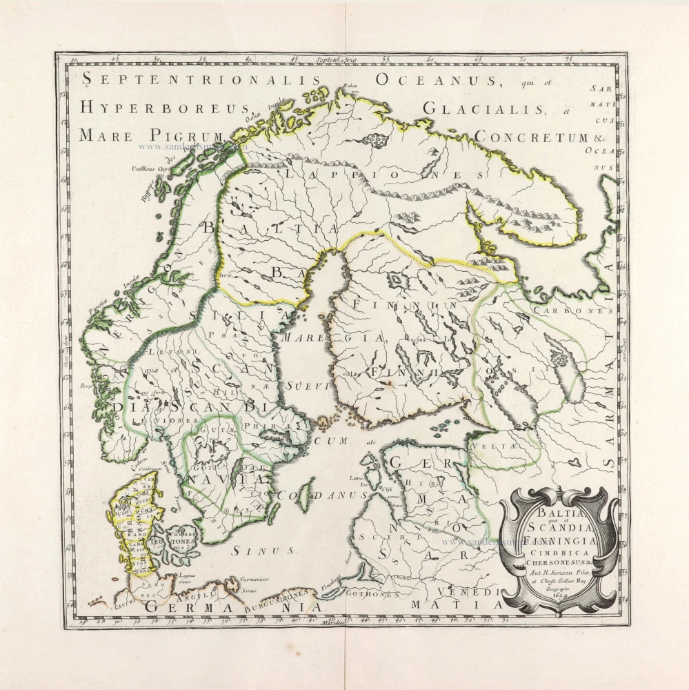
Baltia, quae et Scandia, Cimbrica Chersonesus &c. 1654-58
Scandinavia by Nicolas Sanson.
[Item number: 29608]
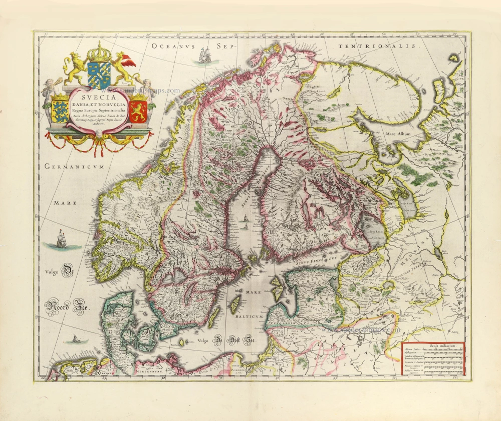
Suecia, Dania et Norvegia, Regna Europae Septentrionalia. 1643
Scandinavia by Joan Blaeu.
[Item number: 29998]
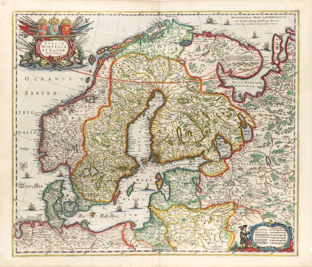
Sueciae, Norvegiae, et Daniae, Nova Tabula. 1666
Scandinavia, by Johannes Janssonius.
[Item number: 30290]