
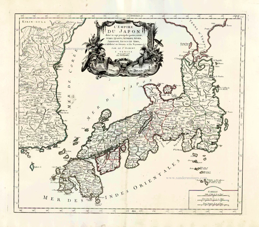
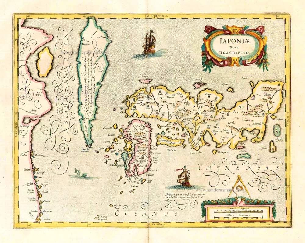
Japan, by Francesco Santini. 1776-79
Francesco and Paolo Santini (c.1729-1793)
Francesco Santini, a Venetian publisher, acquired the printing plates of Vaugondy’s Atlas Universel …, a commercial and cartographic success, with widespread influence on mapmakers throughout Europe. Together with his brother Paolo, he commissioned a new set of plates and reissued the atlas in 1776. The following year, Paolo Santini assigned all his publication rights to M. Remondini, who in 1777 reissued the same atlas but with his name.
Gilles and Didier Robert de Vaugondy
Gilles Robert de Vaugondy (1688-1766) and his son Didier Robert de Vaugondy (1723-1786) were leading cartographers in France during the 18th century. They served both as geographer to the king of France. The father, Gilles is also known as ‘Le Sieur’ or ‘Monsieur Robert’. He descended from the Nicolas Sanson family through Sanson's grandson Pierre Moulard-Sanson, from whom he inherited Sanson's cartographic material. After Hubert Jaillot died in 1712, the de Vaugondy's acquired numerous copies of his maps and plates, which formed the basis of their beautiful Atlas Universel (1757).
Their business flourished from 1731 to 1778. They made a substantial contribution to the world of cartography.
L'Empire du Japon Divisé en sept principales parties, savoir, Ochio, Quanto, Jetsegen, Jetsen, Jamaisoit, Xicoco et Ximo, et subdivisé en soixante et six Royaumes.
Item Number: 26975 Authenticity Guarantee
Category: Antique maps > Asia > Japan
Old, antique map of Japan, by Paolo Santini.
Cartographer: Sr Robert de Vaugondy
First state with the imprint of Remondini: with engraved page numbers in the top right corner: "P.II.35".
Date of the first edition: 1778
Date of this map: 1778
Copper engraving, printed on paper.
Size (not including margins): 47 x 53.5cm (18.3 x 20.9 inches)
Verso: Blank
Condition: Original coloured in outline, excellent.
Condition Rating: A+
References: Walter OAG 118.
From: Atlas Universel dressé sur les meilleures cartes modernes. Venice, Remondini, 1776-79.
Francesco and Paolo Santini (c.1729-1793)
Francesco Santini, a Venetian publisher, acquired the printing plates of Vaugondy’s Atlas Universel …, a commercial and cartographic success, with widespread influence on mapmakers throughout Europe. Together with his brother Paolo, he commissioned a new set of plates and reissued the atlas in 1776. The following year, Paolo Santini assigned all his publication rights to M. Remondini, who in 1777 reissued the same atlas but with his name.
Gilles and Didier Robert de Vaugondy
Gilles Robert de Vaugondy (1688-1766) and his son Didier Robert de Vaugondy (1723-1786) were leading cartographers in France during the 18th century. They served both as geographer to the king of France. The father, Gilles is also known as ‘Le Sieur’ or ‘Monsieur Robert’. He descended from the Nicolas Sanson family through Sanson's grandson Pierre Moulard-Sanson, from whom he inherited Sanson's cartographic material. After Hubert Jaillot died in 1712, the de Vaugondy's acquired numerous copies of his maps and plates, which formed the basis of their beautiful Atlas Universel (1757).
Their business flourished from 1731 to 1778. They made a substantial contribution to the world of cartography.
Related items
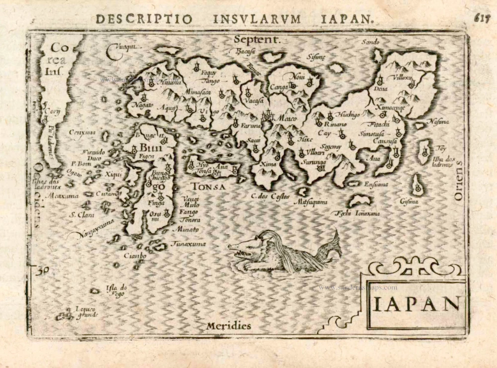
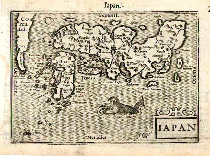
Iapan. 1602
Japan by Langenes, published by Bertius P.
[Item number: 12487]
Scarce map in old colour
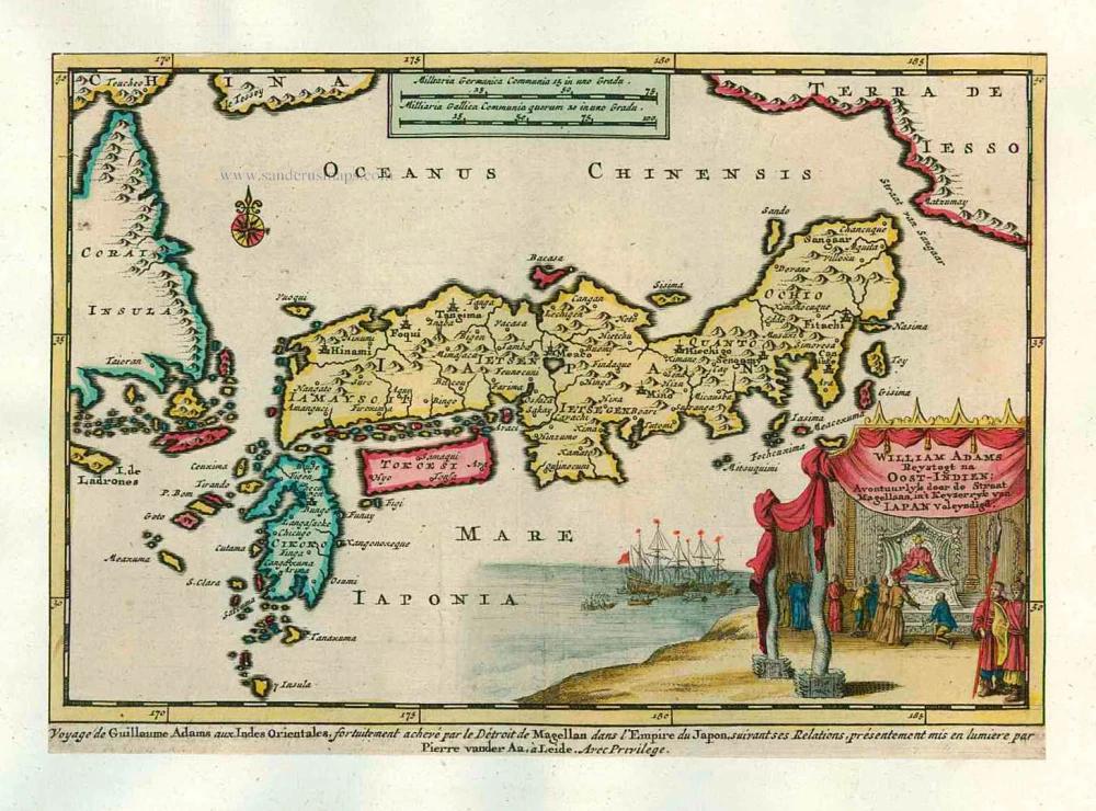
William Adams Reystogt na Oost-Indien; Avontuurlyk door de Straat Magellaan, in't Keyzerryk van Japan Voleyndigd. 1713
Japan by P. Van der Aa
[Item number: 26121]
In rare old colour
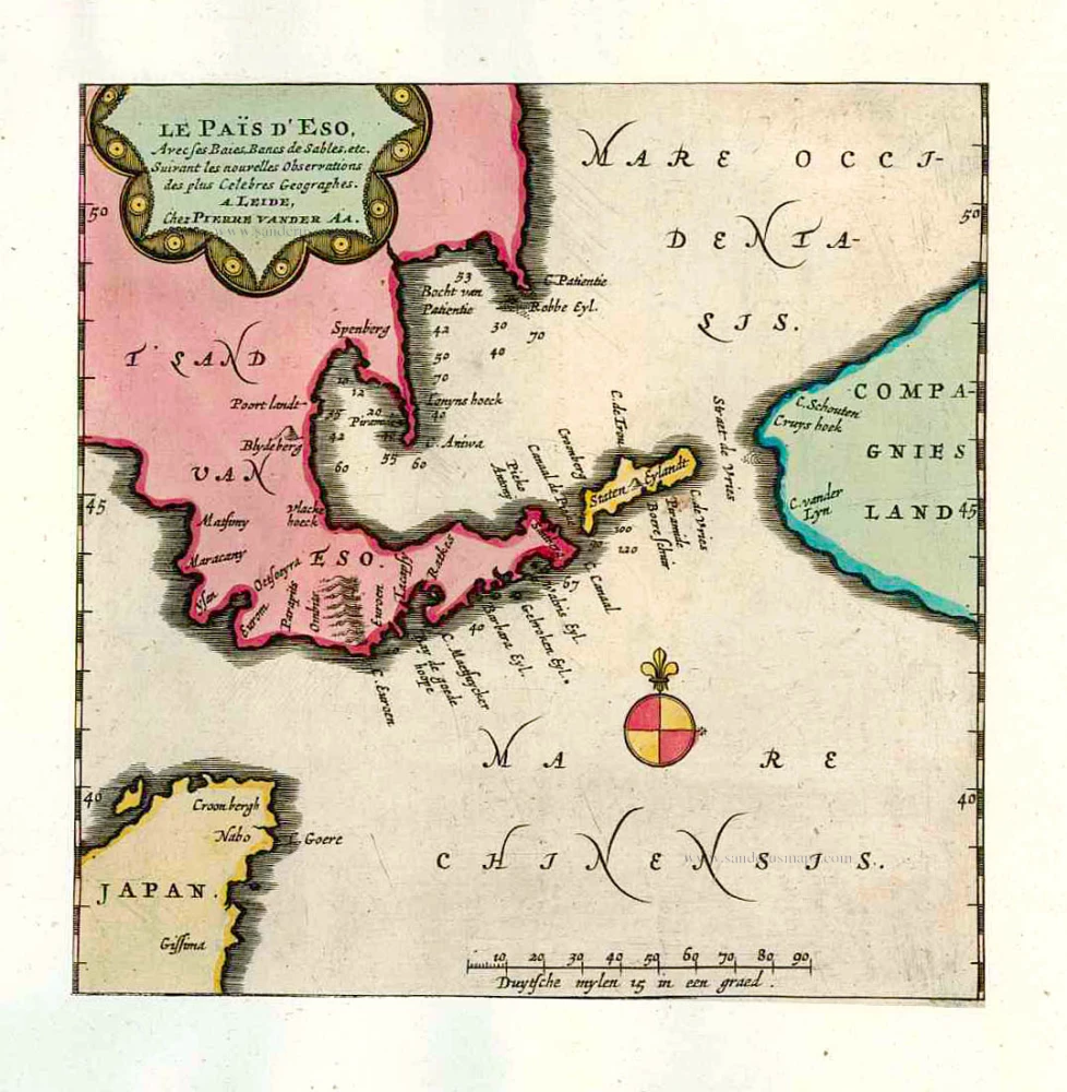
Le Païs d'Eso, Avec ses Baies, Bancs de Sables, etc. 1713
Eso (Hokkaido), by Pieter van der Aa.
[Item number: 26122]
In rare old colour
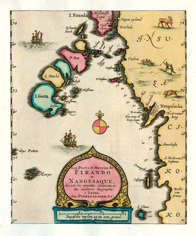
Les Ports et Havres de Firando et Nangesaque. 1713
Nagasaki and Hirado, by Pieter Van der Aa.
[Item number: 26123]
Iaponiae Nova Desciptio. 1641
Japan & Korea by Johannes Janssonius
[Item number: 26441]
Rare first edition!
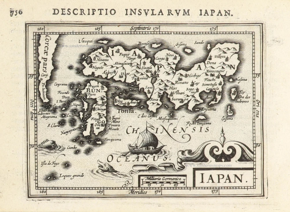
Iapan. 1598
Japan by Barent Langenes & Cornelis Claesz
[Item number: 26543]
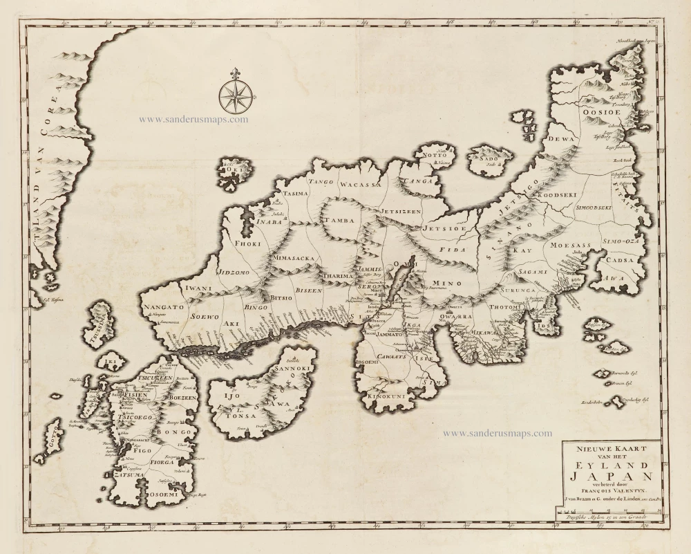
Nieuwe kaart van het Eyland Japan. 1724-26
Japan by François Valentyn (Valentijn).
[Item number: 26876]
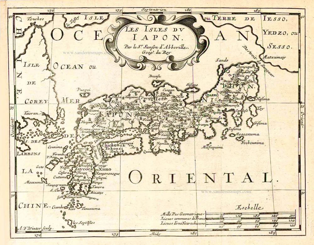
Les Isles du Iapon. 1683
Japan, by Nicolas Sanson.
[Item number: 27081]

The first accurate European map of Japan.
Iaponiae Insulae Descriptio. 1609
Japan by Abraham Ortelius.
[Item number: 28433]
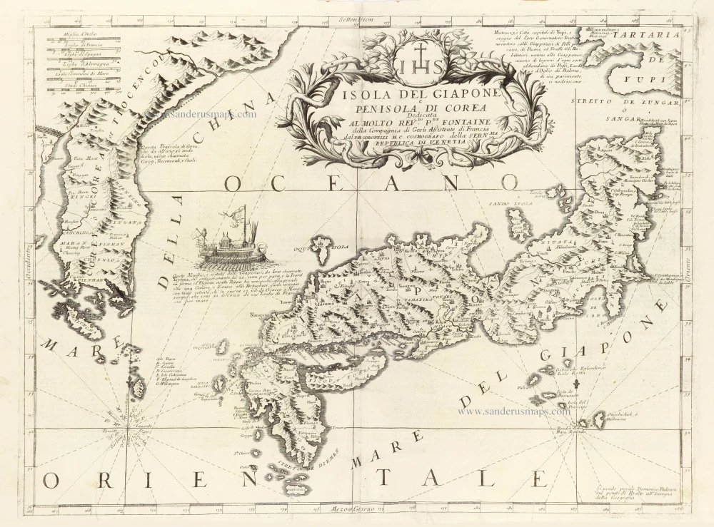
Isola del Giapone e Penisola di Corea. 1696
Japan - Korea by Vincenzo Coronelli.
[Item number: 28757]
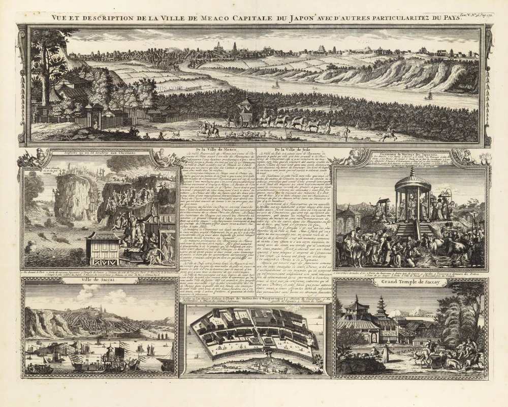
Vue et Description de la Ville de Meaco, Capitale du Japon avec d'autres Particularitez du Pays. 1719
Meaco (Kyoto - Japan), by Z. Châtelain.
[Item number: 29373]
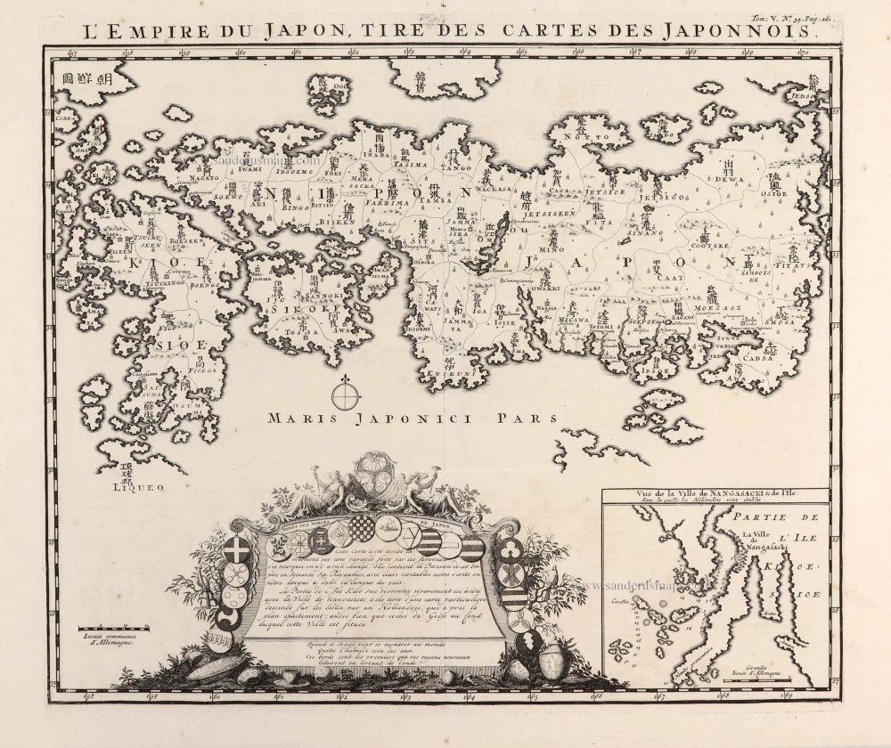
L'Empire du Japon, tiré des Cartes des Japonnois. 1719
Japan, by Z. Châtelain.
[Item number: 29379]
First map to show Korea as a peninsula. Excellent condition.
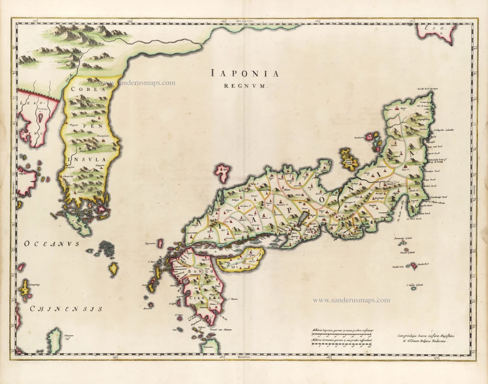
Iaponia Regnum. 1655-1659
Japan & Korea by Joan Blaeu.
[Item number: 29853]
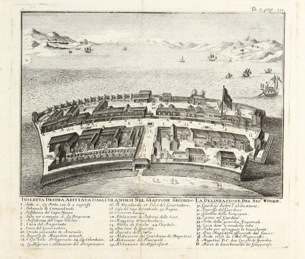
Isoletta Desima abittata dagli Olandeis nel Giappone secondo la delineazione del Sigr. Voogt. 1736
Deshima (Dejima - Japan) by Thomas Salmon after Gerrits Voogt.
[Item number: 29892]
Scarce
Iapan. 1616
Japan by Petrus Bertius, published by Jodocus Hondius jr.
[Item number: 30244]
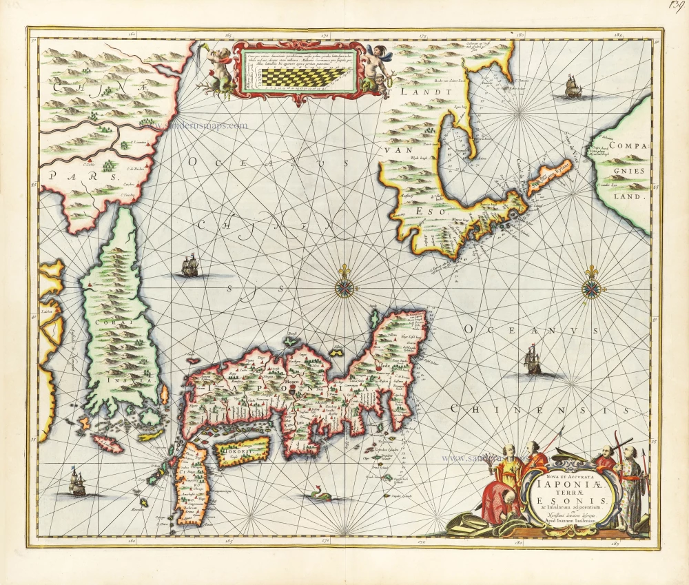
Nova et Accurata Iaponiae, Terrae Esonis, ac Insularum Adjacentium. 1666
Japan - Korea by Johannes Janssonius
[Item number: 30335]