
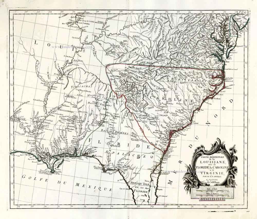
The United States (Southeast), by Francesco Santini. 1776-79
Francesco and Paolo Santini (c.1729-1793)
Francesco Santini, a Venetian publisher, acquired the printing plates of Vaugondy’s Atlas Universel …, a commercial and cartographic success, with widespread influence on mapmakers throughout Europe. Together with his brother Paolo, he commissioned a new set of plates and reissued the atlas in 1776. The following year, Paolo Santini assigned all his publication rights to M. Remondini, who in 1777 reissued the same atlas but with his name.
Jean-Baptiste Bourguignon d'Anville (1697 -1782)
French geographer and cartographer to the king. He made more than 200 maps during his life. His maps remained the reference point in cartography throughout the 19th century.
Partie Méridionale de la Louisiane, avec la Floride, la Caroline et la Virginie.
Item Number: 26983 Authenticity Guarantee
Category: Antique maps > America > North America
Old, antique map of the southeast of the United States, by Paolo Santini.
First state with the imprint of Remondini: with engraved page numbers in the top right corner: "P.II.48".
Cartographer: Jean Baptiste Bourguignon d'Anville
Date of the first edition: 1776
Date of this map: 1776
Copper engraving, printed on paper.
Size (not including margins): 48 x 57cm (18.7 x 22.2 inches)
Verso: Blank
Condition: Original coloured in outline, excellent.
Condition Rating: A+
From: Atlas Universel dressé sur les meilleures cartes modernes. Venice, Remondini, 1776-79.
Francesco and Paolo Santini (c.1729-1793)
Francesco Santini, a Venetian publisher, acquired the printing plates of Vaugondy’s Atlas Universel …, a commercial and cartographic success, with widespread influence on mapmakers throughout Europe. Together with his brother Paolo, he commissioned a new set of plates and reissued the atlas in 1776. The following year, Paolo Santini assigned all his publication rights to M. Remondini, who in 1777 reissued the same atlas but with his name.
Jean-Baptiste Bourguignon d'Anville (1697 -1782)
French geographer and cartographer to the king. He made more than 200 maps during his life. His maps remained the reference point in cartography throughout the 19th century.
Related items
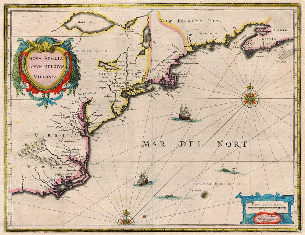
Nova Anglia Novum Belgium et Virginia 1638
United States (Northeast) by Janssonius J.
[Item number: 19011]
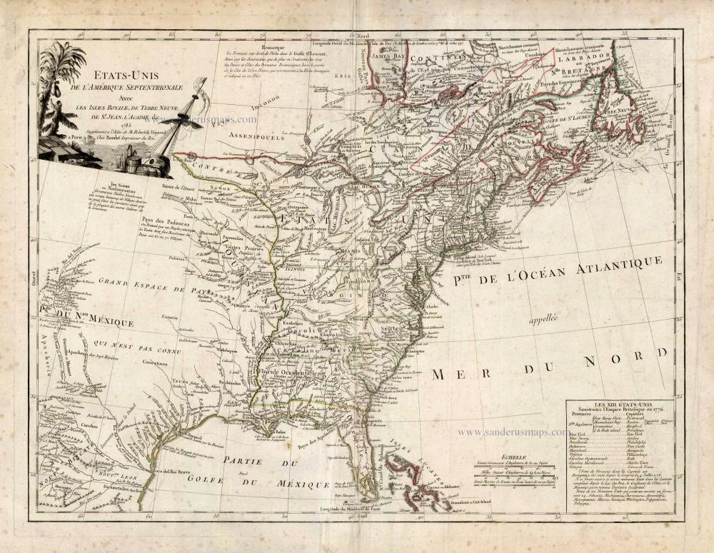
Etats-Unis de l'Amerique Septentrionale avec les Isles Royale, de Terre Neuve de St. Jean, l'Acadie &c. 1786
United States (East) by Boudet A. - de Vaugondy R.
[Item number: 25265]
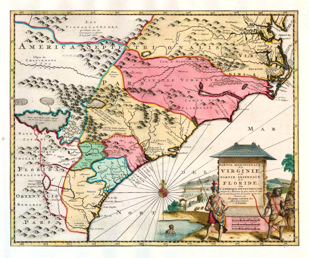
Partie Meridionale de la Virginie, et la Partie Orientale de la Floride dans l'Amerique Septentrionale. 1713
Carolina by Pieter van der Aa.
[Item number: 26137]
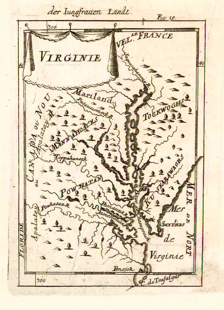
Virginie. 1685
Virginia and Maryland, by A.M. Mallet.
[Item number: 26602]
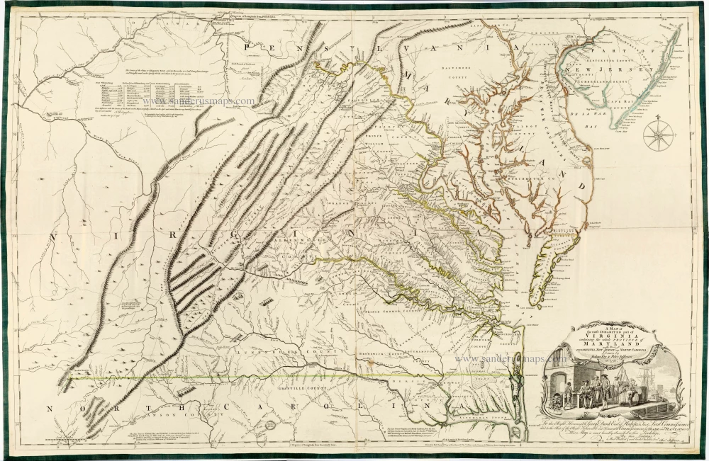
Very important Virginia map.
A Map of the Most Inhabited Part of Virginia Containing the Whole Province of Maryland with Part of Pensilvania, New Jersey and North Carolina. 1775
Joshua Fry & Peter Jefferson
[Item number: 28119]