
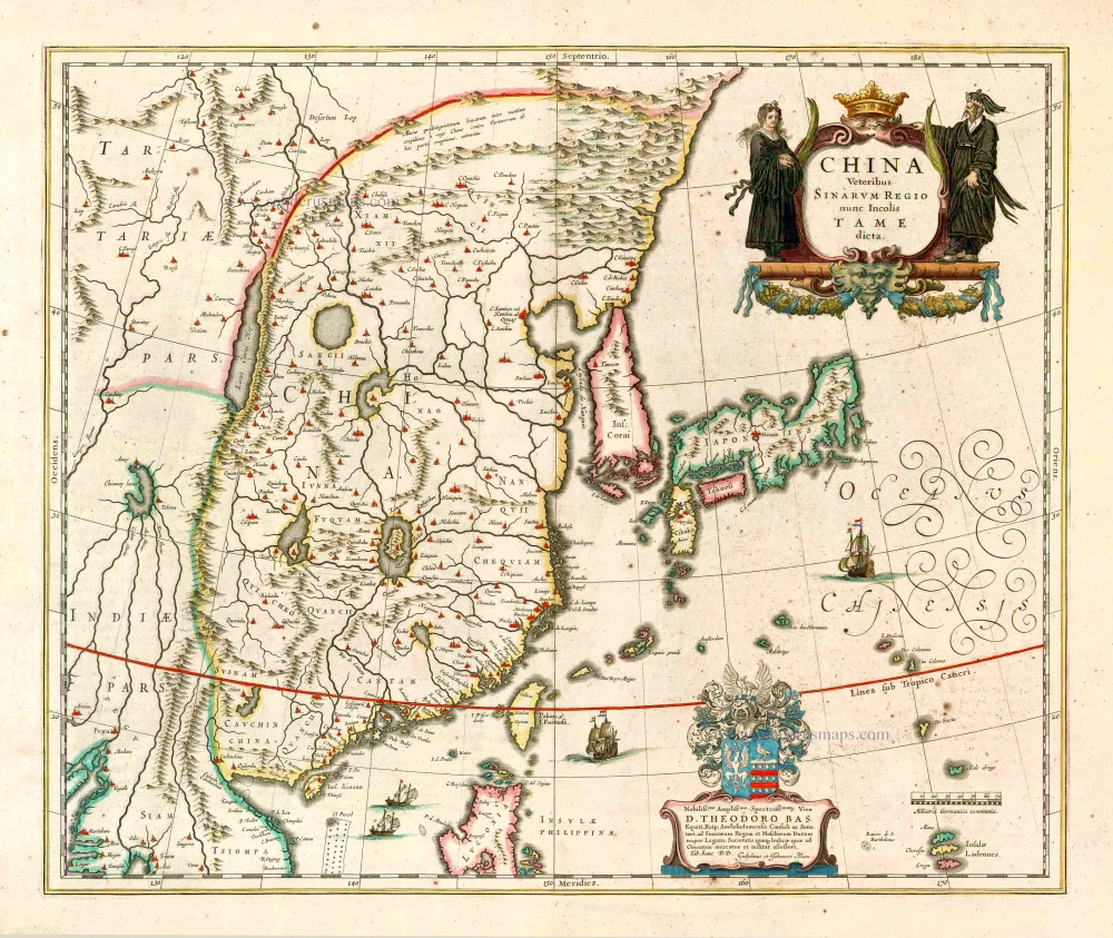
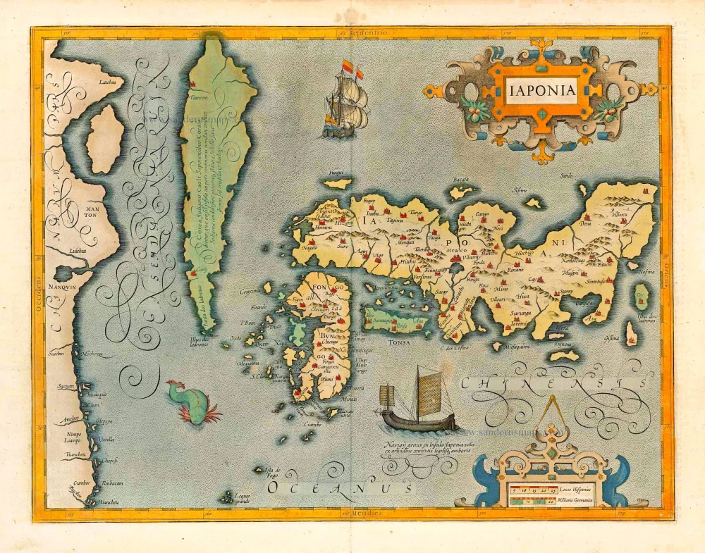
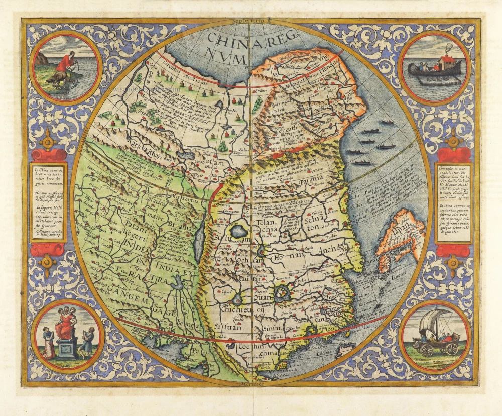
China - Japan - Korea, by Willem & Joan Blaeu. 1649-55
The Blaeus: Willem Janszoon, Cornelis & Joan
Willem Jansz. Blaeu and his son Joan Blaeu are the seventeenth century's most widely known cartographic publishers.
Willem Jansz. (also written Guilielmus Janssonius) = Willem Janszoon Blaeu was born in Uitgeest (Netherlands), near Alkmaar, in 1571. He studied mathematics under Tycho Brahe and learned the theory and practice of astronomical observations and the art of instrument- and globe-making.
In 1596, he came to Amsterdam, where he settled down as a globe-, instrument- and map-maker. He published his first cartographic work (a globe) in 1599 and probably published his first printed map (a map of the Netherlands) in 1604. He specialised in maritime cartography, published the first edition of the pilot guide Het Licht der Zeevaert in 1608, and was appointed Hydrographer of the V.O.C. (United East India Company) in 1633. After publishing books, wall maps, globes, charts and pilot guides for thirty years, he brought out his first atlas, Atlas Appendix (1630). This was the beginning of the great tradition of atlas-making by the Blaeus.
In 1618, another mapmaker, bookseller and publisher, Johannes Janssonius, established himself in Amsterdam next door to Blaeu's shop. No wonder these two neighbours began accusing each other of copying and stealing their information and became fierce competitors who did not have a good word to say about each other. In about 1621 Willem Jansz. decided to end the confusion between his name and his competitor's and assumed his grandfather's nickname, 'blauwe Willem' ('blue Willem'), as the family name; after that, he called himself Willem Jansz. Blaeu.
Willem Janszoon Blaeu died in 1638, leaving his prospering business to his sons, Cornelis and Joan. We only know that Cornelis's name occurs in the prefaces of books and atlases until c. 1645.
Joan Blaeu, born in Amsterdam in 1596, became a partner in his father’s book trade and printing business. 1638, he was appointed his father’s successor in the Hydrographic Office of the V.O.C. His efforts culminated in the magnificent Atlas Major and the town books of the Netherlands and Italy – works unsurpassed in history and modern times, giving eternal fame to the name of the Blaeu's.
On February 23, 1672, a fire ruined the business. One year later, Dr Joan Blaeu died. The fire of 1672 and the passing away of the director gave rise to a complete sale of the stock of the Blaeu House. Five public auctions dispersed the remaining books, atlases, copperplates, globes, etc., among many other map dealers and publishers in Amsterdam. The majority was acquired by several booksellers acting in partnership.
In the succeeding years, the remaining printing department was left in the hands of the Blaeu family until 1695, when the printing house's inventory was sold at a public auction. That meant the end of the Blaeu's as a printing house of world renown.
China Veteribus Sinarum Regio Nunc Incolis Tame Dicta.
Item Number: 27043 Authenticity Guarantee
Category: Antique maps > Asia > China
Old, antique map of China - Japan - Korea by Willem and Joan Blaeu
Date of the first edition: 1634
Date of this map: 1649-55
Copper engraving, printed on paper.
Size (not including margins): 41.5 x 50cm (16.1 x 19.4 inches)
Verso text: Latin
Condition: Original coloured, slightly age-toned, some spotting.
Condition Rating: A
References: Van der Krogt 2, 8410:2A.
From: Theatrum Orbis Terrarum. J. Blaeu, 1649-55. (Van der Krogt 2, 2:203)
The Blaeus: Willem Janszoon, Cornelis & Joan
Willem Jansz. Blaeu and his son Joan Blaeu are the seventeenth century's most widely known cartographic publishers.
Willem Jansz. (also written Guilielmus Janssonius) = Willem Janszoon Blaeu was born in Uitgeest (Netherlands), near Alkmaar, in 1571. He studied mathematics under Tycho Brahe and learned the theory and practice of astronomical observations and the art of instrument- and globe-making.
In 1596, he came to Amsterdam, where he settled down as a globe-, instrument- and map-maker. He published his first cartographic work (a globe) in 1599 and probably published his first printed map (a map of the Netherlands) in 1604. He specialised in maritime cartography, published the first edition of the pilot guide Het Licht der Zeevaert in 1608, and was appointed Hydrographer of the V.O.C. (United East India Company) in 1633. After publishing books, wall maps, globes, charts and pilot guides for thirty years, he brought out his first atlas, Atlas Appendix (1630). This was the beginning of the great tradition of atlas-making by the Blaeus.
In 1618, another mapmaker, bookseller and publisher, Johannes Janssonius, established himself in Amsterdam next door to Blaeu's shop. No wonder these two neighbours began accusing each other of copying and stealing their information and became fierce competitors who did not have a good word to say about each other. In about 1621 Willem Jansz. decided to end the confusion between his name and his competitor's and assumed his grandfather's nickname, 'blauwe Willem' ('blue Willem'), as the family name; after that, he called himself Willem Jansz. Blaeu.
Willem Janszoon Blaeu died in 1638, leaving his prospering business to his sons, Cornelis and Joan. We only know that Cornelis's name occurs in the prefaces of books and atlases until c. 1645.
Joan Blaeu, born in Amsterdam in 1596, became a partner in his father’s book trade and printing business. 1638, he was appointed his father’s successor in the Hydrographic Office of the V.O.C. His efforts culminated in the magnificent Atlas Major and the town books of the Netherlands and Italy – works unsurpassed in history and modern times, giving eternal fame to the name of the Blaeu's.
On February 23, 1672, a fire ruined the business. One year later, Dr Joan Blaeu died. The fire of 1672 and the passing away of the director gave rise to a complete sale of the stock of the Blaeu House. Five public auctions dispersed the remaining books, atlases, copperplates, globes, etc., among many other map dealers and publishers in Amsterdam. The majority was acquired by several booksellers acting in partnership.
In the succeeding years, the remaining printing department was left in the hands of the Blaeu family until 1695, when the printing house's inventory was sold at a public auction. That meant the end of the Blaeu's as a printing house of world renown.
Related items
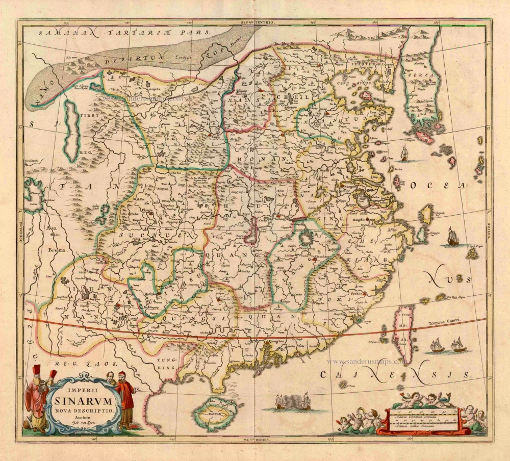
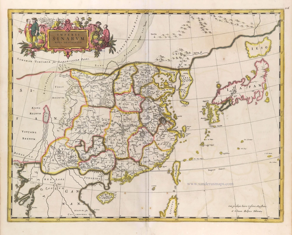
Imperii Sinarum Nova Descriptio. c. 1680.
China with Japan, Korea and Taiwan, by J. Janssonius.
[Item number: 2618]
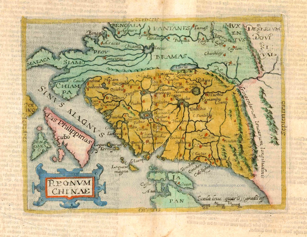
Regnum Chinae. 1596
Old antique map of China - Philippines - Japan by Giovanni Botero / Natalis Metellus.
[Item number: 3181]
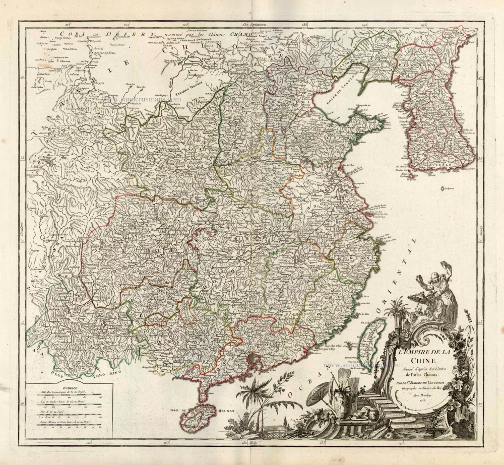
L'Empire de la Chine Dresse d'apres les Cartes de l'Atlas Chinois ... c. 1757
China, by Robert de Vaugondy.
[Item number: 5093]

With Korea as an island.
China 1619
China, Korea and Japan by J. Hondius.
[Item number: 6494]
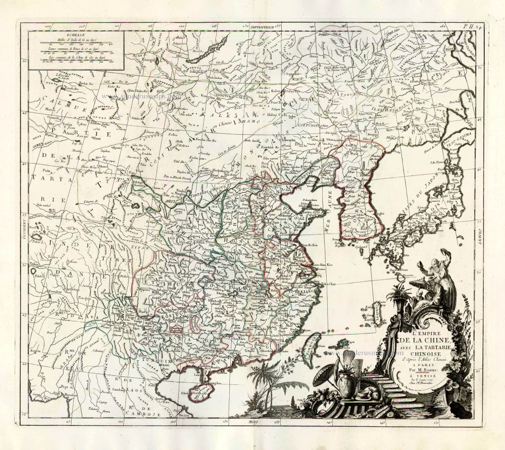
L'Empire de la Chine, avec la Tartarie Chinoise d'après l'Atlas Chinois. 1776-79
China with Korea and Japan, by Paolo Santini.
[Item number: 26974]
Important map.
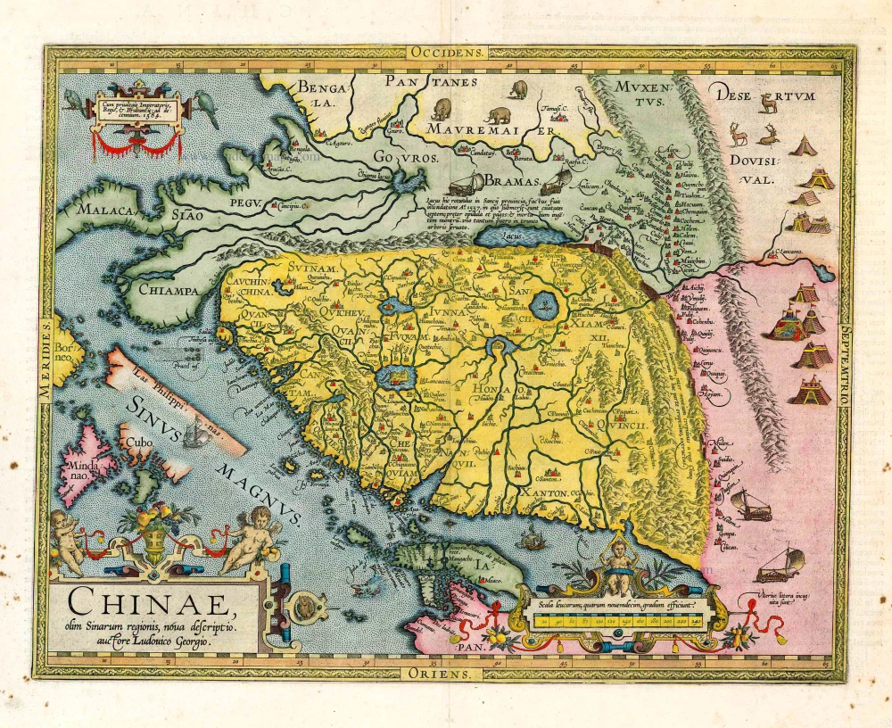
Chinae, Olim Sinarum regionis, nova descriptio. 1603
China by Abraham Ortelius
[Item number: 27040]
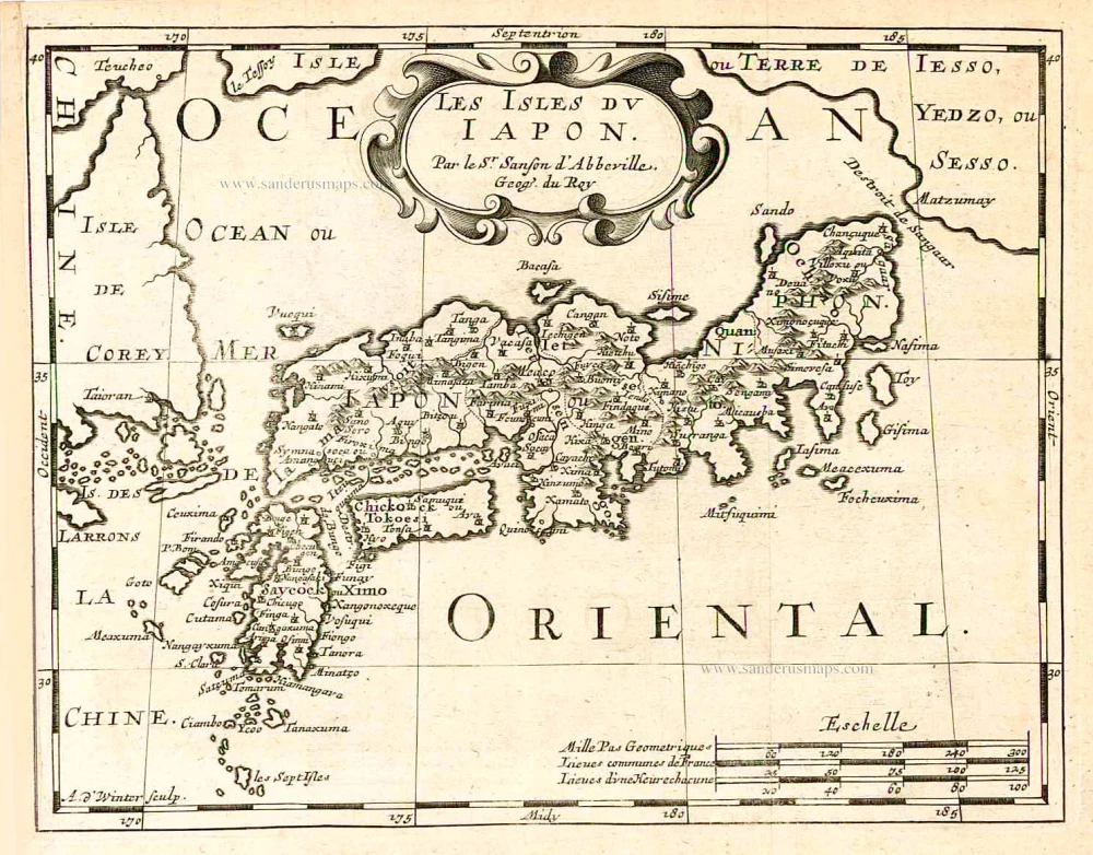
Les Isles du Iapon. 1683
Japan, by Nicolas Sanson.
[Item number: 27081]
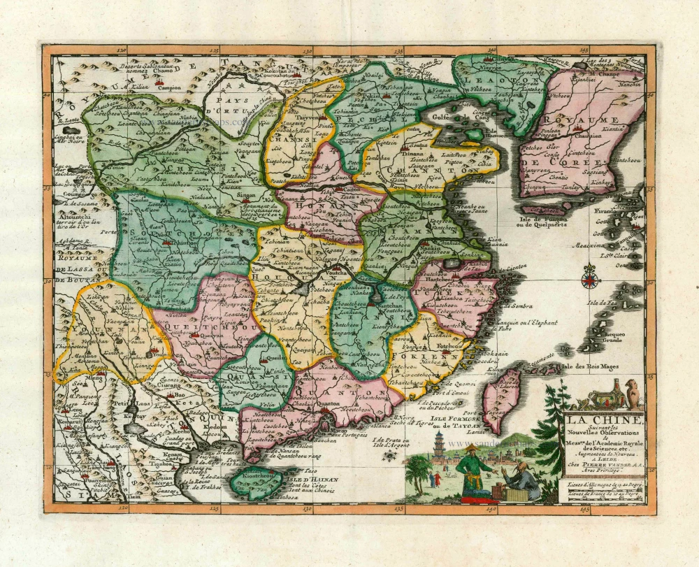
La Chine, Suivant les Nouvelles Observations. 1713
China, by Pieter van der Aa.
[Item number: 27095]
Very nice old colour
Iaponia. 1623
Japan, Jodocus Hondius.
[Item number: 27819]
First printed map of China.
Ta. Superioris Indiae et Tartariae Maioris. 1525
China - Japan, by Lorenz Fries.
[Item number: 27928]
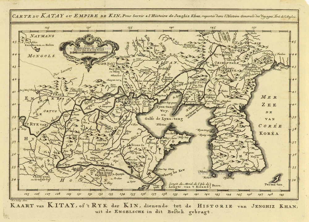
Carte du Katay, ou Empire de Kin. 1750
China - Korea by Jacques Nicolas Bellin.
[Item number: 28177]
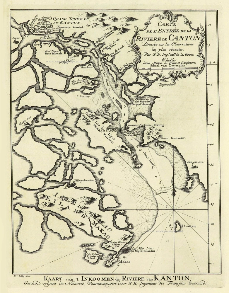
Carte de l'Entrée de la Rivière de Canton. 1749
Guangzhou (Canton) by Jacques Nicolas Bellin.
[Item number: 28194]
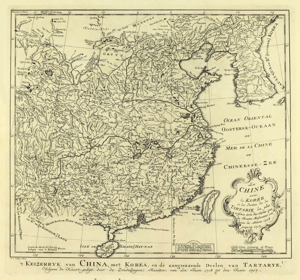
La Chine avec la Korée et les Parties de la Tartarie les plus voisines, 1749
China - Korea by Jacques Nicolas Bellin.
[Item number: 28195]

The first accurate European map of Japan.
Iaponiae Insulae Descriptio. 1609
Japan by Abraham Ortelius.
[Item number: 28433]
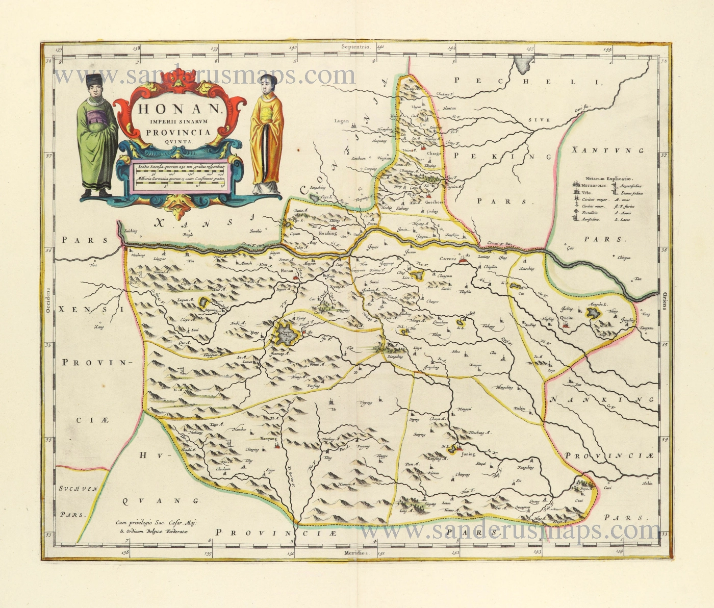
Honan, Imperii Sinarum Provincia Quinta. 1655-1659
Honan by Joan Blaeu
[Item number: 28593]
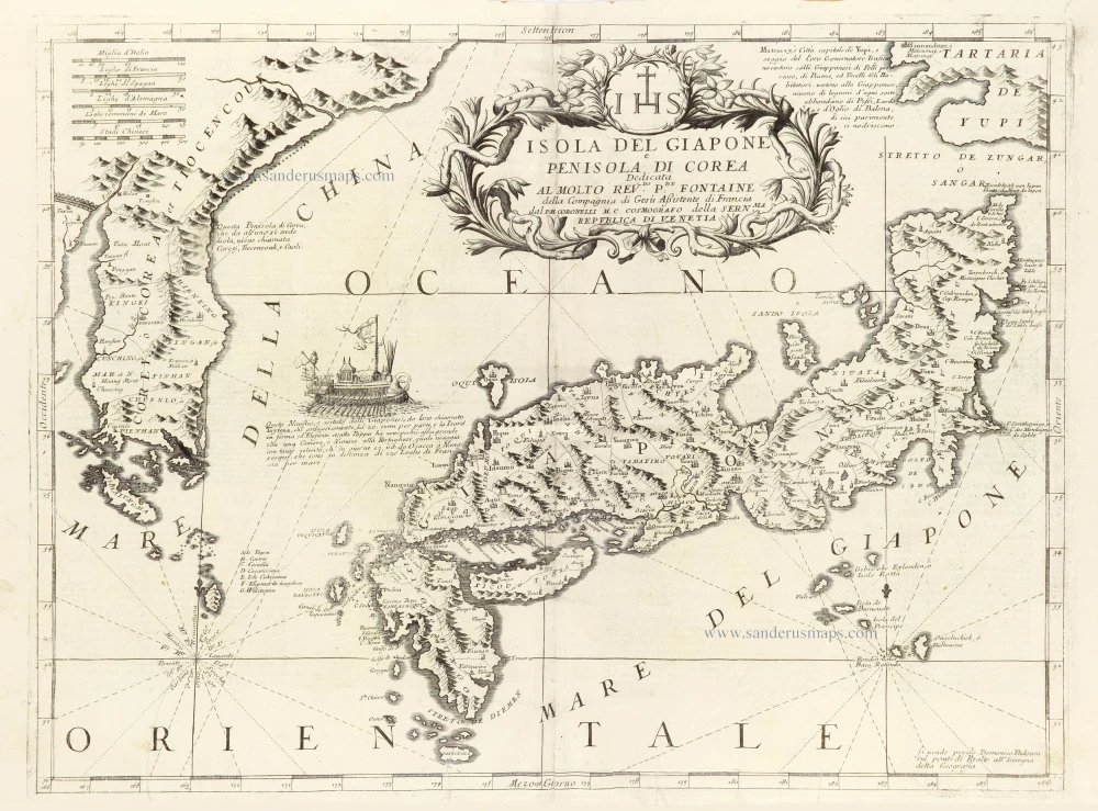
Isola del Giapone e Penisola di Corea. 1696
Japan - Korea by Vincenzo Coronelli.
[Item number: 28757]
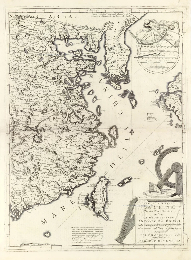
Parte Orientale della China, 1696
Eastern part of China with Korea and Formosa (Taiwan), by Vincenzo Coronelli.
[Item number: 28775]
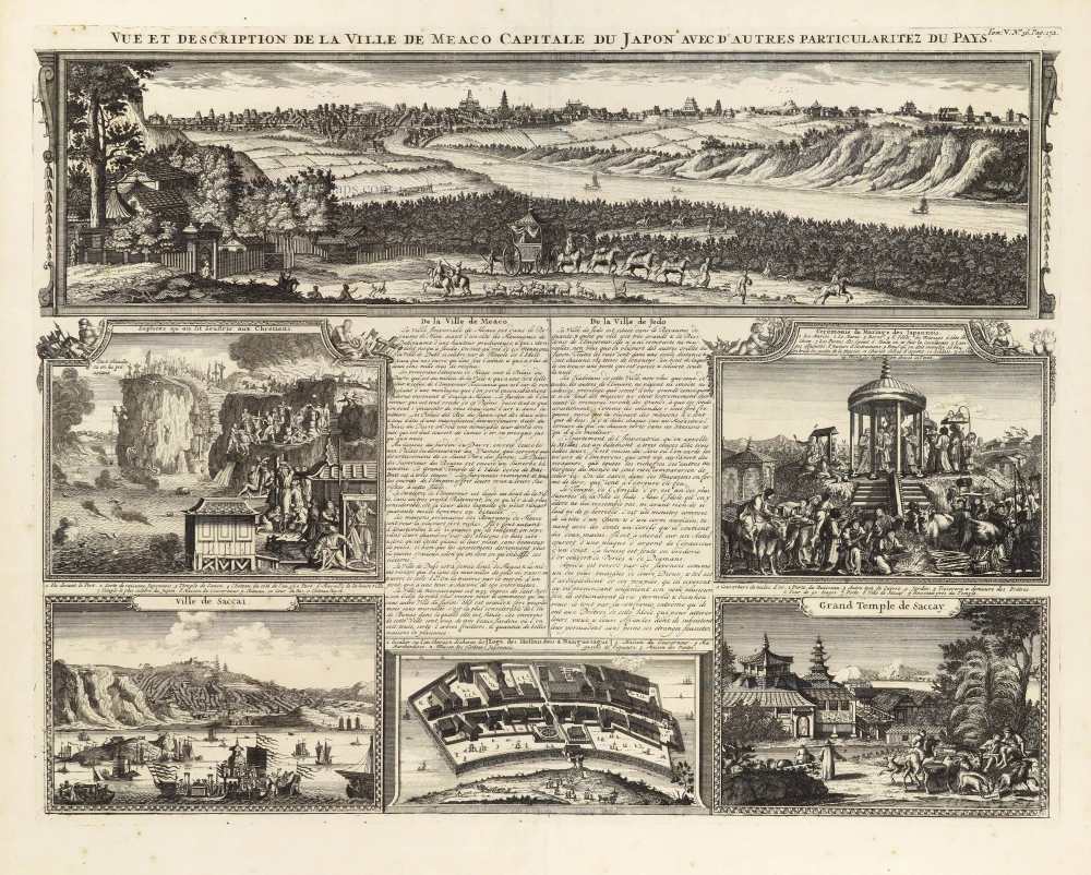
Vue et Description de la Ville de Meaco, Capitale du Japon avec d'autres Particularitez du Pays. 1719
Meaco (Kyoto - Japan), by Z. Châtelain.
[Item number: 29373]
From the Martini atlas
Imperii Sinarum Nova Descriptio. c. 1691-97
China by Joan Blaeu, published by Frederick de Wit.
[Item number: 29431]
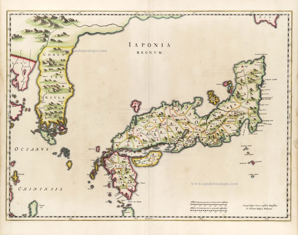
First map to show Korea as a peninsula. Excellent condition.
Iaponia Regnum. 1655-1659
Japan & Korea by Joan Blaeu.
[Item number: 29853]
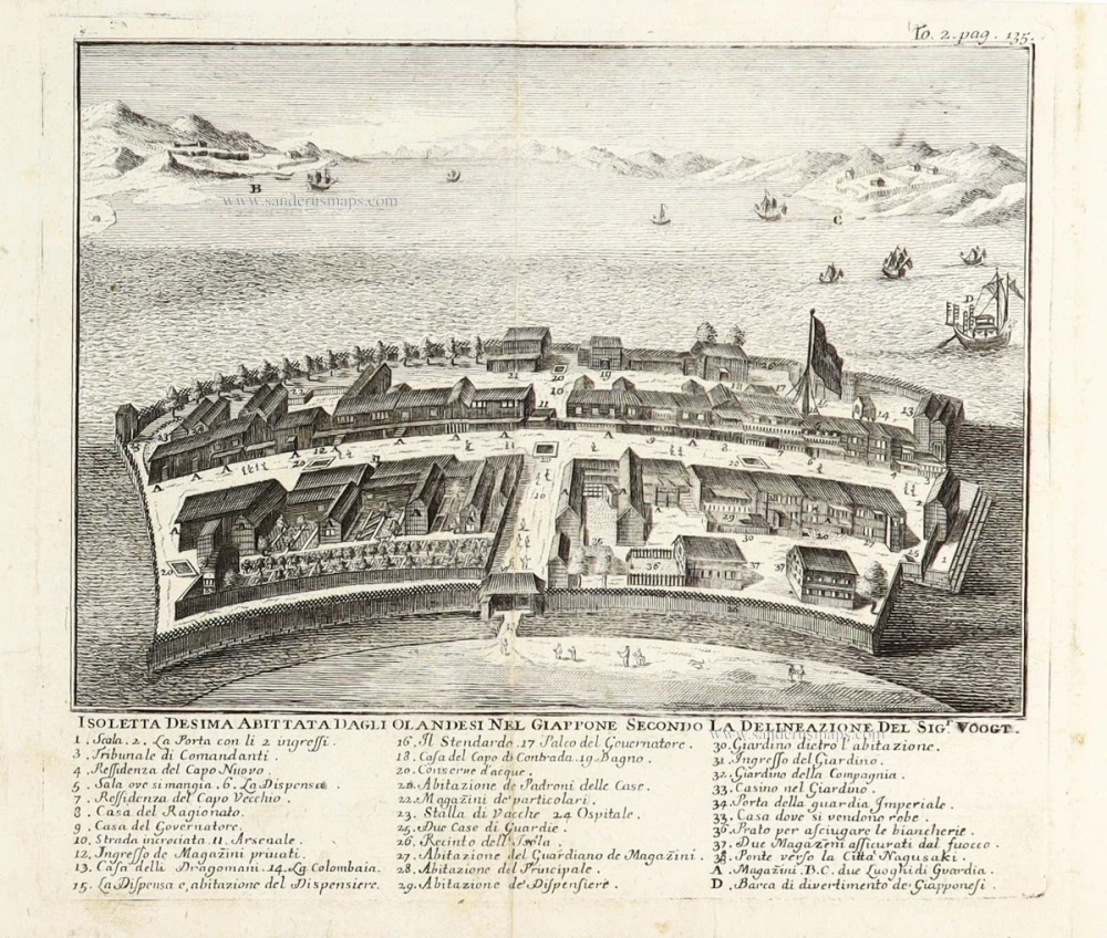
Isoletta Desima abittata dagli Olandeis nel Giappone secondo la delineazione del Sigr. Voogt. 1736
Deshima (Dejima - Japan) by Thomas Salmon after Gerrits Voogt.
[Item number: 29892]
China. 1634
China by Jodocus Hondius.
[Item number: 30165]
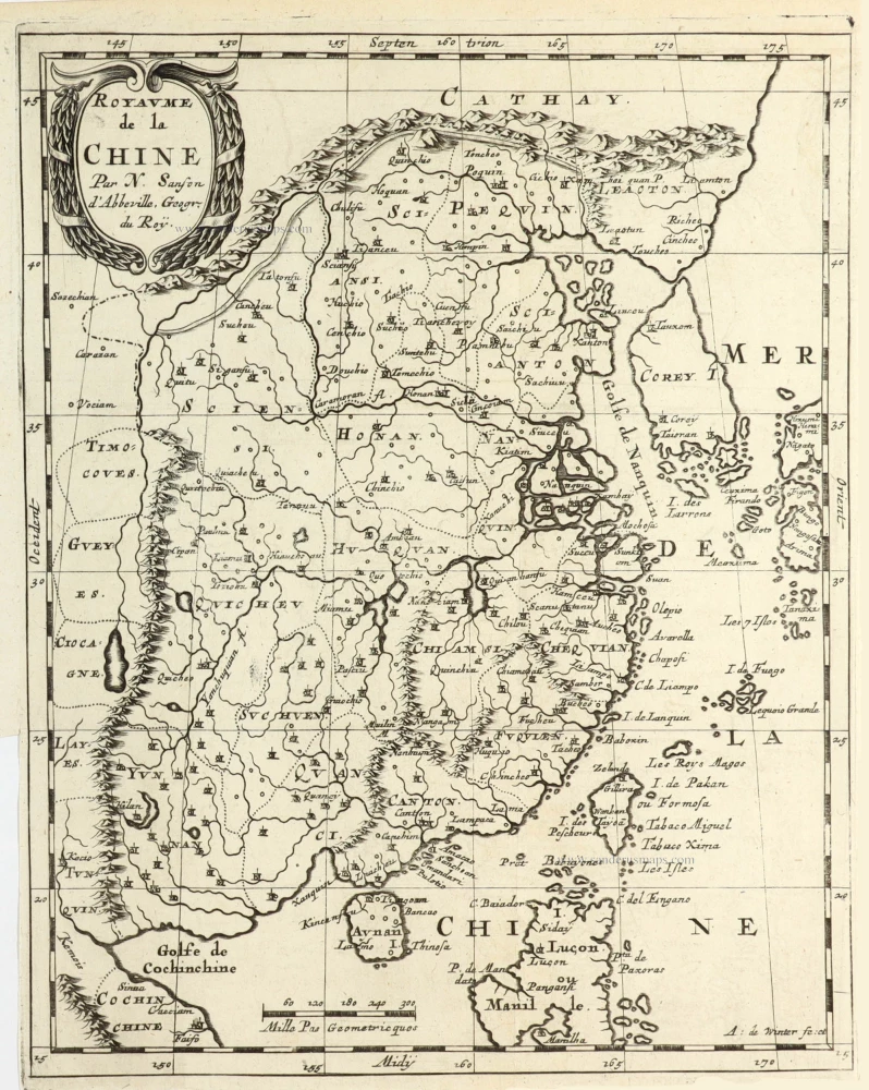
Royaume de la Chine. 1682
China by Nicolas Sanson, published by Simon de Vries.
[Item number: 30235]
Scarce
Iapan. 1616
Japan by Petrus Bertius, published by Jodocus Hondius jr.
[Item number: 30244]
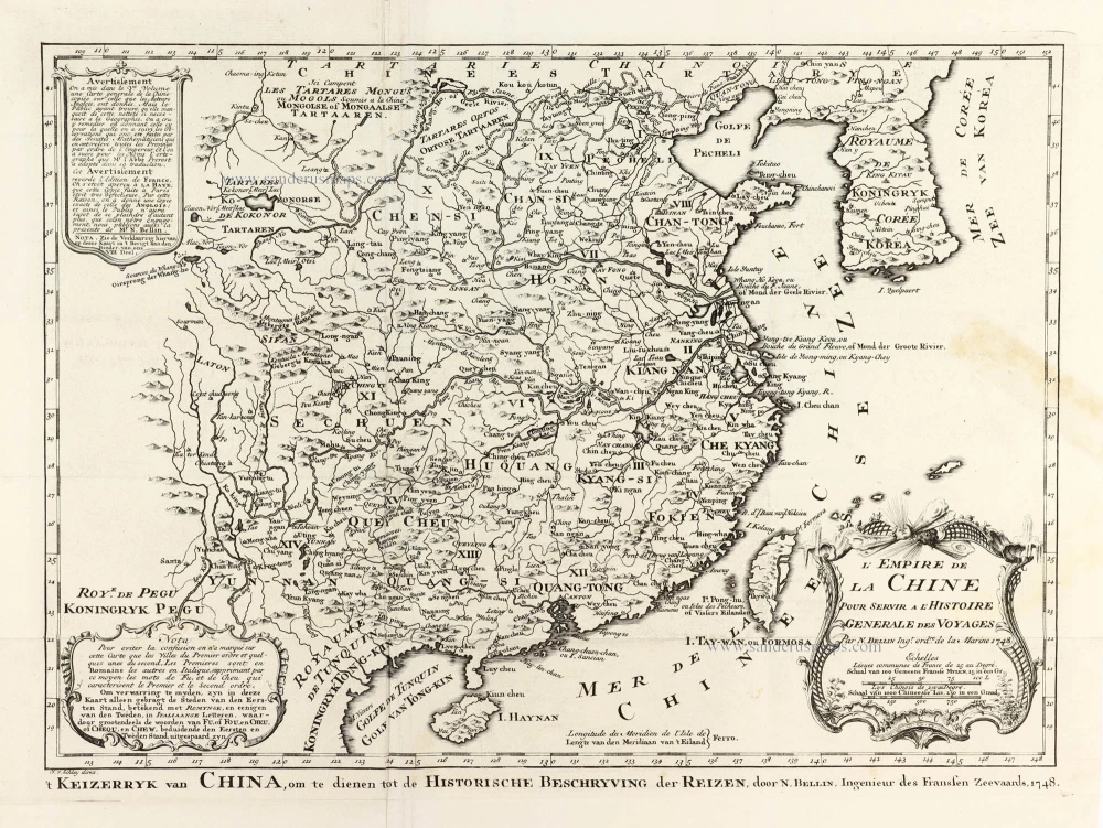
L'Empire de la Chine 1748
China by N. Bellin.
[Item number: 30260]
Important and rare china map.
China Regnum. 1593
China by Cornelis de Jode
[Item number: 30312]
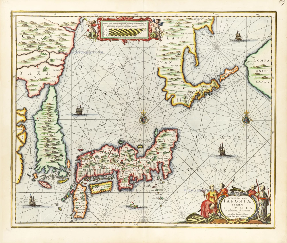
Nova et Accurata Iaponiae, Terrae Esonis, ac Insularum Adjacentium. 1666
Japan - Korea by Johannes Janssonius
[Item number: 30335]
SCARCE !
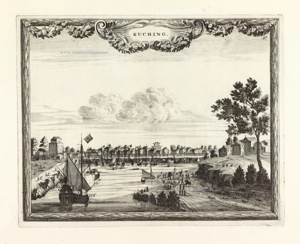
Kuching. 1685/90
View of Tianjin (Tientsin - China), by Carel Allard.
[Item number: 30585]
new