
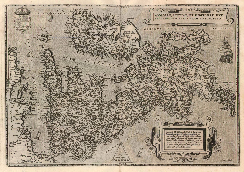
The British Isles, by François de Belleforest. 1575
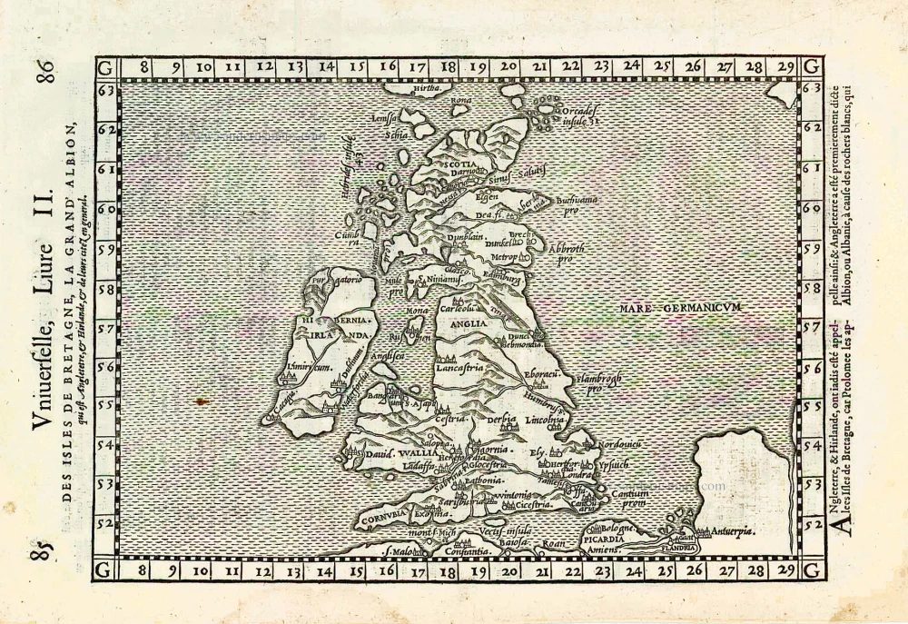
This map is a direct copy of the one which appeared in the modern section of Girolamo Ruscelli's Venetian version of Ptolemy's Geographia in 1561.
The Cosmographie Universelle of F. de Belleforest was published in a shared edition by Nicolas Chesneau and Michel Sonnius. The objective of the two partners was to reprint Sébastien Münster's Cosmographie in French. Münster's work, published in Basel in 1544, had indeed been a great success and had known multiple reissues. It had been published in French in 1552, but Chesneau and Sonnius, noting that Münster had mainly treated his own country, Germany, wanted to satisfy the tastes of their compatriots more.
They appealed for the text of the work to François de Belleforest (1530-1583). Belleforest probably helped Chesneau and Sonnius in their quest for new city plans.
Belleforest's Cosmographie is presented in two parts, the first of which is divided into two volumes; each of the three volumes has its own title. Some copies bear the imprint of Chesneau and others that of Sonnius.
Of the 163 plates in the Cosmographie, only 49 are copied from the work of Sebastian Münster. Little is known about the engravers of the Cosmographie. The name of Cruche appears only once, at the bottom of the plate of Paris. Raymont Rancurel is the second known engraver in the Cosmographie. In 1572 appeared, the first volume of the Civitates Orbis Terrarum of Braun and Hogenberg. Twenty of these plates were copied by the Cosmographie of Belleforest. On the other hand, the later volumes of the Civitates borrowed eleven cities from Belleforest's work. From the Theatrum Orbis Terrarum of Abraham Ortelius (1570), Chesneau and Sonnius have retained more modern maps than those of Münster. Other plans have been copied from the Plantz and Pourtraitz by Antoine Du Pinet or from the small maps of Camocio.
Des Isles de Bretagne la Grand Albion.
Item Number: 27162 Authenticity Guarantee
Category: Antique maps > Europe > British Isles
Old antique map of the British Isles, by François de Belleforest.
Title: The British Isles, by François de Belleforest.
Oriented to the west.
Cartographer: G. Ruscelli.
Date of the first edition: 1575.
Date of this map: 1575.
Woodcut, printed on paper.
Map size: 180 x 280mm (7.09 x 11.02 inches).
Sheet size: 220 x 340mm (8.66 x 13.39 inches).
Verso: Blank.
Condition: Excellent.
Condition Rating: A+.
From: La Cosmographie Universelle de tout le Monde. Paris, Nicolas Chesneau - Michel Sonnius, 1575. (= French edition of Münster's Cosmographia).
This map is a direct copy of the one which appeared in the modern section of Girolamo Ruscelli's Venetian version of Ptolemy's Geographia in 1561.
The Cosmographie Universelle of F. de Belleforest was published in a shared edition by Nicolas Chesneau and Michel Sonnius. The objective of the two partners was to reprint Sébastien Münster's Cosmographie in French. Münster's work, published in Basel in 1544, had indeed been a great success and had known multiple reissues. It had been published in French in 1552, but Chesneau and Sonnius, noting that Münster had mainly treated his own country, Germany, wanted to satisfy the tastes of their compatriots more.
They appealed for the text of the work to François de Belleforest (1530-1583). Belleforest probably helped Chesneau and Sonnius in their quest for new city plans.
Belleforest's Cosmographie is presented in two parts, the first of which is divided into two volumes; each of the three volumes has its own title. Some copies bear the imprint of Chesneau and others that of Sonnius.
Of the 163 plates in the Cosmographie, only 49 are copied from the work of Sebastian Münster. Little is known about the engravers of the Cosmographie. The name of Cruche appears only once, at the bottom of the plate of Paris. Raymont Rancurel is the second known engraver in the Cosmographie. In 1572 appeared, the first volume of the Civitates Orbis Terrarum of Braun and Hogenberg. Twenty of these plates were copied by the Cosmographie of Belleforest. On the other hand, the later volumes of the Civitates borrowed eleven cities from Belleforest's work. From the Theatrum Orbis Terrarum of Abraham Ortelius (1570), Chesneau and Sonnius have retained more modern maps than those of Münster. Other plans have been copied from the Plantz and Pourtraitz by Antoine Du Pinet or from the small maps of Camocio.
Related items
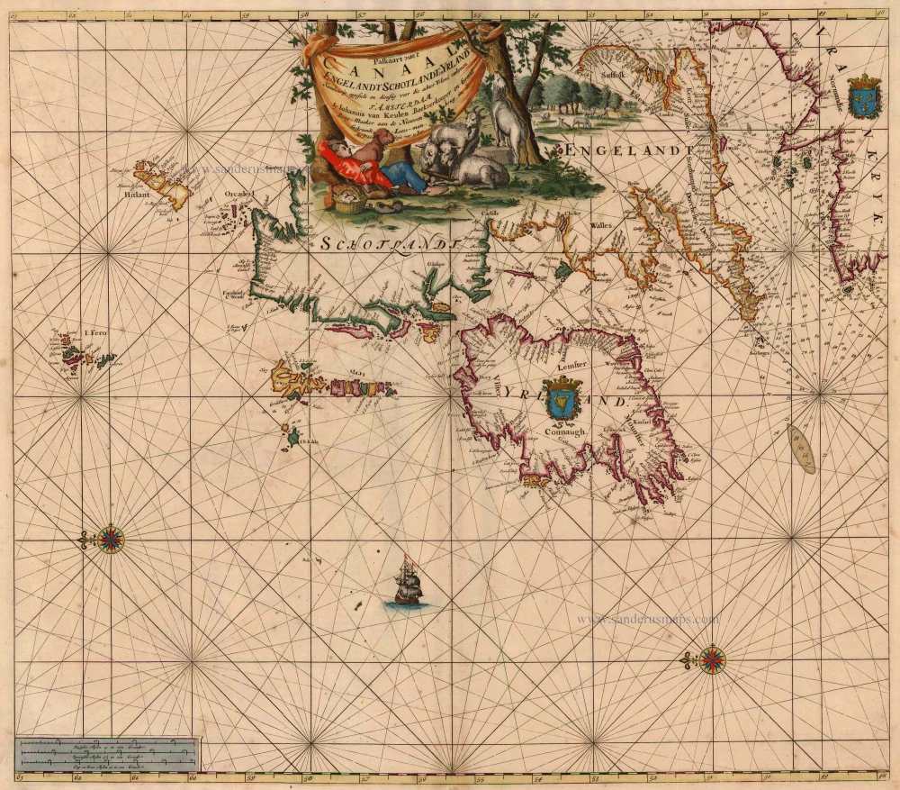
Paskaart van 't Canaal Engelandt Schotlandt en Yrland 1697-1709
British Isles, by Van Keulen Johannes.
[Item number: 5817]
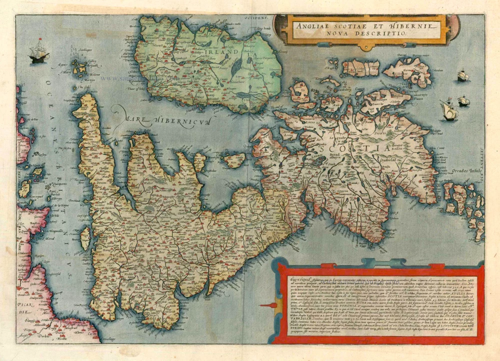
Angliae Scotiae et Hibernie Nova Descriptio 1593
British Isles, by de G. Jode.
[Item number: 11236]
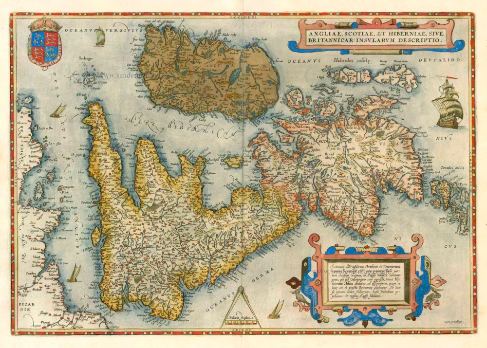
Angliae, Scotiae, et Hiberniae, sive Britannicae Insularum Descriptio. 1579
The British Isles by Abraham Ortelius.
[Item number: 17897]
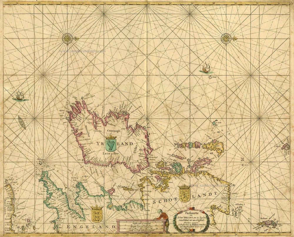
Paskaarte om achter Yrlant om te Zeylen van Hitlant tot aen Heyssant. 1665
British Isles, by Hendrik Doncker.
[Item number: 18567]
Angliae, Scotiae, et Hiberniae, sive Britannicae Insularum Descriptio. 1601
The British Isles, by Ortelius A.
[Item number: 22869]
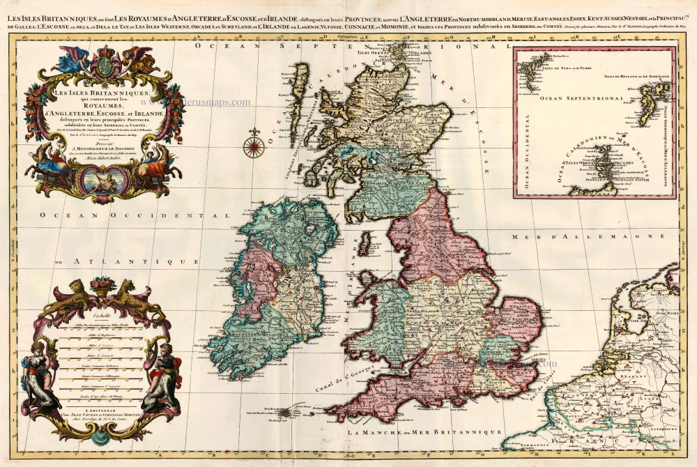
Les Isles Britanniques; qui Contiennent les Royaumes d'Angleterre, Escosse, et Irlande ... 1710
British Isles by Sanson - Covens & Mortier.
[Item number: 23726]
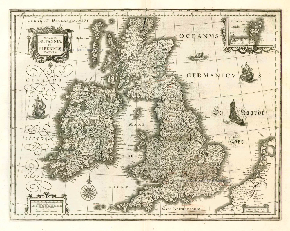
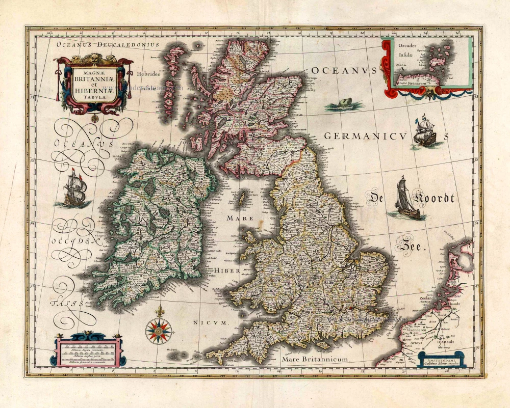
Magnae Britanniae et Hiberniae Tabula. 1662
British Isles, by W. & J. Blaeu.
[Item number: 25200]
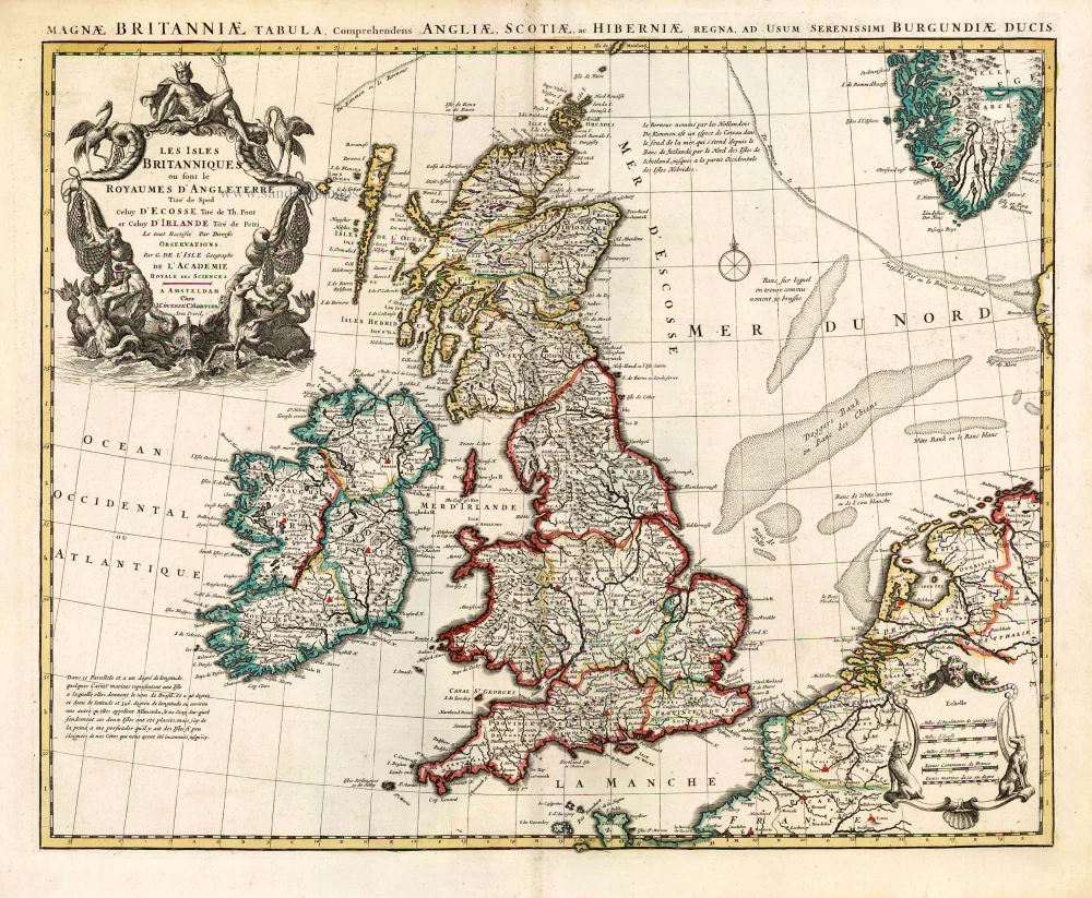
Les Isles Britanniques ou sont le Royaume D'Angleterre Tiré de Sped Celuy D'Ecosse Tiré de Th. Pont et Celuy D'Irlande Riré de Petti. 1730
British Isles by Guillaume Delisle, published by Covens & Mortier.
[Item number: 25680]
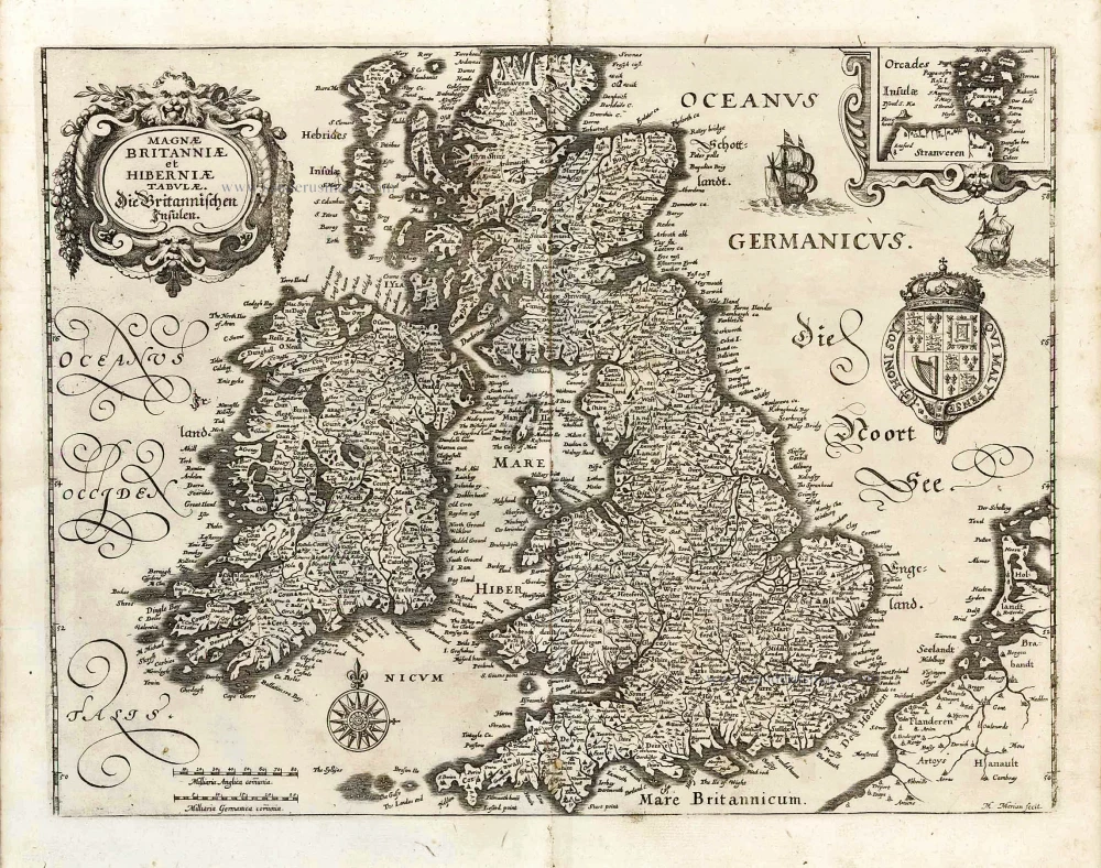
Magnae Britanniae et Hiberniae Tabulae. - Die Britannischen Insulen. 1638
The British Isles, by M. Merian.
[Item number: 25904]
Magnae Britanniae et Hiberniae Tabula. 1645
The British Isles, by Joan and Willem Blaeu
[Item number: 26715]

Les Isles Britanniques Comprenant les Royaumes d'Angleterre, d'Ecosse et d'Iralnade, divisés en grandes provinces, ... 1776-79
British Isles, by Francesco Santini.
[Item number: 26959]

Les Isles Britanniques; qui Contiennent les Royaumes d'Angleterre, Escosse, et Irlande. c. 1705
British Isles, by H. Jaillot
[Item number: 27772]
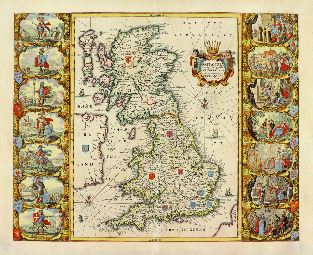
Britannia prout divisa fuit temporibus Anglo-Saxonum, praesertim durante illorum Heptarchia. 1652
Great Brittain by Georg Hornius
[Item number: 28033]
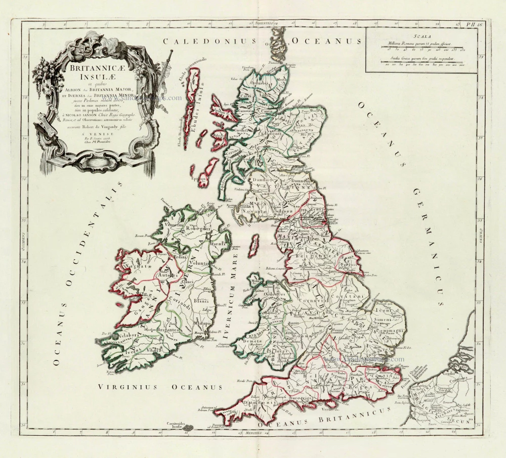
Britannicae Insulae in quibus Albion Seu Britannia Major, et Ivernia Seu Britannia Minor. 1776-79
British Isles, by Paolo Santini, after Nicolas Sanson & Sr. Robert de Vaugondy.
[Item number: 28105]
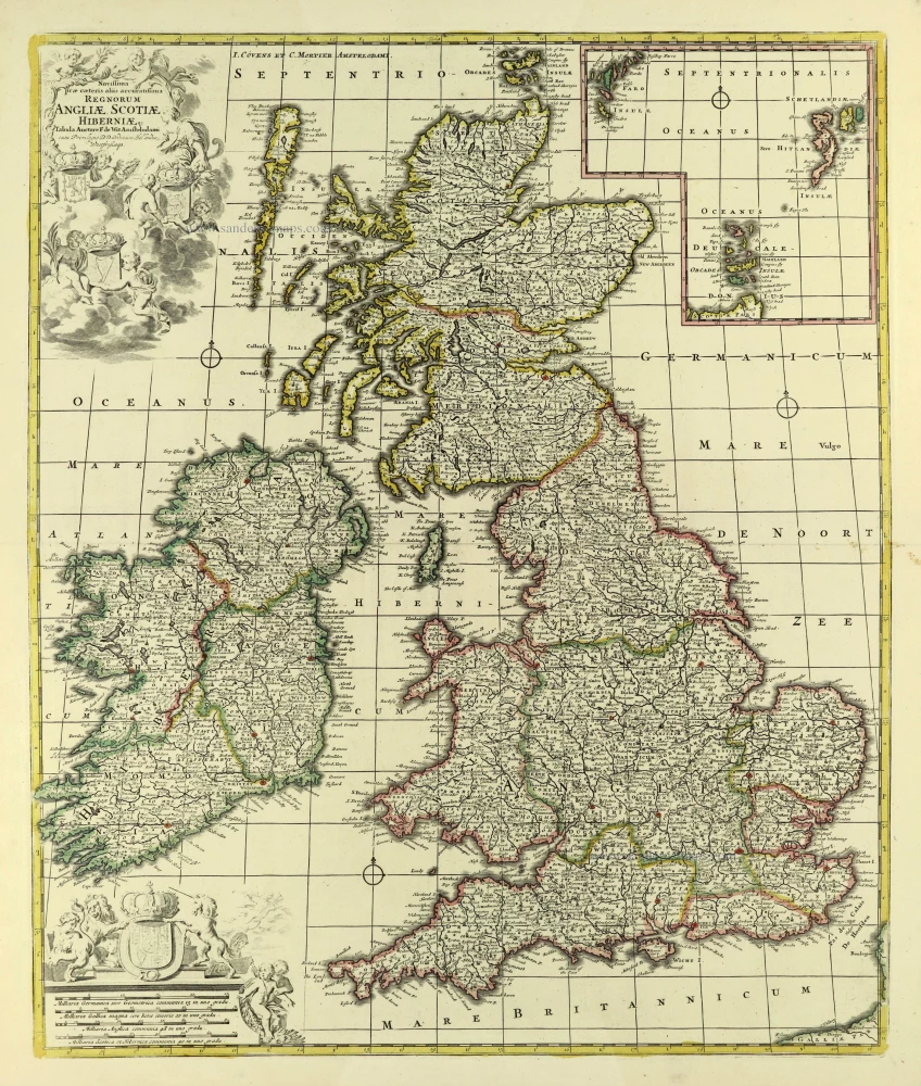
Novissima Prae Caeteris aliis Accuratissima Regnorum Angliae, Scotiae, Hiberniae. c. 1691-96
British Isles by Frederik De Wit.
[Item number: 28239]
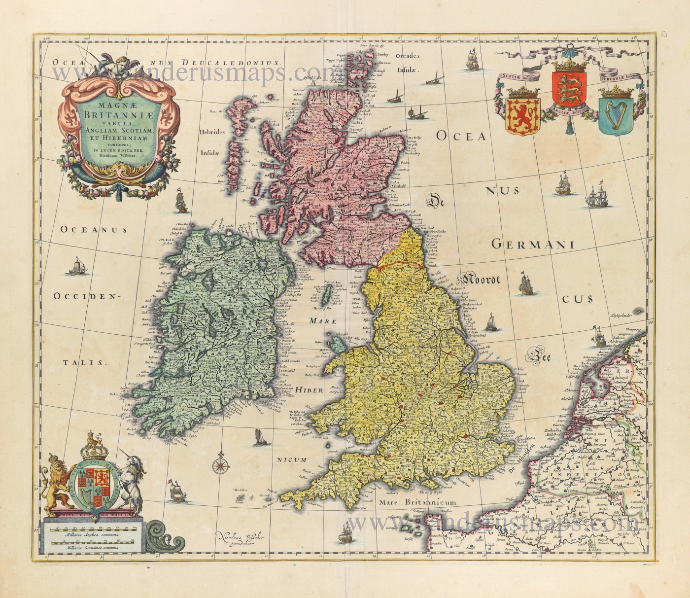
Magnae Britanniae Tabula, Angliam, Scotiam, et Hiberniam continens. 1677-80
British Isles by Nicolaes Visscher I.
[Item number: 28586]
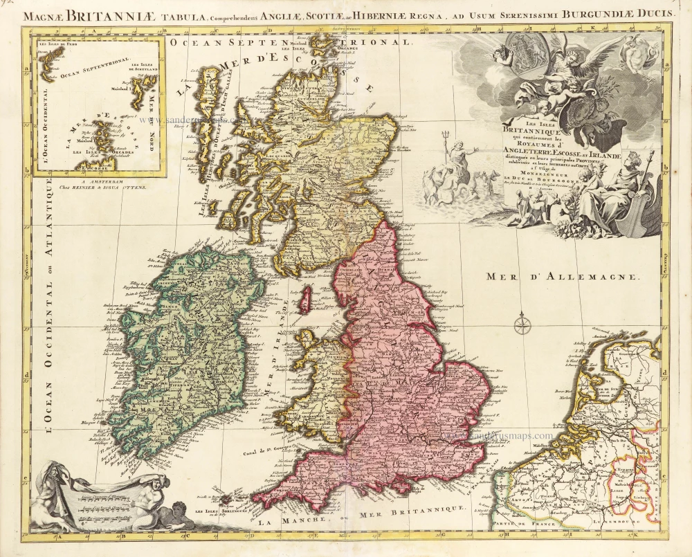
Les Isles Britanniques qui contiennent les Royaumes d'Angleterre Escosse, et Irlande. 1730-45
British Isles by Hubert Jaillot, published by Reinier and Josua Ottens.
[Item number: 28747]