
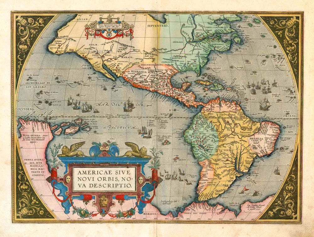
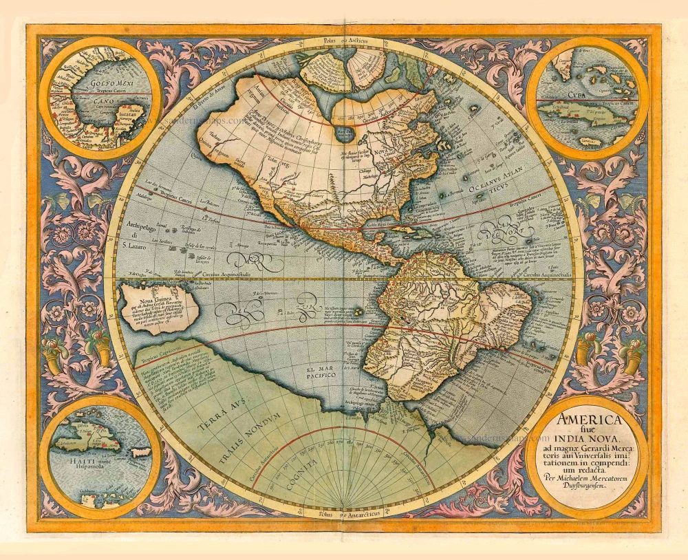
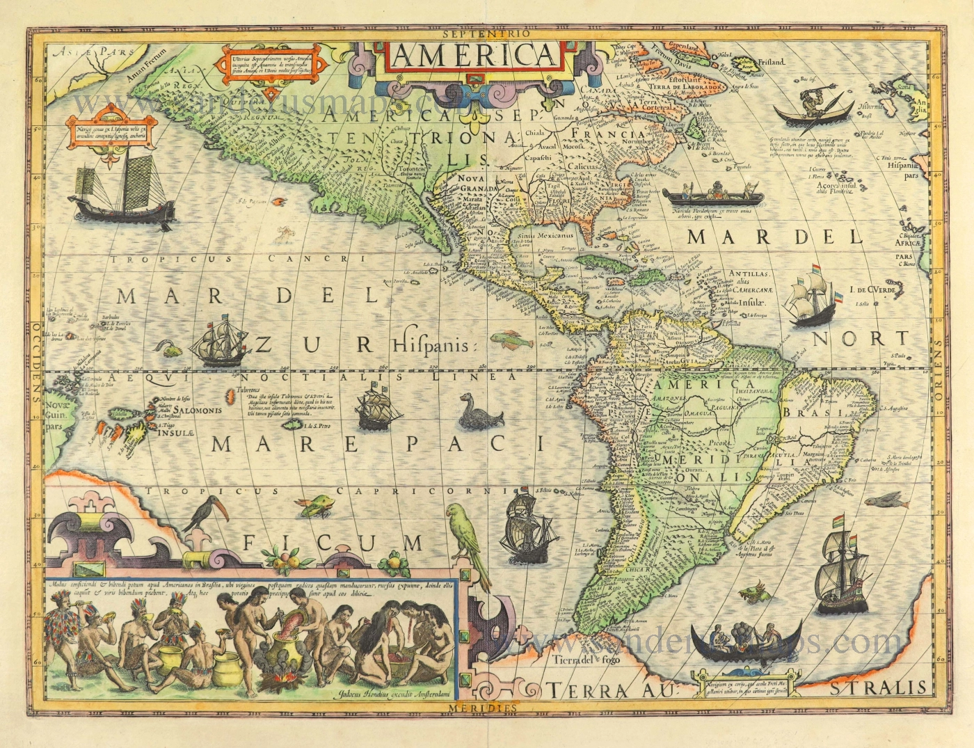
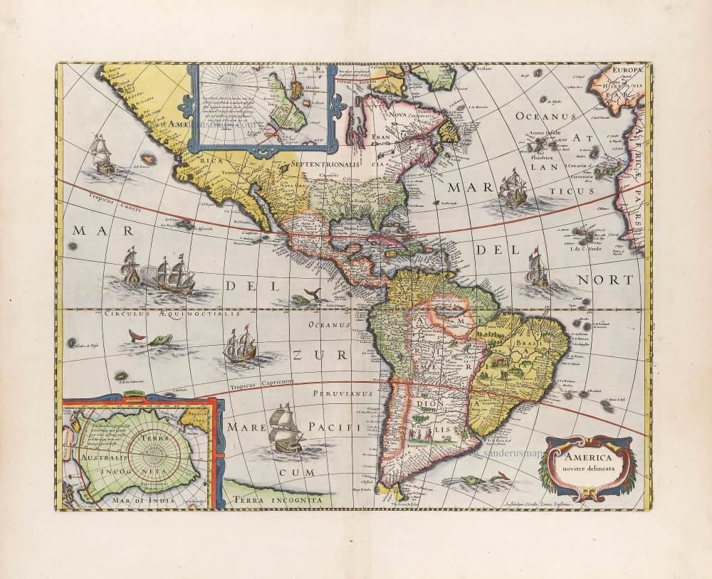
America by Abraham Ortelius. 1603
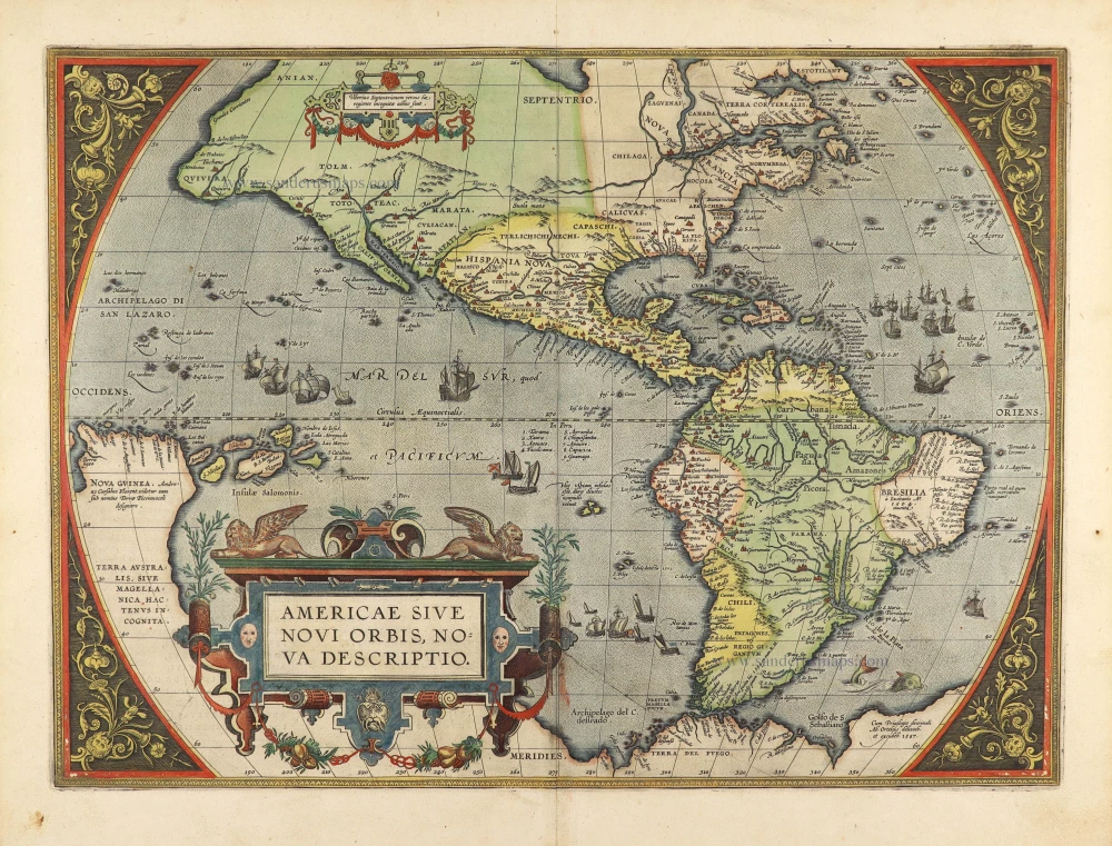

."One of the most famous and easily recognised maps of America, and one that is both functional as well as decorative." (Burden)
This is the third of three copperplates that Ortelius used to depict the American continent. The first, of 1570, had developed several cracks. It is almost identical to the earlier plate except for the following:
1570 plate: The largest ship in the Pacific is sailing westwards, and the Equator is shown with no graduations between the longitudinal marks.
1579 plate: The largest ship in the Pacific is shown sailing eastwards, and graduations now appear along the equatorial line.
1587 plate: The bulge to the southwestern coast of South America is removed.
Ortelius depicts the discoveries of several people on this map. The general shape of the continent is derived from Gerard Mercator's great twenty-one-sheet world map of the previous year. The two of them had a close relationship and shared their knowledge openly with each other. It is recorded that they travelled together through France in 1560. A strategically placed cartouche hides a complete lack of knowledge of the southern waters of the Pacific. Once through the Strait of Magellan, the voyager's sea route took him on an almost direct course for the East Indies. No sight had been made of a vast continent, but conventional wisdom had it that there had to be as much land in the southern hemisphere as in the northern. This was not entirely dispelled until the second voyage of the remarkable Captain James Cook in 1772-75. The west coast of North America is shown too far west, as was standard at the time. There is no new vocabulary shown.
Abraham Ortelius (1527-1598)
The maker of the 'first atlas', the Theatrum Orbis Terrarum (1570), was born on 4 April 1527 into an old Antwerp family. He learned Latin and studied Greek and mathematics.
Abraham and his sisters Anne and Elizabeth took up map colouring. He was admitted to the Guild of St. Luke as an "illuminator of maps." Besides colouring maps, Ortelius was a dealer in antiques, coins, maps, and books, with the book and map trade gradually becoming his primary occupation.
Business went well because his means permitted him to start an extensive collection of medals, coins, antiques, and a library of many volumes. In addition, he travelled a lot and visited Italy and France, made contacts everywhere with scholars and editors, and maintained extensive correspondence with them.
In 1564 he published his first map, a large and ambitious world wall map. The inspiration for this map may well have been Gastaldi's large world map. In 1565 he published a map of Egypt and a map of the Holy Land, a large map of Asia followed.
In 1568 the production of individual maps for his atlas Theatrum Orbis Terrarum was already in full swing. He completed the atlas in 1569, and in May of 1570, the Theatrum was available for sale. It was one of the most expensive books ever published.
This first edition contained seventy maps on fifty-three sheets. Franciscus Hogenberg engraved the maps.
Later editions included Additamenta (additions), resulting in Ortelius' historical atlas, the Parergon, mostly bound together with the atlas. The Parergon can be called a truly original work of Ortelius, who drew the maps based on his research.
The importance of the Theatrum Orbis Terrarum for geographical knowledge in the last quarter of the sixteenth century is difficult to overemphasize. Nothing was like it until Mercator's atlas appeared twenty-five years later. Demand for the Theatrum was remarkable. Some 24 editions appeared during Ortelius's lifetime and another ten after his death in 1598. Editions were published in Dutch, German, French, Spanish, English, and Italian. The number of map sheets grew from 53 in 1570 to 167 in 1612 in the last edition.
In 1577, engraver Philip Galle and poet-translator Pieter Heyns published the first pocket-sized edition of the Theatrum, the Epitome. The work was trendy. Over thirty editions of this Epitome were published in different languages.
Americae Sive Novi Orbis, Nova Descriptio.
Item Number: 27538 Authenticity Guarantee
Category: Antique maps > America > The Americas
Old, antique map of AMERICA by Abraham Ortelius.
Title: Americae Sive Novi Orbis, Nova Descriptio.
Cum Privilegio decennali Ab. Ortelius delineab. et excudeb. 1587.
Second plate.
Date of the first plate first edition: 1570.
Date of the second plate first edition: 1587.
Date of this map: 1603.
Copper engraving, printed on paper.
Map size: 352 x 484mm (13.86 x 19.06 inches).
Sheet size: 435 x 535mm (17.13 x 21.06 inches).
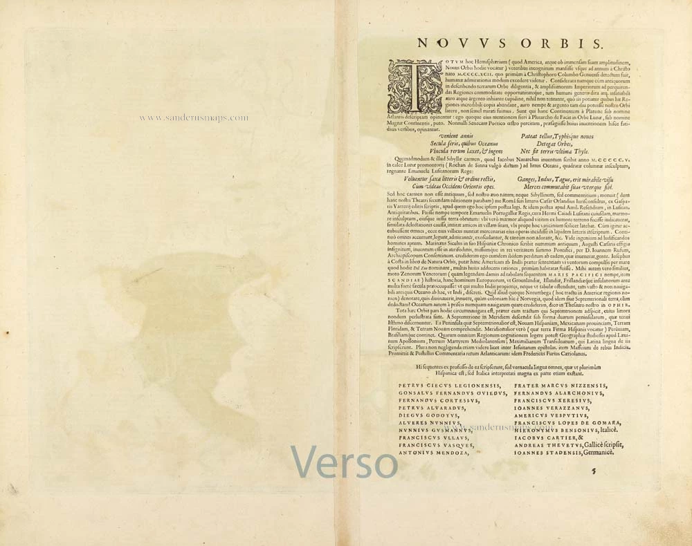
Verso: Latin text.
Condition: Original coloured, mint.
Condition Rating: A+.
From: Theatrum Orbis Terrarum Abrahami Ortelii Antverp. Geographi Regii. Antwerpen, J.B. Vrients, 1603. (Van der Krogt 3, 1:053)
."One of the most famous and easily recognised maps of America, and one that is both functional as well as decorative." (Burden)
This is the third of three copperplates that Ortelius used to depict the American continent. The first, of 1570, had developed several cracks. It is almost identical to the earlier plate except for the following:
1570 plate: The largest ship in the Pacific is sailing westwards, and the Equator is shown with no graduations between the longitudinal marks.
1579 plate: The largest ship in the Pacific is shown sailing eastwards, and graduations now appear along the equatorial line.
1587 plate: The bulge to the southwestern coast of South America is removed.
Ortelius depicts the discoveries of several people on this map. The general shape of the continent is derived from Gerard Mercator's great twenty-one-sheet world map of the previous year. The two of them had a close relationship and shared their knowledge openly with each other. It is recorded that they travelled together through France in 1560. A strategically placed cartouche hides a complete lack of knowledge of the southern waters of the Pacific. Once through the Strait of Magellan, the voyager's sea route took him on an almost direct course for the East Indies. No sight had been made of a vast continent, but conventional wisdom had it that there had to be as much land in the southern hemisphere as in the northern. This was not entirely dispelled until the second voyage of the remarkable Captain James Cook in 1772-75. The west coast of North America is shown too far west, as was standard at the time. There is no new vocabulary shown.
Abraham Ortelius (1527-1598)
The maker of the 'first atlas', the Theatrum Orbis Terrarum (1570), was born on 4 April 1527 into an old Antwerp family. He learned Latin and studied Greek and mathematics.
Abraham and his sisters Anne and Elizabeth took up map colouring. He was admitted to the Guild of St. Luke as an "illuminator of maps." Besides colouring maps, Ortelius was a dealer in antiques, coins, maps, and books, with the book and map trade gradually becoming his primary occupation.
Business went well because his means permitted him to start an extensive collection of medals, coins, antiques, and a library of many volumes. In addition, he travelled a lot and visited Italy and France, made contacts everywhere with scholars and editors, and maintained extensive correspondence with them.
In 1564 he published his first map, a large and ambitious world wall map. The inspiration for this map may well have been Gastaldi's large world map. In 1565 he published a map of Egypt and a map of the Holy Land, a large map of Asia followed.
In 1568 the production of individual maps for his atlas Theatrum Orbis Terrarum was already in full swing. He completed the atlas in 1569, and in May of 1570, the Theatrum was available for sale. It was one of the most expensive books ever published.
This first edition contained seventy maps on fifty-three sheets. Franciscus Hogenberg engraved the maps.
Later editions included Additamenta (additions), resulting in Ortelius' historical atlas, the Parergon, mostly bound together with the atlas. The Parergon can be called a truly original work of Ortelius, who drew the maps based on his research.
The importance of the Theatrum Orbis Terrarum for geographical knowledge in the last quarter of the sixteenth century is difficult to overemphasize. Nothing was like it until Mercator's atlas appeared twenty-five years later. Demand for the Theatrum was remarkable. Some 24 editions appeared during Ortelius's lifetime and another ten after his death in 1598. Editions were published in Dutch, German, French, Spanish, English, and Italian. The number of map sheets grew from 53 in 1570 to 167 in 1612 in the last edition.
In 1577, engraver Philip Galle and poet-translator Pieter Heyns published the first pocket-sized edition of the Theatrum, the Epitome. The work was trendy. Over thirty editions of this Epitome were published in different languages.
Related items
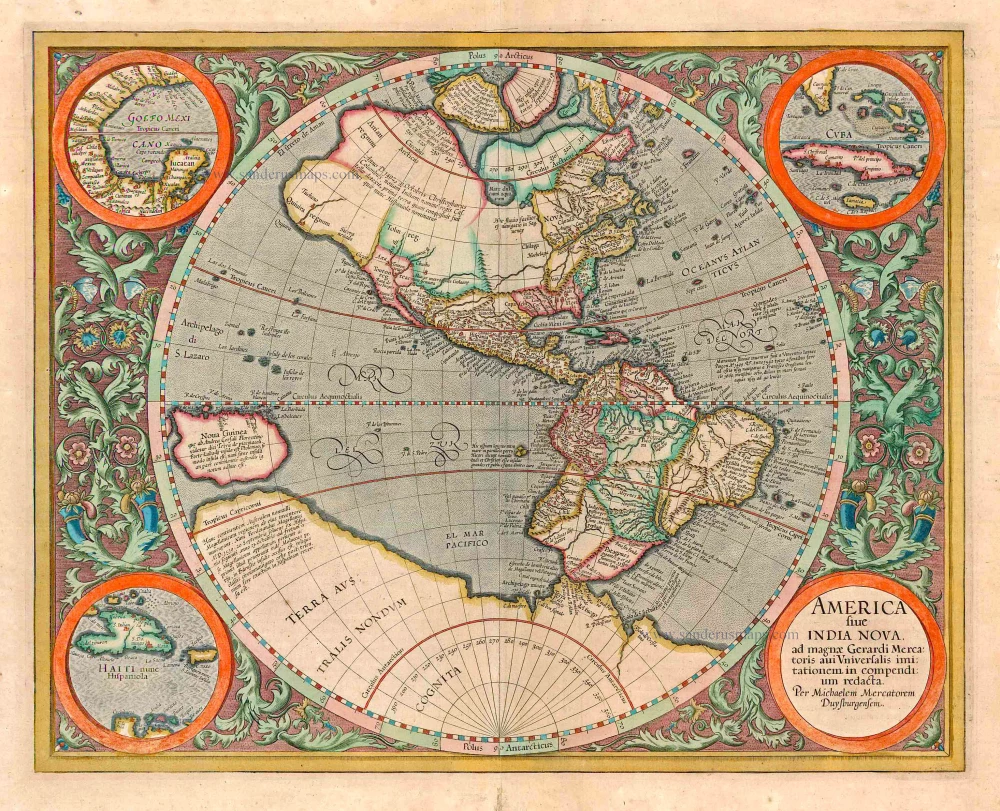
America sive India Nova ad magnae Gerardi Mercatoris avi Universalis imitationem in compendium redacta. 1623
America, by Gerard Mercator
[Item number: 131]
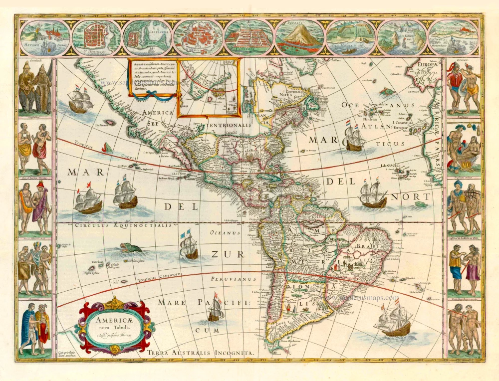
Americae nova Tabula. 1647-49
America, by Willem Blaeu.
[Item number: 6717]

America 1602
America by Langenes, published by Bertius P.
[Item number: 12494]
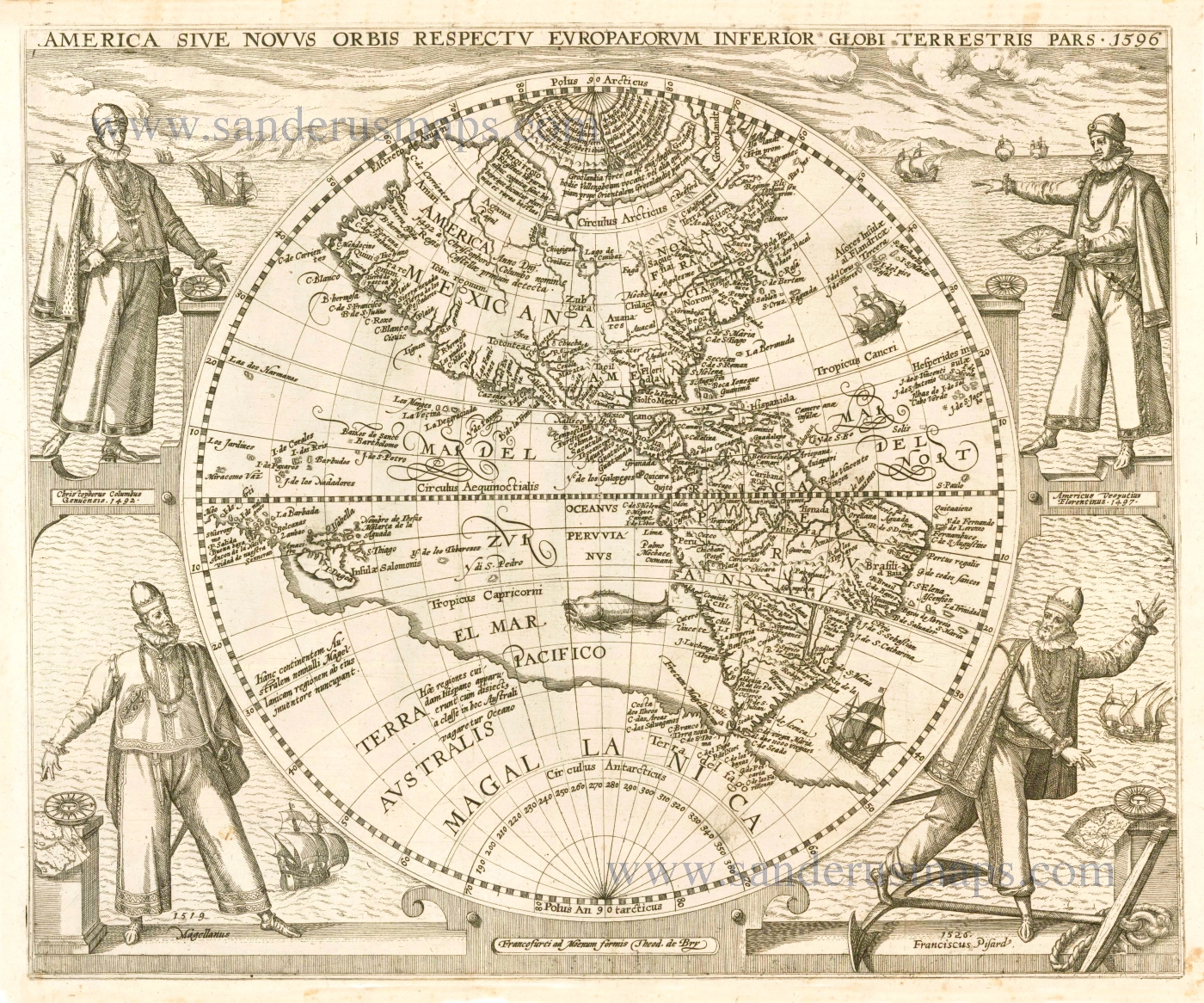
America Sive Novus Orbis Respectu Europaeorum Inferior Globi Terrestri Pars. 1596. 1596
The Americas by Theodore de Bry.
[Item number: 12546]
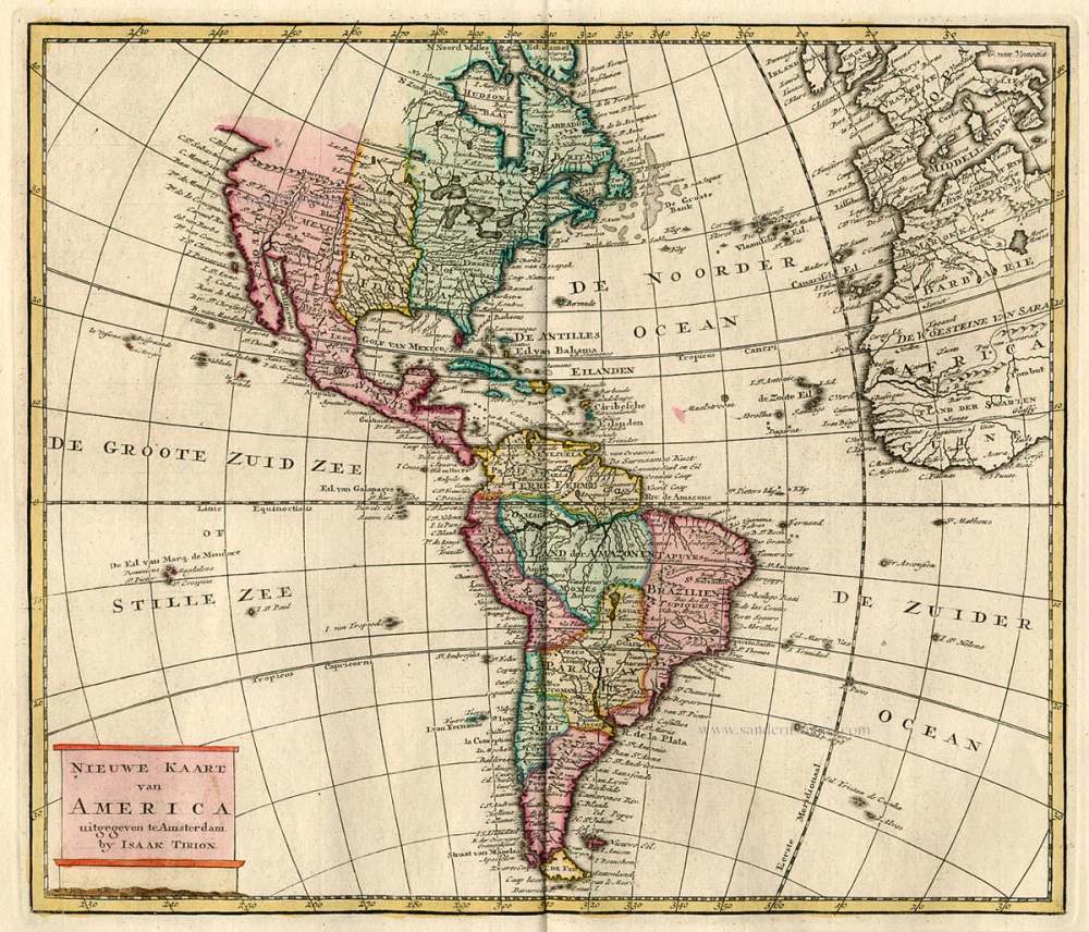
Nieuwe Kaart van America c. 1770
Antique map of America by Tirion I.
[Item number: 19194]

America. 1597
AMERICA by Giovanni Magini
[Item number: 22492]
Americae Sive Novi Orbis, Nova Descriptio. 1598
America, by Abraham Ortelius.
[Item number: 25618]
Americae tam Septentrionalis quam Meridionalis in Mappa Geographica Delineatio. c. 1700
America by A.F. Zürner, published by Petrus Schenk.
[Item number: 25715]
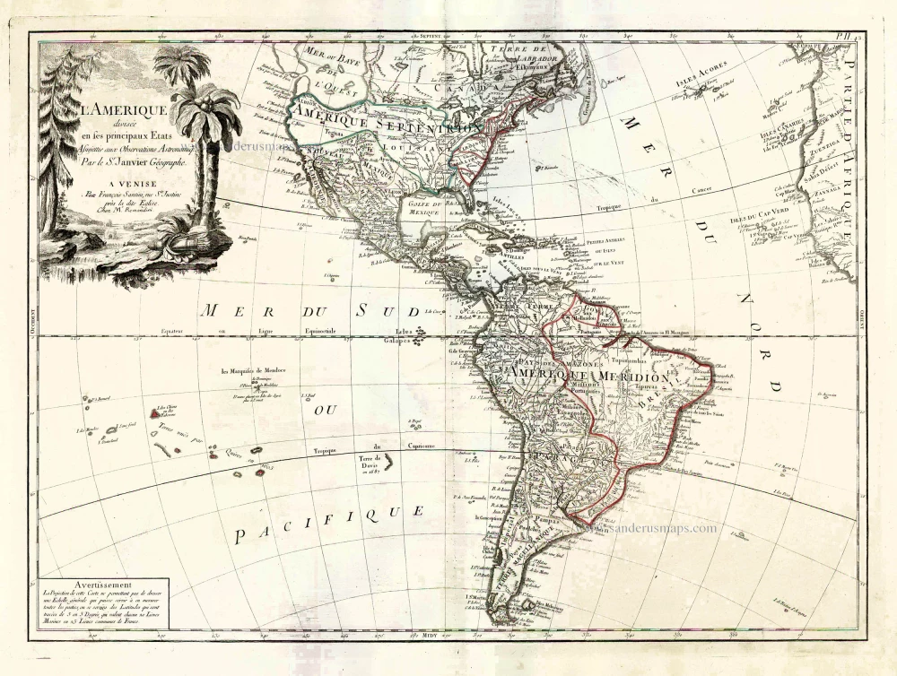
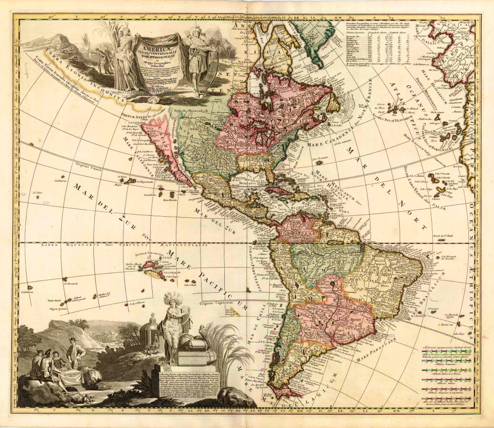
L'Amerique Divisée en ses Principaux Etats Assujettie aux Observations Astronomiqes. 1776-79
America, by Francesco Santini.
[Item number: 26978]
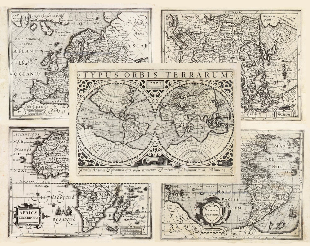
Typus Orbis Terrarum, [in set with:] Europa, [and] Asia, [and] Americae Descrip., [and] Africae Descriptio. 1607
World + Continents, by Jodocus Hondius.
[Item number: 27088]
America sive India Nova. 1623
America, by Gerard Mercator.
[Item number: 27752]
Original Halma edition.
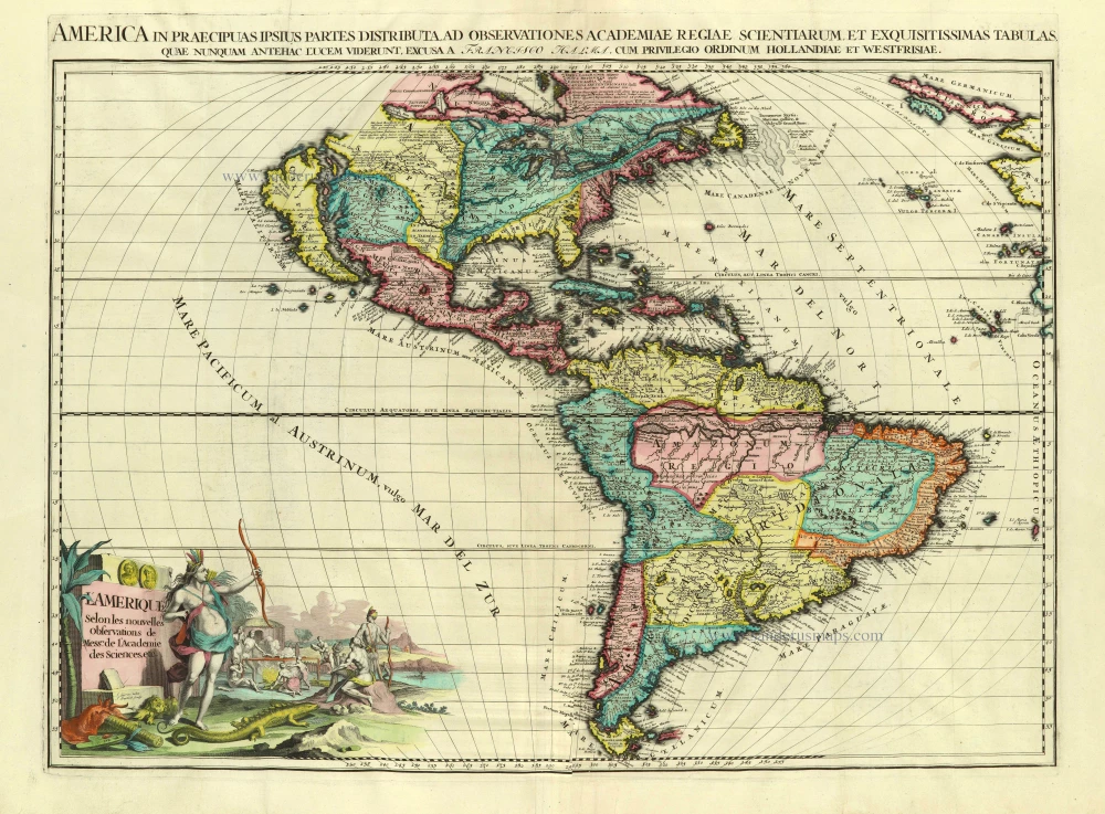
L'Amerique selon les Nouvelles Observations de Messrs. de l'Academie des Sciences, etc. Before 1713
America, by François Halma.
[Item number: 28017]
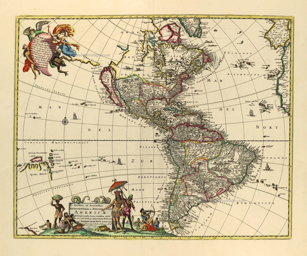
Novissima et Accuratissima Septentrionalis ac Meridionalis Americae. c. 1715
America by Frederick de Wit, published by Covens & Mortier.
[Item number: 28295]
California as an island
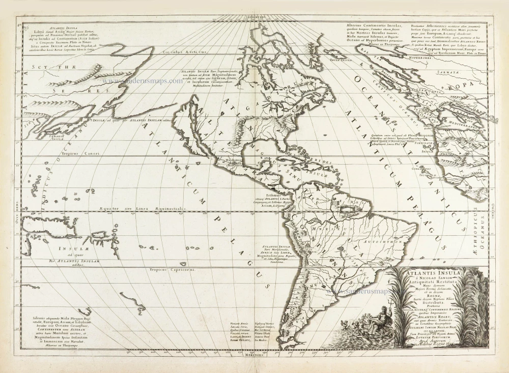
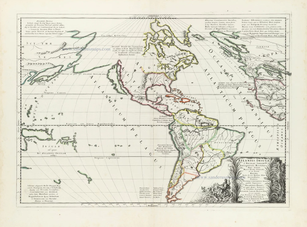
Atlantis Insula. 1692
The Americas by Guillaume Sanson.
[Item number: 28376]
America. 1598
America, by Giovanni Lorenzo d'Anania, published by Girolamo Ruscelli.
[Item number: 28432]
America. 1613
America by Jodocus Hondius.
[Item number: 28530]
Novissima et Accuratissima Totius Americae Descriptio. 1656-77
America by Nicolaes Visscher I.
[Item number: 28554]
First plate
Americae Sive Novi Orbis, Nova Descriptio. 1572
America by Abraham Ortelius.
[Item number: 29237]
One of the most elaborately engraved maps ever published.
Carte tres Curieuse de la Mer du Sud, Contenant des Remarques Nouvelles et tres Utiles non Seulement sur les Ports et Iles de cette Mer, 1719
Pacific by Zacharias Châtelain after Nicolas de Fer.
[Item number: 29466]
Luxury colour.
America noviter delineata. 1666
America by Jodocus Hondius Jr, published by Joannes Janssonius.
[Item number: 29790]
First state
Atlantis Insula. 1667-69
The Americas and the Pacific and Atlantic Ocean by Guillaume Sanson.
[Item number: 29999]
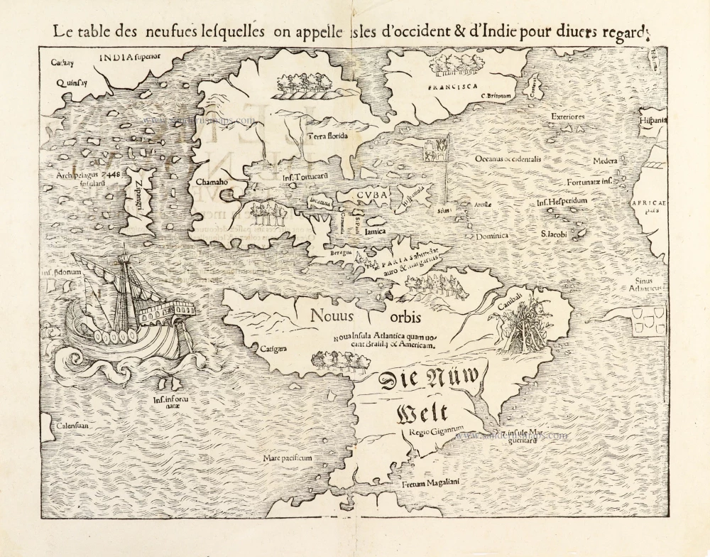
Le table des neufues lesquelles on appelle isles d'Occident & d'Indie pour divers regard. 1555
America by Sebastian Münster.
[Item number: 30379]
new
Le table des neufues lesquelles on appelle isles d'Occident & d'Indie pour divers regard. 1568
America by Sebastian Münster.
[Item number: 30518]