
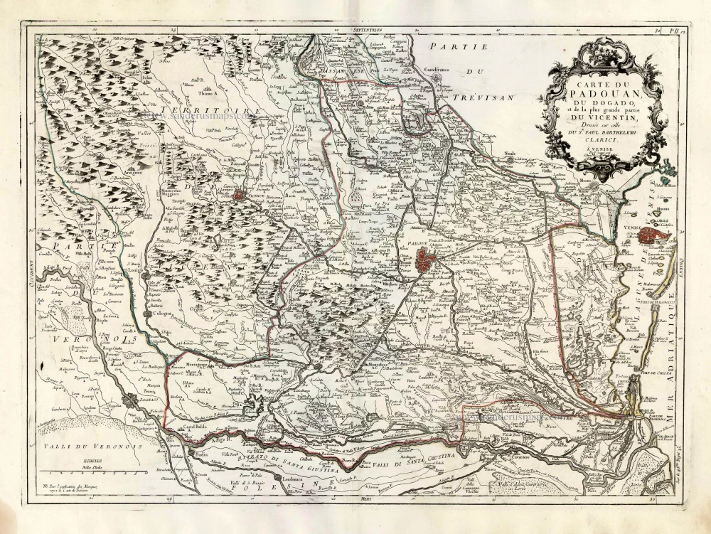
Vicenza, Padua and Venice, by Paolo Santini. 1776-79
Francesco and Paolo Santini (c.1729-1793)
Francesco Santini, a Venetian publisher, acquired the printing plates of Vaugondy’s Atlas Universel …, a commercial and cartographic success, with widespread influence on mapmakers throughout Europe. Together with his brother Paolo, he commissioned a new set of plates and reissued the atlas in 1776. The following year, Paolo Santini assigned all his publication rights to M. Remondini, who in 1777 reissued the same atlas but with his name.
Carte du Padouan, du Dogado, et de la plus grande partie du Vincentin. Dressée sur celle du Sr. Paul Barthelemi Clarici.
Item Number: 27717 Authenticity Guarantee
Category: Antique maps > Europe > Italy
Old, antique map of Vicenza, Padua and Venice, by Paolo Santini.
Title: Carte du Padouan, du Dogado, et de la plus grande partie du Vincentin. Dressée sur celle du Sr. Paul Barthelemi Clarici.
Date of the first edition: 1780.
Date of this map: 1776-79.
Copper engraving, printed on paper.
Size (not including margins): 480 x 650mm (18.9 x 25.59 inches).
Verso: Blank.
Condition: Original coloured in outline, excellent.
Condition Rating: A+.
From: Atlas Universel dressé sur les meilleures cartes modernes. Venice, Remondini, 1776-79.
Francesco and Paolo Santini (c.1729-1793)
Francesco Santini, a Venetian publisher, acquired the printing plates of Vaugondy’s Atlas Universel …, a commercial and cartographic success, with widespread influence on mapmakers throughout Europe. Together with his brother Paolo, he commissioned a new set of plates and reissued the atlas in 1776. The following year, Paolo Santini assigned all his publication rights to M. Remondini, who in 1777 reissued the same atlas but with his name.
Related items
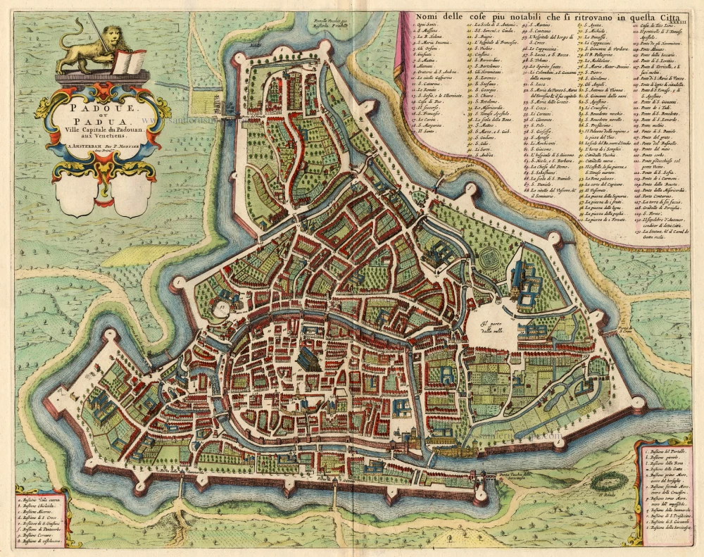
Padoue, ou Padua, Ville Capitale du Padouani aux Venetiens. 1704
Padova, by Blaeu - Mortier.
[Item number: 18093]
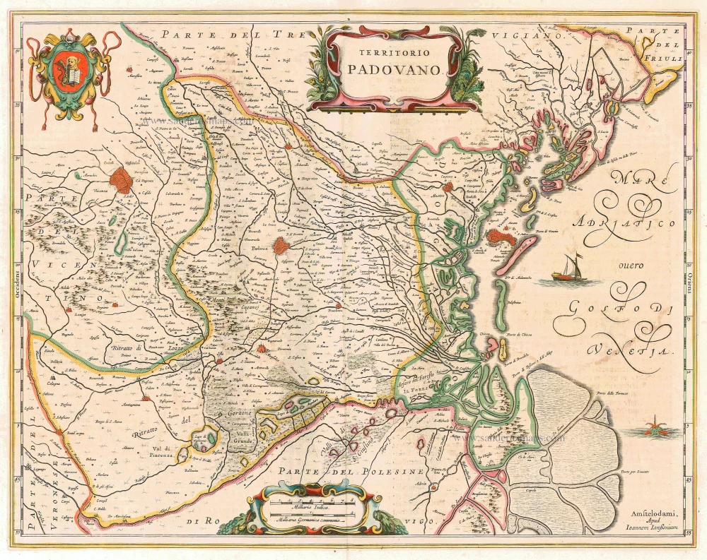
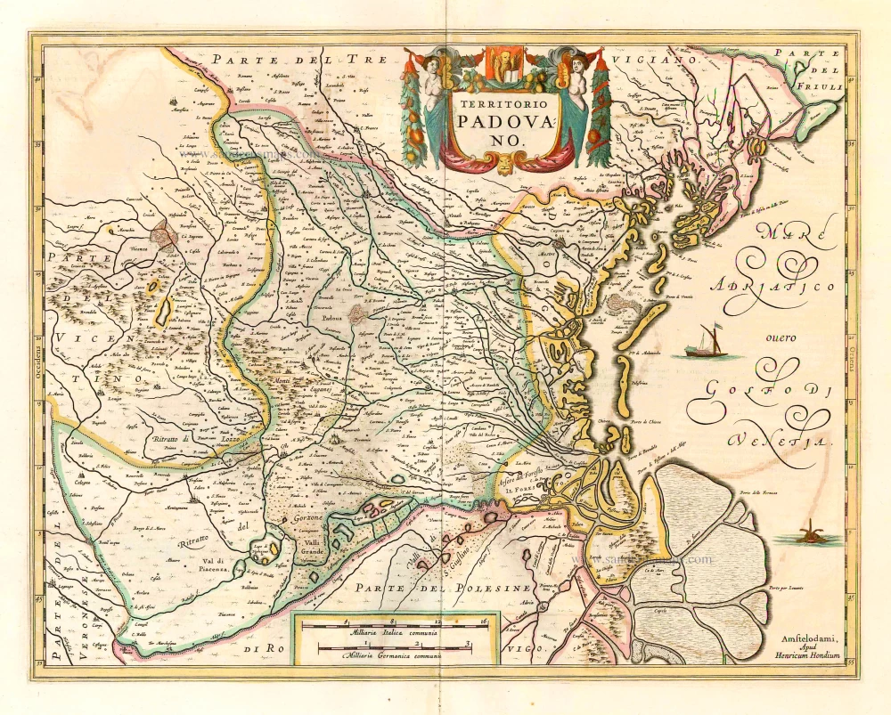
Territorio Padovano. 1644-58
Padova, by Janssonius J. - Hondius H.
[Item number: 9582]
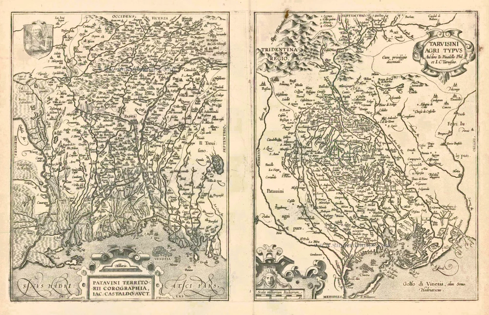
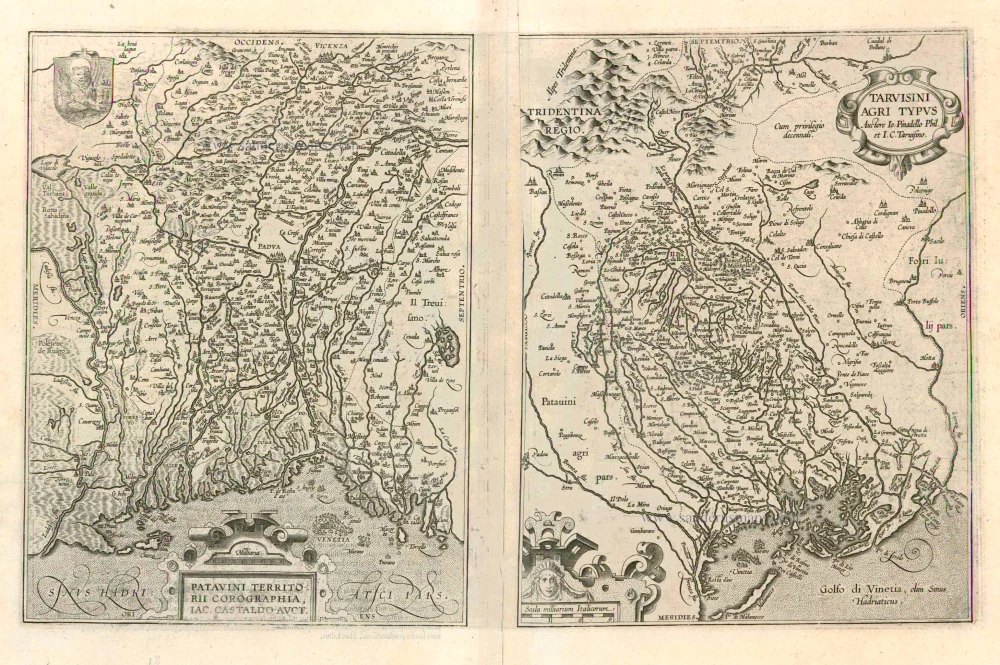
Patavini Territorii Corographia [on sheet with:] Tarvisini Agri Typus. 1612
Padova and Tarviso, by A. Ortelius.
[Item number: 23017]
Patavini Territorii Corographia [on sheet with:] Tarvisini Agri Typus. 1612
Padova and Tarviso, by Abraham Ortelius.
[Item number: 23123]
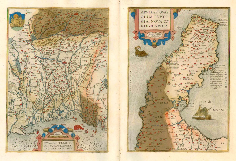
Patavini Territorii Corographia - Apuliae quae olim Iapygia, Nova Corographia 1579
Padova and Apulia by Abraham Ortelius..
[Item number: 23490]

Territorio Padovano. 1641-42
Padova, by J. Blaeu.
[Item number: 24642]
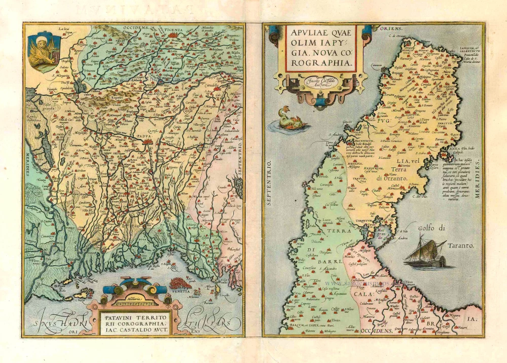
Patavini Territorii Corographia [on sheet with:] Apuliae quae olim Iapygia, Nova Corographia. 1573
Padova & Puglia, by Abraham Ortelius.
[Item number: 25875]
Territorio Padovano. 1641
Padova, by Henricus Hondius.
[Item number: 26369]
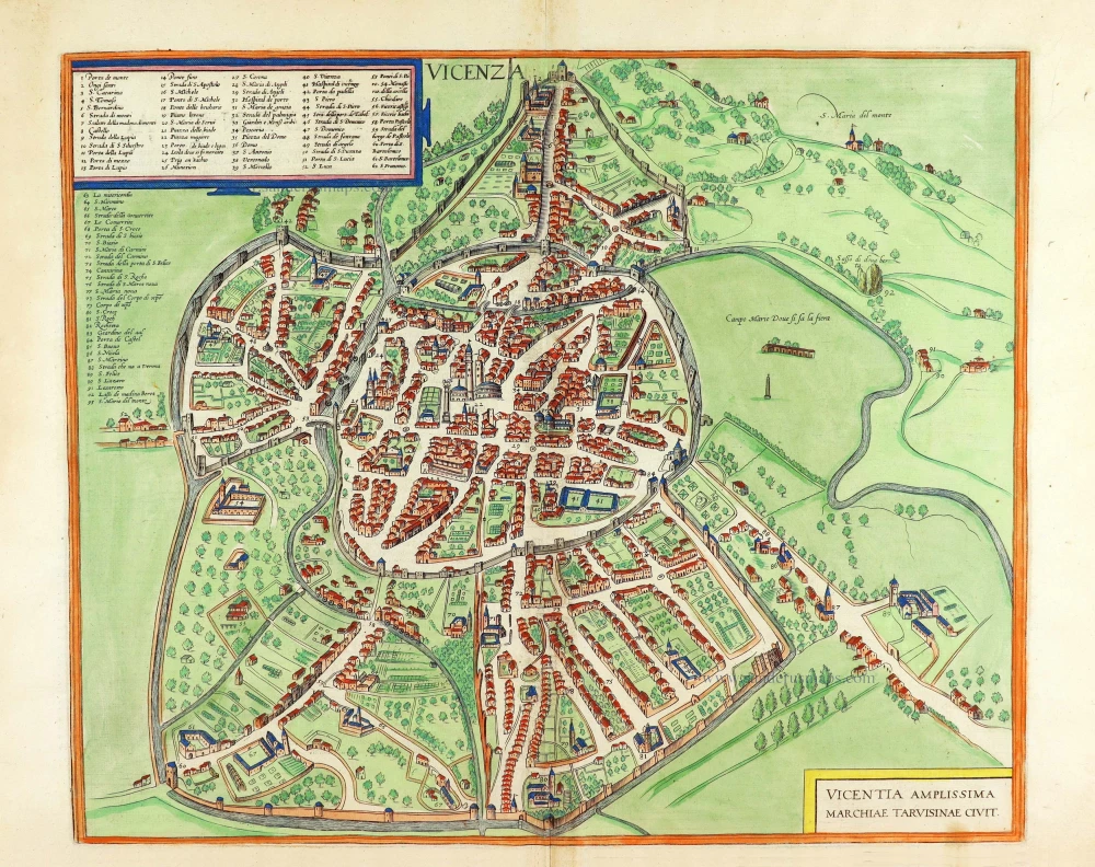
Vicenza - Vicentia Amplissima Marchiae Tarvisinae Civit. 1588
Vicenza, by Georg Braun and Frans Hogenberg.
[Item number: 29160]
Important
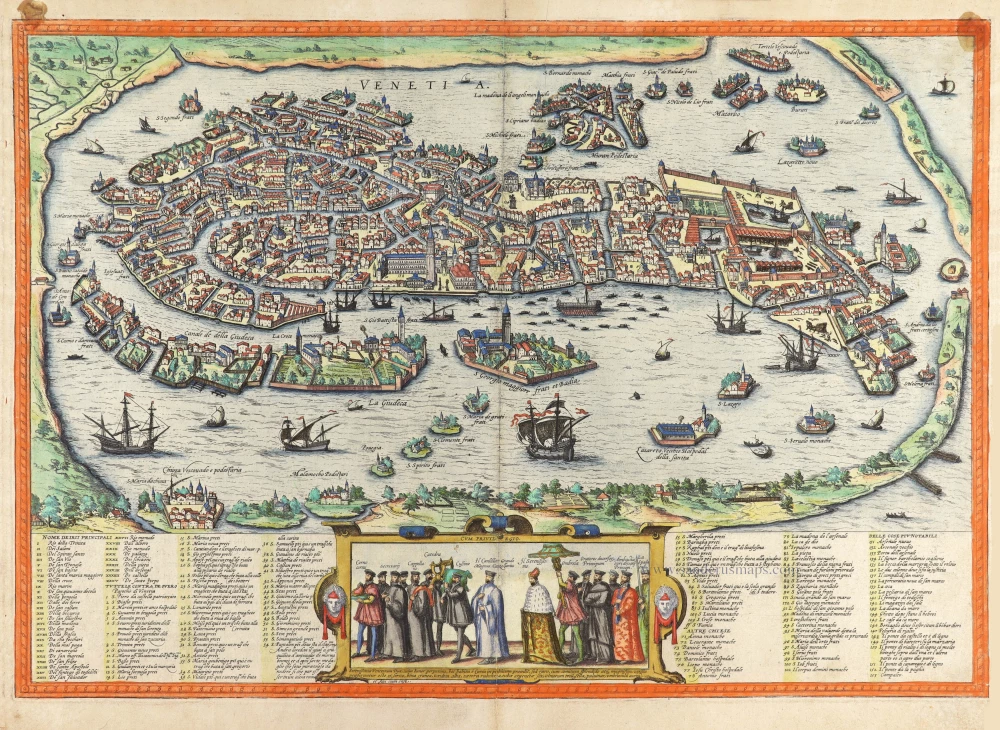
Venetia. 1577
Venice (Venezia) by Georg Braun & Frans Hogenberg.
[Item number: 30240]