
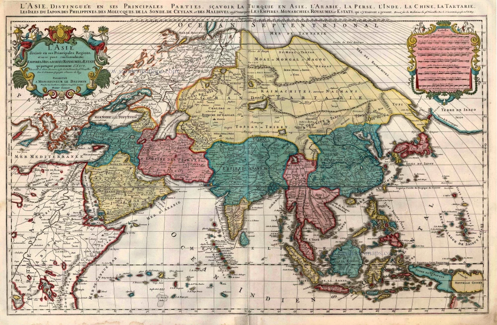
Asia, by François Halma. Before 1713
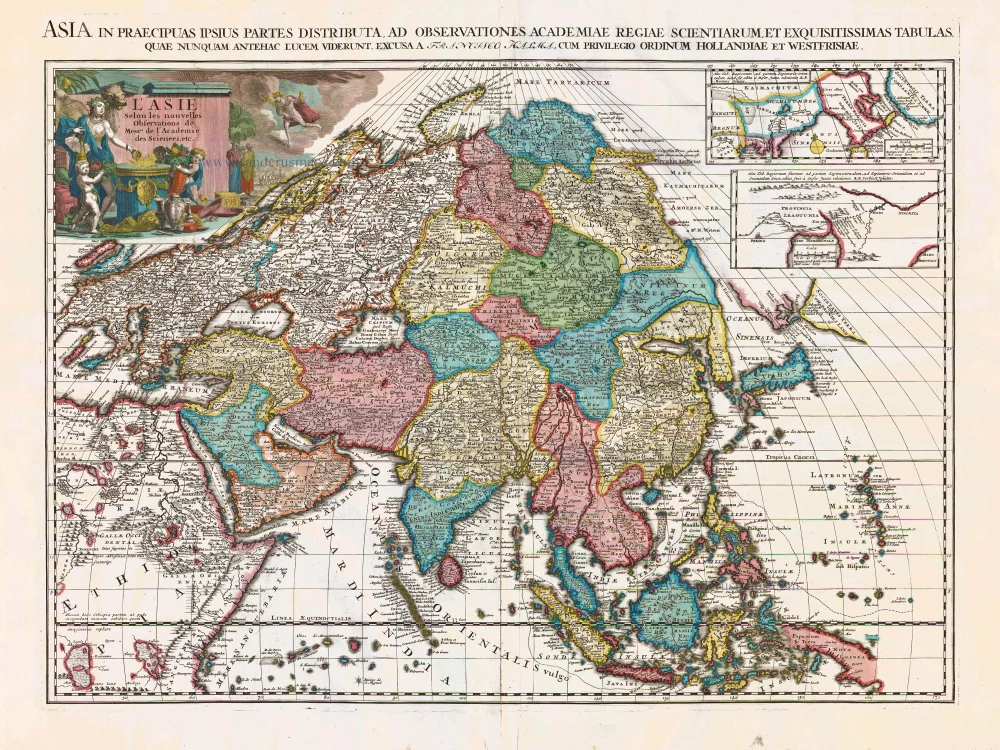
This map is probably an earlier state of Van der Aa's large-format Asia map. Van der Aa re-engraved the text in the cartouche and added his imprint. At the bottom right of the cartouche is a monogram of Halma: "FH", which, in the Van der Aa edition, is changed into "PA".
François Halma (Langerak, 1653 – Leeuwarden, 1722)
François Halma was a publisher who first established his business at Utrecht in 1674; later moved to Amsterdam where he worked as printer and publisher from 1699-1710 and finally settled at Leeuwarden, where he died in 1722.
Apart from many theological and historical works, he published a small number of geographical works and atlases. In 1695, during his period at Utrecht, he published Ptolemy’s Tabulae Geographicae orbis terrarium. His finest work appeared at Leeuwarden in 1718: the re-issue of Schotanus à Sterringa’s Friesche Atlas of 1698. He also published an edition of Sanson’s Description de l’Univers.
L'Asie Selon les Nouvelles Observations de Messrs. de l'Academie des Sciences, etc.
Item Number: 27851 Authenticity Guarantee
Category: Antique maps > Asia > Asia
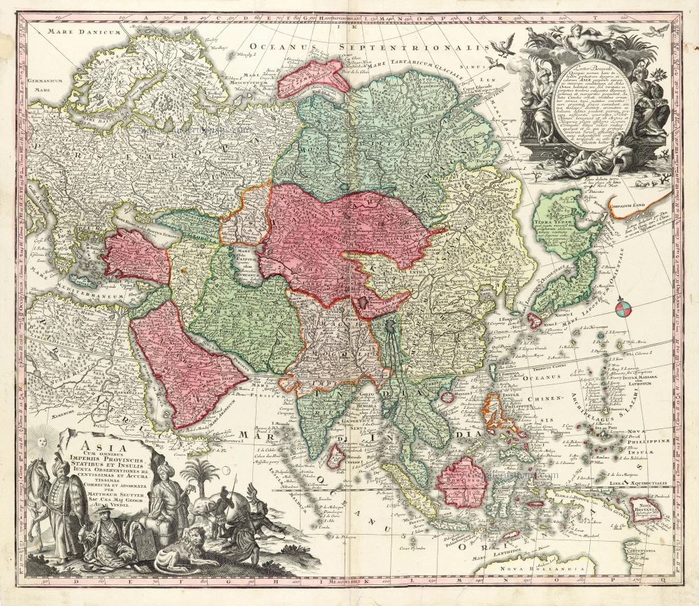
Old, antique map of Asia, by François Halma.
Title: L'Asie Selon les Nouvelles Observations de Messrs. de l'Academie des Sciences, etc.
[Above map:] Asia in Praecipuas ipsius Partes Distributa, ad Observationes Academiae Regiae Scientiarum, et Exquisitissimas Tabulas, quae nunquam Antehac Lucem Viderunt, Excusa A Francisco Halma, Cum privilegio Ordinum Hollandiae et Westfrisiae.
With two insets: a) Map of the region northeast of Beijing according to Martinus Martini. - b) Map of the region northeast of Beijing according to Ferdinand Verbiest.
Date of the first edition: Before 1713.
Date of this map: Before 1713.
Copper engraving, printed on paper.
Size (not including margins): 505 x 665mm (19.88 x 26.18 inches).
Verso: Blank text.
Condition: Original coloured, excellent.
Condition Rating: A+.
References: van der Krogt A, See 48:03
Separate publication.
This map is probably an earlier state of Van der Aa's large-format Asia map. Van der Aa re-engraved the text in the cartouche and added his imprint. At the bottom right of the cartouche is a monogram of Halma: "FH", which, in the Van der Aa edition, is changed into "PA".
François Halma (Langerak, 1653 – Leeuwarden, 1722)
François Halma was a publisher who first established his business at Utrecht in 1674; later moved to Amsterdam where he worked as printer and publisher from 1699-1710 and finally settled at Leeuwarden, where he died in 1722.
Apart from many theological and historical works, he published a small number of geographical works and atlases. In 1695, during his period at Utrecht, he published Ptolemy’s Tabulae Geographicae orbis terrarium. His finest work appeared at Leeuwarden in 1718: the re-issue of Schotanus à Sterringa’s Friesche Atlas of 1698. He also published an edition of Sanson’s Description de l’Univers.
Related items
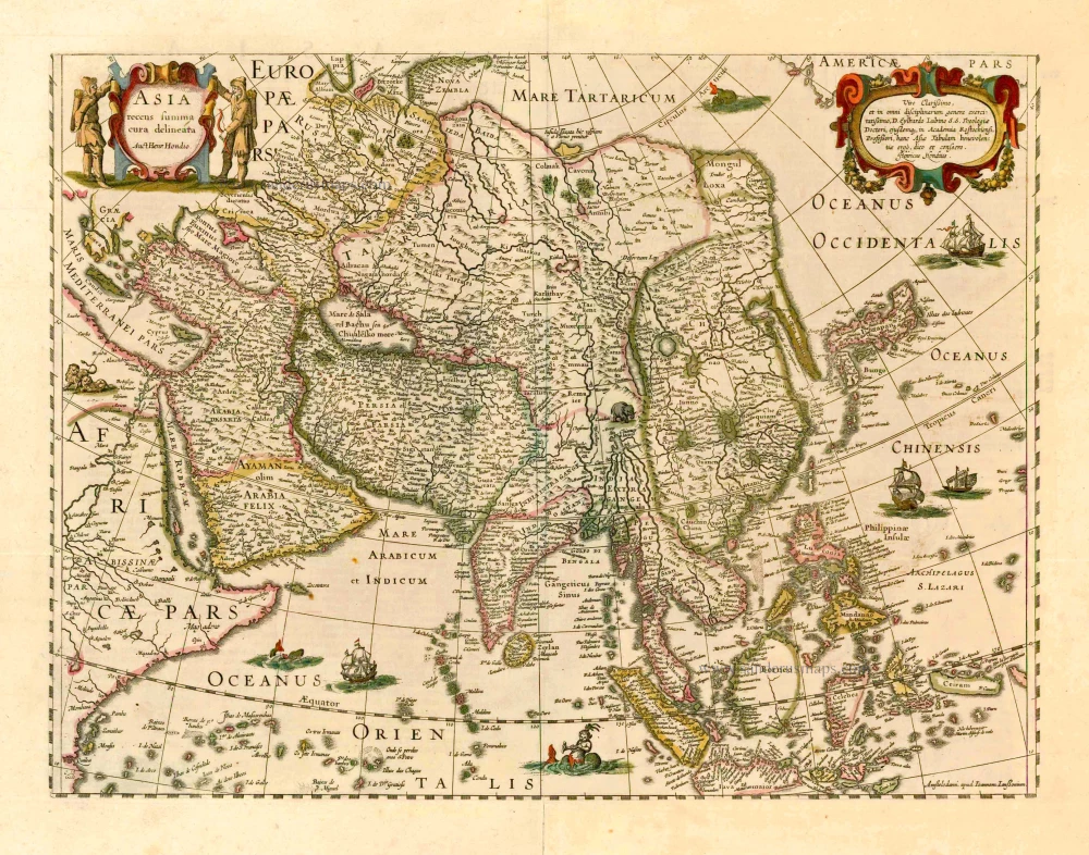
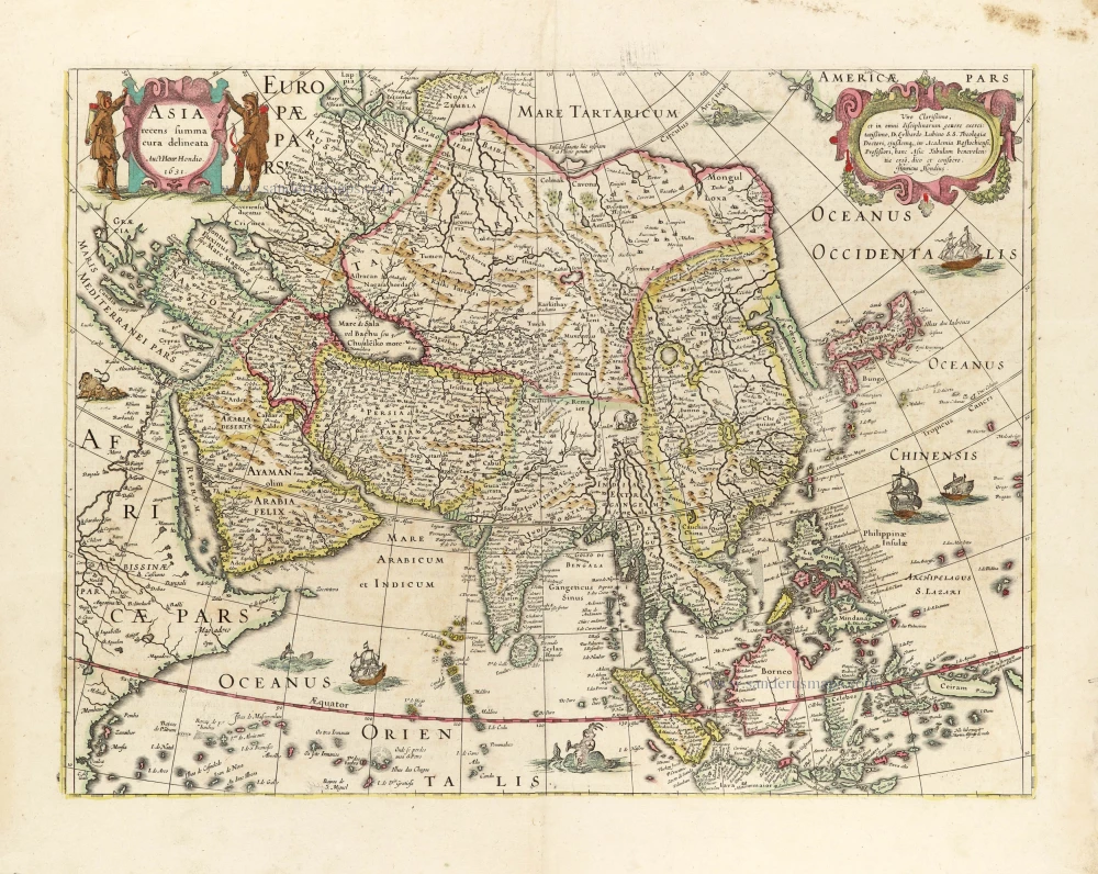
Asia Recens Summa Cura Delineata. 1644-58
Asia, by J. Janssonius
[Item number: 7508]

Accuratissima totius Asiae Tabula. c. 1691-96
Asia, by F. De Wit.
[Item number: 10960]
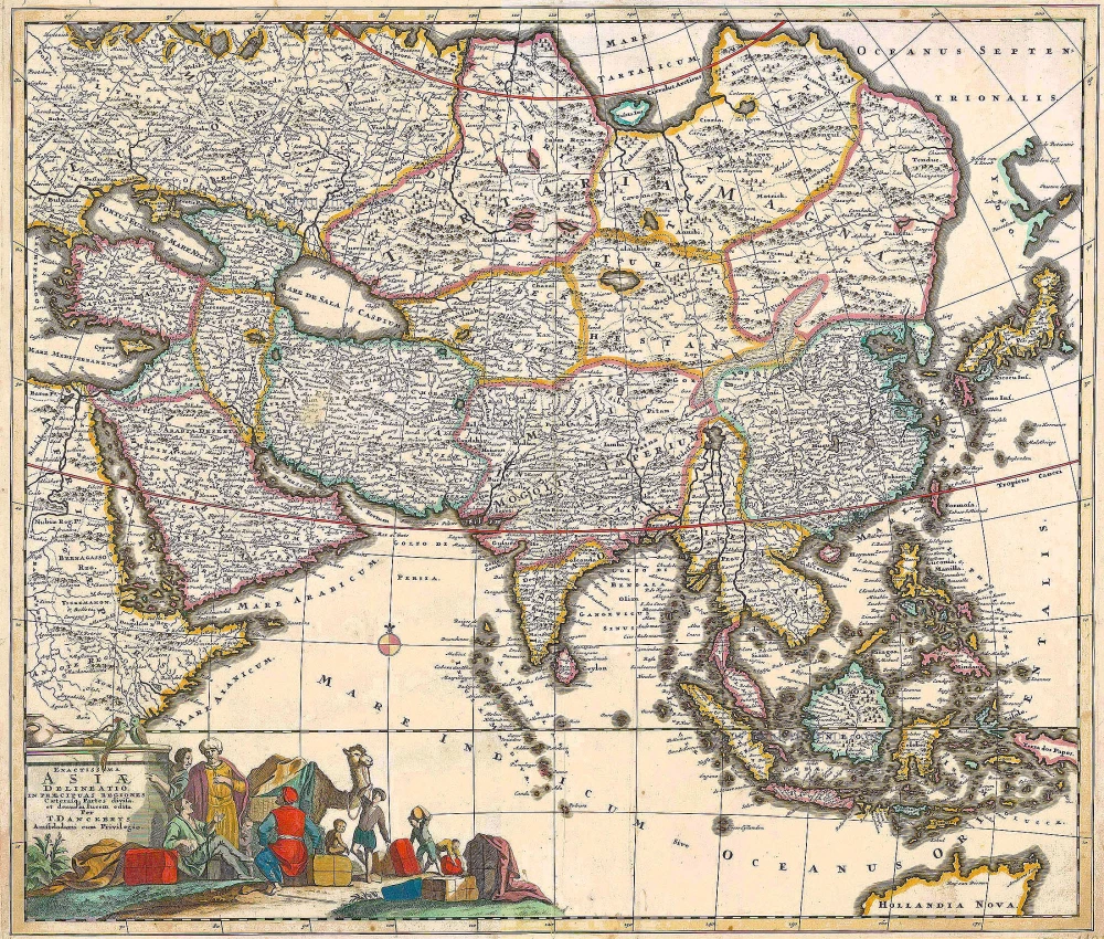
Exactissima Asiae Delineatio in praecipuas regiones Caeterasq Partes divisa. c. 1700
Asia by Th. Danckerts.
[Item number: 11298]
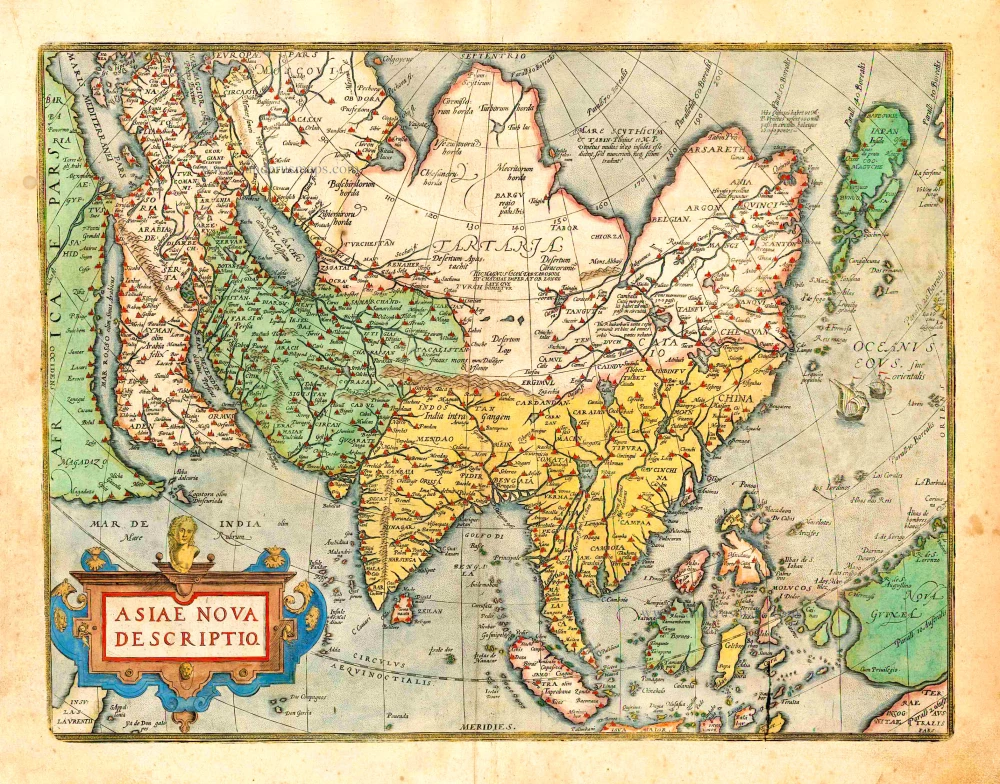
Asiae Nova Descriptio. 1612
Asia, by Abraham Ortelius.
[Item number: 22925]
Asia Recens Summa Cura Delineata. 1639
ASIA by Hondius H.
[Item number: 24473]
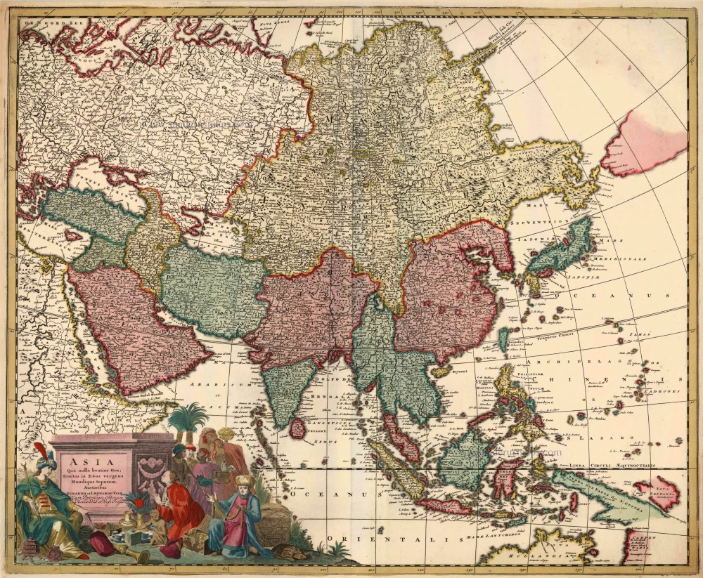
Asia qua Nulla Beatior Ora; Tractus in Eoos Vergens Mundique Teporem. c. 1730.
Asia, by G.& L. Valk.
[Item number: 24538]

Asiae in Tabula Geographica Delineatio. c. 1700
Asia by A.F. Zürner, published by Petrus Schenk.
[Item number: 25842]
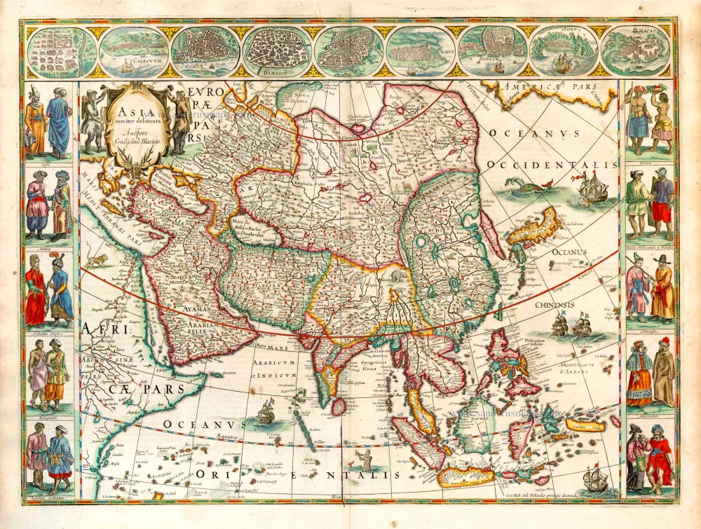
Asia Noviter Delineata. 1641-42
Asia, by Willem Blaeu.
[Item number: 27041]
L'Asie divisée en ses Principales Regions, et ou se peut voir l'estendue Des Empites, Monarchies, Royaumes, et Estats qui partagent présentement L'Asie. c. 1705
Asia, by H. Jaillot, published by P. Mortier.
[Item number: 27858]
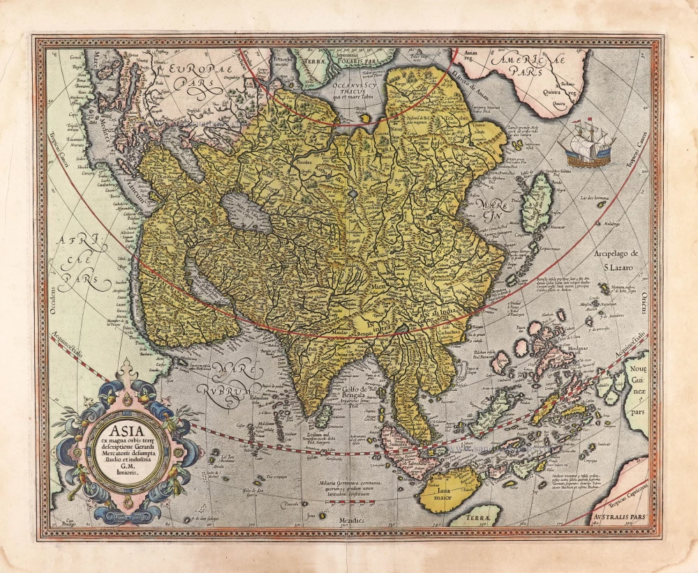
Asia ex magna orbis terre descriptione Gerardi Mercatoris desumpta studio et industria G.M. Iunioris. 1613
Asia, by Gerard Mercator.
[Item number: 28072]
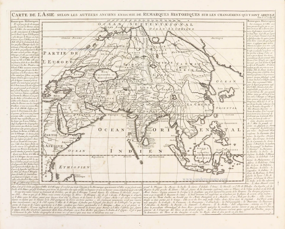
Carte de l'Asie selon les auteurs anciens enrichie de remarques historiques sur les changemens qui y sont arrivez. 1719
Asia, by Zacharias Châtelain.
[Item number: 29387]
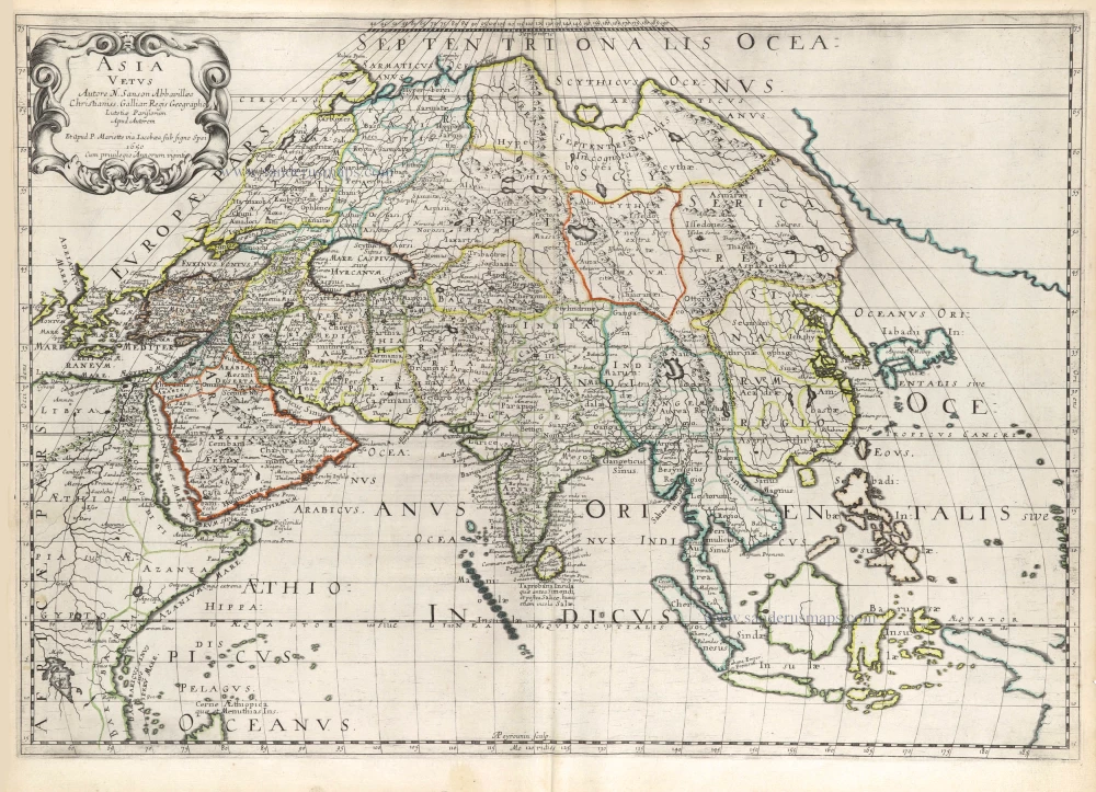
Asia Vetus. 1652
Ancient Asia by Nicolas Sanson.
[Item number: 29687]
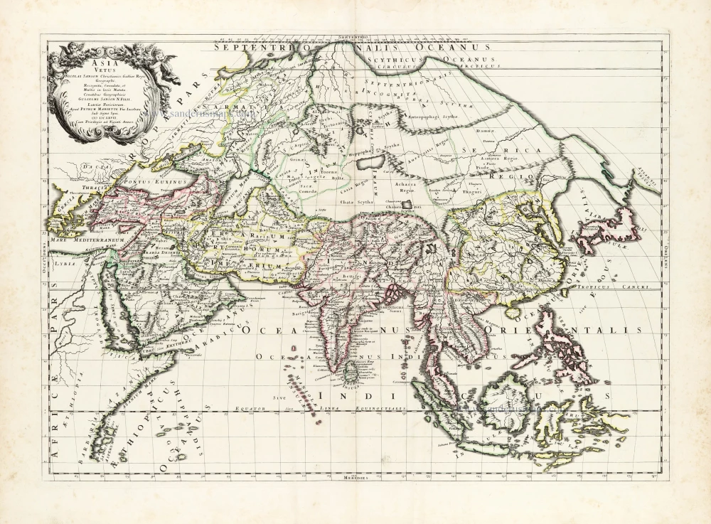
Asia Vetus. 1667-69
Ancient Asia by Nicolas & Guillaume Sanson.
[Item number: 30002]
Asia Cum omnibus Imperiis Provinciis, Statibus et Insulis Iuxta Observationes receentissimas et Accuratissimas Correcta et Adornata. 1728
Asia by Matthäus Seutter.
[Item number: 30201]

Asia Antiqua cum finitimis Africae et Europae Regionibus. 1675
Antique map of Asia by Janssonius à Waesberghe -
[Item number: 30385]
new
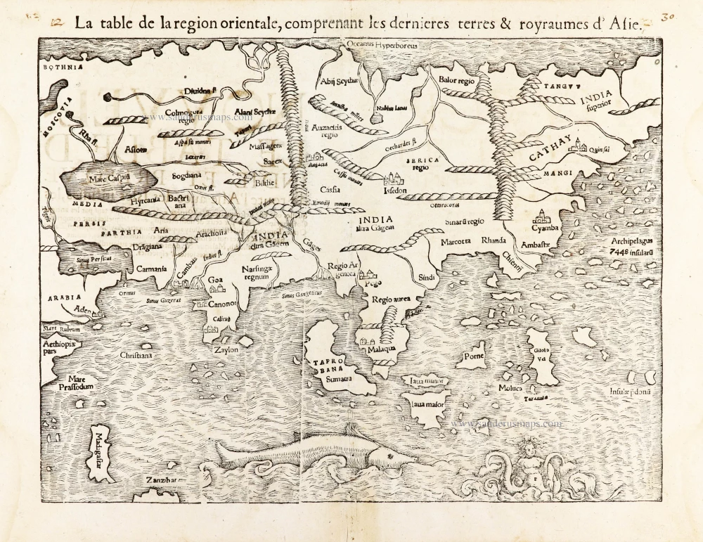
La table de la region orientale, comprenant les derniered terres & royraumes d'Asie. 1568
Asia by Sebastian Munster.
[Item number: 30528]
new