
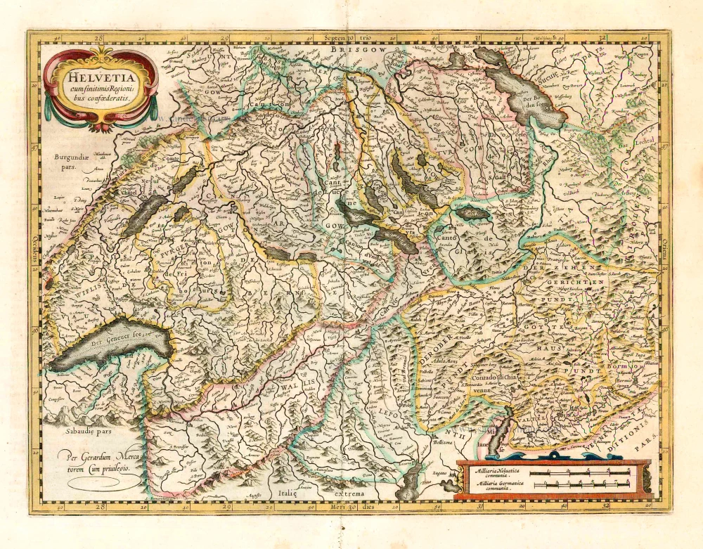
Switzerland, by Gerard Mercator. 1623


Gerard Mercator (1512 – 1594)
Gerard Mercator was born Gerard de Cremere in Rupelmonde (near Antwerp) on 5 March 1512.
Young Gerard learned what Latin he could in Rupelmonde, and when he was about fifteen, his uncle sent him to s'Hertogenbosch to study at a school run by the Brothers of the Common Life. One of Mercator’s teachers was the celebrated humanist Macropedius. After three and a half years with the brothers, Gerard went to Louvain, where he enrolled in the university in 1530 as one of the poor students at Castle College.
By this time, he had Latinized his name to Mercator. He studied philosophy and took his master’s degree in 1532. The problems of the creation of the Universe and the Earth interested him in particular; this is reflected by his works written in later years.
After spending a few years in Antwerp, he returned to Louvain in c. 1535, where he took courses in mathematics under Gemma Frisius. Soon, he was recognised as an expert on the construction of mathematical instruments, as a land surveyor and, after 1537, as a cartographer. He drew his income from these activities after his marriage on August 3, 1536. He also qualified himself as a copper engraver, the first to introduce italic handwriting to this trade. The first maps, drawn and engraved by Gerard Mercator, are Palestine, 1537; the World in double heart-shaped projection, 1538; and Flanders, 1540.
In 1544, Mercator came into great danger: he was arrested on the accusation of heresy and put into jail. Thanks to the intervention of the University of Louvain, he was released after four months. In 1552, he moved with his family to Duisburg (Germany). In 1560, Mercator became a cosmographer in service of the Duke of Jülich-Cleve-Berge, and in 1563, he became a lecturer at the Grammar School of the new University in Duisburg. During this period, he made wall maps of Europe, 1554; of Loraine, 1564; the British Isles, 1564; and the famous world map with increasing latitudes, 1569. About this time, Mercator was also working on the project for a complete description of the creation, the Heavens, Earth, Sea and world history. This resulted in his Atlas, sive cosmographicae meditationes de fabrica mundi et fabricati figura. He also worked on an edition of Ptolemy’s Geographia, which appeared in 1578. The first part of his book with modern maps (France, Germany and the Netherlands) appeared in 1585.
Shortly after the publication of the second part of his map book (not yet called Atlas) with the maps of Italy (1589), he had a stroke that ended his highly significant productivity. The great man passed away on 2 December 1594, leaving the responsibility of finishing the map book to his son Rumold. The final part of it appeared in 1595. Its title is Pars Altera, and it constitutes an essential part of what was then called Mercator’s Atlas.
The map of Europe and the world map in the Atlas are by Rumold Mercator. After Rumold died in 1599, the Atlas was reissued in 1602.
The plates of the maps, both of the Ptolemy edition and the Atlas, were sold in 1604 to Jodocus Hondius of Amsterdam. The following year, Hondius managed to bring out Ptolemy’s Geographia. In 1606, the first Amsterdam edition of the Mercator Atlas appeared in the next year. From then to 1638, the Atlas saw many enlarged editions in various languages.
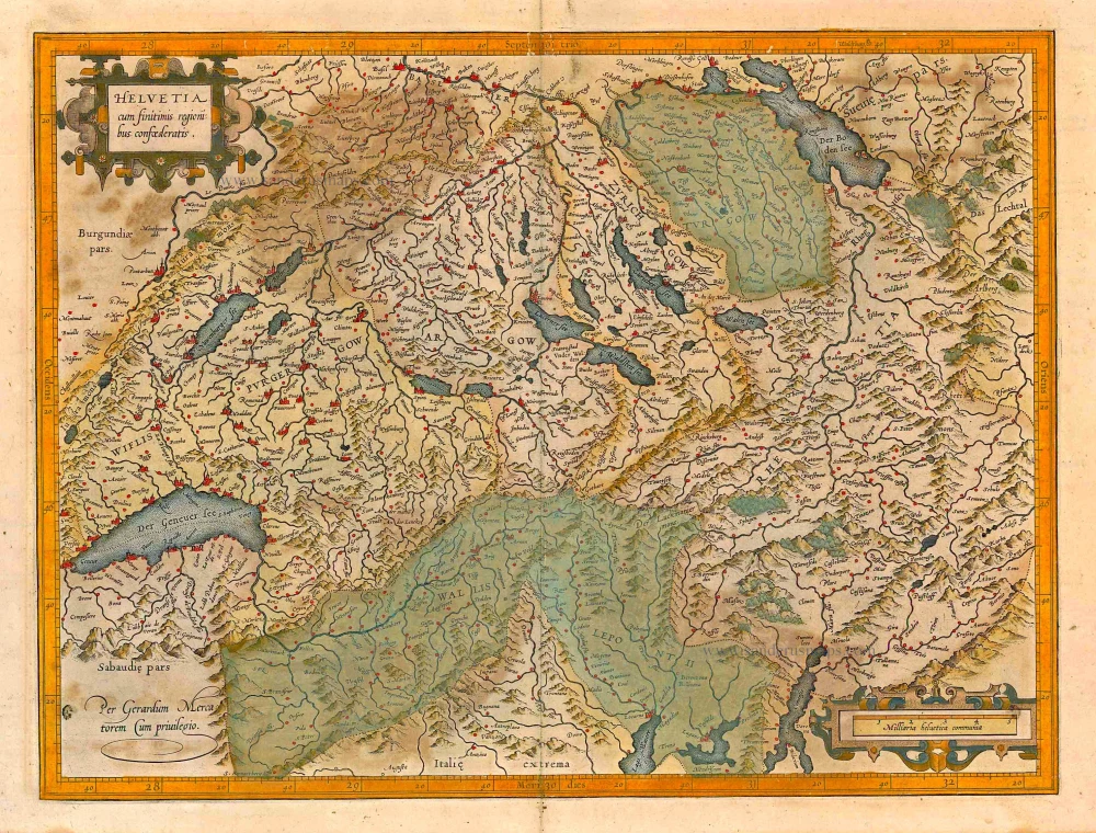
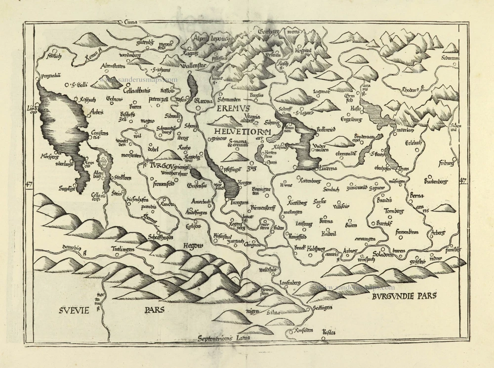
Helvetia cum finitimis regionibus confoederatis.
Item Number: 27884 Authenticity Guarantee
Category: Antique maps > Europe > Switzerland
Old, antique map of Switzerland, by Gerard Mercator.
Title: Helvetia cum finitimis regionibus confoederatis.
Per Gerardum Mercatorem. Cum privilegio.
Cartographer: Gerard Mercator.
Date of the first edition: 1585.
Date of this map: 1623.
Copper engraving, printed on paper.
Size (not including margins): 355 x 470mm (13.98 x 18.5 inches).
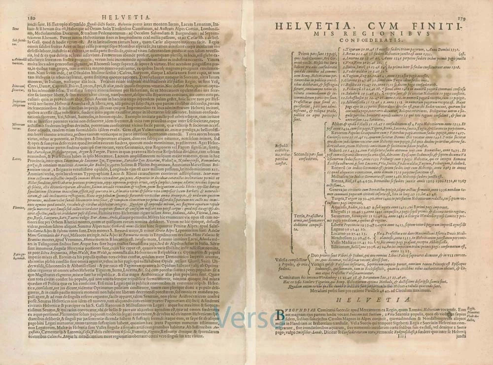
Verso: Latin text.
Condition: Original coloured, some offsetting.
Condition Rating: A.
References: Van der Krogt 1, 4900:1A.1; Karrow, 56/79; Blumer (Schweiz), p.52 #67
From: Gerardi Mercatoris - Atlas sive Cosmographicae Meditationes de Fabrica Mundi et Fabricati Figura. Denuo auctus Editio Quinta. Henricus Hondius. 1623. (Van der Krogt 1, 105)
Gerard Mercator (1512 – 1594)
Gerard Mercator was born Gerard de Cremere in Rupelmonde (near Antwerp) on 5 March 1512.
Young Gerard learned what Latin he could in Rupelmonde, and when he was about fifteen, his uncle sent him to s'Hertogenbosch to study at a school run by the Brothers of the Common Life. One of Mercator’s teachers was the celebrated humanist Macropedius. After three and a half years with the brothers, Gerard went to Louvain, where he enrolled in the university in 1530 as one of the poor students at Castle College.
By this time, he had Latinized his name to Mercator. He studied philosophy and took his master’s degree in 1532. The problems of the creation of the Universe and the Earth interested him in particular; this is reflected by his works written in later years.
After spending a few years in Antwerp, he returned to Louvain in c. 1535, where he took courses in mathematics under Gemma Frisius. Soon, he was recognised as an expert on the construction of mathematical instruments, as a land surveyor and, after 1537, as a cartographer. He drew his income from these activities after his marriage on August 3, 1536. He also qualified himself as a copper engraver, the first to introduce italic handwriting to this trade. The first maps, drawn and engraved by Gerard Mercator, are Palestine, 1537; the World in double heart-shaped projection, 1538; and Flanders, 1540.
In 1544, Mercator came into great danger: he was arrested on the accusation of heresy and put into jail. Thanks to the intervention of the University of Louvain, he was released after four months. In 1552, he moved with his family to Duisburg (Germany). In 1560, Mercator became a cosmographer in service of the Duke of Jülich-Cleve-Berge, and in 1563, he became a lecturer at the Grammar School of the new University in Duisburg. During this period, he made wall maps of Europe, 1554; of Loraine, 1564; the British Isles, 1564; and the famous world map with increasing latitudes, 1569. About this time, Mercator was also working on the project for a complete description of the creation, the Heavens, Earth, Sea and world history. This resulted in his Atlas, sive cosmographicae meditationes de fabrica mundi et fabricati figura. He also worked on an edition of Ptolemy’s Geographia, which appeared in 1578. The first part of his book with modern maps (France, Germany and the Netherlands) appeared in 1585.
Shortly after the publication of the second part of his map book (not yet called Atlas) with the maps of Italy (1589), he had a stroke that ended his highly significant productivity. The great man passed away on 2 December 1594, leaving the responsibility of finishing the map book to his son Rumold. The final part of it appeared in 1595. Its title is Pars Altera, and it constitutes an essential part of what was then called Mercator’s Atlas.
The map of Europe and the world map in the Atlas are by Rumold Mercator. After Rumold died in 1599, the Atlas was reissued in 1602.
The plates of the maps, both of the Ptolemy edition and the Atlas, were sold in 1604 to Jodocus Hondius of Amsterdam. The following year, Hondius managed to bring out Ptolemy’s Geographia. In 1606, the first Amsterdam edition of the Mercator Atlas appeared in the next year. From then to 1638, the Atlas saw many enlarged editions in various languages.
Related items
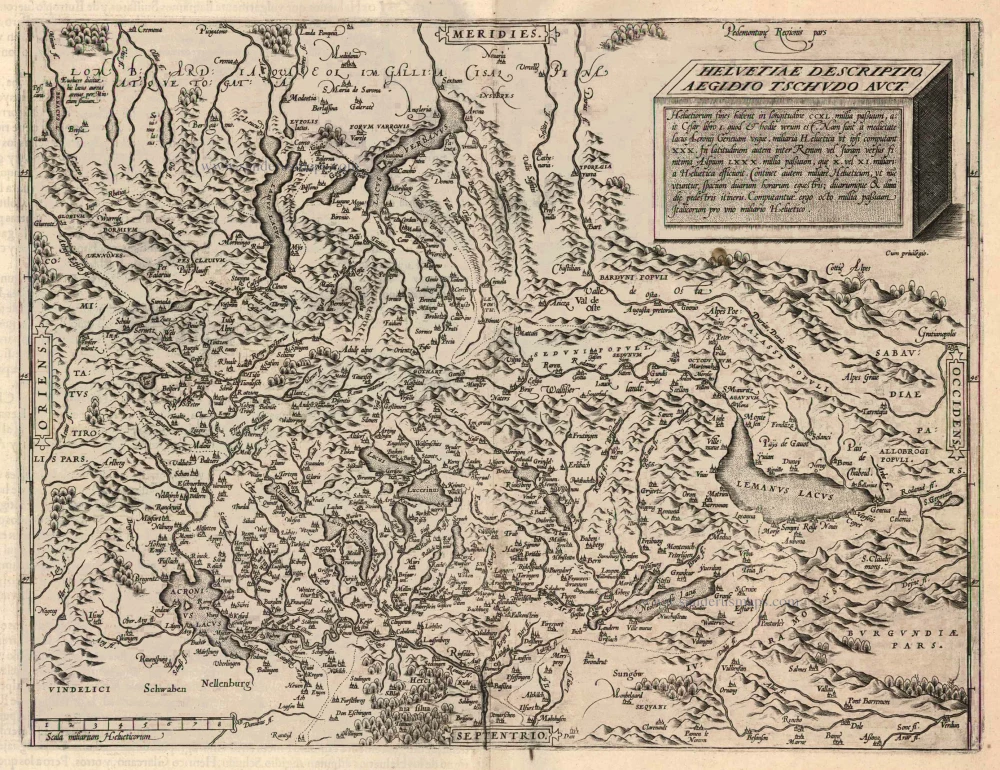
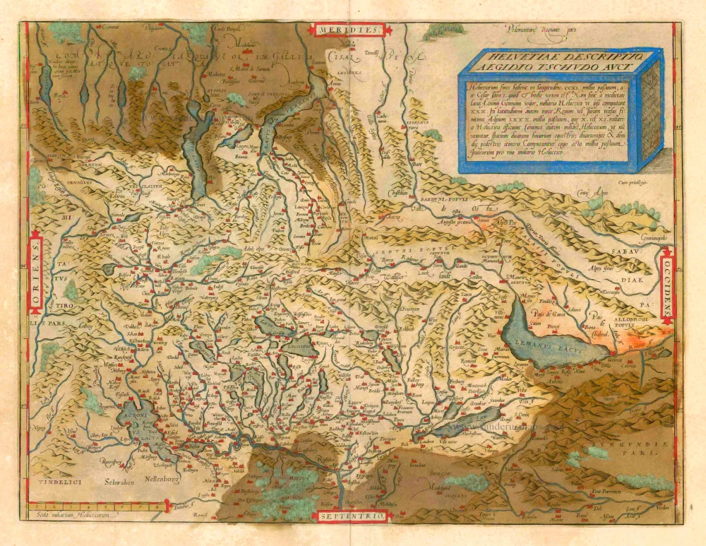
Helvetiae Descriptio Aegidio Tschudo Auct. 1598
Switzerland, by Abraham Ortelius.
[Item number: 3868]
Die erst Tafel innhaltend das Schweytzerlandt mit den anstossenden Ländern. 1588
Switzerland by Sebastian Münster.
[Item number: 14631]
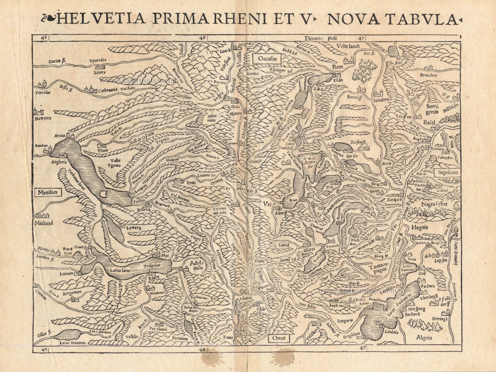
Helvetia Prima Rheni et V Nova Tabula. 1542
Switzerland by Sebastian Munster.
[Item number: 14925]
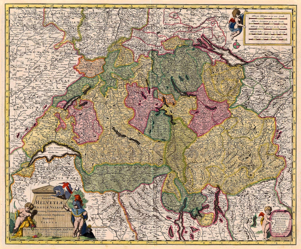
Exactissima Helvetiae Rhaetiae, Valesiae ... 1683-1696
Switzerland, by Visscher N.
[Item number: 18692]
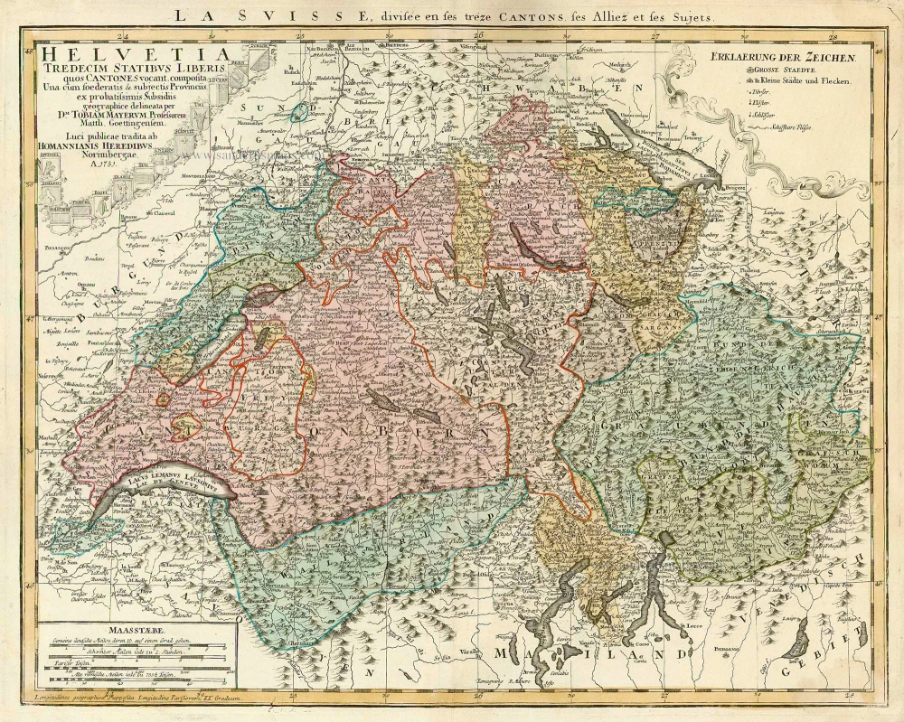
Helvetia Tredecim Statibus Liberis quos Cantones vocant Composita ... c. 1757.
Switzerland, by Homann Heirs.
[Item number: 22480]
Helvetiae Descriptio Aegidio Tschudo Auct. 1612
Switzerland, by Ortelius A.
[Item number: 22945]
Helvetiae Descriptio Aegidio Tschudo Auct. 1579
SWITZERLAND by Abraham Ortelius
[Item number: 23164]
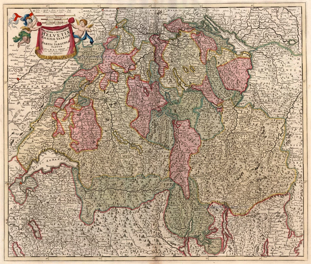
Novissima et Acuratissima Helvetiae, Rhaetiae, Valesiae et Partis Sabaudiae Tabula 1756
Antique map of Switzerland by Ottens R. & J.
[Item number: 23506]
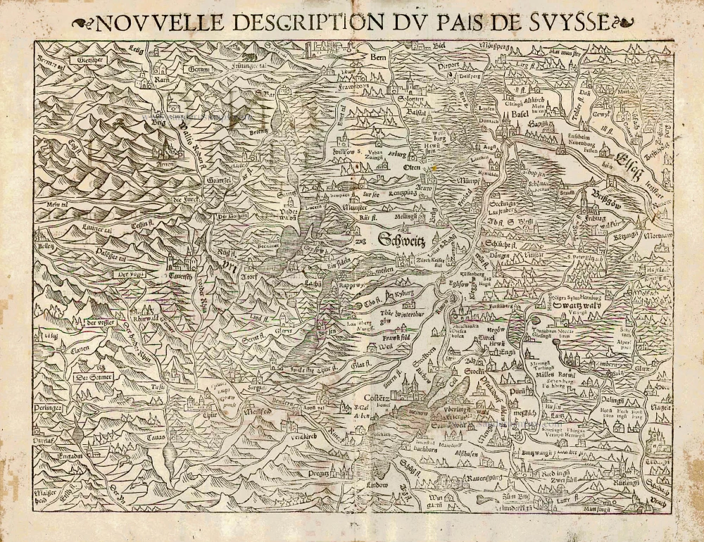
Nouvelle Description du Pais de Suysse. 1555
Switzerland, by Sebastian Munster.
[Item number: 25172]
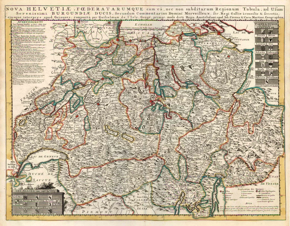
Nova Helvetiae, Foederatarumque cum ea, nec non Subditarum Regionum Tabula ... 1730
Switzerland by Guillaume Delisle, published by Covens & Mortier.
[Item number: 25699]
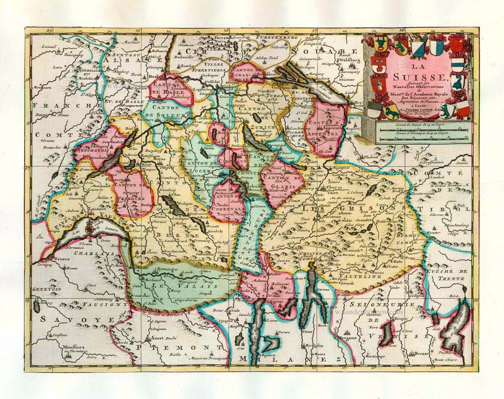
La Suisse. 1713
Switzerland, by Pieter Van der Aa.
[Item number: 26174]
Helvetia cum finitimis regionibus confoederatis. 1641
Switzerland, by Henricus Hondius
[Item number: 26292]
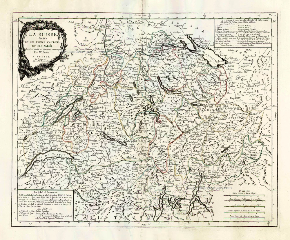
La Suisse Divisee en ses Treize Cantons et ses Allies. 1776-79
Switzerland, by Francesco Santini.
[Item number: 26957]

Zurichgow. [Lettering in lower right quadrant.] 1628.
Northern Switzerland, by Gerard Mercator.
[Item number: 27450]
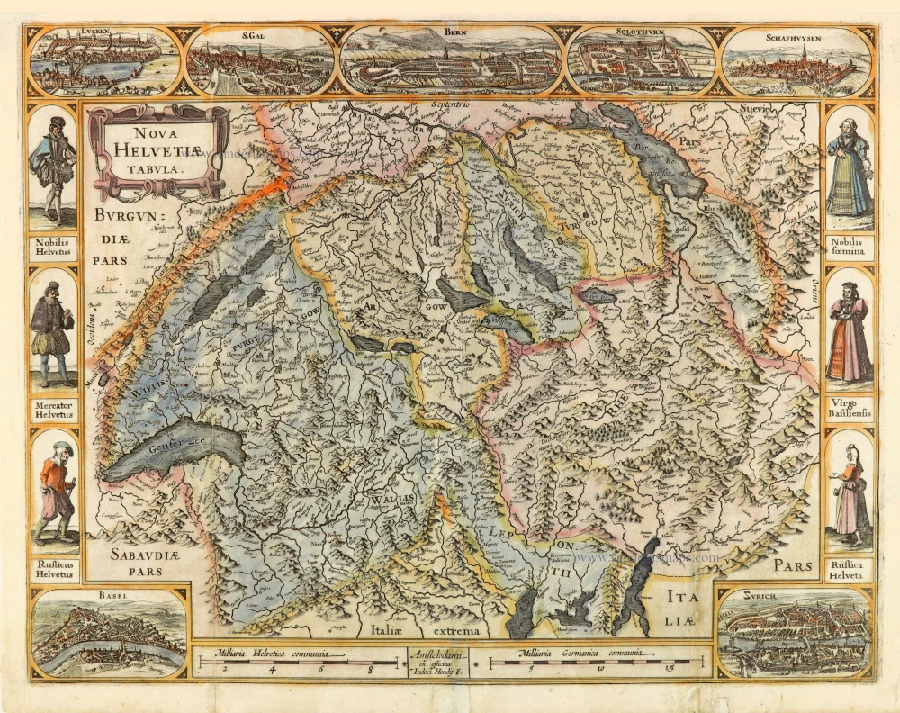
Nova Helvetiae Tabula. c. 1634
Switzerland, by Jodocus Hondius.
[Item number: 28003]
Ta . Here . Helve. [From verso] 1525
Switzerland by Lorenz Fries.
[Item number: 28199]
Helvetia Divisa in Tredicem Cantones sive Regiones, Bernam nempe Fruburgum, Solodurum, Basileam, Schafhusiam; Tigurum et Lucernam, cum foederatis Regionibus, numirum Comitatu Neoburgensi, urbe Biela, Resp. Genevensi Abbatia S. Galleni et Vallesia. c. 1702
Switzerland by Gerard & Leonard Valck.
[Item number: 28270]
Helvetiae Rhetiae & Valesiae cum omnibus finitimis regionibus Tabula Vulgo Schweitzerland. c. 1678
Switzerland by Johannes Janssonius.
[Item number: 28538]
Carte Générale des treize Cantons Suisse, et des différents Etats de leur Dépendance; ainsi que la pluspart des Etats qui leur sont voisins et aliez; avec des tables pour l'intelligence de l'Histoire. 1708
Switzerlandx, by Zacharias Châtelain.
[Item number: 29444]
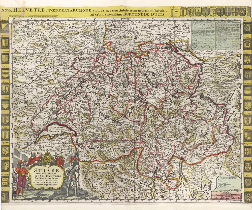
La Suisse divisée en ses Treze Cantons, Ses Alliez & Ses Sujets, c. 1709
Switzerland by Hubert Jaillot, published by Pierre Mortier.
[Item number: 29566]