
XVII Provinces, by A. Goos - J. Janssonius. 1630
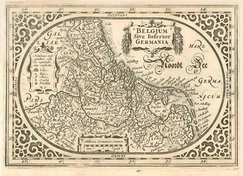
Abraham Goos (c. 1590-1643)
Abraham Goos was active as a map engraver for the workshops of Claes Jansz Visscher and the Hondius family and engraved and published on his account. In 1616 Goos published his Nieuw Nederlandtsch Caertboeck, a small atlas of the Seventeen Provinces in 23 maps.
Belgium sive Inferior Germania.
Item Number: 27988 Authenticity Guarantee
Category: Antique maps > Europe > The Low Countries
Old, antique map of the XVII Provinces, by A. Goos - J. Janssonius.
Title: Belgium sive Inferior Germania.
Cum privil.
Oriented to the west.
Date of the first edition: 1616.
Date of this map: 1631.
Copper engraving, printed on paper.
Size (not including margins): 120 x 175mm (4.72 x 6.89 inches).
Verso: German text.
Condition: Excellent.
Condition Rating: A+.
References: Van der Krogt 3, 3000:363; Van der Heijden (Netherlands), #77
From: A. Goos, Atlas Minor (German) . Amsterdam, J. Janssonius, 1631. (Van der Krogt 3, 352:31)
Abraham Goos (c. 1590-1643)
Abraham Goos was active as a map engraver for the workshops of Claes Jansz Visscher and the Hondius family and engraved and published on his account. In 1616 Goos published his Nieuw Nederlandtsch Caertboeck, a small atlas of the Seventeen Provinces in 23 maps.
Related items
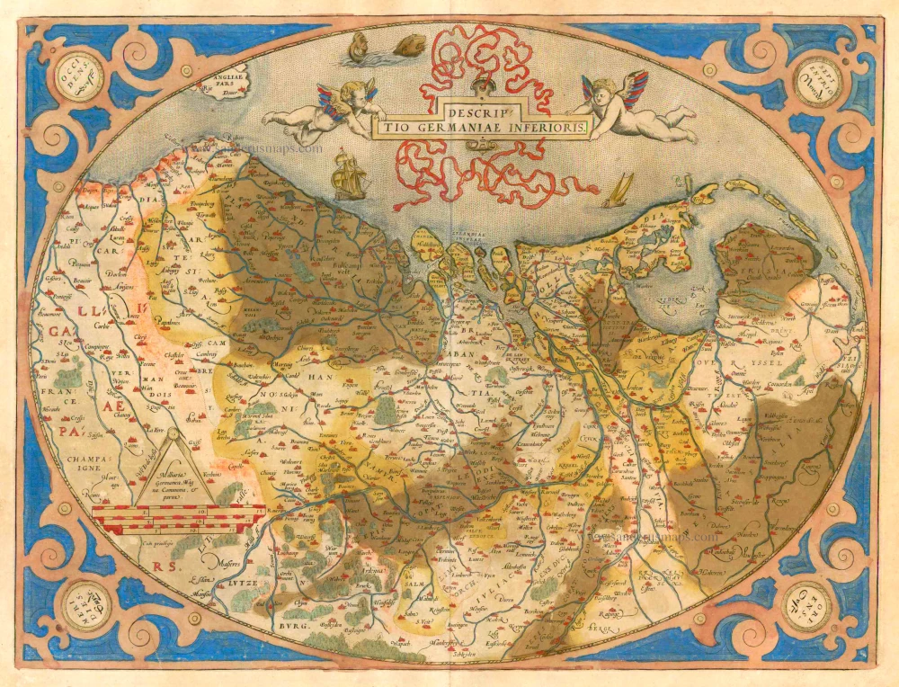
Descriptio Germaniae Inferioris. 1579
XVII Provinces by Abraham Ortelius.
[Item number: 21663]

Belgiae Inferioris descriptio emendata cum circu(m)jacentium regionum confinijs. 1609
The 17 Provinces, by Ludovico Guicciardini.
[Item number: 25913]
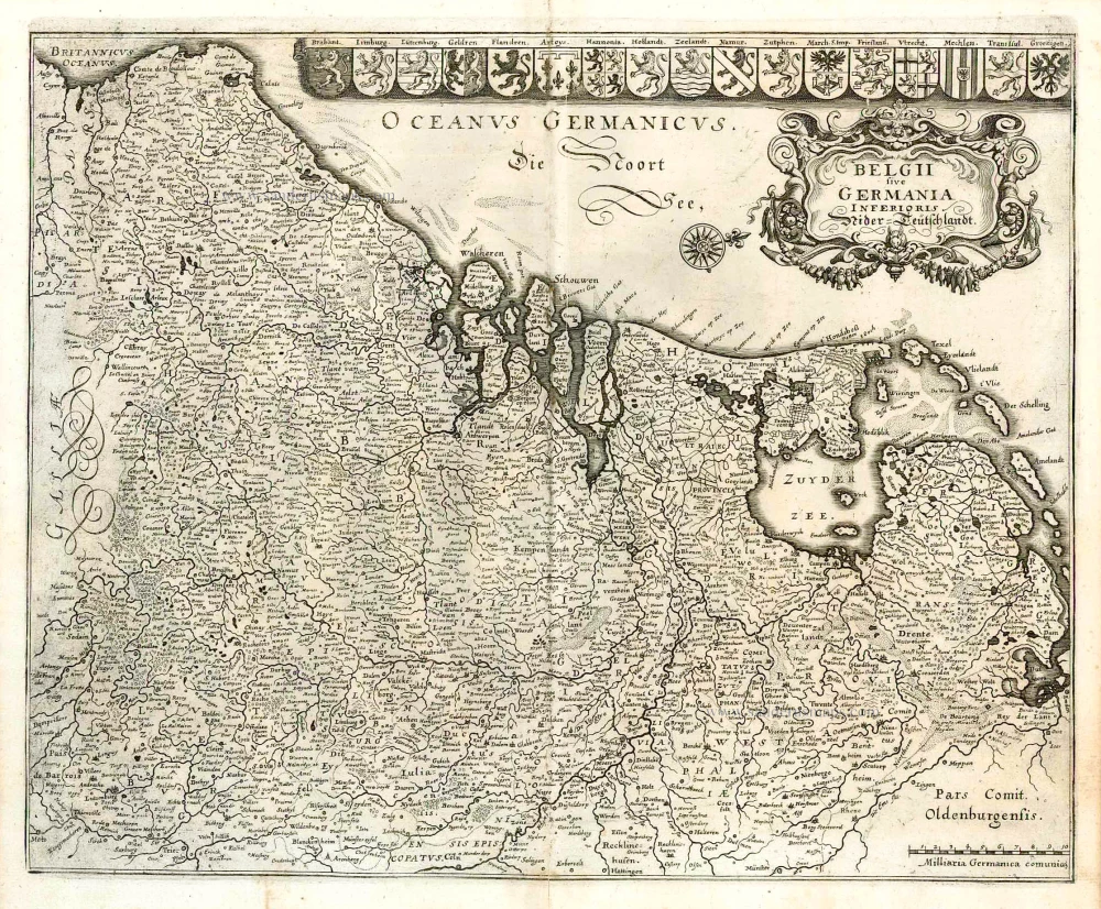
Belgii sive Germania Inferioris - Nider Teutschlandt. 1638
The 17 Provinces, by Matthäus Merian.
[Item number: 26030]
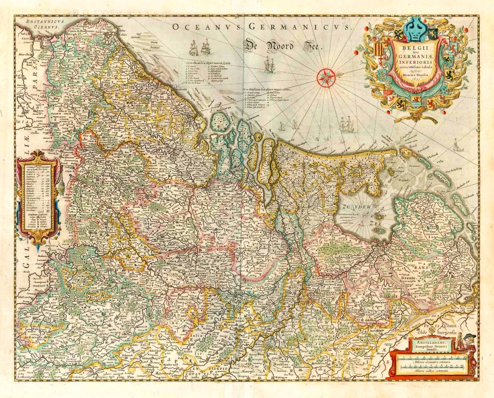
belgii sive germaniae inferioris accuratissima tabula. auctore henrico hondio 1631. amstelodami, sumptibus henrici hondio 1631. 1641
The 17 Provinces, by Henricus Hondius.
[Item number: 26301]
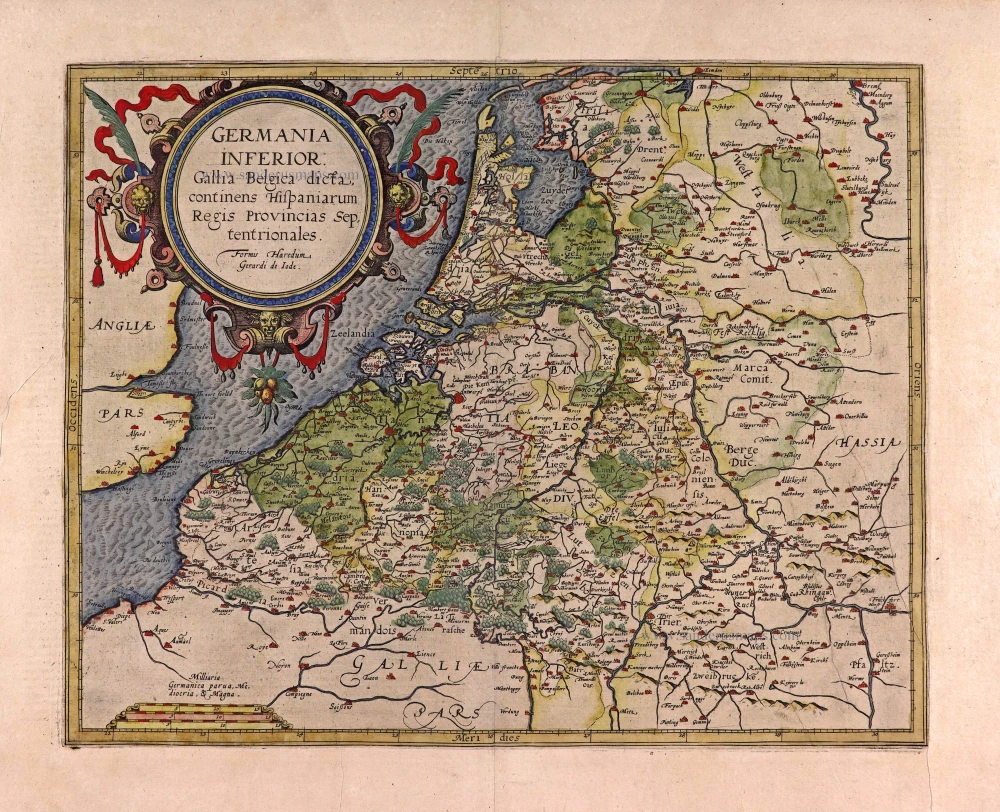
Germania Inferior. Gallia Belgica Dicta, continens Hispaniarum Regis Provincias Septentrionales. 1593
XVII Provinces, by Gerard de Jode.
[Item number: 27943]
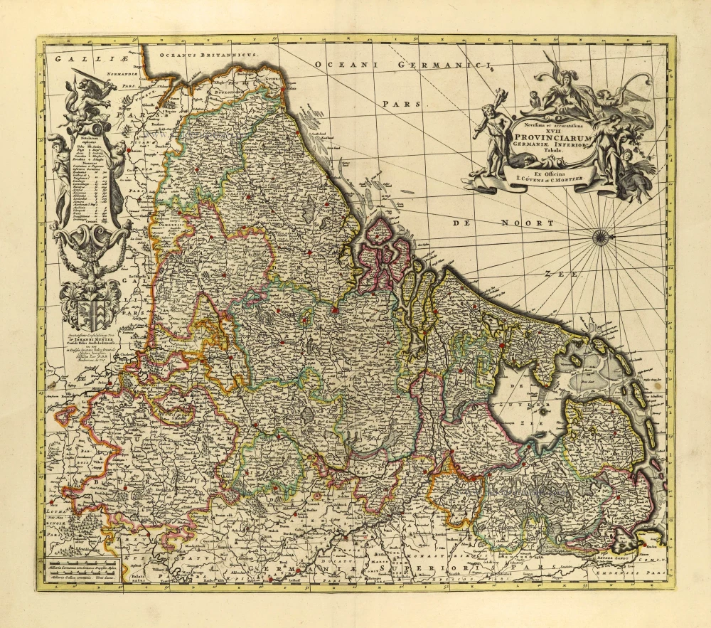
Novissima et accuratissima XVII provinciarum Germaniae Inferioris Tabula. c. 1715
17 Provinces, by Frederik de Wit, published by Covens & Mortier.
[Item number: 28284]
In luxury colouring
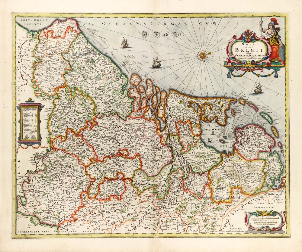
Nova Totius Belgii Sive Germaniae Inferioris. 1666
XVII Provinces (Low Countries) by Joannes Janssonius.
[Item number: 30079]