
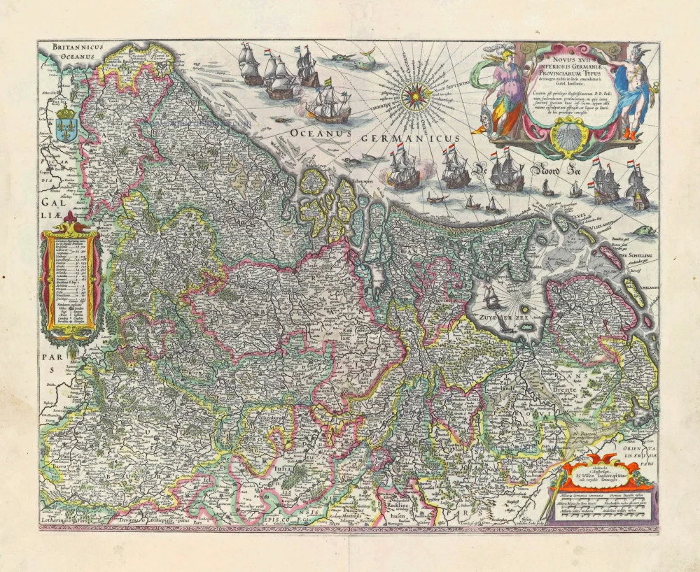
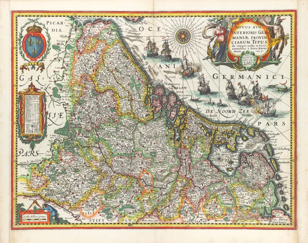
17 Provinces, by Willem Blaeu. 1631
Rare second state with the name Guliel. janßonio (= Willem Blaeu).
The first state of this map appeared in 1608 with three decorative borders, a map that was one of the finest designed cartographic products of the period (Schilder).
The copperplate of the folio-sized map of the Seventeen Provinces was used for a long time by the Blaeu family, albeit in a smaller size. When Willem Jansz Blaeu wanted to realize his plans for a world atlas in 1630, he lacked a general map of the Seventeen Provinces. His folio-sized map of the area, published in 1608, was too large (because of its border decorations) to be added to the other maps. He found a radical solution to this problem: he trimmed strips off three sides of the copper plate so that the beautiful border decorations were lost to accommodate the atlas's size. He made no alterations to the geographical content.
In 1640 a minor revision was made: the name Ianssonio in the title cartouche and the name Ianszoon in the imprint were replaced by the name Blaeu.
The Blaeus: Willem Janszoon, Cornelis & Joan
Willem Jansz. Blaeu and his son Joan Blaeu are the most widely known cartographic publishers of the seventeenth century.
Willem Jansz. (also written Guilielmus Janssonius) = Willem Janszoon Blaeu, was born in Uitgeest (Netherlands), near Alkmaar in 1571. He studied mathematics under Tycho Brahe and learned the theory and practice of astronomical observations and the art of instrument- and globe making.
In 1596 he came to Amsterdam where he settled down as a globe-, instrument- and map-maker. He published his first cartographic work (a globe) in 1599 and probably published his first printed map (a map of the Netherlands) in 1604. He specialized in maritime cartography and published the first edition of the pilot guide Het Licht der Zeevaert in 1608, and was appointed Hydrographer of the V.O.C. (United East India Company) in 1633. After thirty years of publishing books, wall maps, globes, charts and pilot guides, he brought out his first atlas, Atlas Appendix (1630). This was the beginning of the great tradition of atlas-making by the Blaeus.
In 1618 another mapmaker, bookseller and publisher, Johannes Janssonius established himself in Amsterdam next door to Blaeu's shop. It is no wonder that these two neighbours, who began accusing each other of copying and stealing their information, became fierce competitors who did not have a good word to say about each other. In about 1621 Willem Jansz. decided to put an end to the confusion between his name and his competitor's, and assumed his grandfather's sobriquet, 'blauwe Willem' ('blue Willem'), as the family name; thereafter he called himself Willem Jansz. Blaeu.
Willem Janszoon Blaeu died in 1638, leaving his prospering business to his sons, Cornelis and Joan. Of Cornelis we only know that his name occurs in the prefaces of books and atlases until c. 1645.
Joan Blaeu, born in Amsterdam, 1596, became partner in his father’s book trade and printing business. In 1638 he was appointed his father’s successor in the Hydrographic office of the V.O.C. His efforts culminated in the magnificent Atlas Major and the town-books of the Netherland and of Italy – works unsurpassed in history and in modern times, which gave eternal fame to the name of the Blaeus.
On February 23, 1672, a fire ruined the business. One year later, Dr. Joan Blaeu died. The fire of 1672 and the passing away of the director gave rise to a complete sale of the stock of the Blaeu House. Five public auctions dispersed the remaining books, atlases, copperplates, globes, etc., among many other map dealers and publishers in Amsterdam. The majority was acquired by a number of booksellers acting in partnership.
In the succeeding years, the remaining printing department was left in the hands of the Blaeu family until 1695 when also the inventory of the printing house was sold at a public auction. That meant the end of the Blaeus as a printing house of world renown.
Novus XVII Inferioris Germaniae Provinciarum Typus.
Item Number: 28019 Authenticity Guarantee
Category: Antique maps > Europe > The Low Countries
Old, antique map of 17 Provinces, by Willem Blaeu.
Oude, antieke kaart van de 17 Provinciën, door Willem Blaeu.
Title: Novus XVII Inferioris Germaniae Provinciarum Typus.
de integro multis locis emendatus à Guliel. janßonio.
Cautum est privilegio...
Josua vanden Ende sculp.
Gedruckt t'Amsterdam, bij Willem Ianszoon op 't Water inde vergulde Zonnewyser.
Oriented to the northwest.
Date of the first edition: 1608 (First state)
Date of the first atlas edition: 1630
Date of this map: 1631
Engraver: Josua Vanden Ende
Copper engraving, printed on paper.
Size (not including margins): 400 x 500mm (15.75 x 19.69 inches).
Verso: Latin text.
Condition: Original coloured, excellent.
Condition Rating: A+.
References: Van der Krogt 2, 3000:2.1; Van der Heijden (Netherlands), 64.2; Schilder 4, 23.2; Schilder 6, 52.2
From: Appendix Theatri A. Ortelii et Atlantis G. Mercatoris, continens Tabulas Geographicas diversarum Orbis Regionum, ... Amsterdam, W. Blaeu, 1631. (Van der Krogt 2, 2:022).
Rare second state with the name Guliel. janßonio (= Willem Blaeu).
The first state of this map appeared in 1608 with three decorative borders, a map that was one of the finest designed cartographic products of the period (Schilder).
The copperplate of the folio-sized map of the Seventeen Provinces was used for a long time by the Blaeu family, albeit in a smaller size. When Willem Jansz Blaeu wanted to realize his plans for a world atlas in 1630, he lacked a general map of the Seventeen Provinces. His folio-sized map of the area, published in 1608, was too large (because of its border decorations) to be added to the other maps. He found a radical solution to this problem: he trimmed strips off three sides of the copper plate so that the beautiful border decorations were lost to accommodate the atlas's size. He made no alterations to the geographical content.
In 1640 a minor revision was made: the name Ianssonio in the title cartouche and the name Ianszoon in the imprint were replaced by the name Blaeu.
The Blaeus: Willem Janszoon, Cornelis & Joan
Willem Jansz. Blaeu and his son Joan Blaeu are the most widely known cartographic publishers of the seventeenth century.
Willem Jansz. (also written Guilielmus Janssonius) = Willem Janszoon Blaeu, was born in Uitgeest (Netherlands), near Alkmaar in 1571. He studied mathematics under Tycho Brahe and learned the theory and practice of astronomical observations and the art of instrument- and globe making.
In 1596 he came to Amsterdam where he settled down as a globe-, instrument- and map-maker. He published his first cartographic work (a globe) in 1599 and probably published his first printed map (a map of the Netherlands) in 1604. He specialized in maritime cartography and published the first edition of the pilot guide Het Licht der Zeevaert in 1608, and was appointed Hydrographer of the V.O.C. (United East India Company) in 1633. After thirty years of publishing books, wall maps, globes, charts and pilot guides, he brought out his first atlas, Atlas Appendix (1630). This was the beginning of the great tradition of atlas-making by the Blaeus.
In 1618 another mapmaker, bookseller and publisher, Johannes Janssonius established himself in Amsterdam next door to Blaeu's shop. It is no wonder that these two neighbours, who began accusing each other of copying and stealing their information, became fierce competitors who did not have a good word to say about each other. In about 1621 Willem Jansz. decided to put an end to the confusion between his name and his competitor's, and assumed his grandfather's sobriquet, 'blauwe Willem' ('blue Willem'), as the family name; thereafter he called himself Willem Jansz. Blaeu.
Willem Janszoon Blaeu died in 1638, leaving his prospering business to his sons, Cornelis and Joan. Of Cornelis we only know that his name occurs in the prefaces of books and atlases until c. 1645.
Joan Blaeu, born in Amsterdam, 1596, became partner in his father’s book trade and printing business. In 1638 he was appointed his father’s successor in the Hydrographic office of the V.O.C. His efforts culminated in the magnificent Atlas Major and the town-books of the Netherland and of Italy – works unsurpassed in history and in modern times, which gave eternal fame to the name of the Blaeus.
On February 23, 1672, a fire ruined the business. One year later, Dr. Joan Blaeu died. The fire of 1672 and the passing away of the director gave rise to a complete sale of the stock of the Blaeu House. Five public auctions dispersed the remaining books, atlases, copperplates, globes, etc., among many other map dealers and publishers in Amsterdam. The majority was acquired by a number of booksellers acting in partnership.
In the succeeding years, the remaining printing department was left in the hands of the Blaeu family until 1695 when also the inventory of the printing house was sold at a public auction. That meant the end of the Blaeus as a printing house of world renown.
Related items

Belgiae Inferioris descriptio emendata cum circu(m)jacentium regionum confinijs. 1609
The 17 Provinces, by Ludovico Guicciardini.
[Item number: 25913]
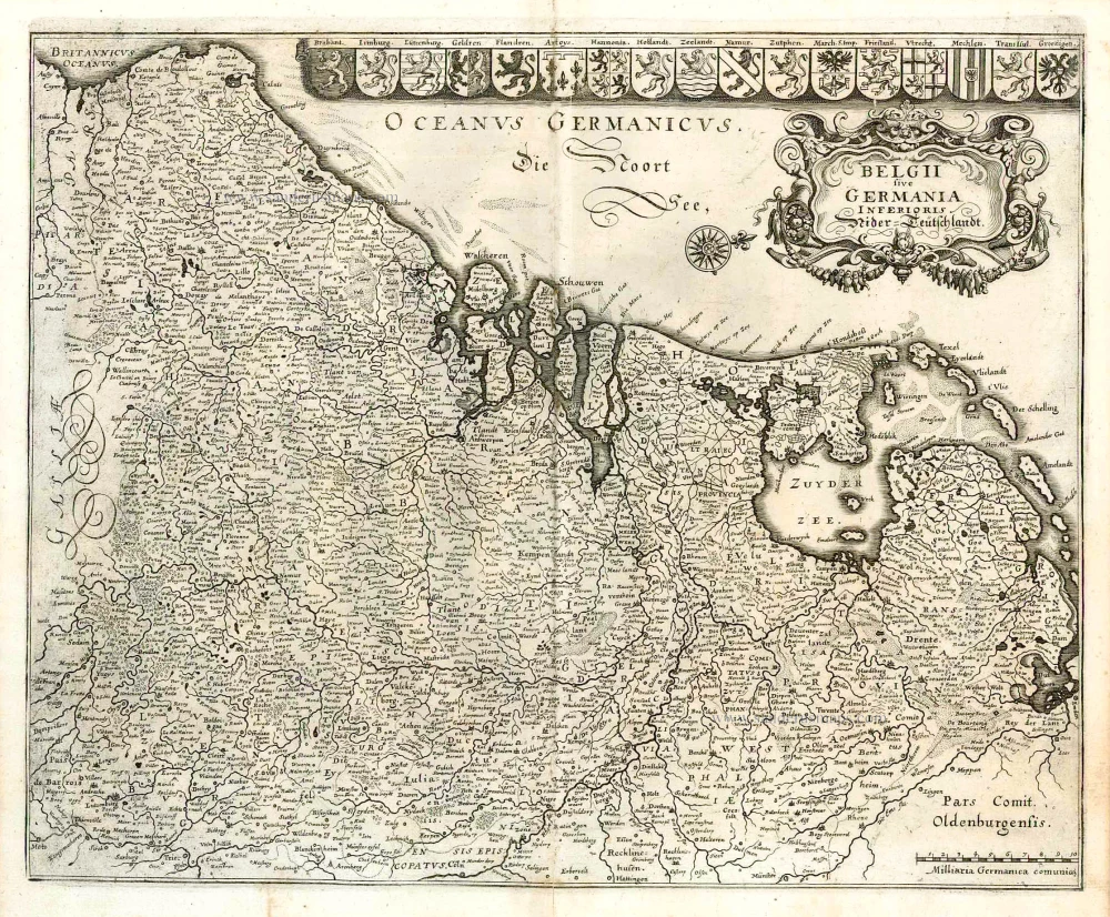
Belgii sive Germania Inferioris - Nider Teutschlandt. 1638
The 17 Provinces, by Matthäus Merian.
[Item number: 26030]
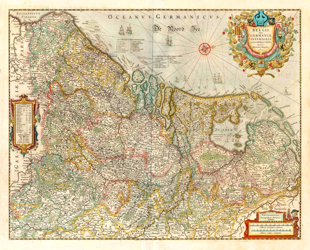
belgii sive germaniae inferioris accuratissima tabula. auctore henrico hondio 1631. amstelodami, sumptibus henrici hondio 1631. 1641
The 17 Provinces, by Henricus Hondius.
[Item number: 26301]
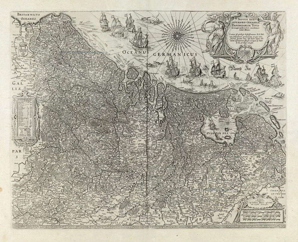
Novus XVII Inferioris Germaniae Provinciarum Typus. 1664-65
17 Provinces, by Willem Blaeu.
[Item number: 28110]
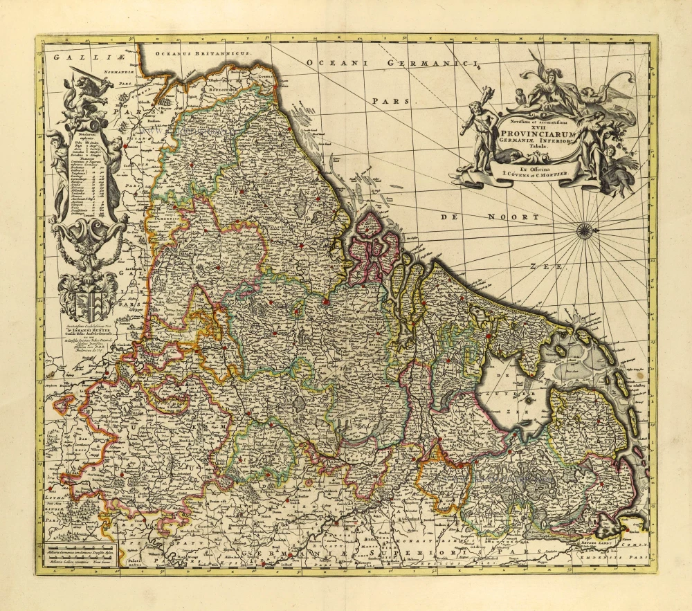
Novissima et accuratissima XVII provinciarum Germaniae Inferioris Tabula. c. 1715
17 Provinces, by Frederik de Wit, published by Covens & Mortier.
[Item number: 28284]
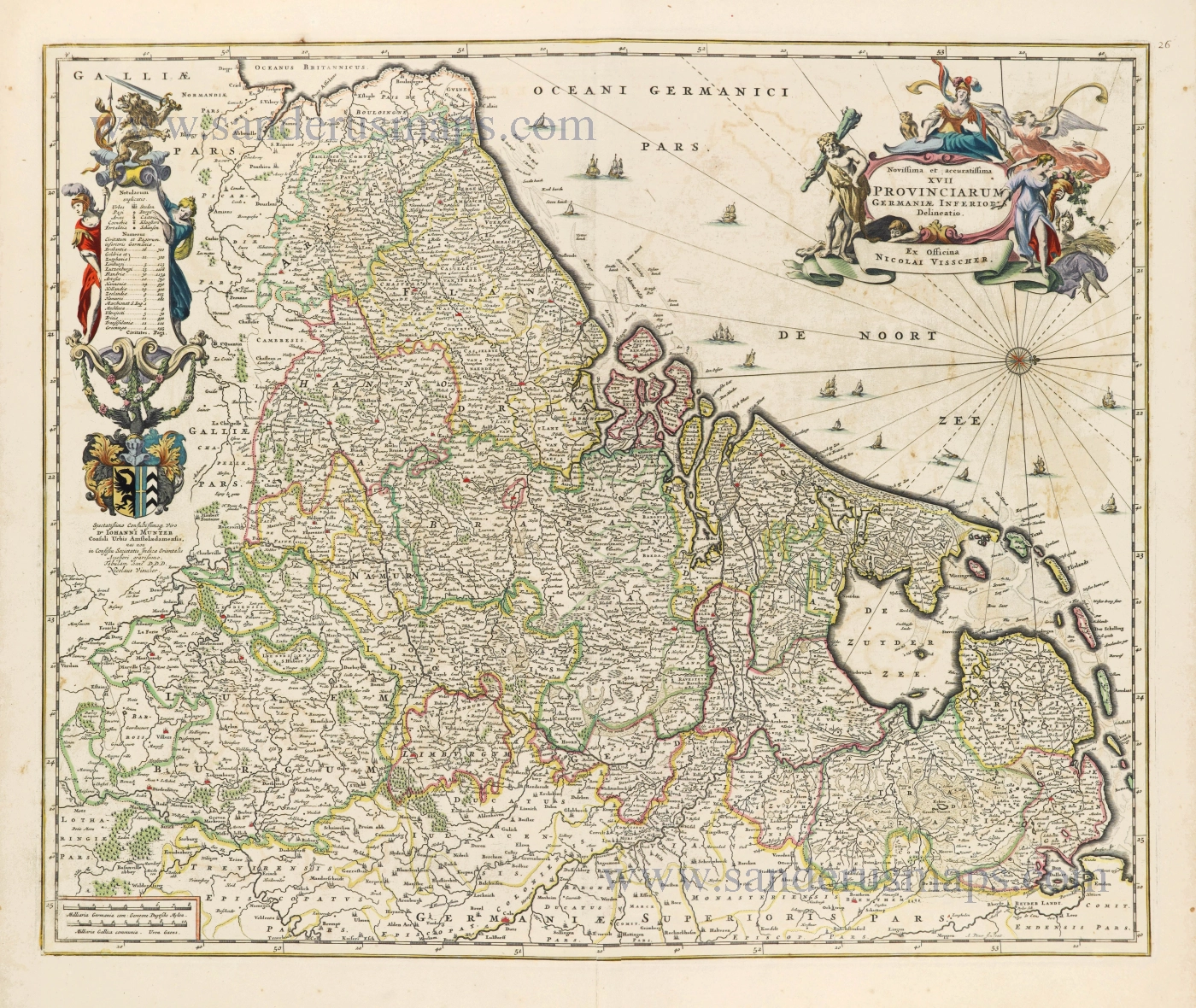
Novissima et accuratissima XVII Provinciarum Germaniae Inferioris Delineatio. c. 1656
Seventeen Provinces by Nicolaes Visscher I.
[Item number: 28539]

Descriptio Germaniae Inferioris. 1603
XVII Provinces by Abraham Ortelius.
[Item number: 28899]

Belgium seu Germania Inferior. 1594
The 17 Provinces, by Giovanni Magini.
[Item number: 28914]
In luxury colouring
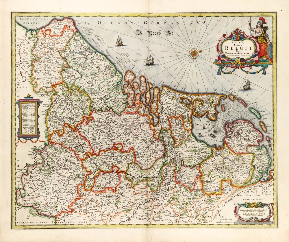
Nova Totius Belgii Sive Germaniae Inferioris. 1666
XVII Provinces (Low Countries) by Joannes Janssonius.
[Item number: 30079]
Novus XVII Inferioris Germaniae Provinciarum Typus. 1617
17 Provinces by Petrus Kaerius (Pieter Van den Keere).
[Item number: 30258]