
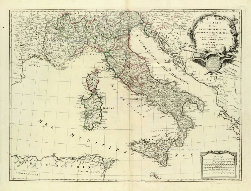
Italy, by Sr. Janvier Jean Denis. 1776-79
Francesco and Paolo Santini (c.1729-1793)
Francesco Santini, a Venetian publisher, acquired the printing plates of Vaugondy’s Atlas Universel …, a commercial and cartographic success, with widespread influence on mapmakers throughout Europe. Together with his brother Paolo, he commissioned a new set of plates and reissued the atlas in 1776. The following year, Paolo Santini assigned all his publication rights to M. Remondini, who in 1777 reissued the same atlas but with his name.
Sr. Janvier Jean Denis [Robert] (? - 1776)
A French cartographer who worked in Paris from about 1746.
He collaborated with other cartographers and publishers in producing a considerable number of maps, many of which were used in general atlases by William Fadan, P. Santini and others.
L'Italie Divisée en ses différents Etats, Royaumes et Républiques.
Item Number: 28076 Authenticity Guarantee
Category: Antique maps > Europe > Italy
Old, antique map of Italy, by Francesco & Paolo Santini.
Title: L'Italie Divisée en ses différents Etats, Royaumes et Républiques.
Dressée et Assujetie aux Observations Astronomiques.
Par le Sr Janvier Géographe A Venise.
Par François Santini rue Ste Justine près la dite Eglise.
Chez M. Remondini.
Date of the first edition: 1776.
Date of this map: 1776.
Copper engraving, printed on paper.
Size (not including margins): 480 x 645mm (18.9 x 25.39 inches).
Verso: Blank.
Condition: Original coloured in outline, excellent.
Condition Rating: A+.
References: Borri (Italy), #305
From: Atlas Universel dressé sur les meilleures cartes modernes. Venice, Remondini, 1776-79.
Francesco and Paolo Santini (c.1729-1793)
Francesco Santini, a Venetian publisher, acquired the printing plates of Vaugondy’s Atlas Universel …, a commercial and cartographic success, with widespread influence on mapmakers throughout Europe. Together with his brother Paolo, he commissioned a new set of plates and reissued the atlas in 1776. The following year, Paolo Santini assigned all his publication rights to M. Remondini, who in 1777 reissued the same atlas but with his name.
Sr. Janvier Jean Denis [Robert] (? - 1776)
A French cartographer who worked in Paris from about 1746.
He collaborated with other cartographers and publishers in producing a considerable number of maps, many of which were used in general atlases by William Fadan, P. Santini and others.
Related items
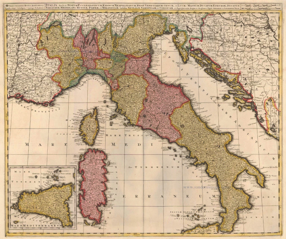
Italia, Divisa in Statum Ecclesiasticum, Regnum Neapolitanum, Resp. Venetiarum, Genuae, et Lucae: Magnum Ducatum Etruriae, Ducatus Sabaudiae, Mediolani, Mutinae, Parmae et Mirandulae: Insulas Siliciam, Sardiniam, et Superjacentia Regna et Regiones c. 1730.
Italy, by Valk G.& L.
[Item number: 14145]
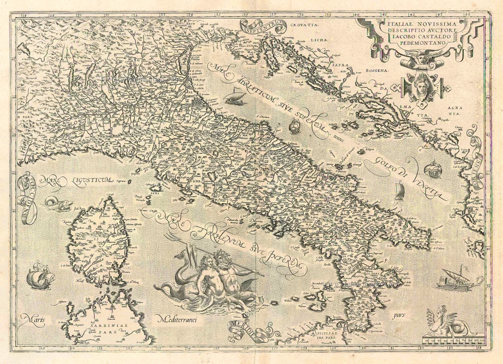
Italiae Novissima Descriptio Auctore Iacobo Castaldo Pedemontano 1612
Italy, by Abraham Ortelius.
[Item number: 22962]

Italiae Novissima Descriptio Auctore Iacobo Castaldo Pedemontano. 1612
Italy by Abraham Ortelius
[Item number: 22982]
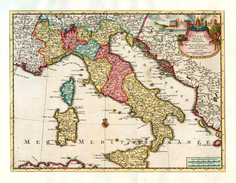
L'Italie. 1713
Italy, by Pieter Van der Aa.
[Item number: 26083]
Italia. 1597
Italy, by Giovanni Magini.
[Item number: 26517]
Important map of modern Italy.
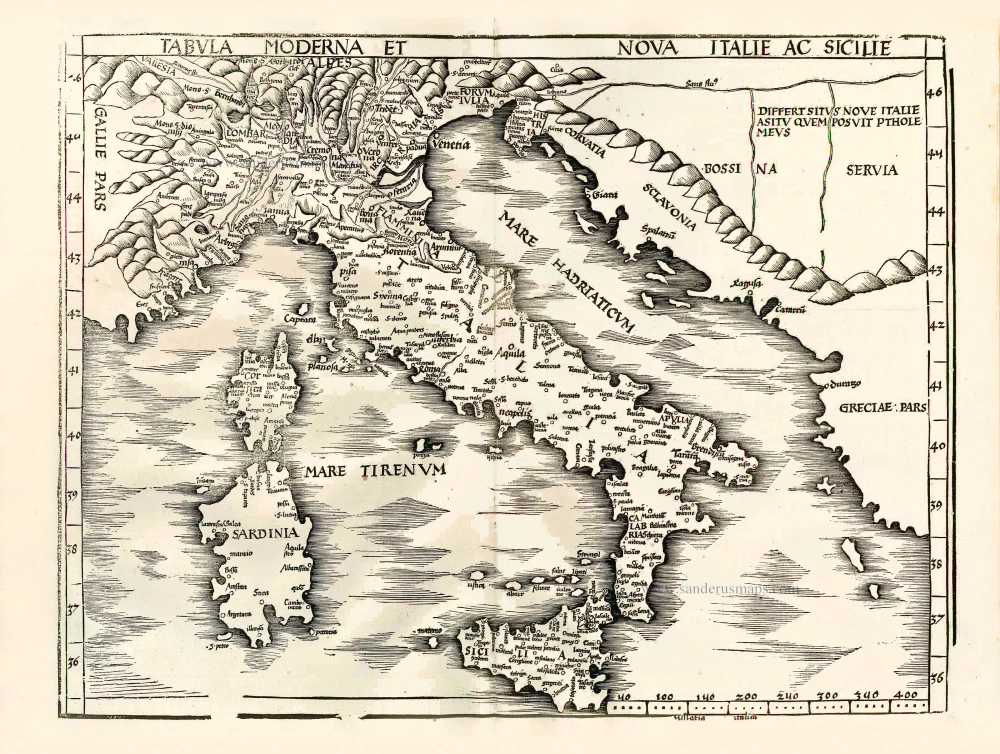
Tabula moderna et nova Italie ac Sicilie. 1513
Italy by Martin Waldseemüller
[Item number: 27587]
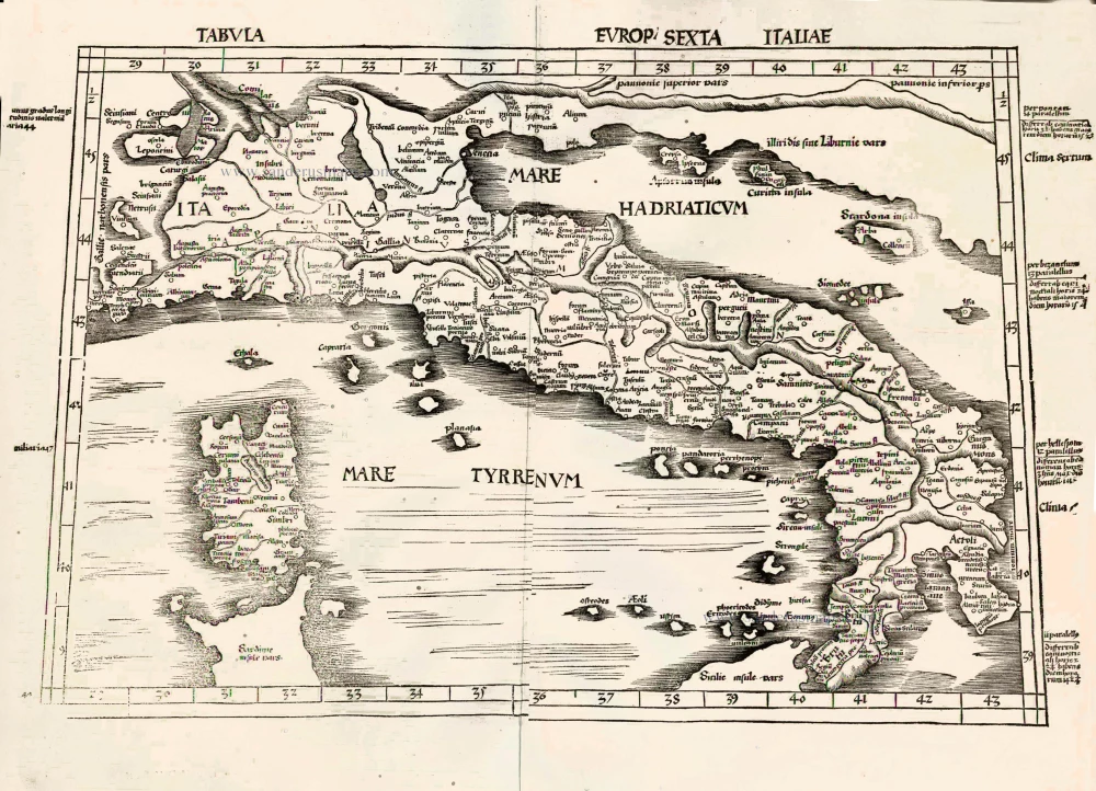
Important Ptolemy map
Tabula Europ. Sexta Italiae. 1513
Italy by Waldseemüller Martin
[Item number: 27588]
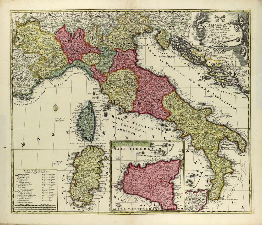
Italia iam tota Principes in suas Partes accuratius distincta; c. 1700
Italy by Petrus Schenk.
[Item number: 28323]
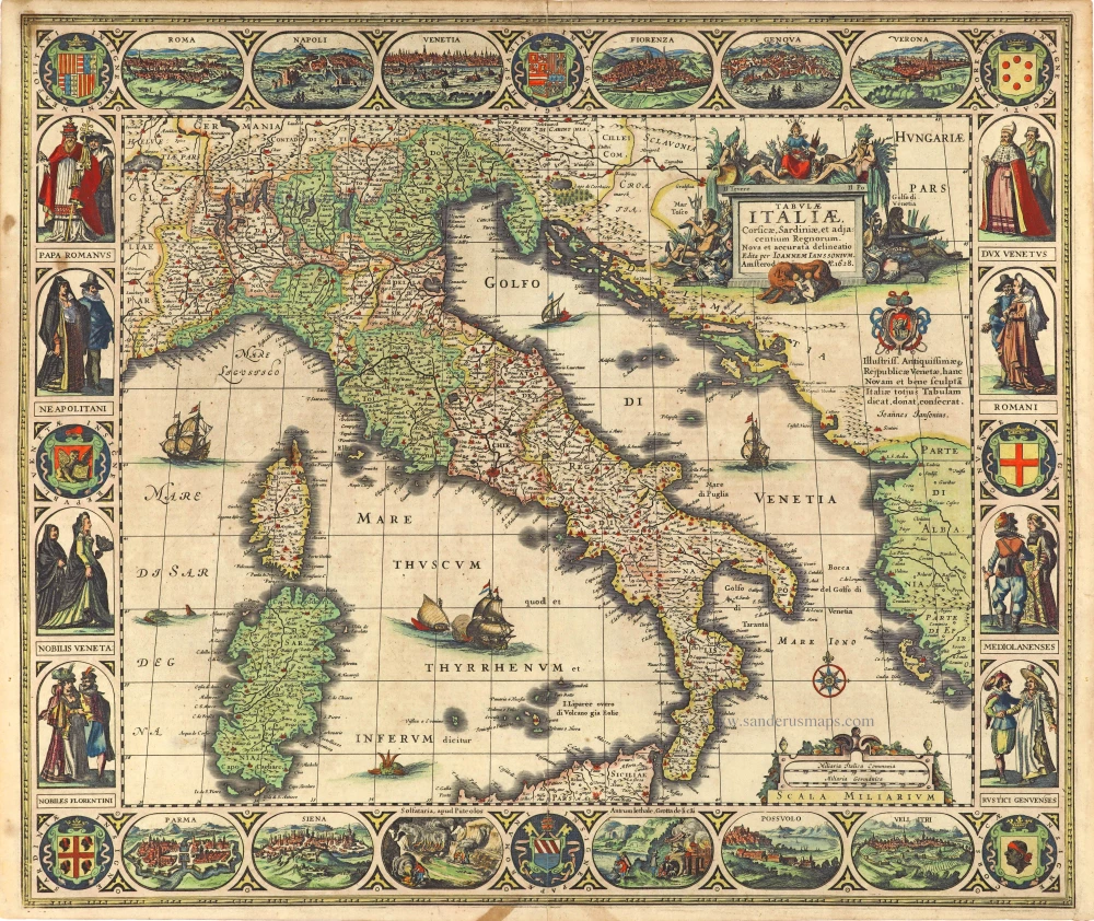
Tabula Italiae, Corsicae, Sardiniae, et adjacentium Regnorum. 1628
Italy by Joannes Janssonius.
[Item number: 28449]
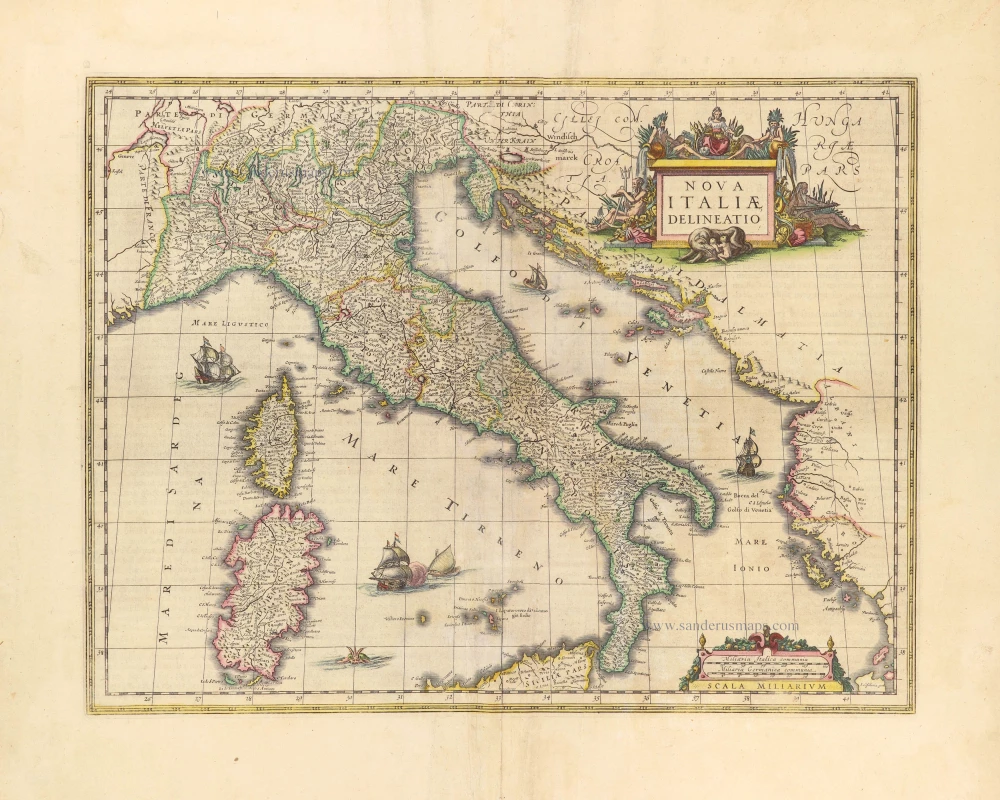
Nova Italiae Delineatio. 1642-43
Italy by Willem Blaeu.
[Item number: 28676]
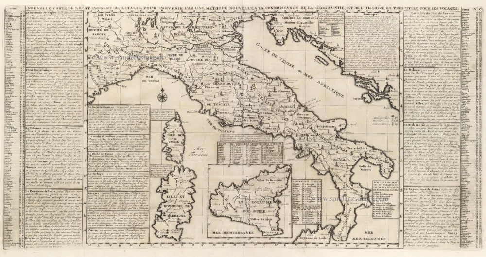
Nouvelle Carte de L'Etat present de l'Italie pour parvenir par une Methode nouvelle, a la connoissance de la Geographie, et de l'Histoire; et tres utile pour les voiages. 1713
Map of Italy by Zacharias Châtelain.
[Item number: 29641]
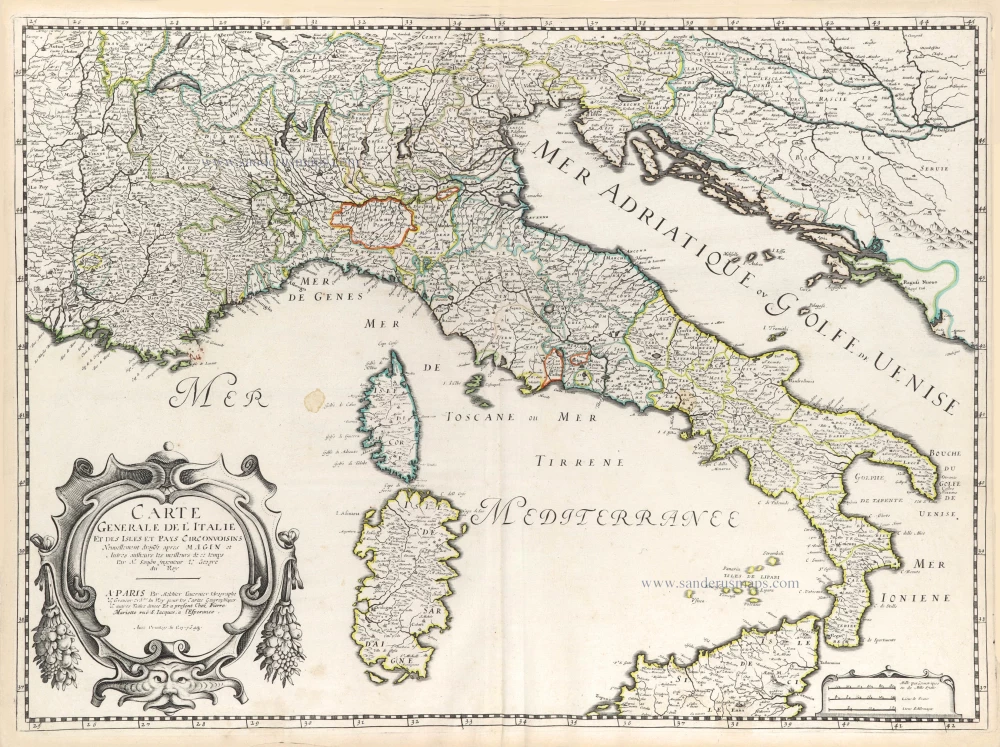
Carte Generale de l'Italie et des Isles et Pays Circonvoisins. 1652
Italy by Nicolas Sanson.
[Item number: 29672]
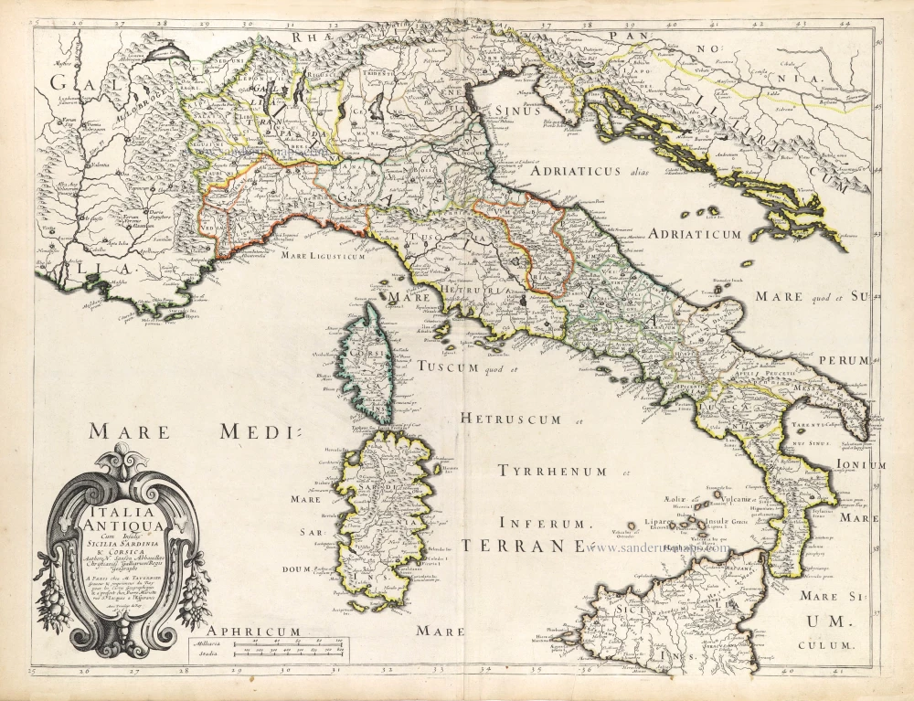
Italia Antiqua Cum Insulis Sicilia Sardinia & Corsica. 1652
Ancient Italy (Italia) by Nicolas Sanson.
[Item number: 29692]
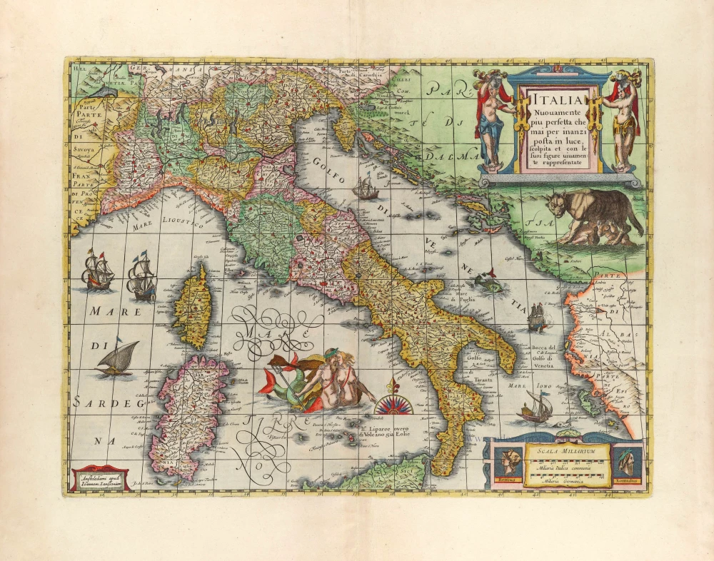
Italia Nuovamente piu perfetta che mai per inanzi posta im luce, scolpita et con le suoi figure uiuamente rappresentate. 1666
Italy by Joannes Janssonius.
[Item number: 29804]
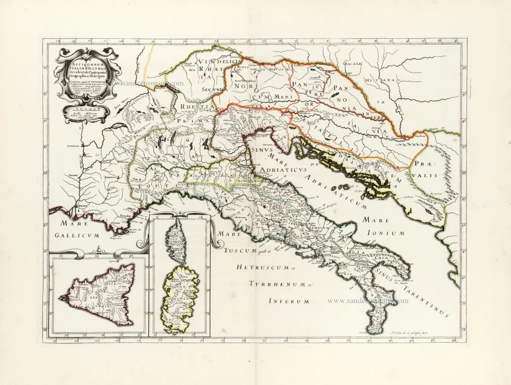
Antiquorum Italiae & Illyrici Occidentalis Episcopatuu Geographica descriptio. 1641 or later
Ancient Italy (Italia) & Dalmatia by Melchior Tavernier.
[Item number: 30035]
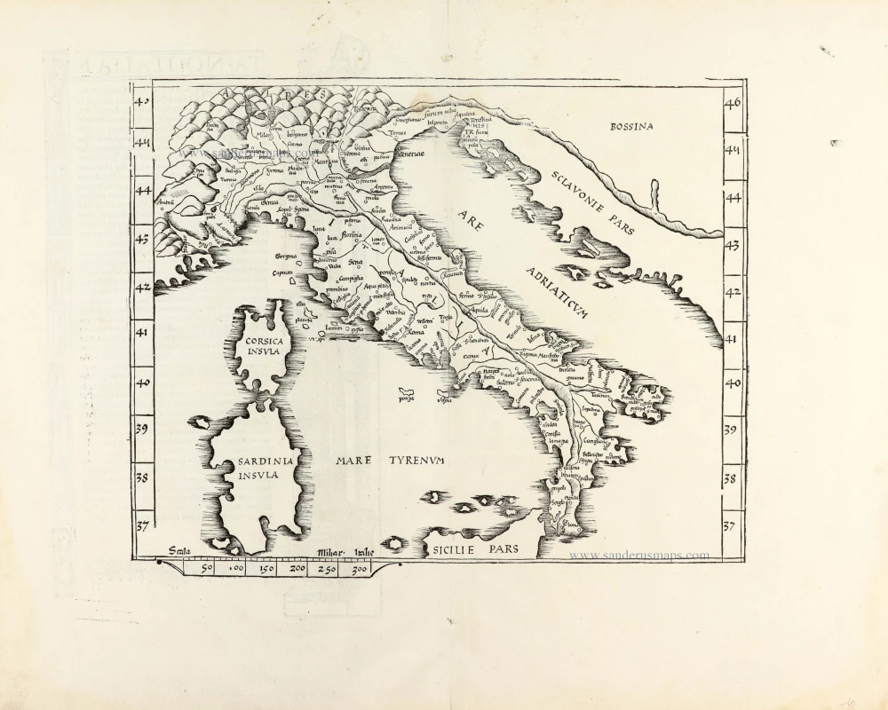
Ta .NO. Italiae. 1525
Italy, by Lorenz Fries.
[Item number: 30321]
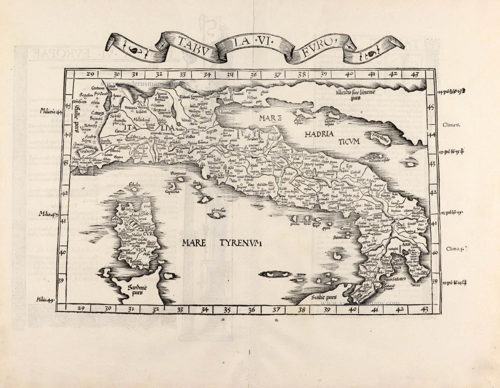
Tabula .VI. Euro. 1525
Italy, by Lorenz Fries.
[Item number: 30370]