
West Africa, by Francesco Santini. 1776-79
Francesco and Paolo Santini (c.1729-1793)
Francesco Santini, a Venetian publisher, acquired the printing plates of Vaugondy’s Atlas Universel …, a commercial and cartographic success, with widespread influence on mapmakers throughout Europe. Together with his brother Paolo, he commissioned a new set of plates and reissued the atlas in 1776. The following year, Paolo Santini assigned all his publication rights to M. Remondini, who in 1777 reissued the same atlas but with his name.
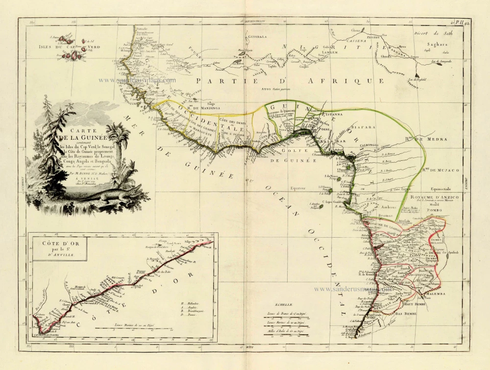
Carte de la Guinée contenant les Isles du Cap Verd, le Senegal, la Côte de Guinée proprement dite, les Royaumes de Loango, Congo, Angola et Benguela, avec les Pays voisins autant qu ils sont connus.
Item Number: 28100 Authenticity Guarantee
Category: Antique maps > Africa
Old, antique map of West Africa, by Paolo Santini.
Title: Carte de la Guinée contenant les Isles du Cap Verd, le Senegal, la Côte de Guinée proprement dite, les Royaumes de Loango, Congo, Angola et Benguela, avec les Pays voisins autant qu ils sont connus.
Par Bonne M.e de Mathem.
A Venise | Par François Santini 1779.
Chez Ir. Remondini.
Cartographer: Rigobert Bonne.
With inset map: 'Côte d'Or' par le Sr. d'Anville.
Date of the first edition: 1779.
Date of this map: 1776-79.
Date on map: 1779.
Copper engraving, printed on paper.
Size (not including margins): 450 x 605mm (17.72 x 23.82 inches).
Verso: Blank.
Condition: Original coloured in outline, excellent.
Condition Rating: A+.
From: Atlas Universel dressé sur les meilleures cartes modernes. Venice, Remondini, 1776-79.
Francesco and Paolo Santini (c.1729-1793)
Francesco Santini, a Venetian publisher, acquired the printing plates of Vaugondy’s Atlas Universel …, a commercial and cartographic success, with widespread influence on mapmakers throughout Europe. Together with his brother Paolo, he commissioned a new set of plates and reissued the atlas in 1776. The following year, Paolo Santini assigned all his publication rights to M. Remondini, who in 1777 reissued the same atlas but with his name.
Related items
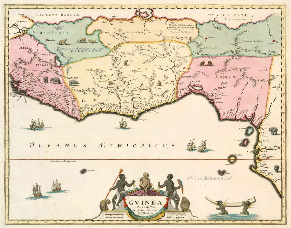
Guinea c. 1680
Guinea by F. De Wit.
[Item number: 2646]

Pascaert vande Bocht van Benin, Tary Ardra en Rio de Lagos, van Acra tot C. Formosa 1683
The Gulf of Benin (West Africa), by Van Keulen Johannes.
[Item number: 9587]
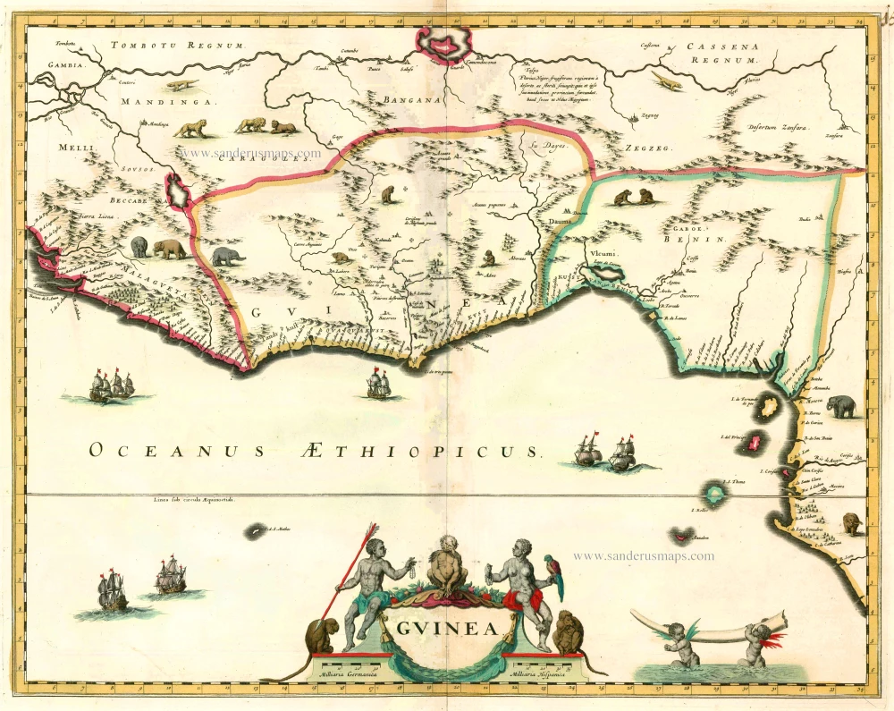
Guinea 1664
Guinea by Blaeu J.
[Item number: 12151]
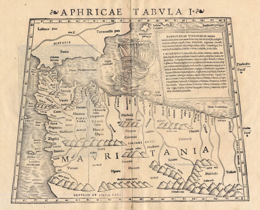
Aphricae Tabula I 1542
Morocco by Sebastian Münster
[Item number: 14709]
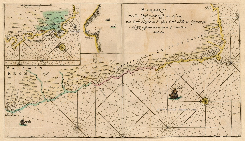
Pas-Kaarte van de Zuyd-West-Kust van Afrika; van Cabo Negro tot Beoosten Cabo de Bona Esperanca 1667
Sea chart of South-West African Coast, by Pieter Goos.
[Item number: 19073]
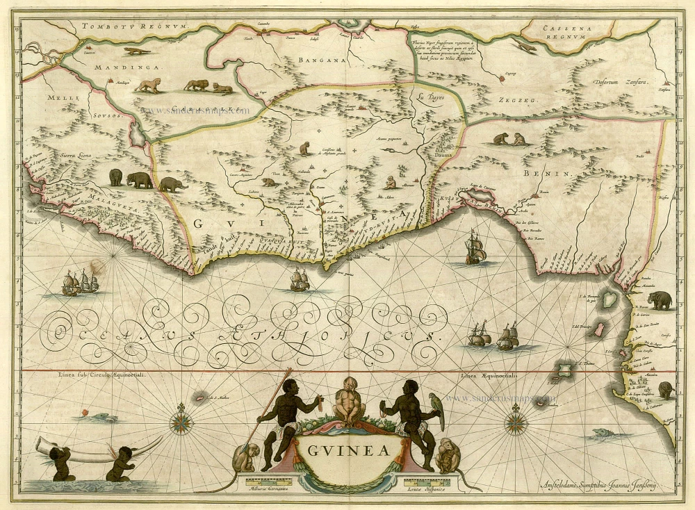
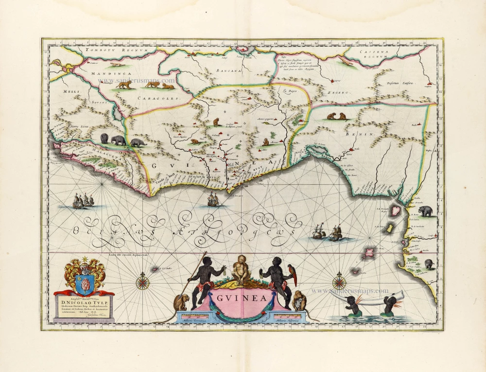
Guinea c. 1658
Guinea, by Janssonius J.
[Item number: 19543]
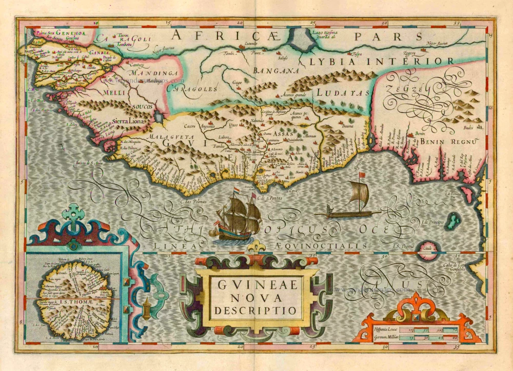
Guineae Nova Descriptio. 1623
Guinea, by Jodocus Hondius.
[Item number: 21985]
Guinea 1721-41
Guinea, by F. De Wit after W. Blaeu.
[Item number: 23613]

Pascaerte van Guinea, tusschen C. Verde, tot Cabo de bona Esperanca. 1661
Sea chart of Guinea, by J. Van Loon.
[Item number: 24328]
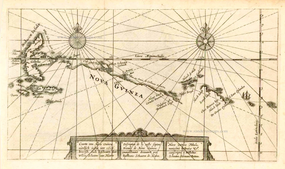
Caarte van Nova Guinea, Nieulijck inden iare 1616 bezeijlt, ende beschreven door Willem Schouten van Hoorn. 1618
New Guinea, by W.C. Schouten
[Item number: 25400]
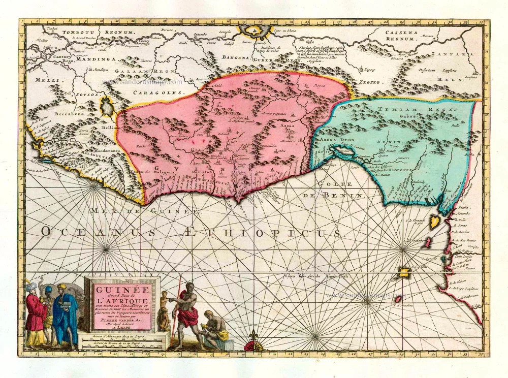
Guinée, Grand Pays de L'Afrique, avec toutes ses Côtes, Havres et Rivieres. 1713
Guinea, by Pieter van der Aa.
[Item number: 26156]