
The most important Italy map of the 16th century
Italy by Giacomo Gastaldi. (Italia) 1561
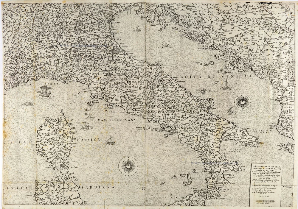
This map represents the most important map of Italy that appeared in the 16th century. It will constitute the cartographic model of the peninsula in Italy for the following century. Almagia defines it as "one of the milestones in the evolution of the cartography of Italy". Gastaldi published the map in 1561, protected by the privilege he obtained from the Venetian Senate on 29 July 1559. The engraving is due to Fabio Licinio. The map contains many improvements over previous maps.
Giacomo Gastaldi (c. 1500 – 1566)
Giacomo Gastaldi was born in Villafranca, in Piedmont, to a wealthy family. Although he is considered one of the greatest cartographers of the sixteenth century, the events of his life and his professional training in the field of cartography are unknown to us until he arrives in Venice, where, in 1539, he obtained a perpetual printing privilege from the Venetian Senate.
One of the first Venetian contacts took place with the geographer and humanist Giovanni Battista Ramusio, with whom he collaborated. At the beginning of the 1540s, Gastaldi was already an established cartographer and began to work on a series of maps first published separately and then included in the Italian edition of Ptolemy's Geography of 1548 and others made from scratch.
By the 1540s, he had developed his distinctive style of copper engraving for his increasingly prolific output of maps. His maps were used as a source by many mapmakers, including Camocio, Bertelli, Forlani, Ramusio, Cock, Luchini and Ortelius.
With the support of his influential friendships, Gastaldi also obtained public positions: in 1549, the Council of Ten commissioned him to make a large map of Africa, for a wall from the armoury in the Doge's Palace and, again for the same room, one map of Asia and one of North America.
It is difficult to quantify the number of maps he produced; more than a hundred have been attributed to him.
Paolo Forlani collaborated for a long time with Gastaldi and published numerous counterfeits and not authorized editions.
Gastaldi died in Venice on 14 October 1566.
Il Disegno della Geografia Moderna de Tutta la Provincia de la Italia.
Item Number: 28121 Authenticity Guarantee
Category: Antique maps > Europe > Italy
Old, antique map of Italy, by Giacomo Gastaldi.
Mappa antica dell'Italia, di Giacomo Gastaldi.
"La piu importante carta dell'Italia apparsa nel XVI secolo".
Title: Il Disegno della Geografia Moderna de Tutta la Provincia de la Italia.
Con le sue regioni, citta, castella Mo[n]ti, Laghi Fiumi Mari, Golfi, capi, Et isle, ch'in quelli si ritrovano, et altre Regioni circonvicine al golfo Di Venetia, per maggiore lucidatione dell'Italia.
All'Illustrissimo et excellentissimo sig.r il S.r Alfonso secondo da Este, duca di Ferrara qui[n]to Giacopo di Castaldi Piamo[n]tese, cosmografo in Venetia.
Con gratia et privilegio del sum[m]o po[n]tifice papa Pio iiii per anni X. E dal serenissimo senato d'Venetia per anni. XV.
M.D.LXI.
fabio licinio Ex.
Cartographer: Giacomo Gastaldi.
Engraver: Fabio Licinio.
Date of the first edition: 1561.
Date of this map: 1561.
Date on map: 1561.
Copper engraving, printed on paper from two plates, joined.
Right plate seems to be trimmed a bit (cf. images in Bifolco-Ronca).
Two watermarks: pilgrim in circle.
Size (not including margins): 535 x 765mm (21.06 x 30.12 inches).
Verso: Blank.
Condition: Old folds, a few reinforcements at the back, some light spotting in places, good.
Condition Rating: A+.
References: Bifolco-Ronca, Tav. 911 State 1 (of 2); Bifolco-Ronca Italia, Tav. 5; Karrow, 30/90; Aliprandi, p.84 #41; Borri, pp. 67-68 #45 fig. 63
Separate publication.
This map represents the most important map of Italy that appeared in the 16th century. It will constitute the cartographic model of the peninsula in Italy for the following century. Almagia defines it as "one of the milestones in the evolution of the cartography of Italy". Gastaldi published the map in 1561, protected by the privilege he obtained from the Venetian Senate on 29 July 1559. The engraving is due to Fabio Licinio. The map contains many improvements over previous maps.
Giacomo Gastaldi (c. 1500 – 1566)
Giacomo Gastaldi was born in Villafranca, in Piedmont, to a wealthy family. Although he is considered one of the greatest cartographers of the sixteenth century, the events of his life and his professional training in the field of cartography are unknown to us until he arrives in Venice, where, in 1539, he obtained a perpetual printing privilege from the Venetian Senate.
One of the first Venetian contacts took place with the geographer and humanist Giovanni Battista Ramusio, with whom he collaborated. At the beginning of the 1540s, Gastaldi was already an established cartographer and began to work on a series of maps first published separately and then included in the Italian edition of Ptolemy's Geography of 1548 and others made from scratch.
By the 1540s, he had developed his distinctive style of copper engraving for his increasingly prolific output of maps. His maps were used as a source by many mapmakers, including Camocio, Bertelli, Forlani, Ramusio, Cock, Luchini and Ortelius.
With the support of his influential friendships, Gastaldi also obtained public positions: in 1549, the Council of Ten commissioned him to make a large map of Africa, for a wall from the armoury in the Doge's Palace and, again for the same room, one map of Asia and one of North America.
It is difficult to quantify the number of maps he produced; more than a hundred have been attributed to him.
Paolo Forlani collaborated for a long time with Gastaldi and published numerous counterfeits and not authorized editions.
Gastaldi died in Venice on 14 October 1566.
Related items
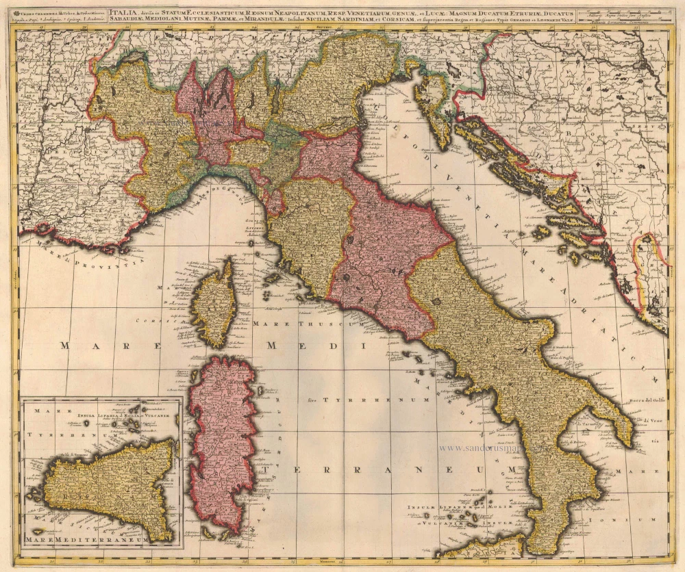
Italia, Divisa in Statum Ecclesiasticum, Regnum Neapolitanum, Resp. Venetiarum, Genuae, et Lucae: Magnum Ducatum Etruriae, Ducatus Sabaudiae, Mediolani, Mutinae, Parmae et Mirandulae: Insulas Siliciam, Sardiniam, et Superjacentia Regna et Regiones c. 1730.
Italy, by Valk G.& L.
[Item number: 14145]
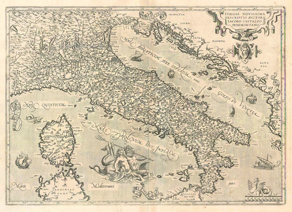
Italiae Novissima Descriptio Auctore Iacobo Castaldo Pedemontano 1612
Italy, by Abraham Ortelius.
[Item number: 22962]

Italiae Novissima Descriptio Auctore Iacobo Castaldo Pedemontano. 1612
Italy by Abraham Ortelius
[Item number: 22982]
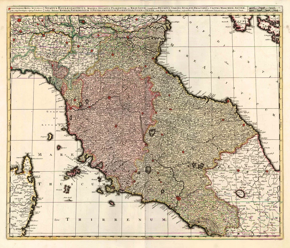
Status Ecclesiasticus, Magnus Ducatus Florentiae, et Resp. Lucae ... c. 1700
Central Italy, by G. & L. Valck, published by R. & I. Ottens.
[Item number: 26005]
Italia. 1597
Italy, by Giovanni Magini.
[Item number: 26517]
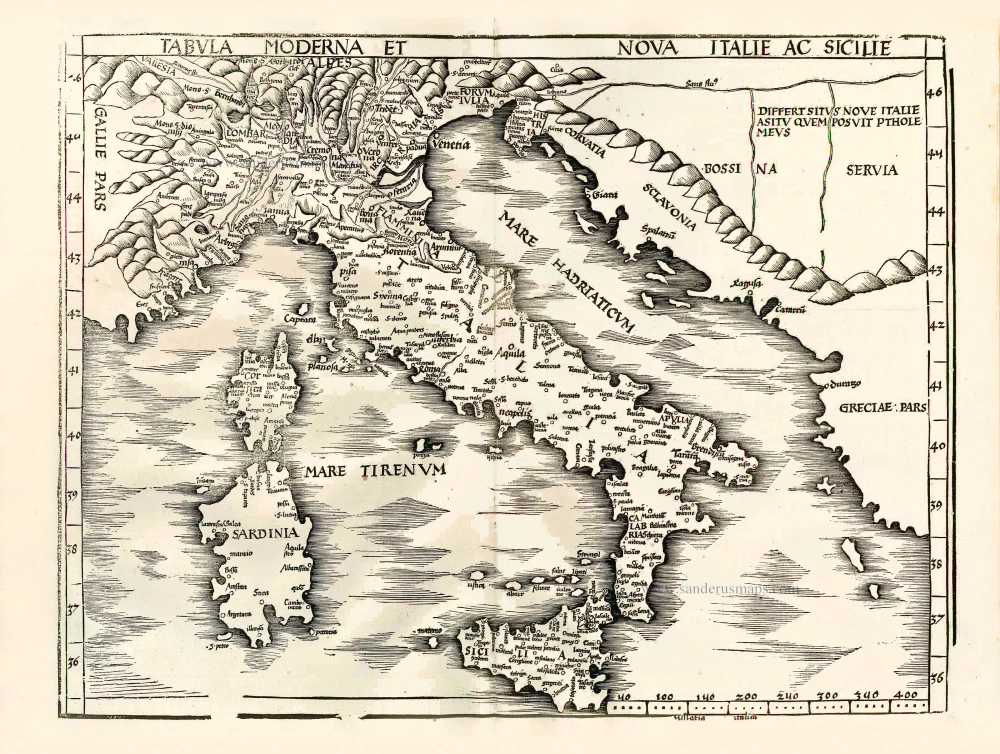
Important map of modern Italy.
Tabula moderna et nova Italie ac Sicilie. 1513
Italy by Martin Waldseemüller
[Item number: 27587]
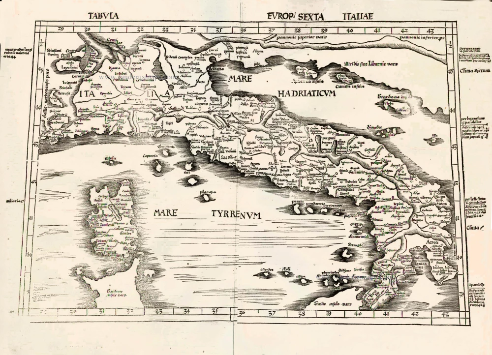
Important Ptolemy map
Tabula Europ. Sexta Italiae. 1513
Italy by Waldseemüller Martin
[Item number: 27588]
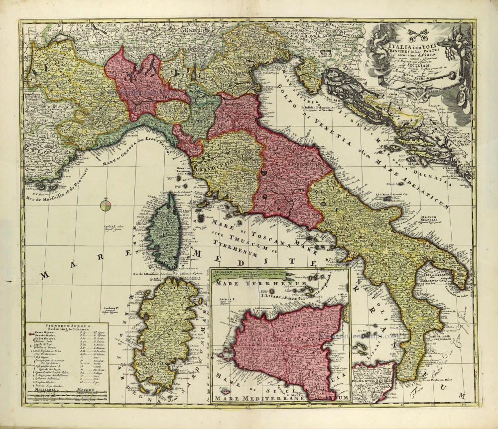
Italia iam tota Principes in suas Partes accuratius distincta; c. 1700
Italy by Petrus Schenk.
[Item number: 28323]
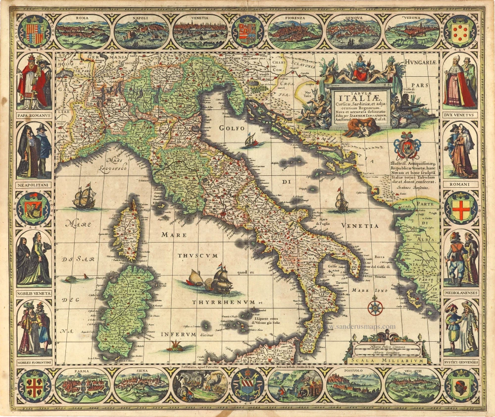
Tabula Italiae, Corsicae, Sardiniae, et adjacentium Regnorum. 1628
Italy by Joannes Janssonius.
[Item number: 28449]
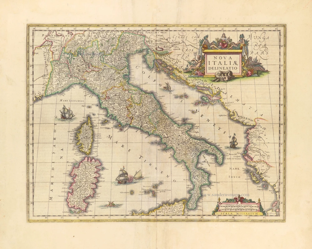
Nova Italiae Delineatio. 1642-43
Italy by Willem Blaeu.
[Item number: 28676]
Rare
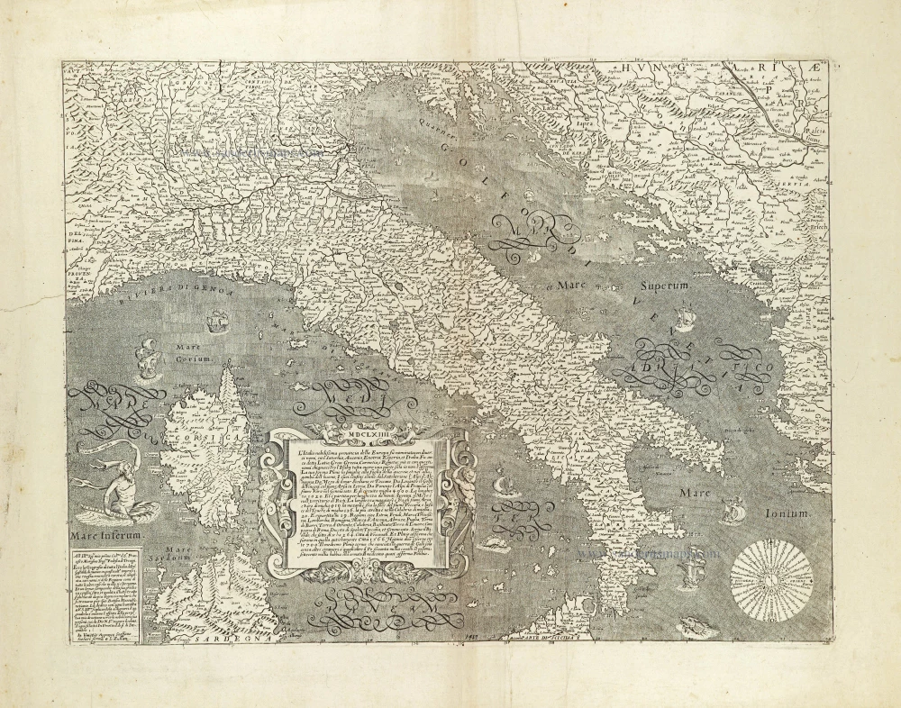
L'Italia nobilissima provincia della Europa su nominata con diversi nomi, ... 1664
Italy by Donato Rascicotti, published in Venice by Steffano Scolari.
[Item number: 28782]
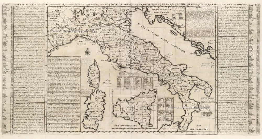
Nouvelle Carte de L'Etat present de l'Italie pour parvenir par une Methode nouvelle, a la connoissance de la Geographie, et de l'Histoire; et tres utile pour les voiages. 1713
Map of Italy by Zacharias Châtelain.
[Item number: 29641]
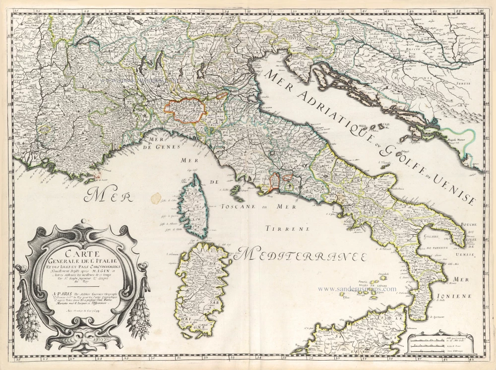
Carte Generale de l'Italie et des Isles et Pays Circonvoisins. 1652
Italy by Nicolas Sanson.
[Item number: 29672]
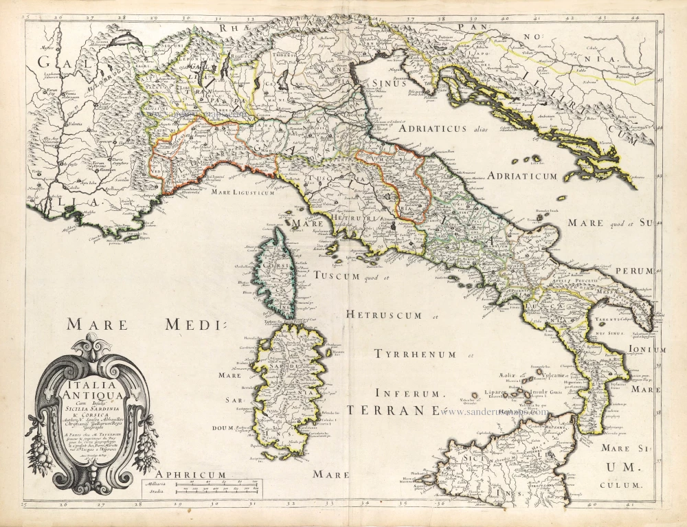
Italia Antiqua Cum Insulis Sicilia Sardinia & Corsica. 1652
Ancient Italy (Italia) by Nicolas Sanson.
[Item number: 29692]
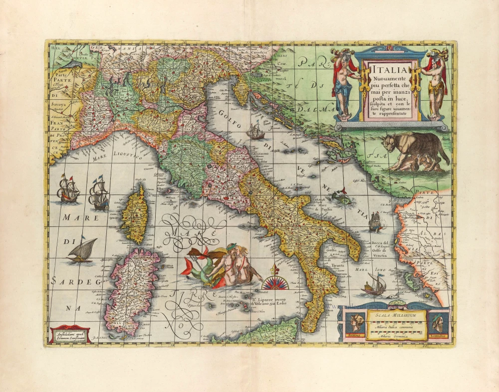
Italia Nuovamente piu perfetta che mai per inanzi posta im luce, scolpita et con le suoi figure uiuamente rappresentate. 1666
Italy by Joannes Janssonius.
[Item number: 29804]
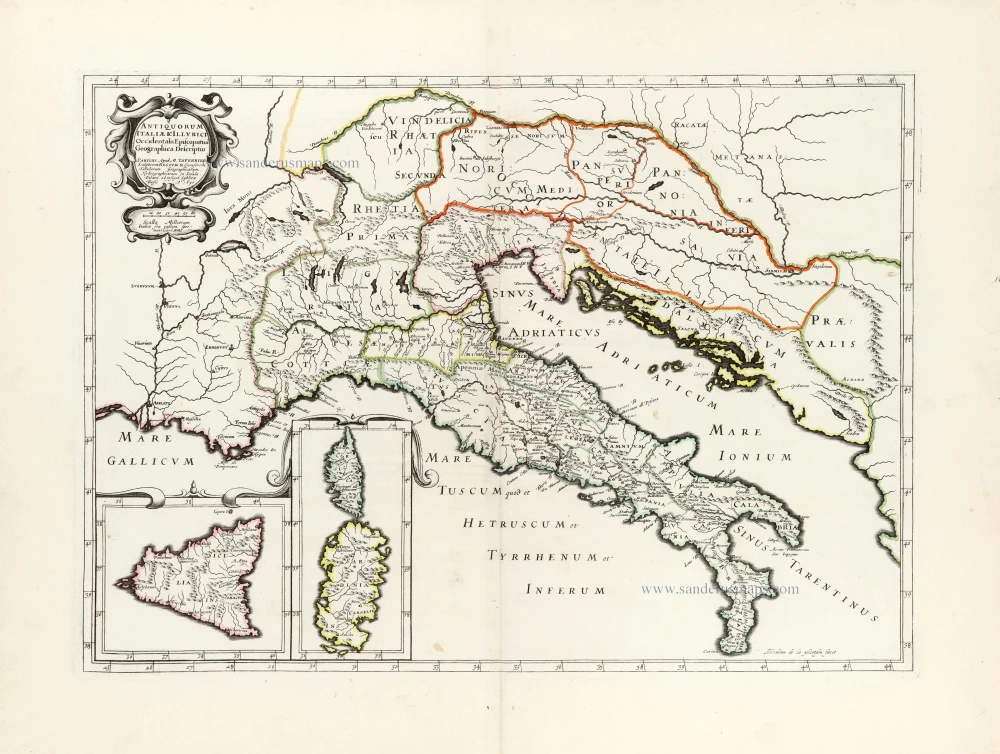
Antiquorum Italiae & Illyrici Occidentalis Episcopatuu Geographica descriptio. 1641 or later
Ancient Italy (Italia) & Dalmatia by Melchior Tavernier.
[Item number: 30035]
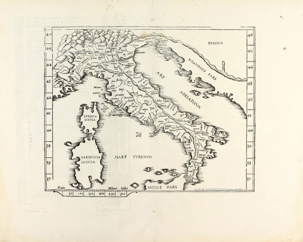
Ta .NO. Italiae. 1525
Italy, by Lorenz Fries.
[Item number: 30321]
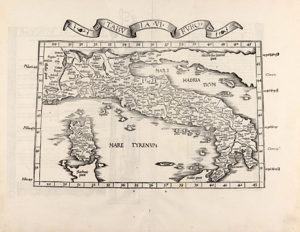
Tabula .VI. Euro. 1525
Italy, by Lorenz Fries.
[Item number: 30370]