
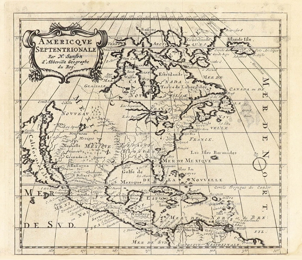
North America by Robert de Vaugondy. 1748
Gilles and Didier Robert de Vaugondy
Gilles Robert de Vaugondy (1688-1766) and his son Didier Robert de Vaugondy (1723-1786) were leading cartographers in France during the 18th century. They served both as geographer to the king of France. The father, Gilles is also known as ‘Le Sieur’ or ‘Monsieur Robert’. He descended from the Nicolas Sanson family through Sanson's grandson Pierre Moulard-Sanson, from whom he inherited Sanson's cartographic material. After Hubert Jaillot died in 1712, the de Vaugondy's acquired numerous copies of his maps and plates, which formed the basis of their beautiful Atlas Universel (1757).
Their business flourished from 1731 to 1778. They made a substantial contribution to the world of cartography.
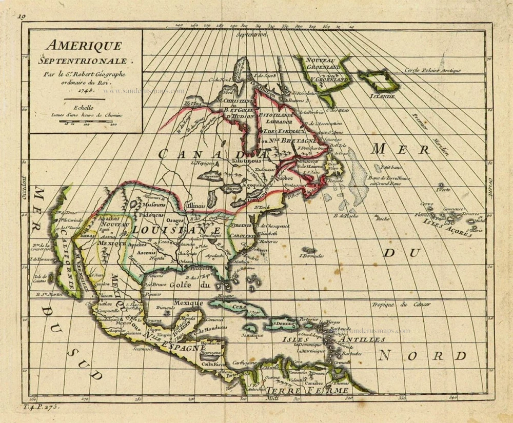
Amerique Septentrionale.
Item Number: 28157 Authenticity Guarantee
Category: Antique maps > America > North America
Old, antique map of North America, by Robert de Vaugondy.
Title: Amerique Septentrionale.
Par le Sr. Robert Géographe ordinaire du Roi.
1748.
Date of the first edition: 1748.
Date of this map: 1748.
Date on map: 1748.
Copper engraving, printed on paper.
Size (not including margins): 16 x 200mm (0.63 x 7.87 inches).
Verso: Blank.
Condition: Original coloured in outline, excellent.
Condition Rating: A+.
References: Pedley, #446
From: de Vaugondy R. - Atlas Portatif Universel et Militaire. Paris, chez l'Auteur, Quay de l'Horloge, 1748.
Gilles and Didier Robert de Vaugondy
Gilles Robert de Vaugondy (1688-1766) and his son Didier Robert de Vaugondy (1723-1786) were leading cartographers in France during the 18th century. They served both as geographer to the king of France. The father, Gilles is also known as ‘Le Sieur’ or ‘Monsieur Robert’. He descended from the Nicolas Sanson family through Sanson's grandson Pierre Moulard-Sanson, from whom he inherited Sanson's cartographic material. After Hubert Jaillot died in 1712, the de Vaugondy's acquired numerous copies of his maps and plates, which formed the basis of their beautiful Atlas Universel (1757).
Their business flourished from 1731 to 1778. They made a substantial contribution to the world of cartography.
Related items
Amerique Septentrionale. 1685
North America, by A.M. Mallet.
[Item number: 26643]
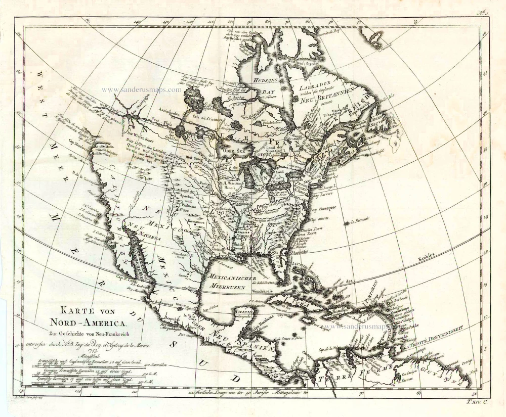
Karte von Nord-America, zur Geschichte von Neu-Frankreich. 1747-74
North America, by Jacques Nicolas Bellin.
[Item number: 26799]
Earliest obtainable map of North America
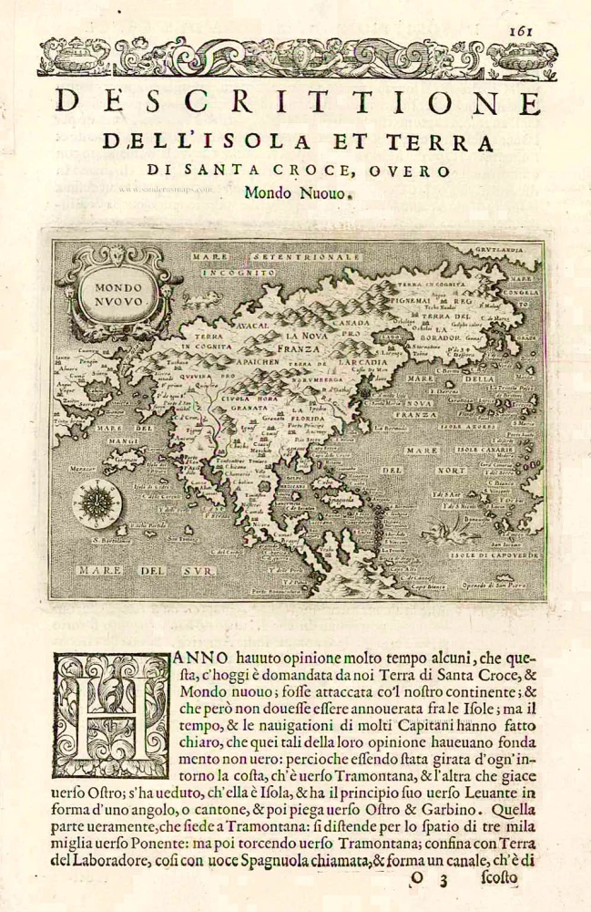
Mondo Nuovo - Descrittione del l'Isola et Terra di Sancta Croce, overo Mondo Nuovo. 1576
North America, by Tomaso Porcacchi.
[Item number: 27651]

Early 'Texas' map
Nueva Hispania Tabula Nova. 1574
North America, by Girolamo Ruscelli.
[Item number: 27755]
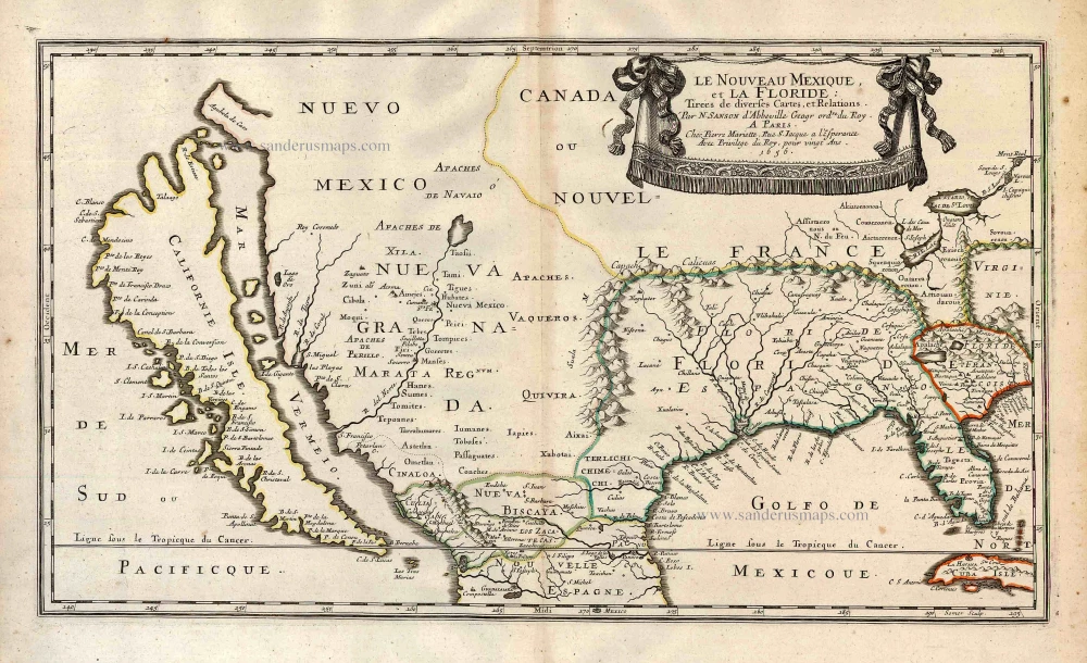
Important map.
Le Nouveau Mexique, et la Floride: 1658
Southern North America, by Nicolas Sanson.
[Item number: 27917]
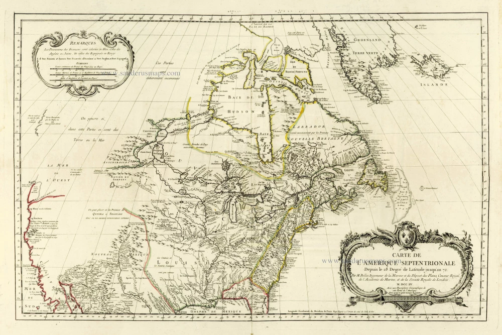
the most comprehensive and up-to-date map published by the French before the fall of New France in 1760
Carte de L'Amerique Septentrionale Depuis to 28. Degré de Latitude Jusqu'au 72. 1756-1770
North America, by J.N. Bellin.
[Item number: 28146]

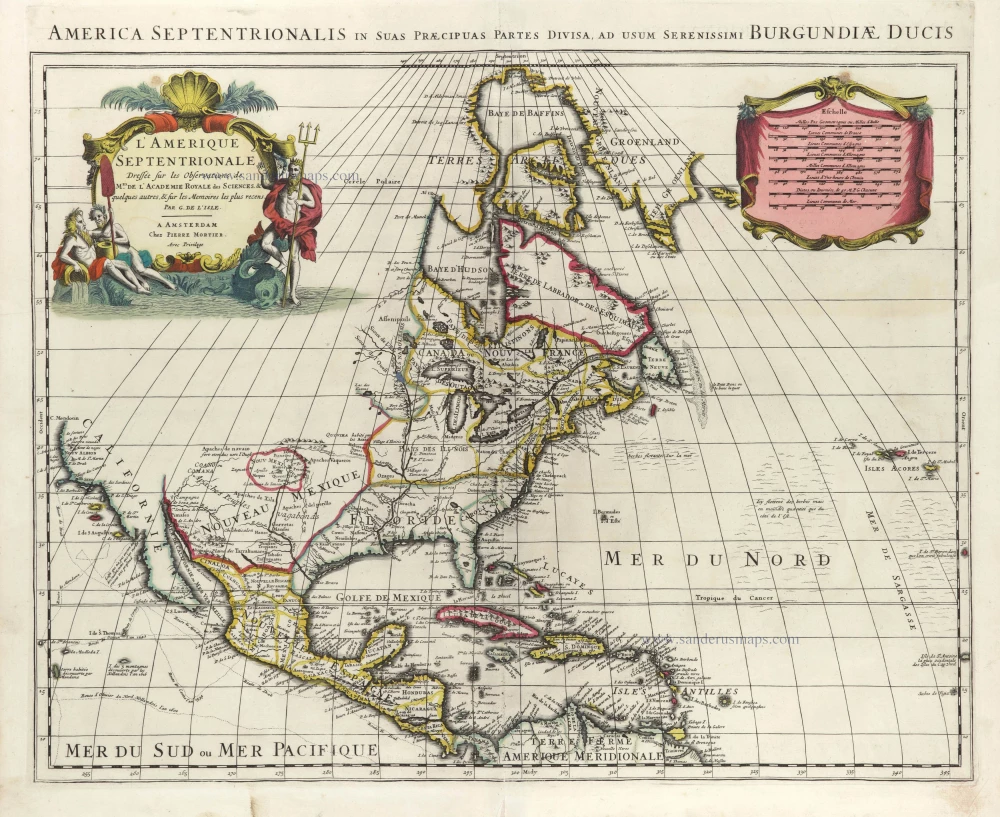
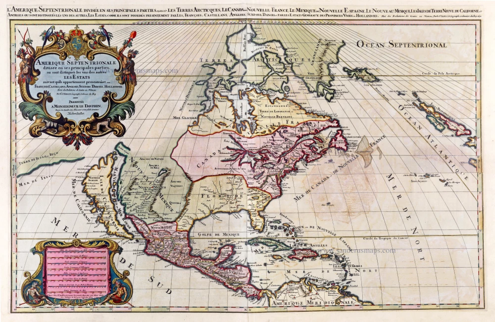
Amerique Septentrionale, Divisee en ses Principales Parties. 1694
North America, by Nicolas Sanson, published by Pierre Mortier after A.H. Jaillot.
[Item number: 29125]
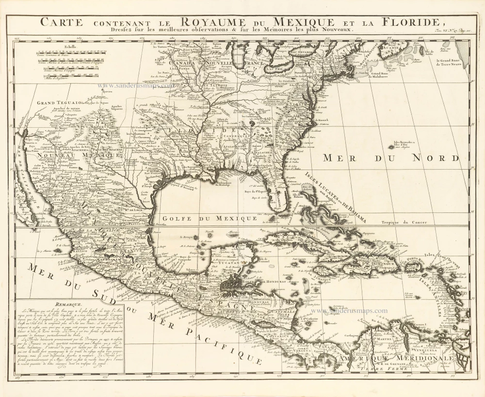
Carte Contenant le Royaume du Mexique et la Floride, 1719
United States, Central America, and the West Indies, by Zacharias Châtelain.
[Item number: 29409]
L'Amerique Septentrionale. 1708
North America by G. de L'Isle, published by Pierre Mortier.
[Item number: 29510]
Landmark map of North Amerika
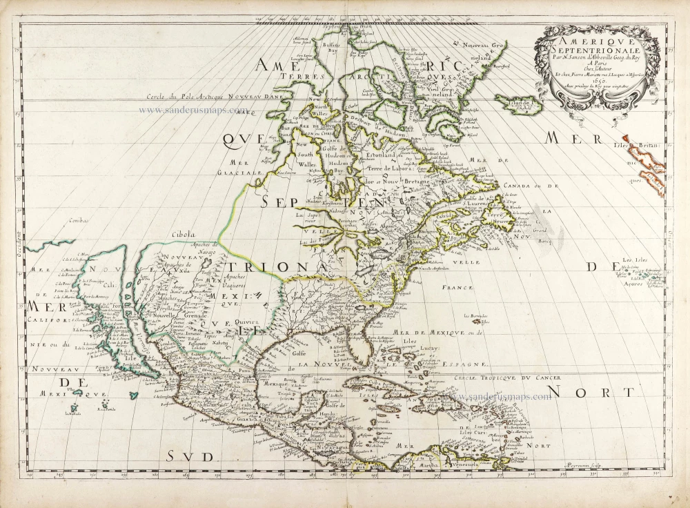
Amerique Septentrionale. 1652
Nicolas Sanson's landmark map of North America, scarce second state.
[Item number: 29597]
Big and spectacular map, heightened in gold.
Amerique Septentrionale, divisée en ses principales parties, ou sont distingués les uns des autres Les Estats suivant qu'ils appartiennet Presentemet aux Francois, Castillans, Anglois, Suedois, Danois, Hollandois. 1692
North America by A. H. Jaillot, published by Pierre Mortier.
[Item number: 29895]
California as an island.
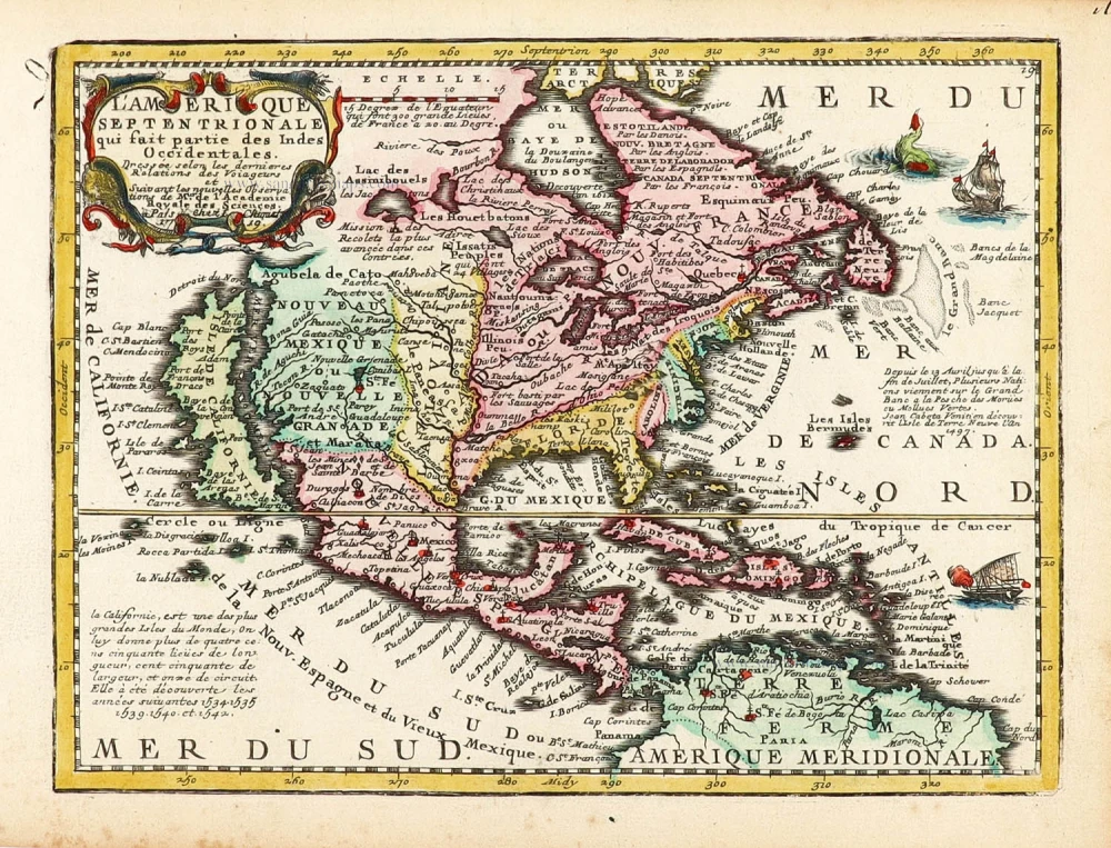
L'Amerique Septentrionale qui fait partie des Indes Occidentales. 1719
North America by Chiquet Jacques.
[Item number: 30085]
California as an island.
Americque Septentrionale. 1715
North America by Nicolas Sanson, published by Nicolas Chemereau.
[Item number: 30086]

California as an island.
L'America Settentrionale. 1677
North America by Giovanni Giacomo de Rossi.
[Item number: 30088]
From 'Diderot & d'Alembert'
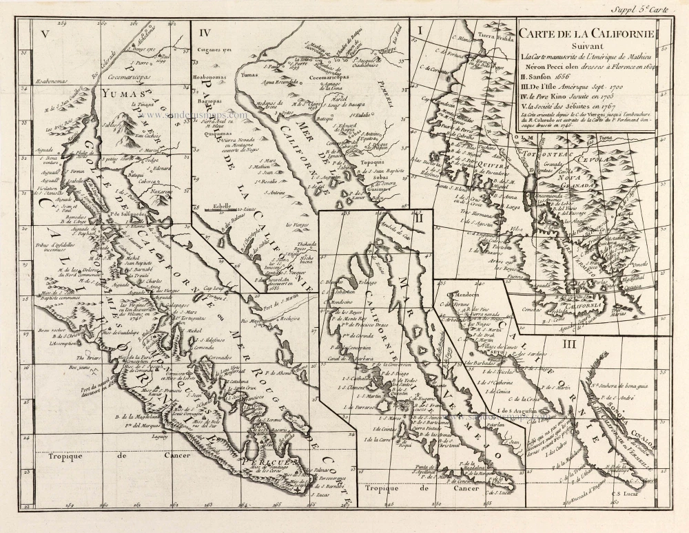
Carte de la Californie Suivant I. La Carte manuscrite de l'Amérique de Mathieu Néron Pecci olen dresses à Florence en 1604. II. Sanson 1656. III. De l'Isle Amérique Sept. 1700. IV. le Pere Kino Jesuite en 1705. V. la Société des Jésuites en 1767. 1777
California by Robert de Vaugondy.
[Item number: 30091]

Carte de la Partie de l'Amérique Septentrionale, comprenant les Possessions Espagnoles. 1788
North America by Louis Brion de la Tour.
[Item number: 30144]