
Iberian Peninsula (Spain & Portugal) by 1680
Frederick de Wit (1630-1706)
The engraver and map-seller, Frederick de Wit, was born in Gouda (Netherlands) in 1630 as a son of Hendrick Fredericksz de Wit. Through his marriage with Maria van der Waag of Amsterdam in 1661, he obtained citizenship of the city where he had been working since 1648 and where he became one of the most famous engravers of maps of the second half of the 17th century. Although De Wit was a Catholic, which meant that he was not favoured at the time by the city council, he was awarded the honour of being listed as one of the "excellent citizens" on the roll of the city council in the years 1694-1704. However, his name was not written in the Guild of St. Luke book before 1664. At that time, he lived on the Kalverstraat "in de Witte Pascaert", where he stayed until his death in 1706. His earliest dates on maps engraved are 1659 (Regni Daniae) and 1660 (World map).
Frederick de Wit published several world atlases, a sea atlas, and an atlas of the Netherlands.
The dating of the maps is difficult. However, as a privilege was granted in 1689, the annotation 'cum privilegio' marks an edition after 1688.
Around 1700, Frederick de Wit entered the market with a town atlas. He produced two volumes with a total of 260 plans and views. Most were printed from plates used for Janssonius and Blaeu town atlases.
After he died in 1706, his widow continued the shop until 1709. The plates and stock of De Wit's atlas were sold to Covens & Mortier in 1710, who sold the atlas for an extended period.
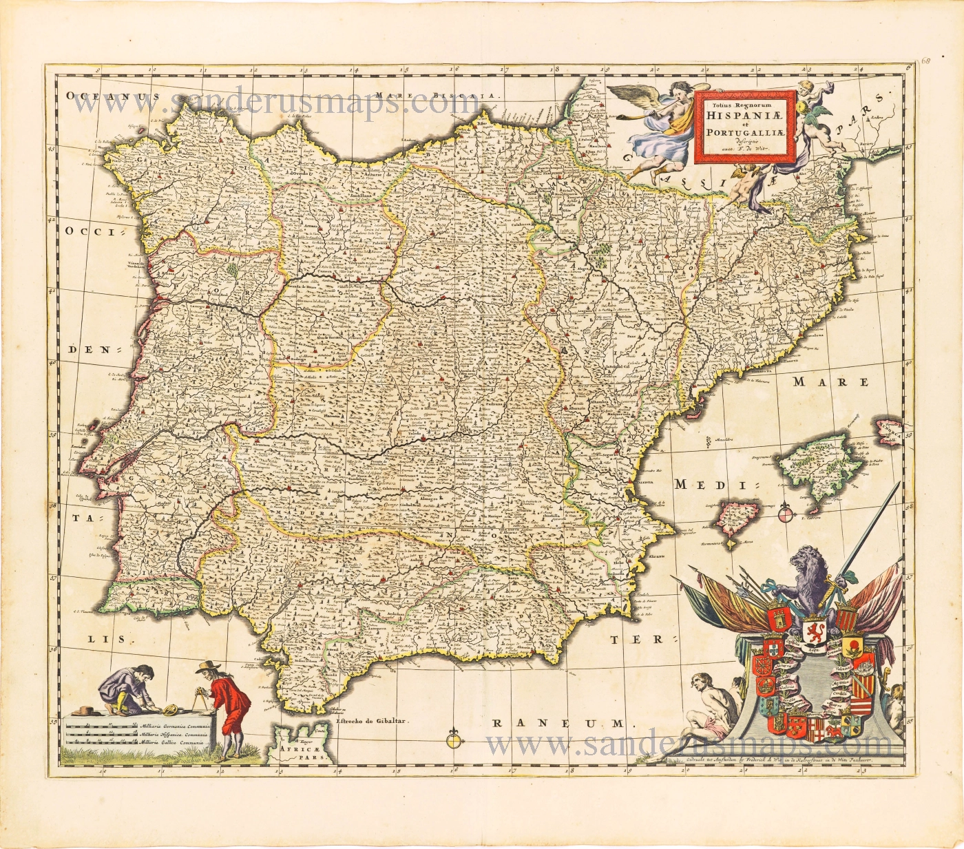
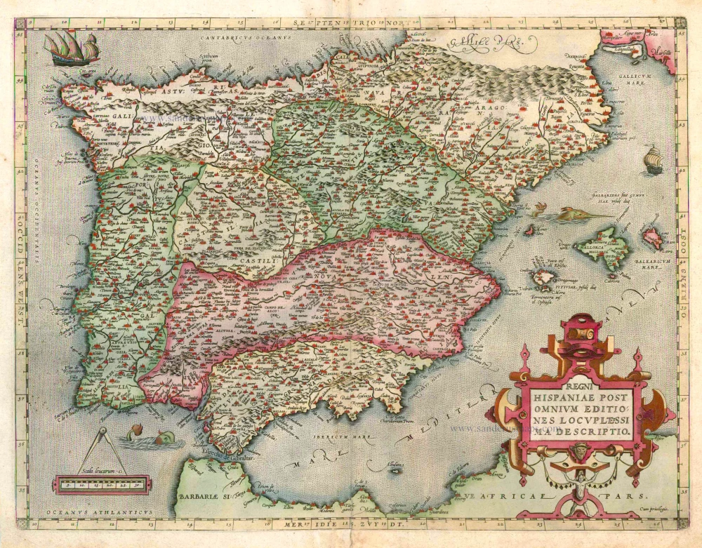
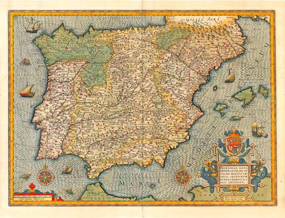
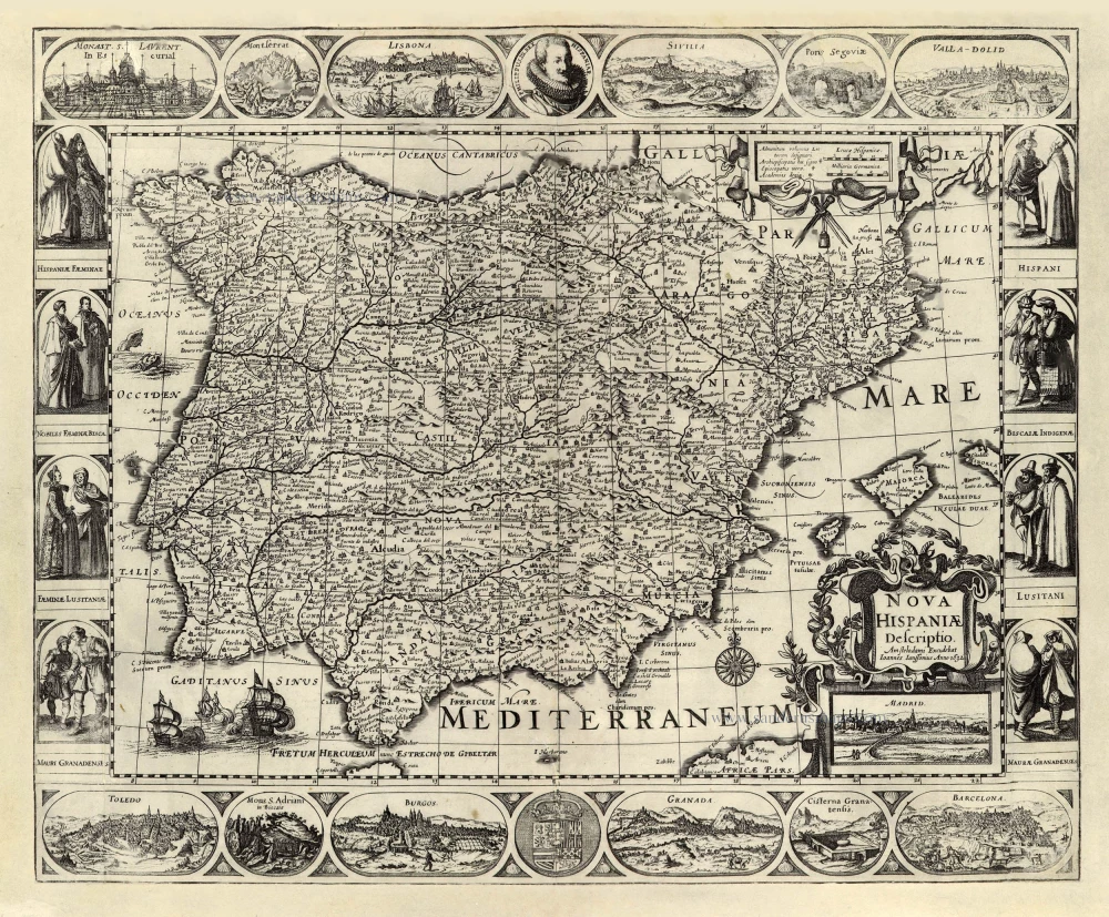
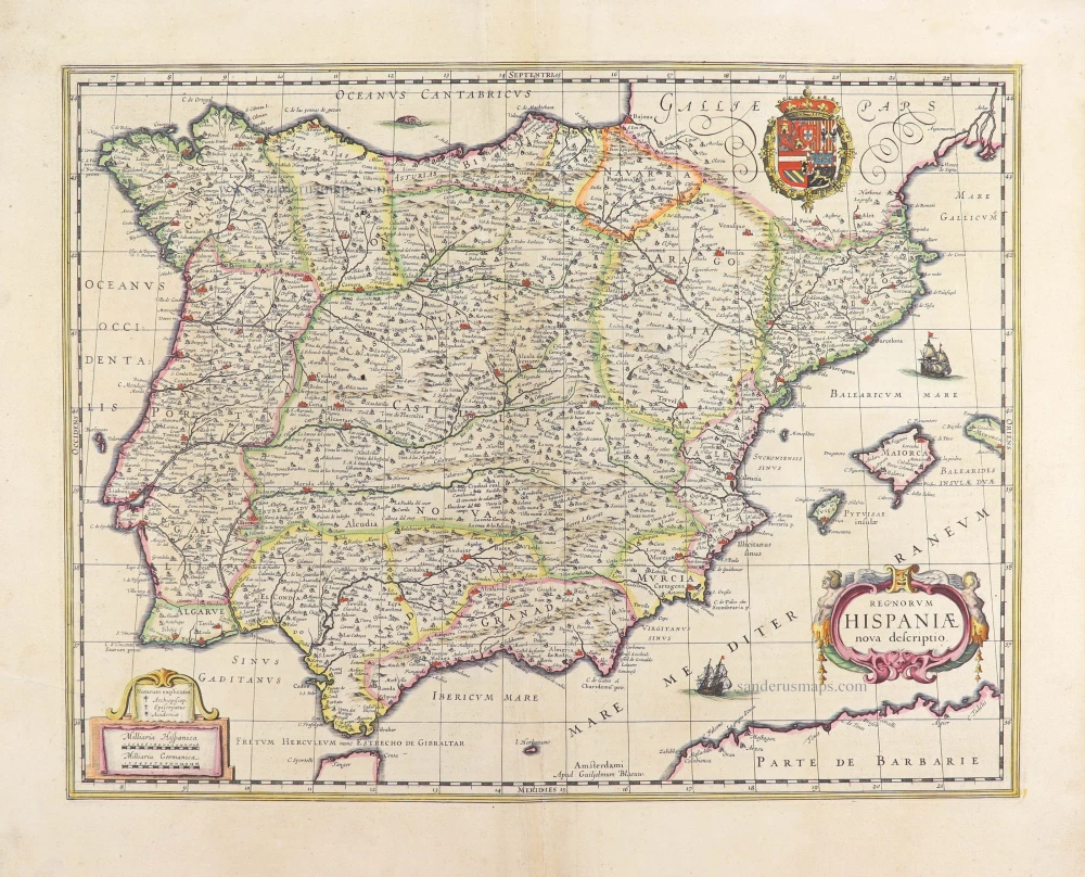
Totius Regnorum Hispaniae et Portugalliae.
Item Number: 28604 Authenticity Guarantee
Category: Antique maps > Europe > Spain and Portugal
Old, antique map of Iberian Peninsula (Spain & Portugal), by Frederick de Wit.
Title: Totius Regnorum Hispaniae et Portugalliae.
descriptio auct: F. de Wit.
Gedruckt tot Amsterdam by Frederick de Wit in de Kalverstraet in de Witte Paskaert.
Date of the first edition: 1680.
Date of this map: 1680.
Copper engraving, printed on paper.
Map size: 460 x 560mm (18.11 x 22.05 inches).
Sheet size: 540 x 615mm (21.26 x 24.21 inches).
Verso: Blank.
Condition: Original coloured, paper slightly age-toned and stained.
Condition Rating: A.
References: Koeman - III, p. 214 [72];
From: Atlas Contractus Orbis Terrarum Praecipuas ac Novissimas Complectens Tabulas. Amsterdam, N. Visscher, 1680. (Koeman III, Vis8)
Frederick de Wit (1630-1706)
The engraver and map-seller, Frederick de Wit, was born in Gouda (Netherlands) in 1630 as a son of Hendrick Fredericksz de Wit. Through his marriage with Maria van der Waag of Amsterdam in 1661, he obtained citizenship of the city where he had been working since 1648 and where he became one of the most famous engravers of maps of the second half of the 17th century. Although De Wit was a Catholic, which meant that he was not favoured at the time by the city council, he was awarded the honour of being listed as one of the "excellent citizens" on the roll of the city council in the years 1694-1704. However, his name was not written in the Guild of St. Luke book before 1664. At that time, he lived on the Kalverstraat "in de Witte Pascaert", where he stayed until his death in 1706. His earliest dates on maps engraved are 1659 (Regni Daniae) and 1660 (World map).
Frederick de Wit published several world atlases, a sea atlas, and an atlas of the Netherlands.
The dating of the maps is difficult. However, as a privilege was granted in 1689, the annotation 'cum privilegio' marks an edition after 1688.
Around 1700, Frederick de Wit entered the market with a town atlas. He produced two volumes with a total of 260 plans and views. Most were printed from plates used for Janssonius and Blaeu town atlases.
After he died in 1706, his widow continued the shop until 1709. The plates and stock of De Wit's atlas were sold to Covens & Mortier in 1710, who sold the atlas for an extended period.
Related items
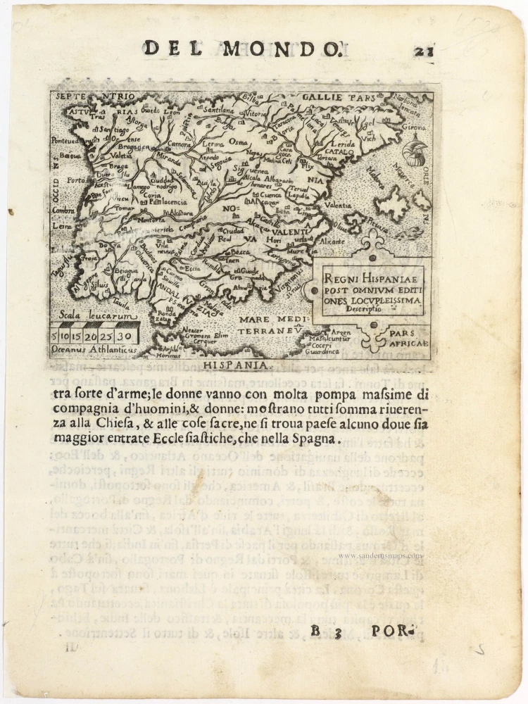
Regni Hispaniae Post Omnium Editiones Locuplessima Descriptio. 1598
Iberian Peninsula (Portugal & Spain), by Abraham Ortelius.
[Item number: 2568]
Regni Hispaniae Post Omnium Editiones Locuplessima Descriptio. 1601
Iberian Peninsula (Spain & Portugal), by A. Ortelius.
[Item number: 5727]
Description Nouvelle du Pais d'Espaigne. 1555
Iberian Peninsula (Spain - Portugal) by S. Munster.
[Item number: 25162]
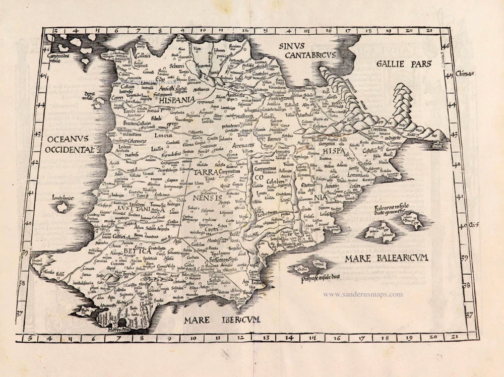
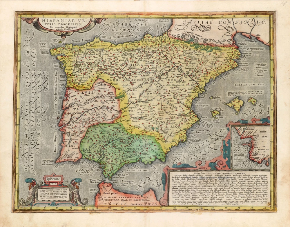
Hispaniae Veteris Descriptio. 1641
Spain (antique), by Johannes Janssonius.
[Item number: 26327]

Typus Hispaniae ab Hesselo Gerardo delineata et juxta annotationes Doctiss. Dni. Don Andreae d'Almada S. Theologiae Publici Professoris apud Coimbricenses emendatus M.DC.XXXI. 1641
The Iberian Peninsula (Spain & Portugal), by Henricus Hondius.
[Item number: 26328]
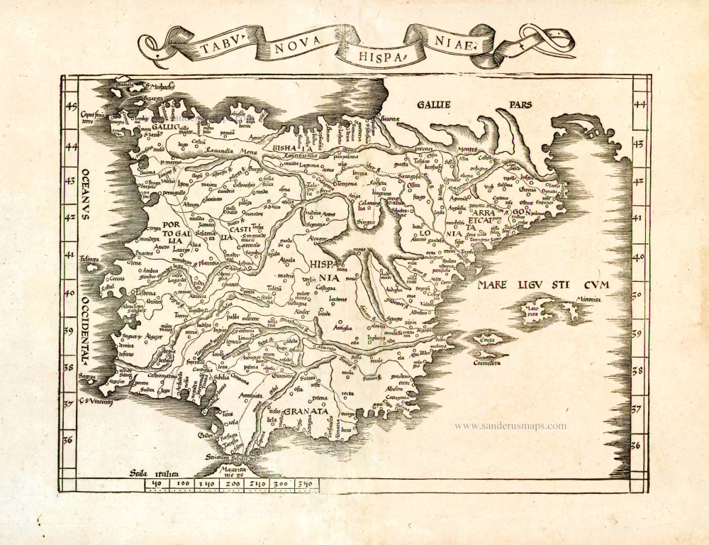
Tabu. Nova Hispaniae. 1535
Iberian Peninsula (Spain and Portugal) by Lorenz Fries.
[Item number: 26762]
Hispaniae Nova Describtio, de integro multis inlocis, secundum hydrographicas, desc. emendata. 1623
Iberian Peninsula (Spain & Portugal), by Jodocus Hondius.
[Item number: 27786]
[No title] - [On verso:] Tabula .II. Europae. 1525
Spain & Portugal, by Spain & Portugal.
[Item number: 27956]

Hispania Antiqua in tres praecipuas partes scilicet Tarraconensem, Lusitaniam, et Baeticam, 1776-79
Ancient Iberian Peninsula (Spain & Portugal), by Francesco Santini, after Nicolas Sanson & Sr. Robert de Vaugondy.
[Item number: 28106]
Very important map.
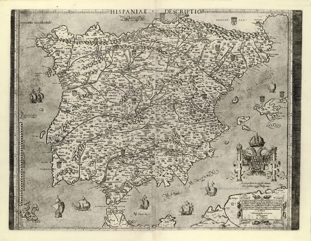
Hispaniae Descriptio. 1559
Iberian Peninsula (Spain & Portugal) by Vincenzo Luchini.
[Item number: 28151]
Nova Hispaniae Descriptio. 1632
Spain by Joannes Janssonius.
[Item number: 28205]
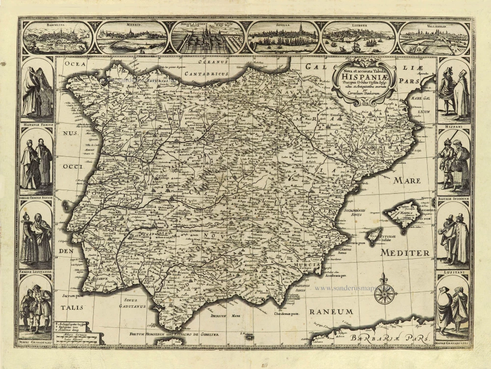
Nova et accurata Tabula Hispaniae Praecipuis Urbibus Vestitu Insignibus et Antiquitatibus exornata. c. 1640
Spain & Portugal (Iberian Peninsula) by Cornelis Danckerts.
[Item number: 28211]
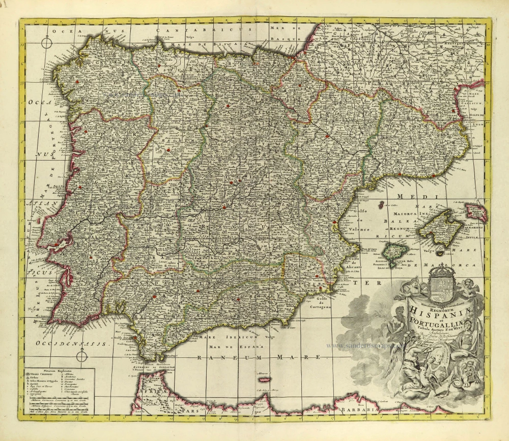
Novissima et Accuratissima Regnorum Hispaniae et Portugalliae. c. 1715
Iberian Peninsula (Spain & Portugal) by Covens & Mortier.
[Item number: 28238]
Rare!
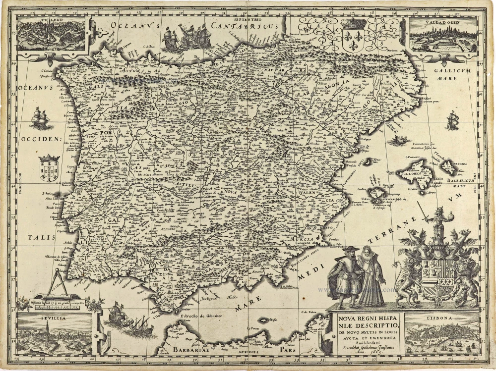
Nova Regni Hispaniae Descriptio, de novo multis in locis aucta et emendata. 1605
Spain by Willem Blaeu
[Item number: 28367]
Regnorum Hispaniae nova descriptio. 1635
Iberian Peninsula (Spain & Portugal) by Willem Blaeu.
[Item number: 28729]
Rare!
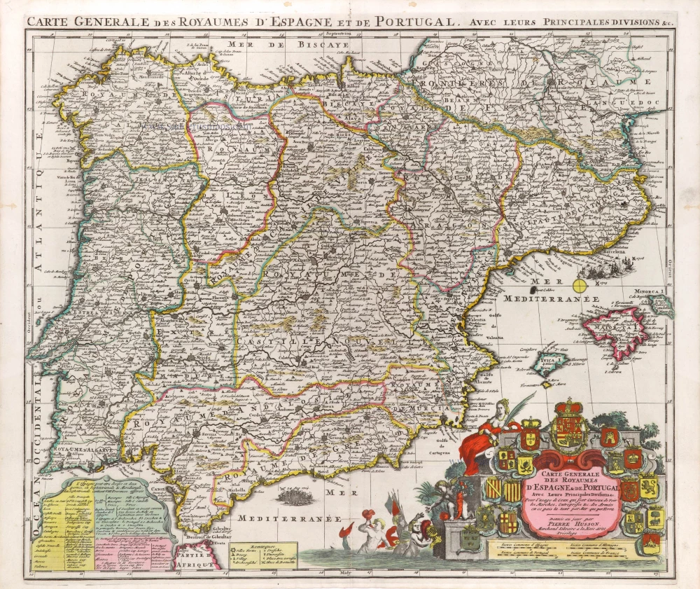
Carte Generale des Royaumes d'Espagne & de Portugal. Avec leurs Principales Divisions &c. c. 1709
Spain by Pierre Husson.
[Item number: 29548]
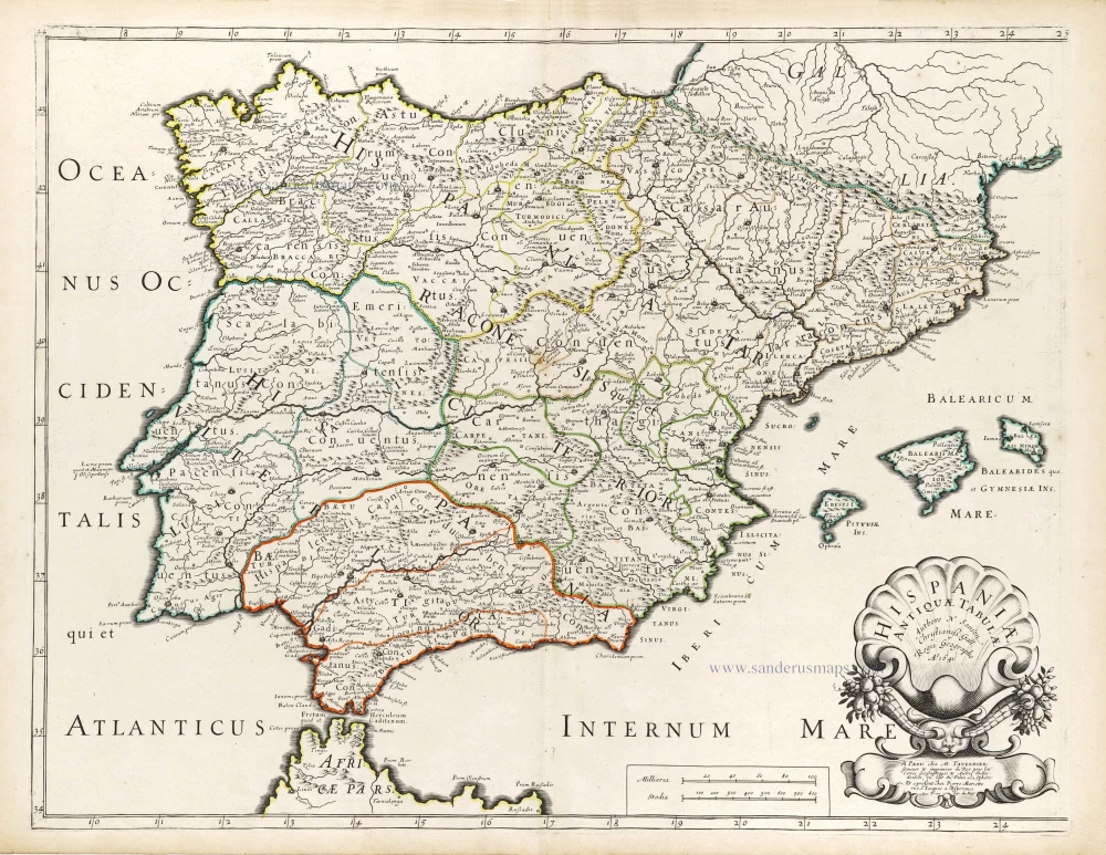
Hispaniae Antiquae Tabulae. 1652
Iberian Peninsula (Spain & Portugal) by Nicolas Sanson.
[Item number: 29694]
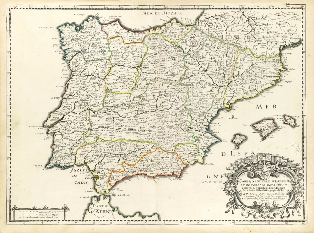
Carte Generale d'Espagne et tous les Royaumes y compris. 1659
Iberian Peninsula (Spain & Portugal) by Nicolas Sanson.
[Item number: 29718]
Regni Hispaniae post omnium editiones locupleissima Descrptio. / Hispania. 1598
Iberian Peninsula (Spain & Portugal) by Abraham Ortelius.
[Item number: 29946]
*** Rare first state. ***
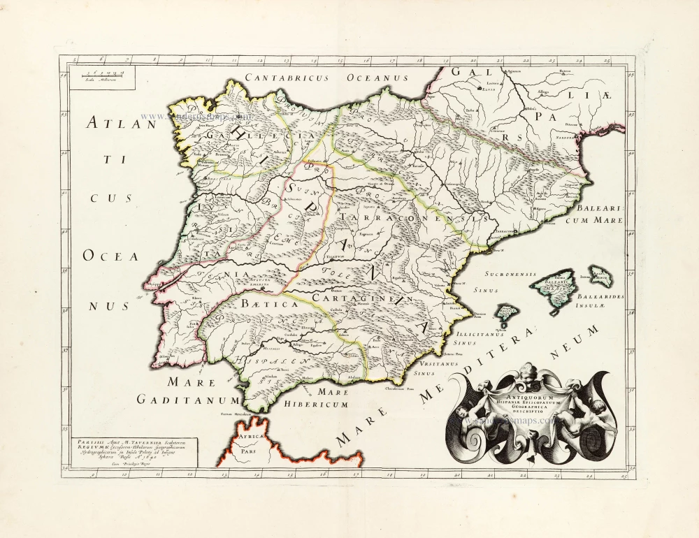
Antiquorum Hispaniae Episcopatuum Geographica Descriptio. 1640
Ancient Iberian Peninsula (Spain & Portugal) by Melchior Tavernier.
[Item number: 30043]
Parergon map
Hispaniae Veteris Descriptio. 1595
Iberian Peninsula by Abraham Ortelius.
[Item number: 30080]