
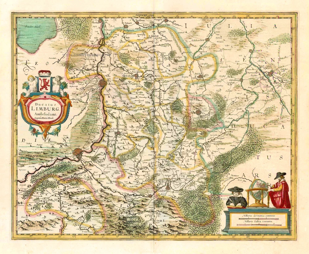
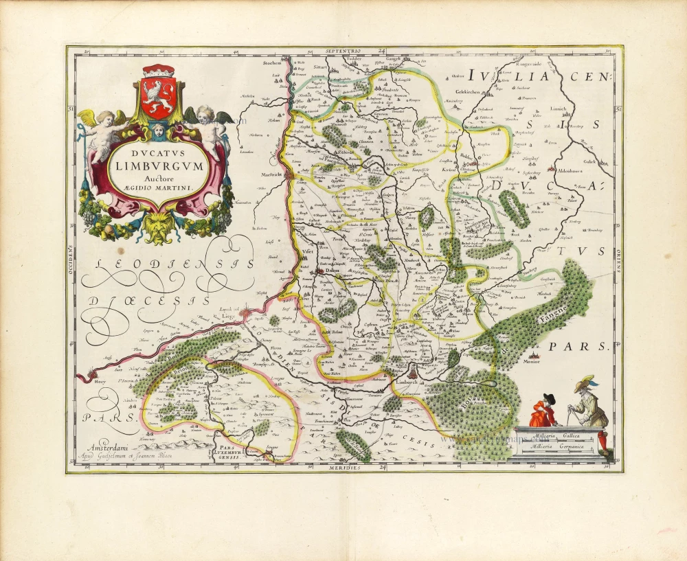
Limburg by Cornelis Danckerts. c. 1636
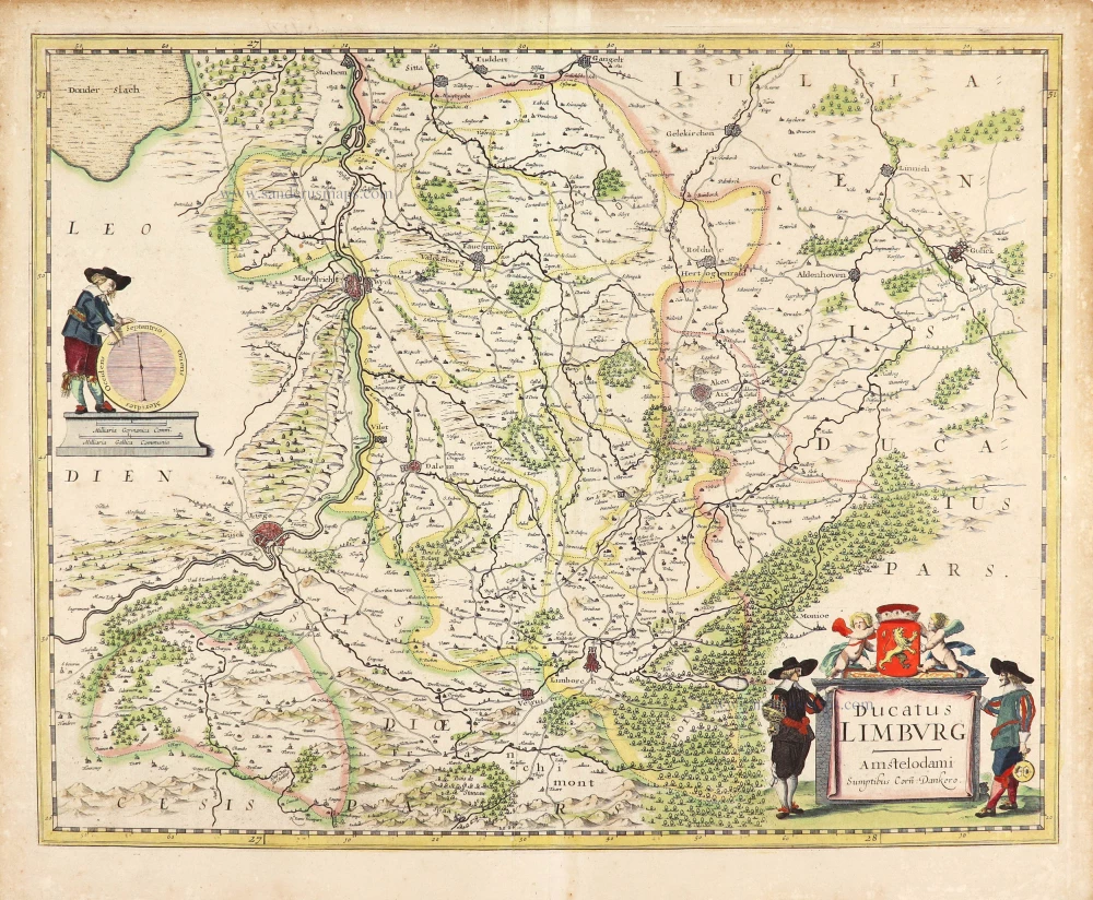
Extremely rare map of Limburg by Cornelis Danckerts.
According to Pastoureau, Cornelis Danckerts has been working at Melchior Tavernier in Paris; she mentions several maps by Danckerts that appear in French composite atlases.
The Danckerts Family.
The Danckerts family of Amsterdam was one of the best-known print and map sellers in 17th century Amsterdam. Their business activity covered a vast period, from ca. 1633. From 1669 until 1701, father Justus and his sons had their shop in the ‘Calverstraet in de Danckbaerheyt’.
Cornelis Danckerts (1561-1631) was a printseller born in Amsterdam and active in Antwerp.
Cornelis Danckerts, the elder (1603-1656) was an engraver and publisher in Amsterdam and Nieuwendijk. Son of Cornelis (above), whom he succeeded in 1631.
The house of Danckerts gained its greatest fame from Justus Danckerts (1635-1701 - son of Cornelis the elder) and his two sons, Theodorus and Cornelis. Dancker Danckerts (1634-1666), the elder brother of Justus, was known for his etchings of paintings, maps, and publications.
The grandfather, father, and sons were highly skilled and excellent artistic drafters and engravers. They are famous for the edition of their Atlas, which appeared from ca. 1686, and for several monumental and beautiful wall maps and views. However, compared with that published by the Blaeu's or Janssonius's, their cartographic work has attracted little attention and has never received proper recognition.
On 14 August 1684, Justus and his sons obtained the privilege from the States of Holland for their publications. In 1713, twelve years after Justus Danckerts, the heirs decided to sell part of the stock of maps and atlases and many copperplates. In 1727, after the death of the last surviving brother Theodorus, a final sale took place.
Ducatus Limburg.
Item Number: 28772 Authenticity Guarantee
Category: Antique maps > Europe > Belgium
Old, antique map of Limburg by Cornelis Danckerts..
Title: Ducatus Limburg.
Amstelodami Sumptibus Corn. Dankero.
Date of the first edition: c. 1636.
Date of this map: c. 1636.
Copper engraving, printed on paper.
Map size: 380 x 480mm (14.96 x 18.9 inches).
Sheet size: 425 x 520mm (16.73 x 20.47 inches).
Verso: Blank.
Condition: Original coloured, excellent.
Condition Rating: A+.
Separate publication.
Extremely rare map of Limburg by Cornelis Danckerts.
According to Pastoureau, Cornelis Danckerts has been working at Melchior Tavernier in Paris; she mentions several maps by Danckerts that appear in French composite atlases.
The Danckerts Family.
The Danckerts family of Amsterdam was one of the best-known print and map sellers in 17th century Amsterdam. Their business activity covered a vast period, from ca. 1633. From 1669 until 1701, father Justus and his sons had their shop in the ‘Calverstraet in de Danckbaerheyt’.
Cornelis Danckerts (1561-1631) was a printseller born in Amsterdam and active in Antwerp.
Cornelis Danckerts, the elder (1603-1656) was an engraver and publisher in Amsterdam and Nieuwendijk. Son of Cornelis (above), whom he succeeded in 1631.
The house of Danckerts gained its greatest fame from Justus Danckerts (1635-1701 - son of Cornelis the elder) and his two sons, Theodorus and Cornelis. Dancker Danckerts (1634-1666), the elder brother of Justus, was known for his etchings of paintings, maps, and publications.
The grandfather, father, and sons were highly skilled and excellent artistic drafters and engravers. They are famous for the edition of their Atlas, which appeared from ca. 1686, and for several monumental and beautiful wall maps and views. However, compared with that published by the Blaeu's or Janssonius's, their cartographic work has attracted little attention and has never received proper recognition.
On 14 August 1684, Justus and his sons obtained the privilege from the States of Holland for their publications. In 1713, twelve years after Justus Danckerts, the heirs decided to sell part of the stock of maps and atlases and many copperplates. In 1727, after the death of the last surviving brother Theodorus, a final sale took place.
Related items
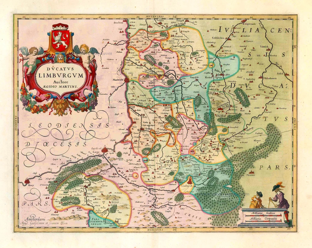
Ducatus Limburgum. 1659-72
Limburg, by Willem and Joan Blaeu.
[Item number: 8841]
Scarce map by Vrients
Limburgensis Ducatus Tabula Nova. 1612
Limburg, by Ortelius A.
[Item number: 22979]
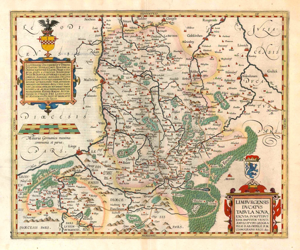
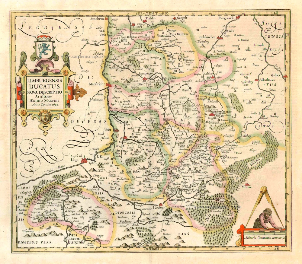
Limburgensis Ducatus. 1623
Limburg, by Henricus Hondius.
[Item number: 24917]
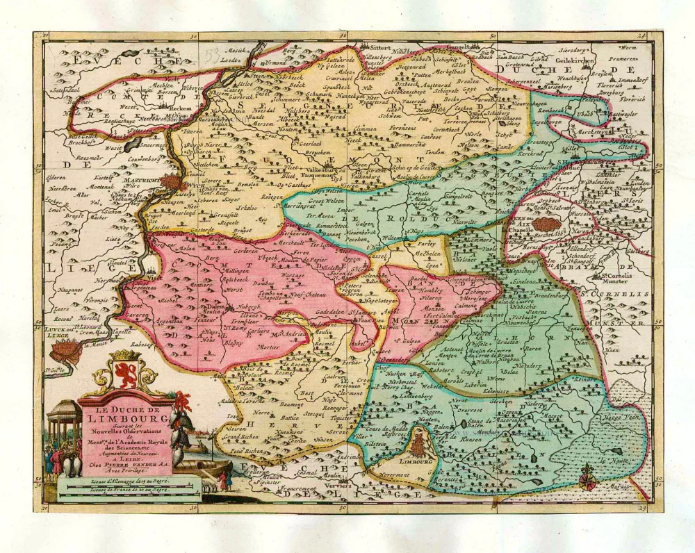
Le Duché de Limbourg. 1713
Limburg, by P. Van der Aa.
[Item number: 26052]

Limburgi Ducatus Et Comitatus Valckenburgi. 1683-1696
Limburg, by Nicolaas Visscher I.
[Item number: 26216]
Ducatus Limburg. 1641
Limburg, by Henricus Hondius.
[Item number: 26308]
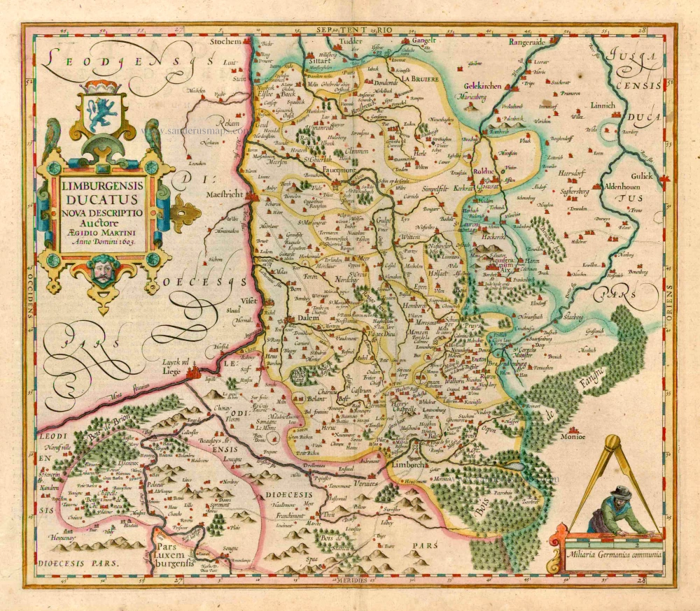
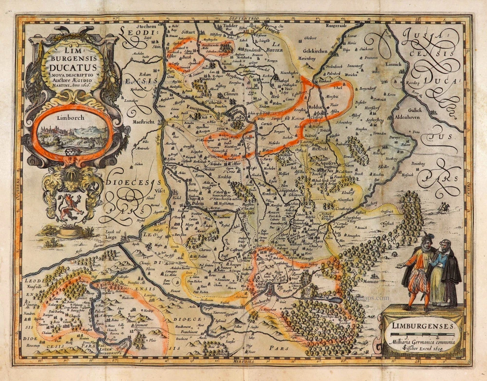
Limburgensis Ducatus. 1619
Limburg, by Henricus Hondius.
[Item number: 26774]
Limburgensis Ducatus Nova Descriptio. 1634
Limburg, by C.J. Visscher.
[Item number: 27969]
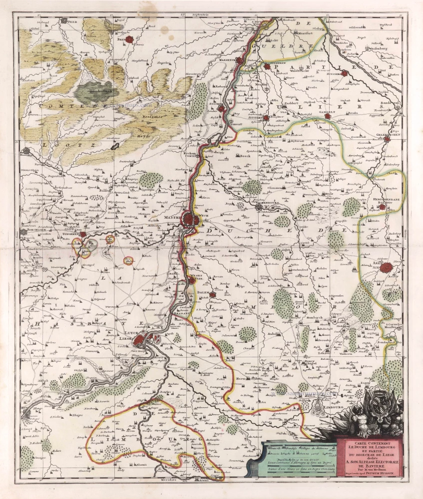
Carte contenant le Duché de Limbourg et partie du Diocèse de Liège. c. 1709
Limburg - Liège by Pierre Husson.
[Item number: 29590]
Ducatus Limburgum. 1643
Limburg by W. & J. Blaeu.
[Item number: 29931]
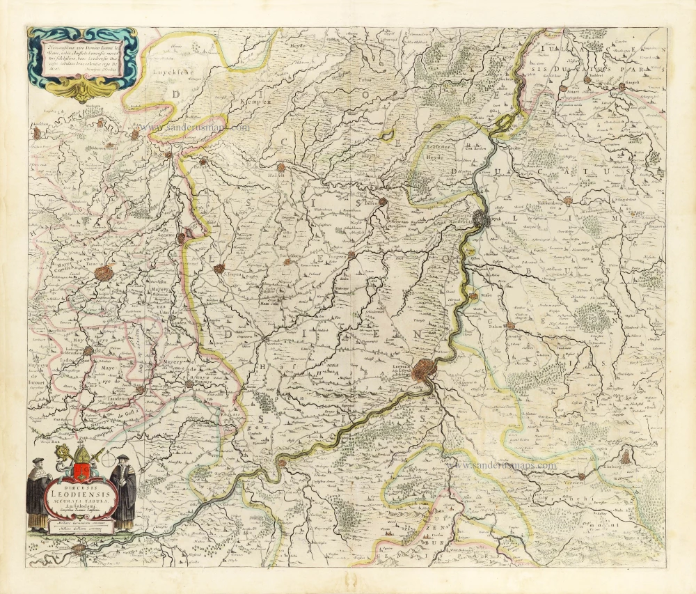
Dioecesis Leodiensis Accurata Tabula. 1653
Diocese of Liège by Johannes Janssonius.
[Item number: 30372]