
World in north polar azimuthal projection. 1792
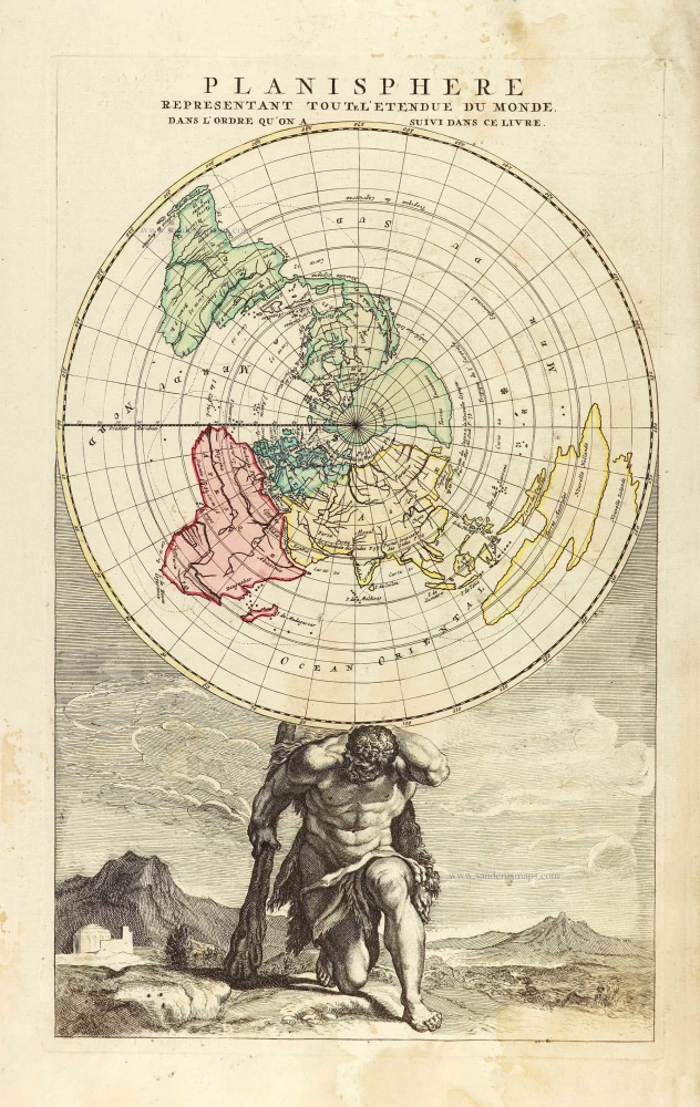
California is shown as a large island. The figure of Atlas at the page bottom is holding the world.
Louis Renard published this title page map already in 1715 in his Atlas de la navigation.
Jan Barend Elwe (florished 1785-1809)
The Amsterdam bookseller and publisher, J.B. Elwe, was probably of foreign origin. His activities in the book trade date back to 1785, a date found on an atlas.
Planisphere representant toute l'Etendue du Monde, dans l'ordre qu'on a suivi dans ce livre.
Item Number: 28810 Authenticity Guarantee
Category: Antique maps > World and Polar
Title page of a world atlas by J.B. Elwe, showing a map of the world in north polar azimuthal projection with an equidistant concentric circle of latitude; also known as Turquet's projection.
Title: Planisphere representant toute l'Etendue du Monde, dans l'ordre qu'on a suivi dans ce livre.
Cartographer: Louis Renard.
Date of the first edition: 1715.
Date of this map: 1792.
Copper engraving, printed on paper.
Map size: 430 x 265mm (16.93 x 10.43 inches).
Sheet size: 550 x 310mm (21.65 x 12.2 inches).
Verso: Blank.
Condition: Margins stained.
Condition Rating: A.
From: Atlas. Amsterdam, J.B. Elwe, 1792. (Koeman, II, El2)
California is shown as a large island. The figure of Atlas at the page bottom is holding the world.
Louis Renard published this title page map already in 1715 in his Atlas de la navigation.
Jan Barend Elwe (florished 1785-1809)
The Amsterdam bookseller and publisher, J.B. Elwe, was probably of foreign origin. His activities in the book trade date back to 1785, a date found on an atlas.
Related items

Rare variant.
Cosmographia Universalis. 1592
World map by H. Bünting - D.A. Veleslavina.
[Item number: 26356]
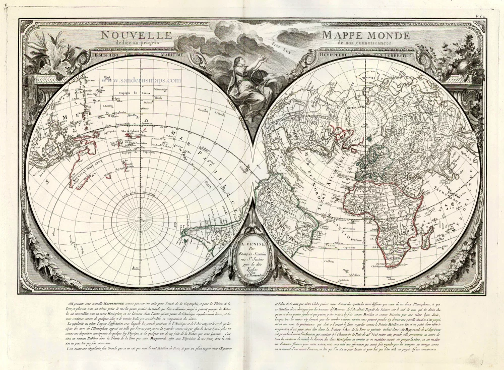
Nouvelle Mappe Monde Dediee au Progres de nos Connoissances. 1776-79
World by Francesco Santini.
[Item number: 26946]

Universi Orbis Descriptio. 1597
World by Giovanni Magini
[Item number: 27837]
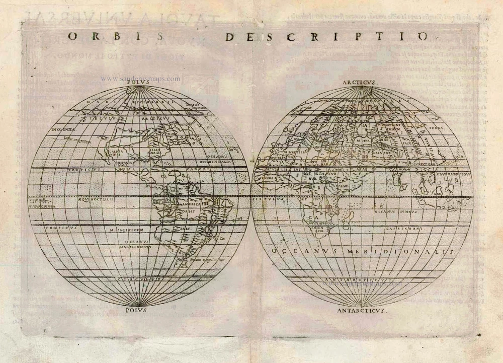
One of the first double hemisphere world maps.
Orbis Descriptio. 1564
World by Girolamo Ruscelli.
[Item number: 27838]
The engraving and layout and elegance of decoration are all of the highest standards.
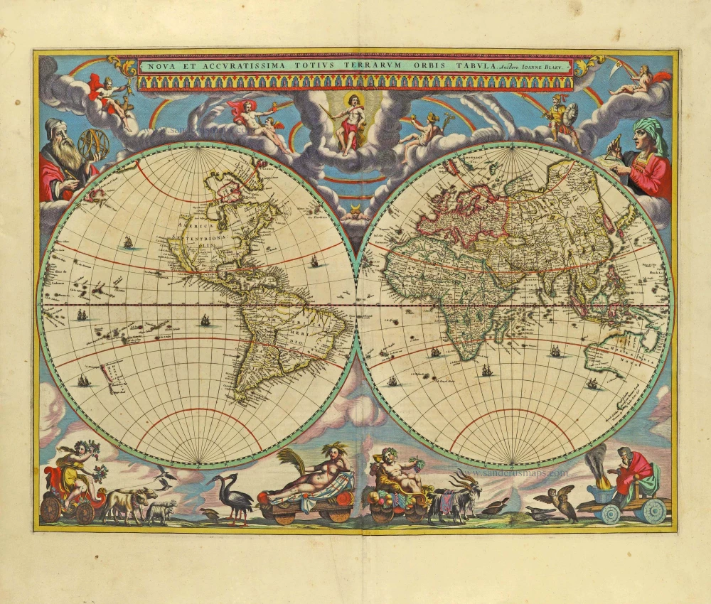
Nova Et Accuratissima Totius Terrarum Orbis Tabula. 1659
World by Joan Blaeu, double hemisphere.
[Item number: 28336]
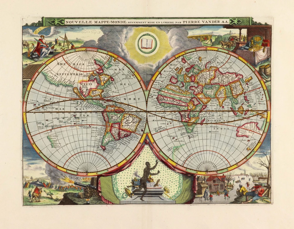
Nouvelle Mappe-Monde, 1710
World by Pieter Van der Aa, double hemisphere.
[Item number: 29136]
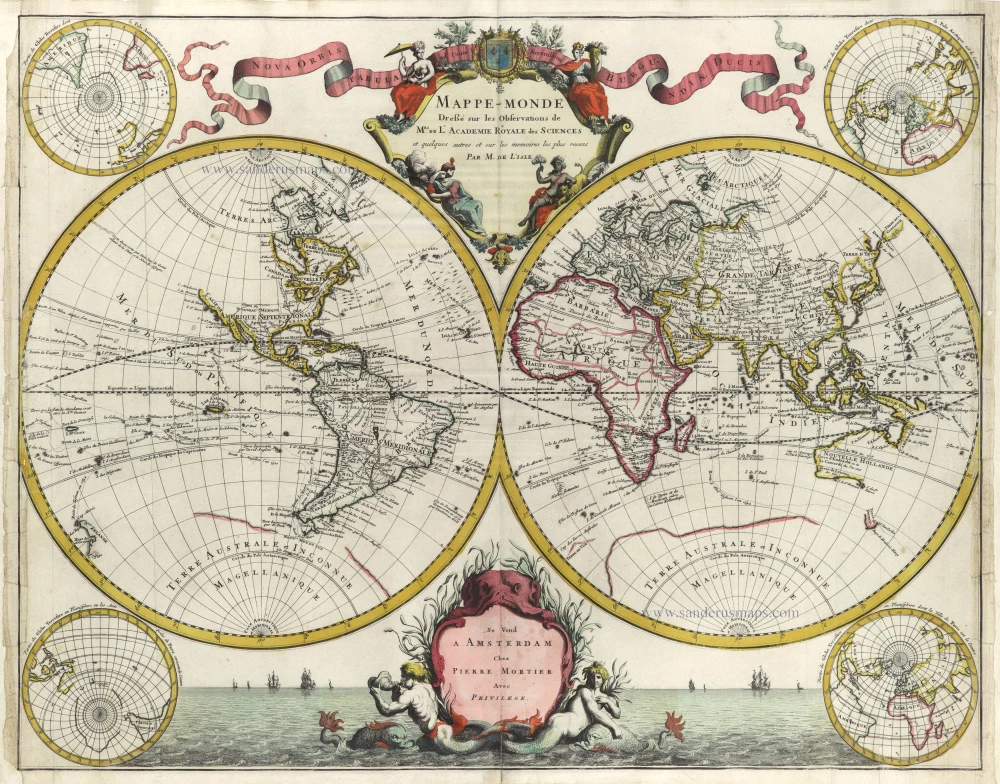
Mappe-Monde Dreßé sur les Observations de Mrs. de l'Academie Royale des Sciences et quelques autres et sur les memoires les plus recens. 1705-1711
World in two hemispheres by Pieter Mortier.
[Item number: 29509]
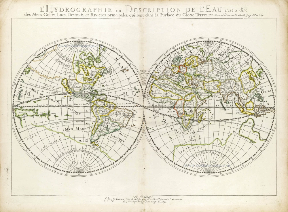
L'Hydrographie ou Description de l'Eau c'est a Dire des Mers, Golfes, Lacs, Destroits et Rivieres Principales qui sont dans la Surface du Globe Terrestre. 1652
World map, double-hemisphere by Nicolas Sanson.
[Item number: 29606]
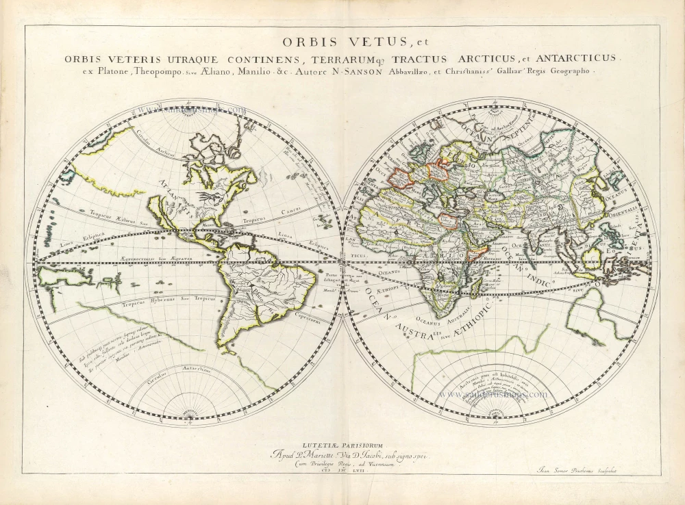
Orbis Vetus, et Orbis Veteris Ultraque continens, Terrarumq. Tractus Arcticus, et Antarcticus ex Platone, Theopompo, sive Aeliano, Manilio &c. 1658
Double hemisphere map of the Ancient World by Nicolas Sanson.
[Item number: 29609]

Mappe-Monde, ou Carte Generale du Monde, 1652
Double hemisphere world map by Nicolas Sanson.
[Item number: 29612]
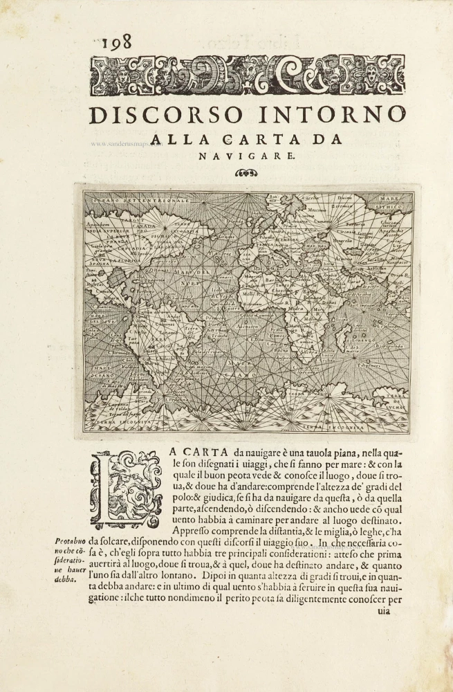
Discorso Intorno alla Carta da Navigare. 1590
World, by Thomaso Porcacchi.
[Item number: 29786]
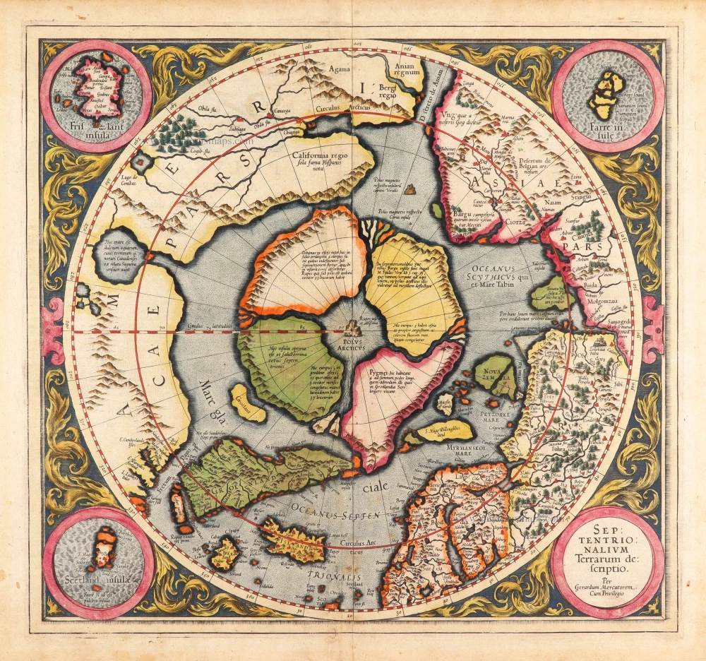
Very rare first state of Mercator's North Pole map.
Septentrionalium Terrarum descriptio. 1595
Arctic Region - North Pole by Gerard Mercator, first state published by Rumold Mercator.
[Item number: 29799]