
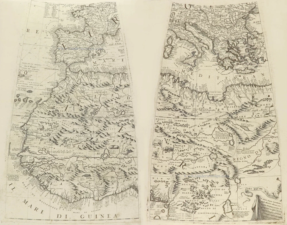
Two half globe gores of Southwestern Europe, Mediterranean, and Northwestern Africa. 1696
Vincenzo Coronelli (1650-1718)
Vincenzo Coronelli was born in Venice on 16 August 1650 and primarily brought up in Ravenna. He returned to Venice in 1665 and joined the convent of the Minor Conventuals. Five years later, he was sent to Rome to study, and by 1673, he was already a doctor of theology.
Having achieved fame by constructing two globes for the Duke of Parma, he was invited to Paris for three years in 1681 and made two enormous examples for Louis XIV. On his return to Venice, he assiduously collected cartographic material and founded the Academy of the Argonauts. In 1685, he was appointed Cosmographer to the Republic of Venice and authorised to publish a large atlas. He became a geography lecturer at the University of Venice and brought out an Atlante Veneto the following year.
In 1696, he visited Germany, Holland and southern England. During intervals in compiling his vast encyclopaedia, he continued with cartographic projects up to 1709. He died in his native Venice on 9 December 1718.
Coronelli became famous for his globes. In addition, he was a renowned encyclopaedist, mapmaker and geographer. Most of his maps and other material are gathered in his Atlante Veneto (13 vols, 1690-1705). The first volume, subtitled Descrizione generale istorica geografica, was his masterpiece, planned as an extension of Blaeu’s atlas.
Other volumes of the atlas which contain maps are Isolario, two parts (1696-8), with detailed maps and plans, mostly of islands; Corso geografico, two parts based on the edition 1694-7; Libro de’ globi (1697); and Lo Specchio del Mare, a reprint of Levanto's Lo Specchio del Mare Mediterraneo of 1664.
The other vital aspects of his mapping are those arising from the Venetian conquest and his travels. His most extensive military compilation was the Teatro della Guerra, in more than 30 volumes.
[No title]
Item Number: 28825 Authenticity Guarantee
Category: Antique maps > Europe > Europe Continent
Two half globe gores of Southwestern Europe, Mediterranean, and Northwestern Africa.
From Vincenzo Coronelli's 42 inch terrestrial globe.
[No title]
Date of the first edition: 1688.
Date of this map: 1696.
Copper engraving, printed on paper.
Map size: 455 x 280mm (17.91 x 11.02 inches).
Sheet size: 480 x 350mm (18.9 x 13.78 inches).
Verso: Blank.
Condition: Excellent.
Condition Rating: A+.
From: Isolario Descrittione Geografico-Historica, Sacro-Profano, Antico-Moderna, Politica, Naturale e Poetica ... di Tutti l'Isole ... Tomo II dell'Atlante Veneto ... del P.Maestro Vincenzo Coronelli ... A'Spese dell'Autore MDCLXXXXVI. (Shirley (Brit.Lib), T.CORO-13a)
Vincenzo Coronelli (1650-1718)
Vincenzo Coronelli was born in Venice on 16 August 1650 and primarily brought up in Ravenna. He returned to Venice in 1665 and joined the convent of the Minor Conventuals. Five years later, he was sent to Rome to study, and by 1673, he was already a doctor of theology.
Having achieved fame by constructing two globes for the Duke of Parma, he was invited to Paris for three years in 1681 and made two enormous examples for Louis XIV. On his return to Venice, he assiduously collected cartographic material and founded the Academy of the Argonauts. In 1685, he was appointed Cosmographer to the Republic of Venice and authorised to publish a large atlas. He became a geography lecturer at the University of Venice and brought out an Atlante Veneto the following year.
In 1696, he visited Germany, Holland and southern England. During intervals in compiling his vast encyclopaedia, he continued with cartographic projects up to 1709. He died in his native Venice on 9 December 1718.
Coronelli became famous for his globes. In addition, he was a renowned encyclopaedist, mapmaker and geographer. Most of his maps and other material are gathered in his Atlante Veneto (13 vols, 1690-1705). The first volume, subtitled Descrizione generale istorica geografica, was his masterpiece, planned as an extension of Blaeu’s atlas.
Other volumes of the atlas which contain maps are Isolario, two parts (1696-8), with detailed maps and plans, mostly of islands; Corso geografico, two parts based on the edition 1694-7; Libro de’ globi (1697); and Lo Specchio del Mare, a reprint of Levanto's Lo Specchio del Mare Mediterraneo of 1664.
The other vital aspects of his mapping are those arising from the Venetian conquest and his travels. His most extensive military compilation was the Teatro della Guerra, in more than 30 volumes.
Related items
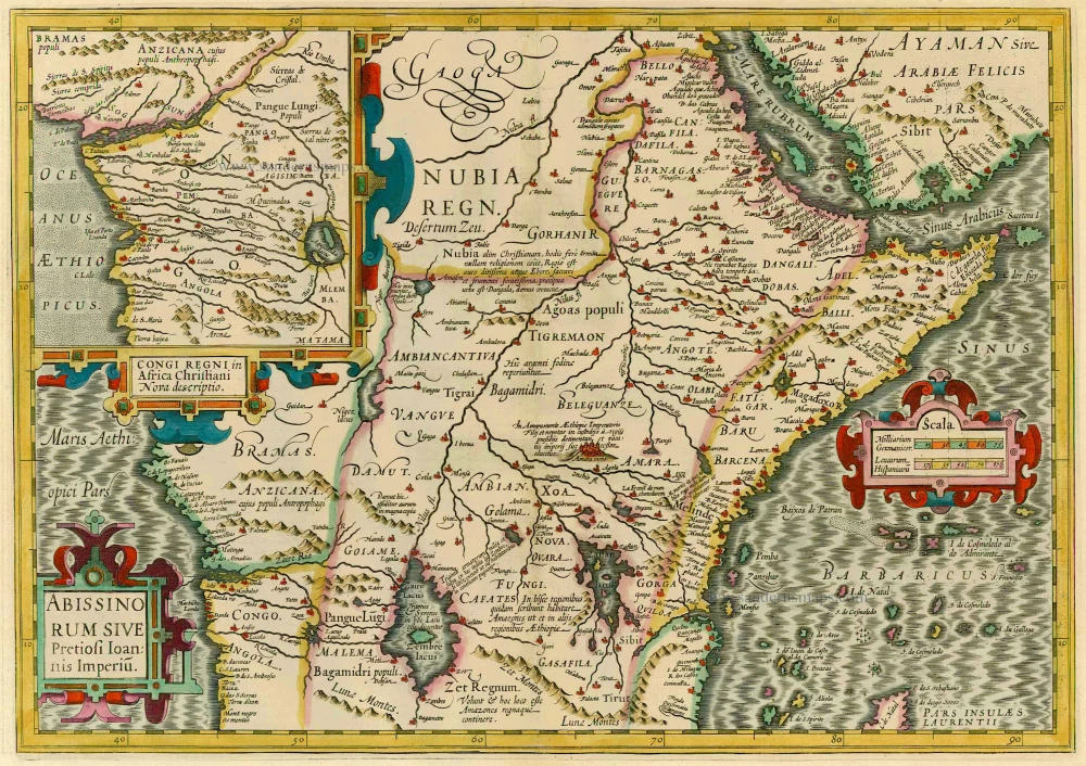
Abissinorum Sive Pretiosi Ioannis Imperiu. 1630
Central Africa by J. Hondius
[Item number: 887]
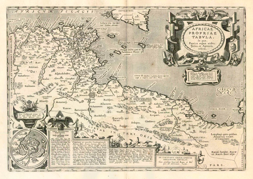
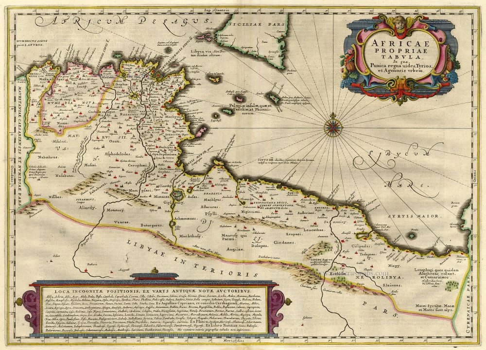
Africae Propriae Tabula. 1624
Ancient Northern Africa, by Ortelius A.
[Item number: 2053]
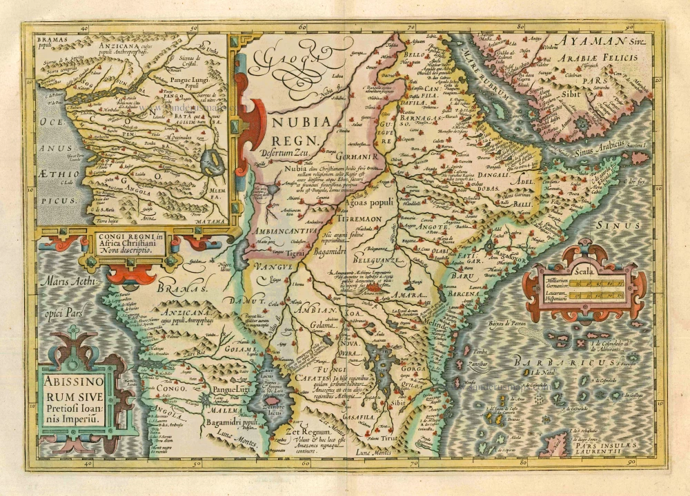
Abissinorum Sive Pretiosi Ioannis Imperiu 1628.
Central Africa, by Jodocus Hondius.
[Item number: 7749]
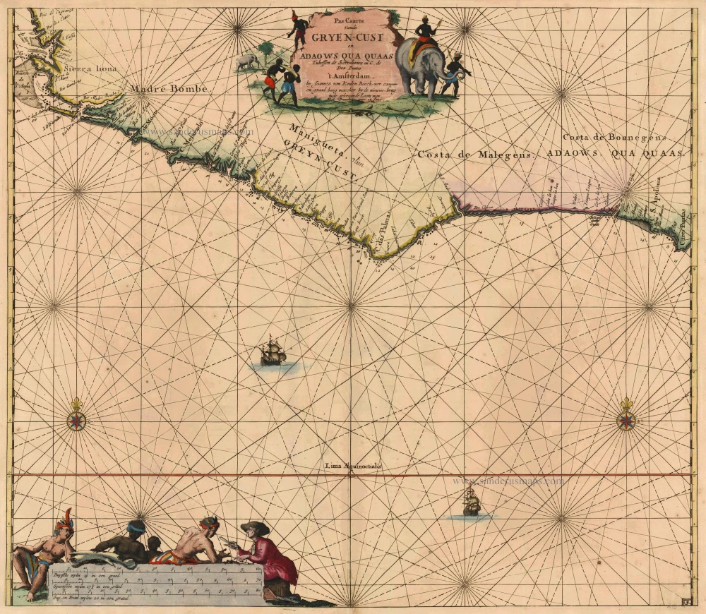
Pas Caarte vande Gryen-Cust en Adaows qua Quaas tuhessen de Serraliones en C. de Tres Puntas. 1683
Grain Coast - West Africa, by Johannes van Keulen.
[Item number: 10776]
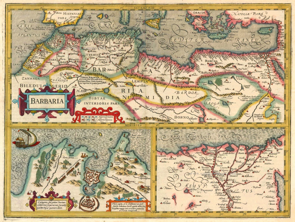
Barbaria 1613-16
Northern Africa by J. Hondius
[Item number: 13746]
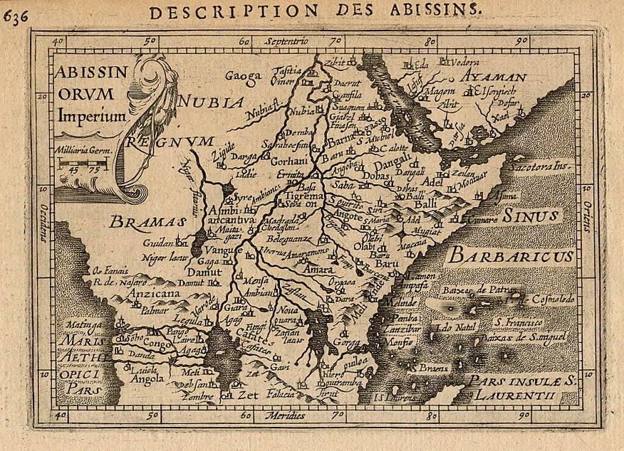
Abissinorum 1618
Central Africa, by Bertius P.
[Item number: 18274]
Africae Propriae Tabula .. 1645-58
Northern Africa, by Janssonius J.
[Item number: 19443]
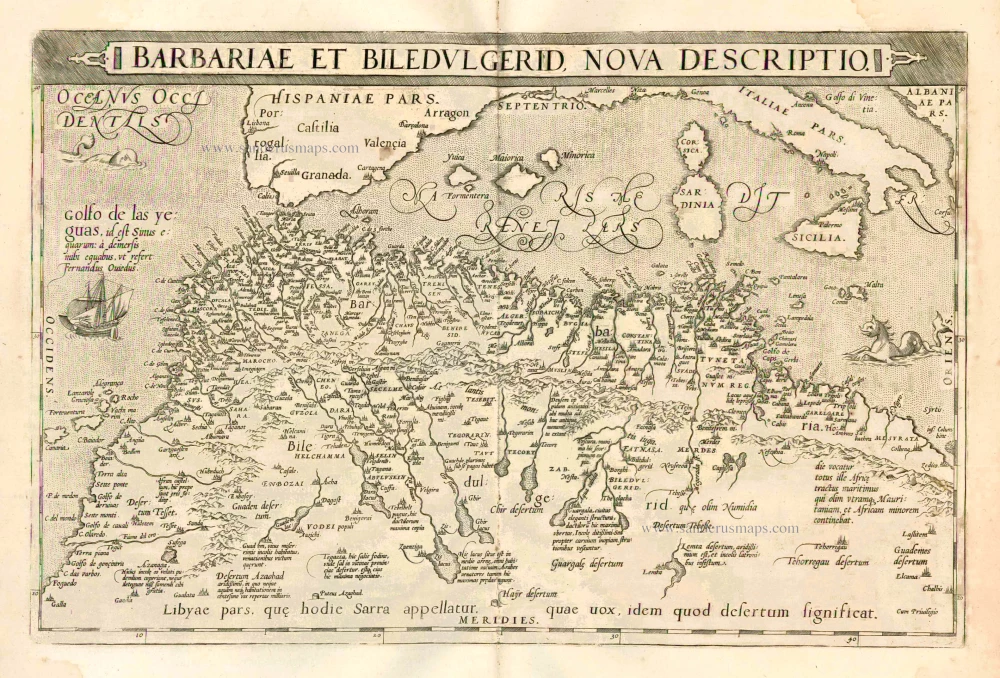
Barbariae et Biledulgerid, Nova Descriptio. 1601
Northern Africa, by A. Ortelius.
[Item number: 22524]

Barbaria 1662
Northern Africa, by Blaeu J.
[Item number: 22814]
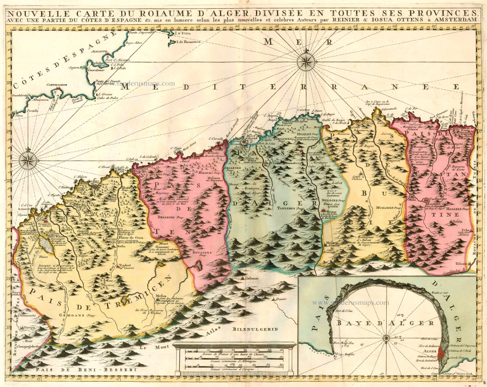
Nouvelle Carte du Roiaume d'Alger, divisée en toutes ses provinces, avec une partie du Côtes d'Espagne &c. 1756
Northern Africa - Algeria (Algiers) by Ottens R. & J.
[Item number: 23495]
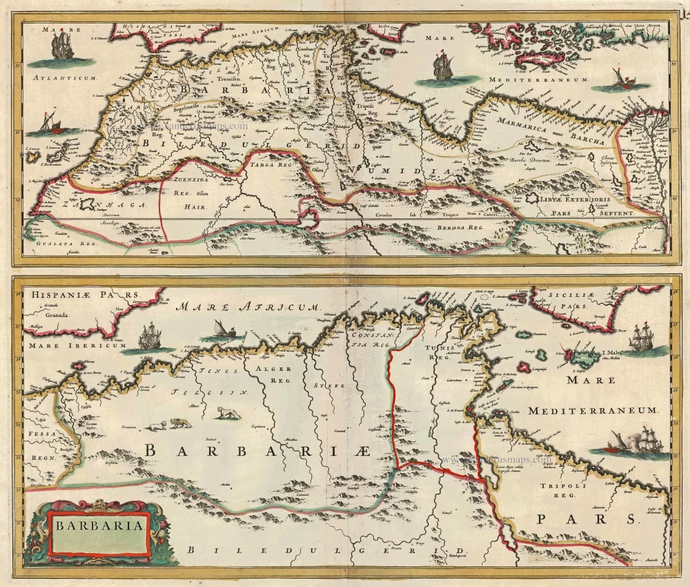
Barbaria c. 1680
Northern Africa, by F. de Wit.
[Item number: 24490]
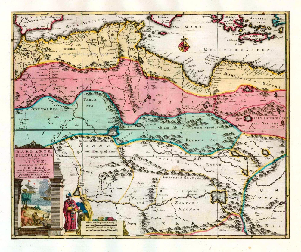
Barbarie, Biledulgerid, (autrefois Libye) et une partie du Pays des Negres. 1713
Northern Africa (Barbary), by Pieter van der Aa.
[Item number: 26154]
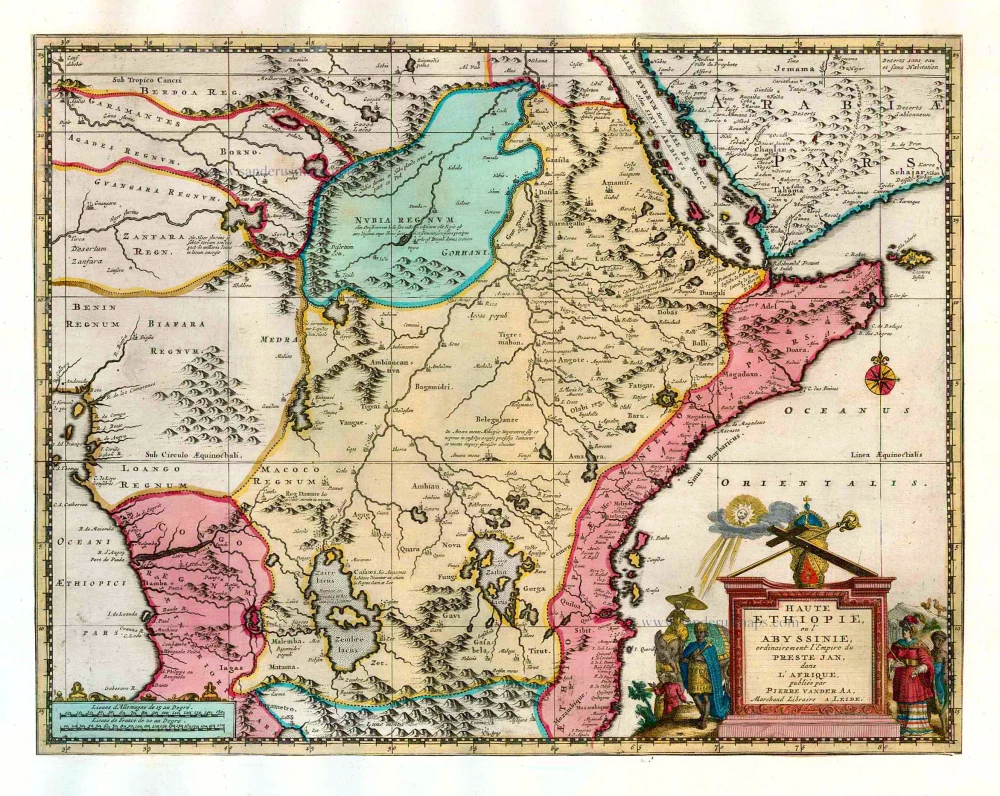
Haute Ethiopie, ou l' Abyssinie, ordinairement l'Empire du Preste Jan, dans l'Afrique. 1713
Central Africa, by Pieter van der Aa.
[Item number: 26157]

Paskaart van de Cust van Portugal, Barbaria, en Genehoa Beginnende van d'Barlengers tot aan C. Verde. 1680-1694
Sea chart of the northwest coast of Africa, with the Azores, Canary Islands and Cape Verde Islands, by Johannes Van Keulen.
[Item number: 26808]