
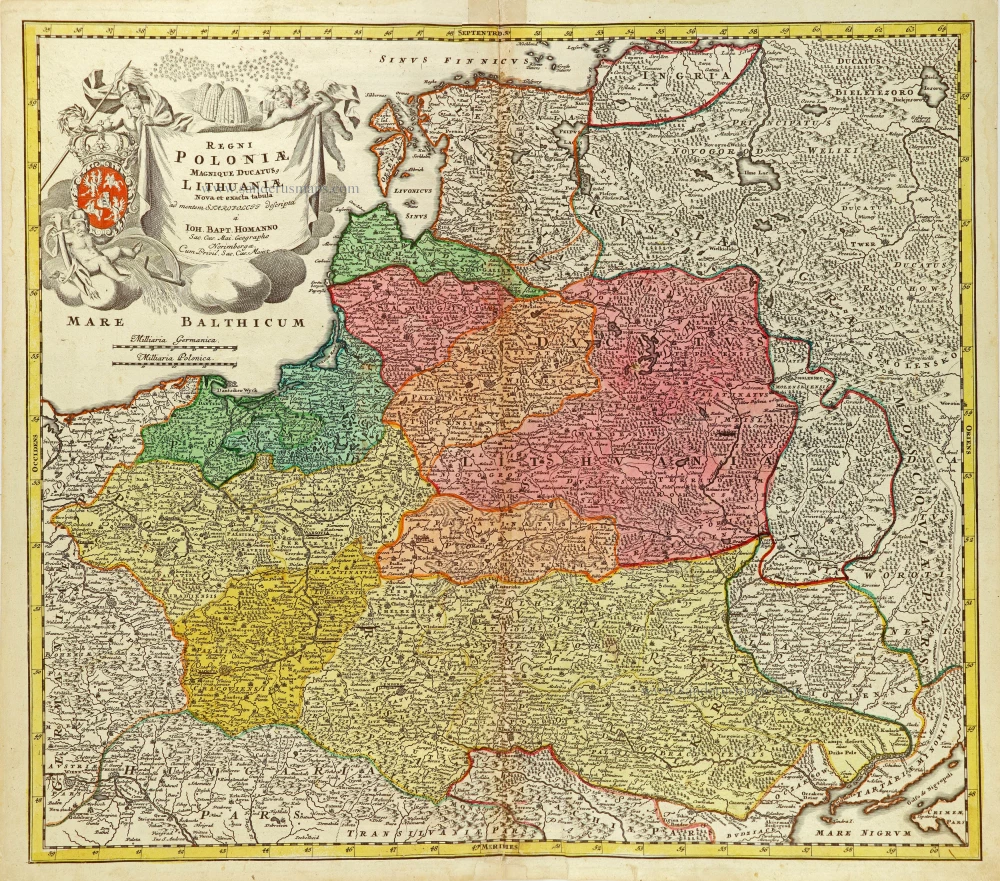
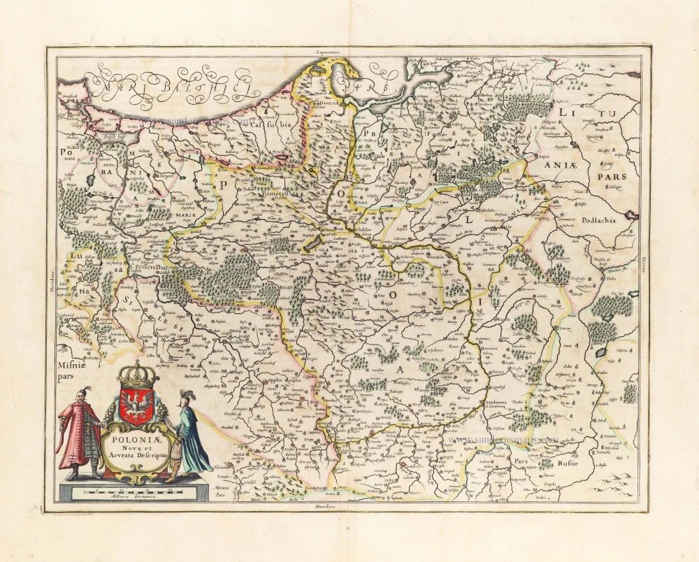
Poland & Lithuania by J.B. Homann After 1715
The Homann Family
Johann Baptist Homann (1664-1724) was born in Oberkammlach in Southern Germany. Around 1693 Homann moved to Vienna, where he lived and studied printing and copper plate engraving until 1695. In 1702 he founded a map publishing company in Nuremberg, which is recognized as one of the most important German map publishers of the eighteenth century. In the next five years, Homann produced hundreds of maps and developed a distinctive style characterized by heavy detailed engraving, elaborate allegorical cartouche work, and vivid hand colour. He published his first atlas in 1707. Homann's company successfully competed with leading European mapmakers. By 1715 Homann's rising star caught the attention of the Holy Roman Emperor Charles the VI, who appointed him Imperial Cartographer. In the same year, he was also appointed a member of the Royal Academy of Sciences in Berlin. Homann's prestigious title came with several significant advantages, including access to the most up to date cartographic information as well as the "Privilege". In 1716 Homann published his masterpiece Grosser Atlas über die ganze Welt (Grand Atlas of all the World).
After Johann Baptist Homann's death in 1724, Johan Christoph Homann (1703-1730) and other heirs continued the company under the name Homann's Erben (Homann's Heirs) until 1852.
Regni Poloniae Magnique Ducatus Lithuaniae Nova et Exacta Tabula.
Item Number: 28830 Authenticity Guarantee
Category: Antique maps > Europe > Eastern Europe
Old, antique map of Poland & Lithuania by J.B. Homann.
Title: Regni Poloniae Magnique Ducatus Lithuaniae Nova et Exacta Tabula.
ad mentem Starovolcii descripta à Ioh. Bapt. Homanno Sac.Caes. Mai. geographo Norimbergae.
Cum Privil. Sac. Caes. Maiest.
Date: After 1715.
Second state of the third plate.
Copper engraving, printed on paper.
Map size: 480 x 550mm (18.9 x 21.65 inches).
Sheet size: 510 x 575mm (20.08 x 22.64 inches).
Verso: Blank.
Condition: Original coloured, some browning along centrefold.
Condition Rating: A.
From: Grosser Atlas Uber die Gantze Welt ... Von Joann Baptist Homann ... Nürnberg, 1716 [- 1737]. [Shirley (Brit.Lib.), T.HOM-1c]
The Homann Family
Johann Baptist Homann (1664-1724) was born in Oberkammlach in Southern Germany. Around 1693 Homann moved to Vienna, where he lived and studied printing and copper plate engraving until 1695. In 1702 he founded a map publishing company in Nuremberg, which is recognized as one of the most important German map publishers of the eighteenth century. In the next five years, Homann produced hundreds of maps and developed a distinctive style characterized by heavy detailed engraving, elaborate allegorical cartouche work, and vivid hand colour. He published his first atlas in 1707. Homann's company successfully competed with leading European mapmakers. By 1715 Homann's rising star caught the attention of the Holy Roman Emperor Charles the VI, who appointed him Imperial Cartographer. In the same year, he was also appointed a member of the Royal Academy of Sciences in Berlin. Homann's prestigious title came with several significant advantages, including access to the most up to date cartographic information as well as the "Privilege". In 1716 Homann published his masterpiece Grosser Atlas über die ganze Welt (Grand Atlas of all the World).
After Johann Baptist Homann's death in 1724, Johan Christoph Homann (1703-1730) and other heirs continued the company under the name Homann's Erben (Homann's Heirs) until 1852.
Related items
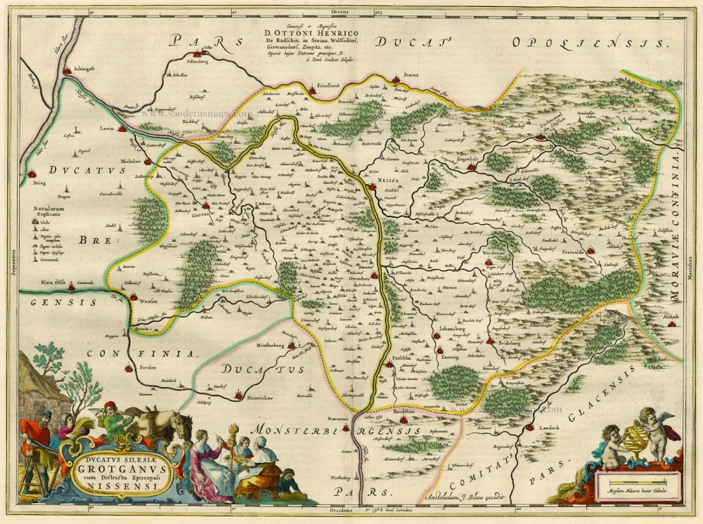
Ducatus Silesiae Grotganus cum Districtu Episcopali Nissensi. 1662
Poland - Grodków and Nysa, by Blaeu J.
[Item number: 15621]
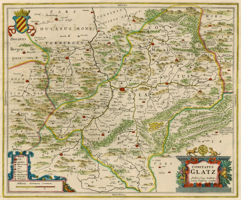
Comitatus Glatz. 1658
Poland - Klodzko, by J. Janssonius.
[Item number: 15619]
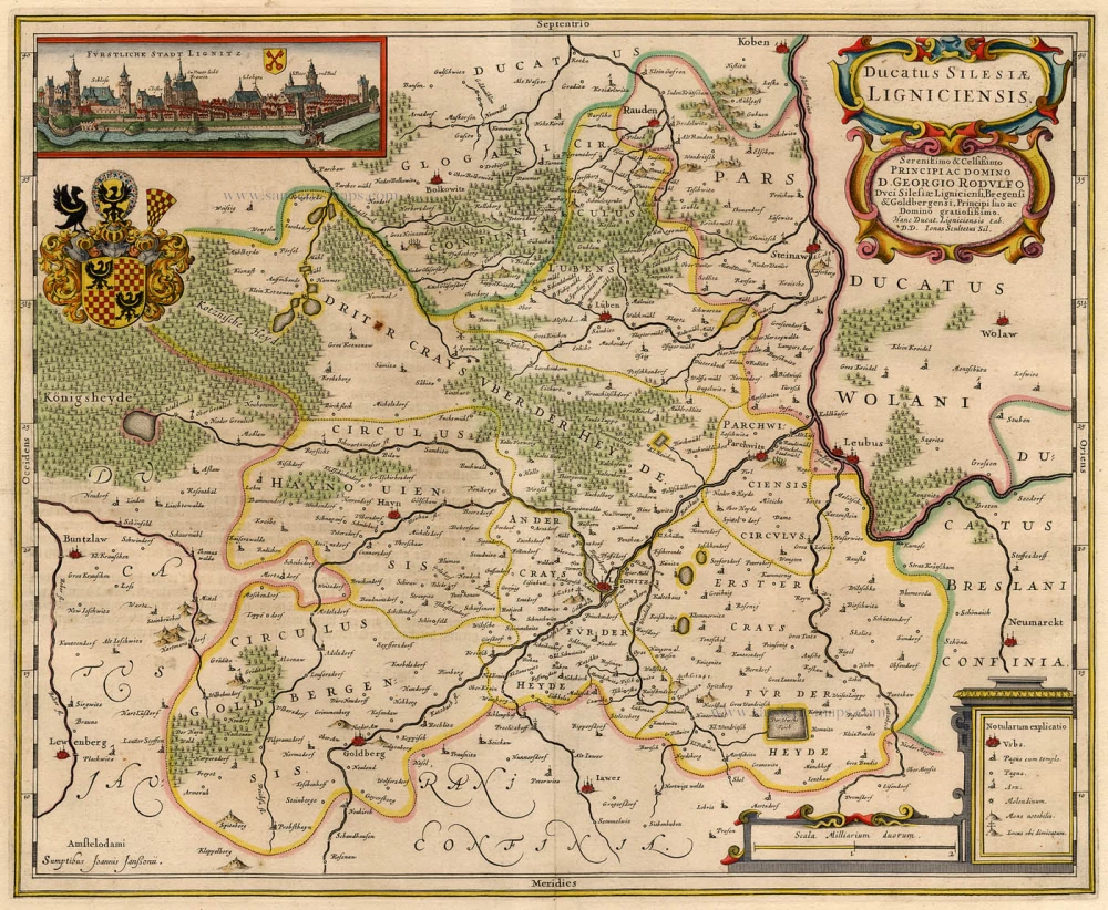
Ducatus Silesiae Ligniciensis 1632+
Poland - Legnica, by Hondius H. - Janssonius J.
[Item number: 6942]
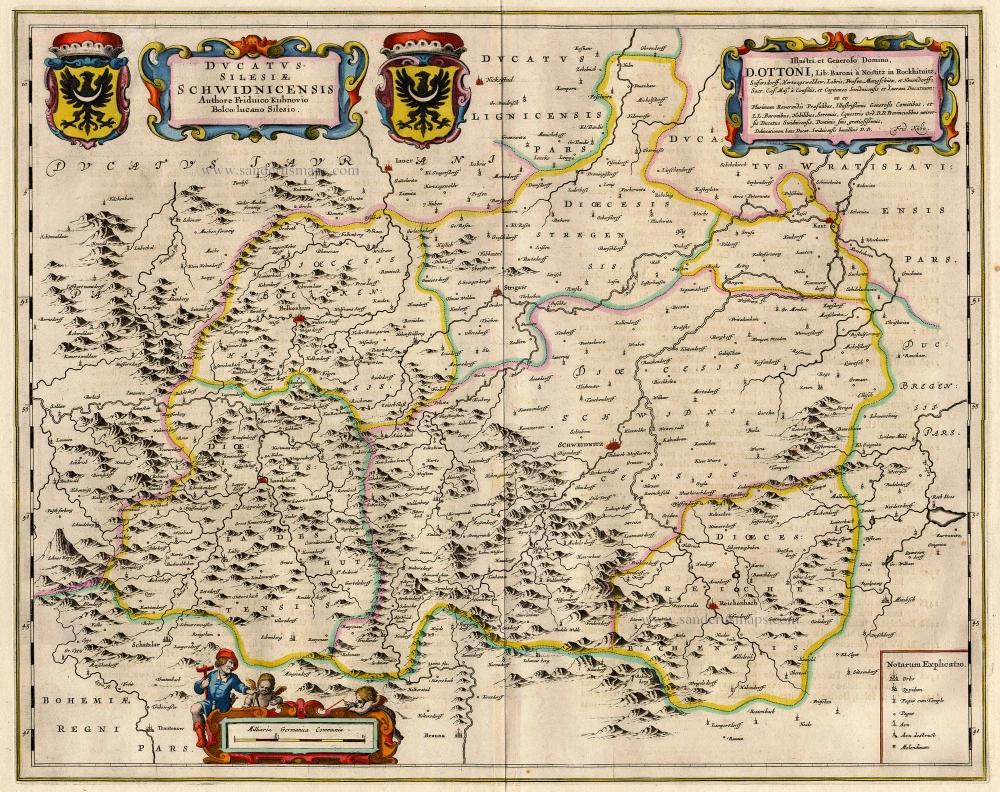
Ducatus Silesiae Schwidnicensis. 1659-72
Poland - Swidnica (Schweidnitz), by Blaeu J.
[Item number: 18702]
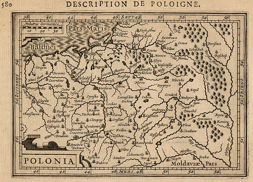
Polonia. 1618
Poland, by Petrus Bertius.
[Item number: 18262]
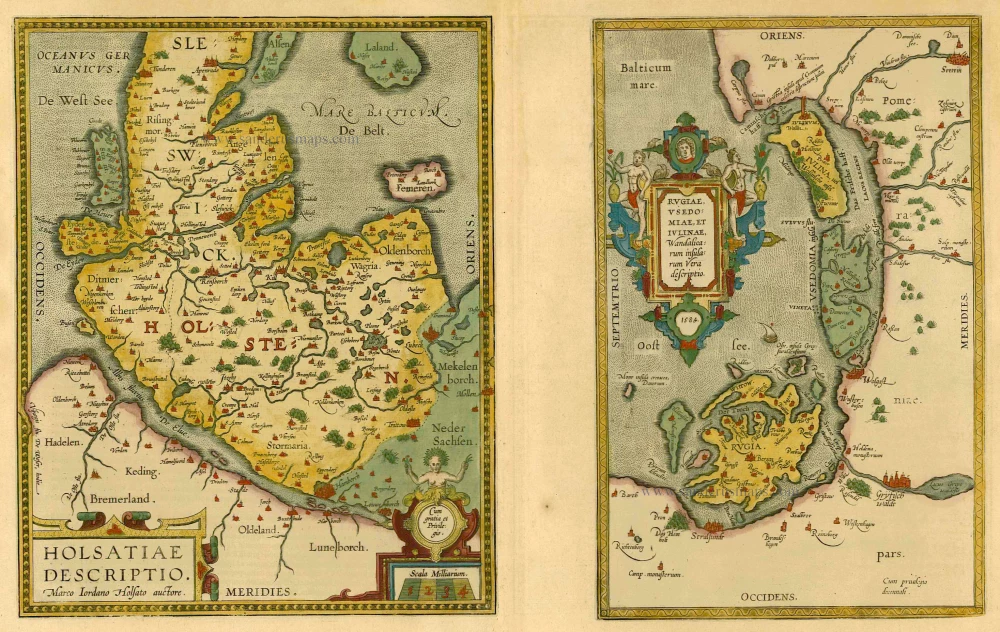
Holsatiae Descriptio [on sheet with] Rugiae, Usedomiae, et Iulinae, Wandalicarum Insularum Vera Descriptio. 1601
Poland - Rügen - Holstein, by Ortelius A.
[Item number: 21277]
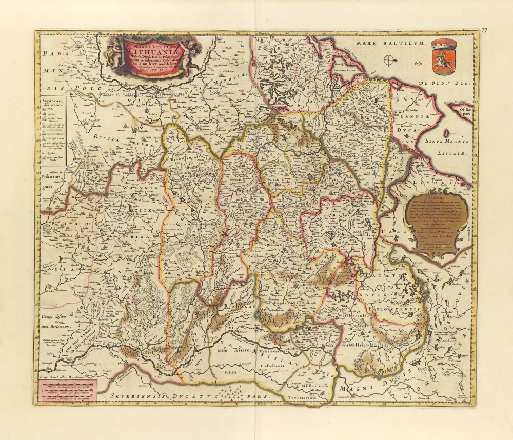
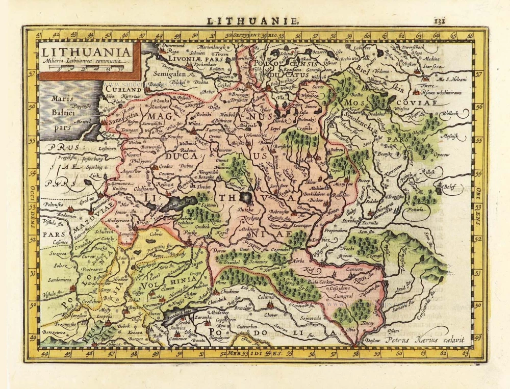
Magni Ducatus Lithuaniae Tabula, divisa tam in Palatinatus, quam in subjacentes Castellanias. c. 1697
Lithuania by Frederick De Wit.
[Item number: 28892]
Lithuania. 1630
Lithuania by Jodocus Hondius.
[Item number: 29159]
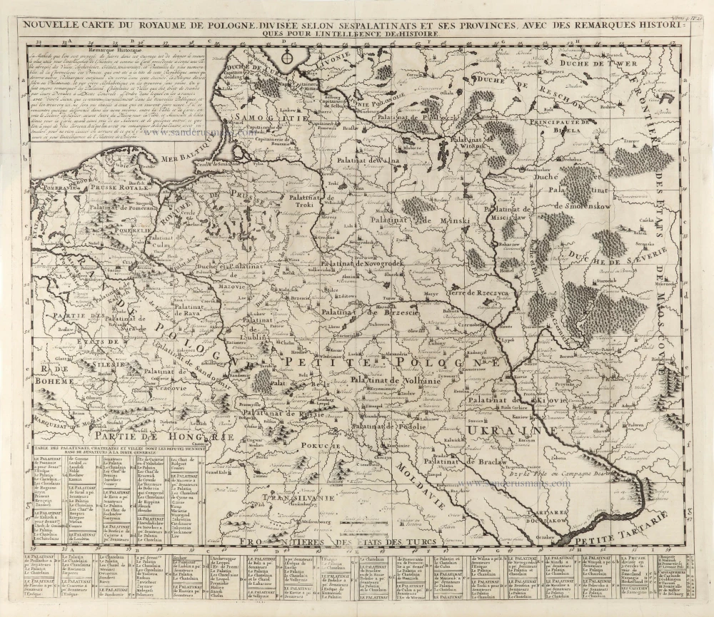
Nouvelle Carte du Royaume de Pologne, divisée selon ses Palatinats et ses Provinces, avec des Remarques Historiques pour l'Intelligence de l'Histoire. 1714
Poland by Zacharias Châtelain.
[Item number: 29427]
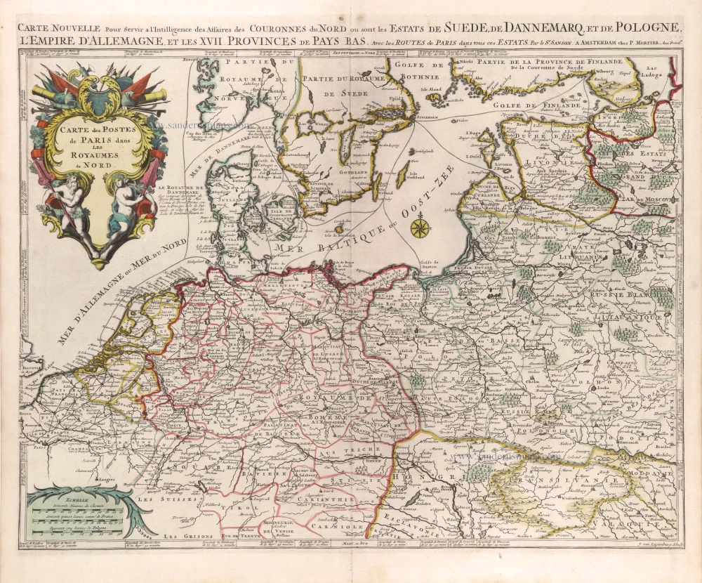
Cartes des Postes de Paris dans les Royaumes du Nord. c. 1709
Postal map of Northern Germania, Poland, and the Baltic States by Nicolas Sanson, published by Pierre Mortier.
[Item number: 29619]
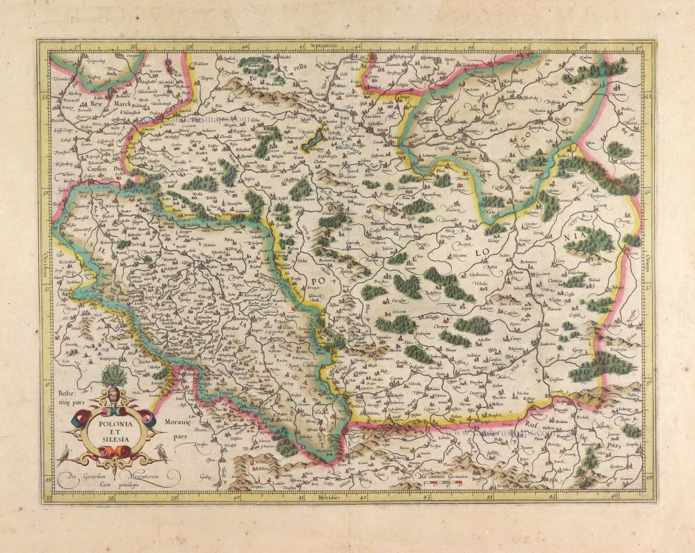
Polonia et Silesia. 1613
Poland, by Gerard Mercator.
[Item number: 29762]
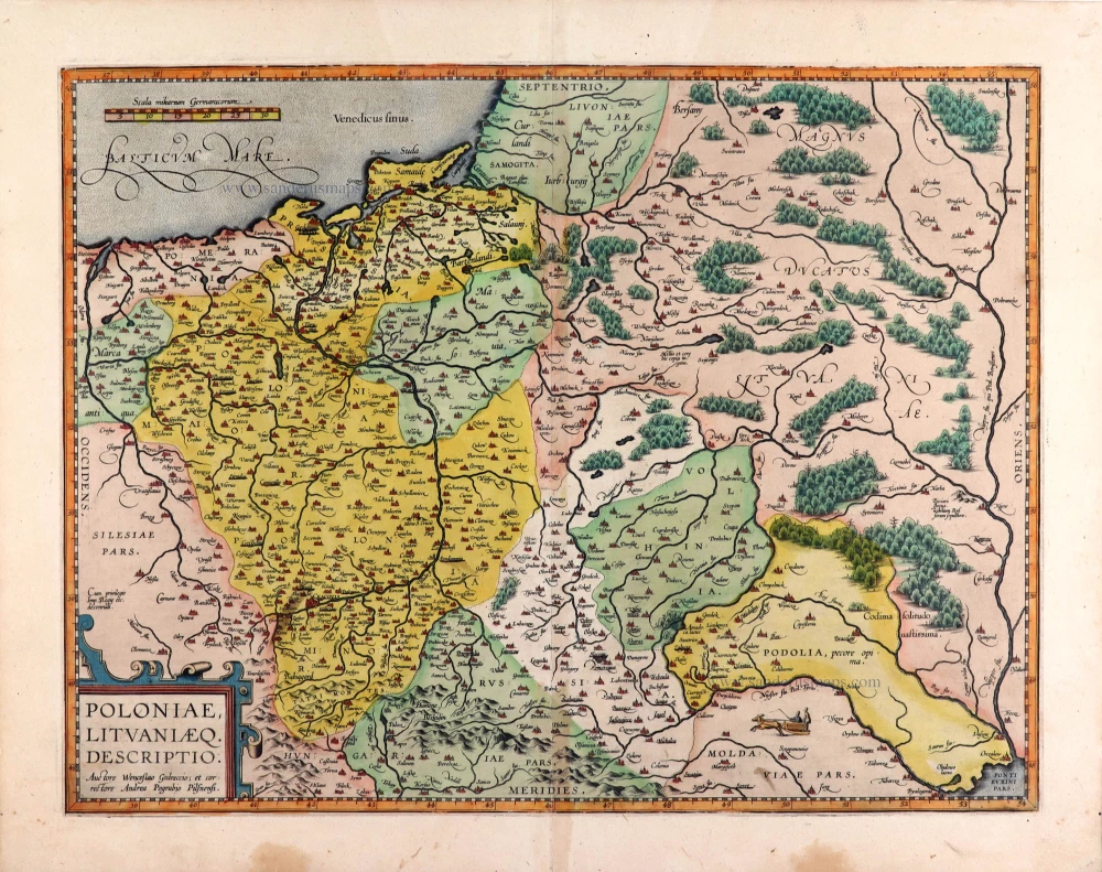
Poloniae, Lituaniaeq. Descriptio. 1595
Lithuania, Poland & Ukraine by Abraham Ortelius
[Item number: 29857]
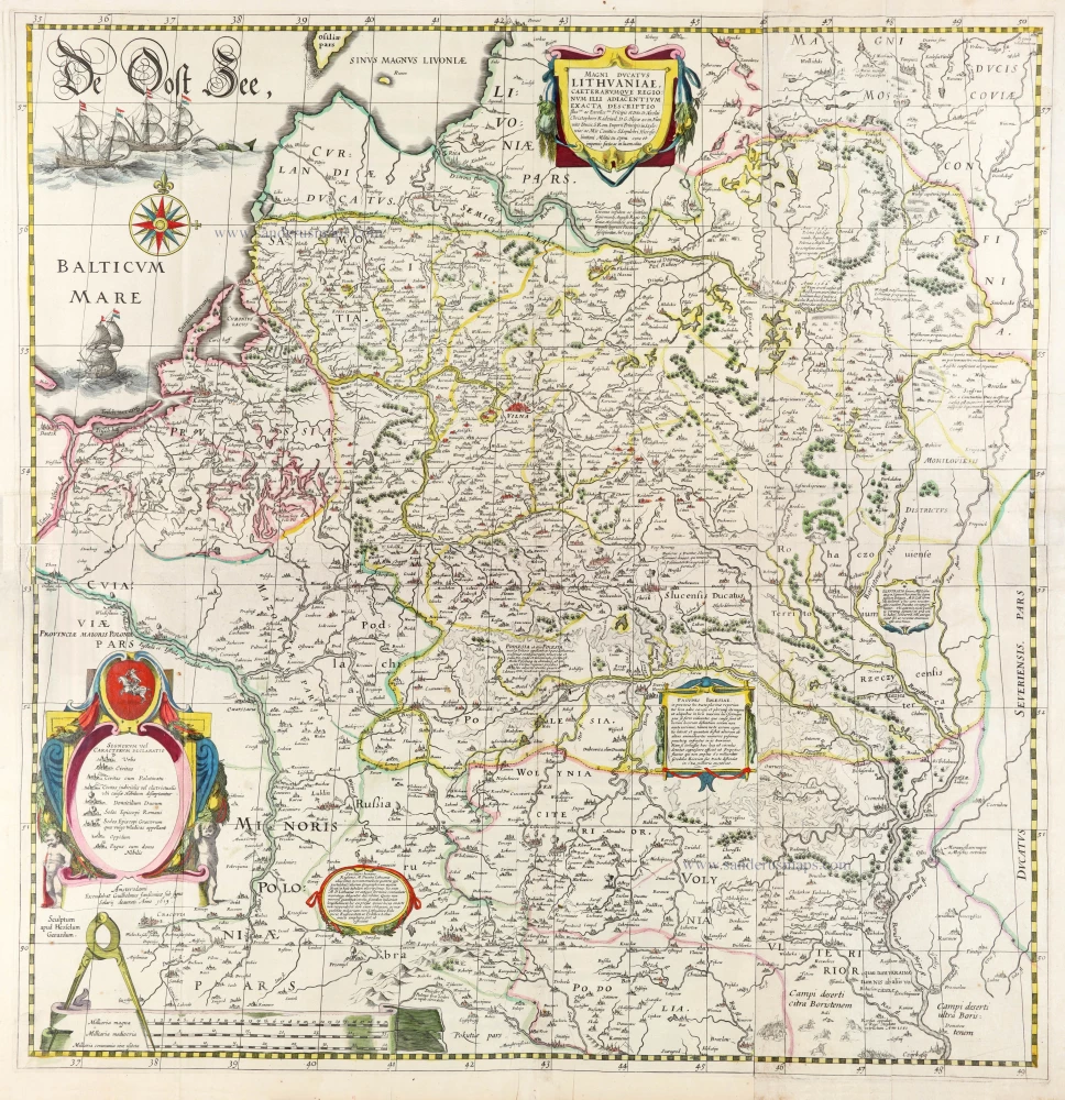
The most important wall map of Lithuania from the 17th century.
Magni Ducatus Lithuaniae Caeterarumque Regionum illi Adiacentium Exacta Descriptio. 1643
Lithuania, by Willem Blaeu.
[Item number: 30171]
Poloniae Nova et Descriptio. 1653
Poland by Johannes Janssonius.
[Item number: 30345]
new