
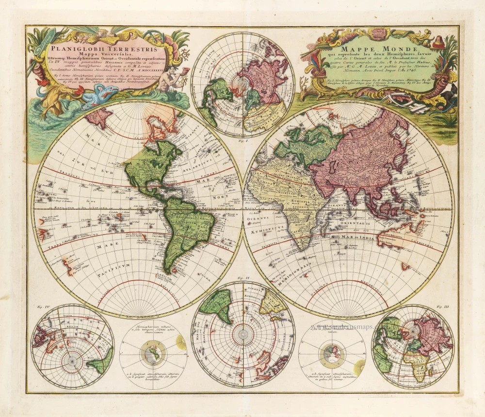
World by Homann Heirs, double hemisphere with six smaller projections. 1746


The Homann Family
Johann Baptist Homann (1664-1724) was born in Oberkammlach in Southern Germany. Around 1693 Homann moved to Vienna, where he lived and studied printing and copper plate engraving until 1695. In 1702 he founded a map publishing company in Nuremberg, which is recognized as one of the most important German map publishers of the eighteenth century. In the next five years, Homann produced hundreds of maps and developed a distinctive style characterized by heavy detailed engraving, elaborate allegorical cartouche work, and vivid hand colour. He published his first atlas in 1707. Homann's company successfully competed with leading European mapmakers. By 1715 Homann's rising star caught the attention of the Holy Roman Emperor Charles the VI, who appointed him Imperial Cartographer. In the same year, he was also appointed a member of the Royal Academy of Sciences in Berlin. Homann's prestigious title came with several significant advantages, including access to the most up to date cartographic information as well as the "Privilege". In 1716 Homann published his masterpiece Grosser Atlas über die ganze Welt (Grand Atlas of all the World).
After Johann Baptist Homann's death in 1724, Johan Christoph Homann (1703-1730) and other heirs continued the company under the name Homann's Erben (Homann's Heirs) until 1852.
Planiglobii Terrestris Mappa Universalis utrumque Hemisphaerium Orient et Occidentale Repraesentans ex IV. Mappis Generalibus ... / Mappe-Monde qui Represente les Deux Hemispheres Savoir celui de l'Orient et celui de l'Occident ...
Item Number: 28839 Authenticity Guarantee
Category: Antique maps > World and Polar
Old, antique map of Double hemispheres world map with four smaller projections, by Homann Heirs.
Title: Planiglobii Terrestris Mappa Universalis utrumque Hemisphaerium Orient et Occidentale Repraesentans ex IV. Mappis Generalibus ... / Mappe-Monde qui Represente les Deux Hemispheres Savoir celui de l'Orient et celui de l'Occident ...
Excudentibus Homanianis Heredibus C.P. S.C.M A. MDCCCCCCVI.
Cartographer: J.M. Haas.
Engraver: J.M. Lowitz.
Date: 1746.
Copper engraving, printed on paper.
Map size: 460 x 540mm (18.11 x 21.26 inches).
Sheet size: 540 x 615mm (21.26 x 24.21 inches).
Verso: Blank.
Condition: Original coloured, excellent.
Condition Rating: A+.
From: Grosser Atlas. Nürnberg, c. 1757.
The Homann Family
Johann Baptist Homann (1664-1724) was born in Oberkammlach in Southern Germany. Around 1693 Homann moved to Vienna, where he lived and studied printing and copper plate engraving until 1695. In 1702 he founded a map publishing company in Nuremberg, which is recognized as one of the most important German map publishers of the eighteenth century. In the next five years, Homann produced hundreds of maps and developed a distinctive style characterized by heavy detailed engraving, elaborate allegorical cartouche work, and vivid hand colour. He published his first atlas in 1707. Homann's company successfully competed with leading European mapmakers. By 1715 Homann's rising star caught the attention of the Holy Roman Emperor Charles the VI, who appointed him Imperial Cartographer. In the same year, he was also appointed a member of the Royal Academy of Sciences in Berlin. Homann's prestigious title came with several significant advantages, including access to the most up to date cartographic information as well as the "Privilege". In 1716 Homann published his masterpiece Grosser Atlas über die ganze Welt (Grand Atlas of all the World).
After Johann Baptist Homann's death in 1724, Johan Christoph Homann (1703-1730) and other heirs continued the company under the name Homann's Erben (Homann's Heirs) until 1852.
Related items

Orbis Vetus in utraque Continente juxta Mentem Sansonianam Distinctus, nec non Observationibus Astronomicis Redactus ... c. 1757
The world by Robert de Vaugondy.
[Item number: 5092]
Superb condition
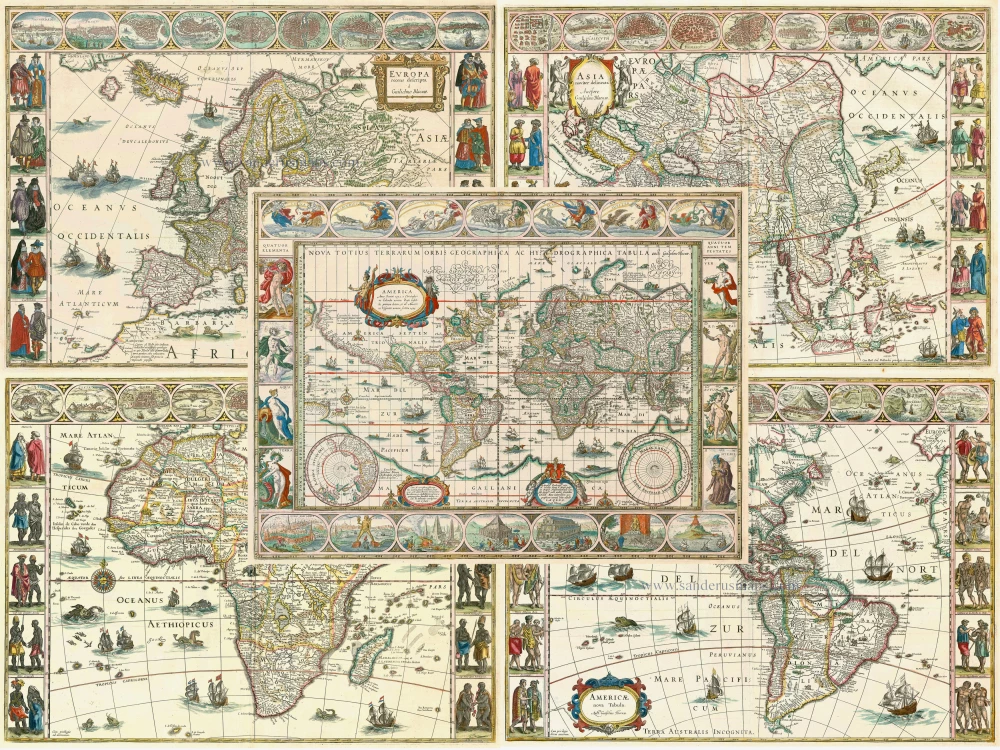
Nova Totius Terrarum Orbis Geographica ac Hydrographica. 1643-50
Willem Blaeu, set of 5 maps: World & continents.
[Item number: 24287]
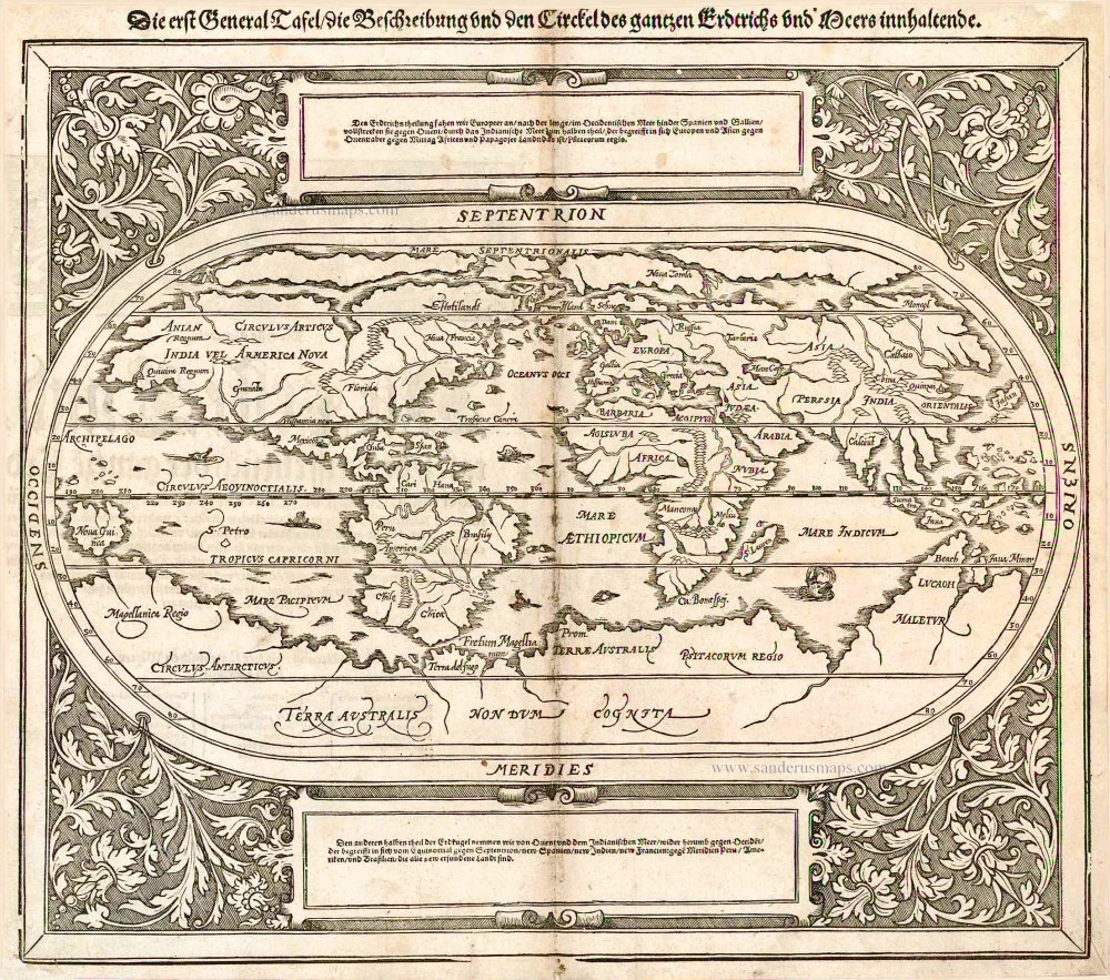
Die erst General Tafel / die Beschreibung und den Circkel des gantzen Erdtrichs und Meers innhaltende. 1588
World by Sebastian Münster.
[Item number: 25622]

Rare variant.
Cosmographia Universalis. 1592
World map by H. Bünting - D.A. Veleslavina.
[Item number: 26356]
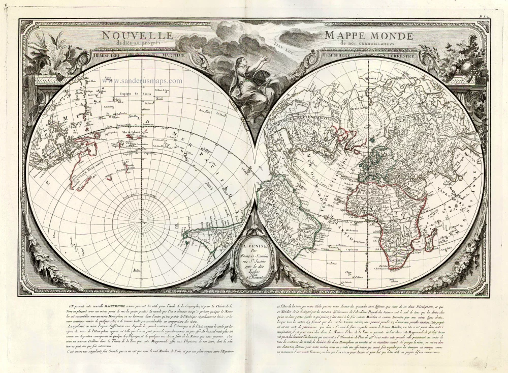
Nouvelle Mappe Monde Dediee au Progres de nos Connoissances. 1776-79
World by Francesco Santini.
[Item number: 26946]

Universi Orbis Descriptio. 1597
World by Giovanni Magini
[Item number: 27837]
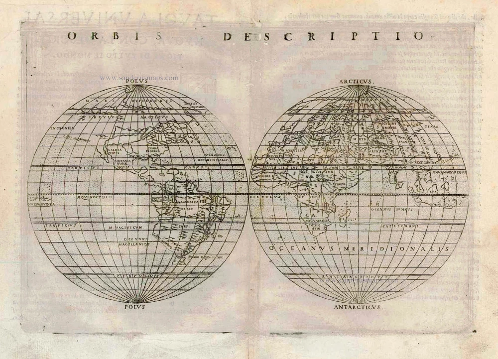
One of the first double hemisphere world maps.
Orbis Descriptio. 1564
World by Girolamo Ruscelli.
[Item number: 27838]
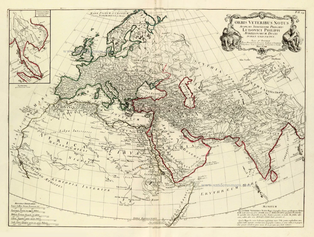
Orbis Veteribus Notus 1776-79
Ancient world, by Francesco & Paolo Santini, after J.B. Bourguignon D'Anville.
[Item number: 28103]
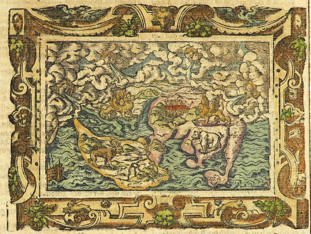
The most mystical world map of all time.
[No title] 1560-1600
Daniel's Dream Map. The Wittenberg world map.
[Item number: 28159]
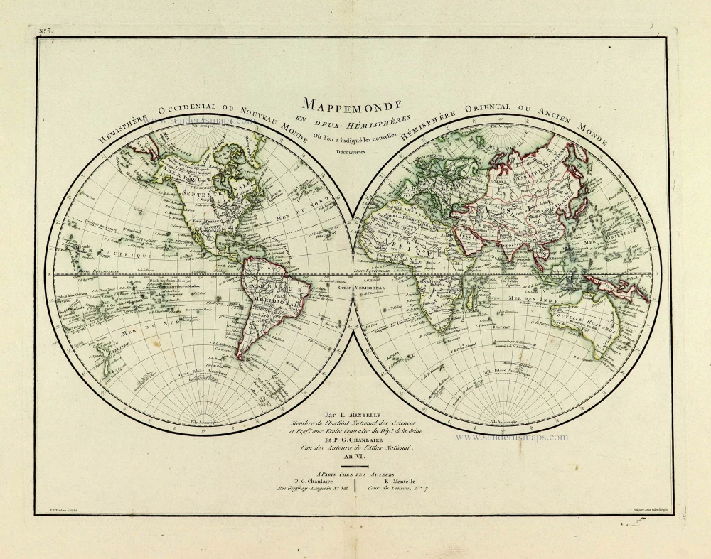
Mappemonde en deux Hémisphères. c. 1797
World map, double hemisphere by Pierre Grégoire Chanlaire.
[Item number: 28209]
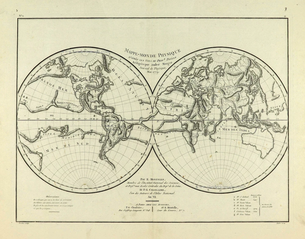
Mappe-Monde Physique. c. 1797
World map, double hemisphere by Pierre Grégoire Chanlaire.
[Item number: 28210]
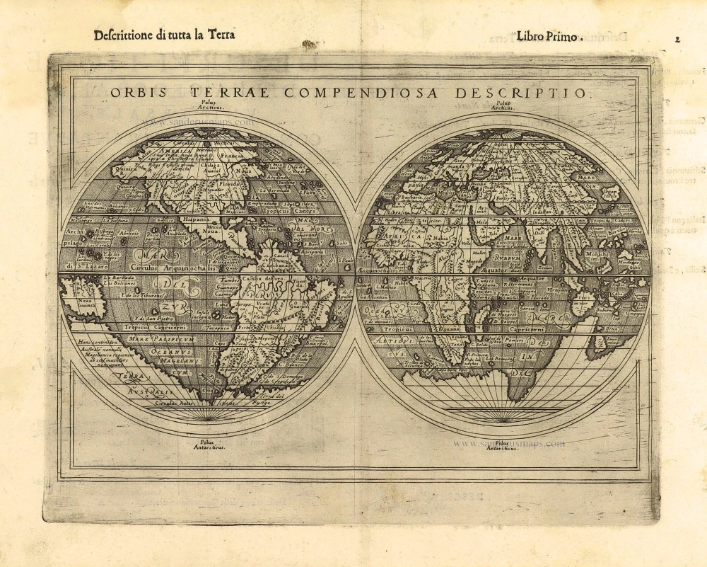
First edition
Orbis Terrae Compendiosa Descriptio. 1598
World by Giuseppe Rosaccio, double hemisphere.
[Item number: 28289]
The engraving and layout and elegance of decoration are all of the highest standards.
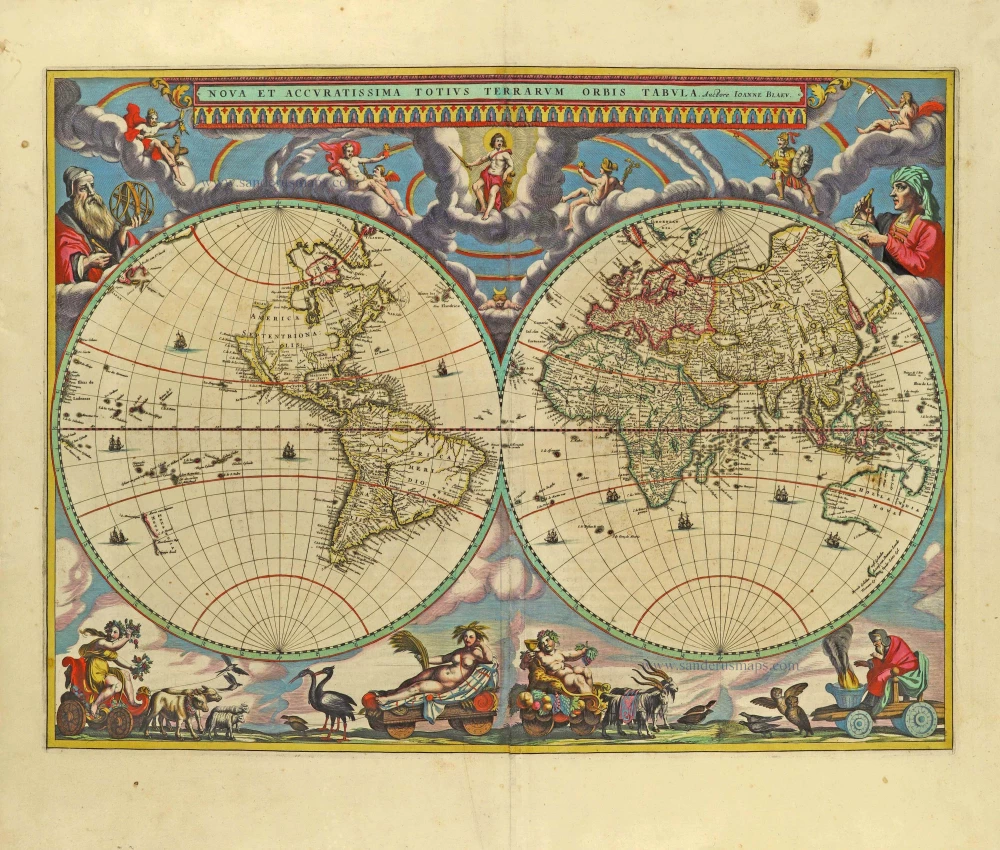
Nova Et Accuratissima Totius Terrarum Orbis Tabula. 1659
World by Joan Blaeu, double hemisphere.
[Item number: 28336]
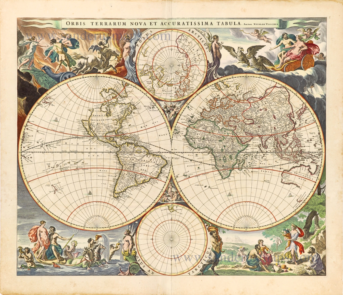
Orbis Terrarum Nova et Accuratissima Tabula. c. 1678
World by Nicolaas Visscher, double hemisphere.
[Item number: 28628]
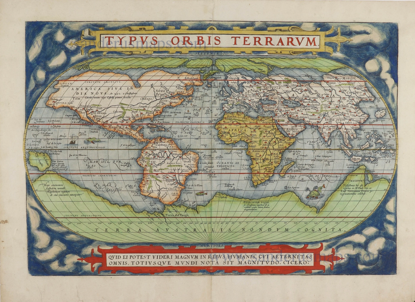
Typus Orbis Terrarum. 1579
World, by Abraham Ortelius.
[Item number: 28640]

A fine ornate example of the decorative cartography of the time.
Nova Totius Terrarum Orbis Geographica ac Hydrographica Tabula. Auct: Henr: Hondio. 1641
Double-hemisphere world map by Henricus Hondius.
[Item number: 28768]
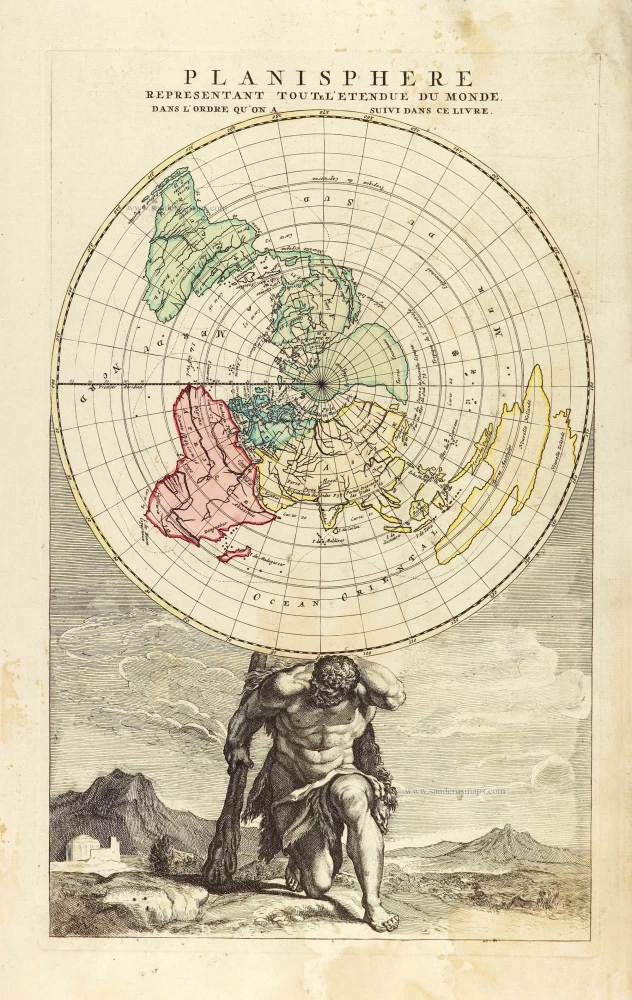
Planisphere representant toute l'Etendue du Monde, dans l'ordre qu'on a suivi dans ce livre. 1792
World in north polar azimuthal projection.
[Item number: 28810]
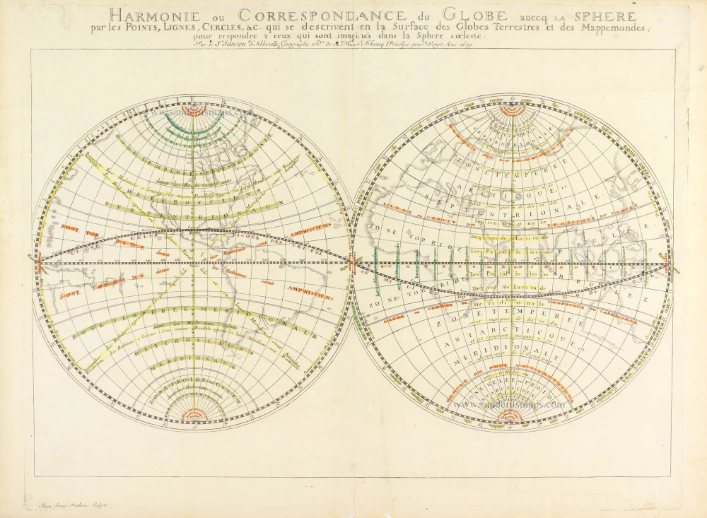
Harmonie ou Correspondance du globe avecq la sphere par les points, lignes, cercles, etc. qui se descrivent en la surface du globe terrestres et des mappemondes; pour respondre a ceux qui sont imaginés dans la sphere coeleste. 1659
World in two hemispheres, by Nicolas Sanson.
[Item number: 28886]

Luxury colouring.
Orbis Terrarum Nova et Accuratissima Tabula. c. 1678
Double-hemisphere world map, by Nicolaas Visscher I.
[Item number: 28934]
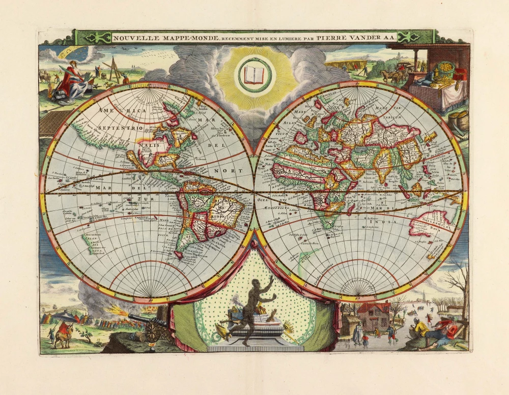
Nouvelle Mappe-Monde, 1710
World by Pieter Van der Aa, double hemisphere.
[Item number: 29136]
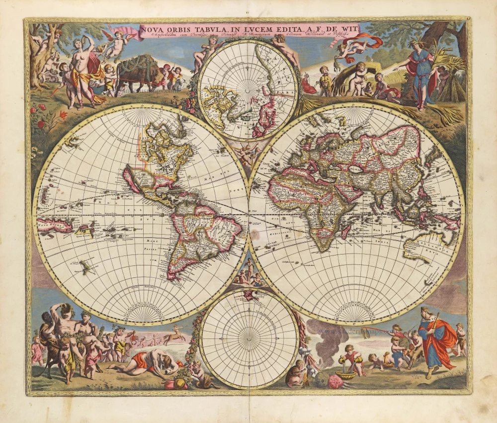
Nova Orbis Tabula in Lucem Edita, A. F. De Wit. c. 1690
World by Frederik De Wit, double hemisphere.
[Item number: 29231]
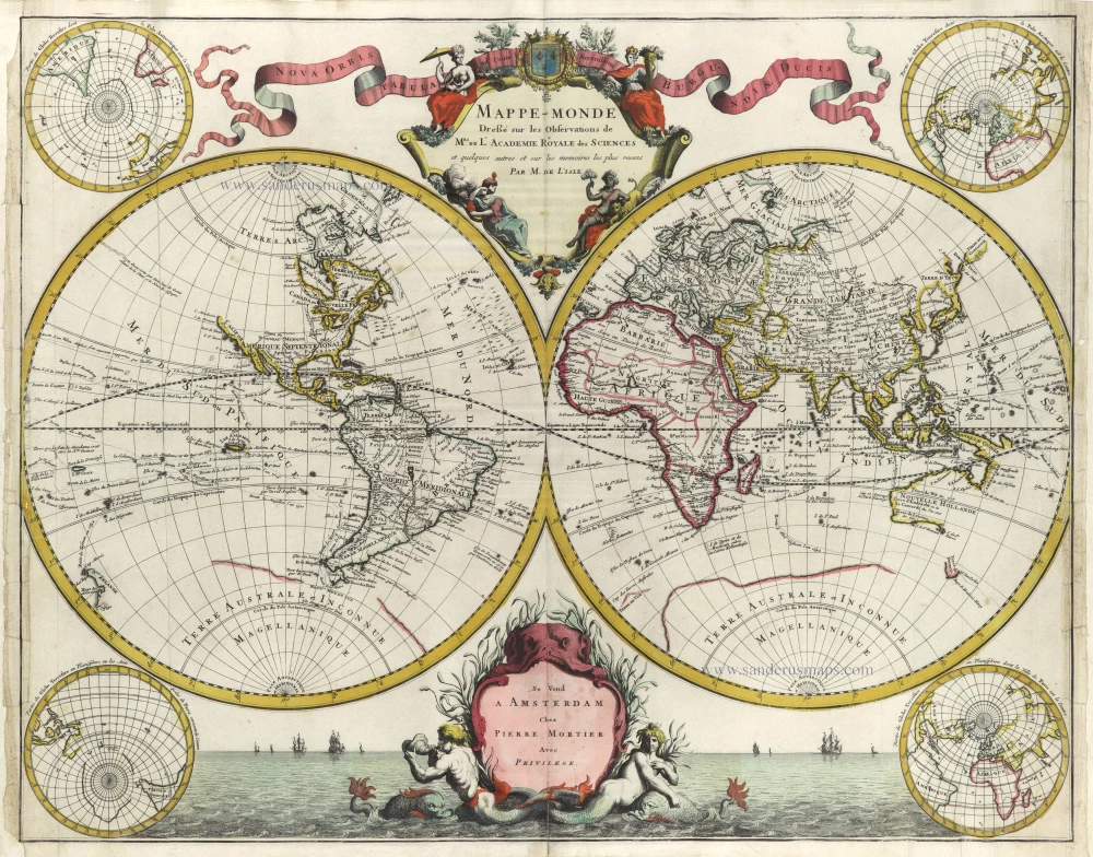
Mappe-Monde Dreßé sur les Observations de Mrs. de l'Academie Royale des Sciences et quelques autres et sur les memoires les plus recens. 1705-1711
World in two hemispheres by Pieter Mortier.
[Item number: 29509]
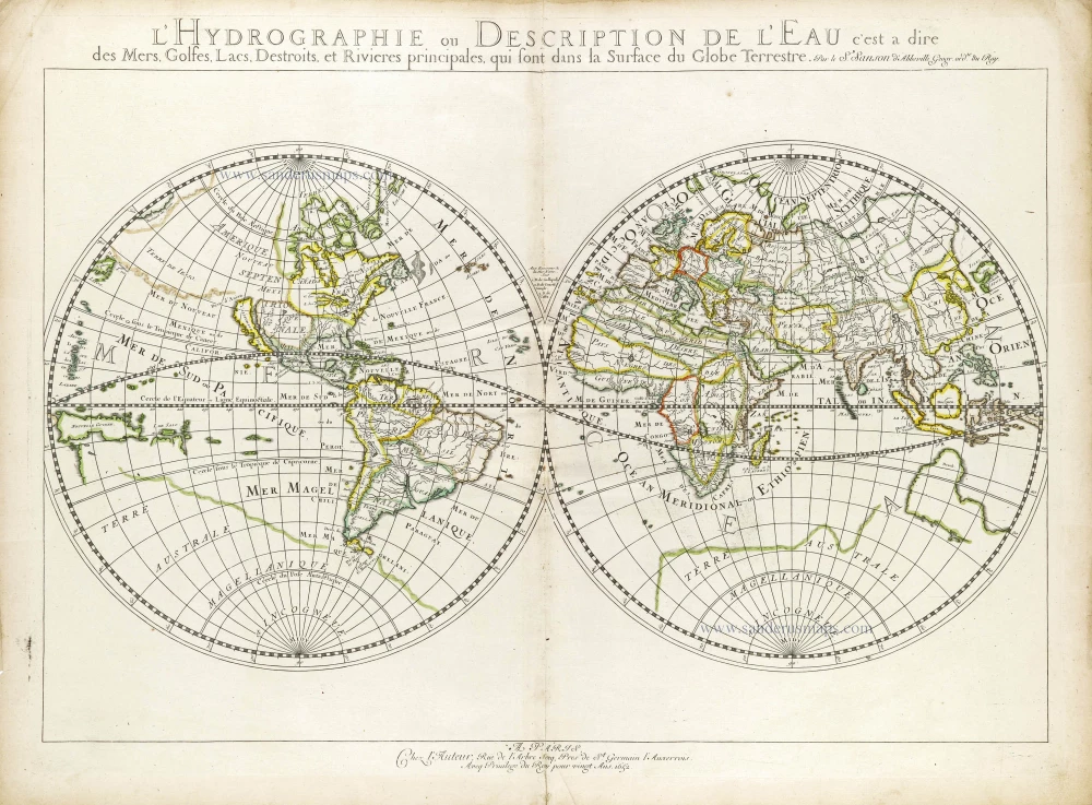
L'Hydrographie ou Description de l'Eau c'est a Dire des Mers, Golfes, Lacs, Destroits et Rivieres Principales qui sont dans la Surface du Globe Terrestre. 1652
World map, double-hemisphere by Nicolas Sanson.
[Item number: 29606]
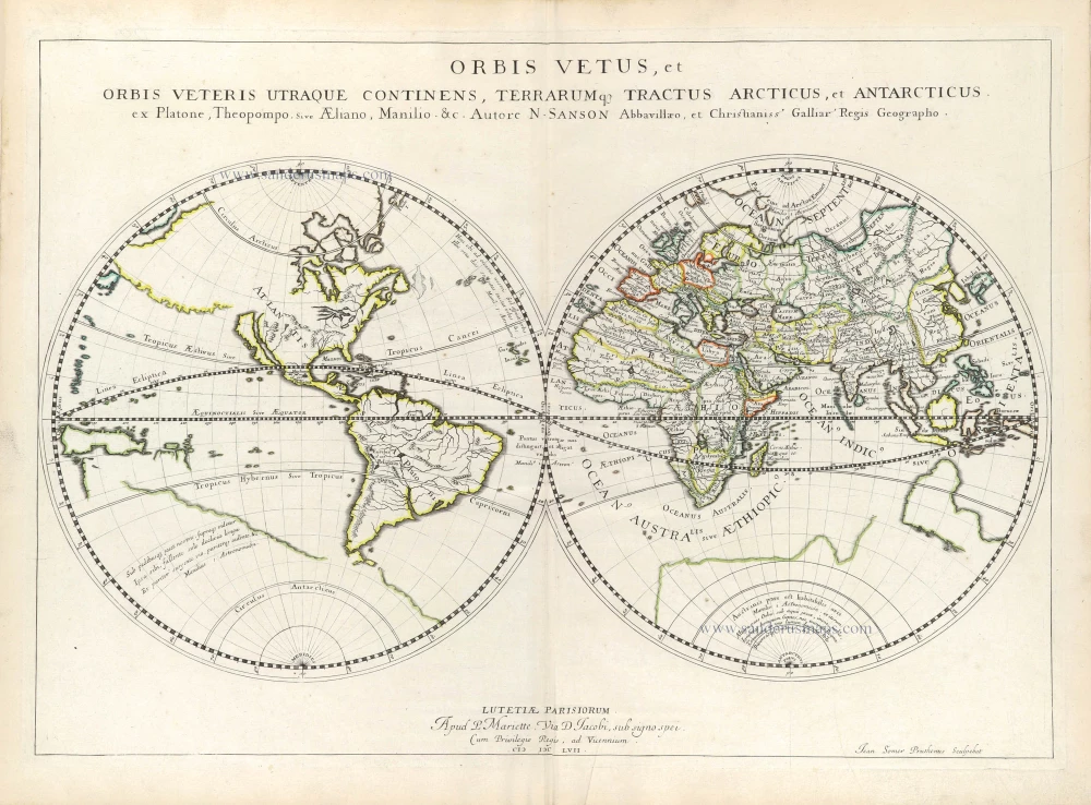
Orbis Vetus, et Orbis Veteris Ultraque continens, Terrarumq. Tractus Arcticus, et Antarcticus ex Platone, Theopompo, sive Aeliano, Manilio &c. 1658
Double hemisphere map of the Ancient World by Nicolas Sanson.
[Item number: 29609]

Mappe-Monde, ou Carte Generale du Monde, 1652
Double hemisphere world map by Nicolas Sanson.
[Item number: 29612]
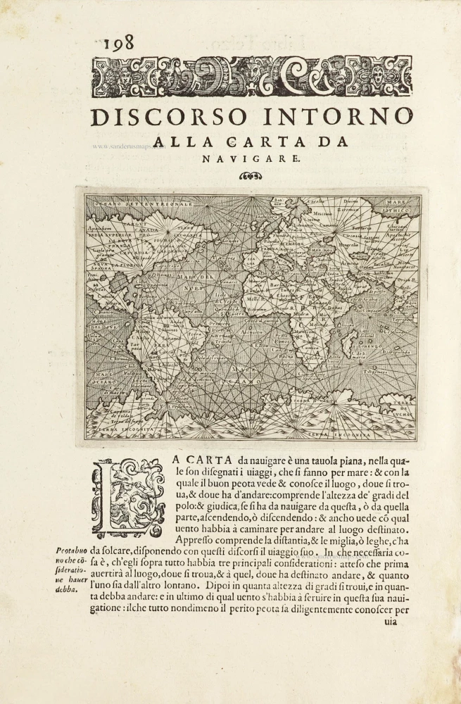
Discorso Intorno alla Carta da Navigare. 1590
World, by Thomaso Porcacchi.
[Item number: 29786]