
Rare.
The XVII Provinciën by A. Goos. 1621
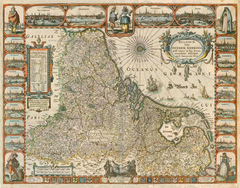


The map of the Seventeen Provinces, engraved and printed by Abraham Goos in 1618, is an example of his activities in the field of the single-sheet map.
The map image in the centre is oriented with the west at the top and is based mainly on the 1608 map of the Seventeen Provinces by Willem Jansz (Blaeu). A striking feature in the map content is the intentional omission of the region known as Leodiensis Episcopatus. This Prince-bishopric of Liege is blank on the map because it does not form part of the Seventeen Provinces in the legal sense (the Goos map is an exception in this respect) because all the other maps of the Seventeen Provinces include the Prince-bishopric of Liege. The reclamation of the Zijpe, Beemster and Purmer polders and a small area in the Dollart region are indicated on the map.
Abraham Goos (c. 1590-1643)
Abraham Goos was active as a map engraver for the workshops of Claes Jansz Visscher and the Hondius family and engraved and published on his account. In 1616 Goos published his Nieuw Nederlandtsch Caertboeck, a small atlas of the Seventeen Provinces in 23 maps.
Belgium Sive Inferior Germania post omnes in hac forma, exactissime descripta.
Item Number: 4048 Authenticity Guarantee
Category: Antique maps > Europe > The Low Countries
Old, antique map of XVII Provinciën by A. Goos.
Title: Belgium Sive Inferior Germania post omnes in hac forma, exactissime descripta.
Oriented to the west.
Date of the first edition: 1618.
Date of this map: 1621.
Date on map: 1621.
Copper engraving, printed on paper.
Size (not including margins): 425 x 555mm (16.73 x 21.85 inches).
Verso: Blank.
Condition: Coloured, cleaned and restored at margins and centrefold.
Condition Rating: C.
From: Atlantis Maioris Appendix. Amsterdam, J. Janssonius, 1630. (Van der Krogt 1, 1:202)
Second state of this beautiful and very rare map (first state 1618), now published by J. Janssonius.
The map of the Seventeen Provinces, engraved and printed by Abraham Goos in 1618, is an example of his activities in the field of the single-sheet map.
The map image in the centre is oriented with the west at the top and is based mainly on the 1608 map of the Seventeen Provinces by Willem Jansz (Blaeu). A striking feature in the map content is the intentional omission of the region known as Leodiensis Episcopatus. This Prince-bishopric of Liege is blank on the map because it does not form part of the Seventeen Provinces in the legal sense (the Goos map is an exception in this respect) because all the other maps of the Seventeen Provinces include the Prince-bishopric of Liege. The reclamation of the Zijpe, Beemster and Purmer polders and a small area in the Dollart region are indicated on the map.
Abraham Goos (c. 1590-1643)
Abraham Goos was active as a map engraver for the workshops of Claes Jansz Visscher and the Hondius family and engraved and published on his account. In 1616 Goos published his Nieuw Nederlandtsch Caertboeck, a small atlas of the Seventeen Provinces in 23 maps.
Related items
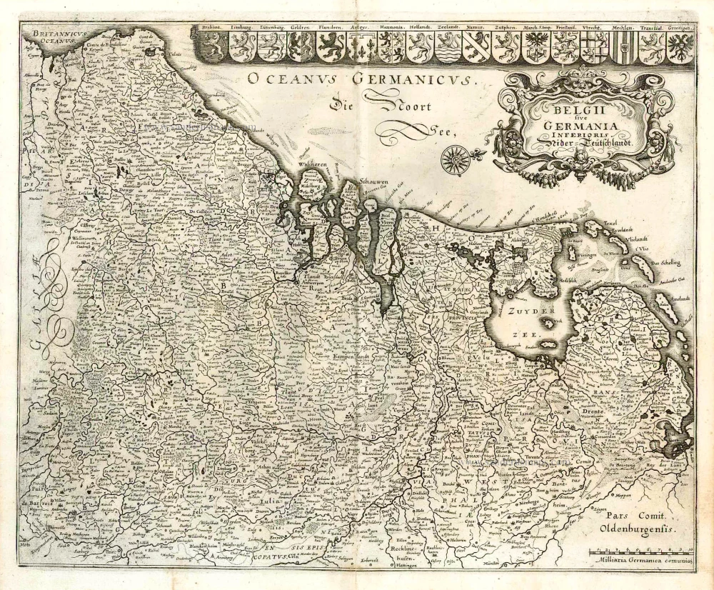
Belgii sive Germania Inferioris - Nider Teutschlandt. 1638
The 17 Provinces, by Matthäus Merian.
[Item number: 26030]
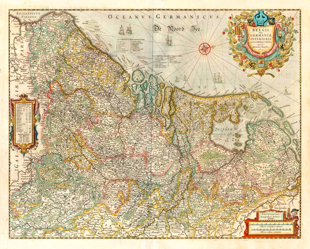
belgii sive germaniae inferioris accuratissima tabula. auctore henrico hondio 1631. amstelodami, sumptibus henrici hondio 1631. 1641
The 17 Provinces, by Henricus Hondius.
[Item number: 26301]