
Southern India, by J.V. Bouchet. 1726
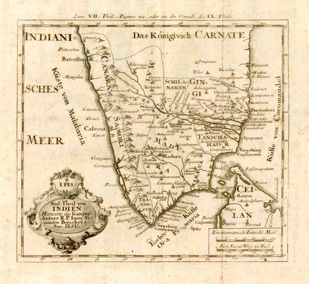
This is one of the earliest maps to accurately detail the interior of Southern India, depicting the subcontinent below the 16th degree of latitiude. Features are the great Indian states of the Nawabs of the Carnatic, Mysore, Madura, Tanjore, Cannara, Marava and Travancore. A legend at bottom left identifies "important locations," the residences of princes and governors, churches and temples. The French Jesuit Jean-Venant Bouchet (1655-1732) travelled with the French embassy to Siam in 1688, but the deteriorating political situation soon forced him to leave the for India. Over the next 30 years, Bouchet walked the countryside of Southern India, making careful surveys. In 1719, he dispatched his manuscript maps to France, which were recognized as revolutionary, as they contained the first accurate depiction of the interior of Southern India, especially the Deccan Plateau, within the mountains of the Eastern and Western Ghats.
Sud-Theil von Indien Herwerts des Ganges. Autore R. P. Ioan. Venantio Bouchet e Soc. IESU.
Item Number: 4184 Authenticity Guarantee
Category: Antique maps > Asia > India - Ceylon
Old, antique map of Southern India, by J.V. Bouchet.
Title: Sud-Theil von Indien Herwerts des Ganges. Autore R. P. Ioan. Venantio Bouchet e Soc. IESU.
Date: 1726.
Copper engraving, printed on paper.
Size (not including margins): 210 x 230mm (8.27 x 9.06 inches).
Verso: Blank.
Condition: Some light foxing.
Condition Rating: A.
From: Stöcklein J. Allerhand So Lehr- als Geistreiche Brief, Schriften und Reis-Beschreibungen, ... Augsburg, 1726.
This is one of the earliest maps to accurately detail the interior of Southern India, depicting the subcontinent below the 16th degree of latitiude. Features are the great Indian states of the Nawabs of the Carnatic, Mysore, Madura, Tanjore, Cannara, Marava and Travancore. A legend at bottom left identifies "important locations," the residences of princes and governors, churches and temples. The French Jesuit Jean-Venant Bouchet (1655-1732) travelled with the French embassy to Siam in 1688, but the deteriorating political situation soon forced him to leave the for India. Over the next 30 years, Bouchet walked the countryside of Southern India, making careful surveys. In 1719, he dispatched his manuscript maps to France, which were recognized as revolutionary, as they contained the first accurate depiction of the interior of Southern India, especially the Deccan Plateau, within the mountains of the Eastern and Western Ghats.
Related items
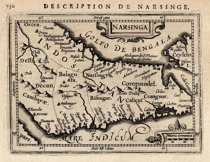
Narsinga. 1618
Narsinga, by P. Bertius.
[Item number: 18299]
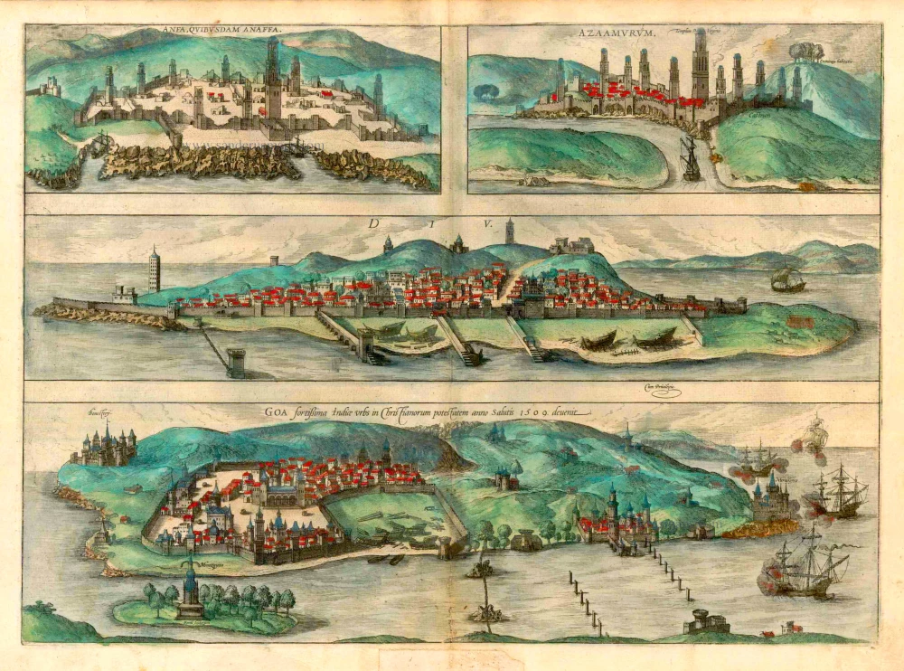
Anfa, quibusdam Anaffa [on sheet with] Azaamurum [and] Diu [and] Goa. 1582
Casablanca (Anfa) - Azemmour (Azamor) - Diu - Old Goa (Velha Goa), by Braun & Hogenberg.
[Item number: 25333]
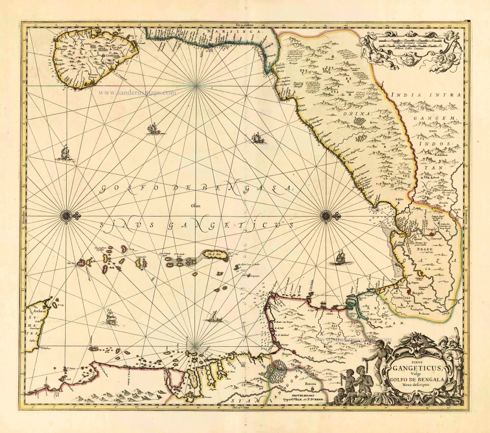
Sinus Gangeticus Vulgo Golfo de Bengala Nova Descriptio. c. 1700
Gulf of Bengal, by G. Valk & P. Schenk.
[Item number: 25835]
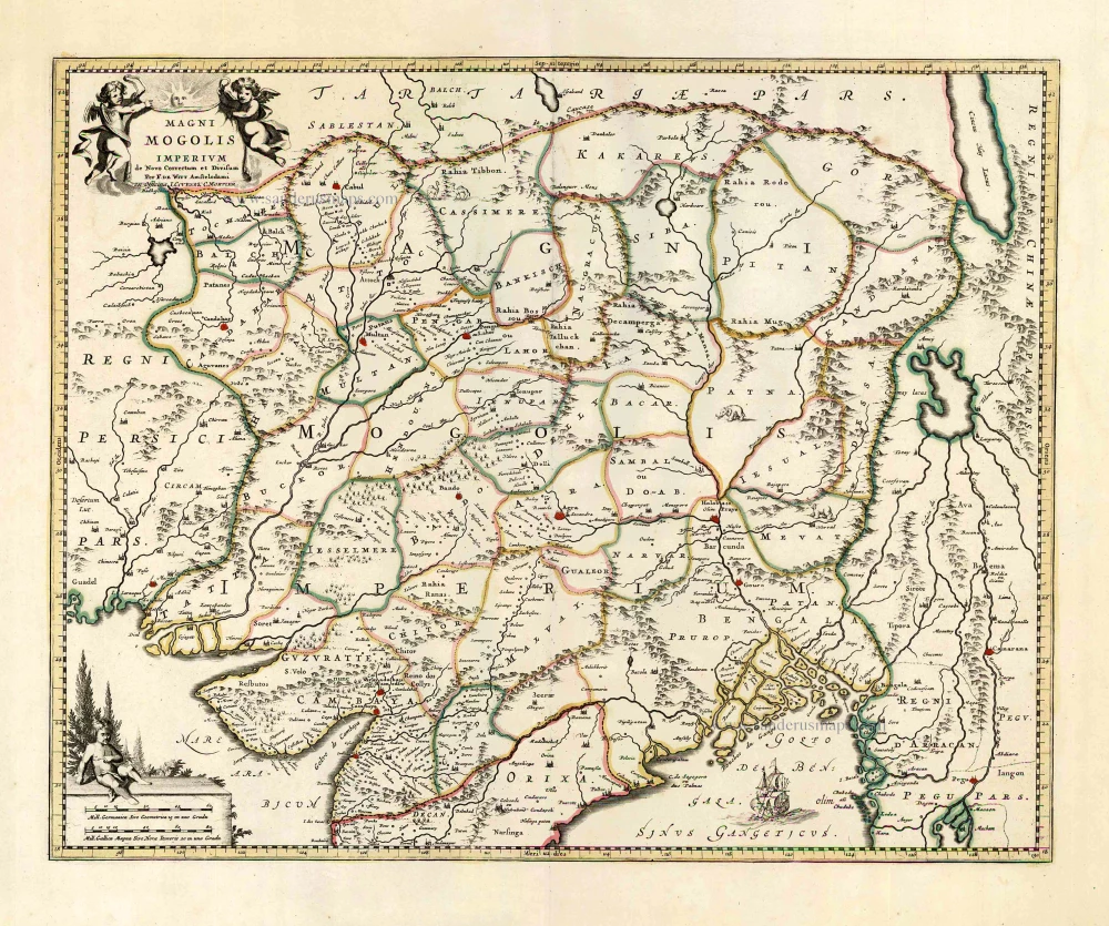
Magni Mogolis Imperium. After 1721
Mongol Empire, by Frederick de Wit - Covens & Mortier.
[Item number: 25838]

Goa. 1638
Goa, by M. Merian.
[Item number: 25903]
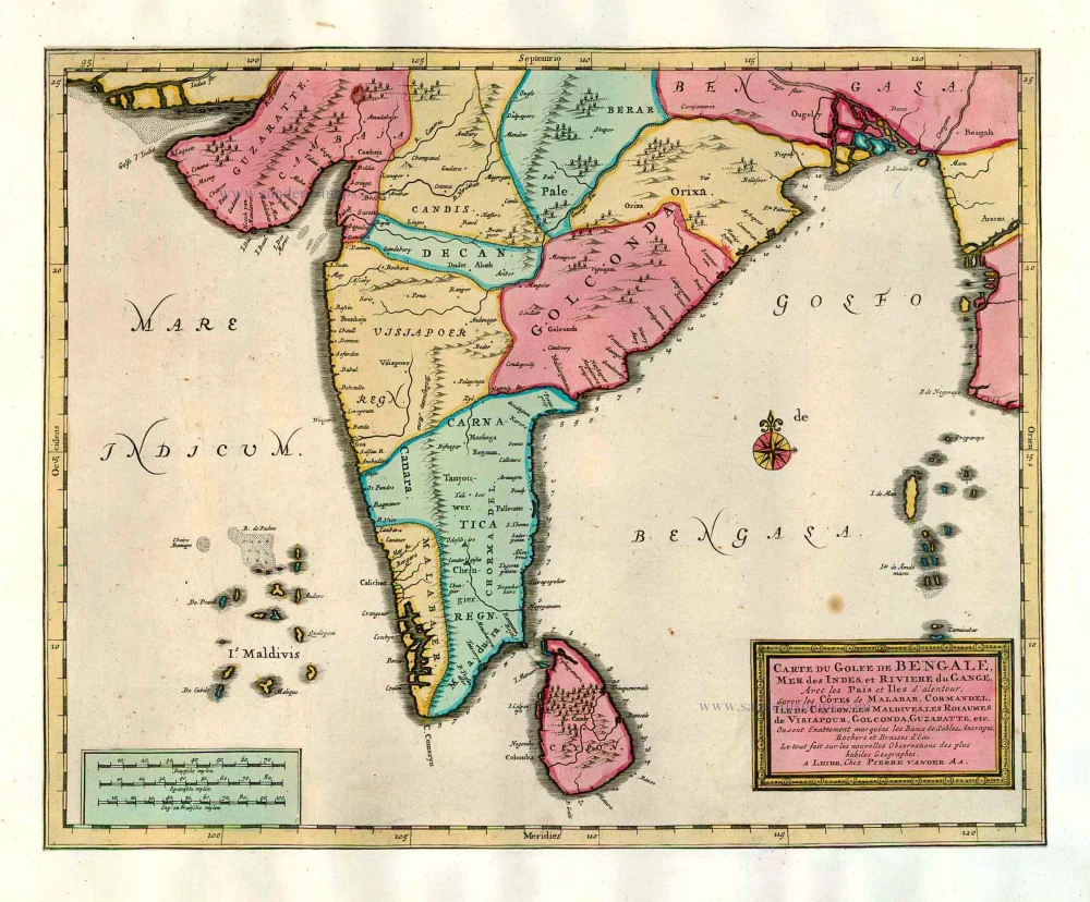
Carte du Golfe de Bengale, Mer des Indes, et Riviere du Gange, Avec les Païs et Iles d'alentour, Savoir les Côtes de Malabar, Cormandel, Ile de Ceylon, les Maldives, les Rolaumes de Visiapour, Golconda, Guzaratte, etc. 1713
India and Ceylon (Sri Lanka), by Pieter van der Aa.
[Item number: 26095]
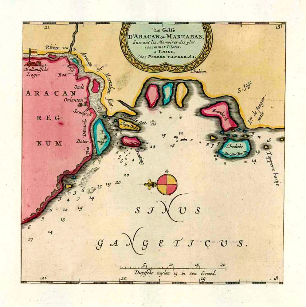
Le Golfe D'Aracan ou Martaban. 1713
The Gulf of Martaban, by Pieter van der Aa.
[Item number: 26106]
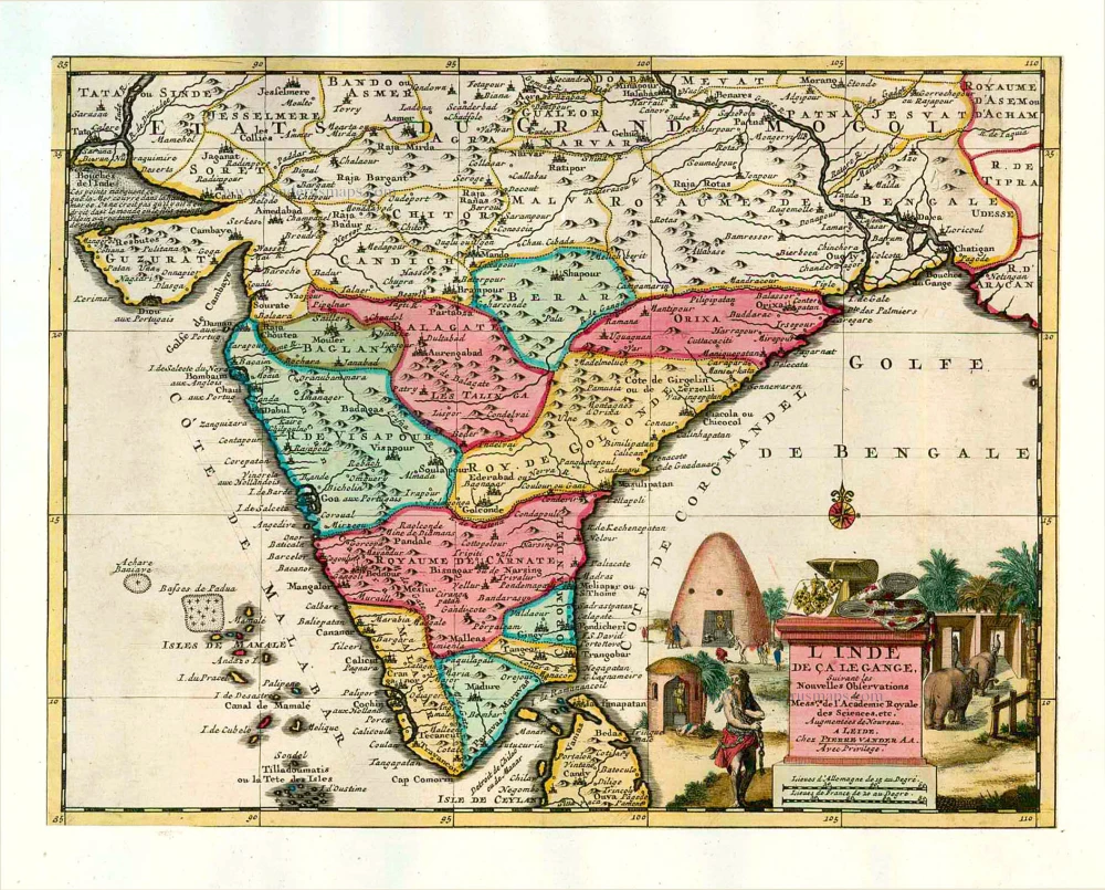
L'Inde de ça le Gange. 1713
India, by Pieter van der Aa.
[Item number: 26107]
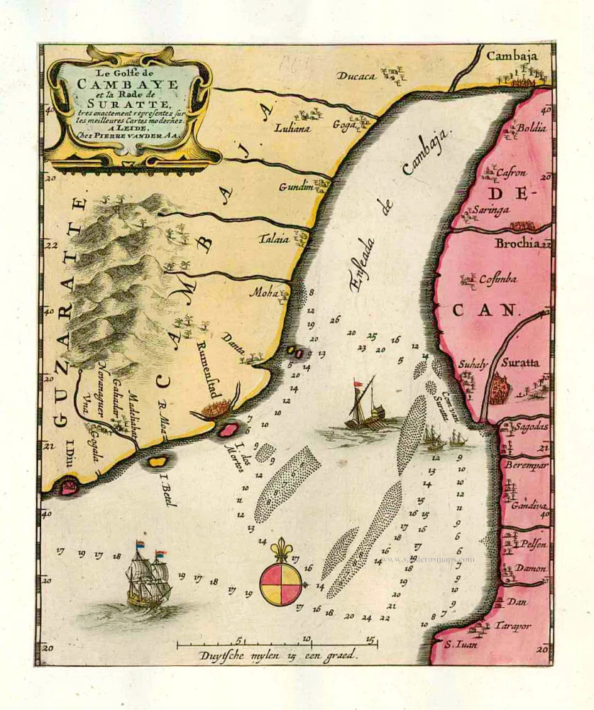
Le Golfe de Cambaye et la Rade de Suratte, tres exactement representez sur les meilleures Cartes modernes. 1713
The gulf of Cambay and the coast of Surat. by P. Van der Aa
[Item number: 26113]
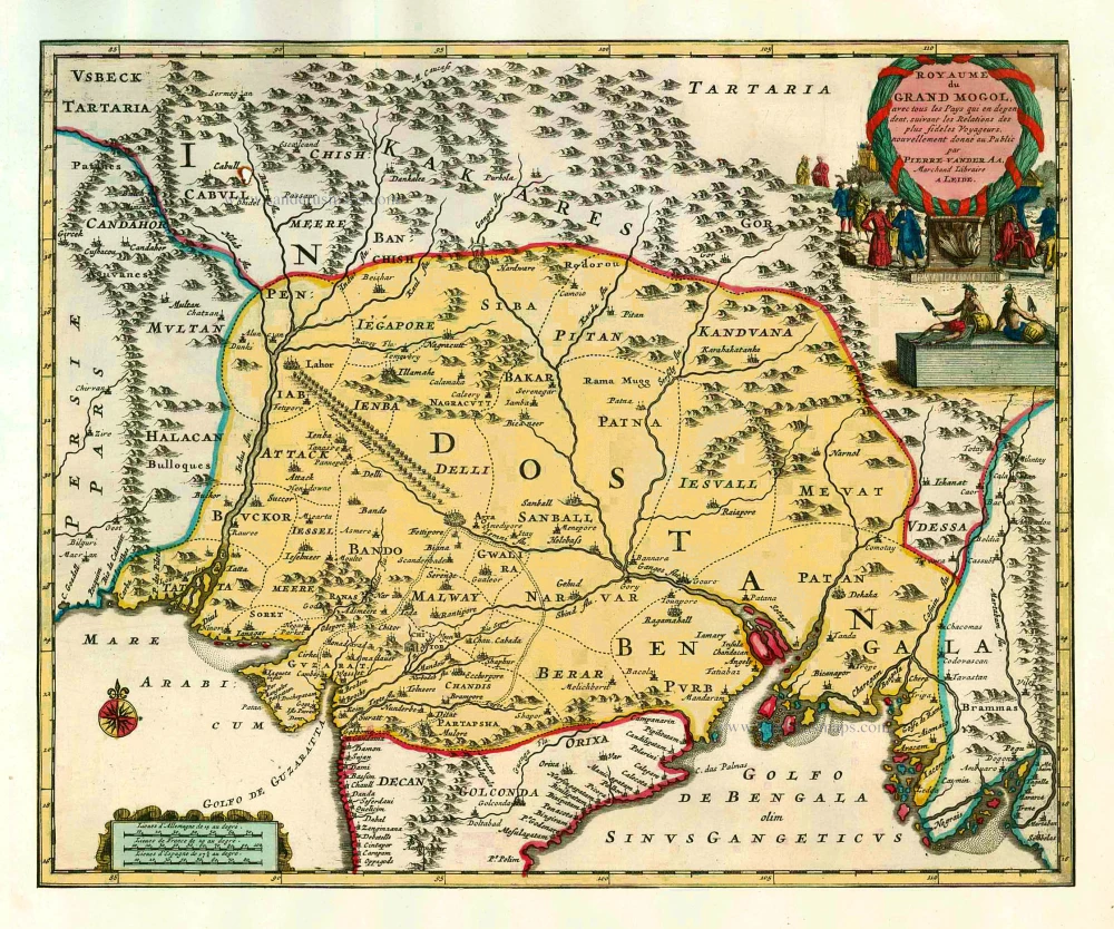
Royaume du Grand Mogol, avec tous les Pays qui en dépendent, suivant les Relations des fideles Voyageurs. 1713
India by Pieter van de Aa
[Item number: 26117]
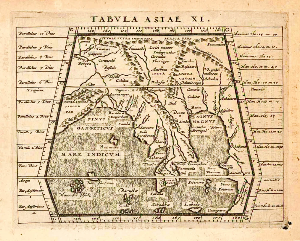
Tabula Asiae XI. 1597
India, by Giovanni Magini
[Item number: 26522]

Peninsula Indiae citra Gangem, hoc est Orae Celeberrimae Malabar & Coromandel. Cum Adjacente Insula non Minus Celebratissima Ceylon. c. 1737
India & Ceylon, by Homann Heirs.
[Item number: 26752]
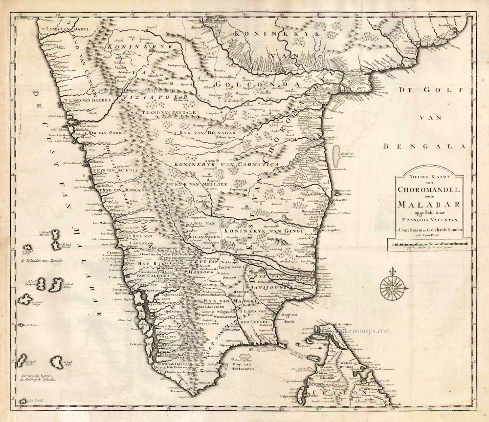
Nieuwe kaart van Choromandel ende Malabar. 1724-26
Southern India, by François Valentyn (Valentijn).
[Item number: 26896]
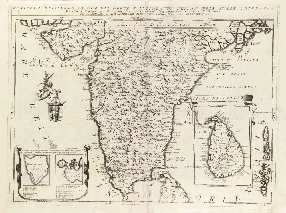
Penisola dell'Indo di qua del Gange, e l'Isola di Ceilan nell'Indie Orientali. 1696
India - Ceylon (Sri Lanka) by Vincenzo Coronelli.
[Item number: 28674]