
Middelburg by Braun & Hogenberg 1575
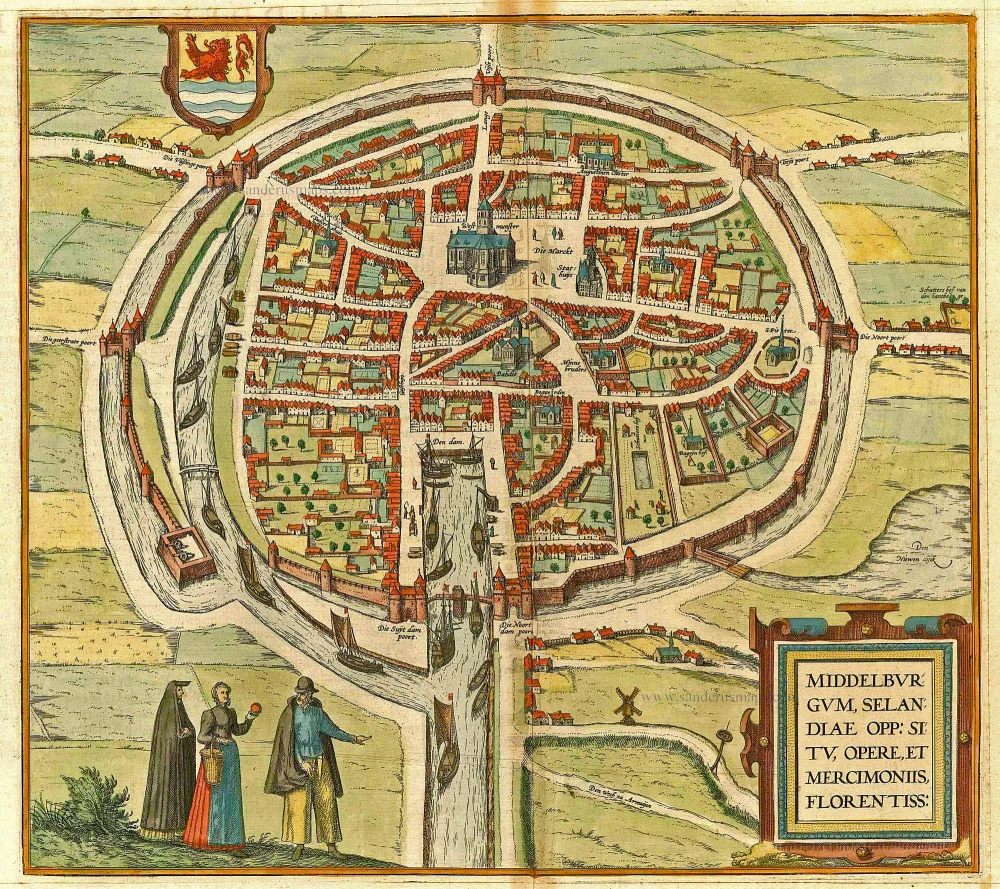
TRANSLATION OF CARTOUCHE TEXT: Middelburg in Zeeland, a town highly reputed for its favourable location and industrious trade.
COMMENTARY BY BRAUN: "From Middelburg there are two channels that are navigable as far as Arnemuiden; one goes in a straight line and is so deep and so wide that ships can easily pass through it, even when they are loaded with 200 barrels of wine. Middelburg is the most important trade centre for wines that are brought to the Netherlands over the sea from France, Spain, Portugal or other places."
This bird's-eye view from the southeast shows the capital of Zeeland province, on the Island of Walcheren. The favourable geographical location and an import monopoly on spices, silk cloth and French wines led to Middelburg being granted a town charter as early as 1217, and in the 16th century it was a prosperous trading city with a population of 30,000. The influential Vereenigde Oostindische Compagnie (VOC) had 336 ships built here between 1602 and 1795. The splendid town hall (Stathuys), built in the late Gothic style under Charles the Bold, can be identified on the market square. In front of it stands the Onze-Lieve-Vrouwe abbey with the Choir Church (Koorkerk) dating from around 1300 with its 85-m-high tower, "De Lange Jan". (Taschen)
Braun G. & Hogenberg F. and the Civitates Orbis Terrarum.
The Civitates Orbis Terrarum, or the "Braun & Hogenberg", is a six-volume town atlas and the most excellent book of town views and plans ever published: 363 engravings, sometimes beautifully coloured. It was one of the best-selling works in the last quarter of the 16th century. Georg Braun wrote the text accompanying the plans and views on the verso. Many plates were engraved after the original drawings of a professional artist, a professional artist, Joris Hoefnagel (1542-1600). The first volume was published in Latin in 1572, and the sixth in 1617. Frans Hogenberg created the tables for volumes I through IV, and Simon van den Neuwel made those for volumes V and VI. Other contributors were cartographers Daniel Freese and Heinrich Rantzau. Works by Jacob van Deventer, Sebastian Münster, and Johannes Stumpf were also used. Translations appeared in German and French.
Following the original publication of Volume 1 of the Civitates in 1572, seven further editions of 1575, 1577, 1582, 1588, 1593, 1599 and 1612 can be identified. Vol.2, first issued in 1575, was followed by further editions in 1597 and 1612. The subsequent volumes appeared in 1581, 1588, 1593, 1599 and 1606. The German translation of the first volume appeared from 1574 on, and the French edition from 1575 on.
Several printers were involved: Theodor Graminaeus, Heinrich von Aich, Gottfried von Kempen, Johannis Sinniger, Bertram Buchholtz and Peter von Brachel, who all worked in Cologne.
Georg Braun (1541-1622)
Georg Braun was born in Cologne in 1541. After his studies in Cologne, he entered the Jesuit Order as a novice. 1561, he obtained his bachelor's degree, and in 1562, he received his Magister Artium. Although he left the Jesuit Order, he studied theology, gaining a licentiate in theology.
Frans Hogenberg (1535-1590)
Frans Hogenberg was a Flemish and German painter, engraver, and mapmaker. He was born in Mechelen as the son of Nicolaas Hogenberg.
By the end of the 1560s, Frans Hogenberg was employed upon Abraham Ortelius's Theatrum Orbis Terrarum, published in 1570; he is named an engraver of numerous maps. In 1568, he was banned from Antwerp by the Duke of Alva and travelled to London, where he stayed a few years before emigrating to Cologne. He immediately embarked on his two most important works, the Civitates, published in 1572 and the Geschichtsblätter, which appeared in several series from 1569 until about 1587.
Thanks to large-scale projects like the Geschichtsblätter and the Civitates, Hogenberg's social circumstances improved with each passing year. He died as a wealthy man in Cologne in 1590.
Middelburgum, Selandiae Opp: Situ, Opere, et Mercimoniis, Florentiss:
Item Number: 4669 Authenticity Guarantee
Category: Antique maps > Europe > The Netherlands - Cities
Antique bird's-eye view plan of Middelburg by Braun & Hogenberg.
Title: Middelburgum, Selandiae Opp: Situ, Opere, et Mercimoniis, Florentiss:
Date of the first edition: 1575.
Date of this map: 1575.
Copper engraving, printed on paper.
Size (not including margins): 317 x 357mm (12.48 x 14.06 inches).
Verso: Latin text.
Condition: Old coloured, excellent.
Condition Rating: A.
From: Civitates Orbis Terrarum, ... Part 2: De Praecipuis, Totius Universi Urbibus, Liber Secundus. Köln, Gottfried von Kempen, 1575. (Van der Krogt 4, 41:1.2)
TRANSLATION OF CARTOUCHE TEXT: Middelburg in Zeeland, a town highly reputed for its favourable location and industrious trade.
COMMENTARY BY BRAUN: "From Middelburg there are two channels that are navigable as far as Arnemuiden; one goes in a straight line and is so deep and so wide that ships can easily pass through it, even when they are loaded with 200 barrels of wine. Middelburg is the most important trade centre for wines that are brought to the Netherlands over the sea from France, Spain, Portugal or other places."
This bird's-eye view from the southeast shows the capital of Zeeland province, on the Island of Walcheren. The favourable geographical location and an import monopoly on spices, silk cloth and French wines led to Middelburg being granted a town charter as early as 1217, and in the 16th century it was a prosperous trading city with a population of 30,000. The influential Vereenigde Oostindische Compagnie (VOC) had 336 ships built here between 1602 and 1795. The splendid town hall (Stathuys), built in the late Gothic style under Charles the Bold, can be identified on the market square. In front of it stands the Onze-Lieve-Vrouwe abbey with the Choir Church (Koorkerk) dating from around 1300 with its 85-m-high tower, "De Lange Jan". (Taschen)
Braun G. & Hogenberg F. and the Civitates Orbis Terrarum.
The Civitates Orbis Terrarum, or the "Braun & Hogenberg", is a six-volume town atlas and the most excellent book of town views and plans ever published: 363 engravings, sometimes beautifully coloured. It was one of the best-selling works in the last quarter of the 16th century. Georg Braun wrote the text accompanying the plans and views on the verso. Many plates were engraved after the original drawings of a professional artist, a professional artist, Joris Hoefnagel (1542-1600). The first volume was published in Latin in 1572, and the sixth in 1617. Frans Hogenberg created the tables for volumes I through IV, and Simon van den Neuwel made those for volumes V and VI. Other contributors were cartographers Daniel Freese and Heinrich Rantzau. Works by Jacob van Deventer, Sebastian Münster, and Johannes Stumpf were also used. Translations appeared in German and French.
Following the original publication of Volume 1 of the Civitates in 1572, seven further editions of 1575, 1577, 1582, 1588, 1593, 1599 and 1612 can be identified. Vol.2, first issued in 1575, was followed by further editions in 1597 and 1612. The subsequent volumes appeared in 1581, 1588, 1593, 1599 and 1606. The German translation of the first volume appeared from 1574 on, and the French edition from 1575 on.
Several printers were involved: Theodor Graminaeus, Heinrich von Aich, Gottfried von Kempen, Johannis Sinniger, Bertram Buchholtz and Peter von Brachel, who all worked in Cologne.
Georg Braun (1541-1622)
Georg Braun was born in Cologne in 1541. After his studies in Cologne, he entered the Jesuit Order as a novice. 1561, he obtained his bachelor's degree, and in 1562, he received his Magister Artium. Although he left the Jesuit Order, he studied theology, gaining a licentiate in theology.
Frans Hogenberg (1535-1590)
Frans Hogenberg was a Flemish and German painter, engraver, and mapmaker. He was born in Mechelen as the son of Nicolaas Hogenberg.
By the end of the 1560s, Frans Hogenberg was employed upon Abraham Ortelius's Theatrum Orbis Terrarum, published in 1570; he is named an engraver of numerous maps. In 1568, he was banned from Antwerp by the Duke of Alva and travelled to London, where he stayed a few years before emigrating to Cologne. He immediately embarked on his two most important works, the Civitates, published in 1572 and the Geschichtsblätter, which appeared in several series from 1569 until about 1587.
Thanks to large-scale projects like the Geschichtsblätter and the Civitates, Hogenberg's social circumstances improved with each passing year. He died as a wealthy man in Cologne in 1590.
Related items
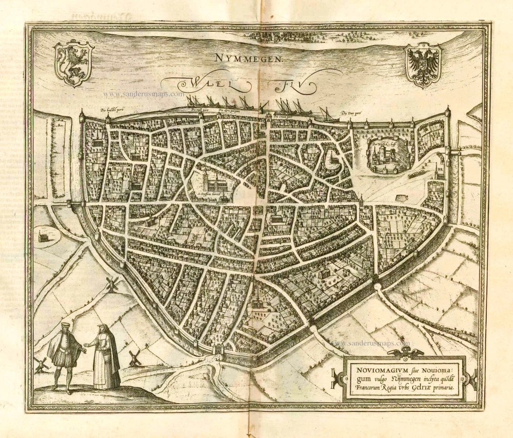
Nymmegen - Noviomagium sive Nouiomagum vulgo Nijmmegen inclyta quoda Francorum Regia Urbs Gelriae primaria. 1582
Nijmegen, by Braun & Hogenberg.
[Item number: 14229]

Urbis Campensis ad Isalam Fluvium Icon. 1581-88
Kampen, by Georg Braun and Frans Hogenberg.
[Item number: 22215]
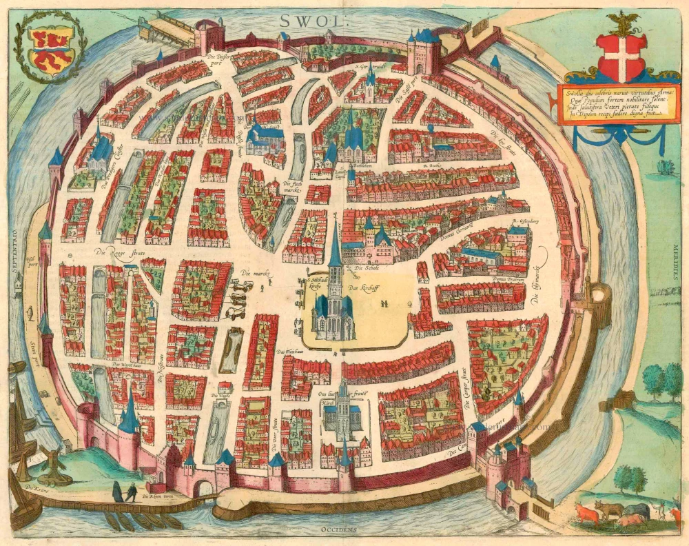
Swolla diu celebris meruit virtutibus Arma: ... 1599
Zwolle, by Georg Braun and Frans Hogenberg.
[Item number: 23318]
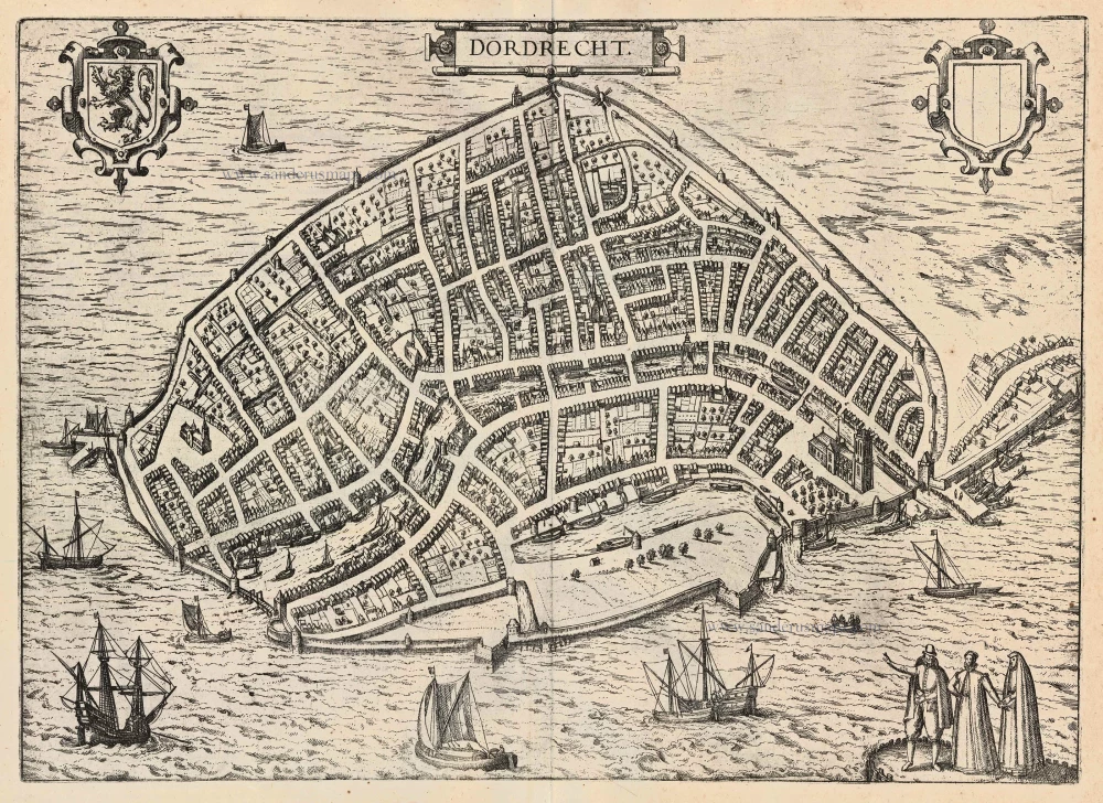
Dordrecht 1599
Dordrecht, by Georg Braun and Frans Hogenberg.
[Item number: 24043]
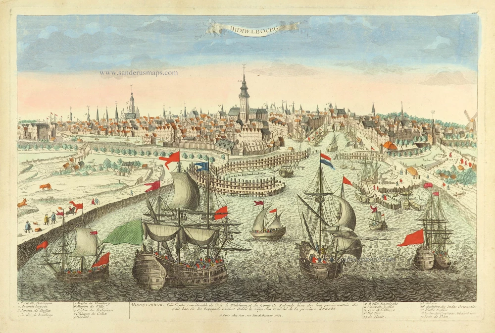
Middelbourg Ville la plus considerable de l'Isle de Walcheren, et du Comté de Zeland l'une des huit provinces-unis des pais-bas, où les Espagnols avoient établis le siège d'un E'vêché de la province d'Utrecht. c. 1780
Middelburg by Pierre Aveline, published in Paris by Jean.
[Item number: 28822]
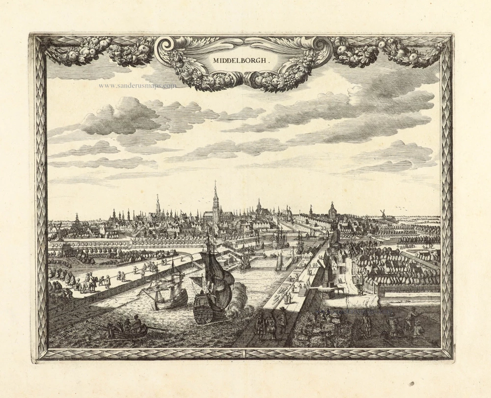
Unrecorded view of Middelburg by Carel Allard
Middelborgh. 1673
View of Middelburg by Carel Allard.
[Item number: 30560]