
Carolina, by A. Montanus. 1671
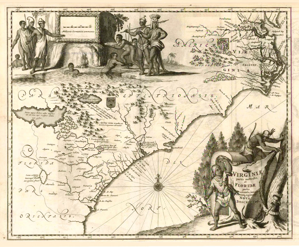
Arnoldus Montanus drew upon the Willem Blaeu map of c.1638 for his map of this region. Already by this date it had been colonised by the English and named Carolina, although no reference is made to it here. It is more decorative than the Blaeu in that it bears two large decorative cartouches depicting native scenes.
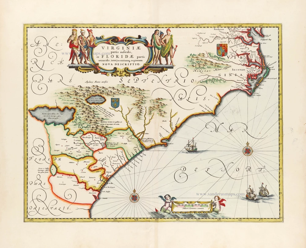
Virginiae partis australis et Floridae.
Item Number: 5211 Authenticity Guarantee
Category: Antique maps > America > North America
Old antique map of Carolina by A. Montanus.
Title: Virginiae partis australis et Floridae.
Date of the first edition: 1671.
Date of this map: 1671.
Copper engraving, printed on paper.
Size (not including margins): 291 x 356mm (11.46 x 14.02 inches).
Verso: Blank.
Condition: Excellent.
Condition Rating: A+.
From: De Nieuwe en Onbekende Weereld: of Beschryving van America. Amsterdam, J. Meurs, 1671.
Arnoldus Montanus drew upon the Willem Blaeu map of c.1638 for his map of this region. Already by this date it had been colonised by the English and named Carolina, although no reference is made to it here. It is more decorative than the Blaeu in that it bears two large decorative cartouches depicting native scenes.
Related items
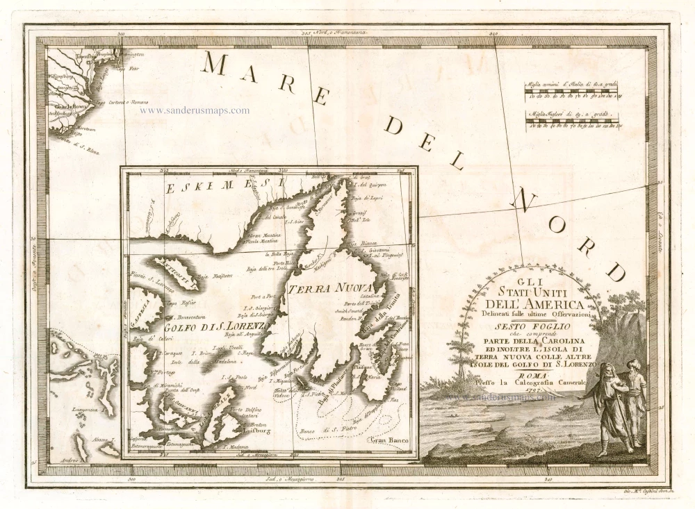
Gli Stati Uniti dell'America Delineati sulle Ultime Osservazioni. Sesto Foglio che Comprende Parte della Carolina ed Inoltre l'Isola di Terra Nuova colle altre Isole del Golfo do S. Lorenzo 1797
Antique map of the Carolinas - Newfoundland, by Cassini, G.M.
[Item number: 23477]
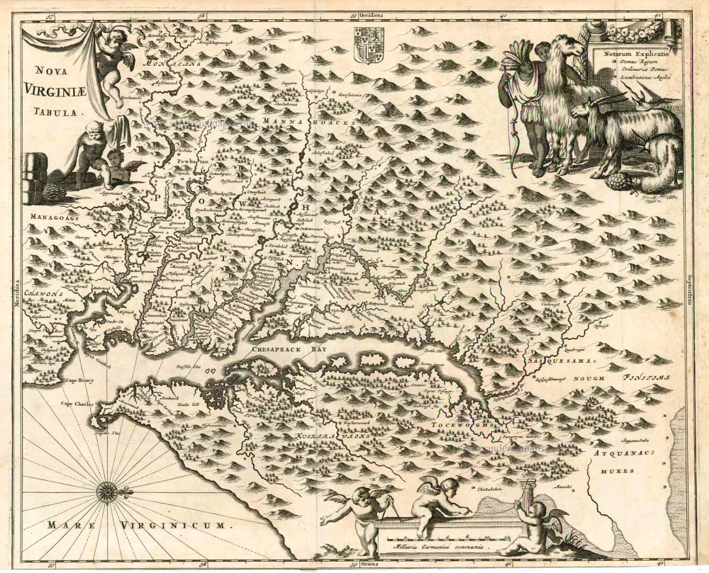
Nova Virginiae Tabula. 1671
Virginia, by A. Montanus.
[Item number: 25613]
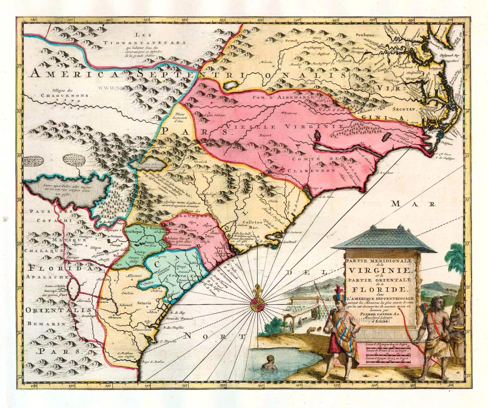
Partie Meridionale de la Virginie, et la Partie Orientale de la Floride dans l'Amerique Septentrionale. 1713
Carolina by Pieter van der Aa.
[Item number: 26137]
Luxury colouring
Virginiae partis australis et Floridae partis orientalis, interjacentiumq; regionum Nova Descriptio. 1666
Carolina by Johannes Janssonius
[Item number: 30020]