
Sea chart of the coasts of Morocco, by Johannes Van Keulen. 1697-1709
The House of Van Keulen
For more than two centuries, the chart makers firm of Van Keulen was established in the house with the name of “De Gekroonde Lootsman” (The Crowned Pilot). In 1678, the founder of the firm, Johannes I Van Keulen (1634-1689), registered with the Amsterdam booksellers’ guild. He had enlisted the aid of the well-known Mathematical Practitioner Claas Janz Vooght in the preparation of his nautical publications. In 1680 he published the first edition of the Zee-Atlas with 40 charts, all issued for the first time. In the short period of four years, they produced the five volumes of the Nieuwe Groote Ligtende Zee-Fakkel (1681-85). His acquisition of the stock of the bookseller Hendrik Doncker was an essential factor in the development of the firm.
In 1678 a son, Gerard Van Keulen (1678-1726), was born out of Johannes’s first marriage. This son was endowed with talent. He was a skilful engraver and proficient in mathematics and navigational science. Gerard was responsible for establishing the scientific basis of the firm of Van Keulen. In 1714 he was appointed to the office of hydrographer to the Dutch East India Company. The Van Keulens remained chart makers to the East India Company until the Company’s liquidation.
With the introductions to the Zee-Fakkel and Zee-Atlas, Gerard van Keulen gave a new impetus to the firm. Unfortunately, he did not live long, dying when he was 49. The business was carried on by his widow Ludwina Konst. Shortly before Gerard’s death, his son Johannes II had entered the bookseller’s guild, and in 1726 he assumed the management of the firm, though his mother retained her financial interests in the business.
Johannes II Van Keulen (1704-1755) is known in particular for his publication in 1753 of a sixth volume of the Zee-Fakkel, the volume containing the charts of the route to the East Indies.
Johannes II had two sons; they joined the firm as partners in 1757. A considerable number of books appeared in the period 1778-1801. New issues of the Zee-Fakkel again saw the light. The firm flourished under different names until 1885.
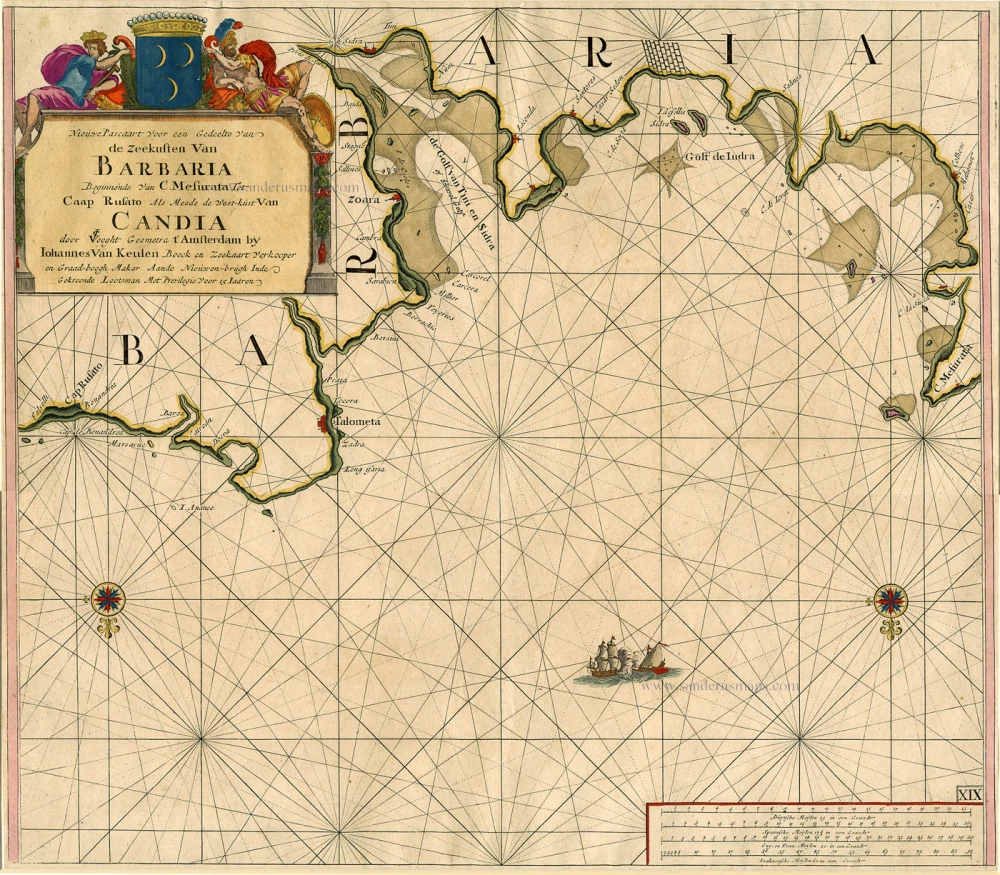
Nieuwe Pascaart voor een Gedeelte van de Zeekusten van Barbaria Beginnende van C. Mesurata tot Caap Rusato Als mede de West-kust van Candia.
Item Number: 6506 Authenticity Guarantee
Category: Antique maps > Mediterranean Sea
Sea chart showing a part of the African Mediterranean coast and the western part of Crete, by Johannes Van Keulen.
Title: Nieuwe Pascaart voor een Gedeelte van de Zeekusten van Barbaria Beginnende van C. Mesurata tot Caap Rusato Als mede de West-kust van Candia.
Oriented to the south.
First state (of two).
Copper engraving, printed on paper.
Size (not including margins): 512 x 588mm (20.16 x 23.15 inches).
Verso: Blank.
Condition: Original coloured.
Condition Rating: .
From: De Nieuwe Groote Lichtende Zee-Fakkel, ... Amsterdam, J. van Keulen, 1697-1709.
The House of Van Keulen
For more than two centuries, the chart makers firm of Van Keulen was established in the house with the name of “De Gekroonde Lootsman” (The Crowned Pilot). In 1678, the founder of the firm, Johannes I Van Keulen (1634-1689), registered with the Amsterdam booksellers’ guild. He had enlisted the aid of the well-known Mathematical Practitioner Claas Janz Vooght in the preparation of his nautical publications. In 1680 he published the first edition of the Zee-Atlas with 40 charts, all issued for the first time. In the short period of four years, they produced the five volumes of the Nieuwe Groote Ligtende Zee-Fakkel (1681-85). His acquisition of the stock of the bookseller Hendrik Doncker was an essential factor in the development of the firm.
In 1678 a son, Gerard Van Keulen (1678-1726), was born out of Johannes’s first marriage. This son was endowed with talent. He was a skilful engraver and proficient in mathematics and navigational science. Gerard was responsible for establishing the scientific basis of the firm of Van Keulen. In 1714 he was appointed to the office of hydrographer to the Dutch East India Company. The Van Keulens remained chart makers to the East India Company until the Company’s liquidation.
With the introductions to the Zee-Fakkel and Zee-Atlas, Gerard van Keulen gave a new impetus to the firm. Unfortunately, he did not live long, dying when he was 49. The business was carried on by his widow Ludwina Konst. Shortly before Gerard’s death, his son Johannes II had entered the bookseller’s guild, and in 1726 he assumed the management of the firm, though his mother retained her financial interests in the business.
Johannes II Van Keulen (1704-1755) is known in particular for his publication in 1753 of a sixth volume of the Zee-Fakkel, the volume containing the charts of the route to the East Indies.
Johannes II had two sons; they joined the firm as partners in 1757. A considerable number of books appeared in the period 1778-1801. New issues of the Zee-Fakkel again saw the light. The firm flourished under different names until 1885.
Related items
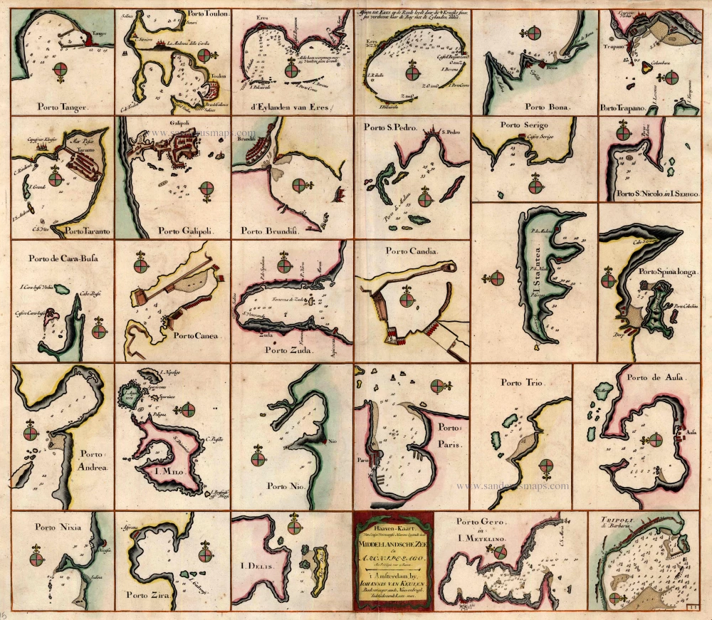
Haaven-Kaart van Eenige Voornaamste Haavens Leggende in de Middel-Landsche Zee en Archipelago 1697-1709
Mediterranean Sea Ports by Johannes Van Keulen.
[Item number: 4125]
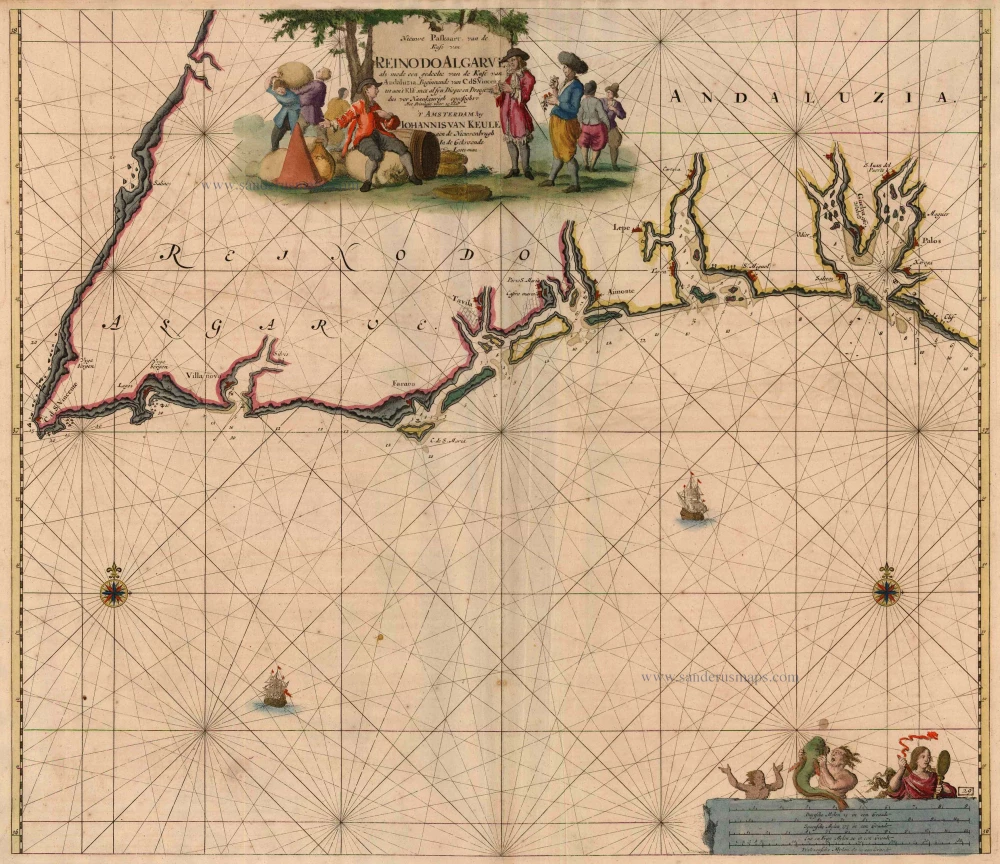
Nieuwe Paskaart, van de Kust van Reino do Algarve als mede een gedeelte van de Kust van Andaluzia. Beginnende vn C. d. S. Vincent tot aen 't Klif, ... 1697-1709
Algarve, by Johannes Van Keulen.
[Item number: 5805]
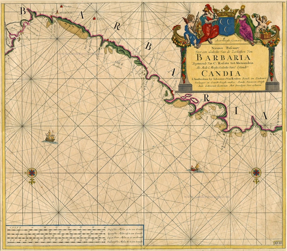
Nieuwe Pascaart Voor een Gedeelte van de Zeekusten van Barbaria ... 1697-1709
Sea chart of the coasts of Morocco, by Johannes Van Keulen.
[Item number: 9775]
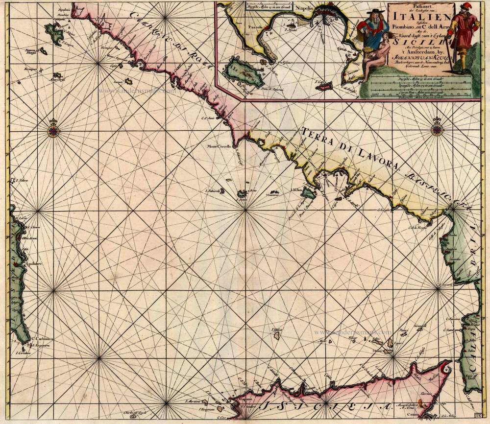
Paskaart der Zeekusten van Italien tusschen Piombino en C. dell Arme met de Noord-Kust van 't Eylandt Sicilia ... 1697-1709
Tyrrhenian Sea, by Van Keulen Johannes.
[Item number: 12955]
Parergon map
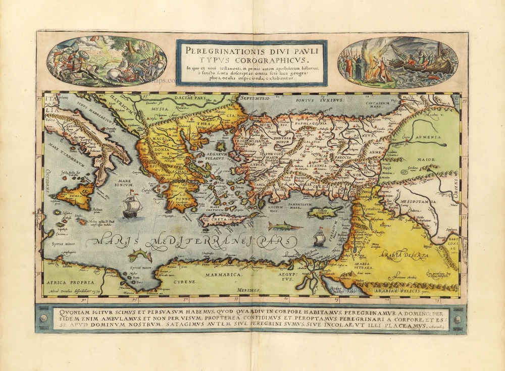
Peregrinationis Divi Pauli Typus Chorographicus. 1598
Paulus's Travels by Abraham Ortelius.
[Item number: 28920]
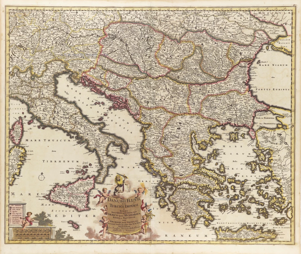
Danubii Fluvii Sive Turcici Imperii in Europa. c. 1705
Danube and European Ottoman Empire, by Frederick de Wit.
[Item number: 29279]
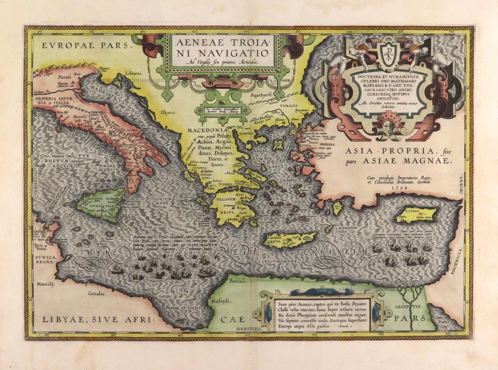
Aeneae Troiani Navigatio Ad Vergilij sex priores Aeneidos. 1595
Aenea's travels by Abraham Ortelius.
[Item number: 29470]
*** Rare first edition ***
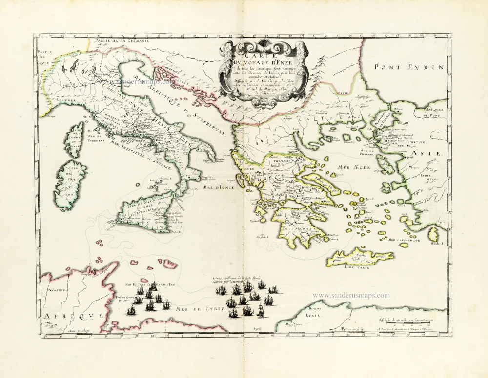
Carte du voyage d'Enée Et de tous les Lieux qui sont nommez dans les Oeuvres de Virgile, pour bien entendre cet Auteur. 1655
Aeneas's Travels by Pierre Duval.
[Item number: 30037]
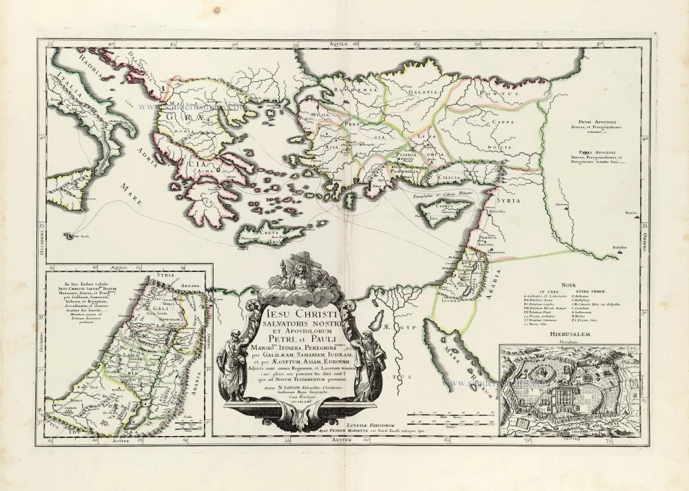
Iesu Christi salvatoris nostri apostolorum Petri, et Pauli mansiones, itinera, peregrinationes &c. per Galilaeam, Samariam, Iudaeam, et per Aegyptum, Asiam, Europam. 1665
Eastern Mediterranean by Nicolas Sanson.
[Item number: 30044]
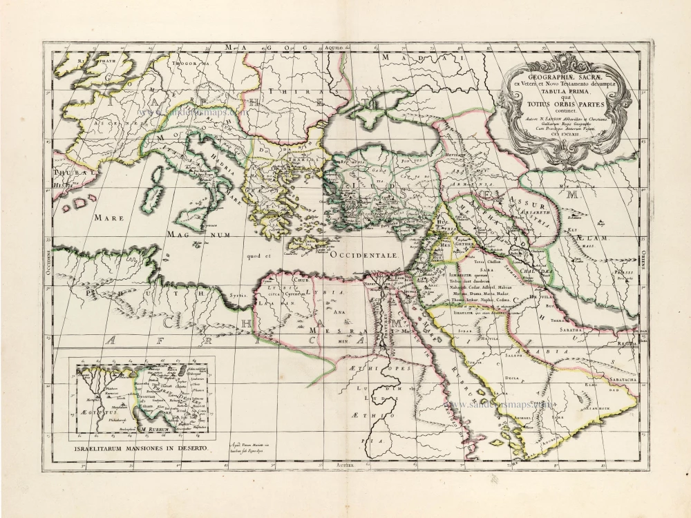
Geographiae Sacrae ex Veteri et Novo Testamento desumptae Tabula Prima, quae Totius Orbis Partet continet. 1665
Eastern Mediterranean by Nicolas Sanson, published by Pierre Mariette.
[Item number: 30075]
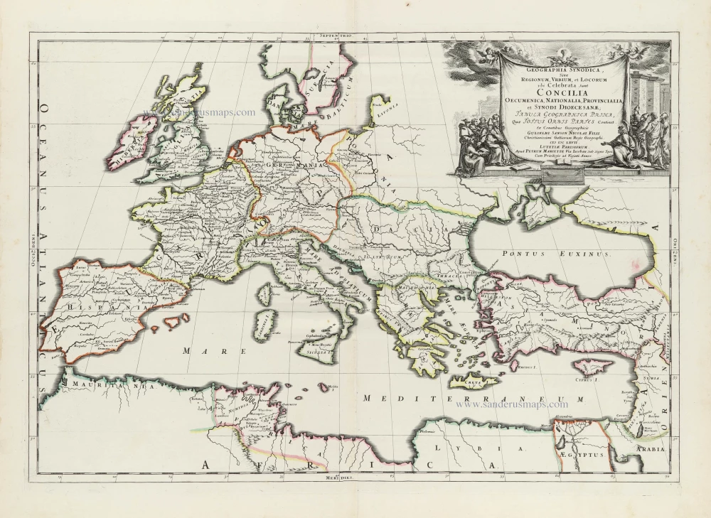
Geographia Synodica, sive regionum, urbium, et locorum ubi celebrata sunt concilia oecumenica, nationalia, provincialia et synodi dioecesanae; Tabula geographica prima, quae totius orbis partes continet. 1667
Map locating the Church Synods throughout Western Europe and the Mediterranean region by Nicolas Sanson, published by Pierre Mariette.
[Item number: 30117]
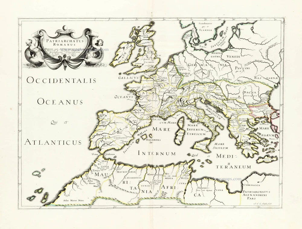
Patriarchatus Romanus c. 1632
Roman Empire in Europe, published by Melchior Tavernier.
[Item number: 30118]
Superb old colouring, heightened with gold.
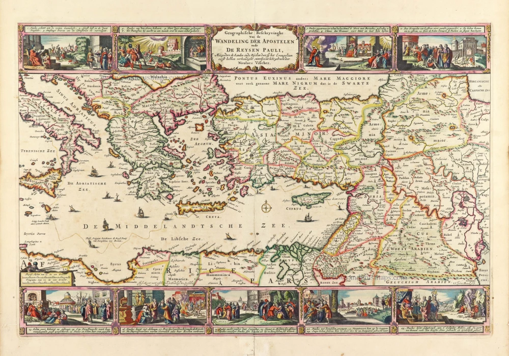
Geografische Beschryvinghe van de Wandeling der Apostelen ende De Reysen Pauli, Mitsgaders de Landen ende Rijcken daer sij het Evangelium eerst hebben verkondight. ... 1663
Eastern Mediterranean Sea, by Nicolaes Visscher I.
[Item number: 30537]
new