
Western Africa by Pierre Van der Aa. 1713
Pieter van der Aa (Leiden, 1659-1733)
Pieter van der Aa was already in 1682 owner of a bookshop and auction house. During his life, he has published an enormous amount of printed material.
After 1700, van der Aa increasingly specialised in books on geography and travel.
He published composite atlases, a series of geographical descriptions of European countries, and some very spectacular works. Between 1706 and 1708 he published the Naauweurige versameling der gedenkwaardigste zee- en land-reysen, in 28 volumes.
Many of Van der Aa’s publications are richly illustrated with maps and plates. He took over many copperplates and prints from other publishers such as Carel Allard and Frederik De Wit. The composite atlases that appeared from his workshop contain a curious mixture of his own material, copies of maps from other publishers, and reprints made from old copper plates, now with his own imprint.
The Galérie agréable du monde, was completed in 1729, and comprised 66 parts, bound in 27 volumes. Van der Aa presented it as a good investment; after publication, the antiquarian value of the work would double, the more so since it was printed in a limited edition of only one hundred copies.
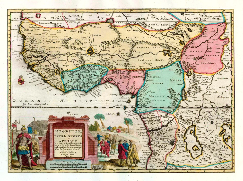
Nigritie, ou le Pays des Negres, en Afrique, avec tous ses Royaumes, Bayes, Rivieres et Ports de Mer.
Item Number: 26155 Authenticity Guarantee
Category: Antique maps > Africa
Old, antique map of Western Africa, by P. Van der Aa.
Title: Nigritie, ou le Pays des Negres, en Afrique, avec tous ses Royaumes, Bayes, Rivieres et Ports de Mer.
Mise au jour par Pierre Vander Aa.,
Marchand Libraire à Leide.
After. O. Dapper.
Date of the first edition: 1713.
Date of this map: 1713.
Copper engraving, printed on paper.
Size (not including margins): 265 x 365mm (10.43 x 14.37 inches).
Verso: Blank.
Condition: Original body colour, trimmed to neatline and mounted on heavy paper at an early time.
Condition Rating: A
References: Van der Krogt 4, 61:11; Koeman, Aa7 (164); Not in Norwich
From: Nouvel Atlas, très exact et fort commode pour toutes sortes de personnes, Contenant Les Principales cartes géographiques. Leiden, P. Van der Aa, n.d. (1713) (Koeman, Aa7).
Pieter van der Aa (Leiden, 1659-1733)
Pieter van der Aa was already in 1682 owner of a bookshop and auction house. During his life, he has published an enormous amount of printed material.
After 1700, van der Aa increasingly specialised in books on geography and travel.
He published composite atlases, a series of geographical descriptions of European countries, and some very spectacular works. Between 1706 and 1708 he published the Naauweurige versameling der gedenkwaardigste zee- en land-reysen, in 28 volumes.
Many of Van der Aa’s publications are richly illustrated with maps and plates. He took over many copperplates and prints from other publishers such as Carel Allard and Frederik De Wit. The composite atlases that appeared from his workshop contain a curious mixture of his own material, copies of maps from other publishers, and reprints made from old copper plates, now with his own imprint.
The Galérie agréable du monde, was completed in 1729, and comprised 66 parts, bound in 27 volumes. Van der Aa presented it as a good investment; after publication, the antiquarian value of the work would double, the more so since it was printed in a limited edition of only one hundred copies.
Related items
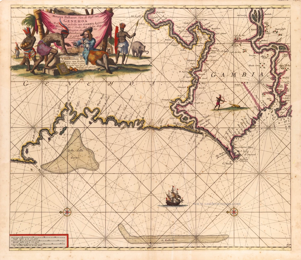
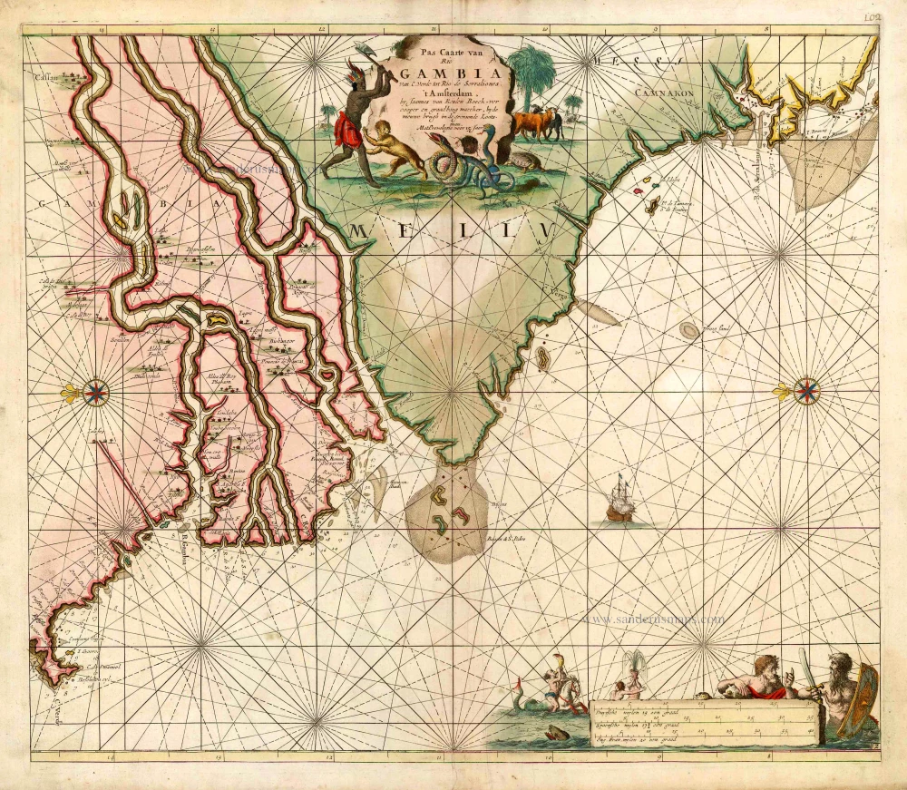
Nieuwe Paskaert, van de Kust van Genehoa als mede een Gedeelte van Gambia, beginnende an C. Blanco tot C. Verde, Met al syn diep ten end droogten, dus Ver Naeukeurig op gestelt. 1697-1709
The coasts of Senegal - Gambia by Johannes Van Keulen.
[Item number: 2016]
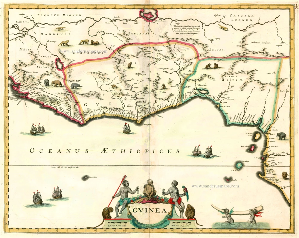
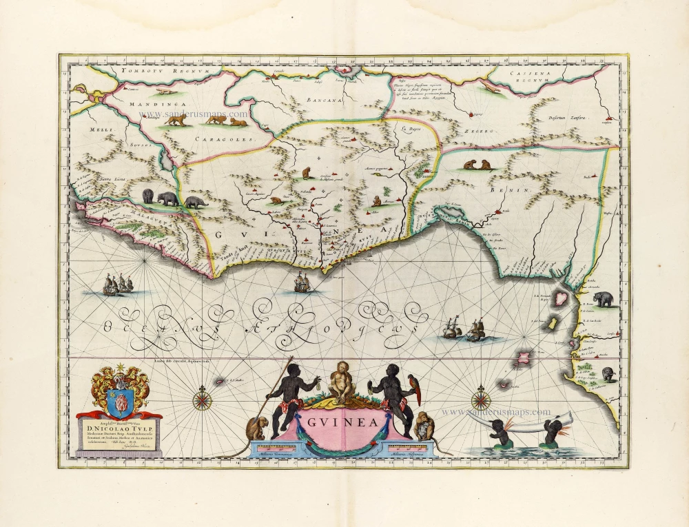
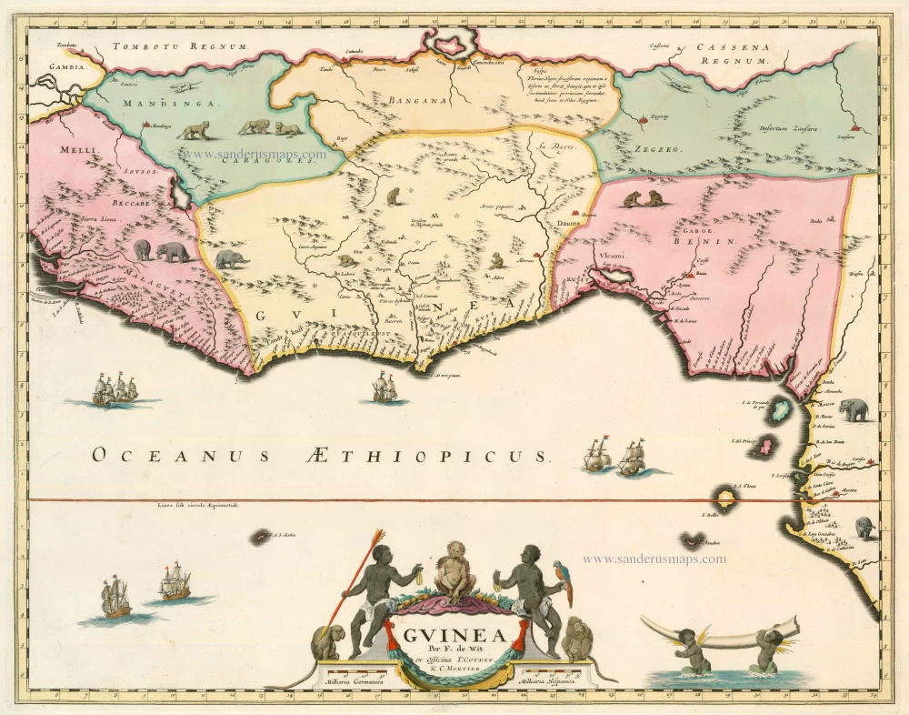
Guinea c. 1680
Guinea by F. De Wit.
[Item number: 2646]
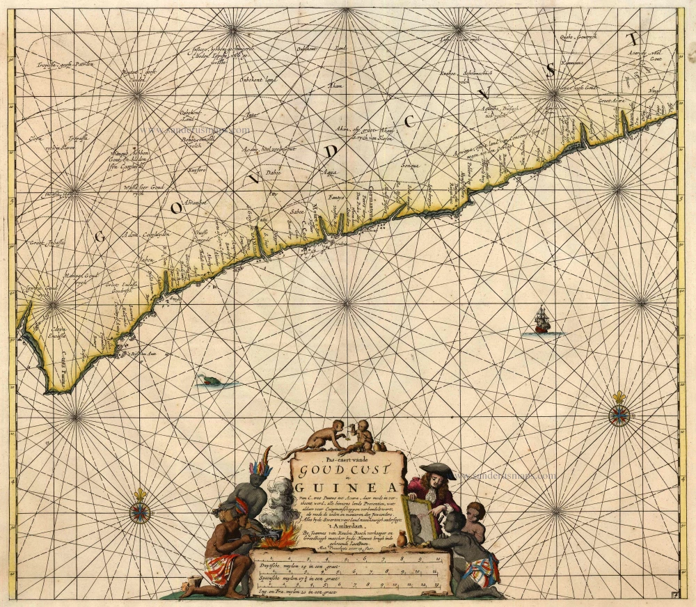
Pas-Caert vande Goud Cust in Guinea van C. Tres Puntas tot Acara ... 1683
Sea chart of Guinea, by Van Keulen Johannes.
[Item number: 4059]
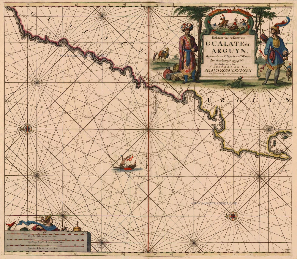
Paskaart van de Kuste van Gualate en Arguyn ... 1681
The coast of the Western Sahara, by J. Van Keulen.
[Item number: 5402]

Pascaert vande Bocht van Benin, Tary Ardra en Rio de Lagos, van Acra tot C. Formosa 1683
The Gulf of Benin (West Africa), by Van Keulen Johannes.
[Item number: 9587]
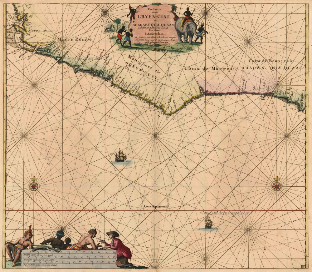
Pas Caarte vande Gryen-Cust en Adaows qua Quaas tuhessen de Serraliones en C. de Tres Puntas. 1683
Grain Coast - West Africa, by Johannes van Keulen.
[Item number: 10776]
Guinea 1664
Guinea by Blaeu J.
[Item number: 12151]
Pas Caarte van Rio Gambia van C. Verde tot Rio de Serraliones. 1683
Sea chart of Western Africa (The Gambia), by J. Van Keulen.
[Item number: 12768]
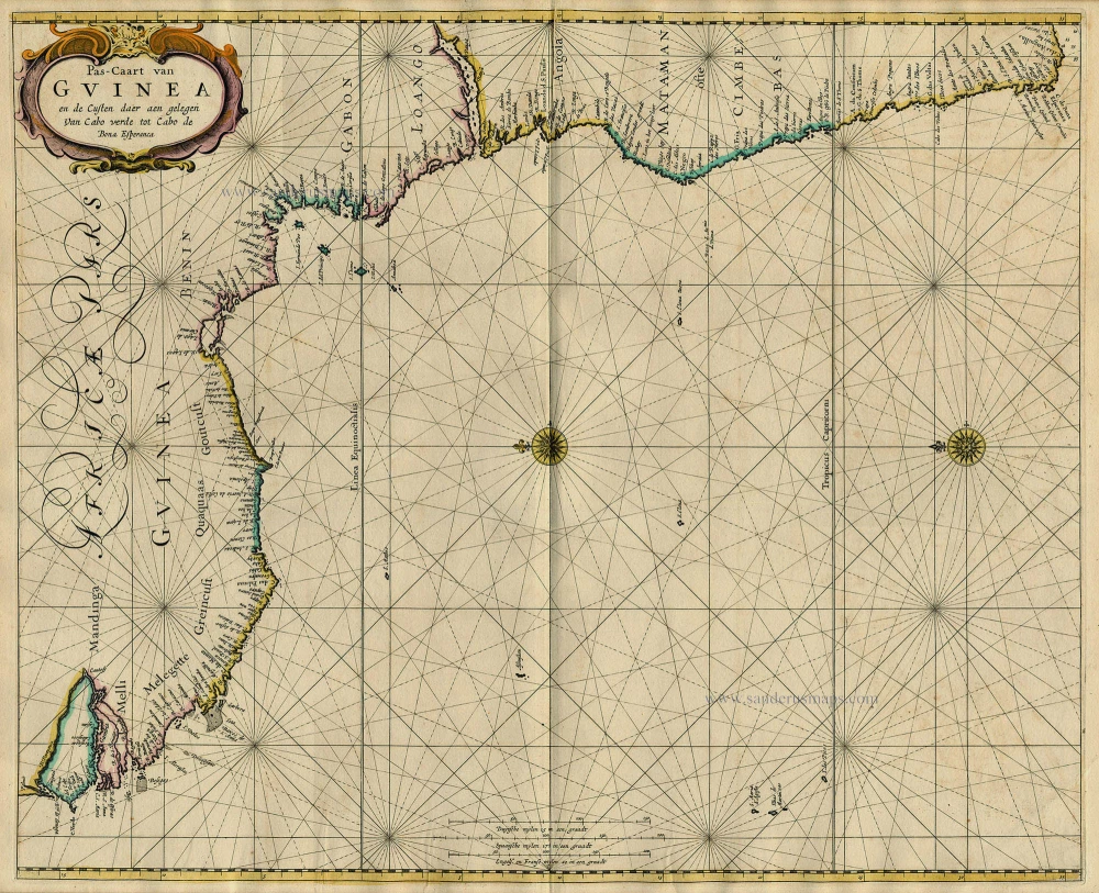
Pas-Caart van Guinea en de Custen daer aen Gelegen van Cabo Verde tot Cabo de Bona Esperanca 1667
Sea chart of Guinea, by Pieter Goos.
[Item number: 19060]
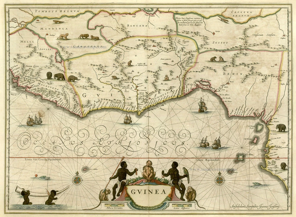
Guinea c. 1658
Guinea, by Janssonius J.
[Item number: 19543]
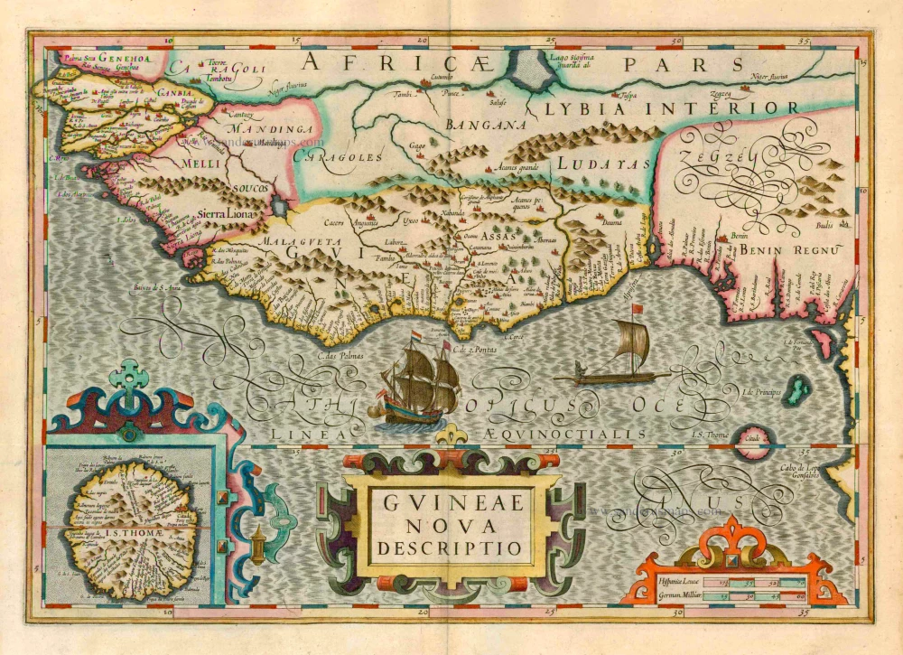
Guineae Nova Descriptio. 1623
Guinea, by Jodocus Hondius.
[Item number: 21985]
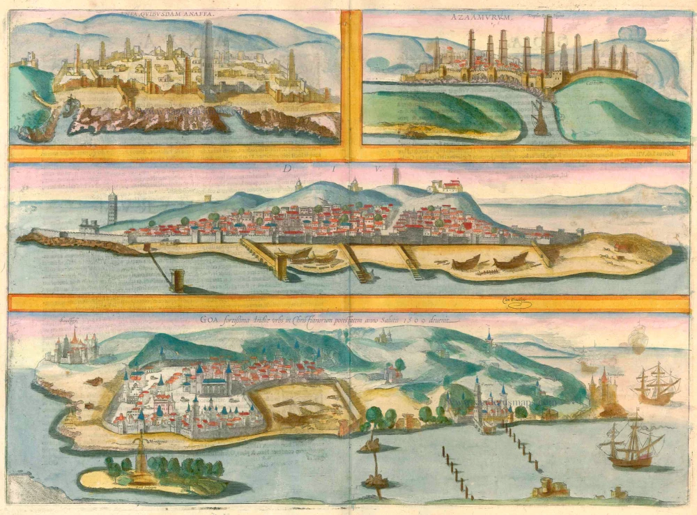
Anfa, quibusdam Anaffa [on sheet with] Azaamurum [and] Diu [and] Goa 1599
Casablanca (Anfa) - Azemmour (Azamor) - Diu - Old Goa (Velha Goa), by Georg Braun and Frans Hogenberg.
[Item number: 23246]
Guinea 1721-41
Guinea, by F. De Wit after W. Blaeu.
[Item number: 23613]
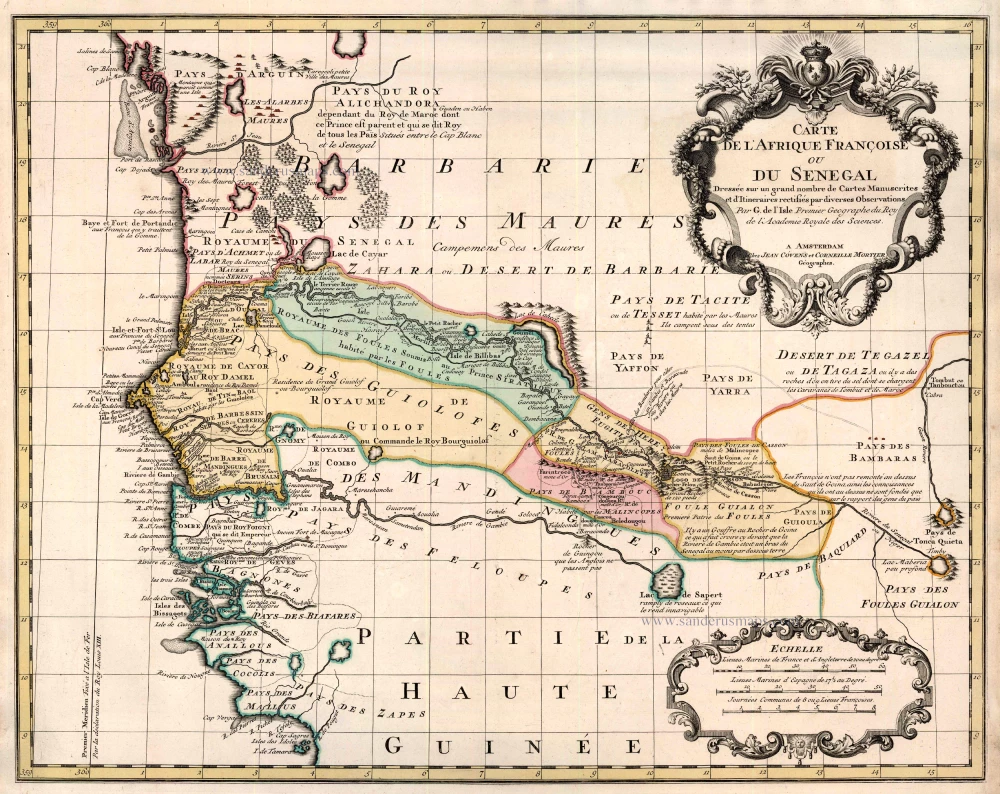
Carte de l'Afrique Françoise ou du Senegal ... 1721-41
Senegal by Guillaume Delisle, published by Covens & Mortier.
[Item number: 23614]
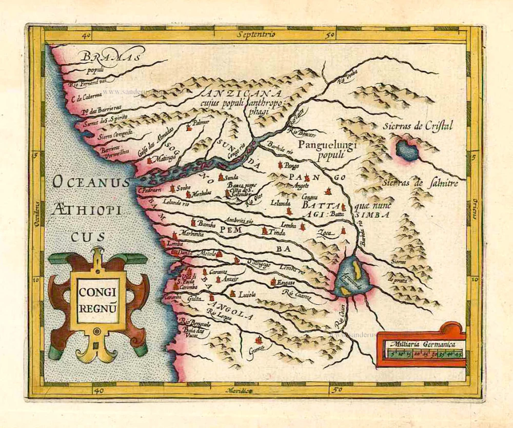
Congi Regnu. 1607
Congo, by G. Mercator - J. Hondius.
[Item number: 25292]