
Florida, Peru and Mexico by Abraham Ortelius. 1612
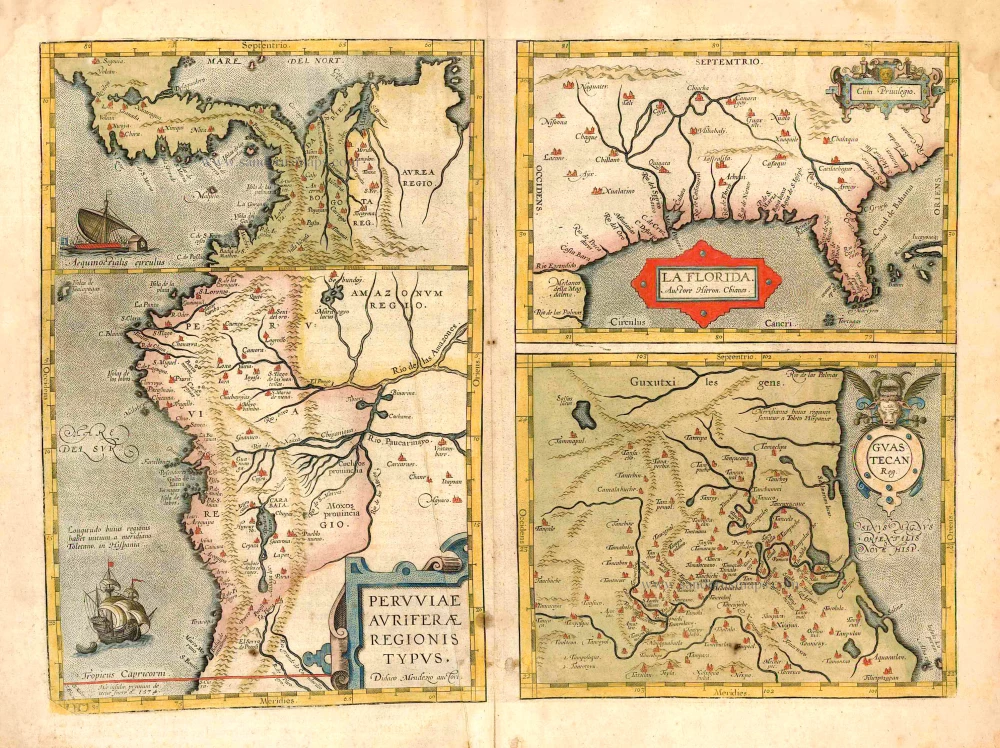
"The Florida map is one of the few maps printed in the sixteenth century based on original Spanish sources. They were very protective of their knowledge of the Americas, a considerable source of their wealth. The author of this map, Géronimo de Chaves, was the Cosmographer Royal to Philip II of Spain. His father, Alonso de Chaves, was an examiner of Pilots at the Casa de Contratacion, and in 1552 his son followed him by being appointed to the Chair of Cartography. The plate contains two other maps of similar Spanish regions of influence. They are PERUVVIAE and <GUASTECAN, the latter combines with LA FLORIDA to extend the coastline of the Gulf of Mexico further south. The map LA FLORIDA is one of the handfuls of prototypes produced, its influence was considerable. Showing a semblance of internal detail for the first time, it draws heavily upon the findings of Hernando de Soto's expedition through the region in 1539-42, derived largely from the account of it given by Gonzalo de Oviedo. However, nothing learnt from the French or Spanish explorations on the Atlantic coastline during the 1560s is incorporated. The map provided the foundation cartography for the region, particularly noticeable by the depiction of the river system. The map appeared for the first time in the Additamentum from 1584 and was issued in all future editions of the Theatrum." (Burden)
Abraham Ortelius (1527-1598)
The maker of the 'first atlas', the Theatrum Orbis Terrarum (1570), was born on 4 April 1527 into an old Antwerp family. He learned Latin and studied Greek and mathematics.
Abraham and his sisters Anne and Elizabeth took up map colouring. He was admitted to the Guild of St. Luke as an "illuminator of maps." Besides colouring maps, Ortelius was a dealer in antiques, coins, maps, and books, with the book and map trade gradually becoming his primary occupation.
Business went well because his means permitted him to start an extensive collection of medals, coins, antiques, and a library of many volumes. In addition, he travelled a lot and visited Italy and France, made contacts everywhere with scholars and editors, and maintained extensive correspondence with them.
In 1564 he published his first map, a large and ambitious world wall map. The inspiration for this map may well have been Gastaldi's large world map. In 1565 he published a map of Egypt and a map of the Holy Land, a large map of Asia followed.
In 1568 the production of individual maps for his atlas Theatrum Orbis Terrarum was already in full swing. He completed the atlas in 1569, and in May of 1570, the Theatrum was available for sale. It was one of the most expensive books ever published.
This first edition contained seventy maps on fifty-three sheets. Franciscus Hogenberg engraved the maps.
Later editions included Additamenta (additions), resulting in Ortelius' historical atlas, the Parergon, mostly bound together with the atlas. The Parergon can be called a truly original work of Ortelius, who drew the maps based on his research.
The importance of the Theatrum Orbis Terrarum for geographical knowledge in the last quarter of the sixteenth century is difficult to overemphasize. Nothing was like it until Mercator's atlas appeared twenty-five years later. Demand for the Theatrum was remarkable. Some 24 editions appeared during Ortelius's lifetime and another ten after his death in 1598. Editions were published in Dutch, German, French, Spanish, English, and Italian. The number of map sheets grew from 53 in 1570 to 167 in 1612 in the last edition.
In 1577, engraver Philip Galle and poet-translator Pieter Heyns published the first pocket-sized edition of the Theatrum, the Epitome. The work was trendy. Over thirty editions of this Epitome were published in different languages.
Peruviae Auriferae Regionis Typus. - La Florida - Guastecan ...
Item Number: 26773 Authenticity Guarantee
Category: Antique maps > America > North America
Old, antique map - double sheet with 3 maps: Florida, Peru and Mexico by Abraham Ortelius.
Date of the first edition: 1584
Date of this map: 1603
Copper engraving
Size of plate: 33.5 x 46.5cm (12.9 x 18.1 inches)
Verso text: Latin
Condition: Original coloured, age-toned, margins soiled, thumbed.
Condition Rating: B
From: Theatrum Orbis Terrarum Abrahami Ortelii Antverp. Geographi Regii. Antwerpen, J.B. Vrients, 1603. (Van der Krogt 3, 1:053)
"The Florida map is one of the few maps printed in the sixteenth century based on original Spanish sources. They were very protective of their knowledge of the Americas, a considerable source of their wealth. The author of this map, Géronimo de Chaves, was the Cosmographer Royal to Philip II of Spain. His father, Alonso de Chaves, was an examiner of Pilots at the Casa de Contratacion, and in 1552 his son followed him by being appointed to the Chair of Cartography. The plate contains two other maps of similar Spanish regions of influence. They are PERUVVIAE and <GUASTECAN, the latter combines with LA FLORIDA to extend the coastline of the Gulf of Mexico further south. The map LA FLORIDA is one of the handfuls of prototypes produced, its influence was considerable. Showing a semblance of internal detail for the first time, it draws heavily upon the findings of Hernando de Soto's expedition through the region in 1539-42, derived largely from the account of it given by Gonzalo de Oviedo. However, nothing learnt from the French or Spanish explorations on the Atlantic coastline during the 1560s is incorporated. The map provided the foundation cartography for the region, particularly noticeable by the depiction of the river system. The map appeared for the first time in the Additamentum from 1584 and was issued in all future editions of the Theatrum." (Burden)
Abraham Ortelius (1527-1598)
The maker of the 'first atlas', the Theatrum Orbis Terrarum (1570), was born on 4 April 1527 into an old Antwerp family. He learned Latin and studied Greek and mathematics.
Abraham and his sisters Anne and Elizabeth took up map colouring. He was admitted to the Guild of St. Luke as an "illuminator of maps." Besides colouring maps, Ortelius was a dealer in antiques, coins, maps, and books, with the book and map trade gradually becoming his primary occupation.
Business went well because his means permitted him to start an extensive collection of medals, coins, antiques, and a library of many volumes. In addition, he travelled a lot and visited Italy and France, made contacts everywhere with scholars and editors, and maintained extensive correspondence with them.
In 1564 he published his first map, a large and ambitious world wall map. The inspiration for this map may well have been Gastaldi's large world map. In 1565 he published a map of Egypt and a map of the Holy Land, a large map of Asia followed.
In 1568 the production of individual maps for his atlas Theatrum Orbis Terrarum was already in full swing. He completed the atlas in 1569, and in May of 1570, the Theatrum was available for sale. It was one of the most expensive books ever published.
This first edition contained seventy maps on fifty-three sheets. Franciscus Hogenberg engraved the maps.
Later editions included Additamenta (additions), resulting in Ortelius' historical atlas, the Parergon, mostly bound together with the atlas. The Parergon can be called a truly original work of Ortelius, who drew the maps based on his research.
The importance of the Theatrum Orbis Terrarum for geographical knowledge in the last quarter of the sixteenth century is difficult to overemphasize. Nothing was like it until Mercator's atlas appeared twenty-five years later. Demand for the Theatrum was remarkable. Some 24 editions appeared during Ortelius's lifetime and another ten after his death in 1598. Editions were published in Dutch, German, French, Spanish, English, and Italian. The number of map sheets grew from 53 in 1570 to 167 in 1612 in the last edition.
In 1577, engraver Philip Galle and poet-translator Pieter Heyns published the first pocket-sized edition of the Theatrum, the Epitome. The work was trendy. Over thirty editions of this Epitome were published in different languages.
Related items

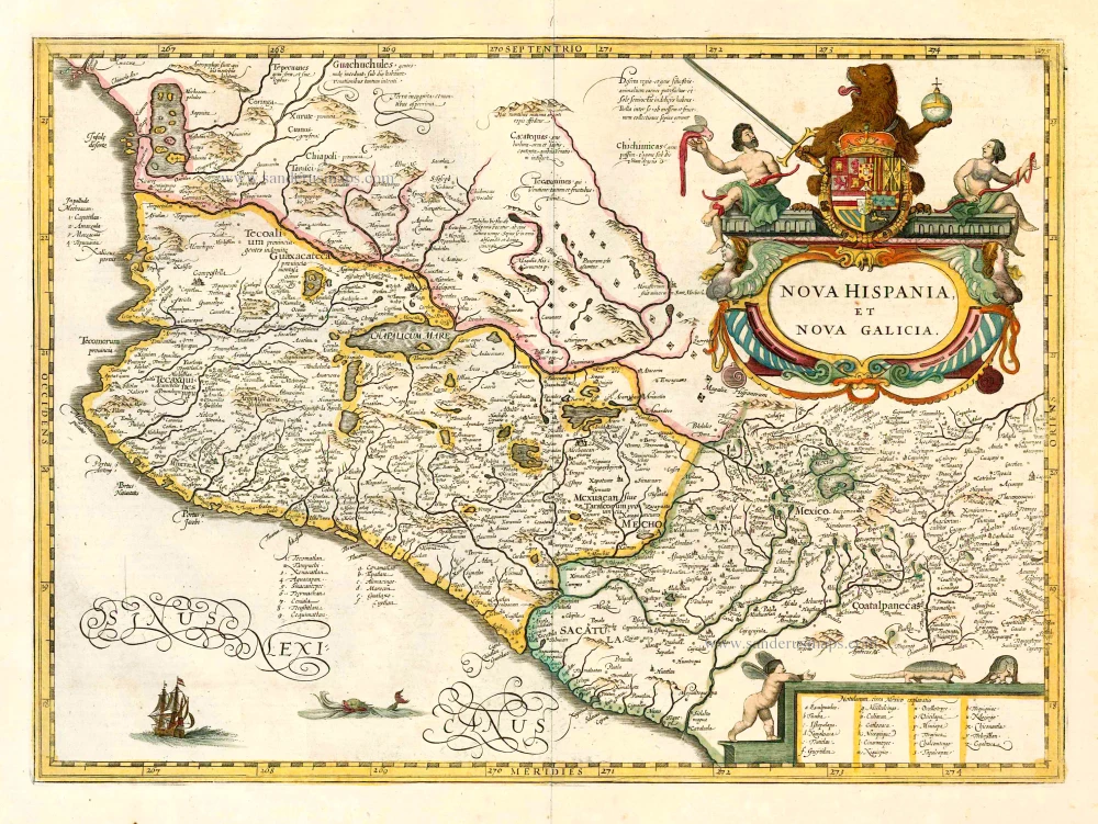
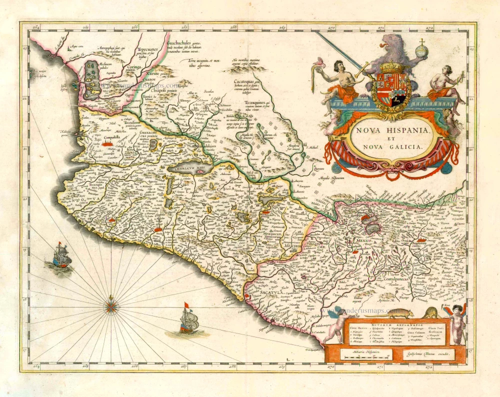
Nova Hispania, Et Nova Galicia. 1633
New Spain (Mexico) by J. Janssonius.
[Item number: 7787]
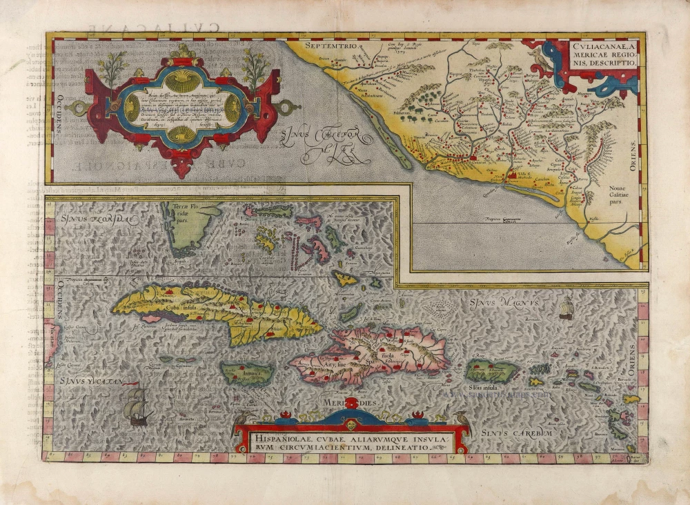
Culiacanae Americae Regionis Descriptio. - Hispaniolae, Cubae, Aliarumquae Insularum Circumiacentium, delineatio. 1581
Antilles - Mexico by Ortelius A.
[Item number: 6245]
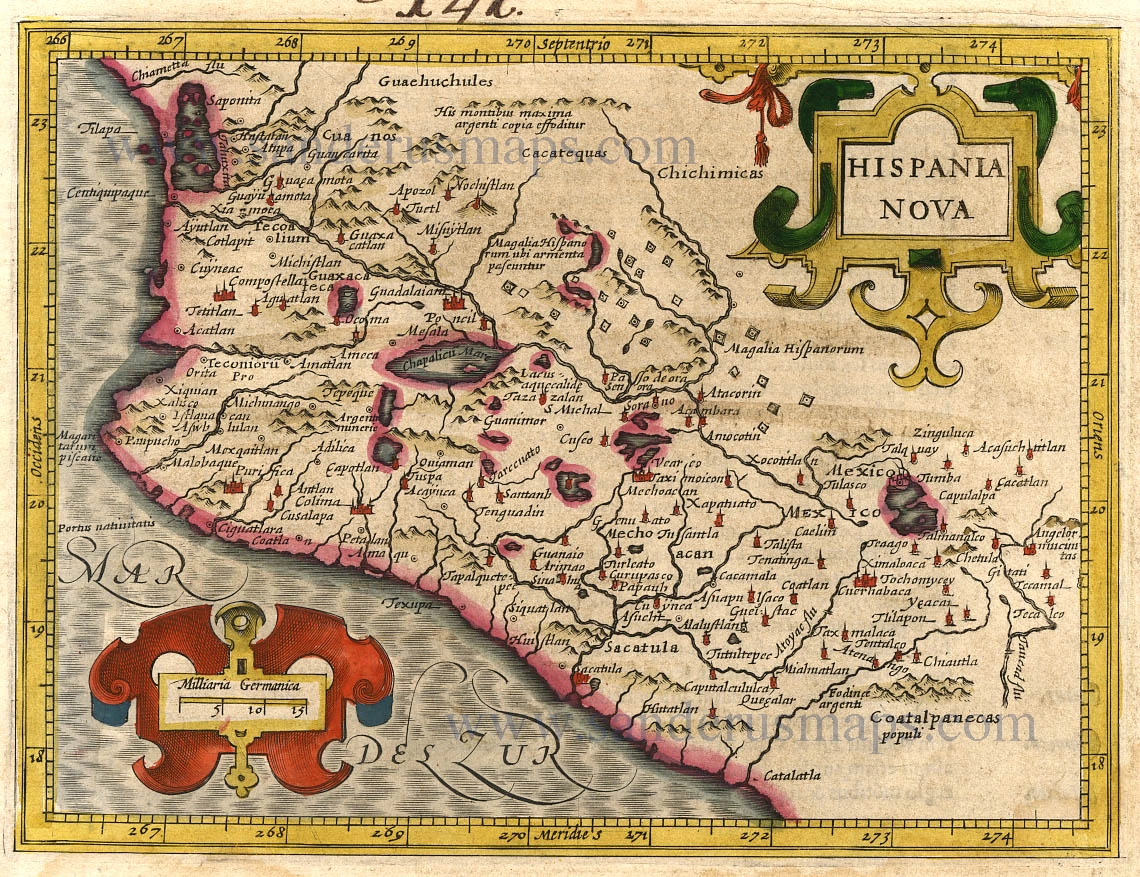
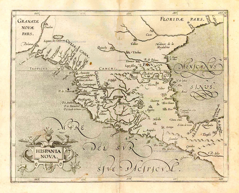
Hispania Nova. 1607
New Spain (Mexico) by G. Mercator.
[Item number: 362]

Pas Kaart van de Boght van Florida met de Canaal tusschen Florida en Cuba ... 1680-1694
Sea chart of the Gulf of Mexico, Yucatan Channel, by J. Van Keulen.
[Item number: 16285]
Nova Hispania et Nova Galicia. 1641
New Spain (Mexico), by Johannes Janssonius.
[Item number: 26463]
Hispania Nova. 1607
Mexico, by C. van Wytfliet.
[Item number: 26501]
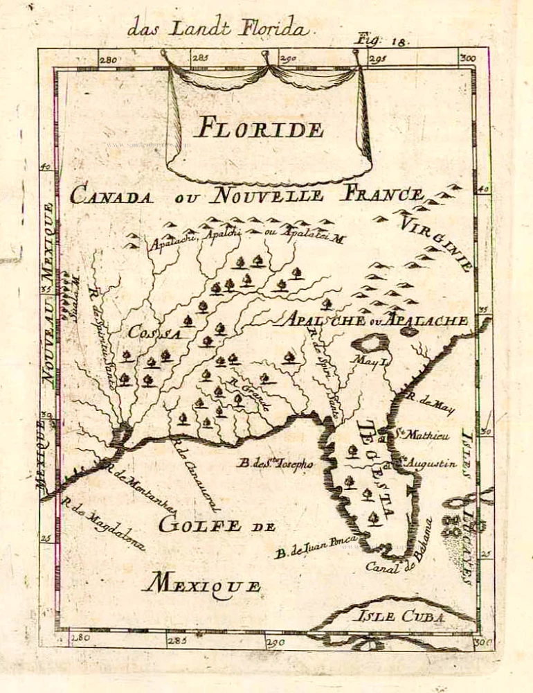
Floride. 1685
Florida, Virginia and Louisiana, by A.M. Mallet.
[Item number: 26599]
Nova Hispania et Nova Galicia. 1643-50
New Spain (West Mexico), by Willem & Joan Blaeu.
[Item number: 26738]
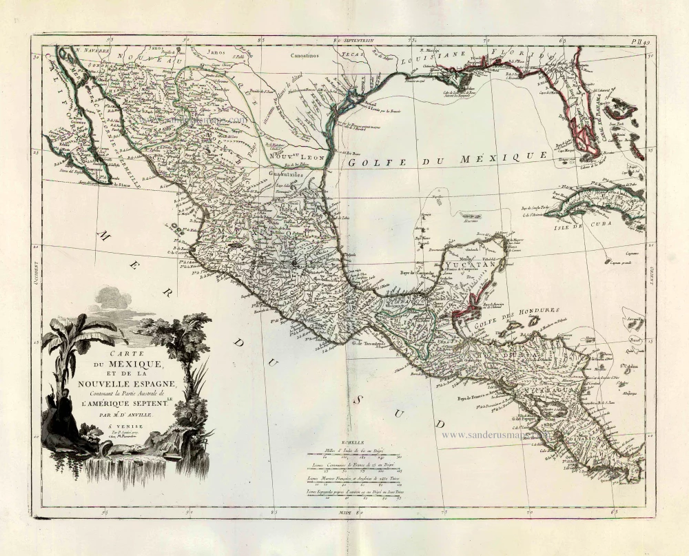
Carte du Mexique, et de la Nouvelle Espagne, Contenant la Partie Australe de l'Amérique Septentle. 1776-79
Mexico, by Paolo Santini.
[Item number: 27009]
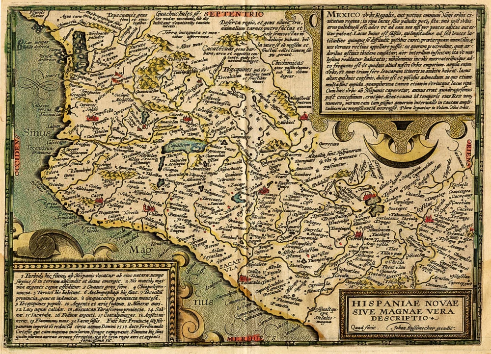
Hispaniae Novae sive Magnae Vera Descriptio. 1608
Mexico, by Quad M.-Bussemacher J.
[Item number: 15869]