
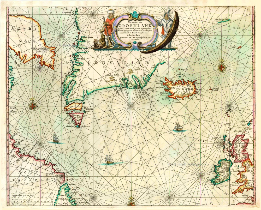
North Atlantic Ocean by Van Loon J. 1666
Joannes Van Loon (? – 1686)
Not much biographical data is known about Johannes Van Loon. He was a well-known mathematical practitioner who worked during a long period for various Amsterdam booksellers. He was also an engraver of sea charts, as he signed the charts made for the well-known sea-atlas: Klaer-Lichtende Noort-star, published by him and his brother Gilles since 1661. This sea-atlas was the first project undertaken at his own risk. Before 1661, he had contributed in the composition of the pilot books published by Johannes Janssonius.
Janssonius employed him further for the cutting of the plates for the celestial atlas: Harmonia Macrocosmica, first published in 1660.
In 1666 the plates for the sea-atlas were sold to Joh. Janssonius van Waesbergen who sold the atlas in partnership with Van Loon, after supplementing the atlas charts with twelve new charts, all signed by Van Loon and Van Waesbergen.
Later he worked on the Zee-Fakkel by Johannes Van Keulen (1681) and on the Brandende Veen by Jacobus Robijn (1685).
Pas-caerte van Groenland, Ysland, Straet Davids en Ian Mayen eyland; hoemen de selvige van Hitland en de noord kusten van Schotlandt en Yrlandt bezeylen mach.
Item Number: 27460 Authenticity Guarantee
Category: Antique maps > America > North America
Old, antique sea chart of the northern part of the Atlantic Ocean, by Joannes van Loon.
Date of the first edition: 1661
Date of this map: 1666
Copper engraving, printed on paper.
Size (not including margins): 42.5 x 53.5cm (16.6 x 20.9 inches)
Verso: Blank
Condition: Coloured, new upper and lower margins.
Condition Rating: B+
References: Koeman, Loon 5 (3); Burden, #364 State 2.
From: Klaer Lichtende Noort-Star Ofte Zee Atlas; Waer in vertoont wordt, De gelegentheydt van alle de Zeekusten des geheelen Aerdtbodems, Niewelicks uytgegeven, door Joannes van Loon. Amsterdam, Joannes van Loon, 1666; (Koeman IV, Loon 5)
Joannes Van Loon (? – 1686)
Not much biographical data is known about Johannes Van Loon. He was a well-known mathematical practitioner who worked during a long period for various Amsterdam booksellers. He was also an engraver of sea charts, as he signed the charts made for the well-known sea-atlas: Klaer-Lichtende Noort-star, published by him and his brother Gilles since 1661. This sea-atlas was the first project undertaken at his own risk. Before 1661, he had contributed in the composition of the pilot books published by Johannes Janssonius.
Janssonius employed him further for the cutting of the plates for the celestial atlas: Harmonia Macrocosmica, first published in 1660.
In 1666 the plates for the sea-atlas were sold to Joh. Janssonius van Waesbergen who sold the atlas in partnership with Van Loon, after supplementing the atlas charts with twelve new charts, all signed by Van Loon and Van Waesbergen.
Later he worked on the Zee-Fakkel by Johannes Van Keulen (1681) and on the Brandende Veen by Jacobus Robijn (1685).
Related items
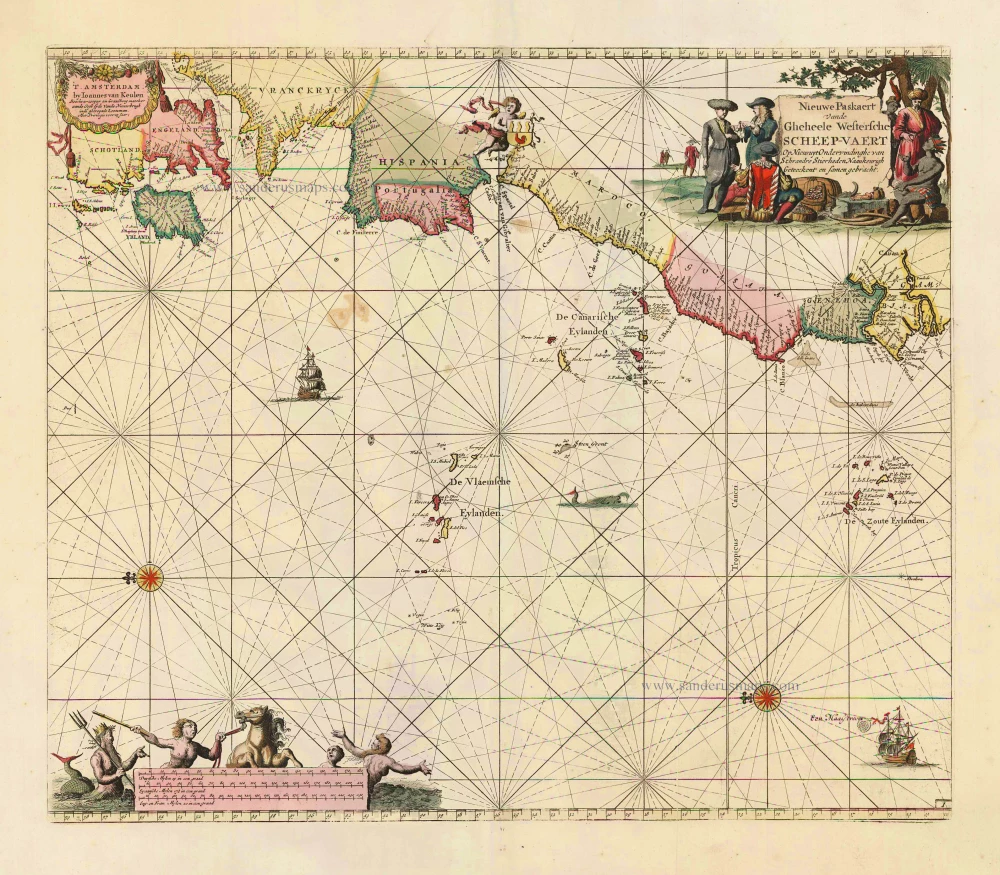
Nieuwe Paskaert vande Gheheele Westersche Scheep-Vaert, op Nieus uyt Ondervindinghe van Schrandre Stierlieden Naaukeurigh Geteeckent en Samen Gebracht. 1697-1709
The Atlantic Ocean, by J. Van Keulen.
[Item number: 11218]

Ocean Atlantique et Mers Adjacentes en Quatre Feuilles Contenant les Cotes de l'Europe, de l'Afrique et de l'Amerique ... 1778
The Atlantic Ocean, by G.L. Le Rouge.
[Item number: 14086]

The first sea chart relating to North America to use the Mercator projection
West-Indische Paskaert waer in de graden der breedde over wederzijden vande middellijn wassende so vergrooten dat die geproportioneert sijn tegen hunne nevenstaende graden der lengde; ... c. 1680
Atlantic Ocean. by P. Goos - J. Van Keulen
[Item number: 25938]
Rare.
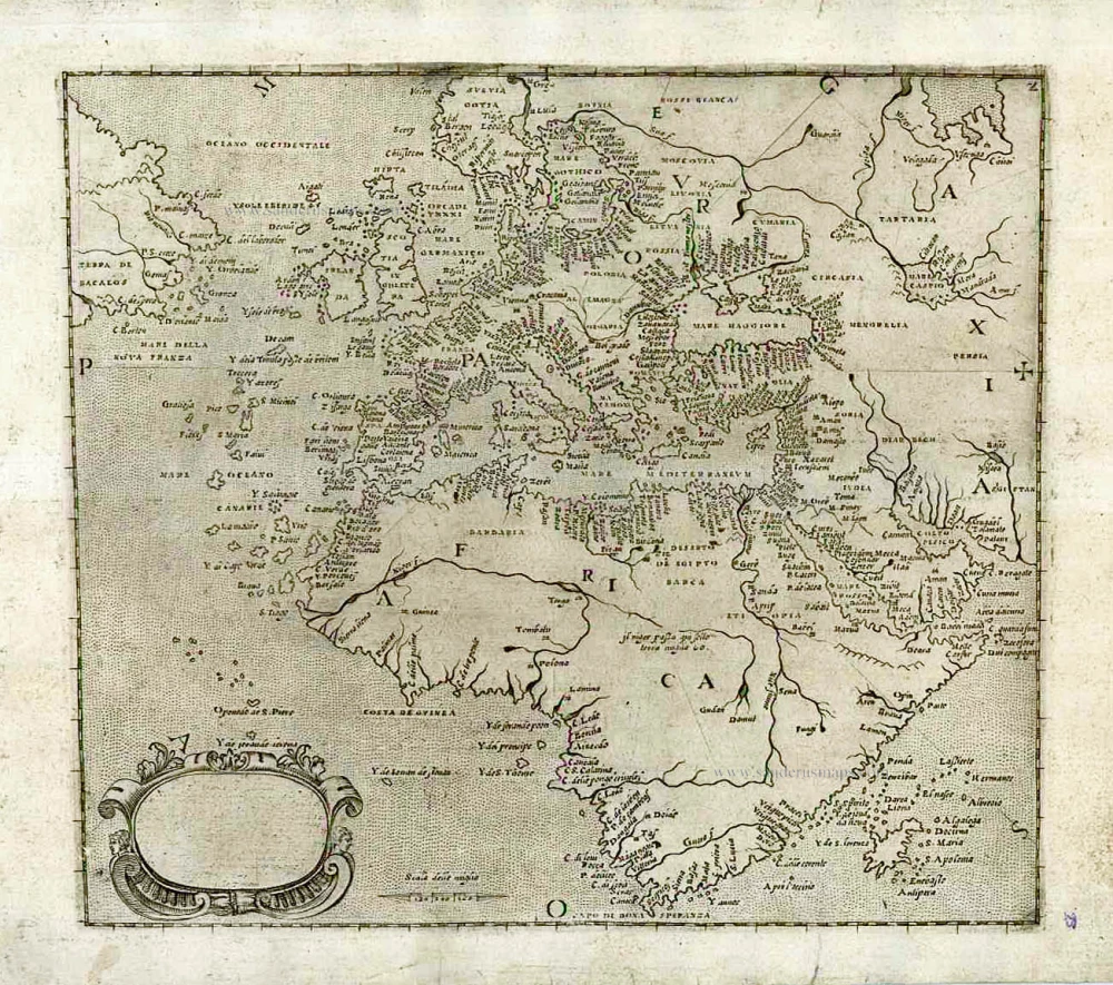
[No title] c. 1575
Atlantic Ocean - Europe, Africa & Eastern Canada by Giovanni Francesco Camocio
[Item number: 27086]