California by Cornelis van Wytfliet 1607
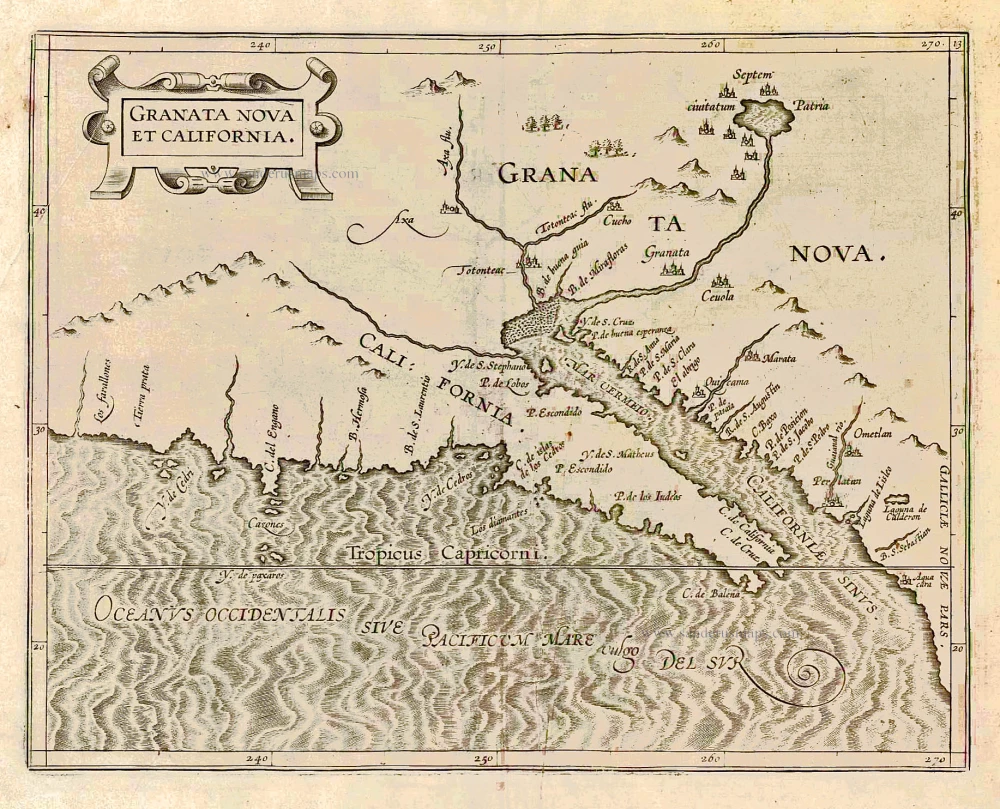
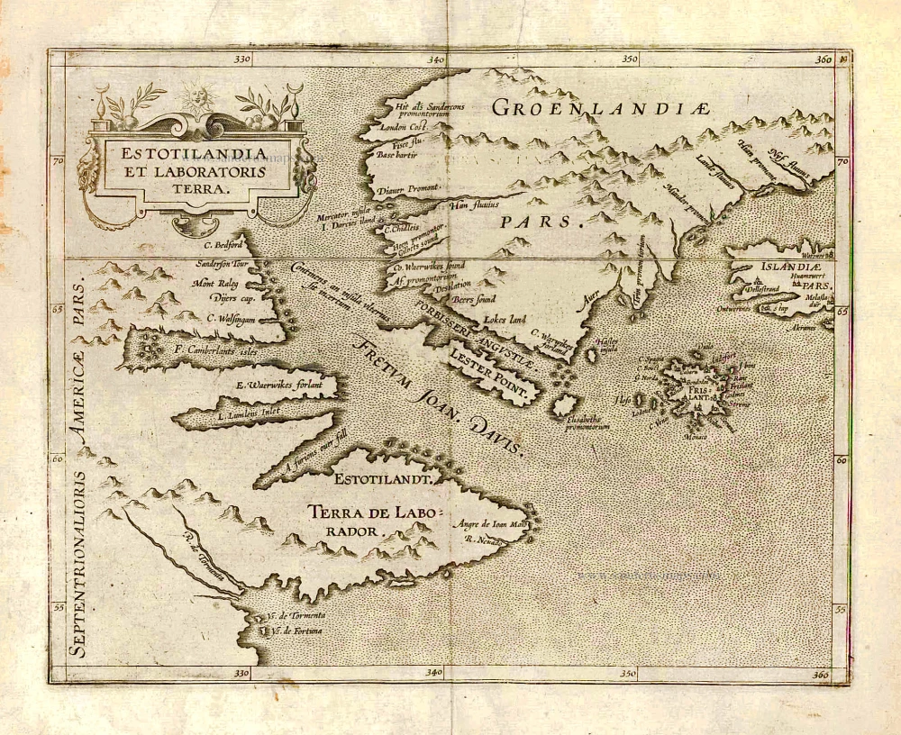
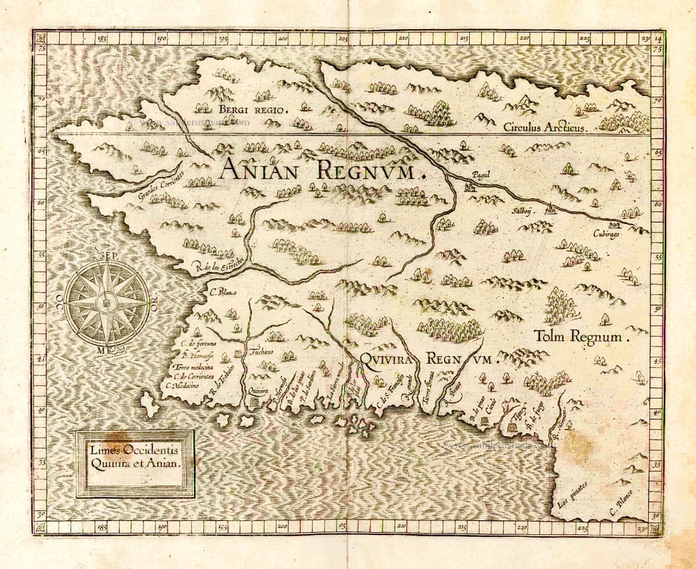
In 1597 Cornelis van Wytfliet published his Augmentum to Ptolemy's Geography. This is true as much as it covers all of the Americas, a part of the world unknown to the latter; however, no other connection exists between them. Dedicated to Philip III of Spain, it is a history of the New World, recording its discovery, natural history etc. For the book, Wytfliet had engraved nineteen maps, by whom we do not know, one of the world and eighteen regional maps of the Americas. As such, this book can be indeed called the first atlas of America. It was an immediate success and ran to several editions.
This is one of two maps of North America's west coast. One of the most exciting features is depicting so many fabled places, mainly from Spanish sources. Most notable amongst these are the seven cities of Cibola, Septem ciuitatum Patria, shown surrounding a lake, which flows a river that empties into the MAR VERMEIO or the Gulf of California. The seven cities originated from the narrative of Fray Marcos de Niza in 1539. The lake's existence was due to Antonio de Espejo, who was sent out as a rescue party in 1582 to find three missing Franciscan friars; he told of a large inland lake on his return. The account of this voyage was first published in Madrid in 1586. Some of the other terminologies originate from Coronado's epic exploration.
The outline of the map is pretty accurate and is derived mainly from Petrus Plancius' large world map of 1592. The prominent coastal irregularity is the westward slant of the Californian coastline. This is entirely forgivable, bearing in mind that it would be shown as part of an island in twenty-five years. (Burden)
Cornelius Wytfliet (? – 1597)
Cornelius Wytfliet was a geographer from Leuven. After graduating with a Licentiate in Laws from the University of Leuven, Wytfliet moved to Brussels and became secretary to the Council of Brabant.
In 1597, he published the first atlas of America: the Descriptionis Ptolemaicae Augmentum (Augmentation to Ptolemy’s description). He named his work an augmentation of Ptolemy’s Geography because it covers the Americas, a part of the world unknown to Ptolemy. However, there is no other connection between the works of Ptolemy and Van Wytfliet. Dedicated to Philip III of Spain, it is a history of the New World to date, recording its discovery, natural history, etc. It provides a history of exploration and the voyages of Christopher Columbus (1492-1502), John Cabot (1497-98), Sebastian Cabot (1526-28), Francisco Pizarro (1527-35), Giovanni de Verazzano (1524), Jacques Cartier (1540-42), and Martin Frobisher (1576-78). Most of Van Wytfliet’s maps are the first or among the earliest of specific regions of North and South America.
For the book, Wytfliet had engraved nineteen maps, one of the world and eighteen regional maps of the Americas. The book was an immediate success and ran to several editions.
Two editions of the Descriptionis Ptolemaicae were published at Leuven in 1597 and 1598, and in 1603, the first Douai edition appeared, with later editions with French text. The last edition was published in Arnhem in 1615.
Granata Nova et California.
Item Number: 26512 Authenticity Guarantee
Category: Antique maps > America > North America
Old, antique map of California, by Cornelis van Wytfliet.
Title: Granata Nova et California.
Date of the first edition: 1597.
Date of this map: 1607.
Copper engraving, printed on paper.
Size (not including margins): 230 x 290mm (9.06 x 11.42 inches).
Verso: Blank.
Condition: Tear reinforced in lower margin, running 2 cm into the image.
Condition Rating: B+.
References: Burden, #106; Van der Krogt 3, 9530:371 Variant b; Wagner, #188
From: Histoire Universelle des Indes Occidentales. Douai, Françoes Fabri, 1607. (Van der Krogt 3, 371:12)
In 1597 Cornelis van Wytfliet published his Augmentum to Ptolemy's Geography. This is true as much as it covers all of the Americas, a part of the world unknown to the latter; however, no other connection exists between them. Dedicated to Philip III of Spain, it is a history of the New World, recording its discovery, natural history etc. For the book, Wytfliet had engraved nineteen maps, by whom we do not know, one of the world and eighteen regional maps of the Americas. As such, this book can be indeed called the first atlas of America. It was an immediate success and ran to several editions.
This is one of two maps of North America's west coast. One of the most exciting features is depicting so many fabled places, mainly from Spanish sources. Most notable amongst these are the seven cities of Cibola, Septem ciuitatum Patria, shown surrounding a lake, which flows a river that empties into the MAR VERMEIO or the Gulf of California. The seven cities originated from the narrative of Fray Marcos de Niza in 1539. The lake's existence was due to Antonio de Espejo, who was sent out as a rescue party in 1582 to find three missing Franciscan friars; he told of a large inland lake on his return. The account of this voyage was first published in Madrid in 1586. Some of the other terminologies originate from Coronado's epic exploration.
The outline of the map is pretty accurate and is derived mainly from Petrus Plancius' large world map of 1592. The prominent coastal irregularity is the westward slant of the Californian coastline. This is entirely forgivable, bearing in mind that it would be shown as part of an island in twenty-five years. (Burden)
Cornelius Wytfliet (? – 1597)
Cornelius Wytfliet was a geographer from Leuven. After graduating with a Licentiate in Laws from the University of Leuven, Wytfliet moved to Brussels and became secretary to the Council of Brabant.
In 1597, he published the first atlas of America: the Descriptionis Ptolemaicae Augmentum (Augmentation to Ptolemy’s description). He named his work an augmentation of Ptolemy’s Geography because it covers the Americas, a part of the world unknown to Ptolemy. However, there is no other connection between the works of Ptolemy and Van Wytfliet. Dedicated to Philip III of Spain, it is a history of the New World to date, recording its discovery, natural history, etc. It provides a history of exploration and the voyages of Christopher Columbus (1492-1502), John Cabot (1497-98), Sebastian Cabot (1526-28), Francisco Pizarro (1527-35), Giovanni de Verazzano (1524), Jacques Cartier (1540-42), and Martin Frobisher (1576-78). Most of Van Wytfliet’s maps are the first or among the earliest of specific regions of North and South America.
For the book, Wytfliet had engraved nineteen maps, one of the world and eighteen regional maps of the Americas. The book was an immediate success and ran to several editions.
Two editions of the Descriptionis Ptolemaicae were published at Leuven in 1597 and 1598, and in 1603, the first Douai edition appeared, with later editions with French text. The last edition was published in Arnhem in 1615.