
Old antique map of Northeast of the U.S. by A. Montanus. 1671
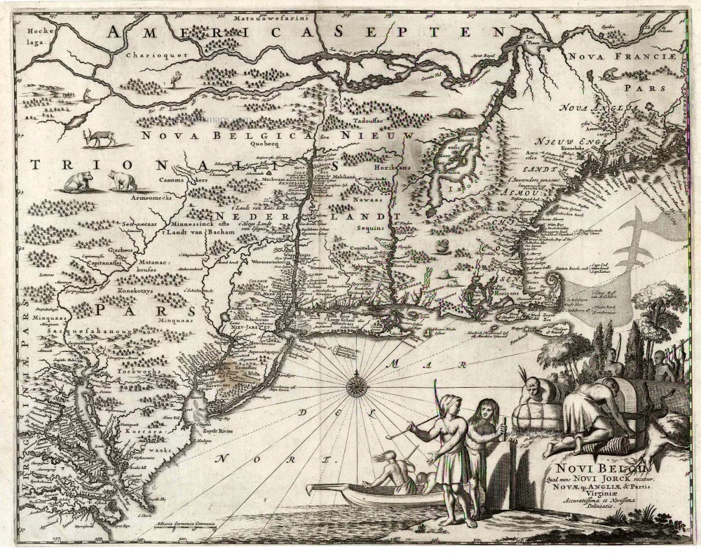
Novi Belgii, quod nunc Novi Jorck Vocatur, Novae qz. Angliae & Partis Virginiae Accuratissima et Novissima Delineatio.
Item Number: 25631 Authenticity Guarantee
Category: Antique maps > America > North America
Old, antique map of the Northeast of the U.S. by A. Montanus.
Date of the first edition: 1671
Date of this map: 1671
Copper engraving
Size (not including margins): 29 x 36cm (11.3 x 14 inches)
Verso: Blank
Condition: Bottom margin trimmed to neatline.
Condition Rating: A
References: Burden, 411. State 1.
From: Montanus A. De Nieuwe en Onbekende Weereld: of Beschryving van America. Amsterdam, J. Meurs, 1671.
This map is derived from the Nicolaas Visscher map of c.1655. The most important differences are the indications of the new English colonies Nieu Jorck (New York) and NIEU-JARSEY (New Jersey). The region was captured by the English in 1664, however, it is still named Nieu Nederlandt, though Fort Orange is identified as NOVA ALBANIA.
Related items
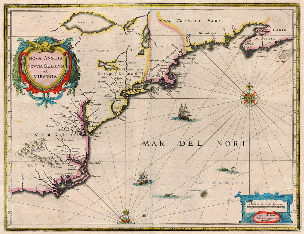
Nova Anglia Novum Belgium et Virginia 1638
United States (Northeast) by Janssonius J.
[Item number: 19011]
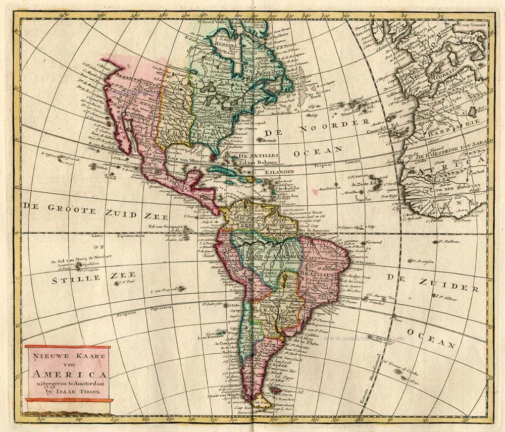
Nieuwe Kaart van America c. 1770
Antique map of America by Tirion I.
[Item number: 19194]
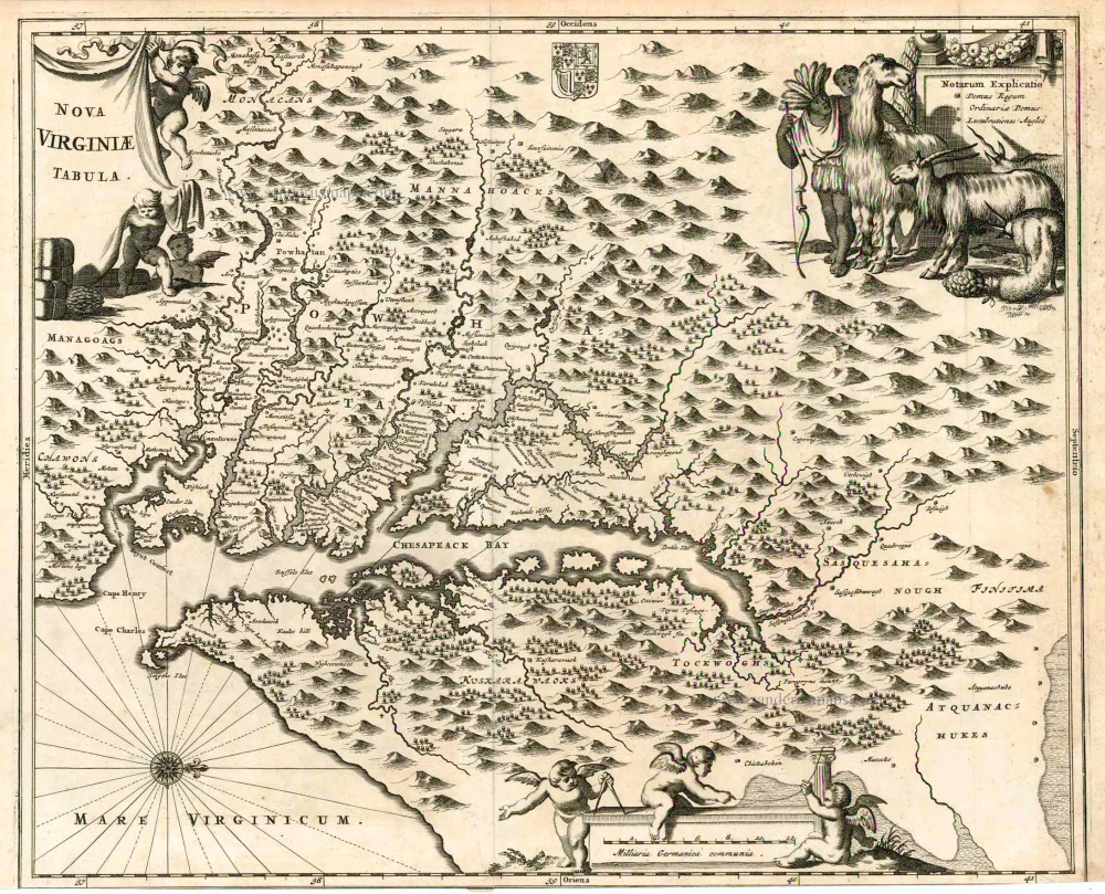
Nova Virginiae Tabula. 1671
Virginia, by A. Montanus.
[Item number: 25613]
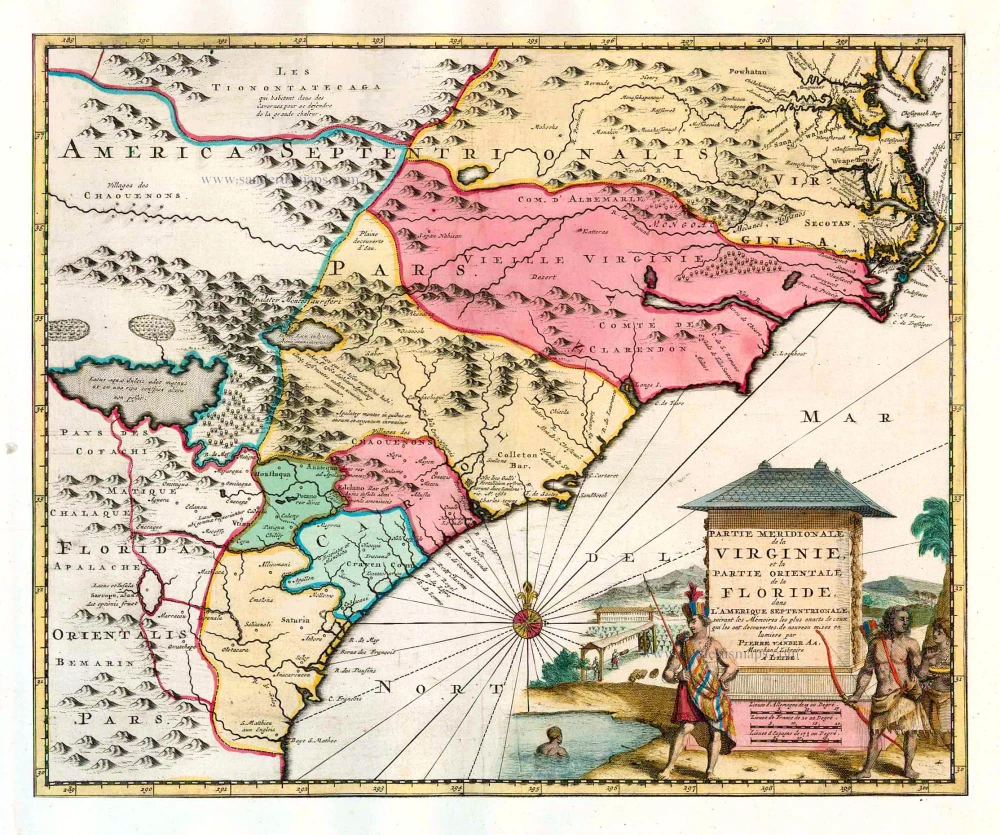
Partie Meridionale de la Virginie, et la Partie Orientale de la Floride dans l'Amerique Septentrionale. 1713
Carolina by Pieter van der Aa.
[Item number: 26137]
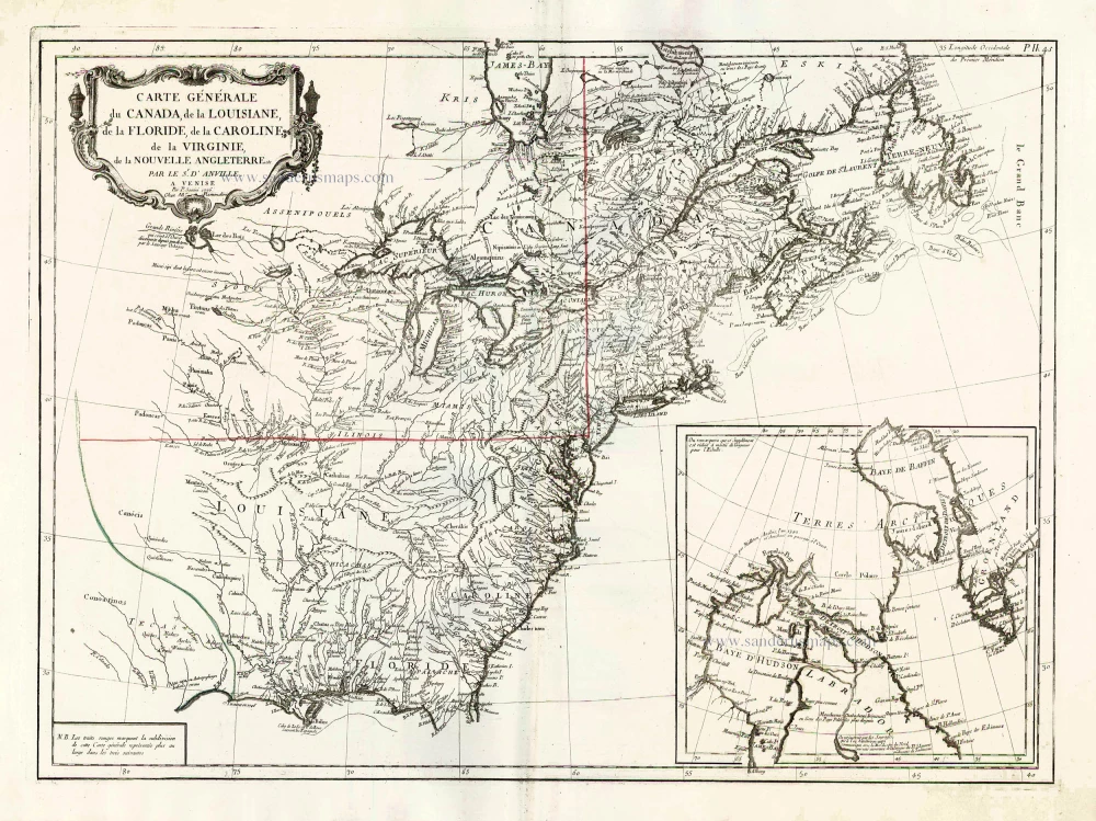
Carte Générale du Canada, de la Louisiane, de la Floride, de la Caroline, de la Virginie, de la Nouvelle Angleterre etc. 1776-79
North America (East), by Paolo Santini.
[Item number: 26980]