
United States (Northeast), by Girolamo Ruscelli. 1561
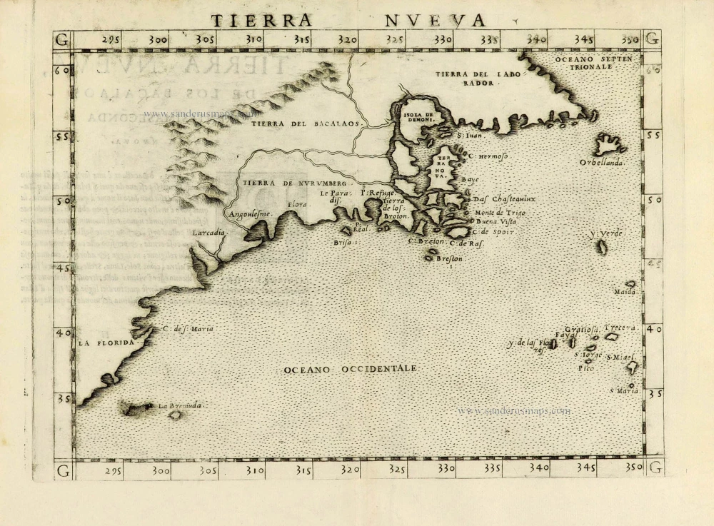
This map of the east coast is an enlarged version of Giacomo Gastaldi's published in 1548. The nomenclature and cartography are unchanged, except for the depiction of the rivers. Here he borrowed the assumption of Ramusio that the Hudson and St. Lawrence Rivers, as we know them today, were connected upriver.
Giacomo Gastaldi (c. 1500 – 1566)
Giacomo Gastaldi was born in Villafranca, in Piedmont, to a wealthy family. Although he is considered one of the greatest cartographers of the sixteenth century, the events of his life and his professional training in the field of cartography are unknown to us until he arrives in Venice, where, in 1539, he obtained a perpetual printing privilege from the Venetian Senate.
One of the first Venetian contacts took place with the geographer and humanist Giovanni Battista Ramusio, with whom he collaborated. At the beginning of the 1540s, Gastaldi was already an established cartographer and began to work on a series of maps first published separately and then included in the Italian edition of Ptolemy's Geography of 1548 and others made from scratch.
By the 1540s, he had developed his distinctive style of copper engraving for his increasingly prolific output of maps. His maps were used as a source by many mapmakers, including Camocio, Bertelli, Forlani, Ramusio, Cock, Luchini and Ortelius.
With the support of his influential friendships, Gastaldi also obtained public positions: in 1549, the Council of Ten commissioned him to make a large map of Africa, for a wall from the armoury in the Doge's Palace and, again for the same room, one map of Asia and one of North America.
It is difficult to quantify the number of maps he produced; more than a hundred have been attributed to him.
Paolo Forlani collaborated for a long time with Gastaldi and published numerous counterfeits and not authorized editions.
Gastaldi died in Venice on 14 October 1566.
Tierra Nueva.
Item Number: 28139 Authenticity Guarantee
Category: Antique maps > America > North America
Old, antique map of the Northeast of the United States, by Girolamo Ruscelli.
Title: Tierra Nueva.
Cartographer: Giacomo Gastaldi.
Engraver: Giulio & Livio Sanuto.
Date of the first edition: 1561.
Date of this map: 1561.
Copper engraving, printed on paper.
Size (not including margins): 190 x 250mm (7.48 x 9.84 inches).
Verso: Italian text.
Condition: Sharp impression, excellent.
Condition Rating: A+.
References: Burden, #30, 1st state; Kershaw I, 18a
From: La Geografia di Claudio Tolomeo Alessandrino, Nuovamente tradotta di Greco in Italiano da Girolamo Ruscelli. Venice, Vincenzo Valgrisi, 1561. (Karrow, p.222 30/C.1)
This map of the east coast is an enlarged version of Giacomo Gastaldi's published in 1548. The nomenclature and cartography are unchanged, except for the depiction of the rivers. Here he borrowed the assumption of Ramusio that the Hudson and St. Lawrence Rivers, as we know them today, were connected upriver.
Giacomo Gastaldi (c. 1500 – 1566)
Giacomo Gastaldi was born in Villafranca, in Piedmont, to a wealthy family. Although he is considered one of the greatest cartographers of the sixteenth century, the events of his life and his professional training in the field of cartography are unknown to us until he arrives in Venice, where, in 1539, he obtained a perpetual printing privilege from the Venetian Senate.
One of the first Venetian contacts took place with the geographer and humanist Giovanni Battista Ramusio, with whom he collaborated. At the beginning of the 1540s, Gastaldi was already an established cartographer and began to work on a series of maps first published separately and then included in the Italian edition of Ptolemy's Geography of 1548 and others made from scratch.
By the 1540s, he had developed his distinctive style of copper engraving for his increasingly prolific output of maps. His maps were used as a source by many mapmakers, including Camocio, Bertelli, Forlani, Ramusio, Cock, Luchini and Ortelius.
With the support of his influential friendships, Gastaldi also obtained public positions: in 1549, the Council of Ten commissioned him to make a large map of Africa, for a wall from the armoury in the Doge's Palace and, again for the same room, one map of Asia and one of North America.
It is difficult to quantify the number of maps he produced; more than a hundred have been attributed to him.
Paolo Forlani collaborated for a long time with Gastaldi and published numerous counterfeits and not authorized editions.
Gastaldi died in Venice on 14 October 1566.
Related items
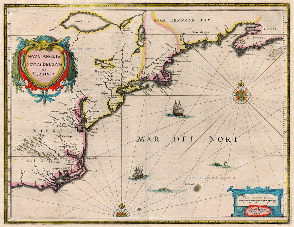
Nova Anglia Novum Belgium et Virginia 1638
United States (Northeast) by Janssonius J.
[Item number: 19011]
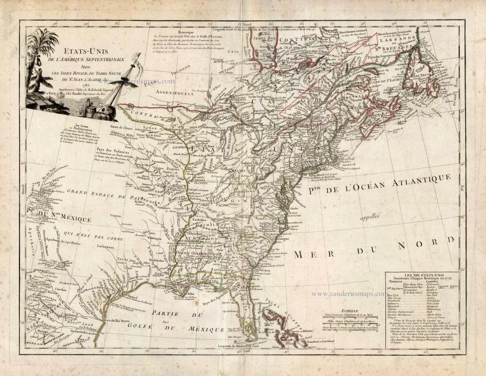
Etats-Unis de l'Amerique Septentrionale avec les Isles Royale, de Terre Neuve de St. Jean, l'Acadie &c. 1786
United States (East) by Boudet A. - de Vaugondy R.
[Item number: 25265]
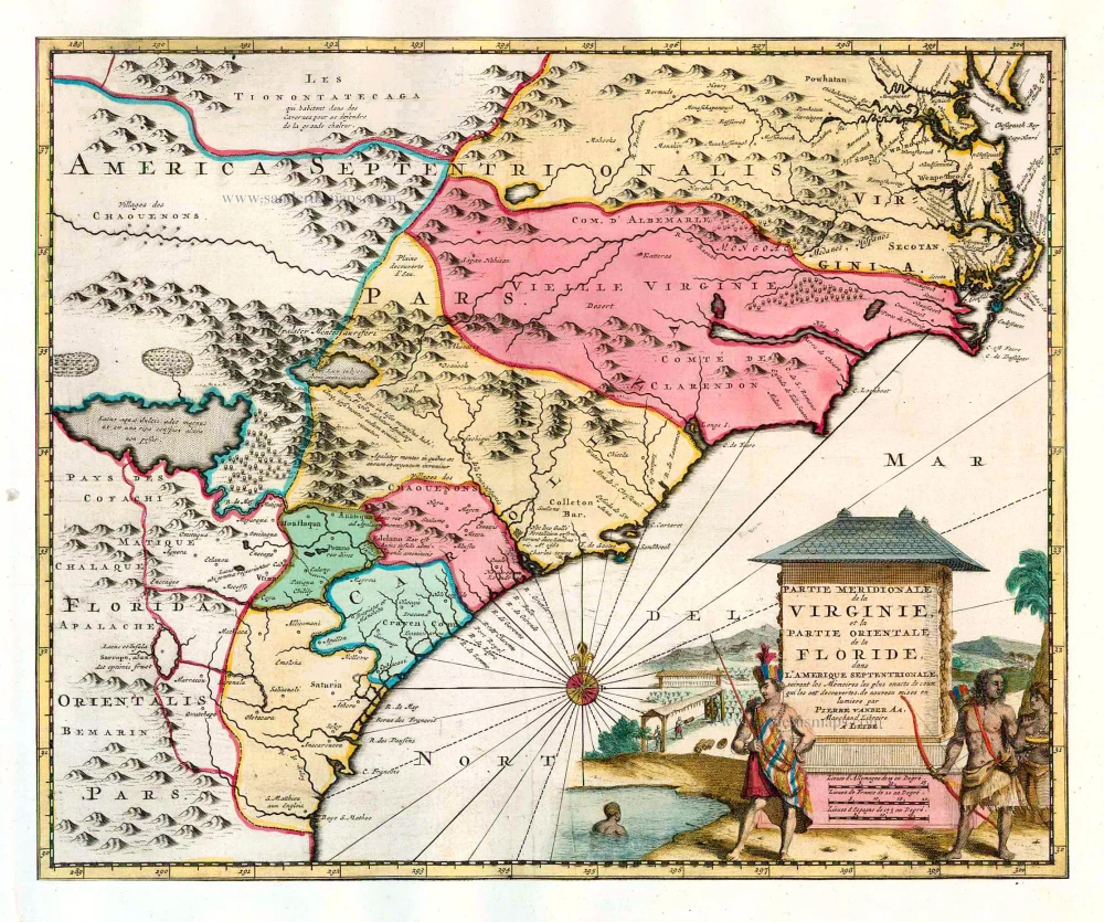
Partie Meridionale de la Virginie, et la Partie Orientale de la Floride dans l'Amerique Septentrionale. 1713
Carolina by Pieter van der Aa.
[Item number: 26137]
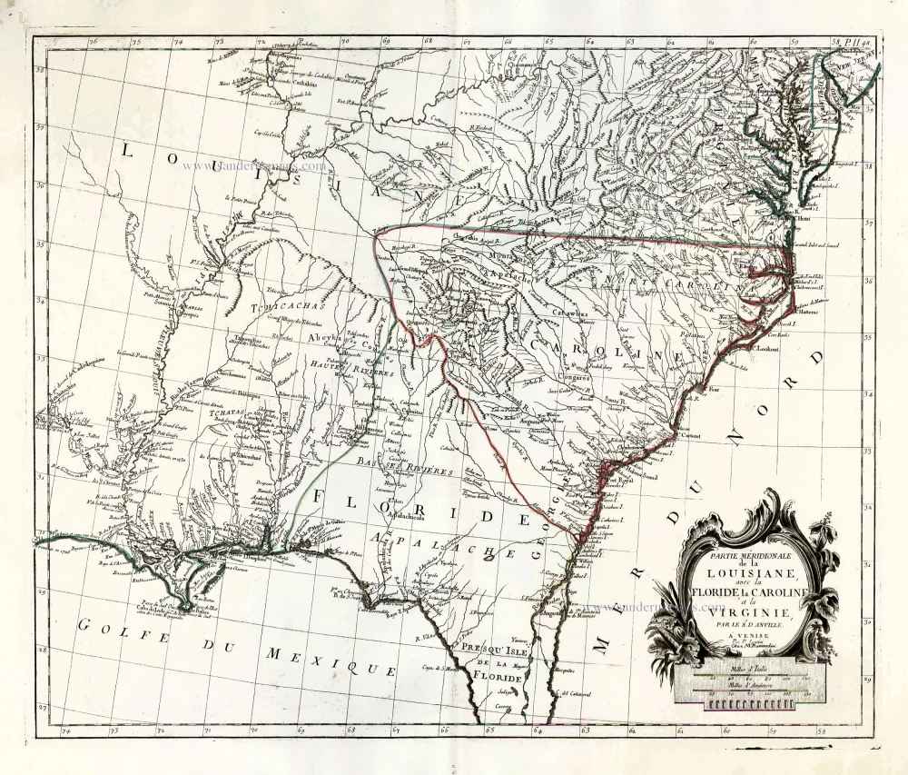
Partie Méridionale de la Louisiane, avec la Floride, la Caroline et la Virginie. 1776-79
The United States (Southeast), by Francesco Santini.
[Item number: 26983]