
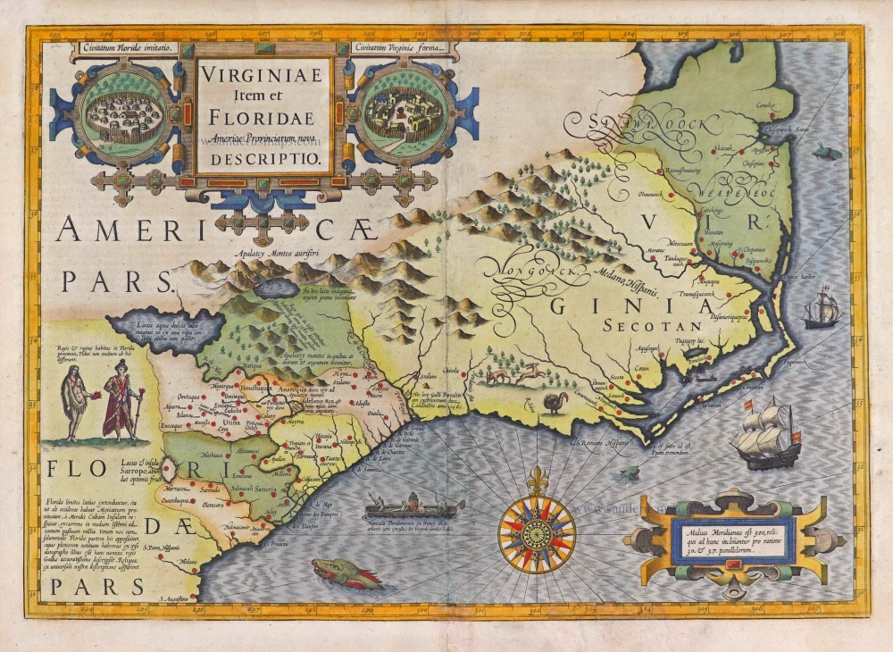
Virginia - Florida, by Jodocus Hondius. 1623


"Though this map by Hondius is based on two earlier maps, those of White 1590 and Le Moyne 1591, subsequent cartographers usually followed this work rather than the earlier maps. It thus became the region's most important type of map until the Ogilby-Moxon "Discription of Carolina" ca. 1672, and its direct and indirect influence extended into the middle of the eighteenth century.
That part of the territory settled by the French in 1562-65 depends chiefly upon Le Moyne's map. The gold-bearing mountains of Apalatcy, the lake fed by the great waterfall, the lake with the unseen shore, Lake Sarrope, the French names for the rivers, the location of the French fort at Port Royal: these and many other details are based on Le Moyne. However, there are significant changes. The great lake with the opposite shore invisible, which in Le Moyne lies in a southwesterly direction from the mouth of the River May, into which it empties, has been moved northward to the foothills of the Apalatcy Montes. This makes the River May flow in a southeasterly direction instead of in the A-shaped course given by Le Moyne. In this, Hondius was influenced by the other maps of the region - Mercator 1569, Ortelius 1584, Wytfliet 1597 - in which the great River Sola flows in a southeasterly direction from the mountains.
However, the River May is Le Moyne's name for St. Johns River in Florida, on which Fort Caroline was built and flows in a northerly direction from its sources and lakes in Florida until near its mouth when it turns eastward toward the sea. By putting the great lake and the direction of the flow of the River May to the northwest of its mouth and changing the accompanying topographical features and Indian settlements, Hondius created geographical misconceptions of the region, which lasted for nearly a century and a half. Also, he moved the latitude of the mouth of the River May from 29°30' N.L. (St. Johns is 30°25') to 31°20'. This is the latitude of the Altamaha in Georgia, the first River above Florida, which has its source in the Appalachian range. These factors undoubtedly encouraged the continuance of erroneous beliefs in the minds of subsequent explorers and cartographers. St. Marys River, which lies between St. Johns and the Altamaha, rises in the Okefenokee Swamp. Some writers think that the River May is the St. Marys River and that the great lake is the Okefenokee Swamp." (Cumming)
The Hondius Family
Jodocus Hondius the Elder (1563-1612)
Joost d’Hondt was born at Wakken (Flanders) in 1563. Two years later, his family settled in Ghent, where young Joost displayed an excellent gift for drawing and calligraphy. Through study and lessons, he developed his talents and became an engraver with a good reputation.
Due to the circumstances of the war, he moved to London in 1584, where he settled down as an engraver, instrument-maker, and map-maker. In 1587, he married Coletta van den Keere, sister of the well-known engraver Pieter van den Keere (Petrus Kaerius); some years earlier, his sister, Jacomina, had married Pieter van den Berghe (Petrus Montanus). Joost, who had Latinized his name to Jodocus Hondius, closely co-operated with his two brothers-in-law.
The political situation in the Northern Netherlands in 1593 was such that Jodocus seemed justified in establishing himself in Amsterdam, where many Antwerp printers, publishers, and engravers had gone. In this new centre of cartography, Jodocus Hondius set up his business “In de Wackere Hondt” (in the vigilant dog), this name being an allusion to his birthplace and name. He engraved many maps and published atlases and many other works, such as his continuation of Gerard Mercator’s Atlas.
He suddenly passed away in February 1612. The publishing firm of Jodocus Hondius was continued by his widow, later on, by his two sons, Jodocus Jr. and Henricus, and by his son-in-law, J. Janssonius.
Jodocus Hondius II (1594-1629) & Henricus Hondius (1597-1651)
After the father’s death, the widow and her seven children continued publishing the atlases under the name of Jodocus Hondius till 1620. The firm was reinforced by the very welcome help of Joannes Janssonius (1588-1664), who married 24-year-old Elisabeth Hondius in 1612. After 1619, Mercator’s Atlas was published under the name of Henricus Hondius.
One of the most dramatic events in the early history of commercial cartography in Amsterdam was the sale of Jodocus Hondius Jr.’s copper plates to Willem Jansz. Blaeu in 1629, the year of his death. At least 34 plates, from which Jodocus II had printed single-sheet maps for his benefit, passed into the hands of his great competitor. Immediately after that, his brother, Henricus, and Joannes Janssonius ordered the engraving of identical plates.
Henricus devoted all his energy to publishing the Atlas for an extended period. He saw its growth up to and including the fourth part in 1646; after that, his name no longer figures on the title pages. After 1638, the title of the Atlas was changed to Atlas Novus; Joannes Janssonius mainly carried it on.
The competition with the Blaeu's dates from 1630. In 1630, Willem Janszoon (=Blaeu) first attacked with his Atlantis Appendix. In 1635, Blaeu completed his Theatrum Orbis Terrarum in two volumes with French, Latin, Dutch, and German texts, prompting Henricus Hondius to speed up the enlargement of his Atlas.
Virginiae Item et Floridae Americae Provinciarum, nova Descriptio.
Item Number: 27960 Authenticity Guarantee
Category: Antique maps > America > North America
Old, antique map of Virginia - Florida, by Jodocus Hondius.
Title: Virginiae Item et Floridae Americae Provinciarum, nova Descriptio.
Date of the first edition: 1606.
Date of this map: 1623.
Copper engraving, printed on paper.
Size (not including margins): 343 x 486mm (13.5 x 19.13 inches).
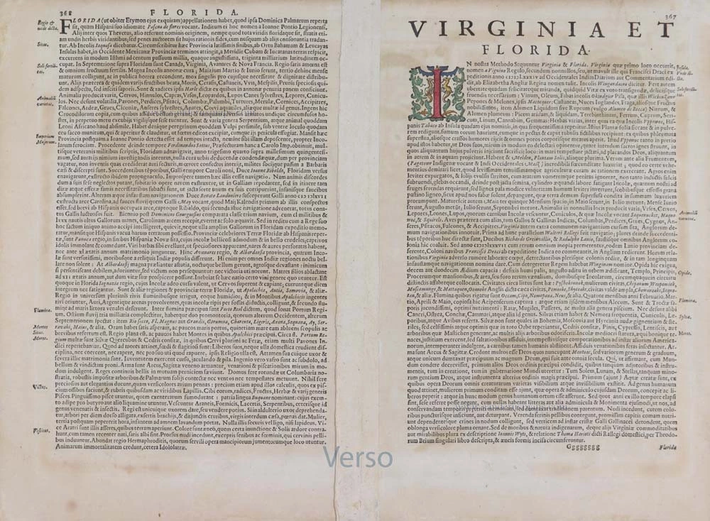
Verso: Latin text.
Condition: Original coloured, centrefold repaired.
Condition Rating: B.
References: Van der Krogt 1, 9400:1A; Burden, #151; Cumming, #26
From: Gerardi Mercatoris - Atlas sive Cosmographicae Meditationes de Fabrica Mundi et Fabricati Figura. Denuo auctus Editio Quinta. Henricus Hondius. 1623. (Van der Krogt 1, 105)
"Though this map by Hondius is based on two earlier maps, those of White 1590 and Le Moyne 1591, subsequent cartographers usually followed this work rather than the earlier maps. It thus became the region's most important type of map until the Ogilby-Moxon "Discription of Carolina" ca. 1672, and its direct and indirect influence extended into the middle of the eighteenth century.
That part of the territory settled by the French in 1562-65 depends chiefly upon Le Moyne's map. The gold-bearing mountains of Apalatcy, the lake fed by the great waterfall, the lake with the unseen shore, Lake Sarrope, the French names for the rivers, the location of the French fort at Port Royal: these and many other details are based on Le Moyne. However, there are significant changes. The great lake with the opposite shore invisible, which in Le Moyne lies in a southwesterly direction from the mouth of the River May, into which it empties, has been moved northward to the foothills of the Apalatcy Montes. This makes the River May flow in a southeasterly direction instead of in the A-shaped course given by Le Moyne. In this, Hondius was influenced by the other maps of the region - Mercator 1569, Ortelius 1584, Wytfliet 1597 - in which the great River Sola flows in a southeasterly direction from the mountains.
However, the River May is Le Moyne's name for St. Johns River in Florida, on which Fort Caroline was built and flows in a northerly direction from its sources and lakes in Florida until near its mouth when it turns eastward toward the sea. By putting the great lake and the direction of the flow of the River May to the northwest of its mouth and changing the accompanying topographical features and Indian settlements, Hondius created geographical misconceptions of the region, which lasted for nearly a century and a half. Also, he moved the latitude of the mouth of the River May from 29°30' N.L. (St. Johns is 30°25') to 31°20'. This is the latitude of the Altamaha in Georgia, the first River above Florida, which has its source in the Appalachian range. These factors undoubtedly encouraged the continuance of erroneous beliefs in the minds of subsequent explorers and cartographers. St. Marys River, which lies between St. Johns and the Altamaha, rises in the Okefenokee Swamp. Some writers think that the River May is the St. Marys River and that the great lake is the Okefenokee Swamp." (Cumming)
The Hondius Family
Jodocus Hondius the Elder (1563-1612)
Joost d’Hondt was born at Wakken (Flanders) in 1563. Two years later, his family settled in Ghent, where young Joost displayed an excellent gift for drawing and calligraphy. Through study and lessons, he developed his talents and became an engraver with a good reputation.
Due to the circumstances of the war, he moved to London in 1584, where he settled down as an engraver, instrument-maker, and map-maker. In 1587, he married Coletta van den Keere, sister of the well-known engraver Pieter van den Keere (Petrus Kaerius); some years earlier, his sister, Jacomina, had married Pieter van den Berghe (Petrus Montanus). Joost, who had Latinized his name to Jodocus Hondius, closely co-operated with his two brothers-in-law.
The political situation in the Northern Netherlands in 1593 was such that Jodocus seemed justified in establishing himself in Amsterdam, where many Antwerp printers, publishers, and engravers had gone. In this new centre of cartography, Jodocus Hondius set up his business “In de Wackere Hondt” (in the vigilant dog), this name being an allusion to his birthplace and name. He engraved many maps and published atlases and many other works, such as his continuation of Gerard Mercator’s Atlas.
He suddenly passed away in February 1612. The publishing firm of Jodocus Hondius was continued by his widow, later on, by his two sons, Jodocus Jr. and Henricus, and by his son-in-law, J. Janssonius.
Jodocus Hondius II (1594-1629) & Henricus Hondius (1597-1651)
After the father’s death, the widow and her seven children continued publishing the atlases under the name of Jodocus Hondius till 1620. The firm was reinforced by the very welcome help of Joannes Janssonius (1588-1664), who married 24-year-old Elisabeth Hondius in 1612. After 1619, Mercator’s Atlas was published under the name of Henricus Hondius.
One of the most dramatic events in the early history of commercial cartography in Amsterdam was the sale of Jodocus Hondius Jr.’s copper plates to Willem Jansz. Blaeu in 1629, the year of his death. At least 34 plates, from which Jodocus II had printed single-sheet maps for his benefit, passed into the hands of his great competitor. Immediately after that, his brother, Henricus, and Joannes Janssonius ordered the engraving of identical plates.
Henricus devoted all his energy to publishing the Atlas for an extended period. He saw its growth up to and including the fourth part in 1646; after that, his name no longer figures on the title pages. After 1638, the title of the Atlas was changed to Atlas Novus; Joannes Janssonius mainly carried it on.
The competition with the Blaeu's dates from 1630. In 1630, Willem Janszoon (=Blaeu) first attacked with his Atlantis Appendix. In 1635, Blaeu completed his Theatrum Orbis Terrarum in two volumes with French, Latin, Dutch, and German texts, prompting Henricus Hondius to speed up the enlargement of his Atlas.
Related items
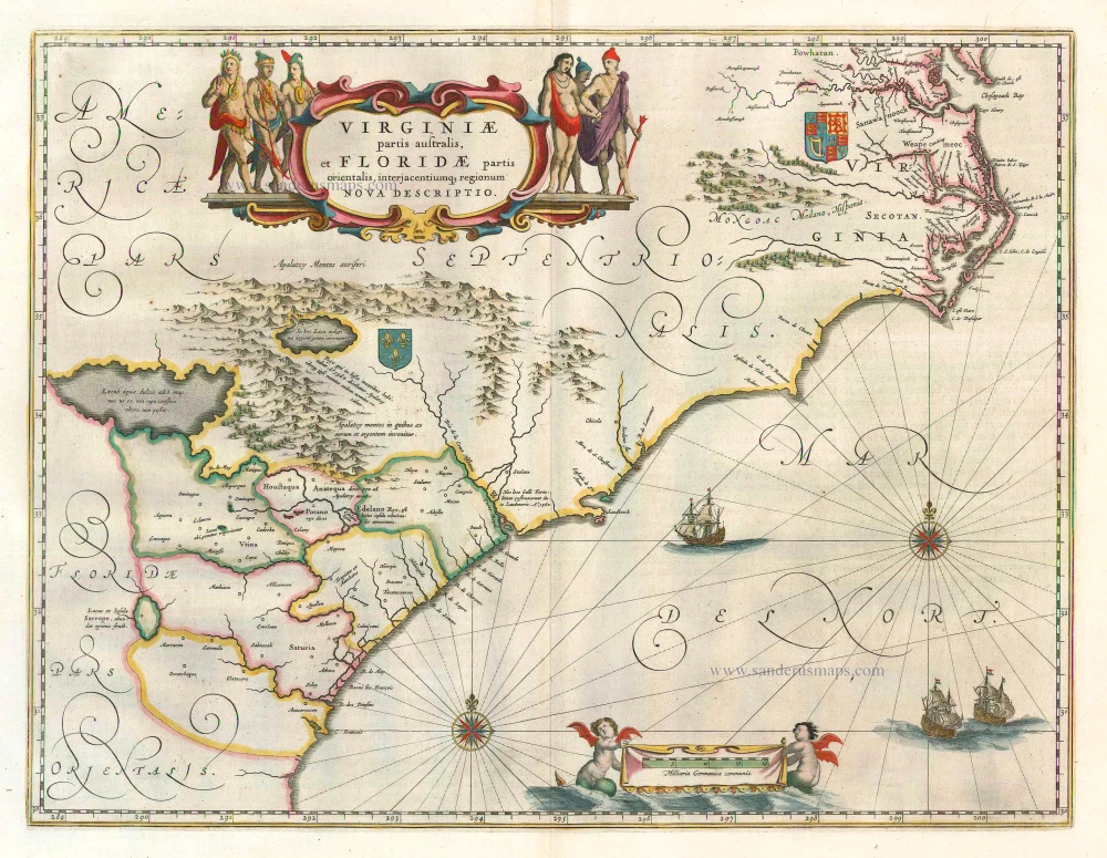
Virginiae Partis Australis, Et Floridae Partis Orientalis ... 1649-55
Virginia by Willem Blaeu.
[Item number: 15427]
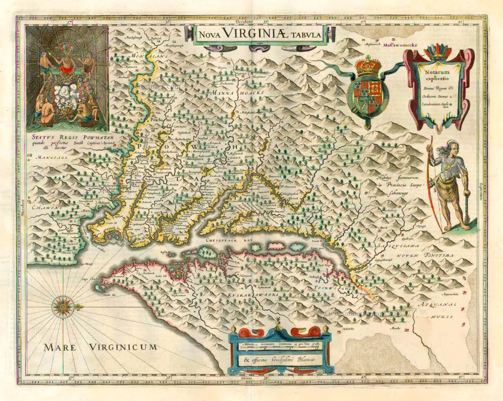
Nova Virginiae Tabula 1647
Virginia by Willem Blaeu.
[Item number: 25096]
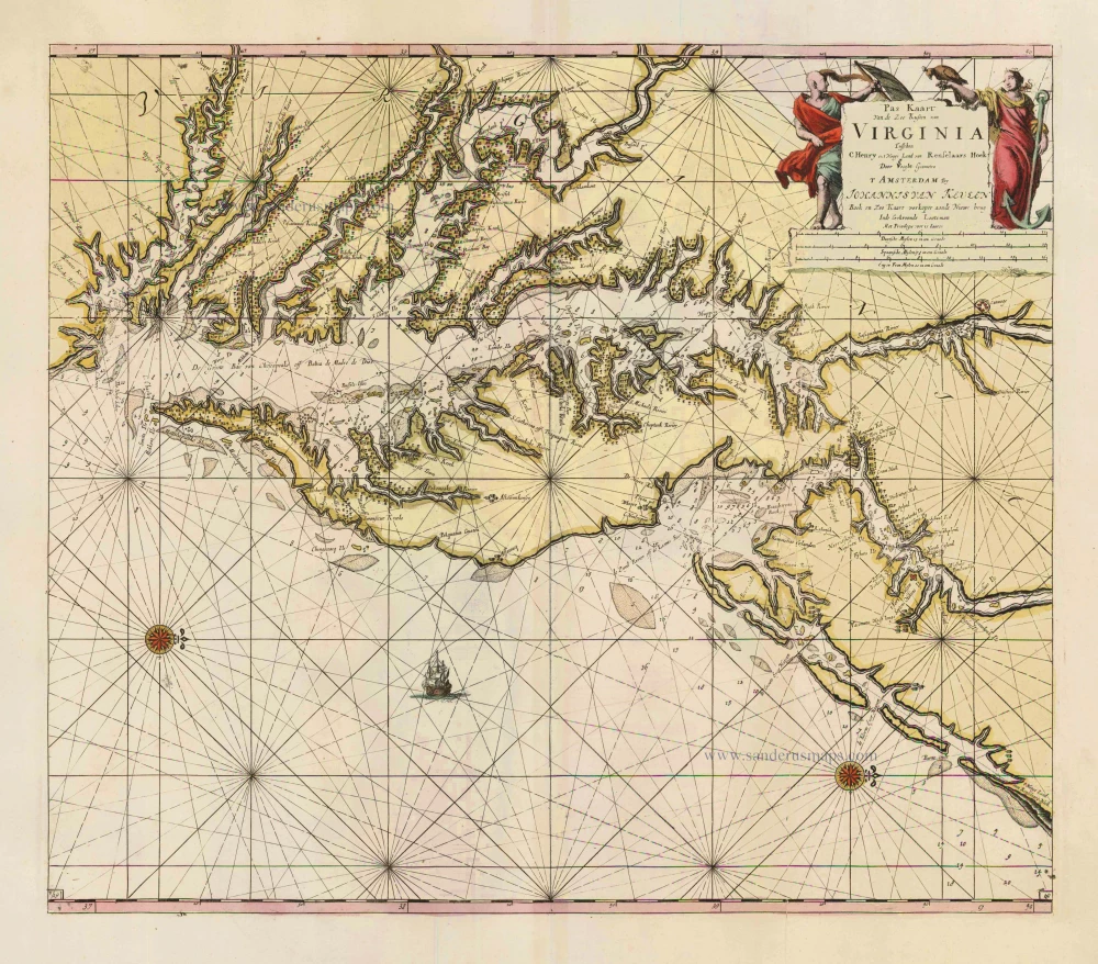
Pas Kaart van de Zee Kusten van Virginia tusschen C. Henry en t Hooge Land van Renselaars Hoek. 1702
Virginia by Johannes van Keulen
[Item number: 1332]
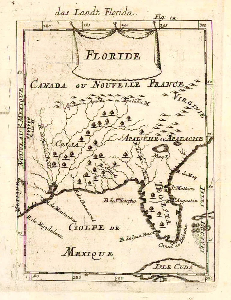
Floride. 1685
Florida, Virginia and Louisiana, by A.M. Mallet.
[Item number: 26599]
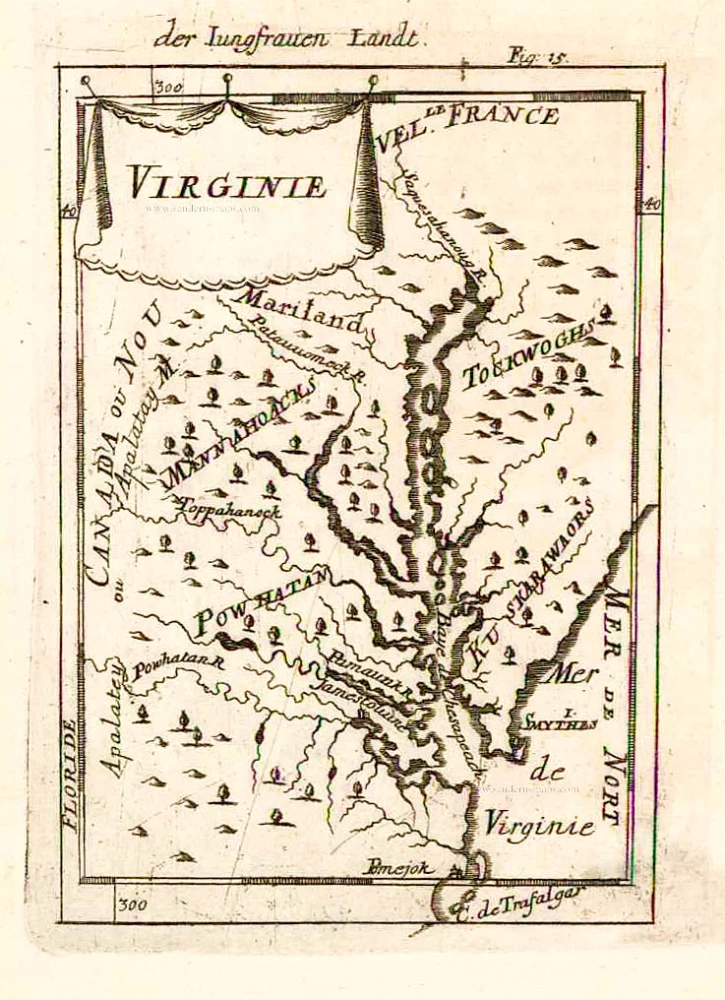
Virginie. 1685
Virginia and Maryland, by A.M. Mallet.
[Item number: 26602]
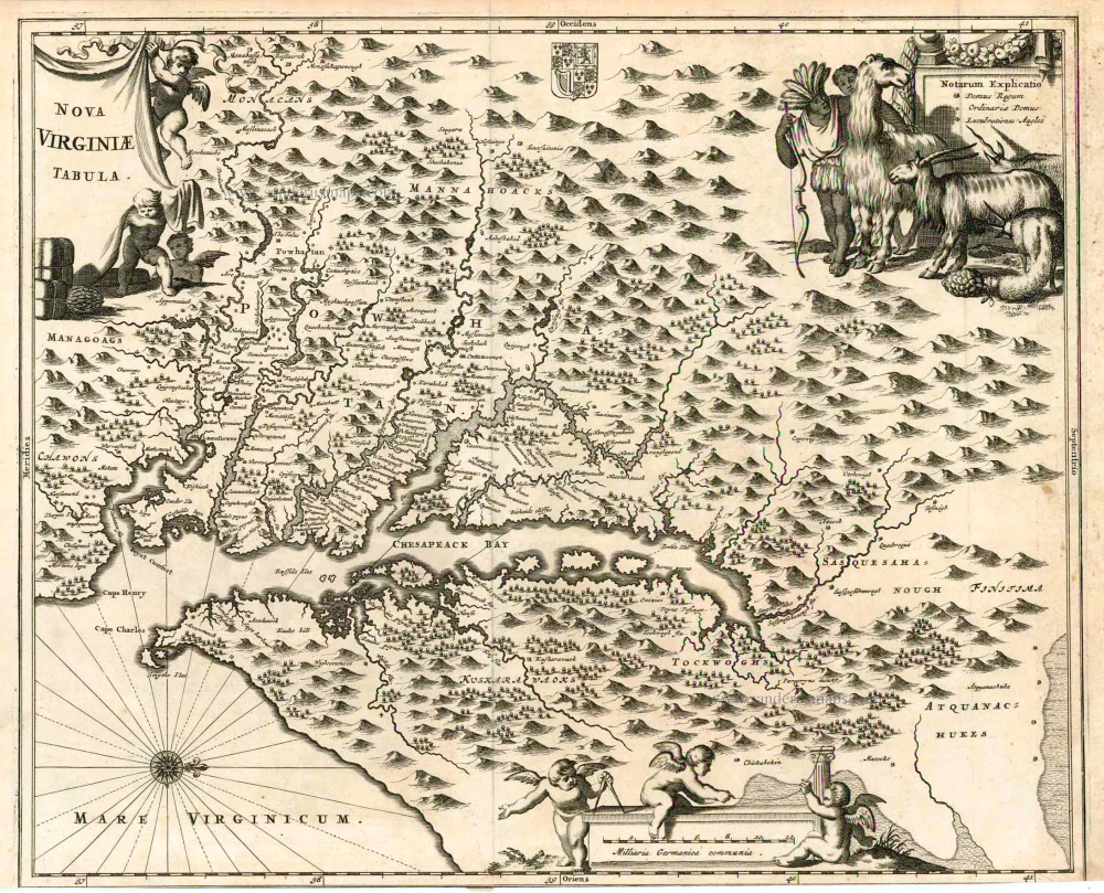
Nova Virginiae Tabula. 1671
Virginia, by A. Montanus.
[Item number: 25613]
A Map of the country between Albemarle Sound, and Lake Erie, comprehending the whole of Virginia, Maryland, Delaware and Pensylvania, with parts of several other of the United States of America. 1787
Virginia by Thomas Jefferson
[Item number: 27301]