
South America, by Jan Huygen van Linschoten. 1596
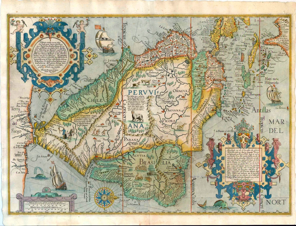


This map sheet, with the north on the right, shows all of South America and also includes the Antilles, Florida, and part of the coasts of the Gulf of Mexico. A strip of the Southern continent (Terra del Fuego) is shown running along the left edge. Striking decorative elements are two elaborate scrollwork cartouches containing the titles. A circular compartment in the upper left corner contains the Latin title with the name of the engraver, while a square panel in the lower right corner contains a description in Dutch. The texts give a more extensive summary of the territories represented on the map (in translation): 'Illustration of all the coasts of the whole Southern part of America called Peruviana, starting from the Rio de la Plata along the coast of Brazil, Paria, and Golden Castilia, with all the islands called the Antilles, Hispaniola, and Cuba to Cape Florida; likewise from the isthmus between Panama and Nombre de Dios, all the coasts and the land of Golden Peru, with the capital Cuzco, and its convenient harbour called Lima; likewise the coasts of Chile, and the channel or isthmus between the land of the Patagonians and Terra del fuego; likewise all the harbours, islands, cliffs, sands, deep and shallow waters, with their actual extent very accurately indicated, revised and improved in accordance with the very best Spanish maps'. In the lower left corner, a simple cartouche contains the scale bars for Dutch and Spanish miles. A scale of latitude is drawn along the upper and lower edge of the map. A compass rose is placed to the north of the mouth of the Rio de la Plata; in addition, three ships and two monsters are shown in the seas. The land masses are decorated with drawings of exotic animals and native peoples.
In the text of the titles, it is noted that everything in the map image is 'very accurately indicated, revised and improved in accordance with the very best Spanish maps'. This remark does not mean that the mapmakers worked directly from a Spanish model. This map is based on the work of Plancius. As noted repeatedly, when composing his maps, Plancius mainly used Iberian sources drawing the coastlines. Here, Arnold Floris van Langren, who refers to himself in the map as Author et Sculptor, combined two of Plancius's maps to make an attractive combination.
On the map itself, the entire territory represented, bears the name PERUANA in large capitals. The coastline of the Atlantic Ocan is a striking departure from reality. It is shown running from the southeast to the northwest. This aberration may be explained by the difficulty of determining longitude, whereby too much width was alotted to the continent. Because the mapmakers also wanted to include the unknown southwestern coastline, this line is shown running in the wrong direction. With respect to the Southern continent, Plancius relied on tradition. Following in his foodsteps, the image drawn by Van Langren was the same as that by Plancius.
Along the coasts, and even along the Southern continent, one finds an uninterrupted series of toponyms, naming rivers, capes, bays, and settlements. In the interior, an extensive network of rivers and the depiction of exotic animals and indigenious inhabitants must have been intended to mask the actual ingnorance about the territory. Scenes of cannibals are drawn in Brazil, and two giants are depicted in Patagonia.
The five detail maps of Van Linschoten's Itinerario, all of which were engraved by Arnold Floris and Hendrik Floris van Langren, cover a large proportion of the non-European world known at the time. According to the map titles, these detail maps were composed with the aid of the best Portuguese and Spanish charts and rutters. These maps clearly reveal the influence of the set of maps that Cornelis Claesz had already published previously (1592-94), for which Petrus Plancius was responsible. Plancius's maps were copied for inclusion into Van Linschoten's work. These copies differ only in minor details from the originals. (Schilder)
Jan Huygen van Linschoten (1562-c.1611)
Jan Huygen van Linschoten was one of the pathfinders for the first Dutch voyages to the East. Born in Haarlem, his parents moved to Enkhuizen in or after 1572 for political and religious reasons. In 1579 he left for Spain, where his older brothers had already been living for several years. In 1583, Jan Huygen set sail with a fleet heading for Goa in India. There he entered the service of the new archbishop.
The years that Jan Huygen spent in Goa, the administrative centre of Portugal’s widespread colonial territory in the East, provided an excellent opportunity to collect a wealth of information. Ships from all directions came into port here, and he could inform himself on the patterns of trade and the economic opportunities to China and Japan. In the foreword to his Itinerario (1596), Jan Huygen refers to the fact that he could not help but take note of everything. For instance, during his six-year sojourn in Goa, he also drew a bird’s eye view of this city, which he included in the Itinerario. He also gave ample attention to the Portuguese sailing routes to, from, and within Asian waters.
In November 1588 he came back home with the pepper ship Santa Cruz. He interrupted this voyage after an eventful journey and spent two years on the island of Terceira. In 1592 he arrived back in Enkhuizen. With his writings, drawings, and tales, he captured the attention of the town, and people encouraged him to publish the report of his journey.
While preparations for the publication of the Itinerario were in full swing, Jan Huygen took part in the first two polar expeditions as a chief commercial officer on the ships fitted out by Enkhuizen.
After these voyages, Jan Huygen stayed on land. He married with Reynu Meinertsdr Semeyns, daughter of one of Enkhuizen’s regent families. Thanks to his in-laws, he subsequently occupied various positions in the city’s civil administration until he died in 1611.
Jan Huygen van Linschoten and his Itinerario (1595-96).
By the time Jan Huygen returned from India, commercial and scientific circles in the Northern Netherlands were strongly motivated to learn more about overseas territories. He came in contact with the Amsterdam publisher Cornelis Claesz, who had been the publisher of Waghenaer’s cartographic work since 1589. Claesz showed great interest in Van Linschoten’s plans. He realized that on the threshold of a new era, cartographic and maritime works would be in high demand in circles of navigators, merchants, and other interested parties. Van Linschoten’s work could also serve as a guide to unknown territories.
On 14 March 1594, shortly before leaving northbound, Van Linschoten and Claesz signed a contract to print a book on navigation to the East Indies. By the end of this year, the States General granted Jan Huygen a ten-year privilege on the publication of his Itinerario and Reysgeschrift.
The volume published under the title Itinerario would include Van Linschoten’s travel account, supplemented by further information on the peoples, flora, and fauna of the Asian territories. Cornelis Claesz expanded the work and gave some attention to the west coast of Africa and also to America, a territory completely unknown to Van Linschoten. Because Jan Huygen had never been in these areas himself, Bernardus Paludanus was called in to help out. With the aid of Portuguese and Spanish sources, Paludanus and Van Linschoten made a compendium entitled Beschryvinghe van de gantsche Custe van Guinea.
The result of all this was a set of four different and distinctly separate individuals works. Each work has its own title page, its own date of publication, and a dedication. These four parts are usually bound in a single volume, with the Itinerario coming first. Therefore, the contents of the whole work are generally referred to by that name.
The Van Doetecum brothers engraved Jan Huygens drawings. Joannes van Doetecum had already engraved the world map of Petrus Plancius in 1594. Cornelis Claesz included this map in some copies of the 1596-99 editions. Still, in some copies, it was replaced by a map by Joan Baptista Vrients, engraved by the Van Langren brothers. The five detail maps, all of which were engraved by Arnold Floris and Hendrik Floris van Langren, cover a large proportion of the non-European world known at the time.
Jan Huygen van Linschoten’s Itinerarium was one of the most impressive works to be published at the end of the sixteenth century. The report of his northern travels appeared a couple of years later.
Deliniatio omnium orarum totius Australis partis Americae, dictae Peruvianae, ...
Item Number: 26988 Authenticity Guarantee
Category: Antique maps > America > South America
Old, antique map of South America, by Jan Huygen van Linschoten.
Oriented to the West.
Engravers: Arnold Floris and Hendrik Floris van Langren.
Cartographer: Petrus Plancius
Date of the first edition: 1596
Date of this map: 1596 or later
Copper engraving, printed on paper.
Size: 39 x 55.5cm (15.2 x 21.6 inches)
Verso: Blank
Condition: Contemporary old coloured, tiny holes at fold junctions.
Condition Rating: A
References: Schilder 7, 10.3.7.
From: Jan Huygen van Linschoten, Itinerario, Voyage ofte Schipvaert naer Oost ofte Portugaels Indien.... Amsterdam: C. Claesz, 1595-96.
This map sheet, with the north on the right, shows all of South America and also includes the Antilles, Florida, and part of the coasts of the Gulf of Mexico. A strip of the Southern continent (Terra del Fuego) is shown running along the left edge. Striking decorative elements are two elaborate scrollwork cartouches containing the titles. A circular compartment in the upper left corner contains the Latin title with the name of the engraver, while a square panel in the lower right corner contains a description in Dutch. The texts give a more extensive summary of the territories represented on the map (in translation): 'Illustration of all the coasts of the whole Southern part of America called Peruviana, starting from the Rio de la Plata along the coast of Brazil, Paria, and Golden Castilia, with all the islands called the Antilles, Hispaniola, and Cuba to Cape Florida; likewise from the isthmus between Panama and Nombre de Dios, all the coasts and the land of Golden Peru, with the capital Cuzco, and its convenient harbour called Lima; likewise the coasts of Chile, and the channel or isthmus between the land of the Patagonians and Terra del fuego; likewise all the harbours, islands, cliffs, sands, deep and shallow waters, with their actual extent very accurately indicated, revised and improved in accordance with the very best Spanish maps'. In the lower left corner, a simple cartouche contains the scale bars for Dutch and Spanish miles. A scale of latitude is drawn along the upper and lower edge of the map. A compass rose is placed to the north of the mouth of the Rio de la Plata; in addition, three ships and two monsters are shown in the seas. The land masses are decorated with drawings of exotic animals and native peoples.
In the text of the titles, it is noted that everything in the map image is 'very accurately indicated, revised and improved in accordance with the very best Spanish maps'. This remark does not mean that the mapmakers worked directly from a Spanish model. This map is based on the work of Plancius. As noted repeatedly, when composing his maps, Plancius mainly used Iberian sources drawing the coastlines. Here, Arnold Floris van Langren, who refers to himself in the map as Author et Sculptor, combined two of Plancius's maps to make an attractive combination.
On the map itself, the entire territory represented, bears the name PERUANA in large capitals. The coastline of the Atlantic Ocan is a striking departure from reality. It is shown running from the southeast to the northwest. This aberration may be explained by the difficulty of determining longitude, whereby too much width was alotted to the continent. Because the mapmakers also wanted to include the unknown southwestern coastline, this line is shown running in the wrong direction. With respect to the Southern continent, Plancius relied on tradition. Following in his foodsteps, the image drawn by Van Langren was the same as that by Plancius.
Along the coasts, and even along the Southern continent, one finds an uninterrupted series of toponyms, naming rivers, capes, bays, and settlements. In the interior, an extensive network of rivers and the depiction of exotic animals and indigenious inhabitants must have been intended to mask the actual ingnorance about the territory. Scenes of cannibals are drawn in Brazil, and two giants are depicted in Patagonia.
The five detail maps of Van Linschoten's Itinerario, all of which were engraved by Arnold Floris and Hendrik Floris van Langren, cover a large proportion of the non-European world known at the time. According to the map titles, these detail maps were composed with the aid of the best Portuguese and Spanish charts and rutters. These maps clearly reveal the influence of the set of maps that Cornelis Claesz had already published previously (1592-94), for which Petrus Plancius was responsible. Plancius's maps were copied for inclusion into Van Linschoten's work. These copies differ only in minor details from the originals. (Schilder)
Jan Huygen van Linschoten (1562-c.1611)
Jan Huygen van Linschoten was one of the pathfinders for the first Dutch voyages to the East. Born in Haarlem, his parents moved to Enkhuizen in or after 1572 for political and religious reasons. In 1579 he left for Spain, where his older brothers had already been living for several years. In 1583, Jan Huygen set sail with a fleet heading for Goa in India. There he entered the service of the new archbishop.
The years that Jan Huygen spent in Goa, the administrative centre of Portugal’s widespread colonial territory in the East, provided an excellent opportunity to collect a wealth of information. Ships from all directions came into port here, and he could inform himself on the patterns of trade and the economic opportunities to China and Japan. In the foreword to his Itinerario (1596), Jan Huygen refers to the fact that he could not help but take note of everything. For instance, during his six-year sojourn in Goa, he also drew a bird’s eye view of this city, which he included in the Itinerario. He also gave ample attention to the Portuguese sailing routes to, from, and within Asian waters.
In November 1588 he came back home with the pepper ship Santa Cruz. He interrupted this voyage after an eventful journey and spent two years on the island of Terceira. In 1592 he arrived back in Enkhuizen. With his writings, drawings, and tales, he captured the attention of the town, and people encouraged him to publish the report of his journey.
While preparations for the publication of the Itinerario were in full swing, Jan Huygen took part in the first two polar expeditions as a chief commercial officer on the ships fitted out by Enkhuizen.
After these voyages, Jan Huygen stayed on land. He married with Reynu Meinertsdr Semeyns, daughter of one of Enkhuizen’s regent families. Thanks to his in-laws, he subsequently occupied various positions in the city’s civil administration until he died in 1611.
Jan Huygen van Linschoten and his Itinerario (1595-96).
By the time Jan Huygen returned from India, commercial and scientific circles in the Northern Netherlands were strongly motivated to learn more about overseas territories. He came in contact with the Amsterdam publisher Cornelis Claesz, who had been the publisher of Waghenaer’s cartographic work since 1589. Claesz showed great interest in Van Linschoten’s plans. He realized that on the threshold of a new era, cartographic and maritime works would be in high demand in circles of navigators, merchants, and other interested parties. Van Linschoten’s work could also serve as a guide to unknown territories.
On 14 March 1594, shortly before leaving northbound, Van Linschoten and Claesz signed a contract to print a book on navigation to the East Indies. By the end of this year, the States General granted Jan Huygen a ten-year privilege on the publication of his Itinerario and Reysgeschrift.
The volume published under the title Itinerario would include Van Linschoten’s travel account, supplemented by further information on the peoples, flora, and fauna of the Asian territories. Cornelis Claesz expanded the work and gave some attention to the west coast of Africa and also to America, a territory completely unknown to Van Linschoten. Because Jan Huygen had never been in these areas himself, Bernardus Paludanus was called in to help out. With the aid of Portuguese and Spanish sources, Paludanus and Van Linschoten made a compendium entitled Beschryvinghe van de gantsche Custe van Guinea.
The result of all this was a set of four different and distinctly separate individuals works. Each work has its own title page, its own date of publication, and a dedication. These four parts are usually bound in a single volume, with the Itinerario coming first. Therefore, the contents of the whole work are generally referred to by that name.
The Van Doetecum brothers engraved Jan Huygens drawings. Joannes van Doetecum had already engraved the world map of Petrus Plancius in 1594. Cornelis Claesz included this map in some copies of the 1596-99 editions. Still, in some copies, it was replaced by a map by Joan Baptista Vrients, engraved by the Van Langren brothers. The five detail maps, all of which were engraved by Arnold Floris and Hendrik Floris van Langren, cover a large proportion of the non-European world known at the time.
Jan Huygen van Linschoten’s Itinerarium was one of the most impressive works to be published at the end of the sixteenth century. The report of his northern travels appeared a couple of years later.
Related items
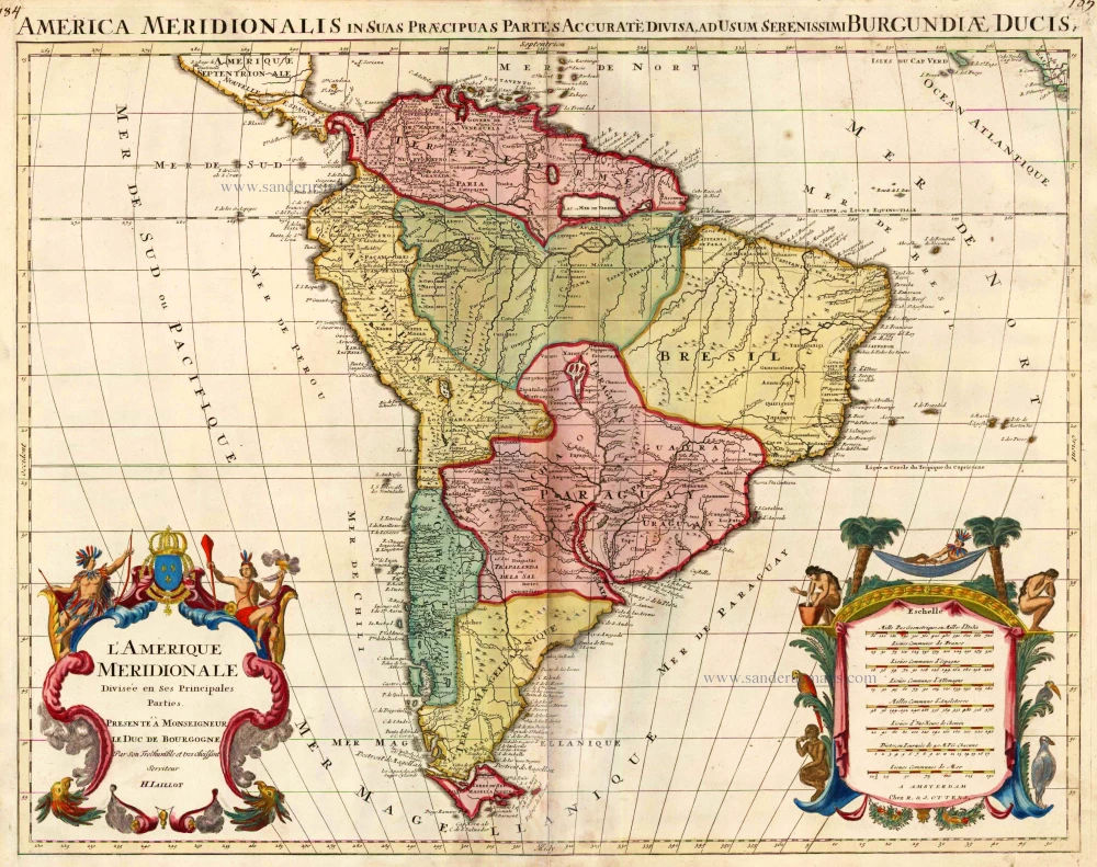
L'Amerique Meridionale Divisee en ses Principales Parties. 1756
South America, by Ottens R. & J.
[Item number: 23510]
Important and rare map
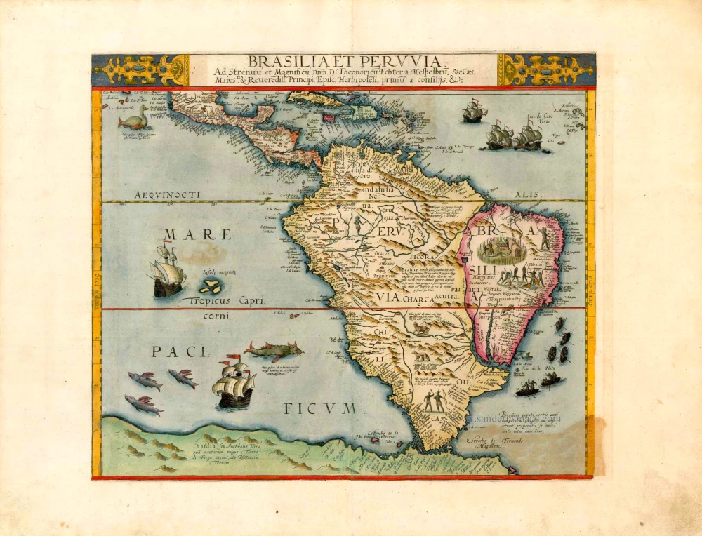
Brasilia et Peruvia ... 1593
South America, by Cornelis de Jode.
[Item number: 25240]
Big and spectacular map in excellent condition
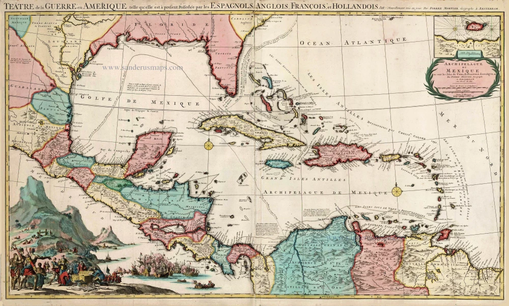
Teatre de la Guerre en Amerique, telle qu'elle est a Present Possedee par les Espagnols, Anglois, Francois, et Hollandois &c. c. 1705
Central America by Pieter Mortier (Pierre).
[Item number: 27766]