Old antique map of the Straits of Magellan and Terra Australis, by Cornelis van Wytfliet. 1597
In 1597 Cornelis van Wytfliet published his Augmentum to Ptolemy's Geography. This is true as much as it covers all the Americas, a part of the world unknown to the latter; however, no other connection exists between them. Dedicated to Philip III of Spain it is a history of the New World to date, recording its discovery, natural history etc. For the book, Wytfliet had engraved nineteen maps, by whom we do not know, one of the world and eighteen regional maps of the Americas. Of these, the following eight maps all relate to the north of the continent. As such, this book can be truly called the first atlas of America. It was an immediate success and ran to several editions. (Burden)
Cornelius Wytfliet (? – 1597)
Cornelius Wytfliet was a geographer from Leuven. After graduating with a Licentiate in Laws from the University of Leuven, Wytfliet moved to Brussels and became secretary to the Council of Brabant.
In 1597, he published the first atlas of America: the Descriptionis Ptolemaicae Augmentum (Augmentation to Ptolemy’s description). He named his work an augmentation of Ptolemy’s Geography because it covers the Americas, a part of the world unknown to Ptolemy. However, there is no other connection between the works of Ptolemy and Van Wytfliet. Dedicated to Philip III of Spain, it is a history of the New World to date, recording its discovery, natural history, etc. It provides a history of exploration and the voyages of Christopher Columbus (1492-1502), John Cabot (1497-98), Sebastian Cabot (1526-28), Francisco Pizarro (1527-35), Giovanni de Verazzano (1524), Jacques Cartier (1540-42), and Martin Frobisher (1576-78). Most of Van Wytfliet’s maps are the first or among the earliest of specific regions of North and South America.
For the book, Wytfliet had engraved nineteen maps, one of the world and eighteen regional maps of the Americas. The book was an immediate success and ran to several editions.
Two editions of the Descriptionis Ptolemaicae were published at Leuven in 1597 and 1598, and in 1603, the first Douai edition appeared, with later editions with French text. The last edition was published in Arnhem in 1615.
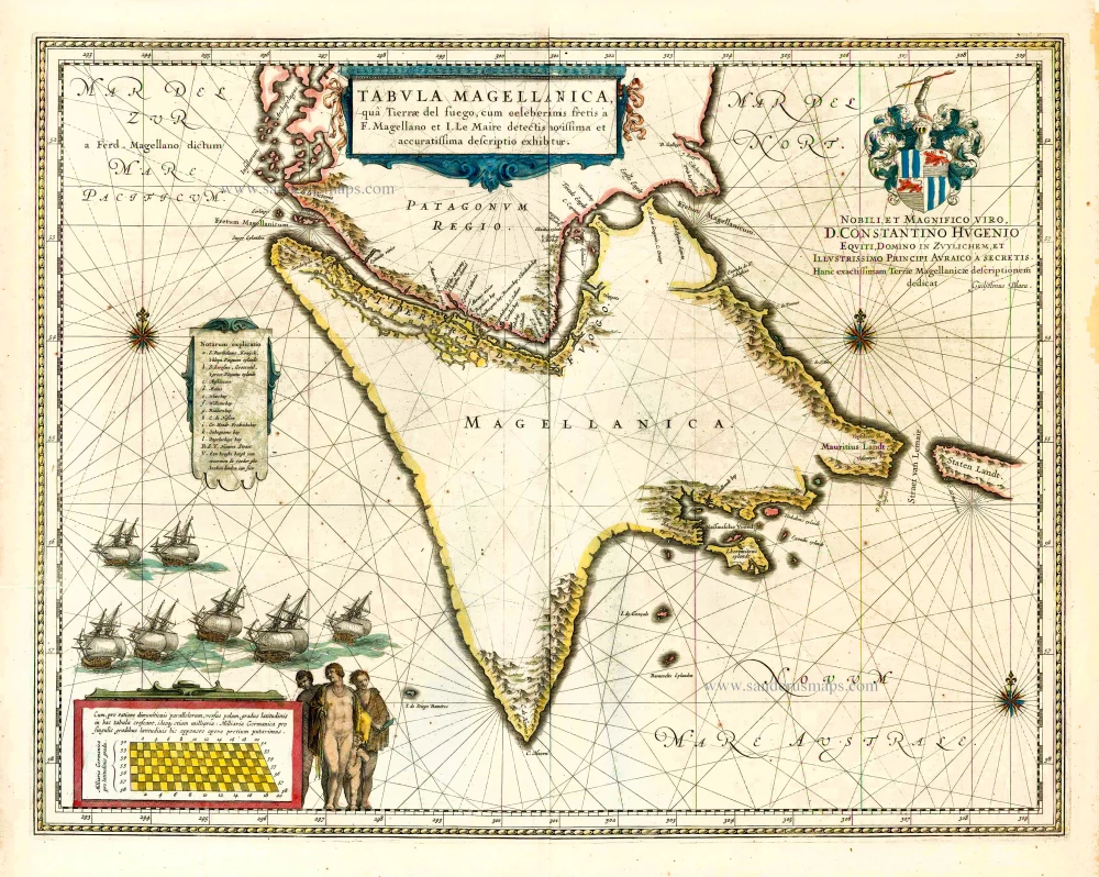
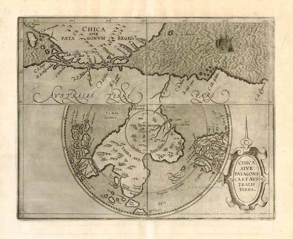
Chica sive Patagonica et Australis Terra.
Item Number: 26717 Authenticity Guarantee
Category: Antique maps > America > South America
Old, antique map of the Straits of Magellan and Terra Australis, by Cornelis van Wytfliet.
Date of the first edition: 1597
Date of this map: 1597
Copper engraving, printed on paper.
Size (not including margins): 23 x 29cm (9 x 11.3 inches)
Verso: Blank
Condition Rating: A+
References: Van der Krogt 3, 9950:371.1; Clancy, p.123 Map 8.2.
From: Descriptionis Ptolemaicae Augmentum Louvain, J. Bogard, 1597. (Van der Krogt 3, 371:01)
Map in two sections: the upper section shows the Straits of Magellan, the lower section the unknown part of the Terra Australis.
In 1597 Cornelis van Wytfliet published his Augmentum to Ptolemy's Geography. This is true as much as it covers all the Americas, a part of the world unknown to the latter; however, no other connection exists between them. Dedicated to Philip III of Spain it is a history of the New World to date, recording its discovery, natural history etc. For the book, Wytfliet had engraved nineteen maps, by whom we do not know, one of the world and eighteen regional maps of the Americas. Of these, the following eight maps all relate to the north of the continent. As such, this book can be truly called the first atlas of America. It was an immediate success and ran to several editions. (Burden)
Cornelius Wytfliet (? – 1597)
Cornelius Wytfliet was a geographer from Leuven. After graduating with a Licentiate in Laws from the University of Leuven, Wytfliet moved to Brussels and became secretary to the Council of Brabant.
In 1597, he published the first atlas of America: the Descriptionis Ptolemaicae Augmentum (Augmentation to Ptolemy’s description). He named his work an augmentation of Ptolemy’s Geography because it covers the Americas, a part of the world unknown to Ptolemy. However, there is no other connection between the works of Ptolemy and Van Wytfliet. Dedicated to Philip III of Spain, it is a history of the New World to date, recording its discovery, natural history, etc. It provides a history of exploration and the voyages of Christopher Columbus (1492-1502), John Cabot (1497-98), Sebastian Cabot (1526-28), Francisco Pizarro (1527-35), Giovanni de Verazzano (1524), Jacques Cartier (1540-42), and Martin Frobisher (1576-78). Most of Van Wytfliet’s maps are the first or among the earliest of specific regions of North and South America.
For the book, Wytfliet had engraved nineteen maps, one of the world and eighteen regional maps of the Americas. The book was an immediate success and ran to several editions.
Two editions of the Descriptionis Ptolemaicae were published at Leuven in 1597 and 1598, and in 1603, the first Douai edition appeared, with later editions with French text. The last edition was published in Arnhem in 1615.