
Old antique map of America, by Hugo Allard. c. 1661
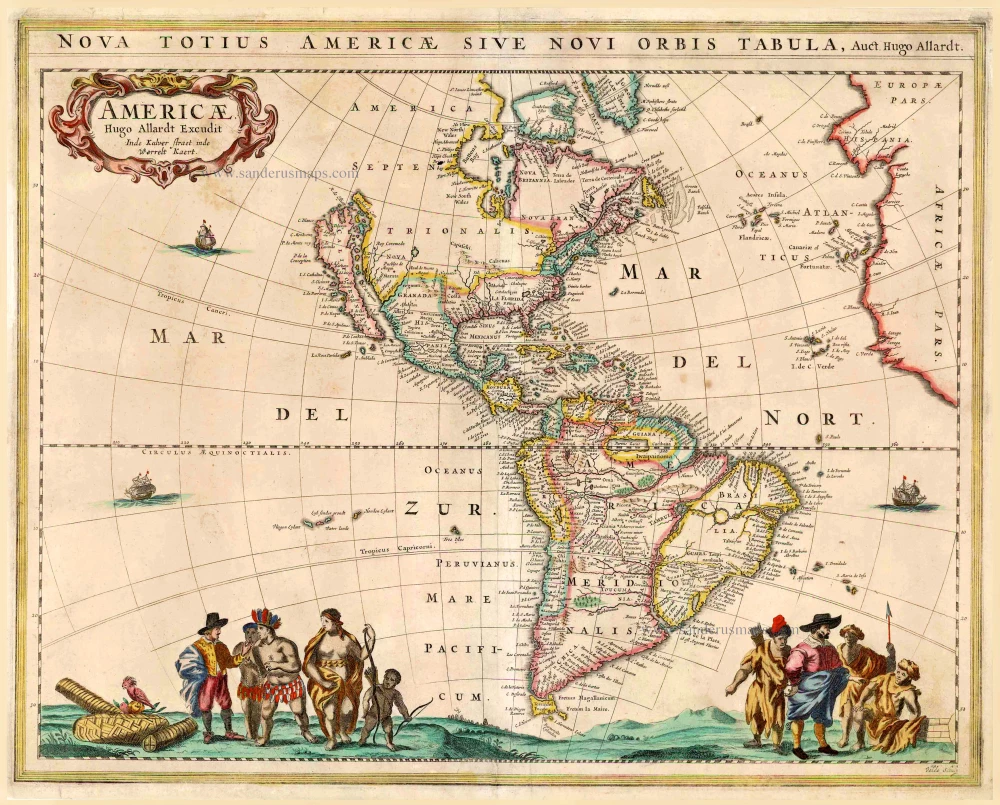


California as an island.
This very rare America map is geographically identical to de Wit's map of 1660. Allard embellished the map along the bottom with a large scene of Europeans trading with the natives. There is only one known state of this map.
The Allard Family
The founder of this family of map-makers, publishers and print-sellers was Huych (Hugo) Allard (1625-1691). He worked in Amsterdam in 1684 and is supposed to have begun his business as early as 1645. He died in 1691, leaving his shop to his son, Carel Allard (1648-c. 1706). Carel brought out many maps and some atlases. His atlases are mainly composed of maps from the stock of other publishers like Janssonius and De Wit. However, some maps were his original creations. For these maps, the States of Holland granted him a privilege in 1683.
One of the sons of Carel, Abraham Allard (1676-c.1730), joined his father in the map trade and was accepted as a member of the ‘Constvercoopers gilde’ (Art dealer’s Guild) in 1708.
The original geographical maps by Allard, designed and cut between 1680 and 1700, are very decorative, well-composed and up-to-date.
Nova Totius Americae sive Novi Orbis Tabula.
Item Number: 26628 Authenticity Guarantee
Category: Antique maps > America > The Americas
Old, antique map of America, by Hugo Allard.
California as an island.
Date of the first edition: c. 1661
Date of this map: c. 1661
Engraved by Jan van den Velde.
Copper engraving, printed on paper.
Size (not including margins): 45 x 56cm (17.6 x 21.8 inches)
Verso: Blank
Condition: Original coloured, centrefold and right margin restored.
Condition Rating: B
References: Burden, #370; McLaughlin, #7; Wagner, #340.
Separate publication.
This very rare America map is geographically identical to de Wit's map of 1660. Allard embellished the map along the bottom with a large scene of Europeans trading with the natives. There is only one known state of this map.
California as an island.
This very rare America map is geographically identical to de Wit's map of 1660. Allard embellished the map along the bottom with a large scene of Europeans trading with the natives. There is only one known state of this map.
The Allard Family
The founder of this family of map-makers, publishers and print-sellers was Huych (Hugo) Allard (1625-1691). He worked in Amsterdam in 1684 and is supposed to have begun his business as early as 1645. He died in 1691, leaving his shop to his son, Carel Allard (1648-c. 1706). Carel brought out many maps and some atlases. His atlases are mainly composed of maps from the stock of other publishers like Janssonius and De Wit. However, some maps were his original creations. For these maps, the States of Holland granted him a privilege in 1683.
One of the sons of Carel, Abraham Allard (1676-c.1730), joined his father in the map trade and was accepted as a member of the ‘Constvercoopers gilde’ (Art dealer’s Guild) in 1708.
The original geographical maps by Allard, designed and cut between 1680 and 1700, are very decorative, well-composed and up-to-date.
Related items
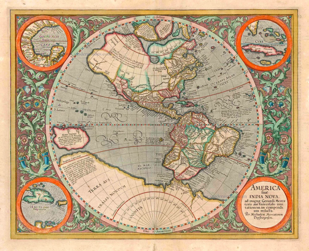
America sive India Nova ad magnae Gerardi Mercatoris avi Universalis imitationem in compendium redacta. 1623
America, by Gerard Mercator
[Item number: 131]

America 1602
America by Langenes, published by Bertius P.
[Item number: 12494]
California as an island
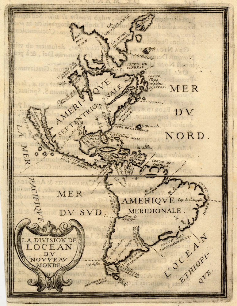
La Division de l'Ocean du Nouveau Monde 1648
America, by Briet Ph.
[Item number: 17771]
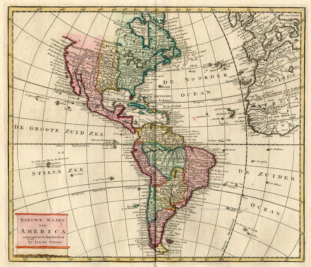
Nieuwe Kaart van America c. 1770
Antique map of America by Tirion I.
[Item number: 19194]

America. 1597
AMERICA by Giovanni Magini
[Item number: 22492]
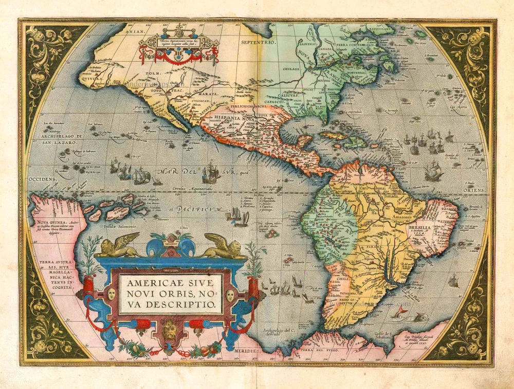
Americae Sive Novi Orbis, Nova Descriptio. 1598
America, by Abraham Ortelius.
[Item number: 25618]
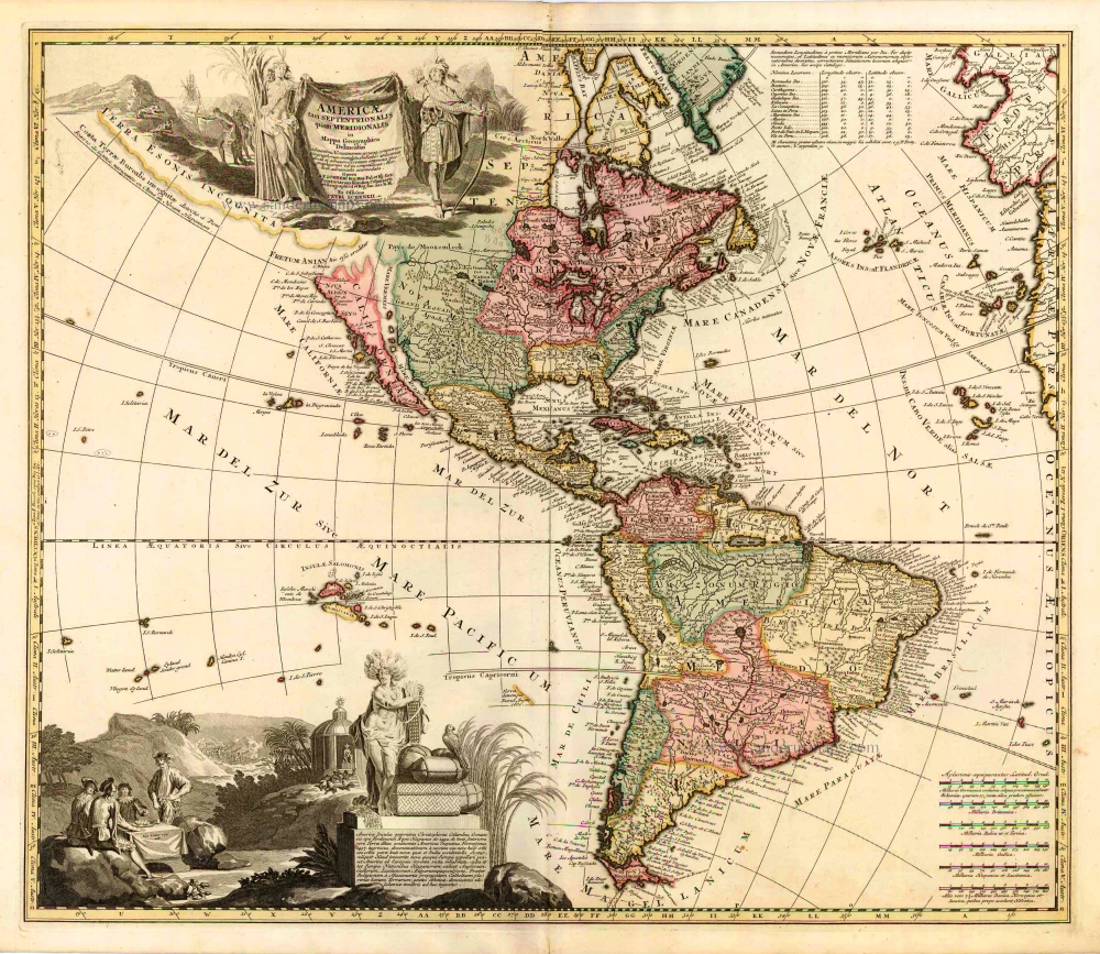
Americae tam Septentrionalis quam Meridionalis in Mappa Geographica Delineatio. c. 1700
America by A.F. Zürner, published by Petrus Schenk.
[Item number: 25715]

California as an island
Nouveau Continent ou Amerique. 1685
The Western Hemisphere, by Alain Manesson-Mallet.
[Item number: 26644]
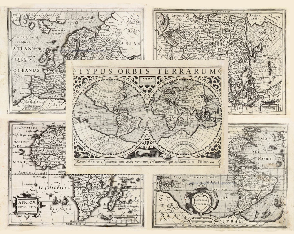
Typus Orbis Terrarum, [in set with:] Europa, [and] Asia, [and] Americae Descrip., [and] Africae Descriptio. 1607
World + Continents, by Jodocus Hondius.
[Item number: 27088]