
Asia depicted as Pegasus by Heinrich Bünting. 1581
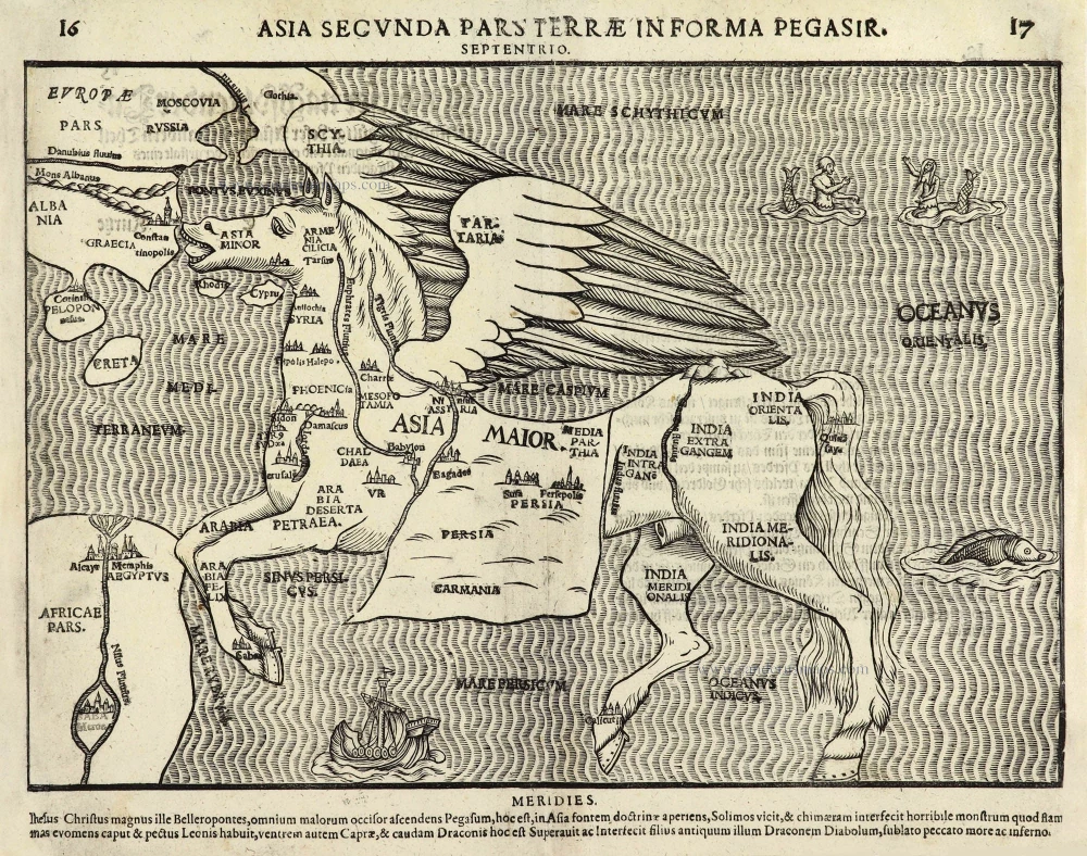
Asia as Pegasus is one of ten maps in Bünting's Itinerarium, in which the author, a theological commentator, rewrote the Bible as an illustrated travel book. Other maps in the series bear out his imaginative approach to cartography, which pictures the world as a cloverleaf and Europe as the Queen of the World.
This is one of the more dramatic curiosity maps, depicted in the form of Pegasus, the winged horse of Greek mythology. He sprang from the body of Gorgon Medusa when Perseus cut her head off. He was tamed by Bellerophon with the assistance of the goddess Athena and featured in several of Bellerophon's exploits, most particularly when Bellerophon provoked the anger of the gods by trying to ride Pegasus up to Heaven.
Turkey represents Pegasus' head and wings Tartary; the forelegs are Arabia and the saddle blanket Persia; the left hind leg is India, and the right is the Malay Peninsula.
It is interesting that despite the Itinerarium being about the Bible, the symbolism of classical mythology was still considered appropriate for this map. (Baynton-Williams)
Heinrich Bünting (Hannover, 1545-1606)
Heinrich Bünting was a protestant pastor and theologian. He was also a brewer in Hannover, and he was concerned with history and wrote a Braunschweigische Chronica in 1584. His main work was the popular Itinerarium Sacrae Scripturae, which after the first edition in Magdeburg in 1581 had many editions in German, Latin, Dutch, Swedish, Danish, Czech and English.
The book gave an overview of biblical geography based on the travel descriptions of various notable people from the Old and New Testaments. It contained ten woodcut maps, including three figurative maps: the world depicted as a cloverleaf with Jerusalem in the centre, Europe in the shape of a crowned woman, and Asia as the winged horse Pegasus.
Asia Secunda Pars Terrae in Forma Pegasir.
Item Number: 28207 Authenticity Guarantee
Category: Antique maps > Asia > Asia
Old, antique map of Asia depicted as Pegasus, by Heinrich Bünting.
Title: Asia Secunda Pars Terrae in Forma Pegasir.
Date of the first edition: 1581.
Date of this map: 1581.
Woodcut, printed on paper.
Size (not including margins): 250 x 355mm (9.84 x 13.98 inches).
Verso: German text.
Condition: excellent.
Condition Rating: A+.
References: Baynton-Williams New Worlds, p.39
From: Itinerarium Sacrae Scriptura . . . Magdeburg, 1581- ....
Asia as Pegasus is one of ten maps in Bünting's Itinerarium, in which the author, a theological commentator, rewrote the Bible as an illustrated travel book. Other maps in the series bear out his imaginative approach to cartography, which pictures the world as a cloverleaf and Europe as the Queen of the World.
This is one of the more dramatic curiosity maps, depicted in the form of Pegasus, the winged horse of Greek mythology. He sprang from the body of Gorgon Medusa when Perseus cut her head off. He was tamed by Bellerophon with the assistance of the goddess Athena and featured in several of Bellerophon's exploits, most particularly when Bellerophon provoked the anger of the gods by trying to ride Pegasus up to Heaven.
Turkey represents Pegasus' head and wings Tartary; the forelegs are Arabia and the saddle blanket Persia; the left hind leg is India, and the right is the Malay Peninsula.
It is interesting that despite the Itinerarium being about the Bible, the symbolism of classical mythology was still considered appropriate for this map. (Baynton-Williams)
Heinrich Bünting (Hannover, 1545-1606)
Heinrich Bünting was a protestant pastor and theologian. He was also a brewer in Hannover, and he was concerned with history and wrote a Braunschweigische Chronica in 1584. His main work was the popular Itinerarium Sacrae Scripturae, which after the first edition in Magdeburg in 1581 had many editions in German, Latin, Dutch, Swedish, Danish, Czech and English.
The book gave an overview of biblical geography based on the travel descriptions of various notable people from the Old and New Testaments. It contained ten woodcut maps, including three figurative maps: the world depicted as a cloverleaf with Jerusalem in the centre, Europe in the shape of a crowned woman, and Asia as the winged horse Pegasus.
Related items
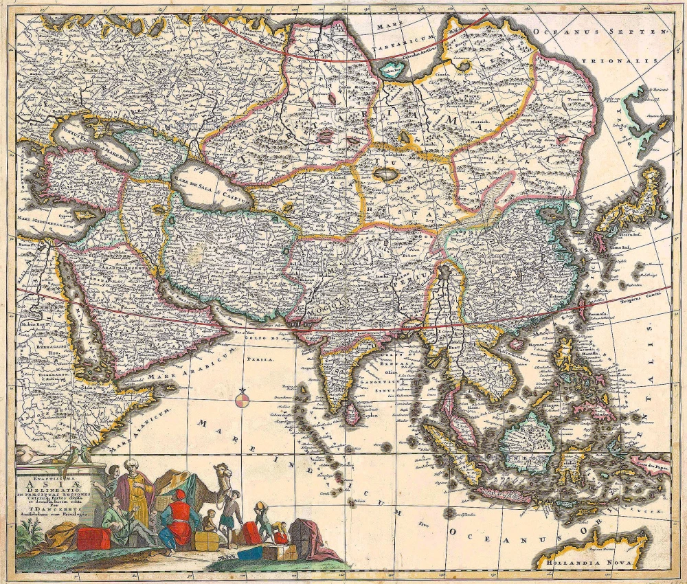
Exactissima Asiae Delineatio in praecipuas regiones Caeterasq Partes divisa. c. 1700
Asia by Th. Danckerts.
[Item number: 11298]
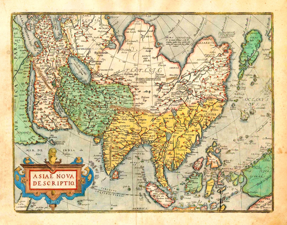
Asiae Nova Descriptio. 1612
Asia, by Abraham Ortelius.
[Item number: 22925]

Accuratissima totius Asiae Tabula. c. 1691-96
Asia, by F. De Wit.
[Item number: 10960]
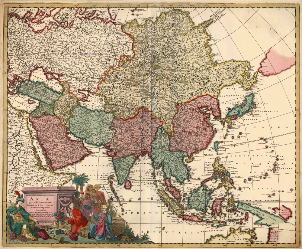
Asia qua Nulla Beatior Ora; Tractus in Eoos Vergens Mundique Teporem. c. 1730.
Asia, by G.& L. Valk.
[Item number: 24538]
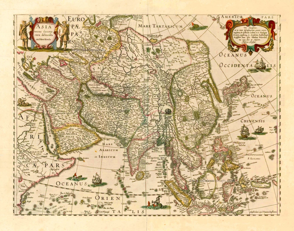
Asia Recens Summa Cura Delineata. 1644-58
Asia, by J. Janssonius
[Item number: 7508]
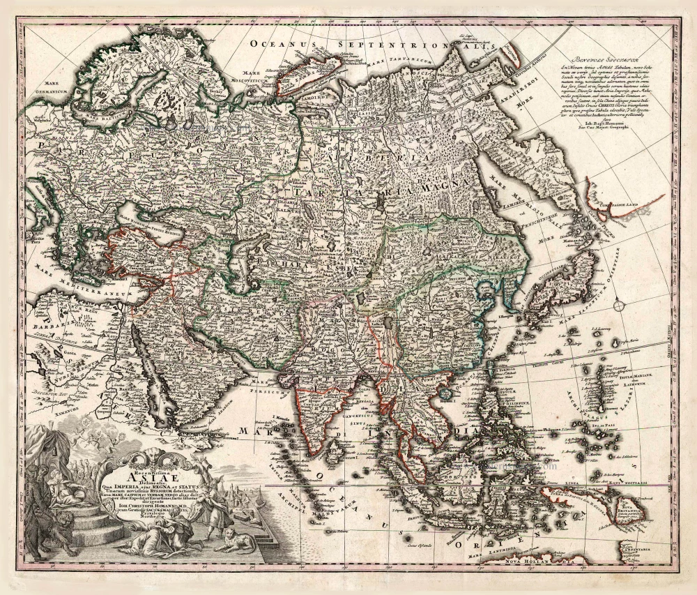
Recentissima Asiae Delineatio qua Imperia, ejus Regna et Status ... 1730-37
Asia, by Homann Johann Christoph.
[Item number: 26733]