
Jerusalem, by Georg Braun and Frans Hogenberg. 1597


The map is largerly based on the map in the diary by Ulrich Prefat von Wikanau, published in the Czech language in 1563, which was copied after the map by the Venetian artist Domenico dalle Greche.
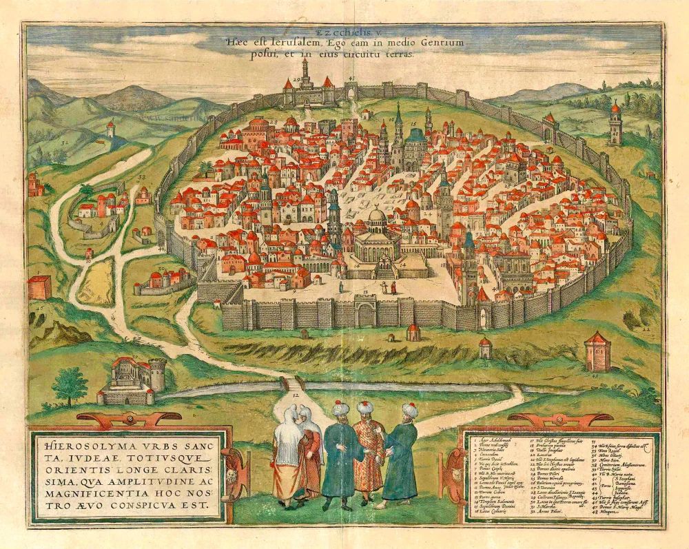
TRANSLATION OF CAPTION: This is Jerusalem, I have set it in the midst of the nations and countries that are round about her."
CARTOUCHE: Jerusalem, the holy city, the most famous of Judea and the entire East, whose size and splendour marvels the imagination.
COMMENTARY BY BRAUN: "The particular holiness and significance of Jerusalem stems from the divine prophecies and miracles that God, in all his supreme power, created there. Especially, however, because Christ, the Son of God, as he walked the earth, not only lived and learned mostly in this city, but also accomplished many wondrous deeds: his prayers, his suffering, death, burial, resurrection, Ascension, spreading the Holy Spirit and dispatching his disciples out into the world."
Whereas the first depiction of Jerusalem shows the city as described in the Old Testament, this second plate features a contemporary bird's-eye view from the otherworldly height of Kidron Valley as well as the most important sites and structures having to do with the life of Jesus and his disciples: among others the birthplace of Mary, the Calvary and the Church of the Holy Sepulchre, the residences of Pontius Pilate and Herod, the place before the city gates were Stephen was stoned as well as where John the Baptist was beheaded. In the centre of the image the Temple of Solomon is depicted - since the late 7th century the location of the Islamic Dome of the Rock that bears a crescent on its dome. (Taschen)
Braun G. & Hogenberg F. and the Civitates Orbis Terrarum.
The Civitates Orbis Terrarum, or the "Braun & Hogenberg", is a six-volume town atlas and the most excellent book of town views and plans ever published: 363 engravings, sometimes beautifully coloured. It was one of the best-selling works in the last quarter of the 16th century. Georg Braun wrote the text accompanying the plans and views on the verso. Many plates were engraved after the original drawings of a professional artist, a professional artist, Joris Hoefnagel (1542-1600). The first volume was published in Latin in 1572, and the sixth in 1617. Frans Hogenberg created the tables for volumes I through IV, and Simon van den Neuwel made those for volumes V and VI. Other contributors were cartographers Daniel Freese and Heinrich Rantzau. Works by Jacob van Deventer, Sebastian Münster, and Johannes Stumpf were also used. Translations appeared in German and French.
Following the original publication of Volume 1 of the Civitates in 1572, seven further editions of 1575, 1577, 1582, 1588, 1593, 1599 and 1612 can be identified. Vol.2, first issued in 1575, was followed by further editions in 1597 and 1612. The subsequent volumes appeared in 1581, 1588, 1593, 1599 and 1606. The German translation of the first volume appeared from 1574 on, and the French edition from 1575 on.
Several printers were involved: Theodor Graminaeus, Heinrich von Aich, Gottfried von Kempen, Johannis Sinniger, Bertram Buchholtz and Peter von Brachel, who all worked in Cologne.
Georg Braun (1541-1622)
Georg Braun was born in Cologne in 1541. After his studies in Cologne, he entered the Jesuit Order as a novice. 1561, he obtained his bachelor's degree, and in 1562, he received his Magister Artium. Although he left the Jesuit Order, he studied theology, gaining a licentiate in theology.
Frans Hogenberg (1535-1590)
Frans Hogenberg was a Flemish and German painter, engraver, and mapmaker. He was born in Mechelen as the son of Nicolaas Hogenberg.
By the end of the 1560s, Frans Hogenberg was employed upon Abraham Ortelius's Theatrum Orbis Terrarum, published in 1570; he is named an engraver of numerous maps. In 1568, he was banned from Antwerp by the Duke of Alva and travelled to London, where he stayed a few years before emigrating to Cologne. He immediately embarked on his two most important works, the Civitates, published in 1572 and the Geschichtsblätter, which appeared in several series from 1569 until about 1587.
Thanks to large-scale projects like the Geschichtsblätter and the Civitates, Hogenberg's social circumstances improved with each passing year. He died as a wealthy man in Cologne in 1590.
Ierusalem, Iudeae, Totiusque Orientis Longe Clarissima ...
Item Number: 27266 Authenticity Guarantee
Category: Antique maps > Asia > Holy Land
Old, antique bird's-eye view plan of Jerusalem, by Georg Braun and Frans Hogenberg.
Date of the first edition: 1575
Date of this map: 1597
Copper engraving, printed on paper.
Size (not including margins): 33 x 41.5cm (12.8 x 16.2 inches)
Verso text: Latin
Condition: Original coloured, some wear along centrefold.
Condition Rating: A
From: Civitates Orbis Terrarum, ... Part 2: De Praecipuis, Totius Universi Urbibus, Liber Secundus. Köln, Bertram Buchholz, 1597. (Van der Krogt 4, 41:1.2)
With key to locations.
The map is largerly based on the map in the diary by Ulrich Prefat von Wikanau, published in the Czech language in 1563, which was copied after the map by the Venetian artist Domenico dalle Greche.
TRANSLATION OF CAPTION: This is Jerusalem, I have set it in the midst of the nations and countries that are round about her."
CARTOUCHE: Jerusalem, the holy city, the most famous of Judea and the entire East, whose size and splendour marvels the imagination.
COMMENTARY BY BRAUN: "The particular holiness and significance of Jerusalem stems from the divine prophecies and miracles that God, in all his supreme power, created there. Especially, however, because Christ, the Son of God, as he walked the earth, not only lived and learned mostly in this city, but also accomplished many wondrous deeds: his prayers, his suffering, death, burial, resurrection, Ascension, spreading the Holy Spirit and dispatching his disciples out into the world."
Whereas the first depiction of Jerusalem shows the city as described in the Old Testament, this second plate features a contemporary bird's-eye view from the otherworldly height of Kidron Valley as well as the most important sites and structures having to do with the life of Jesus and his disciples: among others the birthplace of Mary, the Calvary and the Church of the Holy Sepulchre, the residences of Pontius Pilate and Herod, the place before the city gates were Stephen was stoned as well as where John the Baptist was beheaded. In the centre of the image the Temple of Solomon is depicted - since the late 7th century the location of the Islamic Dome of the Rock that bears a crescent on its dome. (Taschen)
Braun G. & Hogenberg F. and the Civitates Orbis Terrarum.
The Civitates Orbis Terrarum, or the "Braun & Hogenberg", is a six-volume town atlas and the most excellent book of town views and plans ever published: 363 engravings, sometimes beautifully coloured. It was one of the best-selling works in the last quarter of the 16th century. Georg Braun wrote the text accompanying the plans and views on the verso. Many plates were engraved after the original drawings of a professional artist, a professional artist, Joris Hoefnagel (1542-1600). The first volume was published in Latin in 1572, and the sixth in 1617. Frans Hogenberg created the tables for volumes I through IV, and Simon van den Neuwel made those for volumes V and VI. Other contributors were cartographers Daniel Freese and Heinrich Rantzau. Works by Jacob van Deventer, Sebastian Münster, and Johannes Stumpf were also used. Translations appeared in German and French.
Following the original publication of Volume 1 of the Civitates in 1572, seven further editions of 1575, 1577, 1582, 1588, 1593, 1599 and 1612 can be identified. Vol.2, first issued in 1575, was followed by further editions in 1597 and 1612. The subsequent volumes appeared in 1581, 1588, 1593, 1599 and 1606. The German translation of the first volume appeared from 1574 on, and the French edition from 1575 on.
Several printers were involved: Theodor Graminaeus, Heinrich von Aich, Gottfried von Kempen, Johannis Sinniger, Bertram Buchholtz and Peter von Brachel, who all worked in Cologne.
Georg Braun (1541-1622)
Georg Braun was born in Cologne in 1541. After his studies in Cologne, he entered the Jesuit Order as a novice. 1561, he obtained his bachelor's degree, and in 1562, he received his Magister Artium. Although he left the Jesuit Order, he studied theology, gaining a licentiate in theology.
Frans Hogenberg (1535-1590)
Frans Hogenberg was a Flemish and German painter, engraver, and mapmaker. He was born in Mechelen as the son of Nicolaas Hogenberg.
By the end of the 1560s, Frans Hogenberg was employed upon Abraham Ortelius's Theatrum Orbis Terrarum, published in 1570; he is named an engraver of numerous maps. In 1568, he was banned from Antwerp by the Duke of Alva and travelled to London, where he stayed a few years before emigrating to Cologne. He immediately embarked on his two most important works, the Civitates, published in 1572 and the Geschichtsblätter, which appeared in several series from 1569 until about 1587.
Thanks to large-scale projects like the Geschichtsblätter and the Civitates, Hogenberg's social circumstances improved with each passing year. He died as a wealthy man in Cologne in 1590.
Related items
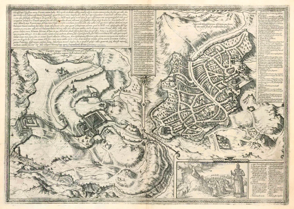
Hierosolyma, Clarissima Totius Orientis Civitas Iudaee Metropolis ... 1599
Jerusalem, by Georg Braun and Frans Hogenberg.
[Item number: 23948]
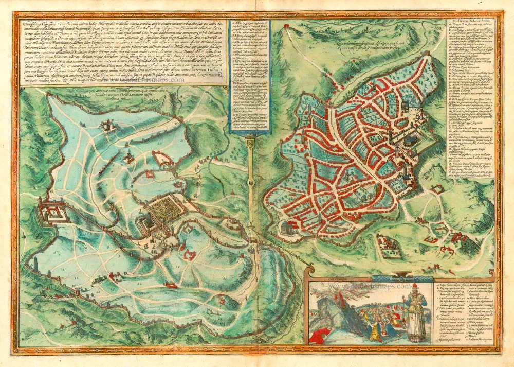
Hierosolyma, Clarissima Totius Orientis Civitas Iudaee Metropolis ... 1582
Jerusalem by Braun Georg & Hogenberg Frans
[Item number: 25330]
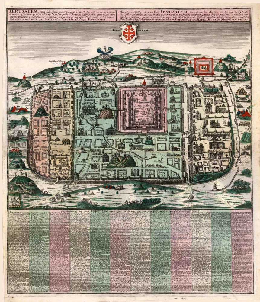
Ierusalem, cum Suburbiis, Prout Tempore Christi Floruit ... 1740
Jerusalem, by M. Seutter.
[Item number: 25345]
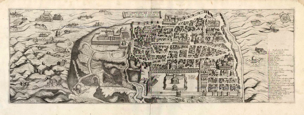
Description de la Ville de Jerusalem avec les Noms des Saints Lieux ou Antiquitez qui sont Visitez par les Pellerins et Voiageurs. 1648
Jerusalem by J. Boisseau.
[Item number: 25598]