
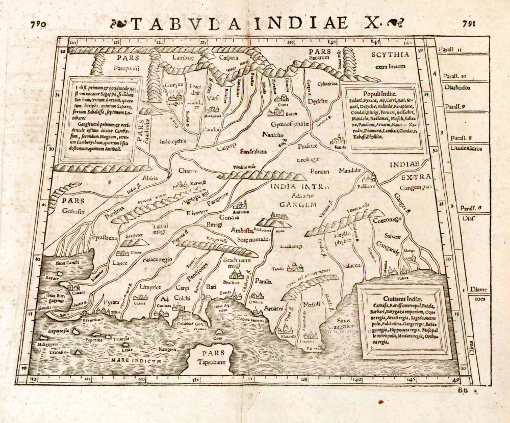
Old antique map of India by Strabo - S. Munster. 1571
Strabo (c. 63 BC - c. 21 AD)
Strabo was a Greek geographer and historian who travelled in Europe, Africa and Asia and influenced later geographers. He compiled the Geographia, a world geography presenting a descriptive history of people and places from different regions of the world known during his lifetime.
His work was first published in 1469, and many later editions followed in the 15th and 16th centuries, some of them illustrated with Ptolemy maps.
Tabula Indiae X.
Item Number: 25640 Authenticity Guarantee
Category: Antique maps > Asia > India - Ceylon
Old, antique map of India by Strabo - S. Munster
Date of the first edition: 1540
Date of this map: 1571
Woodcut
Size (not including margins): 25.5 x 34.5cm (9.9 x 13.5 inches)
Verso text: Latin
Condition: Excellent.
Condition Rating: A
References: Karrow, 58/98.
From: Strabo, Rerum Geographicum Libri Septemdecim. Basel, Heinrich Petri, 1571.
Strabo (c. 63 BC - c. 21 AD)
Strabo was a Greek geographer and historian who travelled in Europe, Africa and Asia and influenced later geographers. He compiled the Geographia, a world geography presenting a descriptive history of people and places from different regions of the world known during his lifetime.
His work was first published in 1469, and many later editions followed in the 15th and 16th centuries, some of them illustrated with Ptolemy maps.
Related items
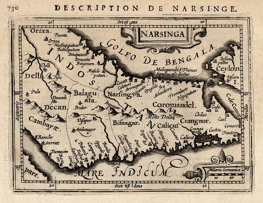
Narsinga. 1618
Narsinga, by P. Bertius.
[Item number: 18299]
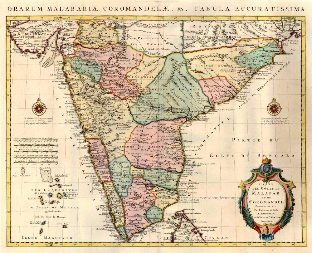
Carte des Cotes de Malabar et de Coromandel. 1721-41
India by Guillaume Delisle, published by Covens & Mortier.
[Item number: 23609]
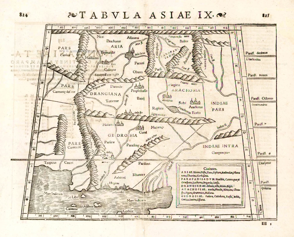
Tabula Asiae IX. 1571
Pakistan, by Sebastian Münster.
[Item number: 25641]
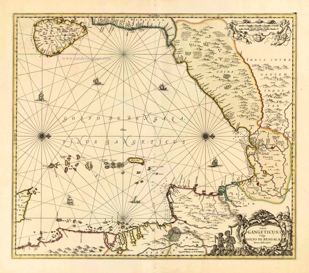
Sinus Gangeticus Vulgo Golfo de Bengala Nova Descriptio. c. 1700
Gulf of Bengal, by G. Valk & P. Schenk.
[Item number: 25835]
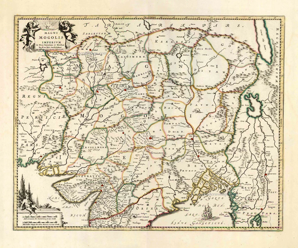
Magni Mogolis Imperium. After 1721
Mongol Empire, by Frederick de Wit - Covens & Mortier.
[Item number: 25838]

Goa. 1638
Goa, by M. Merian.
[Item number: 25903]
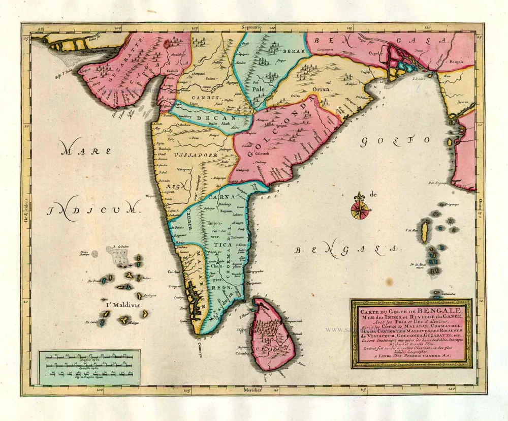
Carte du Golfe de Bengale, Mer des Indes, et Riviere du Gange, Avec les Païs et Iles d'alentour, Savoir les Côtes de Malabar, Cormandel, Ile de Ceylon, les Maldives, les Rolaumes de Visiapour, Golconda, Guzaratte, etc. 1713
India and Ceylon (Sri Lanka), by Pieter van der Aa.
[Item number: 26095]
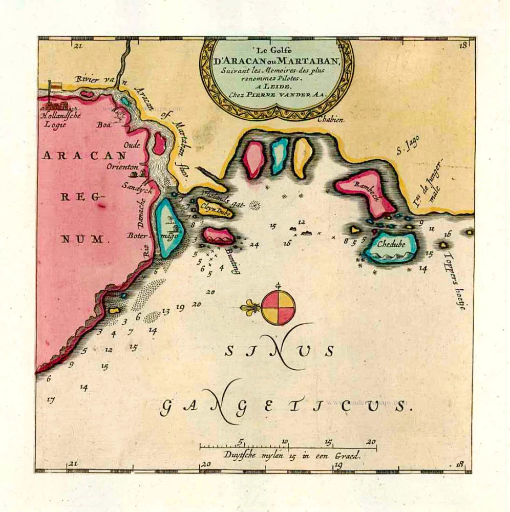
Le Golfe D'Aracan ou Martaban. 1713
The Gulf of Martaban, by Pieter van der Aa.
[Item number: 26106]
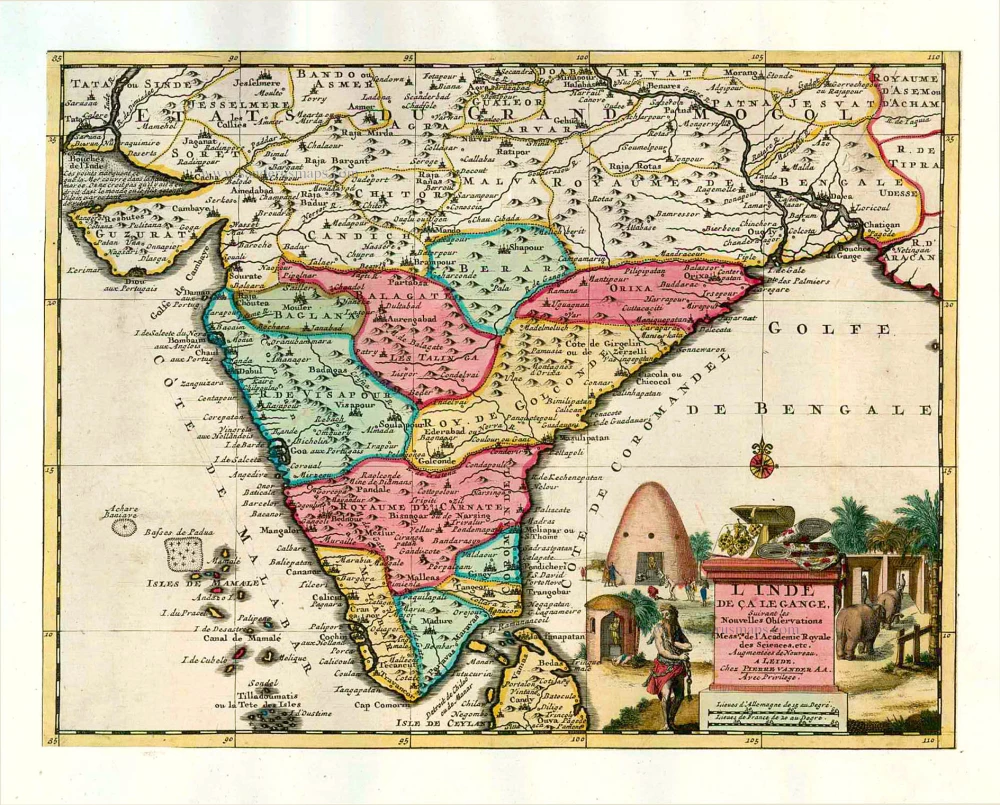
L'Inde de ça le Gange. 1713
India, by Pieter van der Aa.
[Item number: 26107]
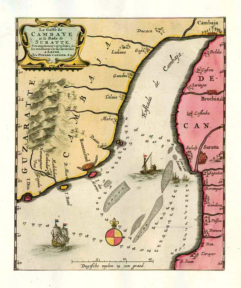
Le Golfe de Cambaye et la Rade de Suratte, tres exactement representez sur les meilleures Cartes modernes. 1713
The gulf of Cambay and the coast of Surat. by P. Van der Aa
[Item number: 26113]
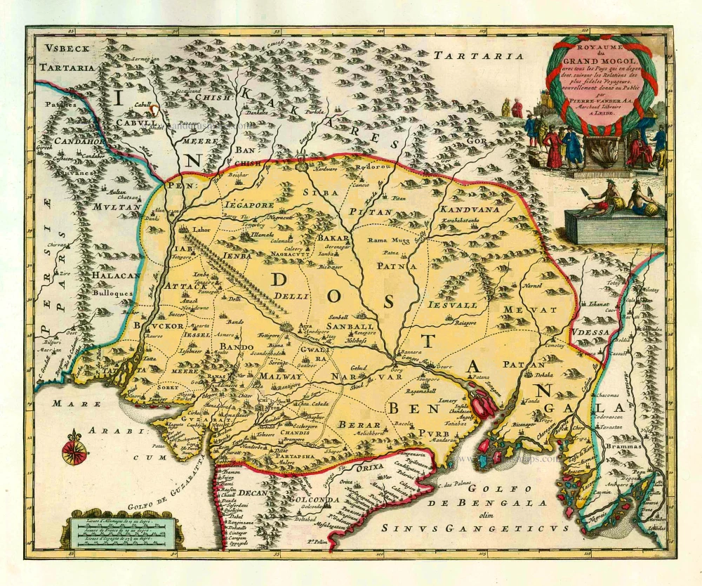
Royaume du Grand Mogol, avec tous les Pays qui en dépendent, suivant les Relations des fideles Voyageurs. 1713
India by Pieter van de Aa
[Item number: 26117]
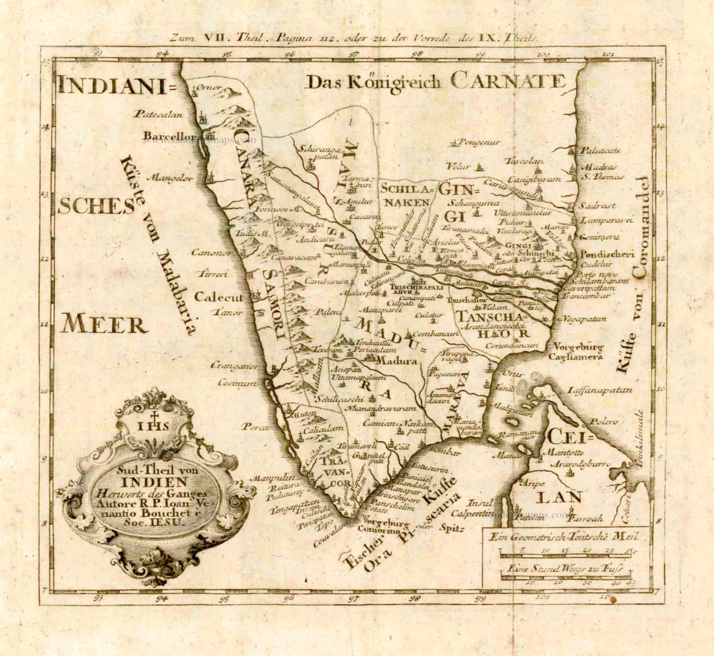
Sud-Theil von Indien Herwerts des Ganges. Autore R. P. Ioan. Venantio Bouchet e Soc. IESU. 1726
Southern India, by J.V. Bouchet.
[Item number: 4184]
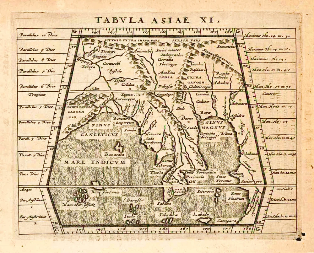
Tabula Asiae XI. 1597
India, by Giovanni Magini
[Item number: 26522]

Peninsula Indiae citra Gangem, hoc est Orae Celeberrimae Malabar & Coromandel. Cum Adjacente Insula non Minus Celebratissima Ceylon. c. 1737
India & Ceylon, by Homann Heirs.
[Item number: 26752]
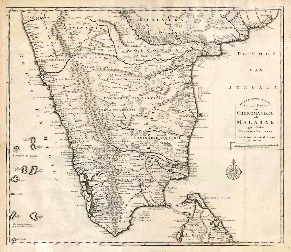
Nieuwe kaart van Choromandel ende Malabar. 1724-26
Southern India, by François Valentyn (Valentijn).
[Item number: 26896]