
Kozhikode (Calicut) - Hormuz (Ormus) - Kannur - Elmina by Georg Braun & Frans Hogenberg. 1582
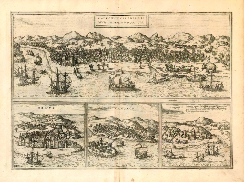
KOZHIKODE (CALICUT)
CARTOUCHE: Calicut, famous Indian centre of Trade.
COMMENTARY BY BRAUN: "Calicut is the noblest of all the Indian cities. It lies on the shores of the sea, is bigger than Lisbon and is impregnable even without ramparts . The king of this city is venerated as a god; the subjects obey him with the greatest servility. When he comes out of his palace, he is carried on a litter studded with all sorts of precious stones, accompanied by choirboys, singers, trumpeters and the like. His retinue and other nobles walk behind him; they carry drawn swords and spears in their hands; his archers and arms bearers go in front."
The city is viewed from the sea, just as it would have appeared to the astonished eyes of the Portuguese explorers arriving from the west. For when Vasco da Gama landed at Kappad, some 25 km from Calicut (today Koshikode) in 1498, it marked an important moment in European history: the sea route to India had finally been discovered. Excuding a foreign air, Calicut appears within a forest of palm trees, set against a backdrop of mountains and with numerous ships in the foreground. The royal procession can be seen on the beach in front of the city, and to the right a working elephant with its driver. Kozhikode had already established itself as an important centre of power and trade even before Vasco da Gama's arrival. After taking the city in 1538, the Potuguese built a fort and from 1540 held the spice-trade monopoly. Kozhikode, which lies on the Malabar Coast in the Indian state of Kerla, today has some 445,000 inhabitants.
HORMUZ (ORMUS)
COMMENTARY BY BRAUN: "Ormus, a magnificent city in Persia, lies on an island and is second to no other city on account of the beautiful and precious pearls that are found there. Fresh water and all the necessities of life are very expensive there, for almost everything that people need has to be brought in from outside. Three days' journey from Ormus, pearl oysters are found that contain larger and more beautiful pearls than elsewhere."
The plate shows Hormuz on an island, in a stereotypical view that is probably a product of the draughtsman's imagination. The city is made up of tall, foreign-seeming houses with flat roofs, built close together, and is surrounded by a solid wall. Hormuz was captured in 1507 by Alfonso de Albuquerque and remained firmly in Portuguese hands from 1515 to 1622. Due to its position on the Strait of Hormuz - one of the most important straits in the world - at the entrance to the Persian Gulf, 16 km off the coast of Iran, the rocky island remains an important strategic location and a major centre of trade for the Arab world.
KANNUR
COMMENTARY BY BRAUN: "In the Indian town of Cannanore the Portuguese king has an impressive fortified palace. The ruler of the town and his subjects worship idols; they pray to the sun, moon and cows. The town has a harbour where horses are imported from Persia, for which a very high toll has to be paid, however: 20,000 crowns for one horse. Many spices grow in the surrounding area, but first and foremost ginger."
The view shows the town of Kannur - formerly anglicized as Cannanore - from the west. As in many engravings of Indian cities, the foreignness of the country is symbolized by palm trees and the simple architecture of the houses. In 1502 Kannur became a strategic base and trading port for the Portuguese, who shipped spices to Europe from here. In 1504 Francisco de Almeida, viceroy of India, built the castle mentioned in the text, Fort St Angelo, which is located 3 km from the town.
ELMINA
CAPTION: The town of St George, called Mina, was built on the orders of King John II of Portugal in Guinea in 1482; the Moorish merchants bring bullion, for which they receive from the Christians red and yellow linen and similarly sought-after goods.
The view of Mina (Elmina in modern-day Ghana) shows a smalll, fenced village (pagus) lying beside the massive castle of São Jorge da Mina, which was built in 1482 in order to protect the most important gold trading post on Africa's Gold Coast. The fort was the first European stronghold on Black African soil and remained the headquarters of the Portuguese in Africa up till 1637, when it was conquered by the Dutch. Due to its gold reserves, the African village that lay near the fort was called El Mina ("The Mine") by the Portuguese and in 1486 was granted a Portuguese municipal charter. Between the end of the 16th century and Ghana's independence, the villages around El Mina converged to become Elmina or Edina state. (Taschen)
Braun G. & Hogenberg F. and the Civitates Orbis Terrarum.
The Civitates Orbis Terrarum, or the "Braun & Hogenberg", is a six-volume town atlas and the most excellent book of town views and plans ever published: 363 engravings, sometimes beautifully coloured. It was one of the best-selling works in the last quarter of the 16th century. Georg Braun wrote the text accompanying the plans and views on the verso. Many plates were engraved after the original drawings of a professional artist, a professional artist, Joris Hoefnagel (1542-1600). The first volume was published in Latin in 1572, and the sixth in 1617. Frans Hogenberg created the tables for volumes I through IV, and Simon van den Neuwel made those for volumes V and VI. Other contributors were cartographers Daniel Freese and Heinrich Rantzau. Works by Jacob van Deventer, Sebastian Münster, and Johannes Stumpf were also used. Translations appeared in German and French.
Following the original publication of Volume 1 of the Civitates in 1572, seven further editions of 1575, 1577, 1582, 1588, 1593, 1599 and 1612 can be identified. Vol.2, first issued in 1575, was followed by further editions in 1597 and 1612. The subsequent volumes appeared in 1581, 1588, 1593, 1599 and 1606. The German translation of the first volume appeared from 1574 on, and the French edition from 1575 on.
Several printers were involved: Theodor Graminaeus, Heinrich von Aich, Gottfried von Kempen, Johannis Sinniger, Bertram Buchholtz and Peter von Brachel, who all worked in Cologne.
Georg Braun (1541-1622)
Georg Braun was born in Cologne in 1541. After his studies in Cologne, he entered the Jesuit Order as a novice. 1561, he obtained his bachelor's degree, and in 1562, he received his Magister Artium. Although he left the Jesuit Order, he studied theology, gaining a licentiate in theology.
Frans Hogenberg (1535-1590)
Frans Hogenberg was a Flemish and German painter, engraver, and mapmaker. He was born in Mechelen as the son of Nicolaas Hogenberg.
By the end of the 1560s, Frans Hogenberg was employed upon Abraham Ortelius's Theatrum Orbis Terrarum, published in 1570; he is named an engraver of numerous maps. In 1568, he was banned from Antwerp by the Duke of Alva and travelled to London, where he stayed a few years before emigrating to Cologne. He immediately embarked on his two most important works, the Civitates, published in 1572 and the Geschichtsblätter, which appeared in several series from 1569 until about 1587.
Thanks to large-scale projects like the Geschichtsblätter and the Civitates, Hogenberg's social circumstances improved with each passing year. He died as a wealthy man in Cologne in 1590.
Calechut Celeberrimum Indiae Emporium [on sheet with] Ormus [and] Canonor [and] S. Georgii Oppidum Mina.
Item Number: 27066 Authenticity Guarantee
Category: Antique maps > Asia > India - Ceylon
Old, antique map with four bird's-eye views on one sheet, by Georg Braun and Frans Hogenberg.
Larger view of Kozhikode and three smaller views below.
KOZHIKODE (CALICUT)
CARTOUCHE: Calicut, famous Indian centre of Trade.
COMMENTARY BY BRAUN: "Calicut is the noblest of all the Indian cities. It lies on the shores of the sea, is bigger than Lisbon and is impregnable even without ramparts . The king of this city is venerated as a god; the subjects obey him with the greatest servility. When he comes out of his palace, he is carried on a litter studded with all sorts of precious stones, accompanied by choirboys, singers, trumpeters and the like. His retinue and other nobles walk behind him; they carry drawn swords and spears in their hands; his archers and arms bearers go in front."
The city is viewed from the sea, just as it would have appeared to the astonished eyes of the Portuguese explorers arriving from the west. For when Vasco da Gama landed at Kappad, some 25 km from Calicut (today Koshikode) in 1498, it marked an important moment in European history: the sea route to India had finally been discovered. Excuding a foreign air, Calicut appears within a forest of palm trees, set against a backdrop of mountains and with numerous ships in the foreground. The royal procession can be seen on the beach in front of the city, and to the right a working elephant with its driver. Kozhikode had already established itself as an important centre of power and trade even before Vasco da Gama's arrival. After taking the city in 1538, the Potuguese built a fort and from 1540 held the spice-trade monopoly. Kozhikode, which lies on the Malabar Coast in the Indian state of Kerla, today has some 445,000 inhabitants.
HORMUZ (ORMUS)
COMMENTARY BY BRAUN: "Ormus, a magnificent city in Persia, lies on an island and is second to no other city on account of the beautiful and precious pearls that are found there. Fresh water and all the necessities of life are very expensive there, for almost everything that people need has to be brought in from outside. Three days' journey from Ormus, pearl oysters are found that contain larger and more beautiful pearls than elsewhere."
The plate shows Hormuz on an island, in a stereotypical view that is probably a product of the draughtsman's imagination. The city is made up of tall, foreign-seeming houses with flat roofs, built close together, and is surrounded by a solid wall. Hormuz was captured in 1507 by Alfonso de Albuquerque and remained firmly in Portuguese hands from 1515 to 1622. Due to its position on the Strait of Hormuz - one of the most important straits in the world - at the entrance to the Persian Gulf, 16 km off the coast of Iran, the rocky island remains an important strategic location and a major centre of trade for the Arab world.
KANNUR
COMMENTARY BY BRAUN: "In the Indian town of Cannanore the Portuguese king has an impressive fortified palace. The ruler of the town and his subjects worship idols; they pray to the sun, moon and cows. The town has a harbour where horses are imported from Persia, for which a very high toll has to be paid, however: 20,000 crowns for one horse. Many spices grow in the surrounding area, but first and foremost ginger."
The view shows the town of Kannur - formerly anglicized as Cannanore - from the west. As in many engravings of Indian cities, the foreignness of the country is symbolized by palm trees and the simple architecture of the houses. In 1502 Kannur became a strategic base and trading port for the Portuguese, who shipped spices to Europe from here. In 1504 Francisco de Almeida, viceroy of India, built the castle mentioned in the text, Fort St Angelo, which is located 3 km from the town.
ELMINA
CAPTION: The town of St George, called Mina, was built on the orders of King John II of Portugal in Guinea in 1482; the Moorish merchants bring bullion, for which they receive from the Christians red and yellow linen and similarly sought-after goods.
The view of Mina (Elmina in modern-day Ghana) shows a smalll, fenced village (pagus) lying beside the massive castle of São Jorge da Mina, which was built in 1482 in order to protect the most important gold trading post on Africa's Gold Coast. The fort was the first European stronghold on Black African soil and remained the headquarters of the Portuguese in Africa up till 1637, when it was conquered by the Dutch. Due to its gold reserves, the African village that lay near the fort was called El Mina ("The Mine") by the Portuguese and in 1486 was granted a Portuguese municipal charter. Between the end of the 16th century and Ghana's independence, the villages around El Mina converged to become Elmina or Edina state. (Taschen)
Date of the first edition: 1572
Date of this map: 1582
Copper engraving, printed on paper.
Size (not including margins): 34 x 48cm (13.3 x 18.7 inches)
Verso text: German
Condition: Excellent.
Condition Rating: A
References: Van der Krogt 4, 750, State 2 (with privilege); Fauser, #2247, #5951, #2320, #3570; Taschen, Br. Hog., p.128
From: Beschreibung und Contrafactur der vornembster Stät der Welt. [Part 1] Cologne, Gottfried von Kempen, 1582. (Van der Krogt 4, 41:2.1)
KOZHIKODE (CALICUT)
CARTOUCHE: Calicut, famous Indian centre of Trade.
COMMENTARY BY BRAUN: "Calicut is the noblest of all the Indian cities. It lies on the shores of the sea, is bigger than Lisbon and is impregnable even without ramparts . The king of this city is venerated as a god; the subjects obey him with the greatest servility. When he comes out of his palace, he is carried on a litter studded with all sorts of precious stones, accompanied by choirboys, singers, trumpeters and the like. His retinue and other nobles walk behind him; they carry drawn swords and spears in their hands; his archers and arms bearers go in front."
The city is viewed from the sea, just as it would have appeared to the astonished eyes of the Portuguese explorers arriving from the west. For when Vasco da Gama landed at Kappad, some 25 km from Calicut (today Koshikode) in 1498, it marked an important moment in European history: the sea route to India had finally been discovered. Excuding a foreign air, Calicut appears within a forest of palm trees, set against a backdrop of mountains and with numerous ships in the foreground. The royal procession can be seen on the beach in front of the city, and to the right a working elephant with its driver. Kozhikode had already established itself as an important centre of power and trade even before Vasco da Gama's arrival. After taking the city in 1538, the Potuguese built a fort and from 1540 held the spice-trade monopoly. Kozhikode, which lies on the Malabar Coast in the Indian state of Kerla, today has some 445,000 inhabitants.
HORMUZ (ORMUS)
COMMENTARY BY BRAUN: "Ormus, a magnificent city in Persia, lies on an island and is second to no other city on account of the beautiful and precious pearls that are found there. Fresh water and all the necessities of life are very expensive there, for almost everything that people need has to be brought in from outside. Three days' journey from Ormus, pearl oysters are found that contain larger and more beautiful pearls than elsewhere."
The plate shows Hormuz on an island, in a stereotypical view that is probably a product of the draughtsman's imagination. The city is made up of tall, foreign-seeming houses with flat roofs, built close together, and is surrounded by a solid wall. Hormuz was captured in 1507 by Alfonso de Albuquerque and remained firmly in Portuguese hands from 1515 to 1622. Due to its position on the Strait of Hormuz - one of the most important straits in the world - at the entrance to the Persian Gulf, 16 km off the coast of Iran, the rocky island remains an important strategic location and a major centre of trade for the Arab world.
KANNUR
COMMENTARY BY BRAUN: "In the Indian town of Cannanore the Portuguese king has an impressive fortified palace. The ruler of the town and his subjects worship idols; they pray to the sun, moon and cows. The town has a harbour where horses are imported from Persia, for which a very high toll has to be paid, however: 20,000 crowns for one horse. Many spices grow in the surrounding area, but first and foremost ginger."
The view shows the town of Kannur - formerly anglicized as Cannanore - from the west. As in many engravings of Indian cities, the foreignness of the country is symbolized by palm trees and the simple architecture of the houses. In 1502 Kannur became a strategic base and trading port for the Portuguese, who shipped spices to Europe from here. In 1504 Francisco de Almeida, viceroy of India, built the castle mentioned in the text, Fort St Angelo, which is located 3 km from the town.
ELMINA
CAPTION: The town of St George, called Mina, was built on the orders of King John II of Portugal in Guinea in 1482; the Moorish merchants bring bullion, for which they receive from the Christians red and yellow linen and similarly sought-after goods.
The view of Mina (Elmina in modern-day Ghana) shows a smalll, fenced village (pagus) lying beside the massive castle of São Jorge da Mina, which was built in 1482 in order to protect the most important gold trading post on Africa's Gold Coast. The fort was the first European stronghold on Black African soil and remained the headquarters of the Portuguese in Africa up till 1637, when it was conquered by the Dutch. Due to its gold reserves, the African village that lay near the fort was called El Mina ("The Mine") by the Portuguese and in 1486 was granted a Portuguese municipal charter. Between the end of the 16th century and Ghana's independence, the villages around El Mina converged to become Elmina or Edina state. (Taschen)
Braun G. & Hogenberg F. and the Civitates Orbis Terrarum.
The Civitates Orbis Terrarum, or the "Braun & Hogenberg", is a six-volume town atlas and the most excellent book of town views and plans ever published: 363 engravings, sometimes beautifully coloured. It was one of the best-selling works in the last quarter of the 16th century. Georg Braun wrote the text accompanying the plans and views on the verso. Many plates were engraved after the original drawings of a professional artist, a professional artist, Joris Hoefnagel (1542-1600). The first volume was published in Latin in 1572, and the sixth in 1617. Frans Hogenberg created the tables for volumes I through IV, and Simon van den Neuwel made those for volumes V and VI. Other contributors were cartographers Daniel Freese and Heinrich Rantzau. Works by Jacob van Deventer, Sebastian Münster, and Johannes Stumpf were also used. Translations appeared in German and French.
Following the original publication of Volume 1 of the Civitates in 1572, seven further editions of 1575, 1577, 1582, 1588, 1593, 1599 and 1612 can be identified. Vol.2, first issued in 1575, was followed by further editions in 1597 and 1612. The subsequent volumes appeared in 1581, 1588, 1593, 1599 and 1606. The German translation of the first volume appeared from 1574 on, and the French edition from 1575 on.
Several printers were involved: Theodor Graminaeus, Heinrich von Aich, Gottfried von Kempen, Johannis Sinniger, Bertram Buchholtz and Peter von Brachel, who all worked in Cologne.
Georg Braun (1541-1622)
Georg Braun was born in Cologne in 1541. After his studies in Cologne, he entered the Jesuit Order as a novice. 1561, he obtained his bachelor's degree, and in 1562, he received his Magister Artium. Although he left the Jesuit Order, he studied theology, gaining a licentiate in theology.
Frans Hogenberg (1535-1590)
Frans Hogenberg was a Flemish and German painter, engraver, and mapmaker. He was born in Mechelen as the son of Nicolaas Hogenberg.
By the end of the 1560s, Frans Hogenberg was employed upon Abraham Ortelius's Theatrum Orbis Terrarum, published in 1570; he is named an engraver of numerous maps. In 1568, he was banned from Antwerp by the Duke of Alva and travelled to London, where he stayed a few years before emigrating to Cologne. He immediately embarked on his two most important works, the Civitates, published in 1572 and the Geschichtsblätter, which appeared in several series from 1569 until about 1587.
Thanks to large-scale projects like the Geschichtsblätter and the Civitates, Hogenberg's social circumstances improved with each passing year. He died as a wealthy man in Cologne in 1590.
Related items
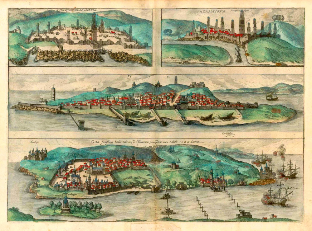
Anfa, quibusdam Anaffa [on sheet with] Azaamurum [and] Diu [and] Goa. 1582
Casablanca (Anfa) - Azemmour (Azamor) - Diu - Old Goa (Velha Goa), by Braun & Hogenberg.
[Item number: 25333]

Goa. 1638
Goa, by M. Merian.
[Item number: 25903]
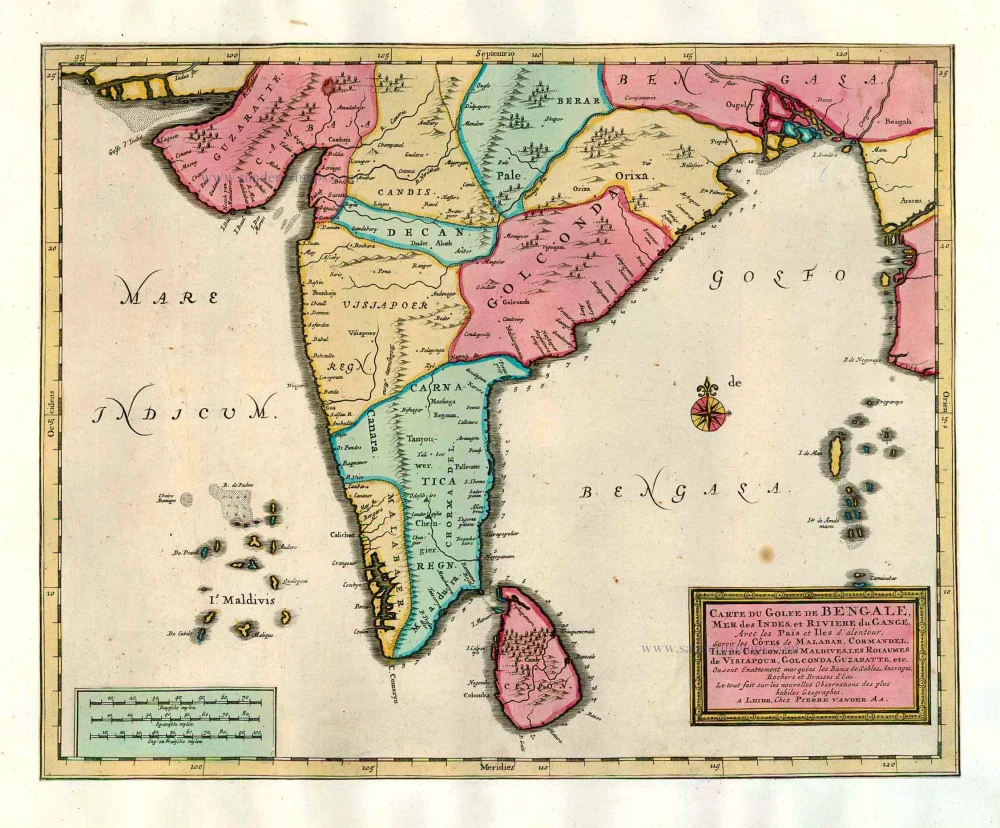
Carte du Golfe de Bengale, Mer des Indes, et Riviere du Gange, Avec les Païs et Iles d'alentour, Savoir les Côtes de Malabar, Cormandel, Ile de Ceylon, les Maldives, les Rolaumes de Visiapour, Golconda, Guzaratte, etc. 1713
India and Ceylon (Sri Lanka), by Pieter van der Aa.
[Item number: 26095]
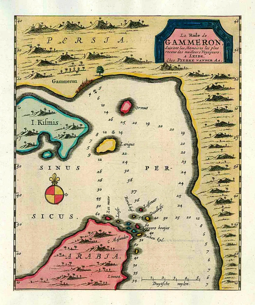
La Rade de Gammeron. 1713
The Strait of Hormuz, by Pieter van der Aa.
[Item number: 26114]