
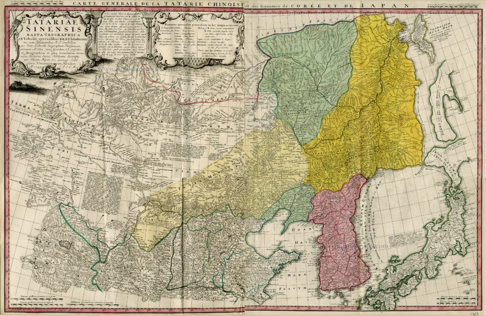
Old, antique map of East Asia by Homann Heirs c. 1737
The Homann Family
Johann Baptist Homann (1664-1724) was born in Oberkammlach in Southern Germany. Around 1693 Homann moved to Vienna, where he lived and studied printing and copper plate engraving until 1695. In 1702 he founded a map publishing company in Nuremberg, which is recognized as one of the most important German map publishers of the eighteenth century. In the next five years, Homann produced hundreds of maps and developed a distinctive style characterized by heavy detailed engraving, elaborate allegorical cartouche work, and vivid hand colour. He published his first atlas in 1707. Homann's company successfully competed with leading European mapmakers. By 1715 Homann's rising star caught the attention of the Holy Roman Emperor Charles the VI, who appointed him Imperial Cartographer. In the same year, he was also appointed a member of the Royal Academy of Sciences in Berlin. Homann's prestigious title came with several significant advantages, including access to the most up to date cartographic information as well as the "Privilege". In 1716 Homann published his masterpiece Grosser Atlas über die ganze Welt (Grand Atlas of all the World).
After Johann Baptist Homann's death in 1724, Johan Christoph Homann (1703-1730) and other heirs continued the company under the name Homann's Erben (Homann's Heirs) until 1852.
Tartariae Sinensis Mappa Geogrphica ex Tabulis Specialibus R.R.P.P. Jesuitarum ...
Item Number: 963 Authenticity Guarantee
Category: Antique maps > Asia > Japan
Old, antique map of East Asia (China, Korea, Japan) by Homann Heirs
Copper engraving, printed on paper.
Size (not including margins): 50.5 x 77.5cm (19.7 x 30.2 inches)
Verso: Blank
Condition: Original coloured, excellent.
Condition Rating: A
From: Atlas Geographicus Maior. Nürnberg, 1759.
The Homann Family
Johann Baptist Homann (1664-1724) was born in Oberkammlach in Southern Germany. Around 1693 Homann moved to Vienna, where he lived and studied printing and copper plate engraving until 1695. In 1702 he founded a map publishing company in Nuremberg, which is recognized as one of the most important German map publishers of the eighteenth century. In the next five years, Homann produced hundreds of maps and developed a distinctive style characterized by heavy detailed engraving, elaborate allegorical cartouche work, and vivid hand colour. He published his first atlas in 1707. Homann's company successfully competed with leading European mapmakers. By 1715 Homann's rising star caught the attention of the Holy Roman Emperor Charles the VI, who appointed him Imperial Cartographer. In the same year, he was also appointed a member of the Royal Academy of Sciences in Berlin. Homann's prestigious title came with several significant advantages, including access to the most up to date cartographic information as well as the "Privilege". In 1716 Homann published his masterpiece Grosser Atlas über die ganze Welt (Grand Atlas of all the World).
After Johann Baptist Homann's death in 1724, Johan Christoph Homann (1703-1730) and other heirs continued the company under the name Homann's Erben (Homann's Heirs) until 1852.
Related items
Exactissima Asiae Delineatio in praecipuas regiones Caeterasq Partes divisa. c. 1700
Asia by Th. Danckerts.
[Item number: 11298]

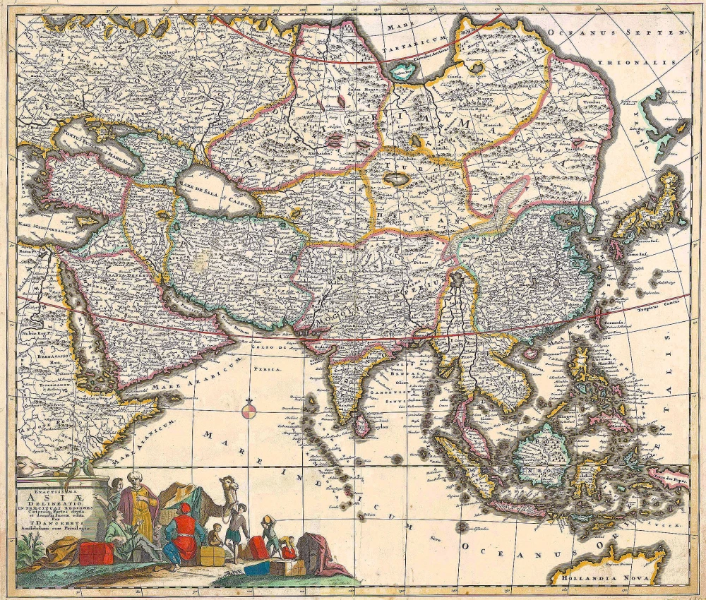
Accuratissima totius Asiae Tabula. c. 1691-96
Asia, by F. De Wit.
[Item number: 10960]
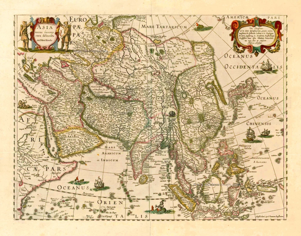
Asia Recens Summa Cura Delineata. 1644-58
Asia, by J. Janssonius
[Item number: 7508]
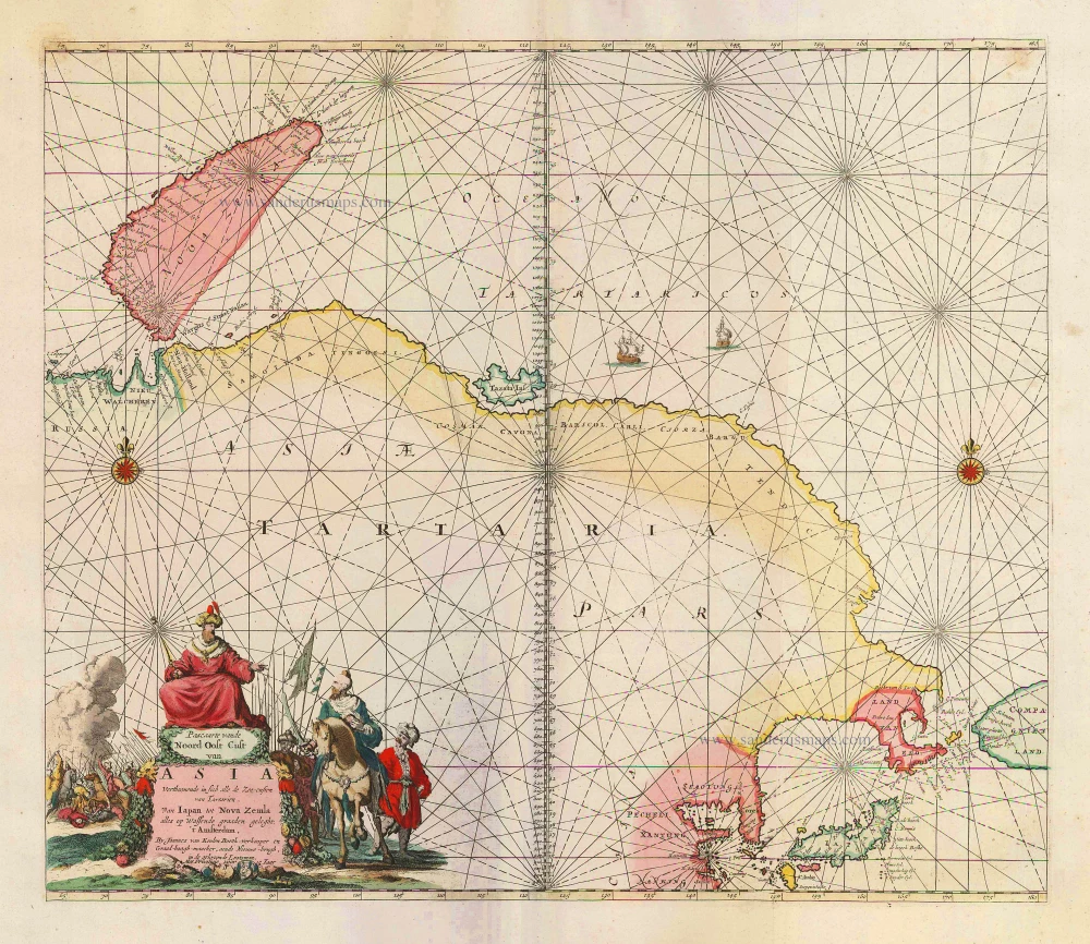
Pascaarte vande Noord Oost Cust van Asia Verthoonende in sich alle de Zee-custen van Tartarien, Van Iapan tot Nova Zemla, ... 1683
Sea chart of Northeast Asia, by J. Van Keulen.
[Item number: 2443]

Asiae in Tabula Geographica Delineatio. c. 1700
Asia by A.F. Zürner, published by Petrus Schenk.
[Item number: 25842]
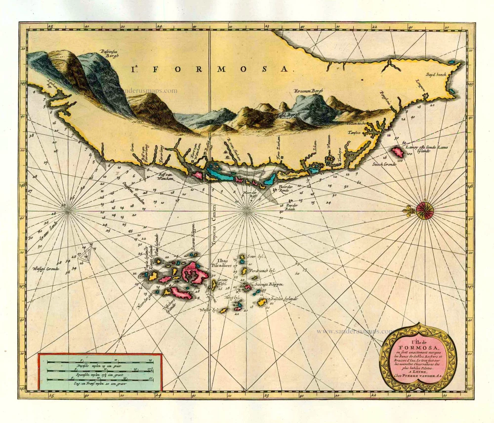
L'Île de Formosa ou sont exactement marquez les Bancs de Sables, Rochers et Brasses d'Eau. 1713
Formosa (Taiwan) and the Pescadores, by Pieter van der Aa.
[Item number: 26098]
Scarce map in old colour
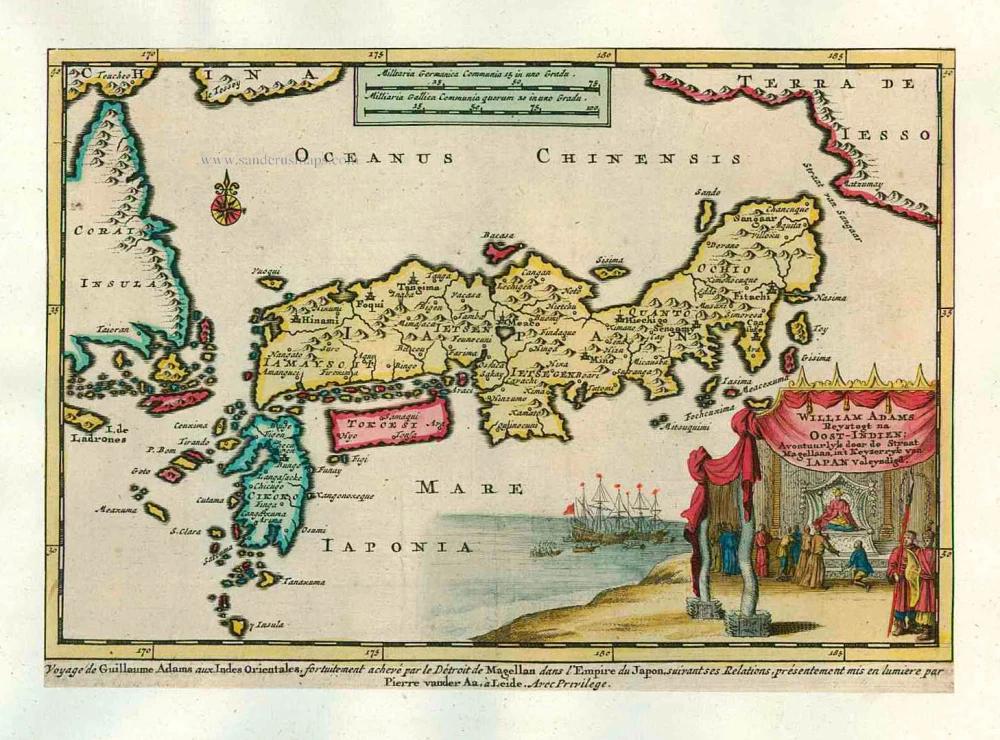
William Adams Reystogt na Oost-Indien; Avontuurlyk door de Straat Magellaan, in't Keyzerryk van Japan Voleyndigd. 1713
Japan by P. Van der Aa
[Item number: 26121]
In rare old colour
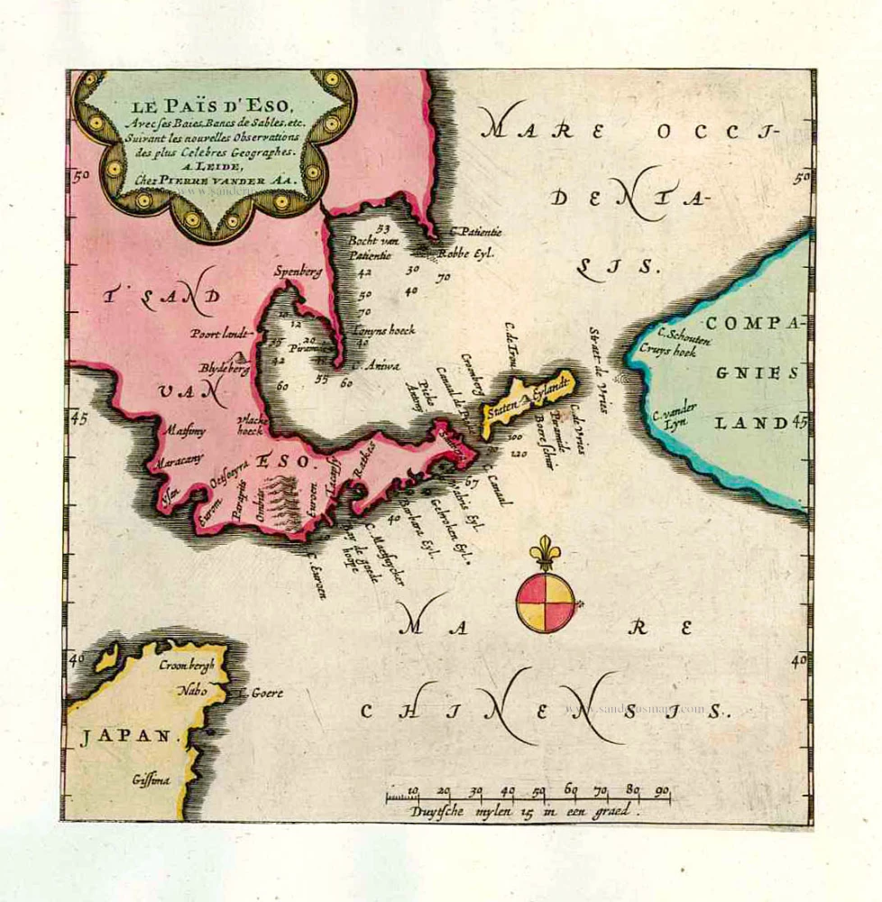
Le Païs d'Eso, Avec ses Baies, Bancs de Sables, etc. 1713
Eso (Hokkaido), by Pieter van der Aa.
[Item number: 26122]
In rare old colour
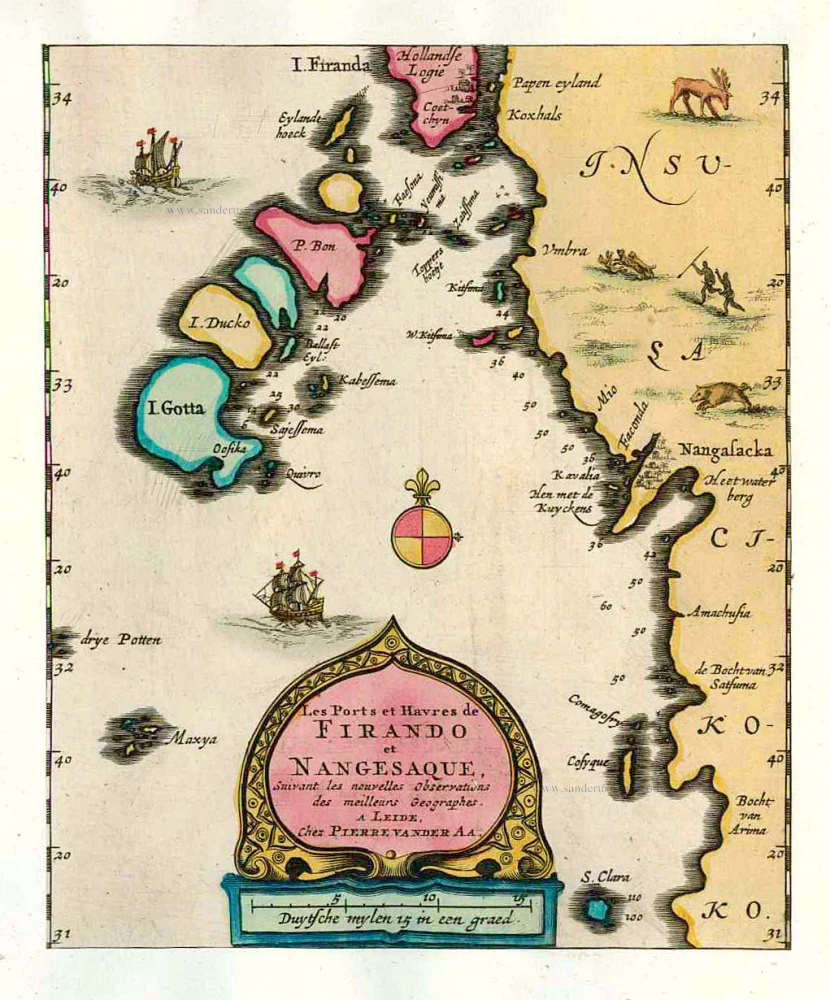
Les Ports et Havres de Firando et Nangesaque. 1713
Nagasaki and Hirado, by Pieter Van der Aa.
[Item number: 26123]
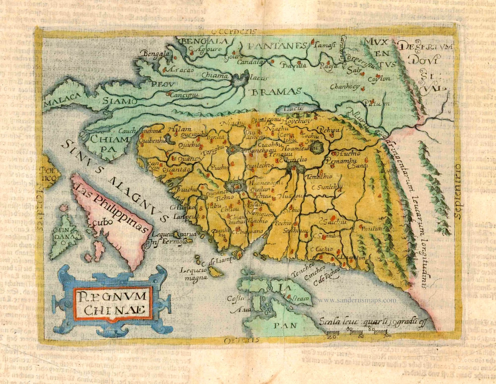
Regnum Chinae. 1596
Old antique map of China - Philippines - Japan by Giovanni Botero / Natalis Metellus.
[Item number: 3181]
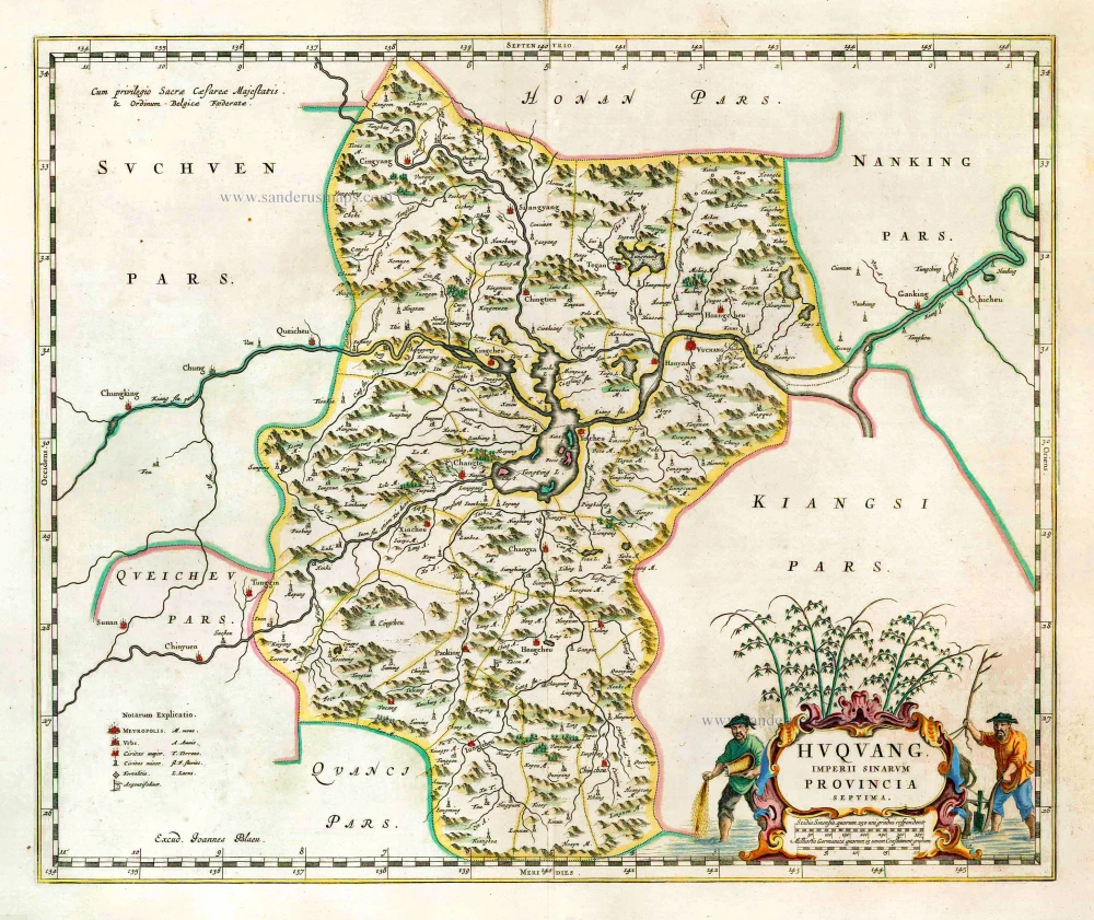
Huquang, Imperii Sinarum Provincia Septima. 1655-1659
Hukuang (China), by J. Blaeu.
[Item number: 26359]