
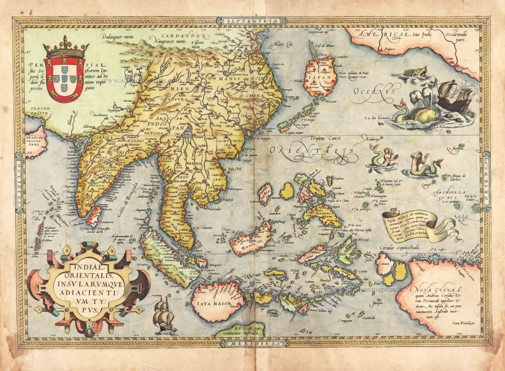
Southeast Asia, by G. Mercator - J. Hondius (small) 1607
Gerard Mercator (1512 – 1594)
Gerard Mercator was born Gerard de Cremere in Rupelmonde (near Antwerp) on 5 March 1512.
Young Gerard learned what Latin he could in Rupelmonde, and when he was about fifteen, his uncle sent him to s'Hertogenbosch to study at a school run by the Brothers of the Common Life. One of Mercator’s teachers was the celebrated humanist Macropedius. After three and a half years with the brothers, Gerard went to Louvain, where he enrolled in the university in 1530 as one of the poor students at Castle College.
By this time, he had Latinized his name to Mercator. He studied philosophy and took his master’s degree in 1532. The problems of the creation of the Universe and the Earth interested him in particular; this is reflected by his works written in later years.
After spending a few years in Antwerp, he returned to Louvain in c. 1535, where he took courses in mathematics under Gemma Frisius. Soon, he was recognised as an expert on the construction of mathematical instruments, as a land surveyor and, after 1537, as a cartographer. He drew his income from these activities after his marriage on August 3, 1536. He also qualified himself as a copper engraver, the first to introduce italic handwriting to this trade. The first maps, drawn and engraved by Gerard Mercator, are Palestine, 1537; the World in double heart-shaped projection, 1538; and Flanders, 1540.
In 1544, Mercator came into great danger: he was arrested on the accusation of heresy and put into jail. Thanks to the intervention of the University of Louvain, he was released after four months. In 1552, he moved with his family to Duisburg (Germany). In 1560, Mercator became a cosmographer in service of the Duke of Jülich-Cleve-Berge, and in 1563, he became a lecturer at the Grammar School of the new University in Duisburg. During this period, he made wall maps of Europe, 1554; of Loraine, 1564; the British Isles, 1564; and the famous world map with increasing latitudes, 1569. About this time, Mercator was also working on the project for a complete description of the creation, the Heavens, Earth, Sea and world history. This resulted in his Atlas, sive cosmographicae meditationes de fabrica mundi et fabricati figura. He also worked on an edition of Ptolemy’s Geographia, which appeared in 1578. The first part of his book with modern maps (France, Germany and the Netherlands) appeared in 1585.
Shortly after the publication of the second part of his map book (not yet called Atlas) with the maps of Italy (1589), he had a stroke that ended his highly significant productivity. The great man passed away on 2 December 1594, leaving the responsibility of finishing the map book to his son Rumold. The final part of it appeared in 1595. Its title is Pars Altera, and it constitutes an essential part of what was then called Mercator’s Atlas.
The map of Europe and the world map in the Atlas are by Rumold Mercator. After Rumold died in 1599, the Atlas was reissued in 1602.
The plates of the maps, both of the Ptolemy edition and the Atlas, were sold in 1604 to Jodocus Hondius of Amsterdam. The following year, Hondius managed to bring out Ptolemy’s Geographia. In 1606, the first Amsterdam edition of the Mercator Atlas appeared in the next year. From then to 1638, the Atlas saw many enlarged editions in various languages.
The Hondius Family
Jodocus Hondius the Elder (1563-1612)
Joost d’Hondt was born at Wakken (Flanders) in 1563. Two years later, his family settled in Ghent, where young Joost displayed an excellent gift for drawing and calligraphy. Through study and lessons, he developed his talents and became an engraver with a good reputation.
Due to the circumstances of the war, he moved to London in 1584, where he settled down as an engraver, instrument-maker, and map-maker. In 1587, he married Coletta van den Keere, sister of the well-known engraver Pieter van den Keere (Petrus Kaerius); some years earlier, his sister, Jacomina, had married Pieter van den Berghe (Petrus Montanus). Joost, who had Latinized his name to Jodocus Hondius, closely co-operated with his two brothers-in-law.
The political situation in the Northern Netherlands in 1593 was such that Jodocus seemed justified in establishing himself in Amsterdam, where many Antwerp printers, publishers, and engravers had gone. In this new centre of cartography, Jodocus Hondius set up his business “In de Wackere Hondt” (in the vigilant dog), this name being an allusion to his birthplace and name. He engraved many maps and published atlases and many other works, such as his continuation of Gerard Mercator’s Atlas.
He suddenly passed away in February 1612. The publishing firm of Jodocus Hondius was continued by his widow, later on, by his two sons, Jodocus Jr. and Henricus, and by his son-in-law, J. Janssonius.
Jodocus Hondius II (1594-1629) & Henricus Hondius (1597-1651)
After the father’s death, the widow and her seven children continued publishing the atlases under the name of Jodocus Hondius till 1620. The firm was reinforced by the very welcome help of Joannes Janssonius (1588-1664), who married 24-year-old Elisabeth Hondius in 1612. After 1619, Mercator’s Atlas was published under the name of Henricus Hondius.
One of the most dramatic events in the early history of commercial cartography in Amsterdam was the sale of Jodocus Hondius Jr.’s copper plates to Willem Jansz. Blaeu in 1629, the year of his death. At least 34 plates, from which Jodocus II had printed single-sheet maps for his benefit, passed into the hands of his great competitor. Immediately after that, his brother, Henricus, and Joannes Janssonius ordered the engraving of identical plates.
Henricus devoted all his energy to publishing the Atlas for an extended period. He saw its growth up to and including the fourth part in 1646; after that, his name no longer figures on the title pages. After 1638, the title of the Atlas was changed to Atlas Novus; Joannes Janssonius mainly carried it on.
The competition with the Blaeu's dates from 1630. In 1630, Willem Janszoon (=Blaeu) first attacked with his Atlantis Appendix. In 1635, Blaeu completed his Theatrum Orbis Terrarum in two volumes with French, Latin, Dutch, and German texts, prompting Henricus Hondius to speed up the enlargement of his Atlas.
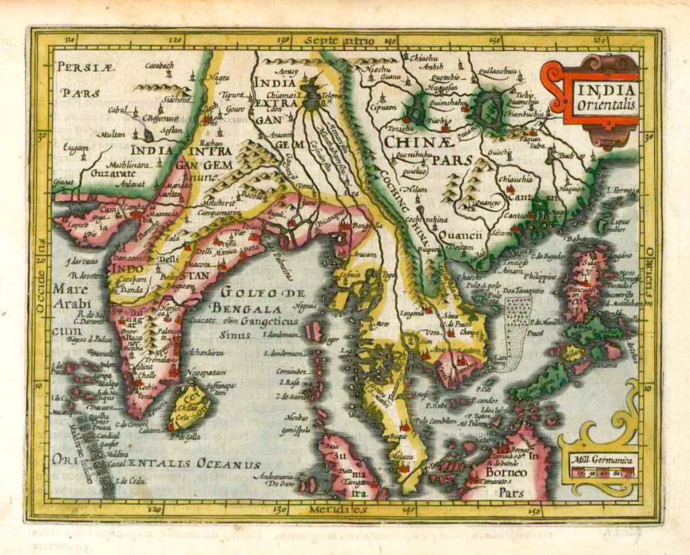
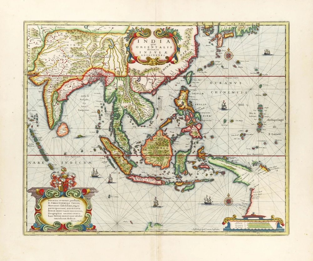
India Orientalis.
Item Number: 25186 Authenticity Guarantee
Category: Antique maps > Asia > Southeast Asia
Old, antique map of Southeast Asia, by G. Mercator - J. Hondius (small).
Title: India Orientalis.
Date of the first edition: 1607.
Date of this map: 1607.
Copper engraving, printed on paper.
Size (not including margins): 145 x 185mm (5.71 x 7.28 inches).
Verso: Latin text.
Condition: Contemporary old coloured, excellent.
Condition Rating: A+.
From: Atlas Minor Gerardi Mercatoris Amsterdam, J. Hondius, 1607. (Van der Krogt 3, 351:01)
Gerard Mercator (1512 – 1594)
Gerard Mercator was born Gerard de Cremere in Rupelmonde (near Antwerp) on 5 March 1512.
Young Gerard learned what Latin he could in Rupelmonde, and when he was about fifteen, his uncle sent him to s'Hertogenbosch to study at a school run by the Brothers of the Common Life. One of Mercator’s teachers was the celebrated humanist Macropedius. After three and a half years with the brothers, Gerard went to Louvain, where he enrolled in the university in 1530 as one of the poor students at Castle College.
By this time, he had Latinized his name to Mercator. He studied philosophy and took his master’s degree in 1532. The problems of the creation of the Universe and the Earth interested him in particular; this is reflected by his works written in later years.
After spending a few years in Antwerp, he returned to Louvain in c. 1535, where he took courses in mathematics under Gemma Frisius. Soon, he was recognised as an expert on the construction of mathematical instruments, as a land surveyor and, after 1537, as a cartographer. He drew his income from these activities after his marriage on August 3, 1536. He also qualified himself as a copper engraver, the first to introduce italic handwriting to this trade. The first maps, drawn and engraved by Gerard Mercator, are Palestine, 1537; the World in double heart-shaped projection, 1538; and Flanders, 1540.
In 1544, Mercator came into great danger: he was arrested on the accusation of heresy and put into jail. Thanks to the intervention of the University of Louvain, he was released after four months. In 1552, he moved with his family to Duisburg (Germany). In 1560, Mercator became a cosmographer in service of the Duke of Jülich-Cleve-Berge, and in 1563, he became a lecturer at the Grammar School of the new University in Duisburg. During this period, he made wall maps of Europe, 1554; of Loraine, 1564; the British Isles, 1564; and the famous world map with increasing latitudes, 1569. About this time, Mercator was also working on the project for a complete description of the creation, the Heavens, Earth, Sea and world history. This resulted in his Atlas, sive cosmographicae meditationes de fabrica mundi et fabricati figura. He also worked on an edition of Ptolemy’s Geographia, which appeared in 1578. The first part of his book with modern maps (France, Germany and the Netherlands) appeared in 1585.
Shortly after the publication of the second part of his map book (not yet called Atlas) with the maps of Italy (1589), he had a stroke that ended his highly significant productivity. The great man passed away on 2 December 1594, leaving the responsibility of finishing the map book to his son Rumold. The final part of it appeared in 1595. Its title is Pars Altera, and it constitutes an essential part of what was then called Mercator’s Atlas.
The map of Europe and the world map in the Atlas are by Rumold Mercator. After Rumold died in 1599, the Atlas was reissued in 1602.
The plates of the maps, both of the Ptolemy edition and the Atlas, were sold in 1604 to Jodocus Hondius of Amsterdam. The following year, Hondius managed to bring out Ptolemy’s Geographia. In 1606, the first Amsterdam edition of the Mercator Atlas appeared in the next year. From then to 1638, the Atlas saw many enlarged editions in various languages.
The Hondius Family
Jodocus Hondius the Elder (1563-1612)
Joost d’Hondt was born at Wakken (Flanders) in 1563. Two years later, his family settled in Ghent, where young Joost displayed an excellent gift for drawing and calligraphy. Through study and lessons, he developed his talents and became an engraver with a good reputation.
Due to the circumstances of the war, he moved to London in 1584, where he settled down as an engraver, instrument-maker, and map-maker. In 1587, he married Coletta van den Keere, sister of the well-known engraver Pieter van den Keere (Petrus Kaerius); some years earlier, his sister, Jacomina, had married Pieter van den Berghe (Petrus Montanus). Joost, who had Latinized his name to Jodocus Hondius, closely co-operated with his two brothers-in-law.
The political situation in the Northern Netherlands in 1593 was such that Jodocus seemed justified in establishing himself in Amsterdam, where many Antwerp printers, publishers, and engravers had gone. In this new centre of cartography, Jodocus Hondius set up his business “In de Wackere Hondt” (in the vigilant dog), this name being an allusion to his birthplace and name. He engraved many maps and published atlases and many other works, such as his continuation of Gerard Mercator’s Atlas.
He suddenly passed away in February 1612. The publishing firm of Jodocus Hondius was continued by his widow, later on, by his two sons, Jodocus Jr. and Henricus, and by his son-in-law, J. Janssonius.
Jodocus Hondius II (1594-1629) & Henricus Hondius (1597-1651)
After the father’s death, the widow and her seven children continued publishing the atlases under the name of Jodocus Hondius till 1620. The firm was reinforced by the very welcome help of Joannes Janssonius (1588-1664), who married 24-year-old Elisabeth Hondius in 1612. After 1619, Mercator’s Atlas was published under the name of Henricus Hondius.
One of the most dramatic events in the early history of commercial cartography in Amsterdam was the sale of Jodocus Hondius Jr.’s copper plates to Willem Jansz. Blaeu in 1629, the year of his death. At least 34 plates, from which Jodocus II had printed single-sheet maps for his benefit, passed into the hands of his great competitor. Immediately after that, his brother, Henricus, and Joannes Janssonius ordered the engraving of identical plates.
Henricus devoted all his energy to publishing the Atlas for an extended period. He saw its growth up to and including the fourth part in 1646; after that, his name no longer figures on the title pages. After 1638, the title of the Atlas was changed to Atlas Novus; Joannes Janssonius mainly carried it on.
The competition with the Blaeu's dates from 1630. In 1630, Willem Janszoon (=Blaeu) first attacked with his Atlantis Appendix. In 1635, Blaeu completed his Theatrum Orbis Terrarum in two volumes with French, Latin, Dutch, and German texts, prompting Henricus Hondius to speed up the enlargement of his Atlas.
Related items
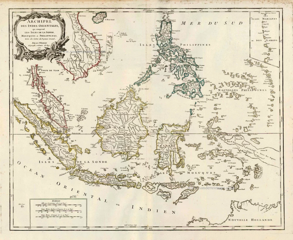
Archipel des Indes Orientales qui Comprend les Isles de la Sonde, Moluques et Philippines. c. 1757
Southeast Asia, par Robert de Vaugondy.
[Item number: 4751]
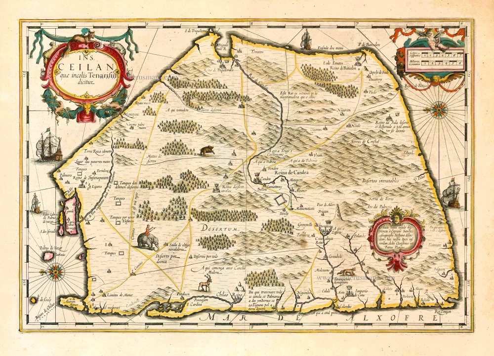
Ins. Ceilan quae incolis Tenarisin dicitur. 1638
Sri Lanka (Ceylon), by Jodocus Hondius.
[Item number: 26006]
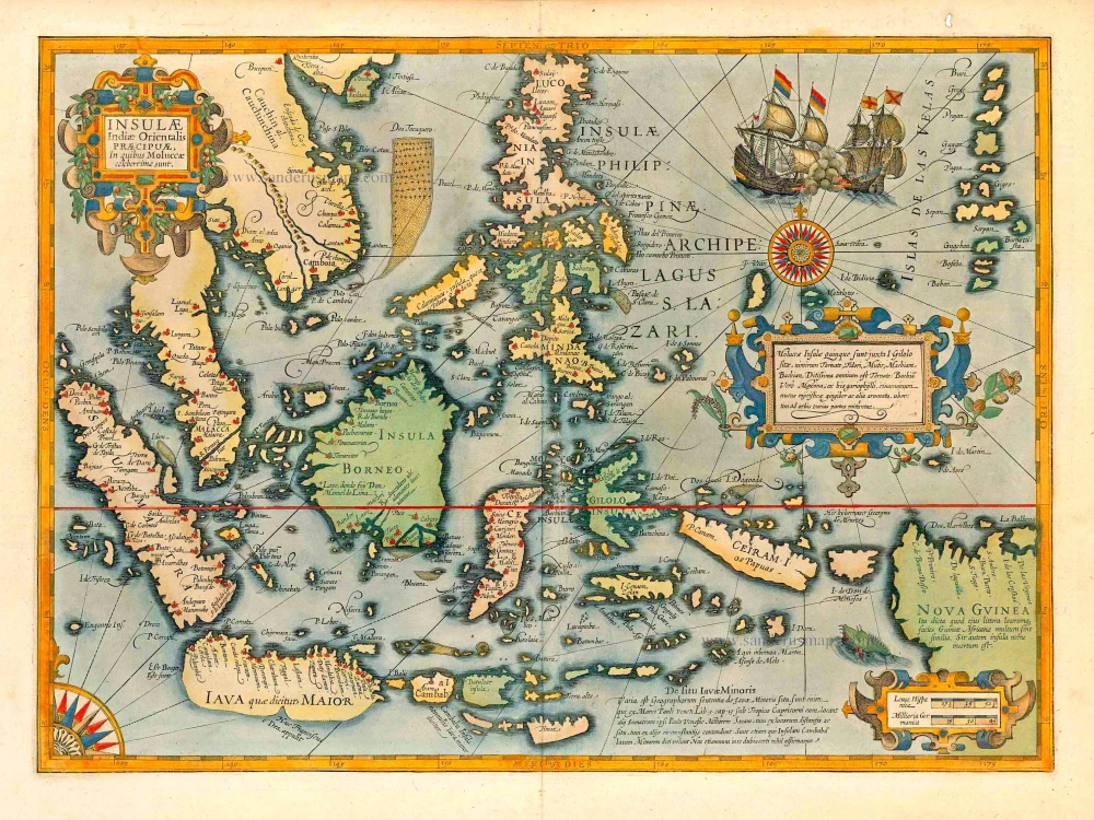
The most elegant and decorative map of East Indies
Insulae Indiae Orientalis Praecipuae, in quibus Moluccae celeberrimae sunt. 1623
East Indies by Jodocus Hondius.
[Item number: 27820]
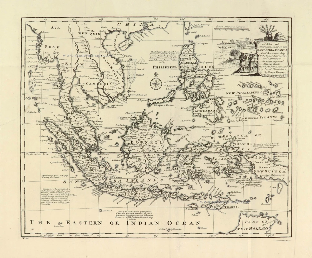
A New and Accurate Map of the East India Islands. 1747
Southeast Asia, by Emanuel Bowen.
[Item number: 28012]
A very important map of the region
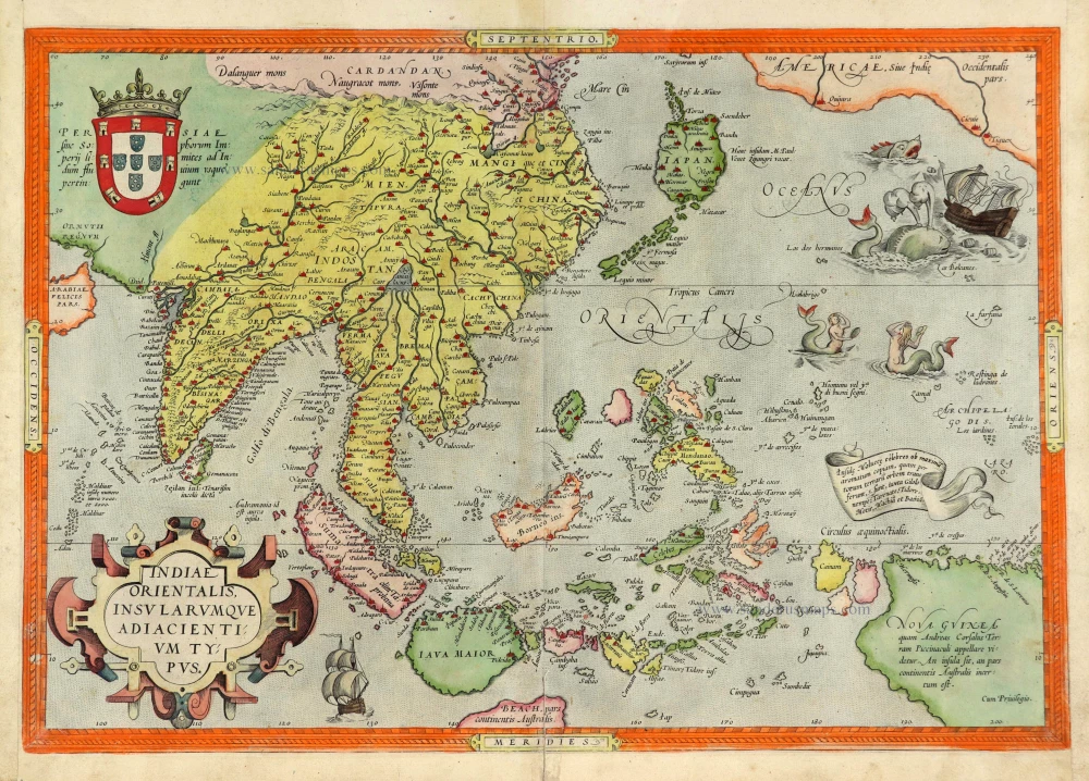
Indiae Orientalis Insularumque Adiacientium Typus. 1572
Southeast Asia, by Abraham Ortelius.
[Item number: 28046]
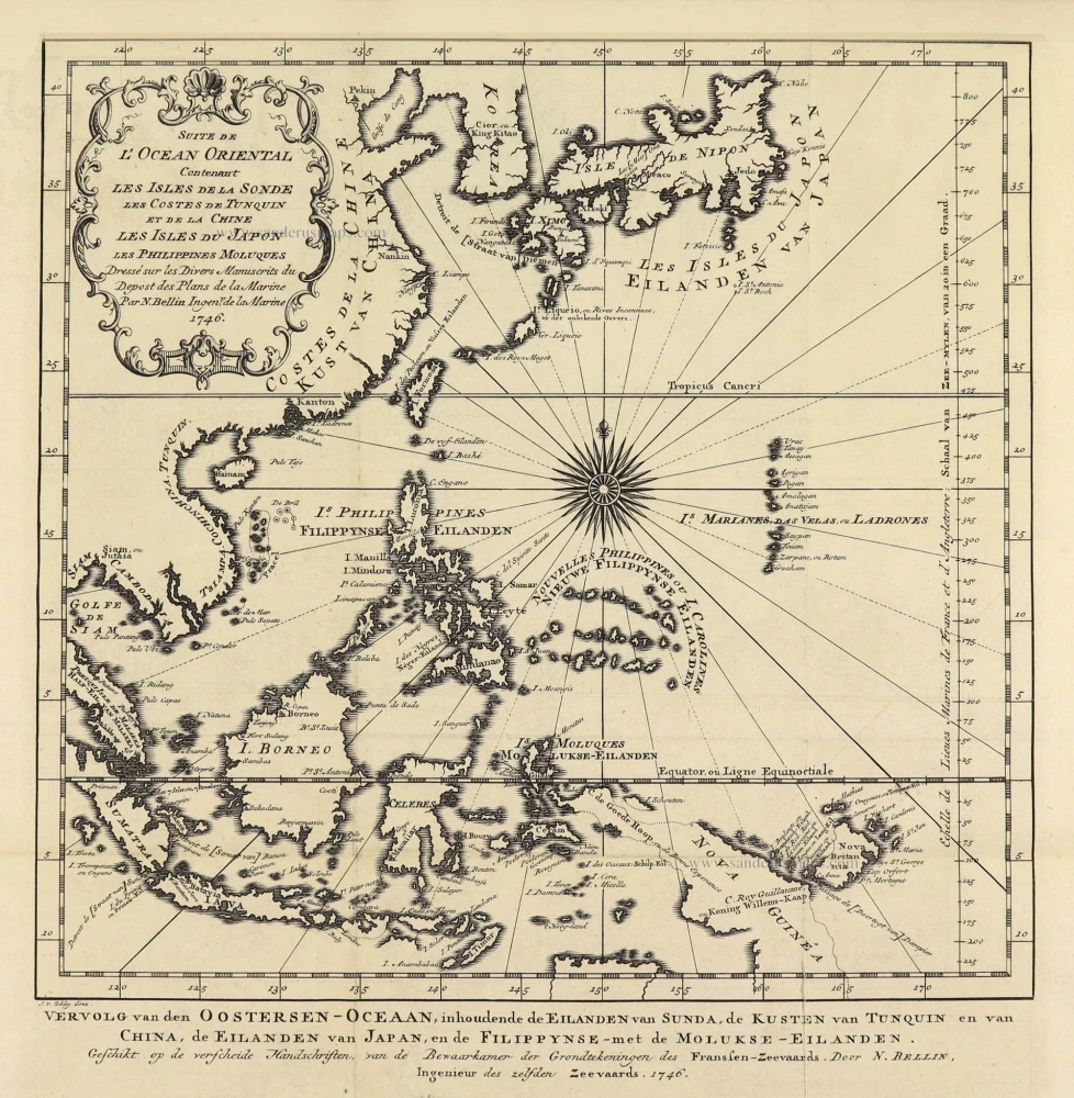
Suite de L'Ocean Oriental Contenant Les Isles de la Sonde Les Costes de Tunquin et de la Chine Les Isles du Japon les Philippines Moluques. 1747
Southeast Asia by Jacques Nicolas Bellin.
[Item number: 28189]
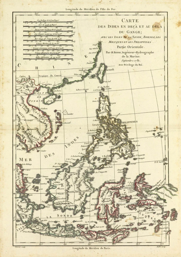
Carte des Indes en deçà et au dela du Gange; avec les Isles de la Sonde, Borneo, les Moluques et les Philippines. Partie Orientale. 1690
Southeast Asia by Rigobert Bonne.
[Item number: 28304]
Scarce
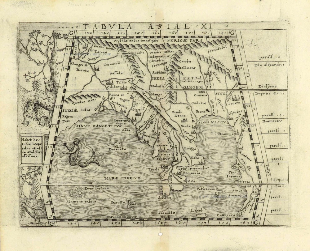
Tabula Asiae XI. 1548
Southeast Asia by Giacomo Gastaldi / Ptolemy.
[Item number: 28362]
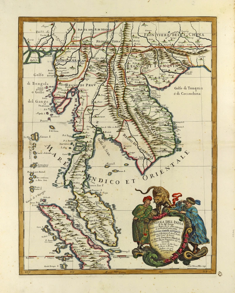
Penisola Dell India di la dal Gange Divisa ne i Regni, che in essasi contengono et accresciuta di varie notizie. 1692
Indochina by Cantelli da Vignola, published by Giovanni Giacomo de Rossi.
[Item number: 28371]
In rare original colour.
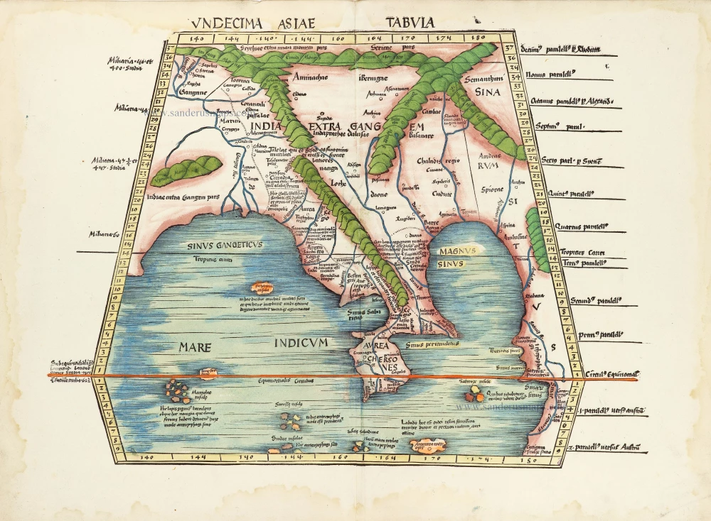
Undecima Asiae Tabula. 1513
South Asia by Waldseemüller Martin
[Item number: 29249]
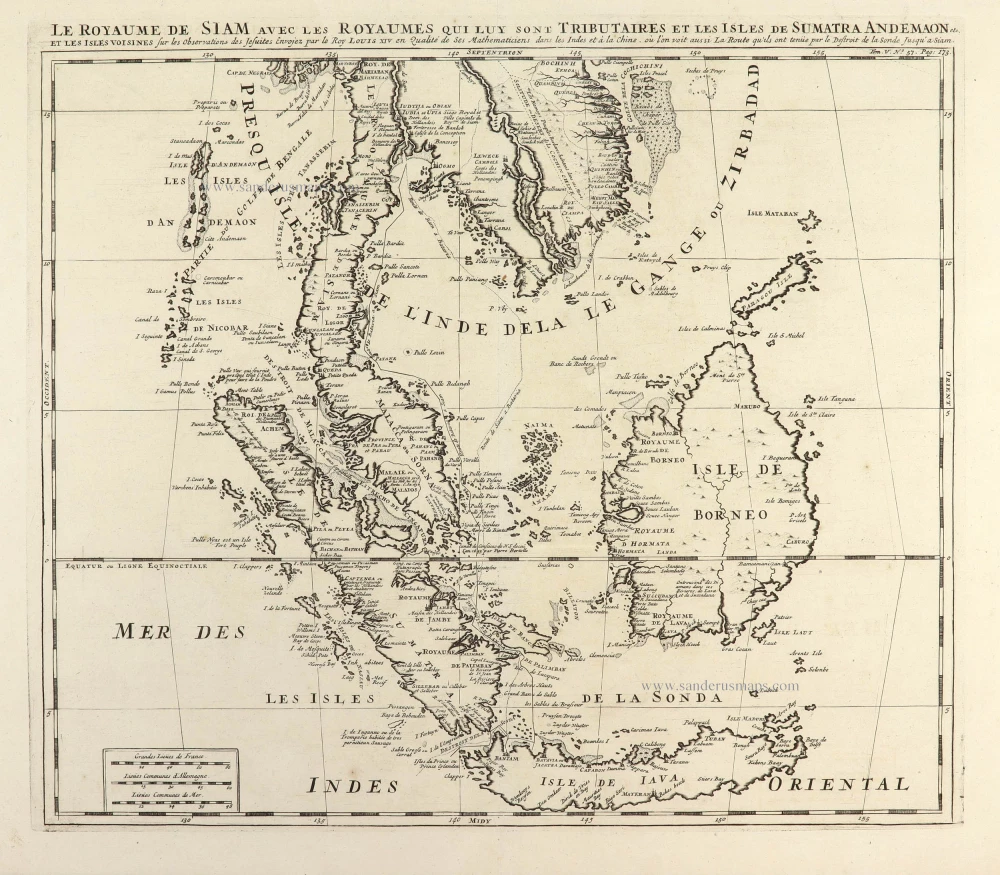
Le Royaume de Siam avec les Royaumes qui luy sont Tributaires et les Isles de Sumatra Andemaon etc. et les isles voisines. 1719
Antique map of Southeast Asia by Châtelain
[Item number: 29372]

Carte des Indes, de la Chine & des Iles de Sumatra, Java &c. 1719
Southeast Asia, by Z. Châtelain.
[Item number: 29376]
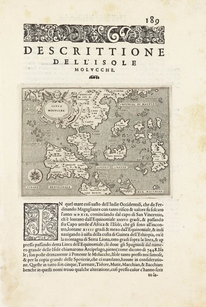
Isole Molucche.- [Above map :] Descrittione del l'Isole Molucche. 1590
Southeast Asia by Tommaso Porcacchi.
[Item number: 29788]

Insulae Indiae Orientalis Praecipuae, in quibus Moluccae celeberrimae sunt. 1630
East Indian Archipelago by Jodocus Hondius.
[Item number: 29863]
With luxury colouring
India quae Orientalis dicitur et Insulae Adiacentes. 1666
Southeast Asia by Henricus Hondius, published by Johannes Janssonius.
[Item number: 29973]
Rare
[No title] - 'Mar di India'. 1645
East Indies by van Spilbergen Joris.
[Item number: 30057]
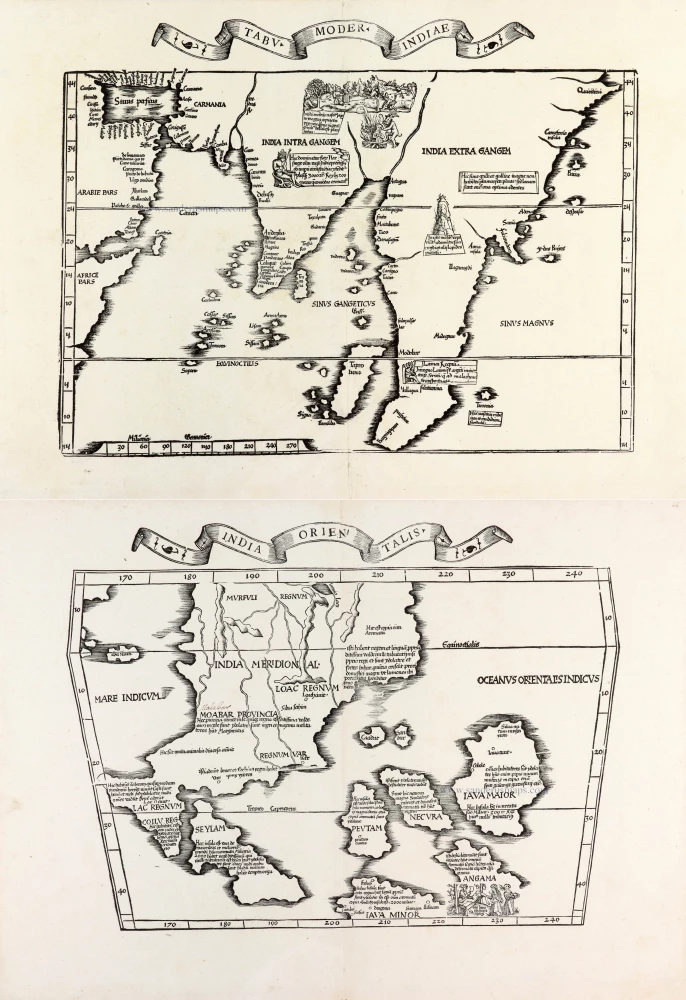
Two early modern maps of Southeast Asia by L. Fries and M. Waldseemüller
Tabu. Moder. Indiae [together with] India Orien talis. 1535
South Asia by Lorens Fries
[Item number: 30141]
Very rare first 1570 A edition.
Indiae Orientalis Insularumque Adiacientium Typus. 1570
Southeast Asia, by Abraham Ortelius.
[Item number: 30592]
new