
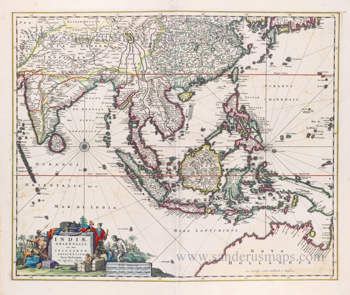
Southeast Asia by Theodorus Danckerts. 1696-1713
This map is very similar in layout and geography to Nicolas Visscher's map of the same title. Still, Danckert's map lists about twenty place names on the northwest coast of Australia, including the landing places of the Eendracht in 1616 and of G.F. de Wits in 1628.
The Danckerts Family.
The Danckerts family of Amsterdam was one of the best-known print and map sellers in 17th century Amsterdam. Their business activity covered a vast period, from ca. 1633. From 1669 until 1701, father Justus and his sons had their shop in the ‘Calverstraet in de Danckbaerheyt’.
Cornelis Danckerts (1561-1631) was a printseller born in Amsterdam and active in Antwerp.
Cornelis Danckerts, the elder (1603-1656) was an engraver and publisher in Amsterdam and Nieuwendijk. Son of Cornelis (above), whom he succeeded in 1631.
The house of Danckerts gained its greatest fame from Justus Danckerts (1635-1701 - son of Cornelis the elder) and his two sons, Theodorus and Cornelis. Dancker Danckerts (1634-1666), the elder brother of Justus, was known for his etchings of paintings, maps, and publications.
The grandfather, father, and sons were highly skilled and excellent artistic drafters and engravers. They are famous for the edition of their Atlas, which appeared from ca. 1686, and for several monumental and beautiful wall maps and views. However, compared with that published by the Blaeu's or Janssonius's, their cartographic work has attracted little attention and has never received proper recognition.
On 14 August 1684, Justus and his sons obtained the privilege from the States of Holland for their publications. In 1713, twelve years after Justus Danckerts, the heirs decided to sell part of the stock of maps and atlases and many copperplates. In 1727, after the death of the last surviving brother Theodorus, a final sale took place.
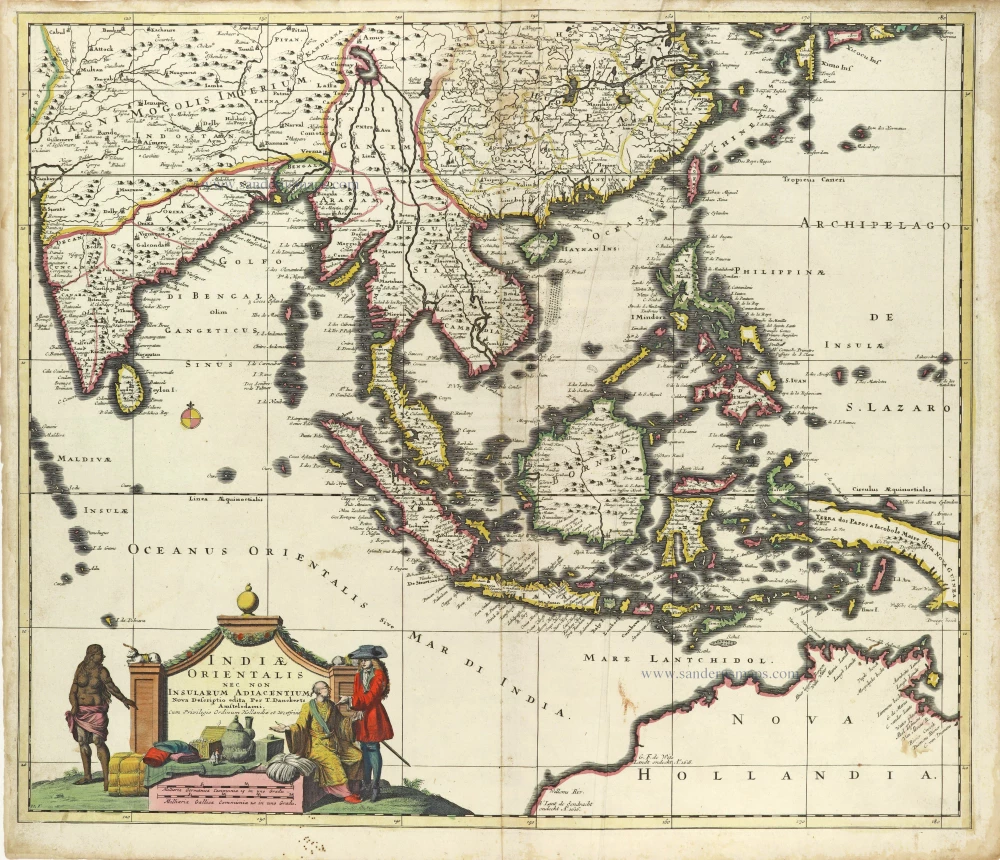
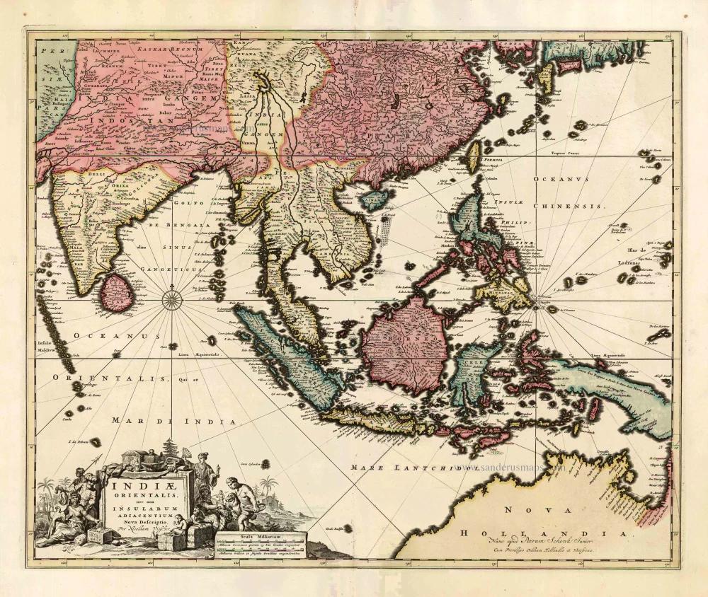
Indiae Orientalis nec non Insularum Adiacentium Nova Descriptio.
Item Number: 28450 Authenticity Guarantee
Category: Antique maps > Asia > Southeast Asia
Old, antique map of Southeast Asia, by Danckerts Theodorus. VERY RARE
Title: Indiae Orientalis nec non Insularum Adiacentium Nova Descriptio.
edita Per T. Danckerts Amstelodami.
Cum Privilegio Ordinum Hollandia et Westfrisie.
I.L.F.
Date: 1696-1713
Copper engraving, printed on paper.
Map size: 500 x 585mm (19.69 x 23.03 inches).
Sheet size: 530 x 610mm (20.87 x 24.02 inches).
Verso: Blank.
Condition: Original coloured, excellent.
Condition Rating: A+.
References: Parry, p. 128; Koeman, II p. 95 (88)
From: Atlas. Amsterdam, after 1696.
This map is very similar in layout and geography to Nicolas Visscher's map of the same title. Still, Danckert's map lists about twenty place names on the northwest coast of Australia, including the landing places of the Eendracht in 1616 and of G.F. de Wits in 1628.
The Danckerts Family.
The Danckerts family of Amsterdam was one of the best-known print and map sellers in 17th century Amsterdam. Their business activity covered a vast period, from ca. 1633. From 1669 until 1701, father Justus and his sons had their shop in the ‘Calverstraet in de Danckbaerheyt’.
Cornelis Danckerts (1561-1631) was a printseller born in Amsterdam and active in Antwerp.
Cornelis Danckerts, the elder (1603-1656) was an engraver and publisher in Amsterdam and Nieuwendijk. Son of Cornelis (above), whom he succeeded in 1631.
The house of Danckerts gained its greatest fame from Justus Danckerts (1635-1701 - son of Cornelis the elder) and his two sons, Theodorus and Cornelis. Dancker Danckerts (1634-1666), the elder brother of Justus, was known for his etchings of paintings, maps, and publications.
The grandfather, father, and sons were highly skilled and excellent artistic drafters and engravers. They are famous for the edition of their Atlas, which appeared from ca. 1686, and for several monumental and beautiful wall maps and views. However, compared with that published by the Blaeu's or Janssonius's, their cartographic work has attracted little attention and has never received proper recognition.
On 14 August 1684, Justus and his sons obtained the privilege from the States of Holland for their publications. In 1713, twelve years after Justus Danckerts, the heirs decided to sell part of the stock of maps and atlases and many copperplates. In 1727, after the death of the last surviving brother Theodorus, a final sale took place.
Related items
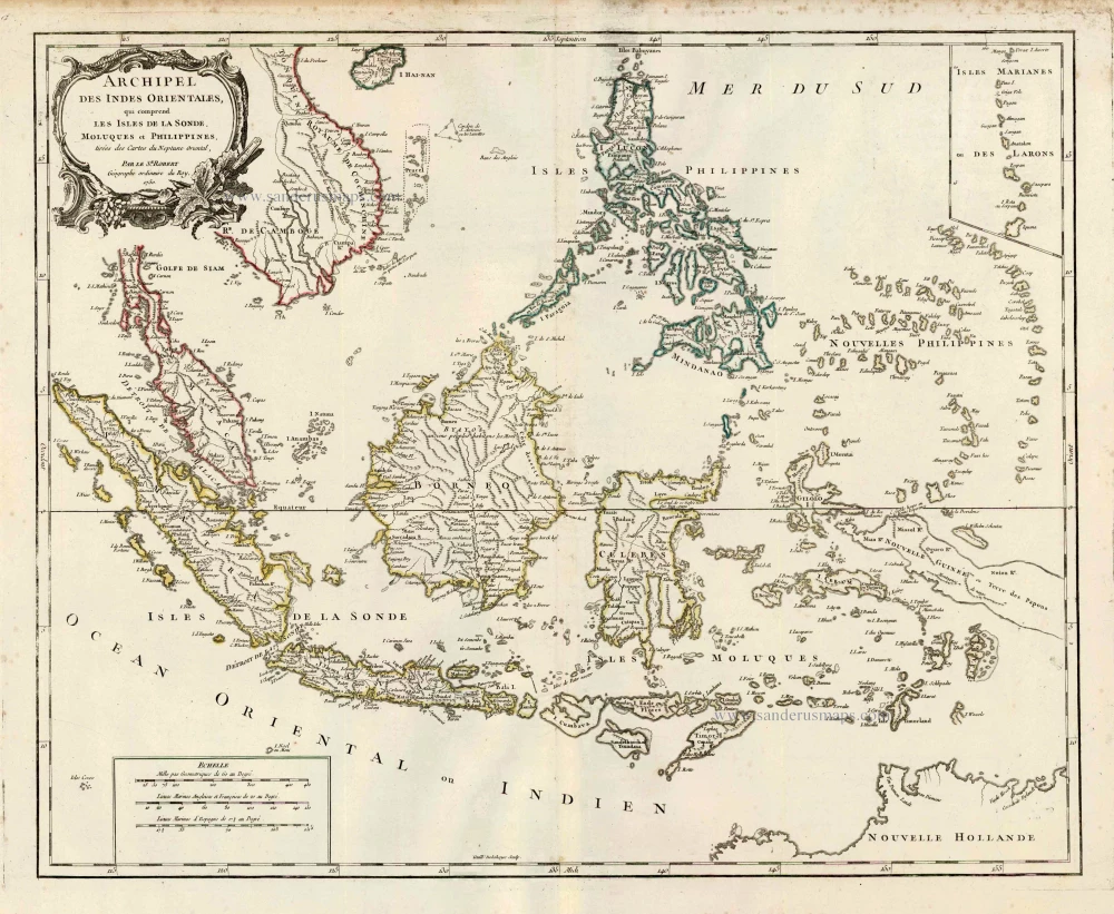
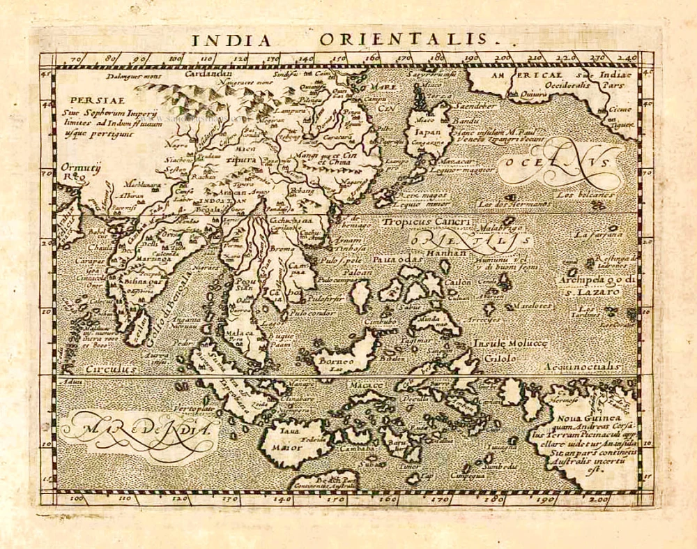
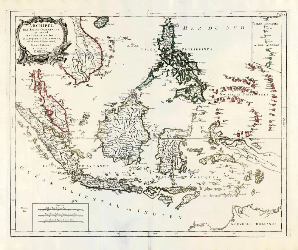
Archipel des Indes Orientales qui Comprend les Isles de la Sonde, Moluques et Philippines. c. 1757
Southeast Asia, par Robert de Vaugondy.
[Item number: 4751]
This map was the most accurate and one of the most elegant seventeenth-century maps of the East Indies
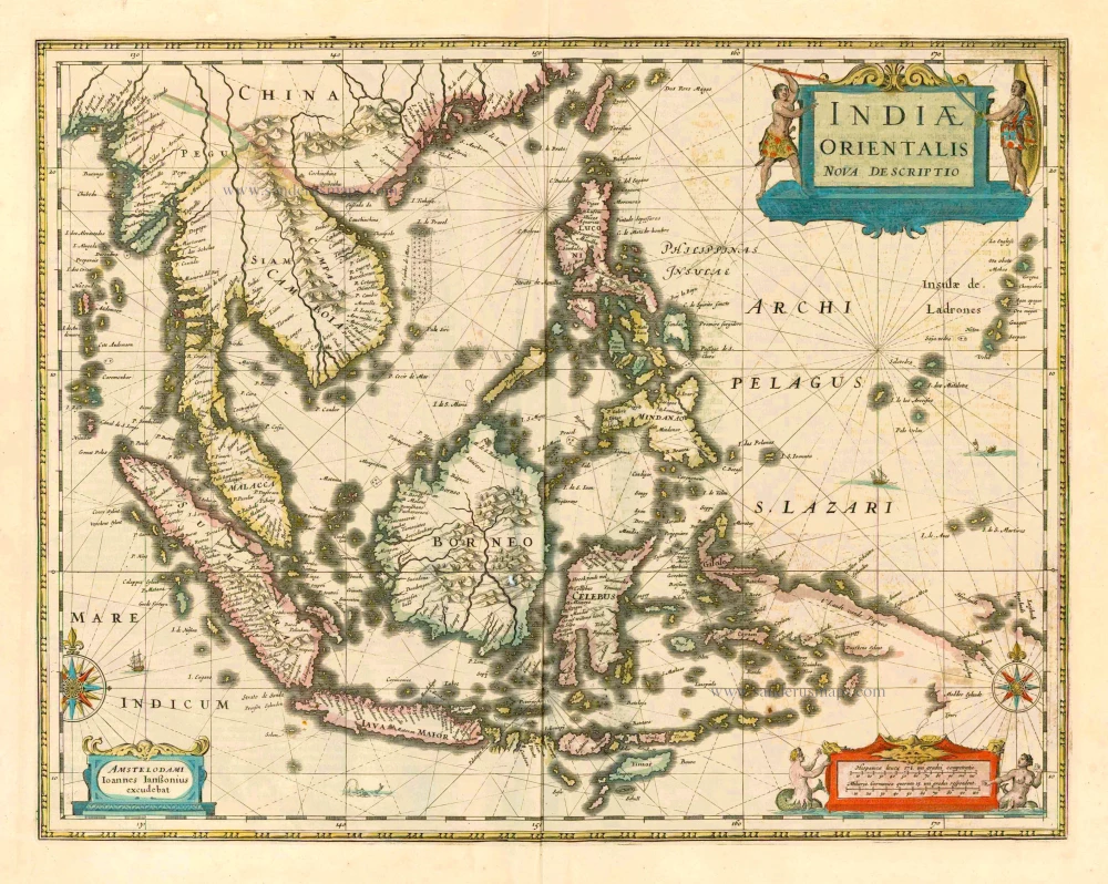
Indiae Orientalis Nova Descriptio. 1644-58
Southeast Asia by Janssonius, Johannes
[Item number: 10013]
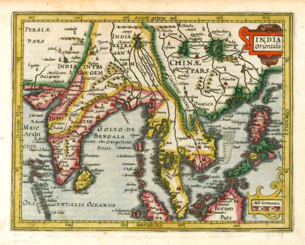
India Orientalis. 1607
Southeast Asia, by G. Mercator - J. Hondius (small)
[Item number: 25186]
From the Cloppenburg edition
Insulae Indiae Orientalis. 1630
Southeast Asia, by G. Mercator - J. Hondius.
[Item number: 25234]
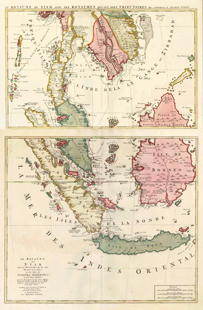
Le Royaume de Siam avec les Royaumes qui luy sont Tributaires, et les Isles de Sumatra, Andemaon, etc. et les Isles Voisine. c. 1700
Southeast Asia, by J. Ottens.
[Item number: 25716]
Indiae Orientalis nec non Insularum Adiacentium Nova Descriptio. c. 1740
Southeast Asia by Nicolaes Visscher, published by Petrus Schenk.
[Item number: 25718]
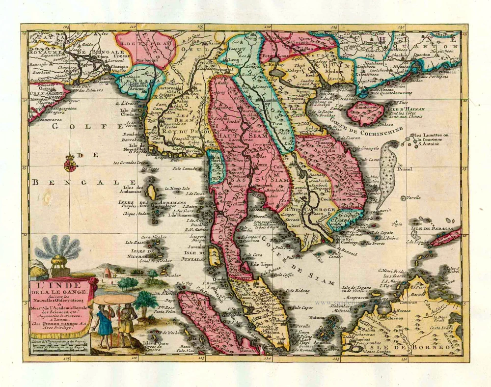
L'Inde de la le Gange, 1713
Southeast Asia, by Pieter van der Aa.
[Item number: 26097]
India Orientalis. 1597
Southeast Asia, by Giovanni Magini.
[Item number: 26521]

This map has the first accurate depiction of the Philippines
India quae Orientalis dicitur et Insulae Adiacentes. 1640-43
Southeast Asia by Willem & Joan Blaeu
[Item number: 26566]
Archipel des Indes Orientales qui comprend les Isles de la Sonde, Moluques et Philippines. 1776-79
Southeast Asia, by Francesco Santini.
[Item number: 26977]
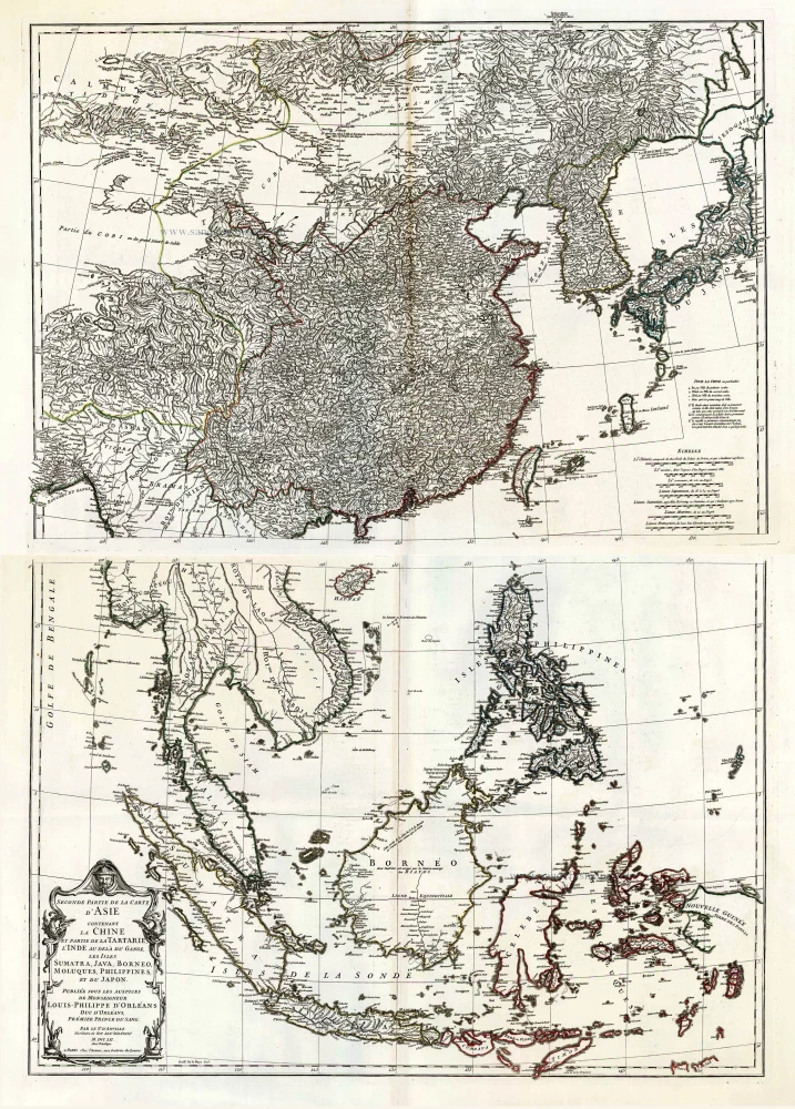
Seconde Partie de la Carte d'Asie Contenant la Chine et Partie de la Tartarie, l'Inde au Deca du Gange, les Isles Sumatra, Java, Borneo, Moluques, Philippines, et du Japo 1746-53
Southeast Asia, by J.B. d'Anville.
[Item number: 27401]
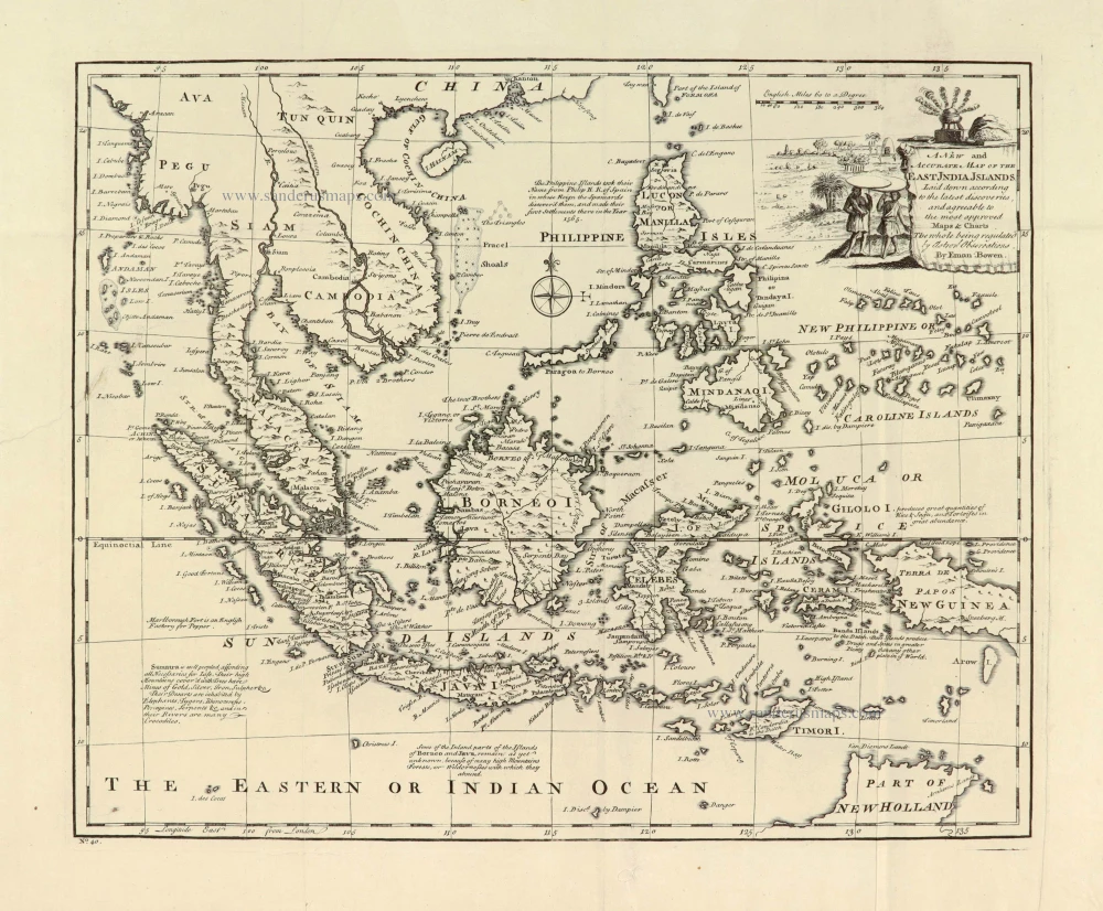
A New and Accurate Map of the East India Islands. 1747
Southeast Asia, by Emanuel Bowen.
[Item number: 28012]
A very important map of the region
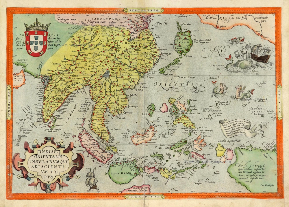
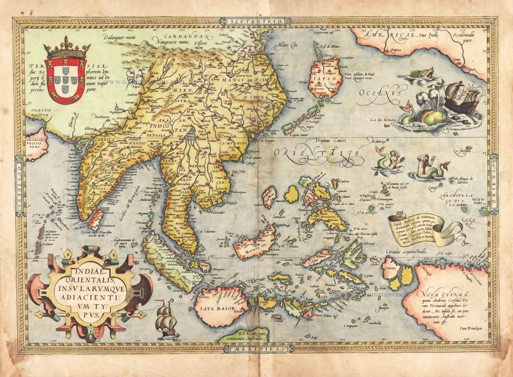
Indiae Orientalis Insularumque Adiacientium Typus. 1572
Southeast Asia, by Abraham Ortelius.
[Item number: 28046]
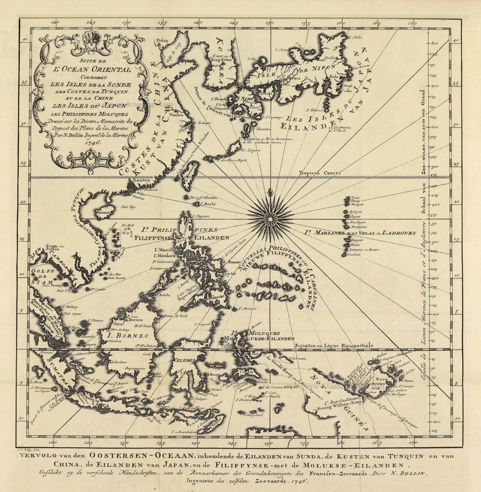
Suite de L'Ocean Oriental Contenant Les Isles de la Sonde Les Costes de Tunquin et de la Chine Les Isles du Japon les Philippines Moluques. 1747
Southeast Asia by Jacques Nicolas Bellin.
[Item number: 28189]
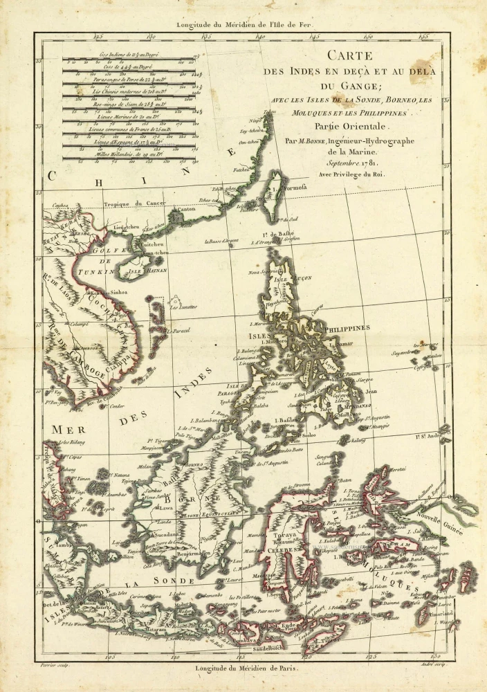
Carte des Indes en deçà et au dela du Gange; avec les Isles de la Sonde, Borneo, les Moluques et les Philippines. Partie Orientale. 1690
Southeast Asia by Rigobert Bonne.
[Item number: 28304]
Scarce
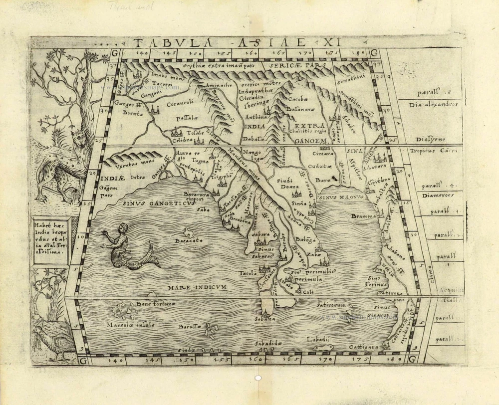
Tabula Asiae XI. 1548
Southeast Asia by Giacomo Gastaldi / Ptolemy.
[Item number: 28362]
Indiae Orientalis nec non Insularum Adiacentium Nova Descriptio. 1678
Southeast Asia by Nicolaes Visscher I.
[Item number: 28555]
Very rare first 1570 A edition.
Indiae Orientalis Insularumque Adiacientium Typus. 1570
Southeast Asia, by Abraham Ortelius.
[Item number: 30592]
new