
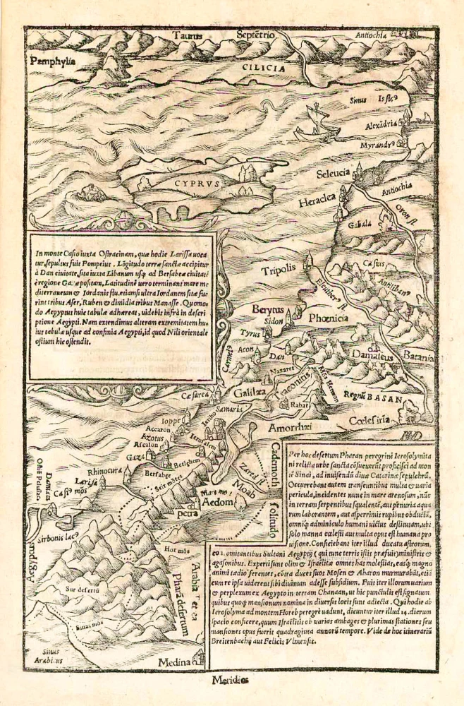
Cyprus and the Holy Land, by Sebastian Münster. 1550

Sebastian Münster (1488-1552)
Sebastian Münster, a German geographer, cartographer, Hebraist, and theologian, was born in Ingelheim, near Mainz In 1505, he went to Heidelberg to enter the Franciscan order. In 1507 he went to Louvain, where he studied mathematics, geography, and astronomy. In 1509 Münster became a student of Konrad Pelikan, who taught Hebrew and Greek as well as mathematics and cosmography. In 1518 he completed his studies at the University of Tübingen. He was the favorite of the famous mathematician and astronomer Johann Stöffler.
In 1524 Münster was appointed professor of Hebrew at Heidelberg University. In 1525 he published his first map as part of a broadside: The Instrument of the Suns combined a map, calendar, astrological almanac, sundial, and nocturnal on one attractive sheet, suitable for wall mounting.
In 1540 he published a Latin edition of Ptolemy's Geographia with illustrations. He based this edition on the Latin translation by Willibald Pirkheimer and produced new maps to supplement the Ptolemaic maps. The twenty-seven maps of the Ptolemaic canon are supplemented by twenty-one new maps. Further editions appeared in 1541 and 1542.
In 1544 he published the Cosmographia, a bulky book with 659 pages and some 520 woodcuts. Maps in this edition included three maps from the Ptolemaic canon and fourteen modern maps (from previous editions of the Geographia), as well as nine new maps. Later editions (1545, 1546, 1548) enlarged the Cosmographia. The 1550 edition contains cities, portraits, and costumes. These editions in both Latin and German constitute the full fruition of Münster's dream of a comprehensive geography.
The Cosmographia was one of the most successful works of the 16th century. It passed through 24 editions in 100 years, in different languages, including Latin, French, Italian, English, and even Czech. The last German edition was published in 1628.
He died at Basel of the plague in 1552.
As a cartographer, Münster deserves special recognition for formulating a plan for a comprehensive and uniform map of a country. As a geographer, his greatest achievement was the Cosmographia. (Karrow).
In monte Casio iuxta Ostracinam, ...
Item Number: 27073 Authenticity Guarantee
Category: Antique maps > Asia > Turkey - Cyprus
Old, antique map of the Holy Land with Cyprus, by Sebastian Münster.
Engraved by Hans Rudolf Manuel Deutsch (with his monogram).
Date of the first edition: 1550
Date of this map: 1550
Woodcut, printed on paper.
Size (not including margins): 26.5 x 17cm (10.3 x 6.6 inches)
Verso text: Latin
Condition: Excellent.
Condition Rating: A+
References: Karrow, 58/186; Zacharakis, 2449/1588; Laor, #528.
From: Cosmographiae universalis Lib. VI. . . . Basle, H. Petri, 1550.
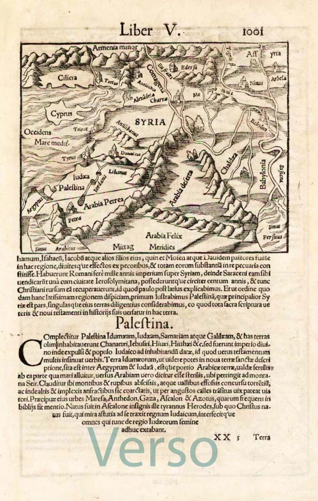
On verso: smaller map of the same region.
Sebastian Münster (1488-1552)
Sebastian Münster, a German geographer, cartographer, Hebraist, and theologian, was born in Ingelheim, near Mainz In 1505, he went to Heidelberg to enter the Franciscan order. In 1507 he went to Louvain, where he studied mathematics, geography, and astronomy. In 1509 Münster became a student of Konrad Pelikan, who taught Hebrew and Greek as well as mathematics and cosmography. In 1518 he completed his studies at the University of Tübingen. He was the favorite of the famous mathematician and astronomer Johann Stöffler.
In 1524 Münster was appointed professor of Hebrew at Heidelberg University. In 1525 he published his first map as part of a broadside: The Instrument of the Suns combined a map, calendar, astrological almanac, sundial, and nocturnal on one attractive sheet, suitable for wall mounting.
In 1540 he published a Latin edition of Ptolemy's Geographia with illustrations. He based this edition on the Latin translation by Willibald Pirkheimer and produced new maps to supplement the Ptolemaic maps. The twenty-seven maps of the Ptolemaic canon are supplemented by twenty-one new maps. Further editions appeared in 1541 and 1542.
In 1544 he published the Cosmographia, a bulky book with 659 pages and some 520 woodcuts. Maps in this edition included three maps from the Ptolemaic canon and fourteen modern maps (from previous editions of the Geographia), as well as nine new maps. Later editions (1545, 1546, 1548) enlarged the Cosmographia. The 1550 edition contains cities, portraits, and costumes. These editions in both Latin and German constitute the full fruition of Münster's dream of a comprehensive geography.
The Cosmographia was one of the most successful works of the 16th century. It passed through 24 editions in 100 years, in different languages, including Latin, French, Italian, English, and even Czech. The last German edition was published in 1628.
He died at Basel of the plague in 1552.
As a cartographer, Münster deserves special recognition for formulating a plan for a comprehensive and uniform map of a country. As a geographer, his greatest achievement was the Cosmographia. (Karrow).
Related items
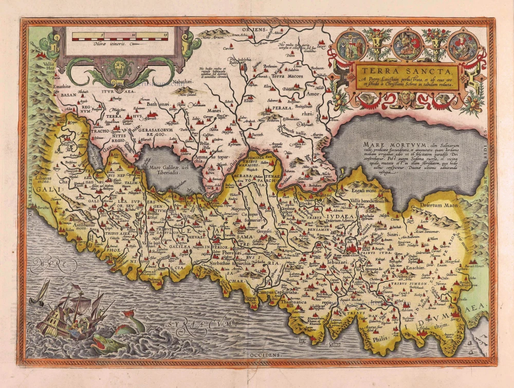
Terra Sancta, A Petro Laicstain perlustrata, et ab eius ore et schedisà Chistino Schrot in tabulam redacta. 1612
Holy Land by Abraham Ortelius.
[Item number: 23099]
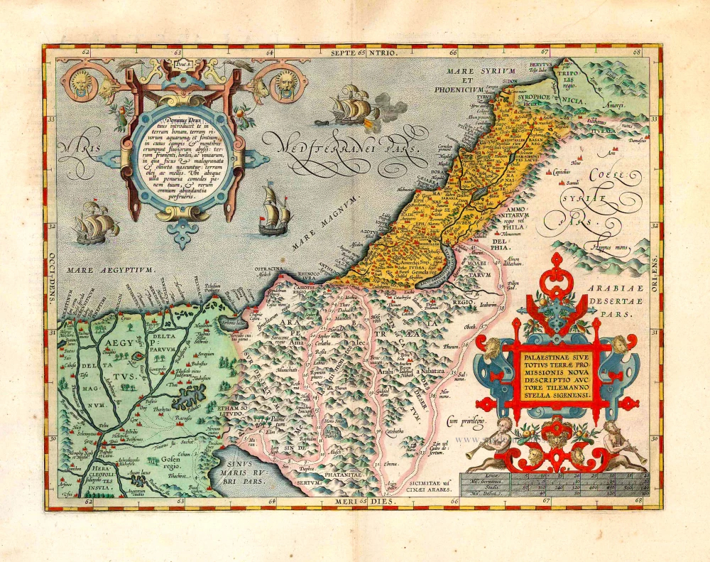
Palaestinae sive totius Terrae Promissionis nova descriptio Auctore Tilemanno Stella Sigenensi. 1624
Holy Land, by Abraham Ortelius.
[Item number: 1583]
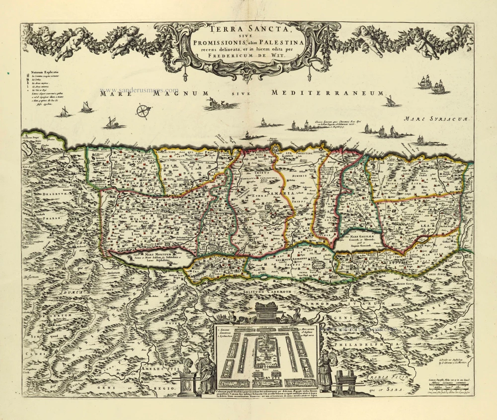
Terra Sancta, sive Promissionis, olim Palestina. after 1721
Holy Land by Frederik de Wit, published by Covens & Mortier.
[Item number: 28329]
Parergon map
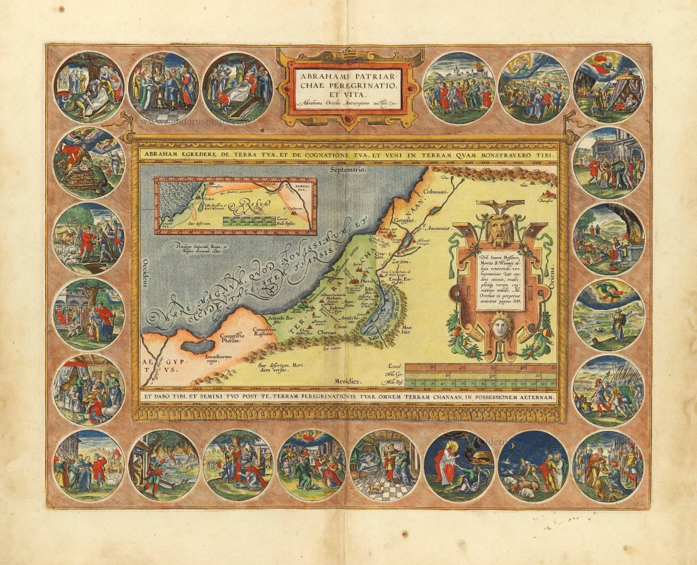
Abrahami Patriarchae Peregrinatio, et Vita. 1612
The Holy Land by Abraham Ortelius.
[Item number: 28921]
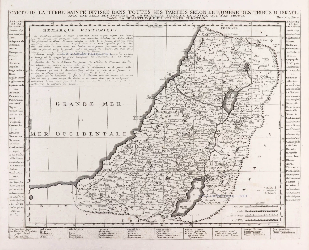
Carte de la Terre Sainte Divisée dans Toutes ses Parties selon le nombre des Tribus d'Israel. 1719
Holy Land, by Zacharias Châtelain.
[Item number: 29383]
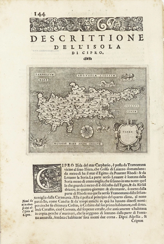
Cipro. - [Above map :] Descrittione dell'Isola di Cipro. 1590
Cyprus by Thomasso Porcacchi.
[Item number: 29827]
Luxury colour
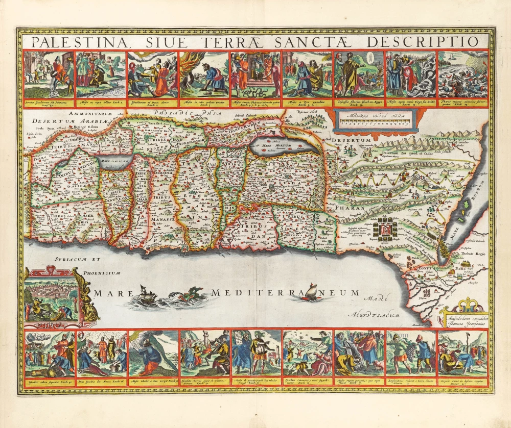
Palestina, sive Terrae Sanctae Descriptio. 1666
The Holy Land by Joannes Janssonius.
[Item number: 29972]
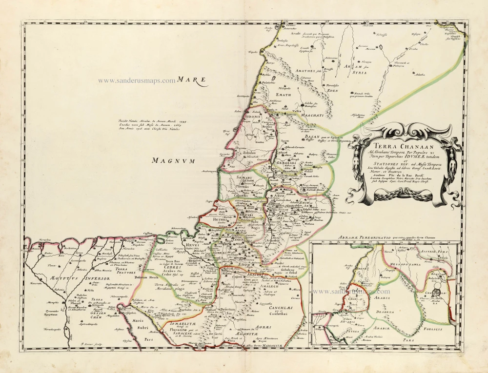
Terra Chanaan Ad Abrahami tempora, per populos XI Item per toparchias Idumeae Totidem et Stationes XLV. ad Mosis Tempora Seu Tabula digesta ad libros Genes. Exodi. Levit. Numer. et Deuteron. 1651
Historic map of the Land of Canaan from the time of Abraham up to the time of Moses, by Philippe de la Rue, published by Pierre Mariette.
[Item number: 30053]
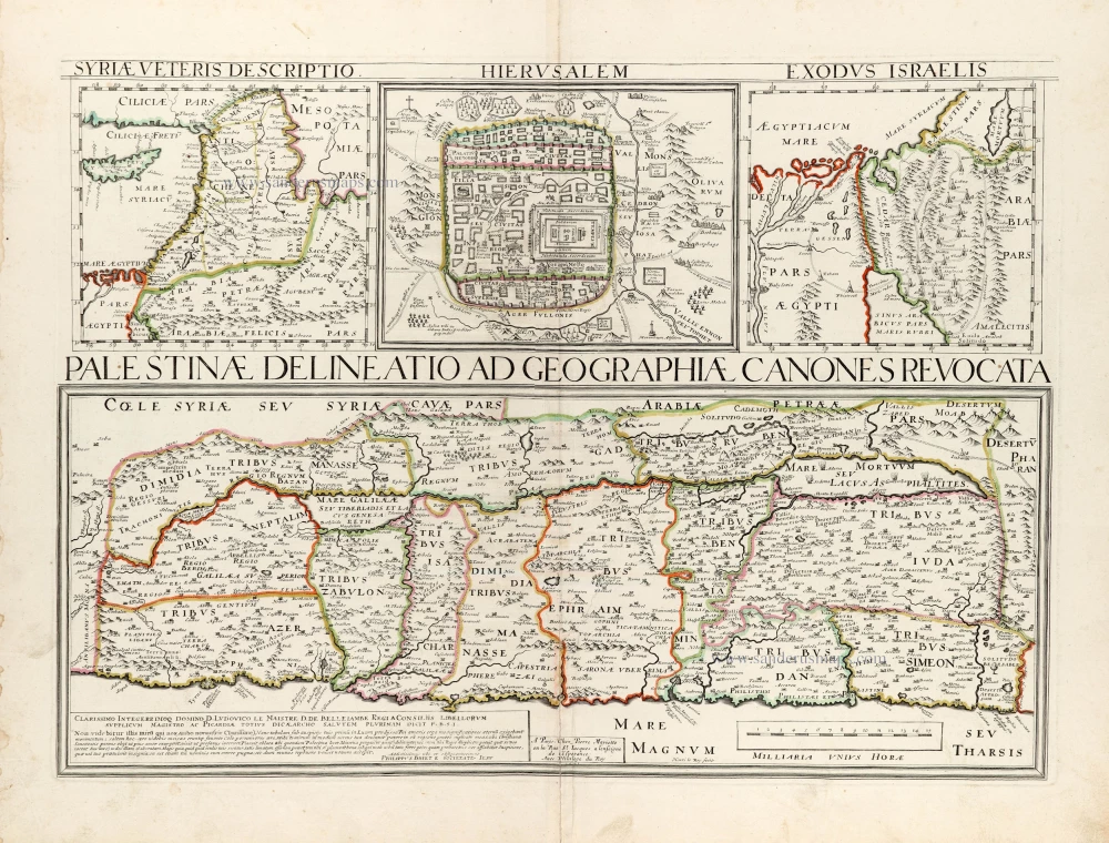
Palestinae Delineatio Ad Geographiae Canones Revocata. 1641
Holy Land - Jerusalem by Philippe Briet, published by Pierre Mariette.
[Item number: 30056]
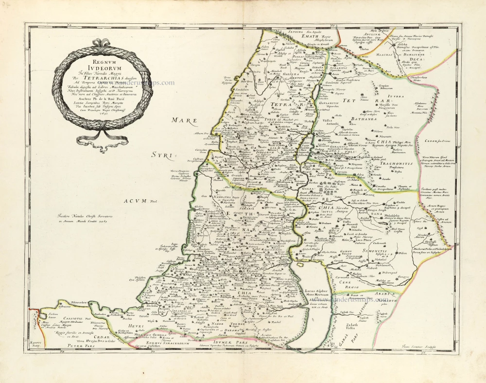
Regnum Iudeorum In Filios Herodis Magni. 1651
Historic map of the Kingdom of Judea in the time of Christ, by Philippe de la Rue, published by Pierre Mariette.
[Item number: 30060]
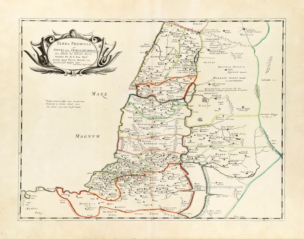
Terra Promissa in Sortes seu Tribus XII Distincta. 1651
The Promised Land divided among the 12 Tribes, by Philippe de la Rue, published by Pierre Mariette.
[Item number: 30061]
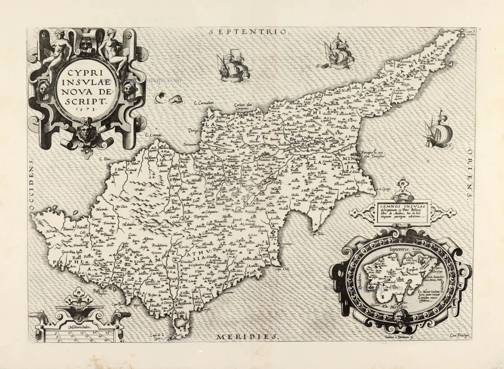
Cypri Insulae Nova Descript. 1573 1575
Cyprus by Abraham Ortelius.
[Item number: 30103]
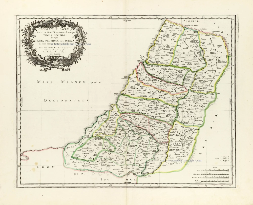
Geographiae Sacrae ex Veteri et Novo Testamento desumptae Tabula Secunda: in qua Terra Promissa, sive Iudaea in suas Tribus Partesq, distincta. 1665
Holy Land by Nicolas Sanson.
[Item number: 30105]
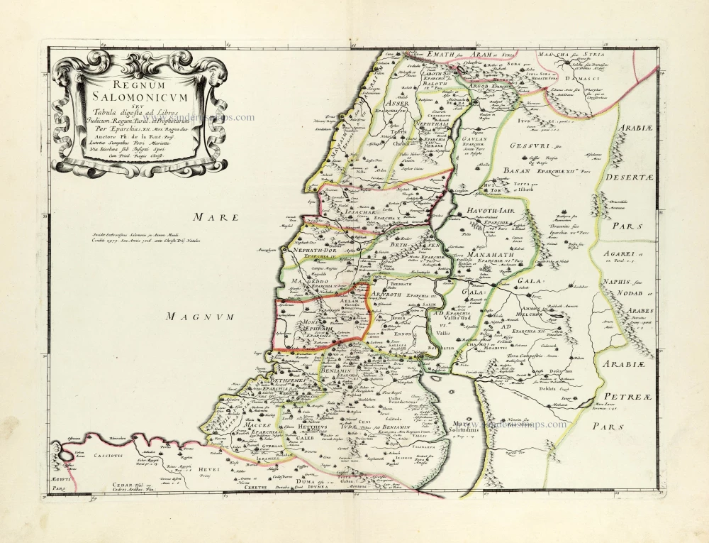
Regnum Salomonicum Seu Tabula digesta ad Libros Judicum, Regum, Paral. et Prophetarum. 1651
Historic map of the Kingdom of Solomon divided into 12 provinces, by Philippe de la Rue, published by Pierre Mariette.
[Item number: 30106]
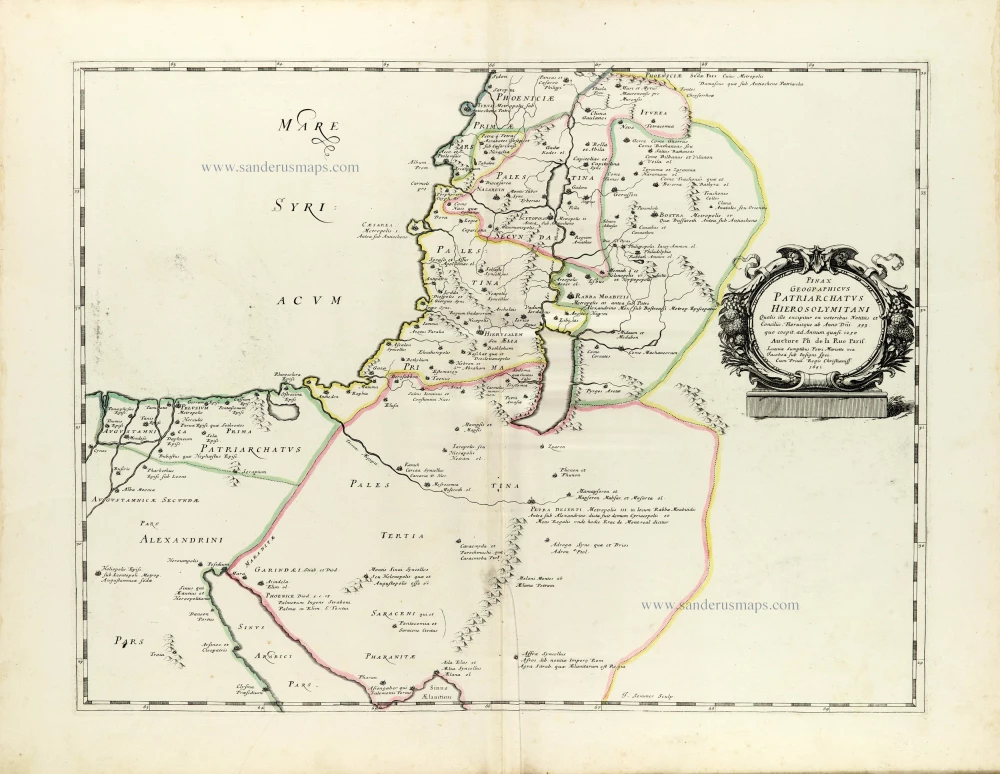
Pinax Geogpaphicus [sic] Patriarchatus Hierosolymitani [...] 1651
The Patriarchate of Jerusalem, by Philippe de la Rue, published by Pierre Mariette.
[Item number: 30120]
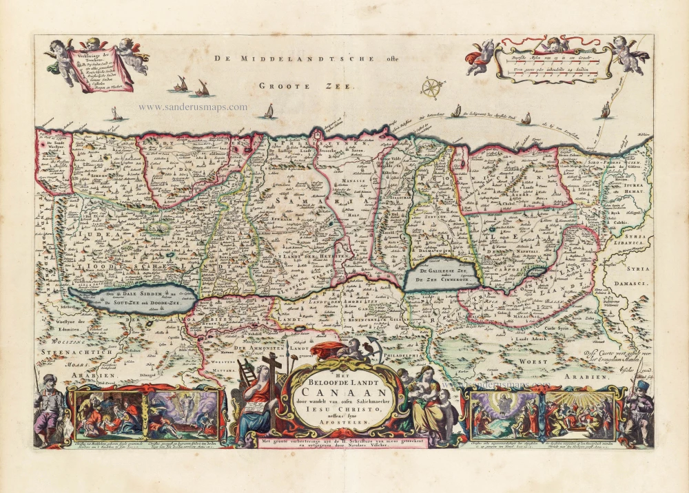
Superb old colouring, heightened with gold.
Het Beloofde Landt Canaan door wandelt van onsen Salichmaeker Iesu Christo, neffens syne Apostelen. 1663
Holy Land by Nicolaas Visscher.
[Item number: 30535]
new
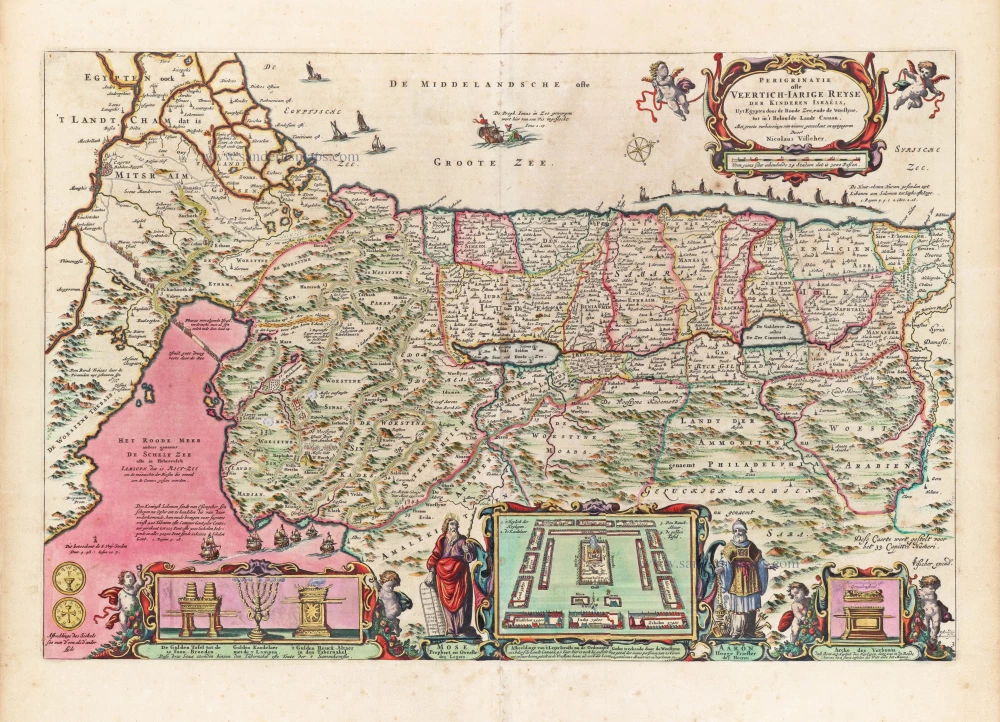
Superb old colouring, heightened with gold.
Perigrinatie ofte Veertigh-Iarige Reyse der Kinderen Israëls. 1663
Holy Land, by Nicolaes Visscher I.
[Item number: 30538]
new
Holy Land map from the very rare "forbidden" van Liesveldt Bible
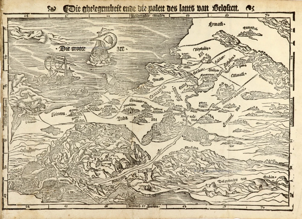
Die ghelegentheit ende die palen des lants van Beloften. 1532-1560
Holy Land by van Jacob van Liesveldt.
[Item number: 30549]
new