
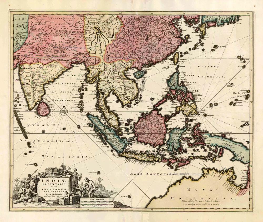
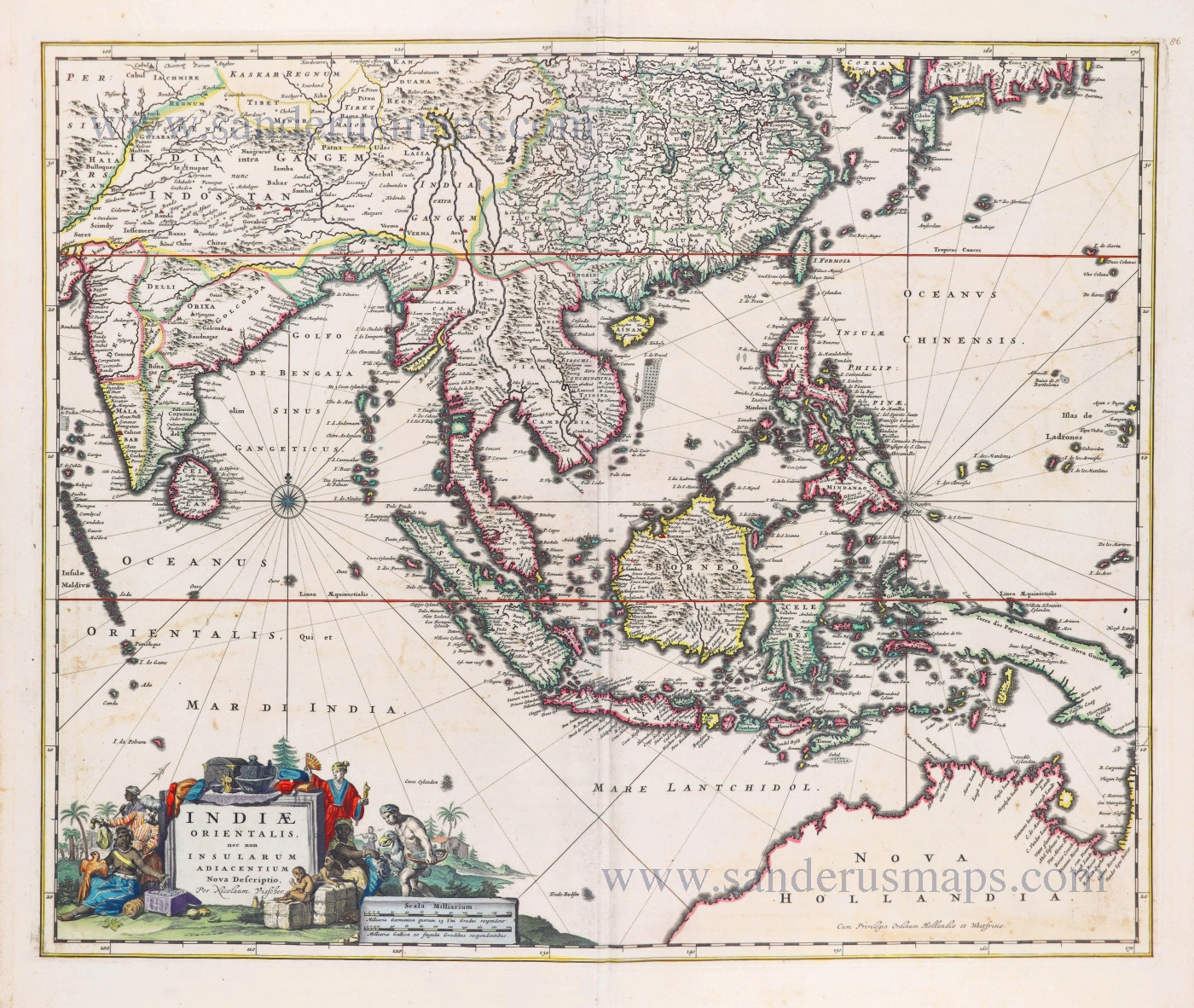
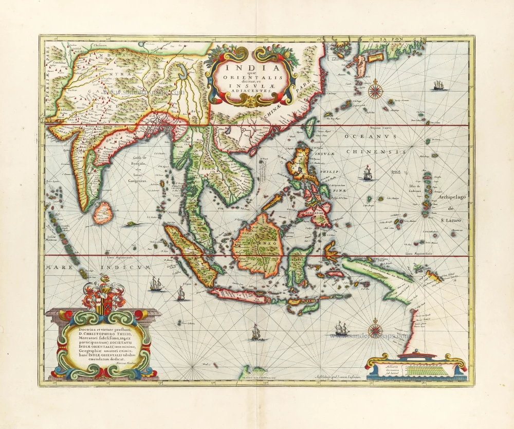
This map was the most accurate and one of the most elegant seventeenth-century maps of the East Indies
Southeast Asia by Janssonius, Johannes 1644-58
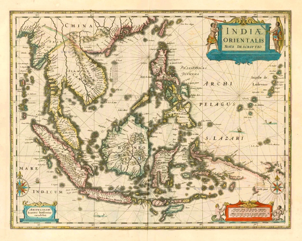


"The Hondius-Jansson publication included a new map of Southeast Asia and the East Indian archipelago by Jan Jansson entitled 'India Orientalis Nova Descriptio'. The map was the most accurate and one of the most elegant seventeenth-century maps of the East Indian Islands. It included one of the first inferences to the discoveries made on the northwestern coast of Australia in 1606 by William Jansz on the ship Duyfken. On the south coast of New Guinea, the name 'Dufkens Eylant' appears, thereby immortalizing the name of the ship by which Australia had been discovered in 1606; however, the map only reaches ten degrees south latitude and does not show any part of the Australian mainland. The False Cape (Valschen Caep) and the Torres Strait or embayment would be hidden behind the decorative scale bar if they were mapped at all. Schilder believes that Jansson's map was of the greatest importance until the copy of the original 'Duyfken' map and the 1622 manuscript map of the Pacific by Hessel Gerritz, Blaeu's predecessor in the post of Official Hydrographer to the VOC, were found. William Blaeu must have been privy to these discoveries from his official position in the Dutch East India Company. Still, he did not publish his classic regional map, 'India Quae Orientalis Dicitur et Insulae Adiacentes' showing part of the Australian mainland, until 1635." (Parry, p.105)
The Janssonius Family
Joannes Janssonius (Arnhem, 1588-1664), son of the Arnhem publisher Jan Janssen, married Elisabeth Hondius, daughter of Jodocus Hondius, in Amsterdam in 1612. After his marriage, he settled down in this town as a bookseller and publisher of cartographic material. In 1618, he established himself in Amsterdam next door to Blaeu’s bookshop. He entered into serious competition with Willem Jansz. Blaeu when copying Blaeu’s Licht der Zeevaert after the expiration of the privilege in 1620. His activities concerned the publication of atlases, books, single maps, and an extensive book trade with branches in Frankfurt, Danzig, Stockholm, Copenhagen, Berlin, Koningsbergen, Geneva, and Lyon. In 1631, he began publishing atlases together with Henricus Hondius.
In the early 1640s, Henricus Hondius left the atlas publishing business to Janssonius. Competition with Joan Blaeu, Willem’s son and successor, in atlas production, prompted Janssonius to enlarge his Atlas Novus finally into a work of six volumes, into which a sea atlas and an atlas of the Old World were inserted. Other atlases published by Janssonius are Mercator’s Atlas Minor, Hornius’s historical atlas (1652), the townbooks in eight volumes (1657), Cellarius’s Atlas Coelestis and several sea atlases and pilot guides.
After the death of Joannes Janssonius, the shop and publishing firm were continued by the heirs under the direction of Johannes van Waesbergen (c. 1616-1681), son-in-law of Joannes Janssonius. Van Waesbergen added Janssonius's name to his own.
In 1676, Joannes Janssonius’s heirs sold by auction “all the remaining Atlases in Latin, French, High and Low German, as well as the Stedeboecken in Latin, in 8 volumes, bound and unbound, maps, plates belonging to the Atlas and Stedeboecken.” The copperplates from Janssonius’s atlases were afterwards sold to Schenk and Valck.
Indiae Orientalis Nova Descriptio.
Item Number: 10013 Authenticity Guarantee
Category: Antique maps > Australia
Old antique map of Southeast Asia by J. Janssonius.
Title: Indiae Orientalis Nova Descriptio.
Date of the first edition: 1630.
Date of this map: 1644-58.
Copper engraving, printed on paper.
Size (not including margins): 390 x 503mm (15.35 x 19.8 inches).
Verso: German text.
Condition: Original coloured, paper age-toned.
Condition Rating: A.
From: Novus atlas, das ist Welt-beschreibung mit schönen newen aussführlichen Taffeln inhaltende die Königreiche und Länder des gantzen Erdtreichs. Amsterdam, J. Janssonius, 1644-45. (Van der Krogt1, 424)
"The Hondius-Jansson publication included a new map of Southeast Asia and the East Indian archipelago by Jan Jansson entitled 'India Orientalis Nova Descriptio'. The map was the most accurate and one of the most elegant seventeenth-century maps of the East Indian Islands. It included one of the first inferences to the discoveries made on the northwestern coast of Australia in 1606 by William Jansz on the ship Duyfken. On the south coast of New Guinea, the name 'Dufkens Eylant' appears, thereby immortalizing the name of the ship by which Australia had been discovered in 1606; however, the map only reaches ten degrees south latitude and does not show any part of the Australian mainland. The False Cape (Valschen Caep) and the Torres Strait or embayment would be hidden behind the decorative scale bar if they were mapped at all. Schilder believes that Jansson's map was of the greatest importance until the copy of the original 'Duyfken' map and the 1622 manuscript map of the Pacific by Hessel Gerritz, Blaeu's predecessor in the post of Official Hydrographer to the VOC, were found. William Blaeu must have been privy to these discoveries from his official position in the Dutch East India Company. Still, he did not publish his classic regional map, 'India Quae Orientalis Dicitur et Insulae Adiacentes' showing part of the Australian mainland, until 1635." (Parry, p.105)
The Janssonius Family
Joannes Janssonius (Arnhem, 1588-1664), son of the Arnhem publisher Jan Janssen, married Elisabeth Hondius, daughter of Jodocus Hondius, in Amsterdam in 1612. After his marriage, he settled down in this town as a bookseller and publisher of cartographic material. In 1618, he established himself in Amsterdam next door to Blaeu’s bookshop. He entered into serious competition with Willem Jansz. Blaeu when copying Blaeu’s Licht der Zeevaert after the expiration of the privilege in 1620. His activities concerned the publication of atlases, books, single maps, and an extensive book trade with branches in Frankfurt, Danzig, Stockholm, Copenhagen, Berlin, Koningsbergen, Geneva, and Lyon. In 1631, he began publishing atlases together with Henricus Hondius.
In the early 1640s, Henricus Hondius left the atlas publishing business to Janssonius. Competition with Joan Blaeu, Willem’s son and successor, in atlas production, prompted Janssonius to enlarge his Atlas Novus finally into a work of six volumes, into which a sea atlas and an atlas of the Old World were inserted. Other atlases published by Janssonius are Mercator’s Atlas Minor, Hornius’s historical atlas (1652), the townbooks in eight volumes (1657), Cellarius’s Atlas Coelestis and several sea atlases and pilot guides.
After the death of Joannes Janssonius, the shop and publishing firm were continued by the heirs under the direction of Johannes van Waesbergen (c. 1616-1681), son-in-law of Joannes Janssonius. Van Waesbergen added Janssonius's name to his own.
In 1676, Joannes Janssonius’s heirs sold by auction “all the remaining Atlases in Latin, French, High and Low German, as well as the Stedeboecken in Latin, in 8 volumes, bound and unbound, maps, plates belonging to the Atlas and Stedeboecken.” The copperplates from Janssonius’s atlases were afterwards sold to Schenk and Valck.
Related items
1738-44
LIEGE - ST.-MARTIN by SAUMERY
[Item number: 283]
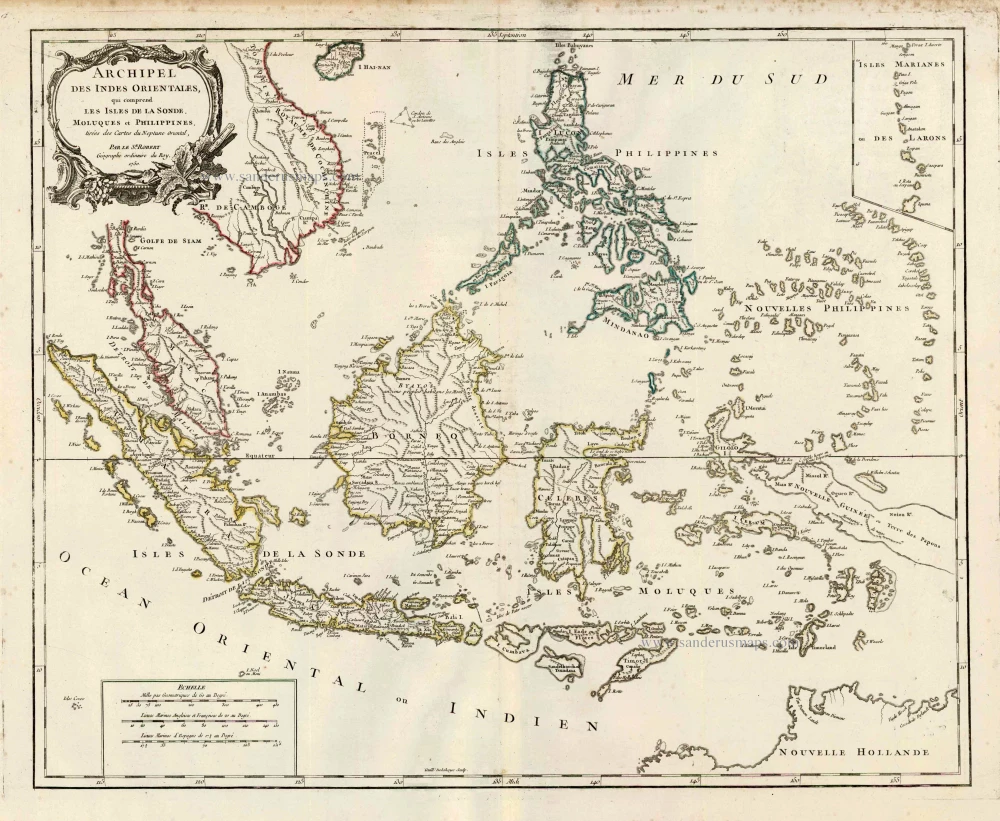
Archipel des Indes Orientales qui Comprend les Isles de la Sonde, Moluques et Philippines. c. 1757
Southeast Asia, par Robert de Vaugondy.
[Item number: 4751]
From the Cloppenburg edition
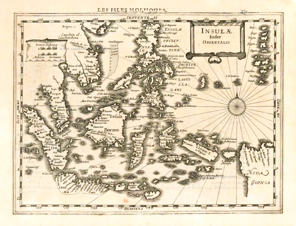
Insulae Indiae Orientalis. 1630
Southeast Asia, by G. Mercator - J. Hondius.
[Item number: 25234]
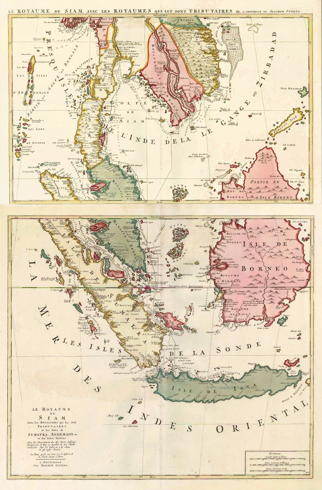
Le Royaume de Siam avec les Royaumes qui luy sont Tributaires, et les Isles de Sumatra, Andemaon, etc. et les Isles Voisine. c. 1700
Southeast Asia, by J. Ottens.
[Item number: 25716]
Indiae Orientalis nec non Insularum Adiacentium Nova Descriptio. c. 1740
Southeast Asia by Nicolaes Visscher, published by Petrus Schenk.
[Item number: 25718]
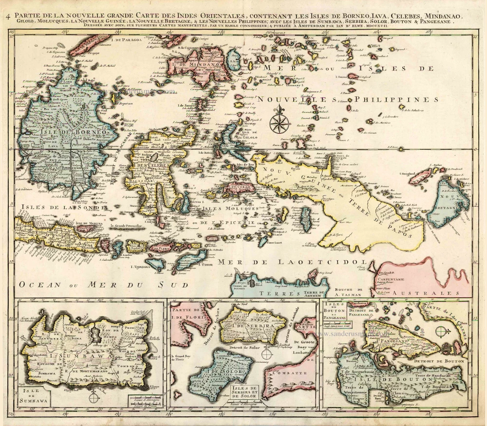
Partie de la Nouvelle Grande Carte des Indes Orientales, Contenant les Isles de Borneo, Iava, Celebes, Mindanao ... 1792
Indonesia - New Guinea - Australia by J.B. Elwe.
[Item number: 2293]
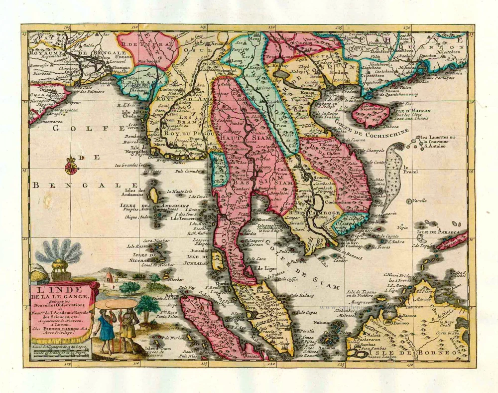
L'Inde de la le Gange, 1713
Southeast Asia, by Pieter van der Aa.
[Item number: 26097]
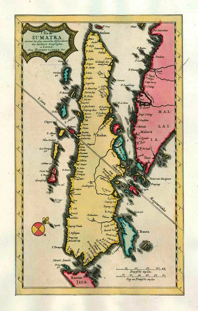
L'Île de Sumatra. 1713
Sumatra by P. Van der Aa
[Item number: 26126]
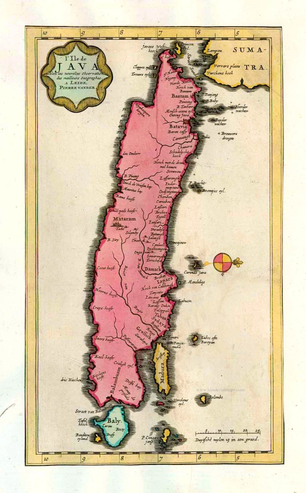
L'Ile de Java. 1713
Java, by Pieter van der Aa.
[Item number: 26127]
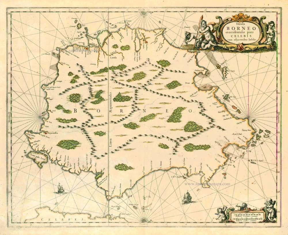
Insula Borneo et occidentalis pars Celebis cum adjacentibus Insulis. 1657-62
Borneo, by J. Janssonius.
[Item number: 26456]
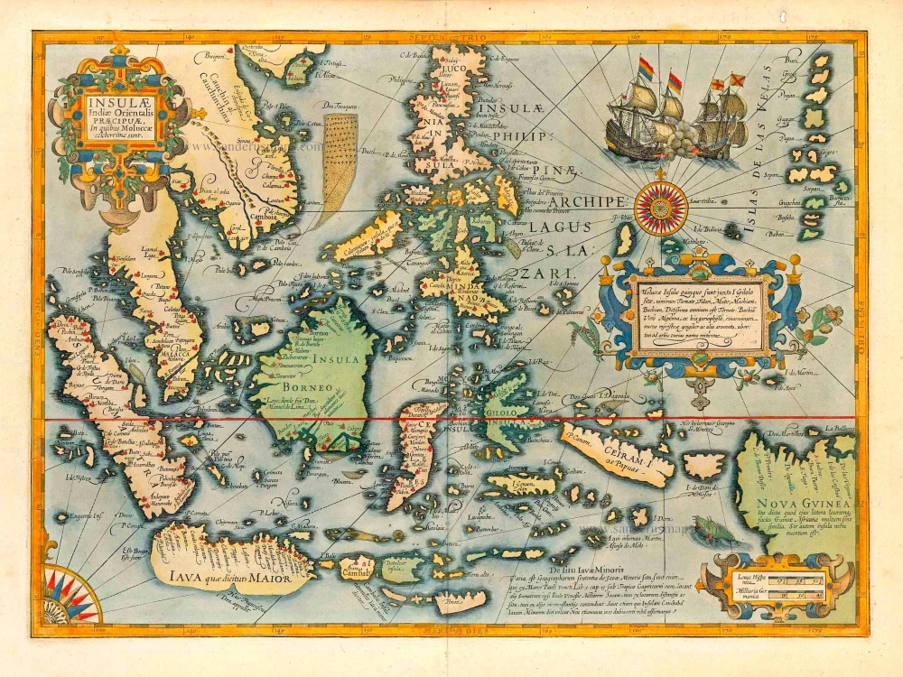
The most elegant and decorative map of East Indies
Insulae Indiae Orientalis Praecipuae, in quibus Moluccae celeberrimae sunt. 1623
East Indies by Jodocus Hondius.
[Item number: 27820]
A very important map of the region
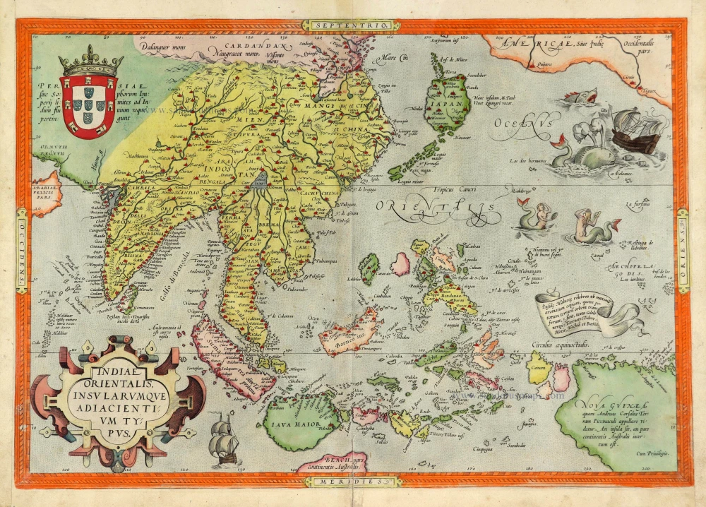
Indiae Orientalis Insularumque Adiacientium Typus. 1572
Southeast Asia, by Abraham Ortelius.
[Item number: 28046]
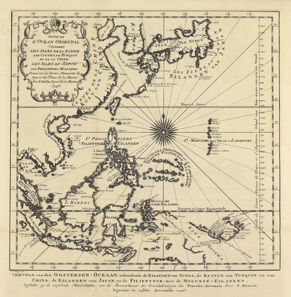
Suite de L'Ocean Oriental Contenant Les Isles de la Sonde Les Costes de Tunquin et de la Chine Les Isles du Japon les Philippines Moluques. 1747
Southeast Asia by Jacques Nicolas Bellin.
[Item number: 28189]
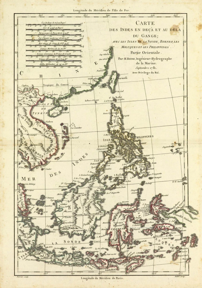
Carte des Indes en deçà et au dela du Gange; avec les Isles de la Sonde, Borneo, les Moluques et les Philippines. Partie Orientale. 1690
Southeast Asia by Rigobert Bonne.
[Item number: 28304]
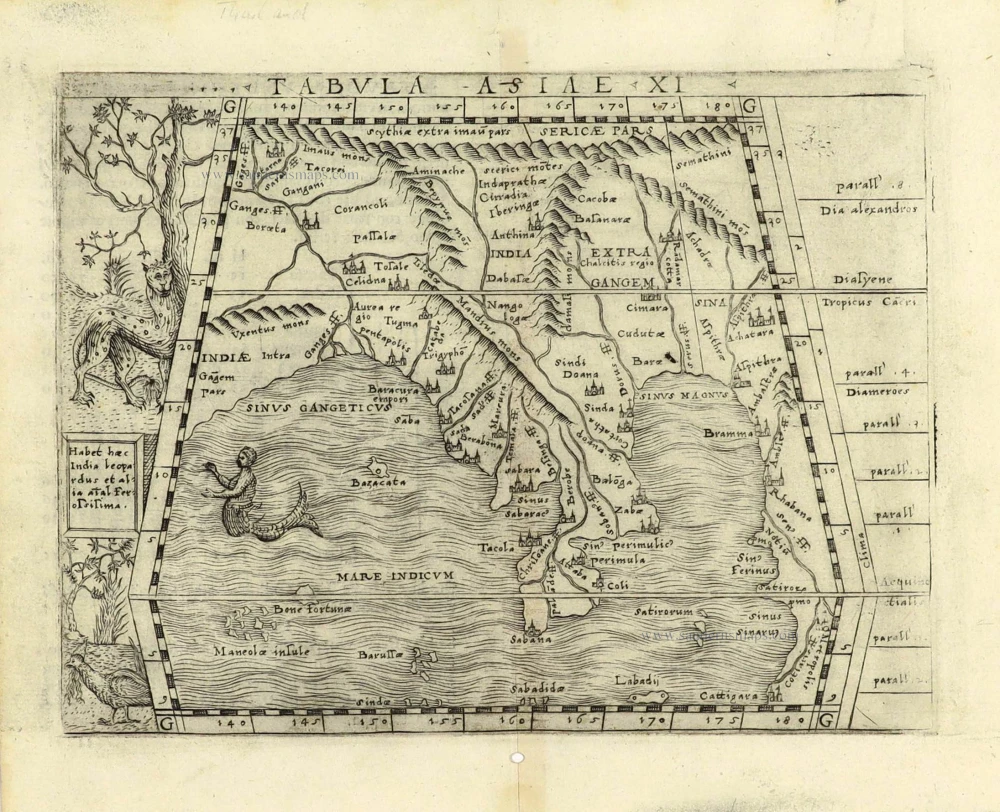
Scarce
Tabula Asiae XI. 1548
Southeast Asia by Giacomo Gastaldi / Ptolemy.
[Item number: 28362]
Indiae Orientalis nec non Insularum Adiacentium Nova Descriptio. 1678
Southeast Asia by Nicolaes Visscher I.
[Item number: 28555]
In rare original colour.
Undecima Asiae Tabula. 1513
South Asia by Waldseemüller Martin
[Item number: 29249]
Le Royaume de Siam avec les Royaumes qui luy sont Tributaires et les Isles de Sumatra Andemaon etc. et les isles voisines. 1719
Antique map of Southeast Asia by Châtelain
[Item number: 29372]

Carte des Indes, de la Chine & des Iles de Sumatra, Java &c. 1719
Southeast Asia, by Z. Châtelain.
[Item number: 29376]
Isole Molucche.- [Above map :] Descrittione del l'Isole Molucche. 1590
Southeast Asia by Tommaso Porcacchi.
[Item number: 29788]

Insulae Indiae Orientalis Praecipuae, in quibus Moluccae celeberrimae sunt. 1630
East Indian Archipelago by Jodocus Hondius.
[Item number: 29863]
With luxury colouring
India quae Orientalis dicitur et Insulae Adiacentes. 1666
Southeast Asia by Henricus Hondius, published by Johannes Janssonius.
[Item number: 29973]
Rare
[No title] - 'Mar di India'. 1645
East Indies by van Spilbergen Joris.
[Item number: 30057]
Two early modern maps of Southeast Asia by L. Fries and M. Waldseemüller
Tabu. Moder. Indiae [together with] India Orien talis. 1535
South Asia by Lorens Fries
[Item number: 30141]
Very rare first 1570 A edition.
Indiae Orientalis Insularumque Adiacientium Typus. 1570
Southeast Asia, by Abraham Ortelius.
[Item number: 30592]
new