
Pacific Ocean, by Jacques Nicolas Bellin. c. 1756

Includes New Holland and Carpentaria without names, Van Diemen's Land with seven names and New Zealand with four names.
Jacques-Nicolas Bellin (1703-1772)
Jacques-Nicolas Bellin, a French geographer, was among the most important mapmakers of the eighteenth century. In 1721, at the age of 18, he was appointed hydrographer of the Ministry of the Navy following the French hydrographic office's creation and the Dépot of charts and plans of the Navy. Appointed hydrographic engineer in August 1741. Member of the Academy of the Navy and the Royal Society of London.
Over the course of a 50-year career, he drew the maps of several major works of his time such as Histoire et description générale de la Nouvelle-France de Charlevoix (1744); Histoire générale des voyages de l'Abbé Prévost (published between 1746 and 1759) ); Neptune François (1753), Hydrographie Françoise (1756-1765), and Petit Atlas Français (1763) - reissued as Petit Atlas Maritime (1765). He is the most copied cartographer of the 18th century.
His maps of Canada and the French territories of North America are of considerable value. This is all the more remarkable since, an archetype of the cabinet cartographer, Bellin never came to America. For his cartography of the St. Lawrence River, he entrusted handwritten maps to navigators to correct and enrich. With each return of these maps, he was updating his knowledge. Two basic needs drive its cartography of North America: to secure navigation on the St. Lawrence River and to claim for France the lands explored by the French in the Great Lakes region and along the Mississippi River.
Jacques-Nicolas Bellin died on March 21, 1772, in Versailles. In the burial certificate, he is described as "the first engineer of the navy and the deposit of plans, royal censor of the academy of navy and the royal society of London".
Carte Reduite des Mers comprises entre l'Asia et l'Amerique Apelées par les Navigateurs Mer du Sud ou Mer Pacifique.
Item Number: 28149 Authenticity Guarantee
Category: Antique maps > Australia
Old, antique sea chart of Pacific Ocean, by Bellin J.N..
Title: Carte Reduite des Mers comprises entre l'Asia et l'Amerique Apelées par les Navigateurs Mer du Sud ou Mer Pacifique.
Pour servir aux Vaisseaux du Roi.
Dressée au Depost des Cartes, Plans et Journeaux de la Marine.
Par ordre de M. Le Comte de Maurepas.
1742.
Dheulland Sculp
Second state with the addition of a nice cartouche.
Engraver: Guillaume Dheulland.
Date of the first edition: 1742.
Date of this map: 1756.
Date on map: 1742 & 1756.
Copper engraving, printed on paper.
Size (not including margins): 570 x 855mm (22.44 x 33.66 inches).
Verso: Blank.
Condition: excellent.
Condition Rating: A+
From: L'Hydrographie Françoise ou Recueil des Cartes Dressées au Deposit des Plans de la Marine pour le Service des Vaisseaux du Roy. Paris, 1756.
Includes New Holland and Carpentaria without names, Van Diemen's Land with seven names and New Zealand with four names.
Jacques-Nicolas Bellin (1703-1772)
Jacques-Nicolas Bellin, a French geographer, was among the most important mapmakers of the eighteenth century. In 1721, at the age of 18, he was appointed hydrographer of the Ministry of the Navy following the French hydrographic office's creation and the Dépot of charts and plans of the Navy. Appointed hydrographic engineer in August 1741. Member of the Academy of the Navy and the Royal Society of London.
Over the course of a 50-year career, he drew the maps of several major works of his time such as Histoire et description générale de la Nouvelle-France de Charlevoix (1744); Histoire générale des voyages de l'Abbé Prévost (published between 1746 and 1759) ); Neptune François (1753), Hydrographie Françoise (1756-1765), and Petit Atlas Français (1763) - reissued as Petit Atlas Maritime (1765). He is the most copied cartographer of the 18th century.
His maps of Canada and the French territories of North America are of considerable value. This is all the more remarkable since, an archetype of the cabinet cartographer, Bellin never came to America. For his cartography of the St. Lawrence River, he entrusted handwritten maps to navigators to correct and enrich. With each return of these maps, he was updating his knowledge. Two basic needs drive its cartography of North America: to secure navigation on the St. Lawrence River and to claim for France the lands explored by the French in the Great Lakes region and along the Mississippi River.
Jacques-Nicolas Bellin died on March 21, 1772, in Versailles. In the burial certificate, he is described as "the first engineer of the navy and the deposit of plans, royal censor of the academy of navy and the royal society of London".
Related items
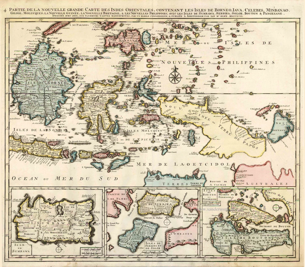
Partie de la Nouvelle Grande Carte des Indes Orientales, Contenant les Isles de Borneo, Iava, Celebes, Mindanao ... 1792
Indonesia - New Guinea - Australia by J.B. Elwe.
[Item number: 2293]
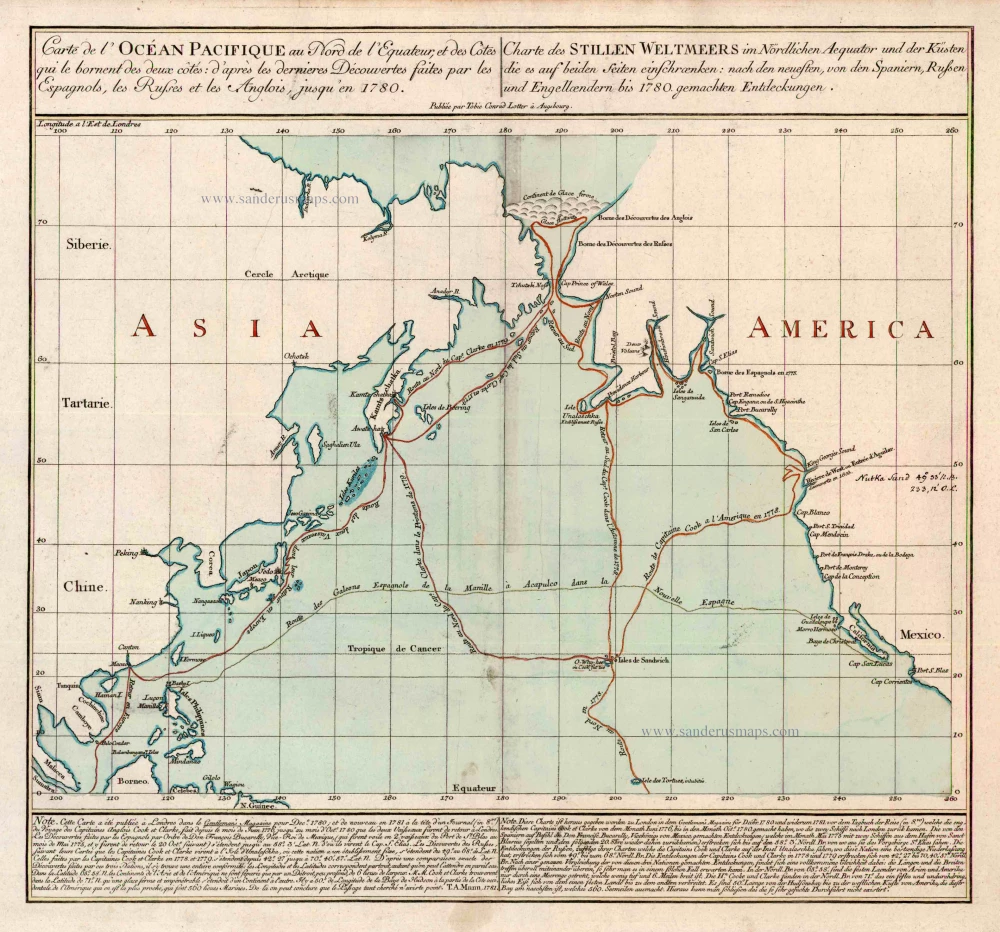
Carte de l'Ocean Pacifique au Nord de l'Equateur, et des Cotes qui le Bornent des Deux Cotes: D'Apres les Dernieres Decouvertes Faites par les Espagnols, les Russes et les Anglois, jusqu'en 1780. 1780
The Northern Pacific Ocean, by T.C. Lotter.
[Item number: 11984]
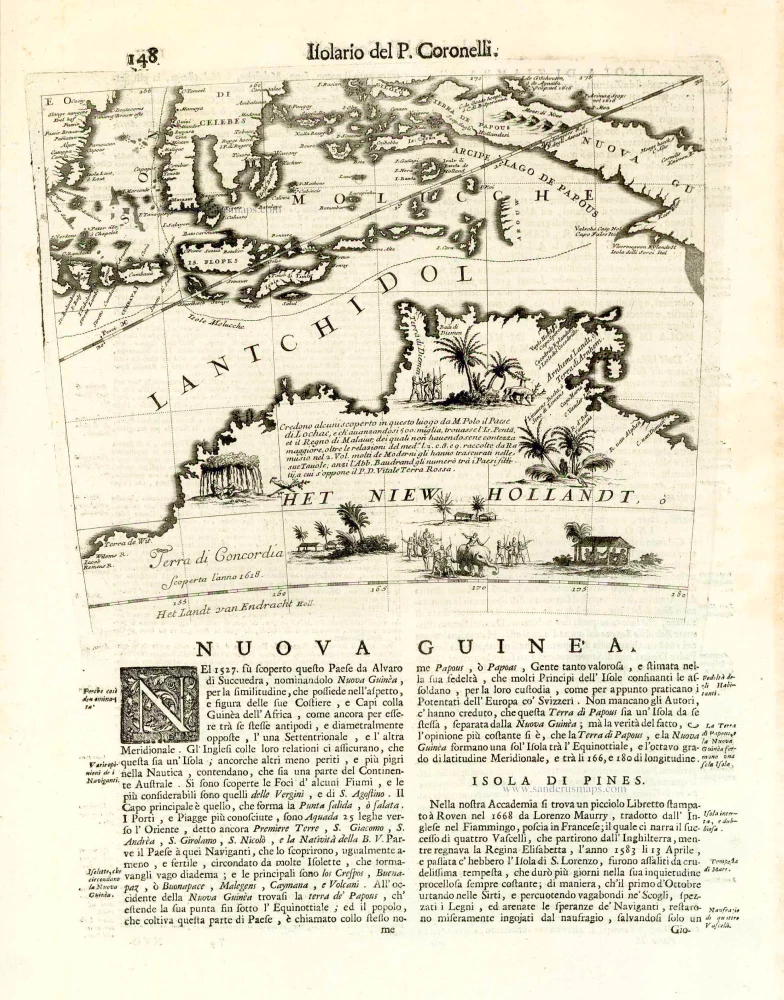
Nuova Guinea. 1696
Globe gore with Northern Australia and the East Indies, by V.M. Coronelli.
[Item number: 26448]
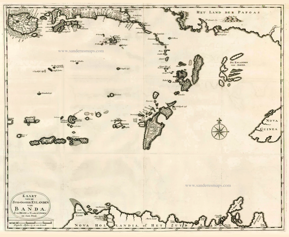
Kaart van de Zuyd-Ooster Eylanden van Banda. 1724-26
The Banda Islands (Southeast) & Northern Australia, by Fr. Valentyn.
[Item number: 26608]
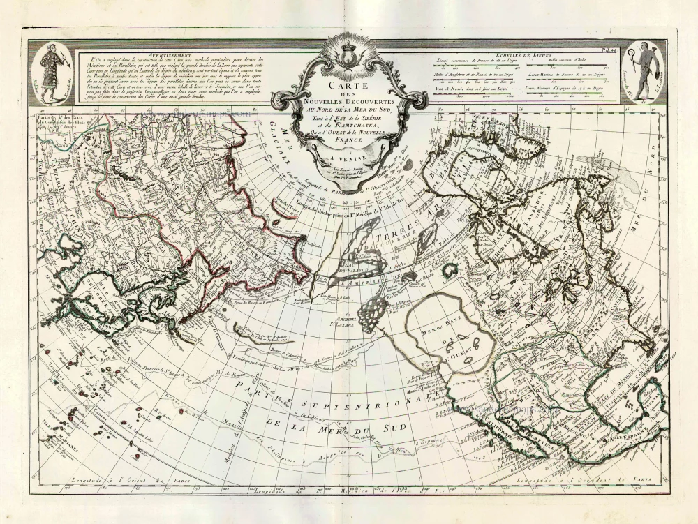
Carte des Nouvelles Decouvertes au Nord de la Mer du Sud, tant à l'Est de la Sibérie et du Kamtchatka, qu'à l'Ouest de la Nouvelle France. 1776-79
Pacific Ocean (North) by Francesco & Paolo Santini
[Item number: 26979]
Very rare second state, including the Tasman discoveries (Australia).
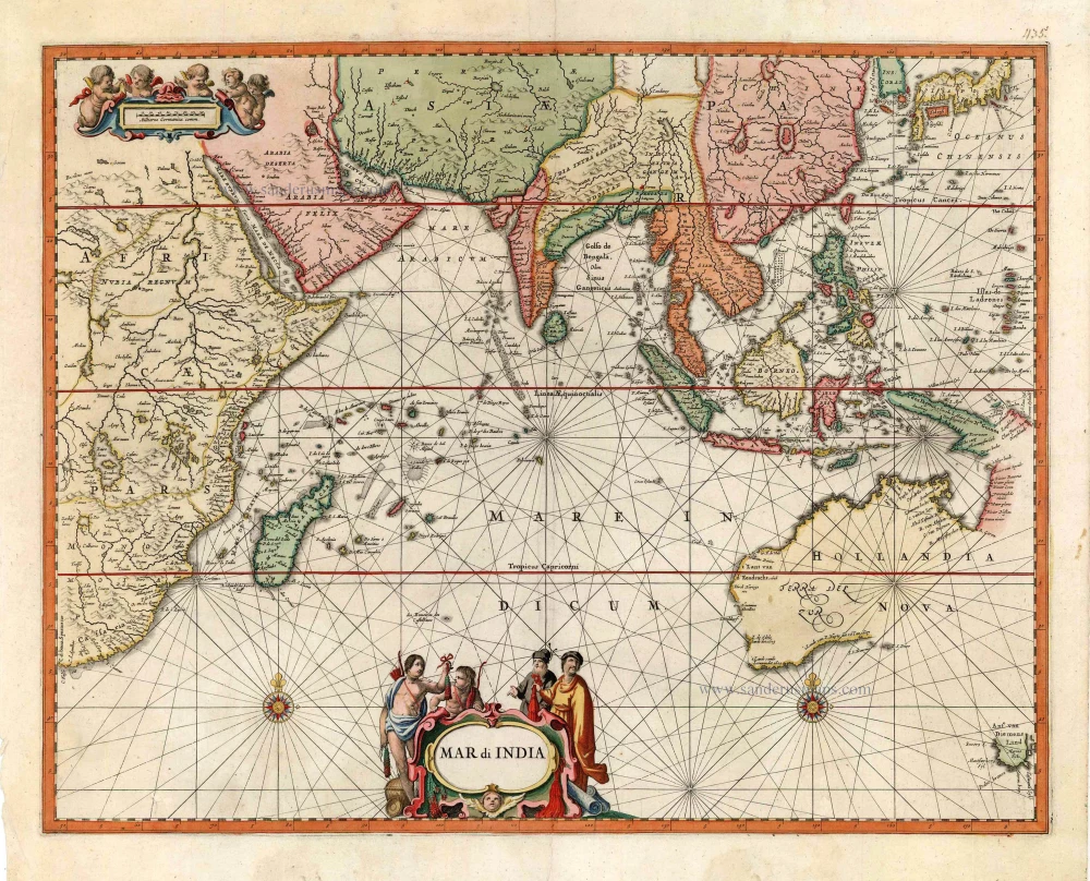
Mar di India. c. 1700
Indian Ocean, by Petrus Schenk
[Item number: 27775]
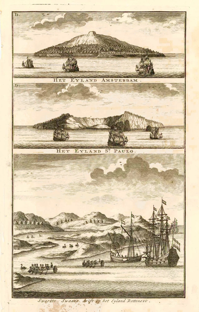
Swarte Swaane drift op het Eyland Rottenest. 1726
View of Australia, by François Valentyn.
[Item number: 27920]
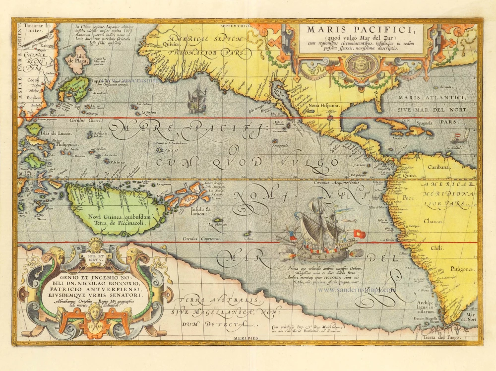
Maris Pacifici, (quod vulgo Mar del Zur) cum regionibus circumiacentibus, insulisque in codem passim sparsis, novissima descriptio. 1601
Pacific Ocean by Abraham Ortelius.
[Item number: 28744]
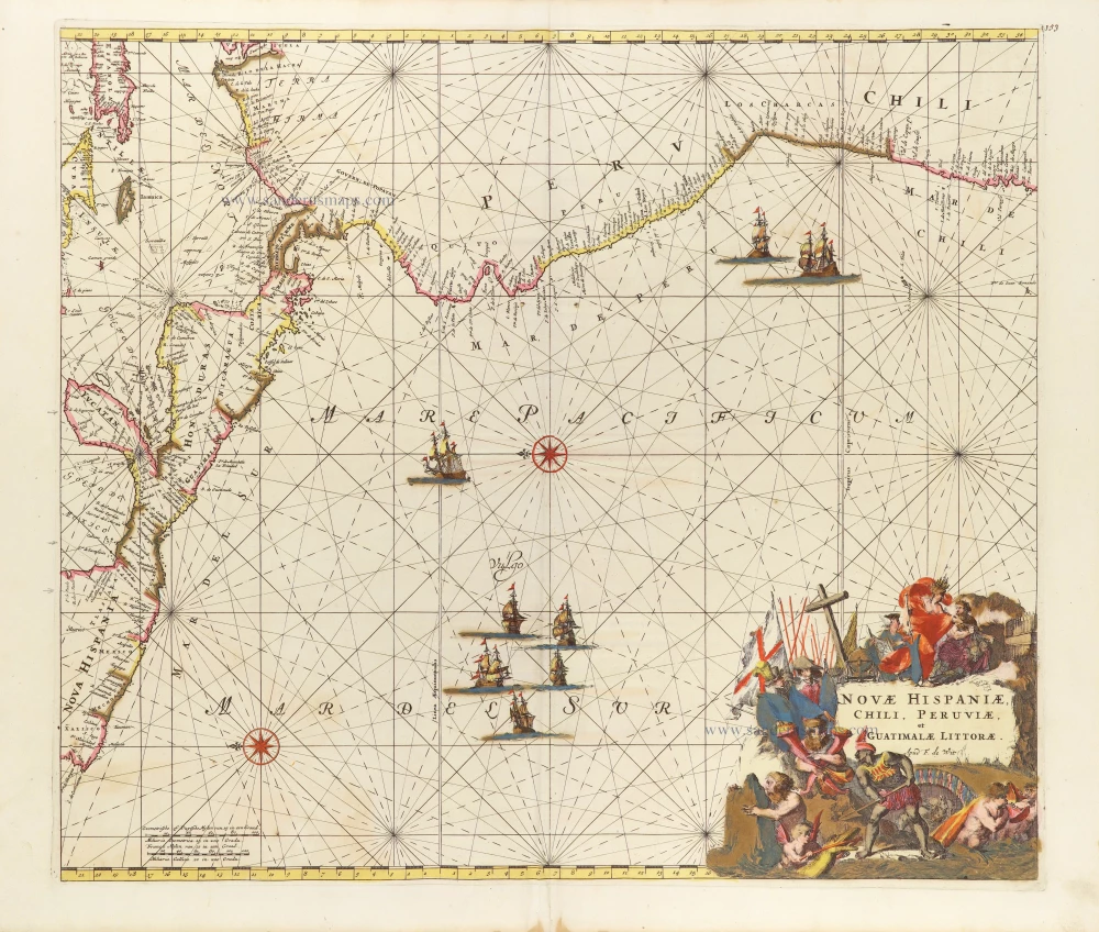
Novae Hispaniae, Chili, Peruviae, et Guatimalae Littorae. ca. 1680
Pacific Coast of America, by Frederick de Wit.
[Item number: 29177]
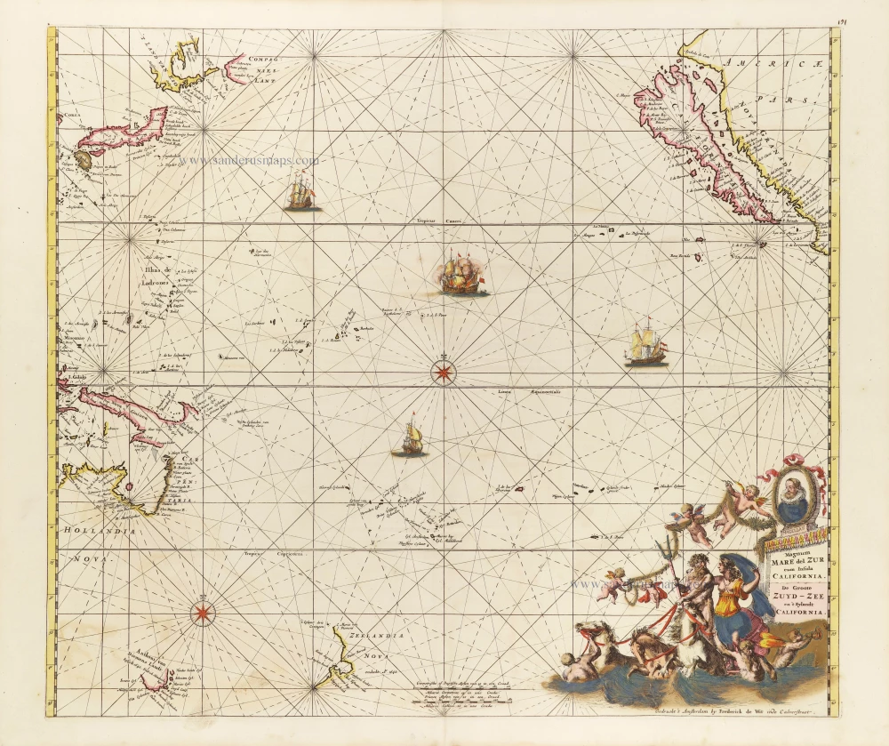
Magnum Mare del Zur cum Insula California = De Groote Zuyd-Zee en 't Eylandt California. c. 1680
Pacific Ocean, by Frederick de Wit.
[Item number: 29241]