
Austria by Ortelius A 1579


Abraham Ortelius (1527-1598)
The maker of the 'first atlas', the Theatrum Orbis Terrarum (1570), was born on 4 April 1527 into an old Antwerp family. He learned Latin and studied Greek and mathematics.
Abraham and his sisters Anne and Elizabeth took up map colouring. He was admitted to the Guild of St. Luke as an "illuminator of maps." Besides colouring maps, Ortelius was a dealer in antiques, coins, maps, and books, with the book and map trade gradually becoming his primary occupation.
Business went well because his means permitted him to start an extensive collection of medals, coins, antiques, and a library of many volumes. In addition, he travelled a lot and visited Italy and France, made contacts everywhere with scholars and editors, and maintained extensive correspondence with them.
In 1564 he published his first map, a large and ambitious world wall map. The inspiration for this map may well have been Gastaldi's large world map. In 1565 he published a map of Egypt and a map of the Holy Land, a large map of Asia followed.
In 1568 the production of individual maps for his atlas Theatrum Orbis Terrarum was already in full swing. He completed the atlas in 1569, and in May of 1570, the Theatrum was available for sale. It was one of the most expensive books ever published.
This first edition contained seventy maps on fifty-three sheets. Franciscus Hogenberg engraved the maps.
Later editions included Additamenta (additions), resulting in Ortelius' historical atlas, the Parergon, mostly bound together with the atlas. The Parergon can be called a truly original work of Ortelius, who drew the maps based on his research.
The importance of the Theatrum Orbis Terrarum for geographical knowledge in the last quarter of the sixteenth century is difficult to overemphasize. Nothing was like it until Mercator's atlas appeared twenty-five years later. Demand for the Theatrum was remarkable. Some 24 editions appeared during Ortelius's lifetime and another ten after his death in 1598. Editions were published in Dutch, German, French, Spanish, English, and Italian. The number of map sheets grew from 53 in 1570 to 167 in 1612 in the last edition.
In 1577, engraver Philip Galle and poet-translator Pieter Heyns published the first pocket-sized edition of the Theatrum, the Epitome. The work was trendy. Over thirty editions of this Epitome were published in different languages.
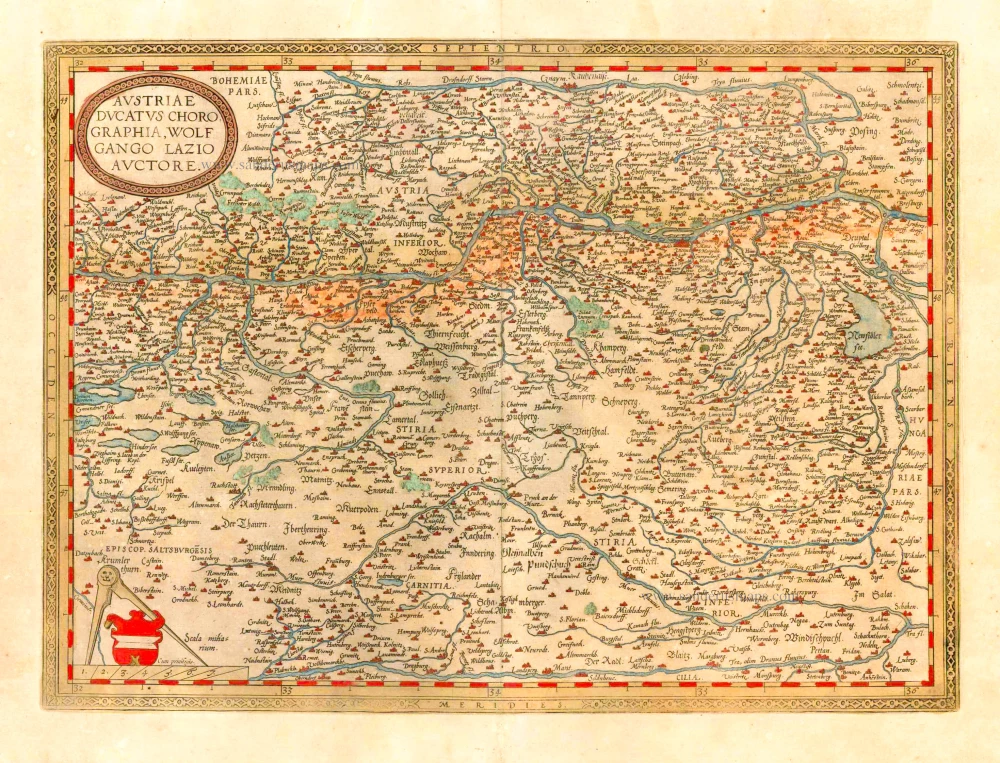
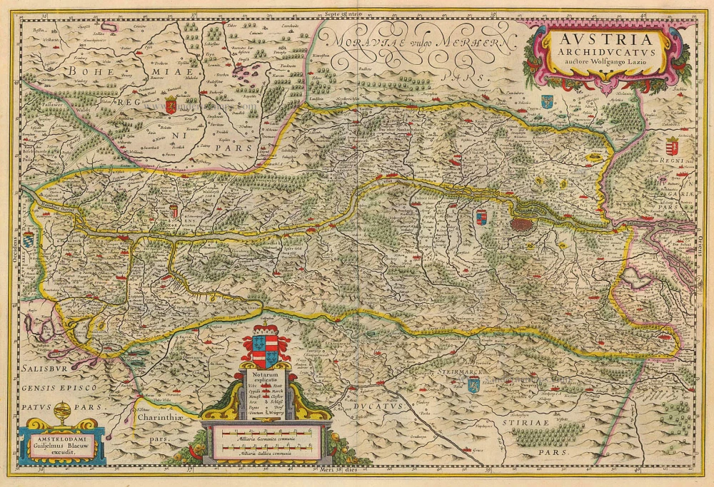
Austriae Ducatus Chorographia, Wolfgango Lazio Auctore.
Item Number: 25323 Authenticity Guarantee
Category: Antique maps > Europe > Austria
Old, antique map of Austria by A. Ortelius.
Cartographer: Wolfgang Lazius
Date of the first edition: 1570
Date of this map: 1579
Copper engraving
Size (not including margins): 34 x 46.5cm (13.3 x 18.1 inches)
Verso text: Latin
Condition: Contemporary old coloured, age-toned.
Condition Rating: A
References: Vander Krogt 3, 2710:31A; Van den Broecke, 105; Karrow, 1/37.
From: Theatrum Orbis Terrarum. Antwerp, Chr. Plantin, 1579. (Van der Krogt 3, 31:021)
Abraham Ortelius (1527-1598)
The maker of the 'first atlas', the Theatrum Orbis Terrarum (1570), was born on 4 April 1527 into an old Antwerp family. He learned Latin and studied Greek and mathematics.
Abraham and his sisters Anne and Elizabeth took up map colouring. He was admitted to the Guild of St. Luke as an "illuminator of maps." Besides colouring maps, Ortelius was a dealer in antiques, coins, maps, and books, with the book and map trade gradually becoming his primary occupation.
Business went well because his means permitted him to start an extensive collection of medals, coins, antiques, and a library of many volumes. In addition, he travelled a lot and visited Italy and France, made contacts everywhere with scholars and editors, and maintained extensive correspondence with them.
In 1564 he published his first map, a large and ambitious world wall map. The inspiration for this map may well have been Gastaldi's large world map. In 1565 he published a map of Egypt and a map of the Holy Land, a large map of Asia followed.
In 1568 the production of individual maps for his atlas Theatrum Orbis Terrarum was already in full swing. He completed the atlas in 1569, and in May of 1570, the Theatrum was available for sale. It was one of the most expensive books ever published.
This first edition contained seventy maps on fifty-three sheets. Franciscus Hogenberg engraved the maps.
Later editions included Additamenta (additions), resulting in Ortelius' historical atlas, the Parergon, mostly bound together with the atlas. The Parergon can be called a truly original work of Ortelius, who drew the maps based on his research.
The importance of the Theatrum Orbis Terrarum for geographical knowledge in the last quarter of the sixteenth century is difficult to overemphasize. Nothing was like it until Mercator's atlas appeared twenty-five years later. Demand for the Theatrum was remarkable. Some 24 editions appeared during Ortelius's lifetime and another ten after his death in 1598. Editions were published in Dutch, German, French, Spanish, English, and Italian. The number of map sheets grew from 53 in 1570 to 167 in 1612 in the last edition.
In 1577, engraver Philip Galle and poet-translator Pieter Heyns published the first pocket-sized edition of the Theatrum, the Epitome. The work was trendy. Over thirty editions of this Epitome were published in different languages.
Related items
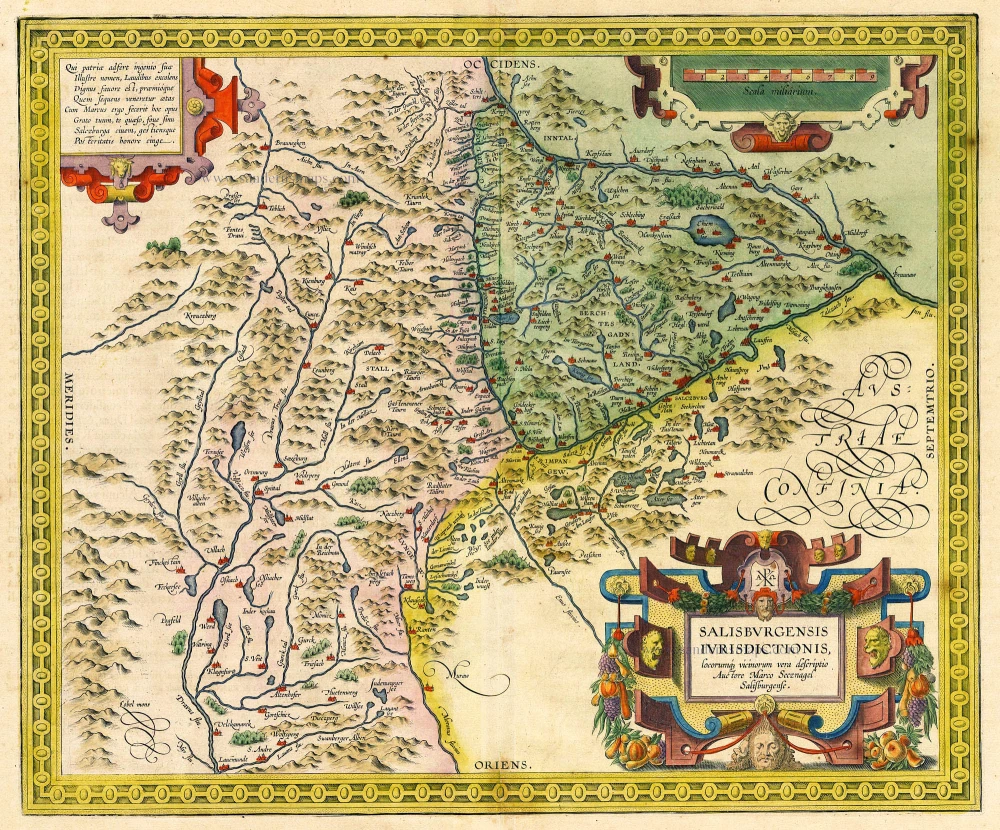
Salisburgensis Iurisdictionis, locorumq vicinorum vera descriptio. Auctore Marco Secznagel Salisburgense. 1612
Salzburg, by Ortelius A.
[Item number: 18677]
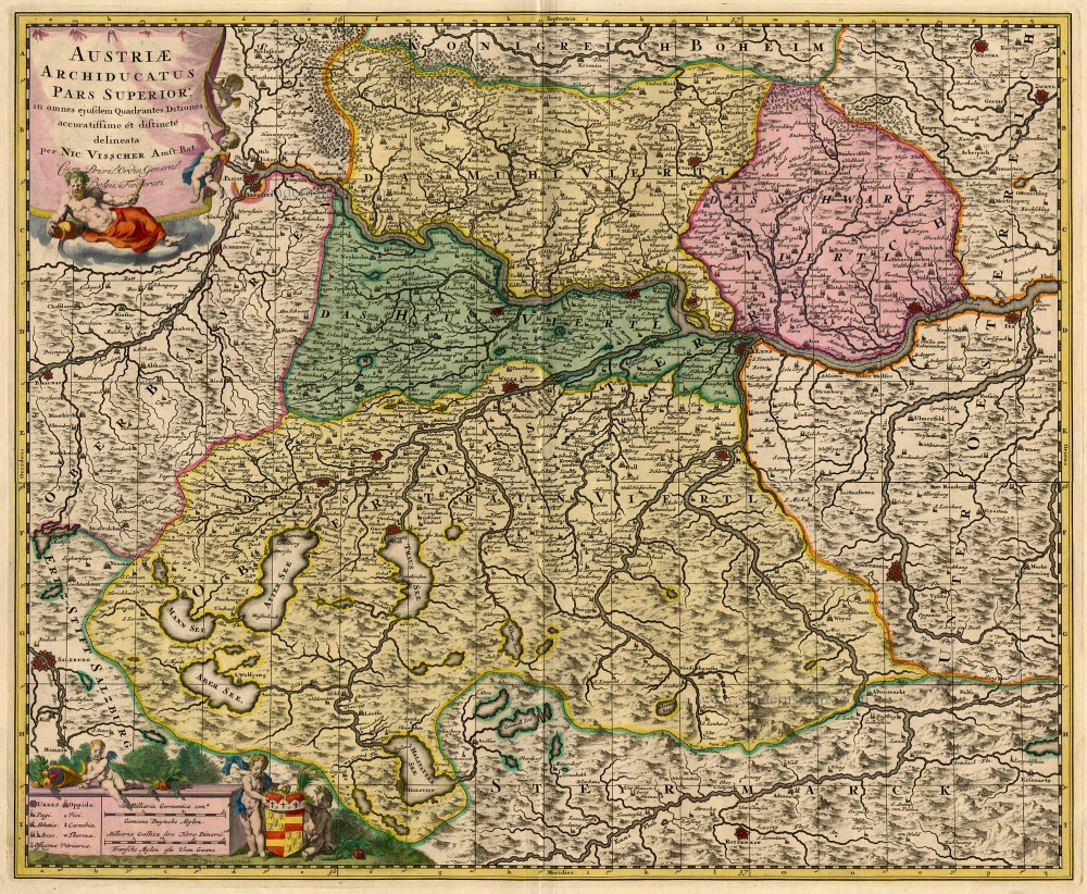
Austriae Archiducatus Pars Superior, in omnes ejusdem Quadrantes Ditiones accuratissime et distincte delineata. 1683-1696
Austria, by N. Visscher.
[Item number: 18679]
Austria Archiducatus. 1635
Austria, by Blaeu W. & J.
[Item number: 20385]
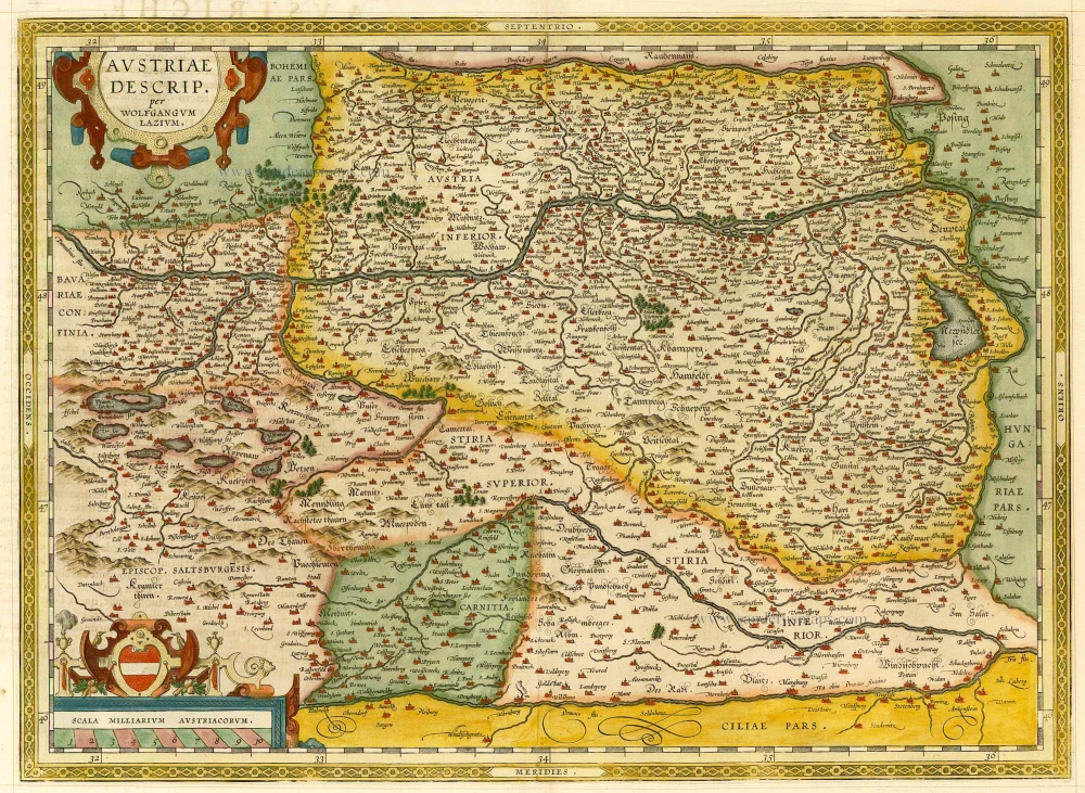
Austriae Descrip. per Wolfgangum Lazium. 1598
Austria, by A. Ortelius.
[Item number: 21893]
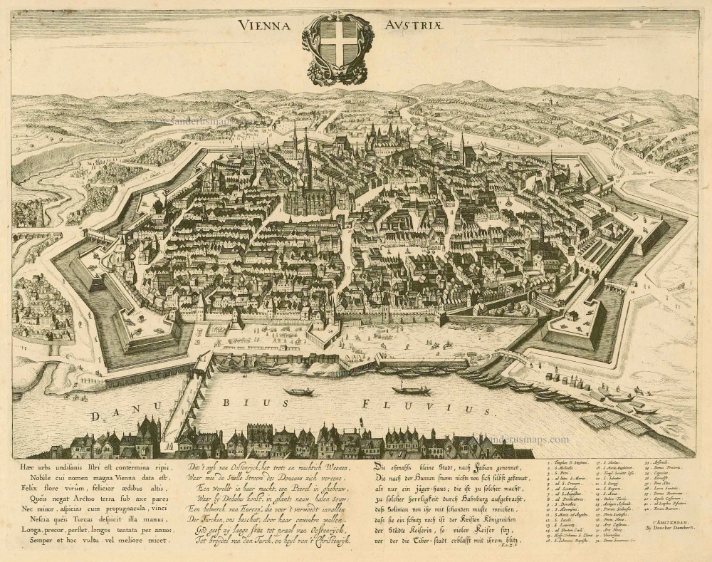
Vienna Austria. c. 1660
Wien, by D. Danckerts.
[Item number: 7049]
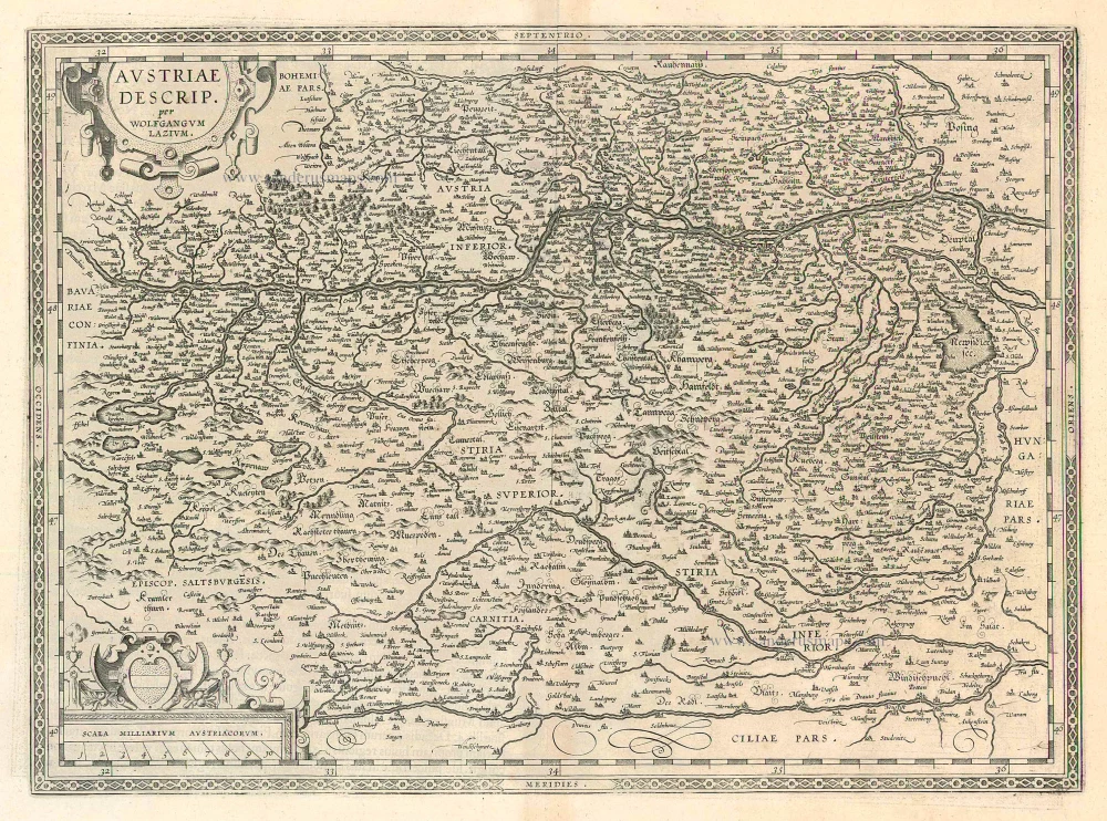
Austriae Descrip. per Wolfgangum Lazium 1612
Austria, by A. Ortelius.
[Item number: 22967]
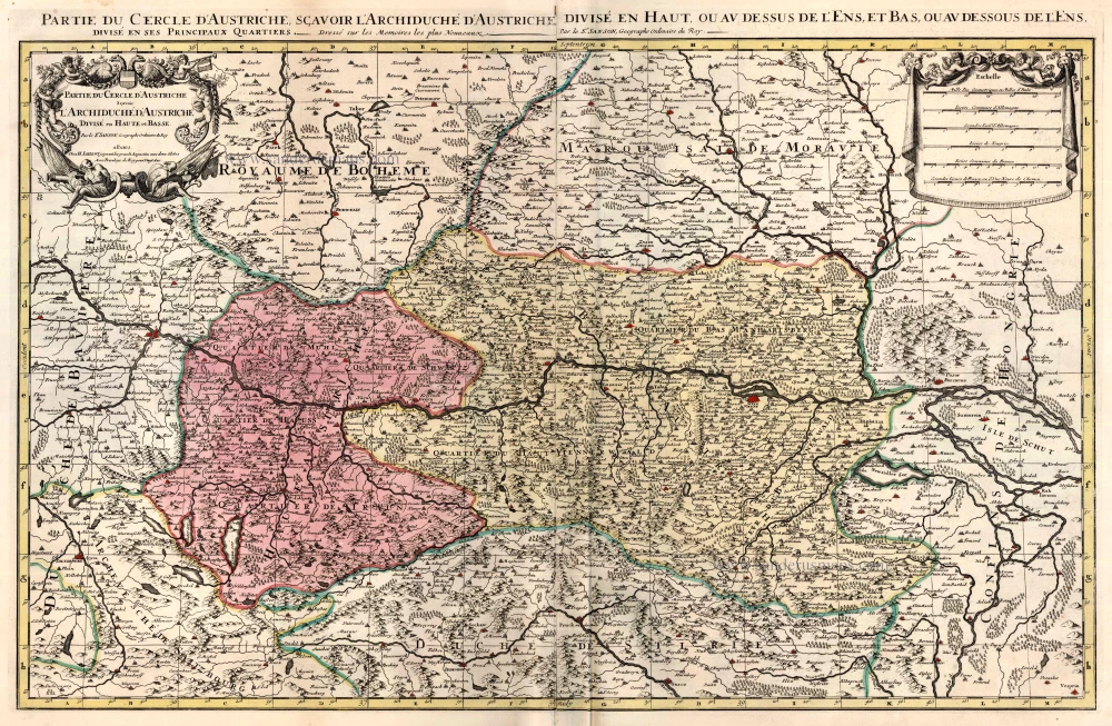
Partie du Cercle d'Austriche, Scavoir l'Archduche d'Austriche Divise en Haute et Basse ... c. 1695
Austria, by Jaillot - Covens & Mortier.
[Item number: 23810]
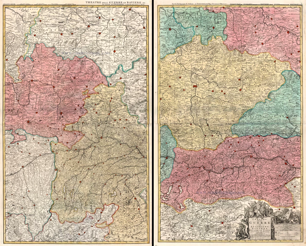
Theatre de la Guerre en Austriche, Baviere, Souabe, le Tirol et le Pays aux Environs. 1721-41
Austria, Bavaria, Swabia and Tyrol, by Covens & Mortier.
[Item number: 23813]
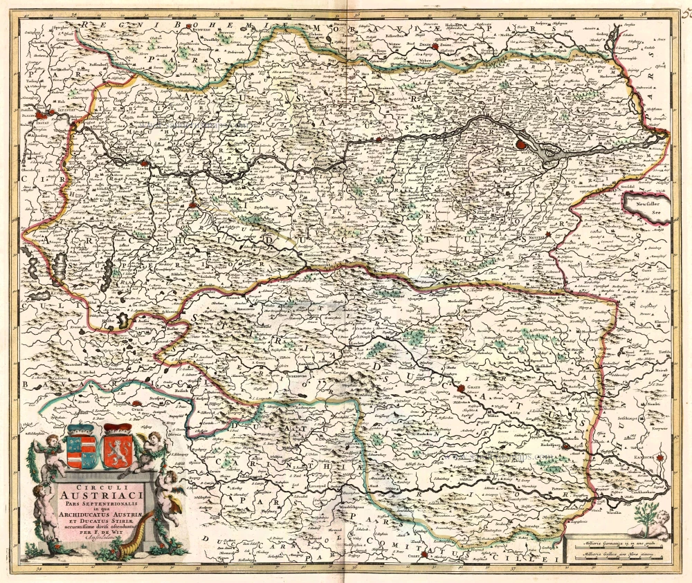
Circuli Austriaci pars Septentrionalis in qua Archiducatus Austriae et Ducatus Stiriae ... c. 1680
Northern Austria, by F. De Wit.
[Item number: 10567]
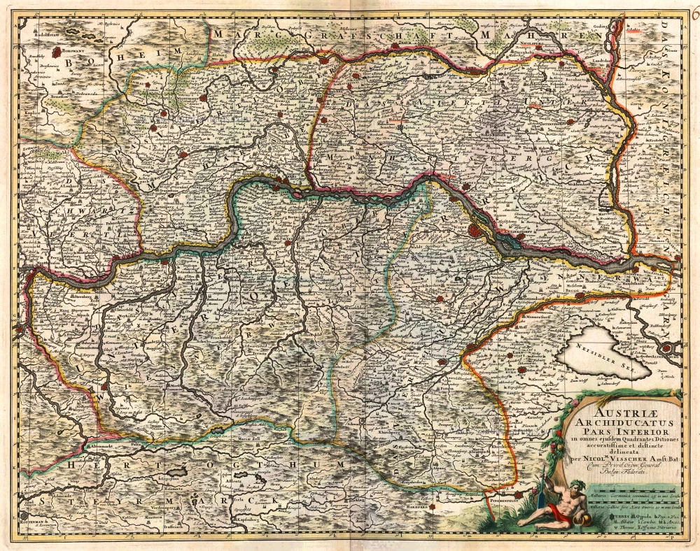
Austriae Archiducatus Pars Inferior 1683-1696
Austria, by Nicolaas Visscher II.
[Item number: 10615]
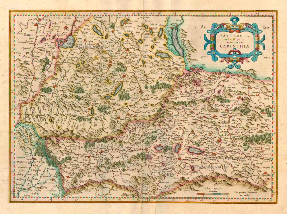
Saltzburg Archiepiscopatus cum Ducatu Carinthiae 1623
Salzburg - Kärnten, by G. Mercator.
[Item number: 24946]
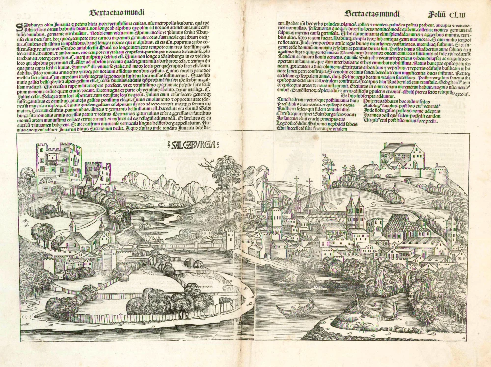
Salczburga 1493
Salzburg, by Hartmann Schedel.
[Item number: 5307]
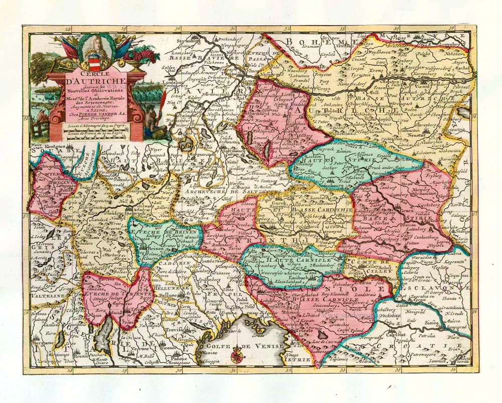
Cercle d'Autriche. 1713
Austria, by Pieter van der Aa.
[Item number: 26180]