
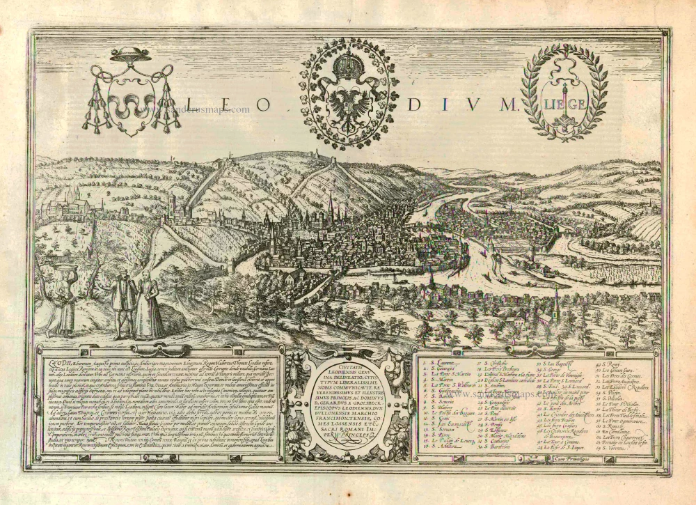
Liège, by Georg Braun and Frans Hogenberg. 1572-1624
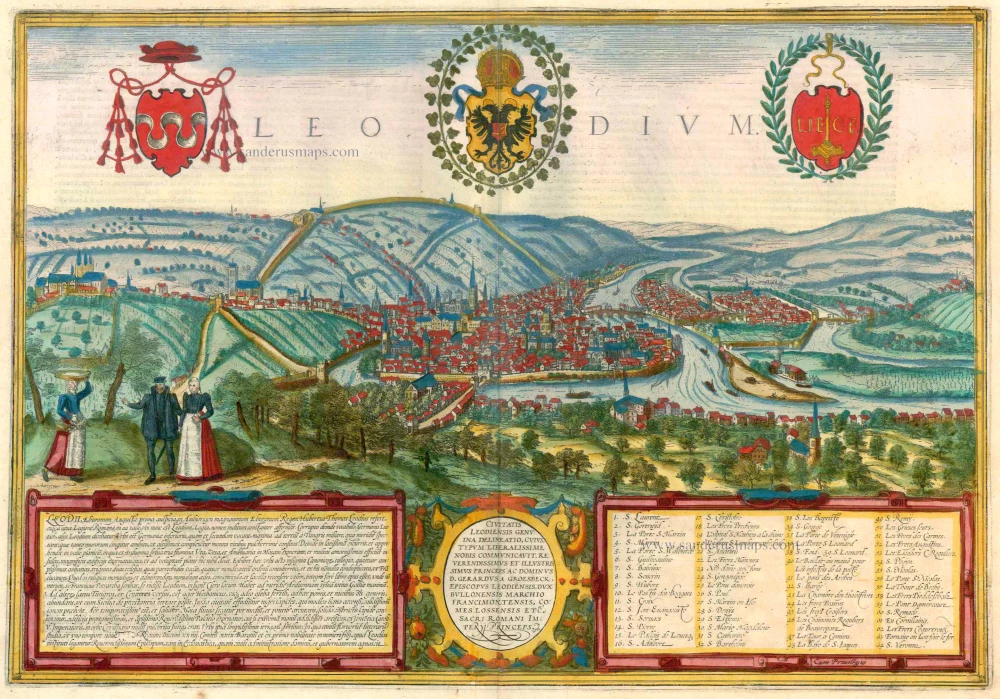


TRANSLATION OF CARTOUCHE TEXT LEFT: The origins of Liège (Lat. Augusta Eburonum) are traced by Hubertus Thomas Leodius back to Ambiorix, the generous king of the Eburones [...]. There are eight colleges of canons, four splendid abbeys, 32 parish churches, and numerous monasteries and nunneries, for which Francesco Petrarch has observed that Liège is noted for its clergy. To the south lies a large forest, to the north fertile pastures with vines, fruit, and other necessities of life, watered by clear and lovely streams. The liberal arts are also prized here; no less than nine young kings, 23 dukes, 29 counts and many barons and the children of the nobility have been educated here.
The central cartouche thanks the bishop of Liège, Gerhard von Groesbeck, who provided the original on which the illustration was based.
COMMENTARY BY BRAUN: "There are many cities that are blessed by the Lord in different ways and are praised by all, some for their grain, others for their wine, their iron or copper, others for their beautiful and magnificent city walls and houses, others again for their favourite location on navigable rivers. But Liège surpasses all these cities, for the Lord God has furnished it with all the above virtues [...]. I must say as much as possible about the River Meuse, however, for it is not only the city's greatest jewel but also its greatest asset, for of what use to a city is its riches if it cannot exchange them for other vital necessities from other lands in a sensible manner?"
The magnificently designed engraving of Liège takes up the ecstatic tone of Braun's description. It shows the city with the Meuse flowing in its favourable location amongst gentle hills, sturdy trees and fertile fields. Presented in spatial depth and exuding a unique sense of animation, it is one of the most successful landscapes in Braun and Hogenberg's city atlas.
In 1468 Liège was attacked by Charles the Bold and set alight, profoundly altering the medieval face of the city. From the second half of the 15th century onwards, much of the town was rebuilt in the contemporary style. The illustration shows the Ourthe flowing into the Meuse and the concentration of buildings in the city centre with its soaring churches and hospices. The cathedral of Saint-Lambert (20), which would later be destroyed in the upheaval of the French Revolution, is impressively documented. The Gothic collegiate church of Saint-Paul (26, centre right) was made Liège's new cathedral. Examples of Romanesque architecture include the collegiate churches of Saint-Denis (right, 28), Saint-Barthélemy (32) and the church of Saint-Martin (far left), which was built in the Gothic style in the early 16th century. (Taschen)
Braun G. & Hogenberg F. and the Civitates Orbis Terrarum.
The Civitates Orbis Terrarum, or the "Braun & Hogenberg", is a six-volume town atlas and the most excellent book of town views and plans ever published: 363 engravings, sometimes beautifully coloured. It was one of the best-selling works in the last quarter of the 16th century. Georg Braun wrote the text accompanying the plans and views on the verso. Many plates were engraved after the original drawings of a professional artist, a professional artist, Joris Hoefnagel (1542-1600). The first volume was published in Latin in 1572, and the sixth in 1617. Frans Hogenberg created the tables for volumes I through IV, and Simon van den Neuwel made those for volumes V and VI. Other contributors were cartographers Daniel Freese and Heinrich Rantzau. Works by Jacob van Deventer, Sebastian Münster, and Johannes Stumpf were also used. Translations appeared in German and French.
Following the original publication of Volume 1 of the Civitates in 1572, seven further editions of 1575, 1577, 1582, 1588, 1593, 1599 and 1612 can be identified. Vol.2, first issued in 1575, was followed by further editions in 1597 and 1612. The subsequent volumes appeared in 1581, 1588, 1593, 1599 and 1606. The German translation of the first volume appeared from 1574 on, and the French edition from 1575 on.
Several printers were involved: Theodor Graminaeus, Heinrich von Aich, Gottfried von Kempen, Johannis Sinniger, Bertram Buchholtz and Peter von Brachel, who all worked in Cologne.
Georg Braun (1541-1622)
Georg Braun was born in Cologne in 1541. After his studies in Cologne, he entered the Jesuit Order as a novice. 1561, he obtained his bachelor's degree, and in 1562, he received his Magister Artium. Although he left the Jesuit Order, he studied theology, gaining a licentiate in theology.
Frans Hogenberg (1535-1590)
Frans Hogenberg was a Flemish and German painter, engraver, and mapmaker. He was born in Mechelen as the son of Nicolaas Hogenberg.
By the end of the 1560s, Frans Hogenberg was employed upon Abraham Ortelius's Theatrum Orbis Terrarum, published in 1570; he is named an engraver of numerous maps. In 1568, he was banned from Antwerp by the Duke of Alva and travelled to London, where he stayed a few years before emigrating to Cologne. He immediately embarked on his two most important works, the Civitates, published in 1572 and the Geschichtsblätter, which appeared in several series from 1569 until about 1587.
Thanks to large-scale projects like the Geschichtsblätter and the Civitates, Hogenberg's social circumstances improved with each passing year. He died as a wealthy man in Cologne in 1590.
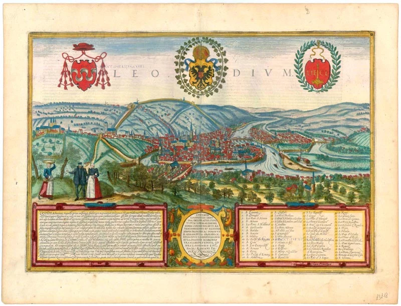
Leodium.
Item Number: 23218 Authenticity Guarantee
Category: Antique maps > Europe > Belgium - Cities
Old, antique bird’s-eye view of Liège, by Georg Braun and Frans Hogenberg.
Title: Leodium.
Date of the first edition: 1572.
Date of this map: 1572-1624.
Copper engraving, printed on paper.
Size (not including margins): 330 x 480mm (12.99 x 18.9 inches).
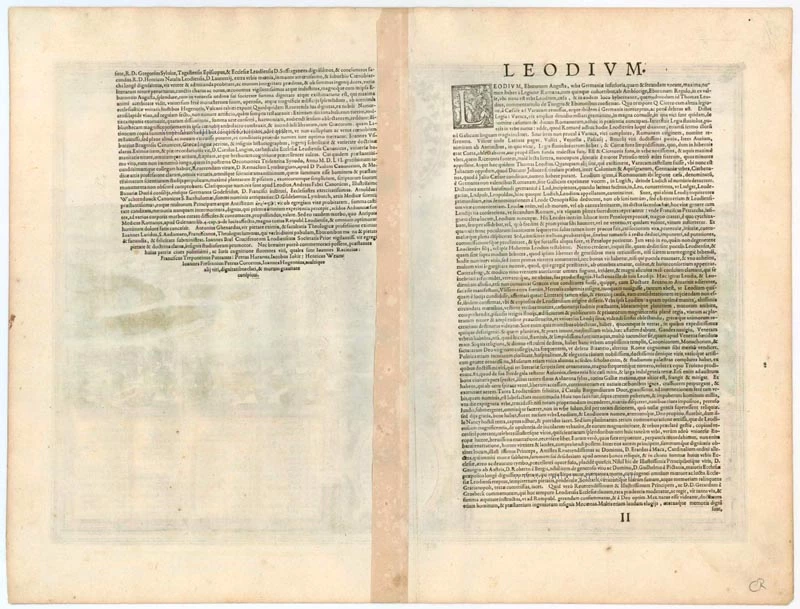
Verso: Latin text.
Condition: Superb old colour, excellent.
Condition Rating: A+.
From: Civitates Orbis Terrarum, ... Part 1. Köln, 1572-1624. (Van der Krogt 4, 41:1.1)
TRANSLATION OF CARTOUCHE TEXT LEFT: The origins of Liège (Lat. Augusta Eburonum) are traced by Hubertus Thomas Leodius back to Ambiorix, the generous king of the Eburones [...]. There are eight colleges of canons, four splendid abbeys, 32 parish churches, and numerous monasteries and nunneries, for which Francesco Petrarch has observed that Liège is noted for its clergy. To the south lies a large forest, to the north fertile pastures with vines, fruit, and other necessities of life, watered by clear and lovely streams. The liberal arts are also prized here; no less than nine young kings, 23 dukes, 29 counts and many barons and the children of the nobility have been educated here.
The central cartouche thanks the bishop of Liège, Gerhard von Groesbeck, who provided the original on which the illustration was based.
COMMENTARY BY BRAUN: "There are many cities that are blessed by the Lord in different ways and are praised by all, some for their grain, others for their wine, their iron or copper, others for their beautiful and magnificent city walls and houses, others again for their favourite location on navigable rivers. But Liège surpasses all these cities, for the Lord God has furnished it with all the above virtues [...]. I must say as much as possible about the River Meuse, however, for it is not only the city's greatest jewel but also its greatest asset, for of what use to a city is its riches if it cannot exchange them for other vital necessities from other lands in a sensible manner?"
The magnificently designed engraving of Liège takes up the ecstatic tone of Braun's description. It shows the city with the Meuse flowing in its favourable location amongst gentle hills, sturdy trees and fertile fields. Presented in spatial depth and exuding a unique sense of animation, it is one of the most successful landscapes in Braun and Hogenberg's city atlas.
In 1468 Liège was attacked by Charles the Bold and set alight, profoundly altering the medieval face of the city. From the second half of the 15th century onwards, much of the town was rebuilt in the contemporary style. The illustration shows the Ourthe flowing into the Meuse and the concentration of buildings in the city centre with its soaring churches and hospices. The cathedral of Saint-Lambert (20), which would later be destroyed in the upheaval of the French Revolution, is impressively documented. The Gothic collegiate church of Saint-Paul (26, centre right) was made Liège's new cathedral. Examples of Romanesque architecture include the collegiate churches of Saint-Denis (right, 28), Saint-Barthélemy (32) and the church of Saint-Martin (far left), which was built in the Gothic style in the early 16th century. (Taschen)
Braun G. & Hogenberg F. and the Civitates Orbis Terrarum.
The Civitates Orbis Terrarum, or the "Braun & Hogenberg", is a six-volume town atlas and the most excellent book of town views and plans ever published: 363 engravings, sometimes beautifully coloured. It was one of the best-selling works in the last quarter of the 16th century. Georg Braun wrote the text accompanying the plans and views on the verso. Many plates were engraved after the original drawings of a professional artist, a professional artist, Joris Hoefnagel (1542-1600). The first volume was published in Latin in 1572, and the sixth in 1617. Frans Hogenberg created the tables for volumes I through IV, and Simon van den Neuwel made those for volumes V and VI. Other contributors were cartographers Daniel Freese and Heinrich Rantzau. Works by Jacob van Deventer, Sebastian Münster, and Johannes Stumpf were also used. Translations appeared in German and French.
Following the original publication of Volume 1 of the Civitates in 1572, seven further editions of 1575, 1577, 1582, 1588, 1593, 1599 and 1612 can be identified. Vol.2, first issued in 1575, was followed by further editions in 1597 and 1612. The subsequent volumes appeared in 1581, 1588, 1593, 1599 and 1606. The German translation of the first volume appeared from 1574 on, and the French edition from 1575 on.
Several printers were involved: Theodor Graminaeus, Heinrich von Aich, Gottfried von Kempen, Johannis Sinniger, Bertram Buchholtz and Peter von Brachel, who all worked in Cologne.
Georg Braun (1541-1622)
Georg Braun was born in Cologne in 1541. After his studies in Cologne, he entered the Jesuit Order as a novice. 1561, he obtained his bachelor's degree, and in 1562, he received his Magister Artium. Although he left the Jesuit Order, he studied theology, gaining a licentiate in theology.
Frans Hogenberg (1535-1590)
Frans Hogenberg was a Flemish and German painter, engraver, and mapmaker. He was born in Mechelen as the son of Nicolaas Hogenberg.
By the end of the 1560s, Frans Hogenberg was employed upon Abraham Ortelius's Theatrum Orbis Terrarum, published in 1570; he is named an engraver of numerous maps. In 1568, he was banned from Antwerp by the Duke of Alva and travelled to London, where he stayed a few years before emigrating to Cologne. He immediately embarked on his two most important works, the Civitates, published in 1572 and the Geschichtsblätter, which appeared in several series from 1569 until about 1587.
Thanks to large-scale projects like the Geschichtsblätter and the Civitates, Hogenberg's social circumstances improved with each passing year. He died as a wealthy man in Cologne in 1590.
Related items
Vetustiss. Ad Mare Thyrrhenum Terracinae Oppidum 1623
Old, antique map - bird's-eye view of Liège by J. Blaeu
[Item number: 2628]
Lüttich. 1726
Liège by D. Fassmann
[Item number: 6112]
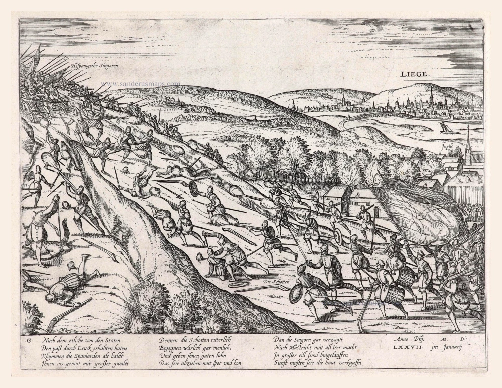
Liege. 1583-1612
The Spanish troops defeated near Liège, by Frans Hogenberg.
[Item number: 7945]
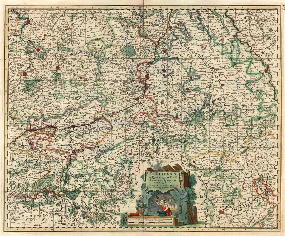
Leodiensis Episcopatus in omnes subjacentes Provincias distincte divisus. 1683-1696
Liège, by N. Visscher II.
[Item number: 10967]
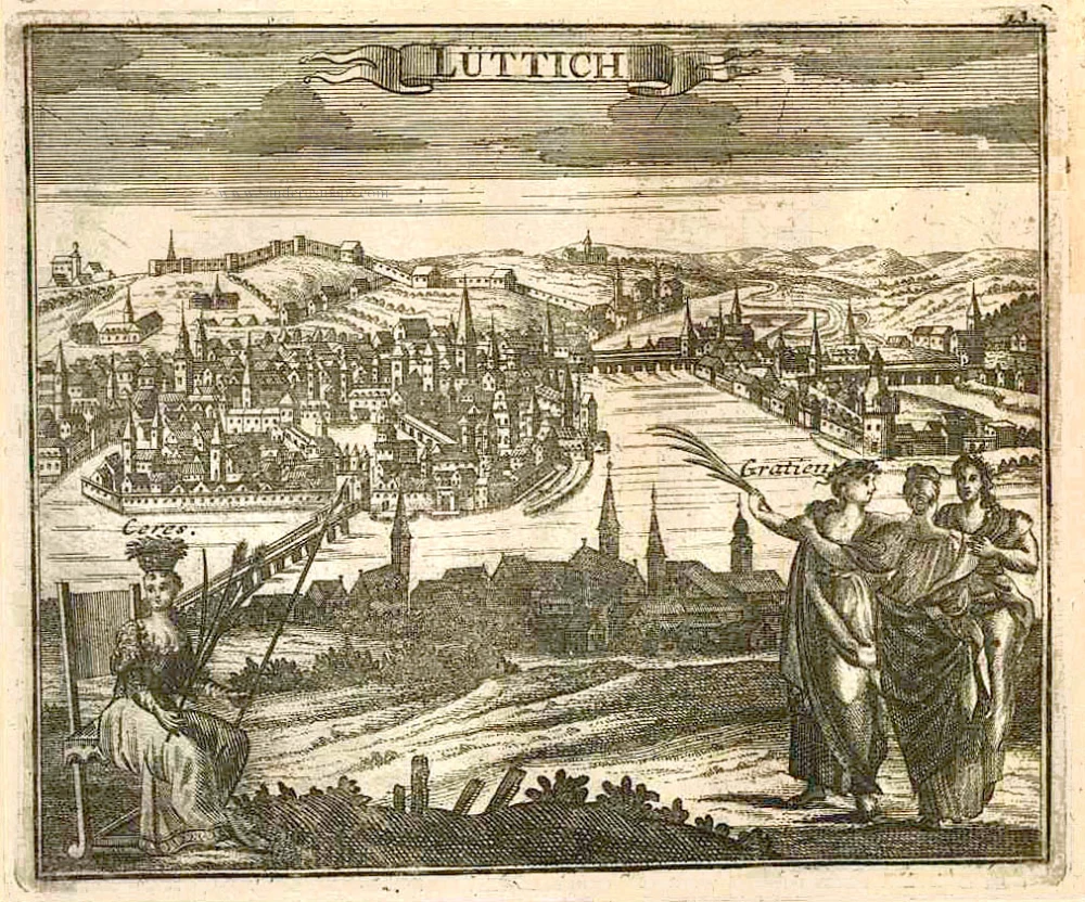
With train station
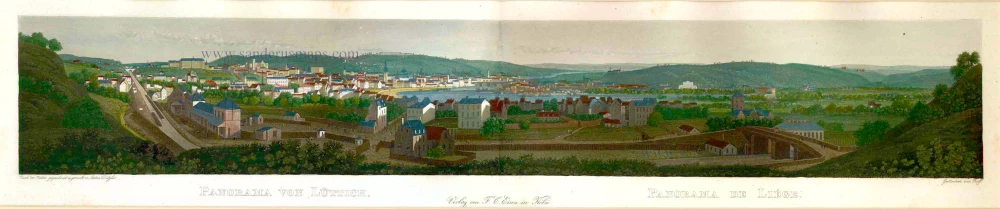
Panorama von Lüttich - Panorama de Liége. c. 1840
Liège by Eisen F.C.
[Item number: 17581]
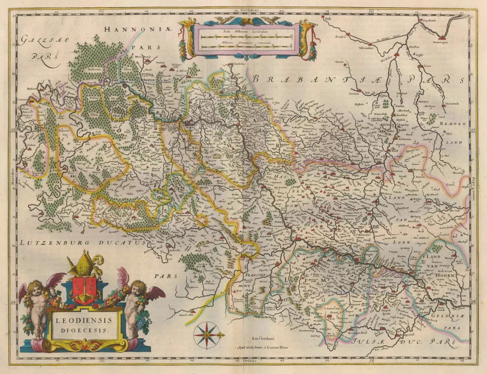
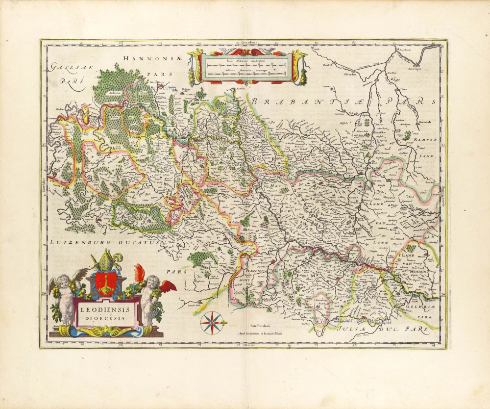
Leodiensis Dioecesis. 1635
Diocese of Liège, by Willem Blaeu.
[Item number: 20335]
Leodium 1612
Liège, by Georg Braun and Frans Hogenberg.
[Item number: 22308]
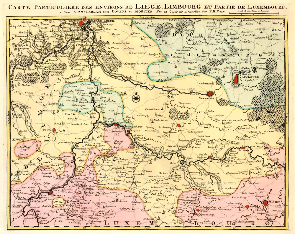
Carte Particulière des environs de Liège, Limbourg et Partie de Luxembourg. 1721-41
Liège, by Covens & Mortier.
[Item number: 23682]

Leodiensis Episcopatus Delineatio. 1609
Hasselt, Maastricht, Liège by Guicciardini Ludovico
[Item number: 27020]
Leodiensis Dioecesis. 1643
Diocese of Liège, by Willem Blaeu.
[Item number: 29933]