
Old, antique map - bird's-eye view of Liège by J. Blaeu 1623
Vetustiss. Ad Mare Thyrrhenum Terracinae Oppidum
Currently not available
Item Number: 2628 Authenticity Guarantee
Category: Antique maps > Europe > Belgium - Cities
Antique map - Bird's-eye view of Terracina by Braun and Hogenberg after G. Hoefnagel, with key to locations.
TRANSLATION OF CAPTION: The ancient town of Terracina on the Tyrrhenian Sea.
COMMENTARY BY BRAUN: "Terracina is a very old city in Latium that in earlier times was surrounded by the sea. It stood originally on a hill surrounded by valleys filled with seawater. But since these valleys have now been filled with earth, the hill is now on the mainland and the city streches down to the coast. The Via Appia that leads from Rome to Brindisi passes by Terracina but at the present time it is flooded by marsh water."
This is a view from the northwest of the city of Terracina that is situated on a steep hillside. The cathedral of San Cesareo (A) can be seen inside the city wall and, on the right on a hill outside the walls, the monastery of Sant'Angelo (B). On the top of Mount Sant'Angelo is an ancient building known as the Theatrum quadratum (C). This is the temple of Jupiter Anxur dating from the 1st century BC. In antiquity Terracina was called Anxur and was a prosperous city, especially after the Via Appia (F) was built nearby in 312 BC. It battled with malaria until the draining of the Pontine Marshes at the beginning of the 20th century. In this plate Hoefnagel has documented the time of the almond harvest, which is shown in the foreground. (Taschen)
Date of the first edition: 1581
Date of this map: 1623
Copper engraving
Size: 33 x 42.5cm (12.9 x 16.6 inches)
Verso text: Latin
Condition: Excellent, superb old colour.
Condition Rating: A
References: Van der Krogt 4, 4280; Taschen, Braun and Hogenberg, p.265.
From: Civitates Orbis Terrarum. - Urbium Praeciuarum Totius Mundi Liber Terius. Cologne, Petrus von Brachel, 1623. (Van der Krogt 4, 41:1.3)
Related items
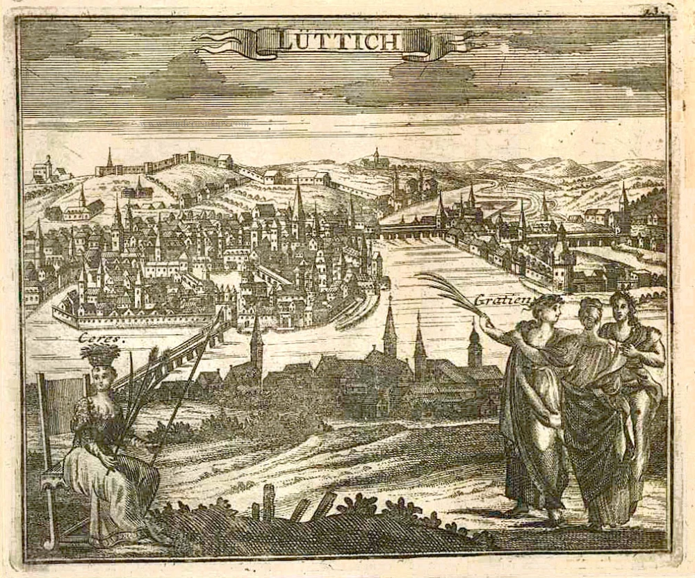
Lüttich. 1726
Liège by D. Fassmann
[Item number: 6112]
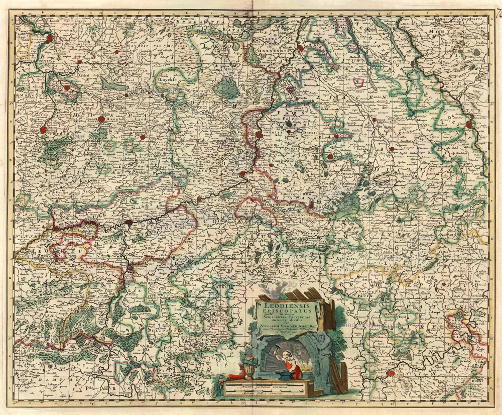
Leodiensis Episcopatus in omnes subjacentes Provincias distincte divisus. 1683-1696
Liège, by N. Visscher II.
[Item number: 10967]
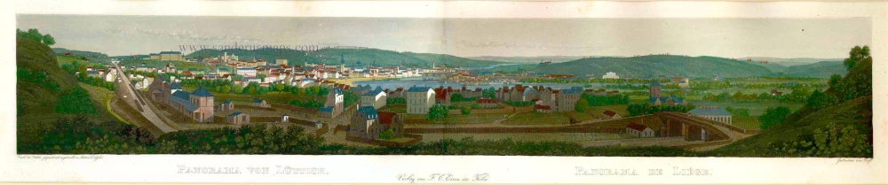
With train station
Panorama von Lüttich - Panorama de Liége. c. 1840
Liège by Eisen F.C.
[Item number: 17581]
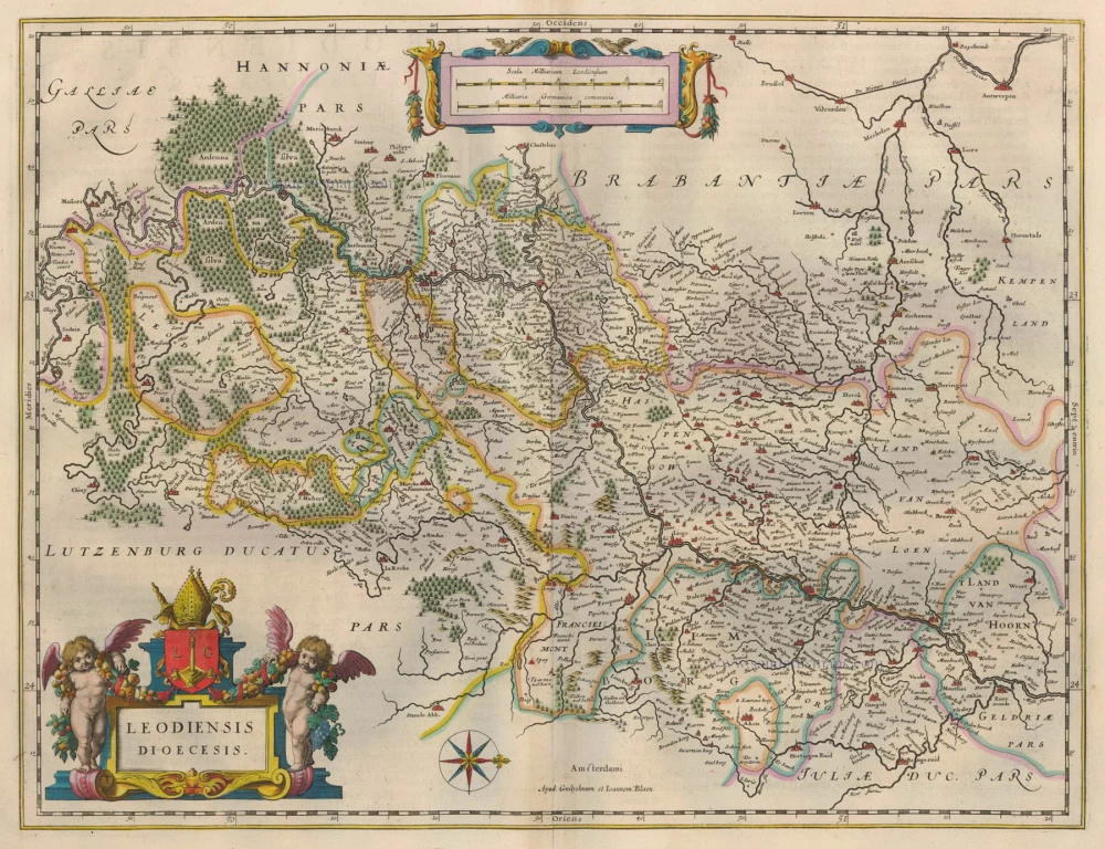
Leodiensis Dioecesis. 1635
Diocese of Liège, by Willem Blaeu.
[Item number: 20335]
Leodium 1612
Liège, by Georg Braun and Frans Hogenberg.
[Item number: 22308]
Carte Particulière des environs de Liège, Limbourg et Partie de Luxembourg. 1721-41
Liège, by Covens & Mortier.
[Item number: 23682]

Limburg. 1652
Limbourg, by Joan Blaeu.
[Item number: 25299]