
British Isles, by Thomaso Porcacchi. 1572
The item displayed on this page has been sold. However, we have a similar map in stock:
British Isles, by Thomaso Porcacchi. 1590
Inghilterra. - [Above map :] Descrittione ...
[Item number: 29755]
![Inghilterra. - [Above map :] Descrittione dell'Isola d'Inghilterra.](https://sanderusmaps.com/assets/RESIZED/thumb_m29755.jpg)
Thomaso (Tommaso) Porcacchi (1530-1585)
Thomaso Porcacchi was born in Castiglion Fiorentino (Arentino), Tuscany, into a poor family. Through the patronage of Duke Cosimo I de' Medici, he was able to pursue his studies; afterwards, he embarked on a career as a translator, editor and author, initially in Florence, often working with the humanist scholar Lodovico Domenichi. His speciality was classical texts, particularly of a geographical and historical nature. Through this work, he came into contact with the prominent Venetian publisher Gabriel Giolito de' Ferrari and, in 1559, he moved to Venice to form a fruitful association with Giolito, who had produced several books containing maps.
Later in his career, Porcacchi composed an isolario, L'isole piu famose del mondo ..., published by Simone Galignani de Karera and Girolamo Porro in 1572. In 1574 Porro engraved the plates for another Porcachi volume, Funerali antichi di diversi popoli, et nationi ..., and he later contributed the maps to a new edition of Claudius Prolemy's Geographiae universae tum veteris tum novae ..., edited by Giovanni Antonio Magini and published by the Heirs of Simone Galignani de Karera.
The first edition of Porcacchi's L'isole piu famose contained 30 engraved maps, set in text. The coverage was worldwide, albeit concentrated on the Mediterranean. For the second edition, the text was rewritten, and 17 additional maps were inserted, to make a total of 47.
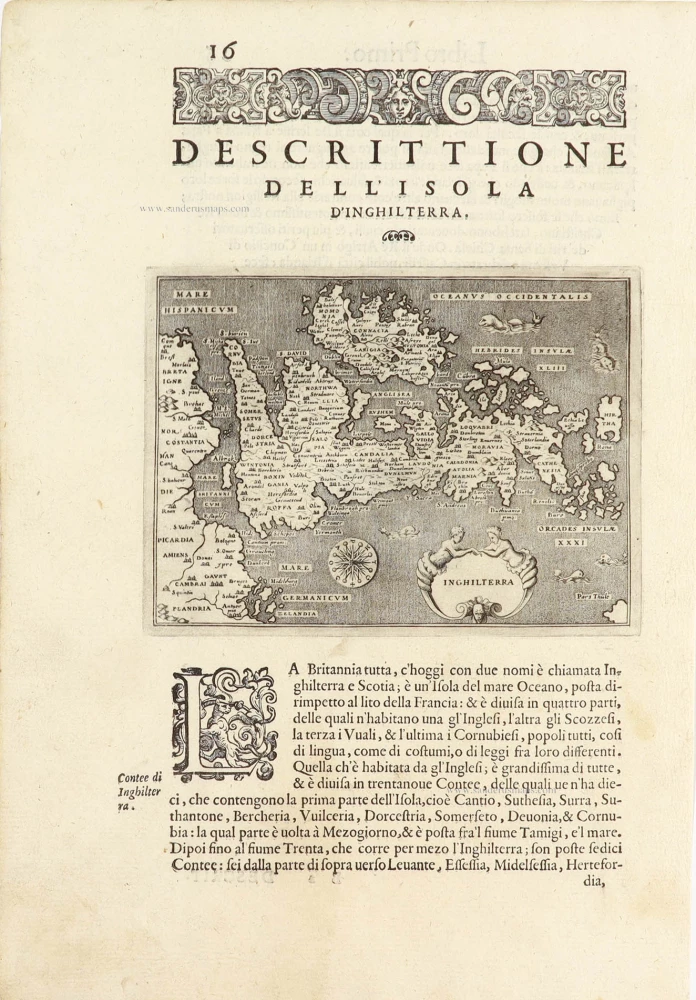
Inghilterra - [Above map :] Descrittione dell'Isola d'Inghilterra.
Item Number: 28911 Authenticity Guarantee
Category: Antique maps > Europe > British Isles
Old, antique map of the British Isles, by Thomaso Porcacchi.
Title: Inghilterra - [Above map :] Descrittione dell'Isola d'Inghilterra.
Oriented to the west.
Engraver: Girolamo Porro.
Date of the first edition: 1572.
Date of this map: 1572.
Copper engraving, printed on paper.
Map size: 110 x 145mm (4.33 x 5.71 inches).
Sheet size: 300 x 205mm (11.81 x 8.07 inches).
Verso: Italian text.
Condition: Excellent.
Condition Rating: A+.
From: Thomaso Porcacchi, L'Isole piu famose del mondo ... Venice, S. Calignanide Karera & Girolamo Porro, 1572.
Thomaso (Tommaso) Porcacchi (1530-1585)
Thomaso Porcacchi was born in Castiglion Fiorentino (Arentino), Tuscany, into a poor family. Through the patronage of Duke Cosimo I de' Medici, he was able to pursue his studies; afterwards, he embarked on a career as a translator, editor and author, initially in Florence, often working with the humanist scholar Lodovico Domenichi. His speciality was classical texts, particularly of a geographical and historical nature. Through this work, he came into contact with the prominent Venetian publisher Gabriel Giolito de' Ferrari and, in 1559, he moved to Venice to form a fruitful association with Giolito, who had produced several books containing maps.
Later in his career, Porcacchi composed an isolario, L'isole piu famose del mondo ..., published by Simone Galignani de Karera and Girolamo Porro in 1572. In 1574 Porro engraved the plates for another Porcachi volume, Funerali antichi di diversi popoli, et nationi ..., and he later contributed the maps to a new edition of Claudius Prolemy's Geographiae universae tum veteris tum novae ..., edited by Giovanni Antonio Magini and published by the Heirs of Simone Galignani de Karera.
The first edition of Porcacchi's L'isole piu famose contained 30 engraved maps, set in text. The coverage was worldwide, albeit concentrated on the Mediterranean. For the second edition, the text was rewritten, and 17 additional maps were inserted, to make a total of 47.
Related items
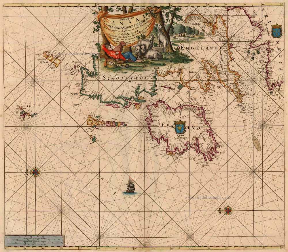
Paskaart van 't Canaal Engelandt Schotlandt en Yrland 1697-1709
British Isles, by Van Keulen Johannes.
[Item number: 5817]
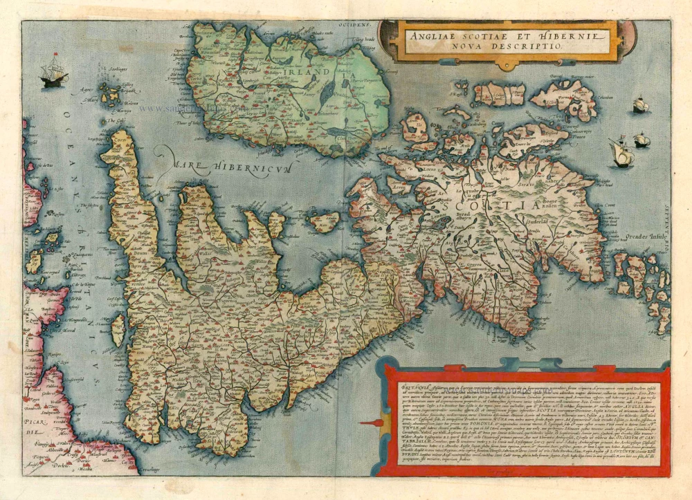
Angliae Scotiae et Hibernie Nova Descriptio 1593
British Isles, by de G. Jode.
[Item number: 11236]
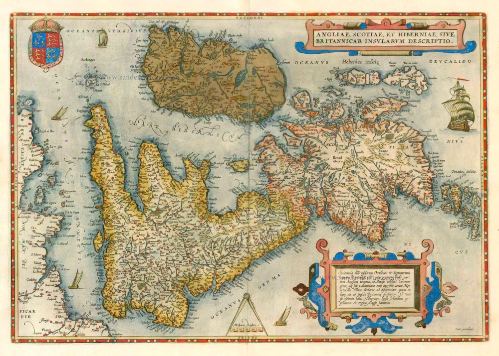
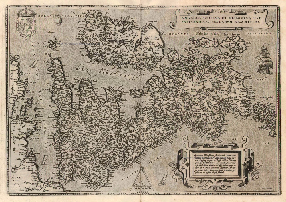
Angliae, Scotiae, et Hiberniae, sive Britannicae Insularum Descriptio. 1579
The British Isles by Abraham Ortelius.
[Item number: 17897]
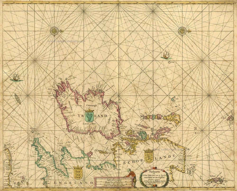
Paskaarte om achter Yrlant om te Zeylen van Hitlant tot aen Heyssant. 1665
British Isles, by Hendrik Doncker.
[Item number: 18567]

Paskaarte om Achter Yrlandt om te Zeylen van Hitlant tot aen Heyssat Nieuwlycx Uytgegeven 1667
The British Isles, by Pieter Goos.
[Item number: 19046]
Angliae, Scotiae, et Hiberniae, sive Britannicae Insularum Descriptio. 1601
The British Isles, by Ortelius A.
[Item number: 22869]
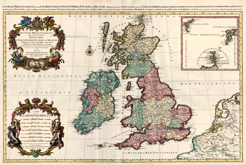
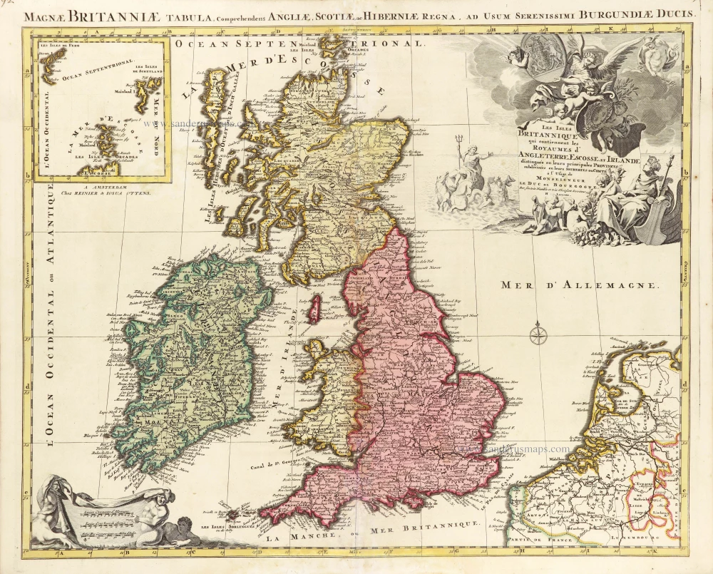
Les Isles Britanniques; qui Contiennent les Royaumes d'Angleterre, Escosse, et Irlande ... 1710
British Isles by Sanson - Covens & Mortier.
[Item number: 23726]
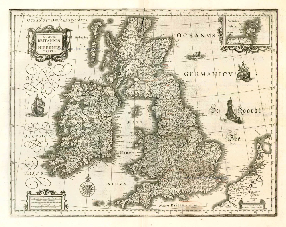
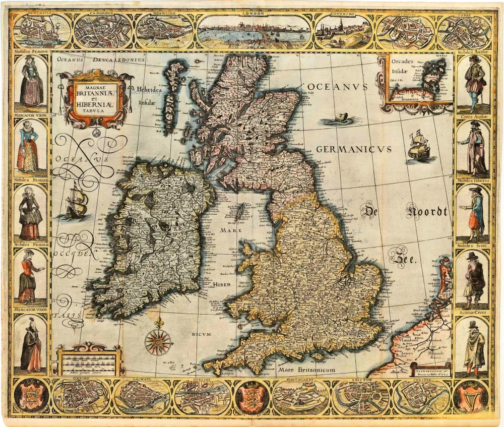
Magnae Britanniae et Hiberniae Tabula. 1662
British Isles, by W. & J. Blaeu.
[Item number: 25200]
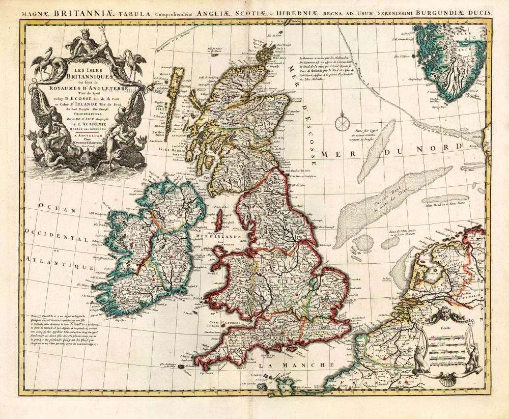
Les Isles Britanniques ou sont le Royaume D'Angleterre Tiré de Sped Celuy D'Ecosse Tiré de Th. Pont et Celuy D'Irlande Riré de Petti. 1730
British Isles by Guillaume Delisle, published by Covens & Mortier.
[Item number: 25680]
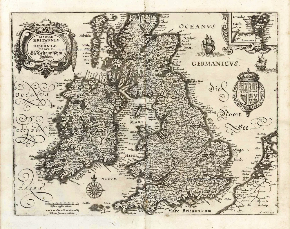
Magnae Britanniae et Hiberniae Tabulae. - Die Britannischen Insulen. 1638
The British Isles, by M. Merian.
[Item number: 25904]
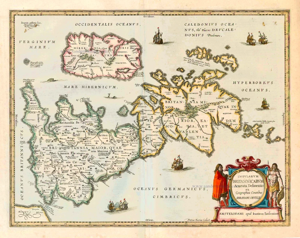
Insularum Britannicarum Acurata Delineatio ex Geographicis Conatibus Abrahami Ortelii. 1641
The British Isles, by Johannes Janssonius.
[Item number: 26483]
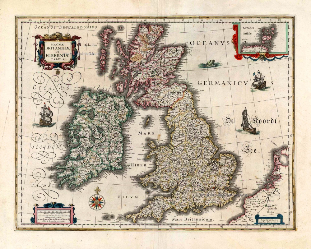
Magnae Britanniae et Hiberniae Tabula. 1645
The British Isles, by Joan and Willem Blaeu
[Item number: 26715]

Les Isles Britanniques Comprenant les Royaumes d'Angleterre, d'Ecosse et d'Iralnade, divisés en grandes provinces, ... 1776-79
British Isles, by Francesco Santini.
[Item number: 26959]
Magnae Britanniae et Hiberniae Tabula. 1629
British Isles by Pieter Verbiest
[Item number: 27737]

Les Isles Britanniques; qui Contiennent les Royaumes d'Angleterre, Escosse, et Irlande. c. 1705
British Isles, by H. Jaillot
[Item number: 27772]
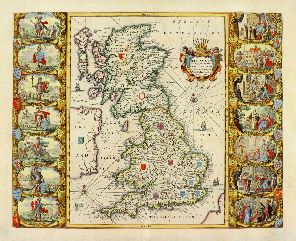
Britannia prout divisa fuit temporibus Anglo-Saxonum, praesertim durante illorum Heptarchia. 1652
Great Brittain by Georg Hornius
[Item number: 28033]
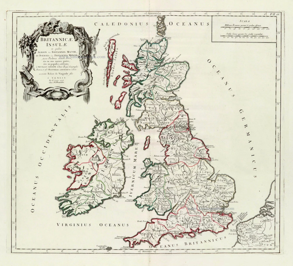
Britannicae Insulae in quibus Albion Seu Britannia Major, et Ivernia Seu Britannia Minor. 1776-79
British Isles, by Paolo Santini, after Nicolas Sanson & Sr. Robert de Vaugondy.
[Item number: 28105]
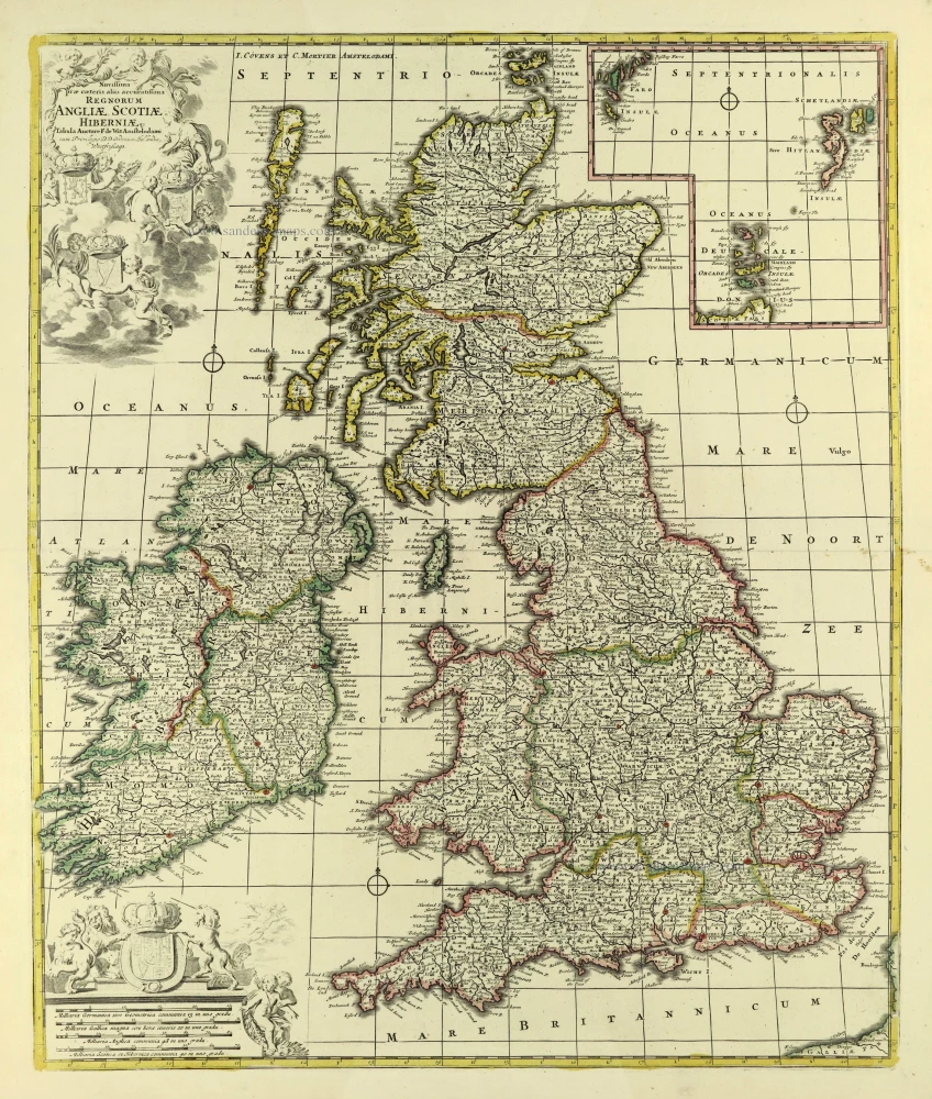
Novissima Prae Caeteris aliis Accuratissima Regnorum Angliae, Scotiae, Hiberniae. c. 1691-96
British Isles by Frederik De Wit.
[Item number: 28239]
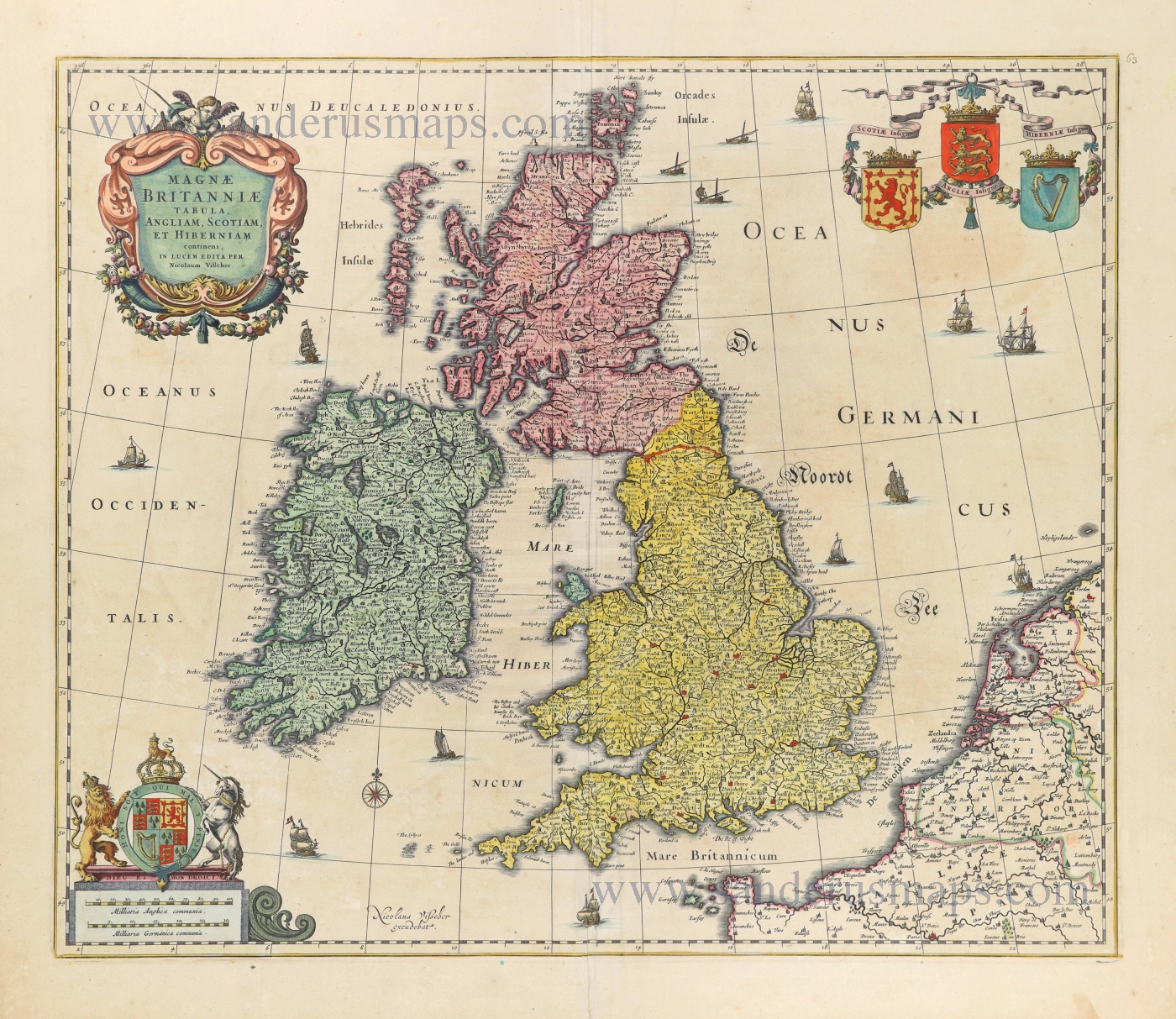
Magnae Britanniae Tabula, Angliam, Scotiam, et Hiberniam continens. 1677-80
British Isles by Nicolaes Visscher I.
[Item number: 28586]
Les Isles Britanniques qui contiennent les Royaumes d'Angleterre Escosse, et Irlande. 1730-45
British Isles by Hubert Jaillot, published by Reinier and Josua Ottens.
[Item number: 28747]